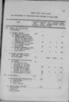
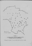
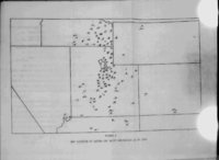
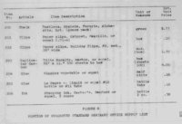
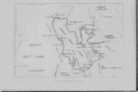
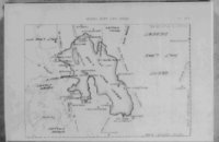
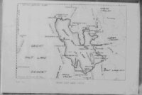
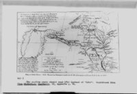
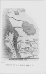
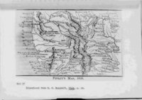
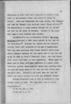
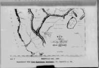
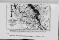
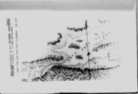
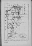
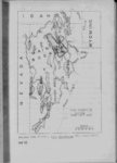
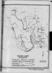
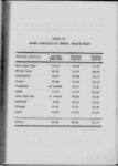
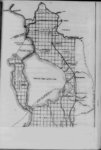
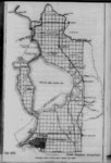
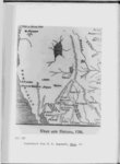
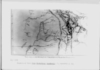
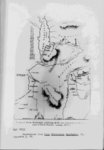
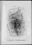
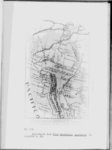
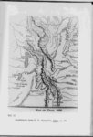
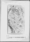
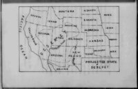
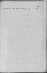
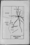
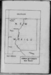
| Show 114 It is true that Ogden had crossed from the Humboldt during the winter of 1828-2- 9 and had struck the northwest shore of the lake But he soon deserted it in search of water Walker followed the west shore for at least eight days reporting it to be completely desolate Bonneville's map of the Rocky Mountain area was the first authentic map to s how the Great Basin as such with interior drainage only On this map although the actual form of the lake is not accurately portrayed its position in the Great Basin is clearly shown It is this map that for the first time shows the lake islands although they are not correctly placed Since Bonneville had not seen the lake and 'Walker had not explored its east and south shores his map was about as accurate as Aside from the fact that it was largely could be expected because of the Bonneville map that he vas reinstated in the United States Army this must also be considered a major The contribution to the knowledge of the Great Salt Lake fact that President Andrew Jackson reinstated Bonneville in the army in 1836 gave his reports and Irving's book somewhat of a standing and added greatly to the popsemi-offic- ial ularity of both 11 See Map V Supra p 28 |