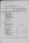
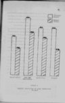
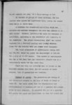
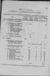
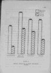
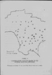
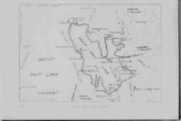
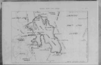
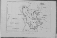
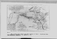
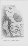
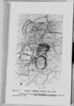
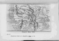
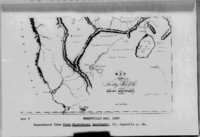
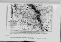
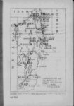
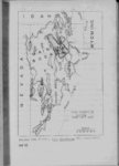
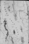
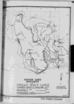
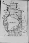
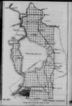
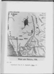
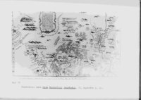
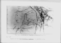
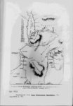
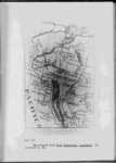
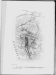
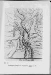
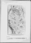
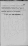
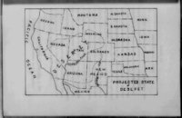
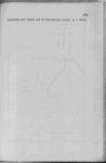
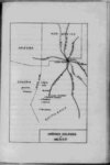
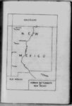
| Show 27 rather a long river to the southern (Utah) lake which it labels "L Salado" From Lake Timpanogos two large rivers the "Timpano Timpanogos as Great Salt lake connected by gos" and the "Mongos" flow westward toward "Nueva Albion" The Buenaventura is shown flowing through the "L Salado" into the sea south of Monterey Several of the early maps seem to have followed this pattern and Irving’s The Rocky Mountains published in 1837 shows islands in the lake for the first time Although the islands are not properly located their mere inclusion on the map is significant The Bonneville This map made map accompanying partially from Joseph Walker ' s notes shows fairly accurate material for the region west of the lake and along the Mary or Ogden’s (Humboldt) river But Lake Bonn"Eutaw Lake" is eville (Great Salt Lake) is very inaccurate shown east of Great Salt Lake connected by a small river Obviously neither Bonneville nor Walker kn ew anything about the east and south sides of the lake and very little about the north side Bonneville had never seen the lake and Yalker had merely touched the north and northwest shores Wyndham Robertson’s several points of view 12 See Map ZEX 13 See Map V The 306 p p map 28 of 1846 is interesting from Great Salt Lake is called |