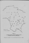
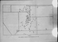
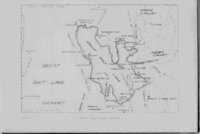
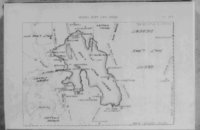
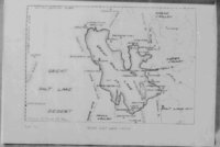
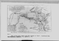
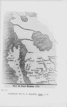
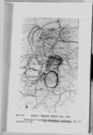
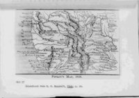
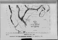
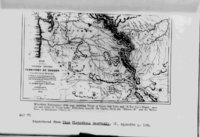
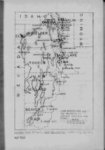
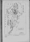
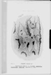
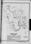
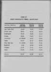
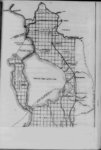
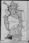
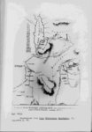
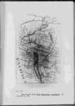
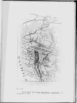
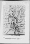
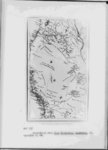
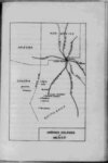
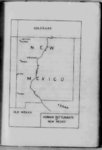
| Show 50 flow southward into Cache valley however Marsh Creek follows the line of the great Ancient Bonneville river that In spite of the deposits of recent years geologists can trace the exact course of the ancient channel The Bonneville shore line can be traced all through Cache valley and into this pass which at its narrowest point is only about 600 feet wide Its height above the present floor of the pass is 340 feet The nearest point at drained Lake Bonneville which the Provo line is observed is about eight miles farther TO south near the town of Oxford Bonneville water first discharged over a barrier of alluvium instead of solid rock Because of the nature of this material it could be easily washed away cut deeper at a rather rapid rate and was allowing the channel to be thus allowing an increasingly larger volume of water to pass This rapid cutting was not halted until through the gorge of solid rock was reached and resulted in the formation of the Provo terrace It has been estimated that Bonneville river was a stream comparable to the Niagara xn volume a sill true the lake might have been and probably was drained to the Provo level in the short space of about twenty five years19 A river of such dimensions flowing If this be 18 19 Gilbert Lake Bonneville 174 Ibid 176 |