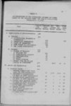
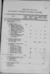
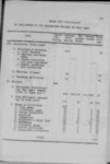
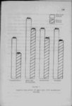
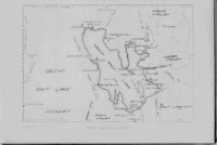
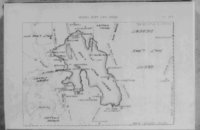
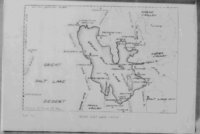
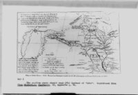
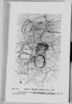
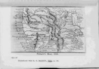
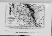
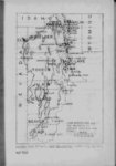
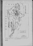
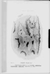
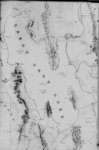
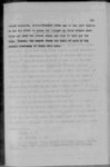
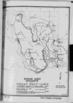
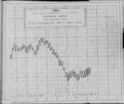
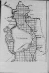
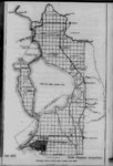
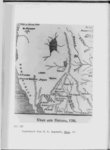
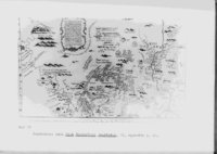
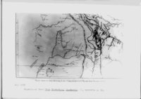
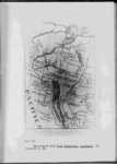
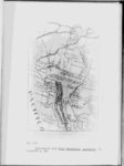
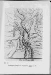
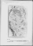
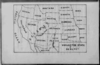
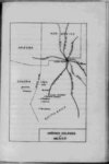
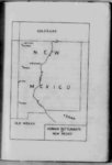
| Show 58 full Six weeks were spent ascending this stream before he arrived at its headwaters Here he planted a "great pole with the arms of France done upon a lake of bulrushes” plate of lead" to indicate the farthest point reached by him and to claim the region for France While in the vicinity of "Long river" La Hontan learned from the numerous tribes of natives about the existence of Four natives of the a great salt lake lying far to the west Mozeemlek tribe supposedly inhabiting the salt lake region had been captured by the Gnacsitares of the Long river couThese four gave a full account of their country stat- ntry i ing that it was some 150 leagues distant that their principal rivers emptied into a salt lake "three hundred leagues in circumference" and that numerous peoples — at least siz noble cities —lived near this lake These natives are described as possessing relatively great wealth and having attained a high state of civilization Boats at least 130 feet long were reportedly used to navigate the lake Using the information given by the four slaves as well as their own knowledge of the western country the Gnacsitares drew a map of the country on a deer hide which map was reproduced by the baron and published in 1710 by John Senex Following the ideas of Baron La Hontan other enthusi- 3 Map I p 19 |