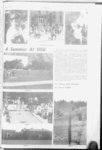
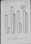
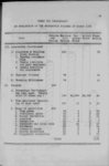
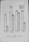
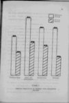
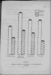
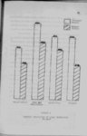
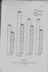
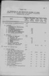
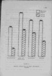
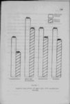
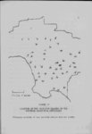
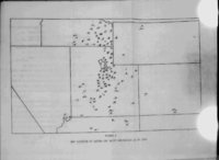
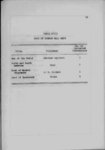
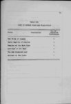
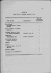
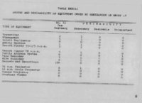
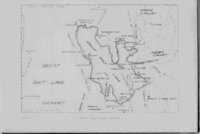
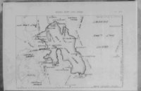
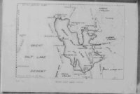
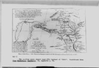
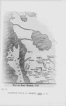
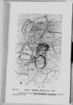
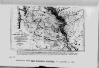
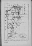
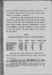
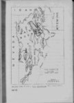
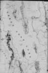
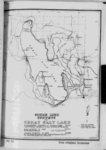
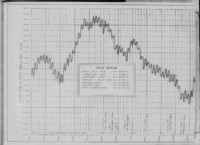
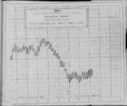
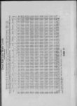
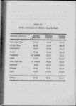
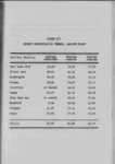
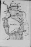
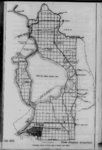
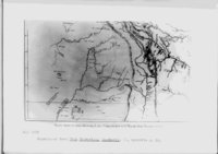
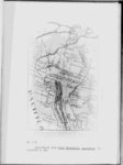
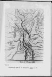
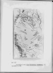
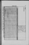
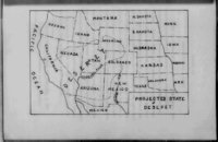
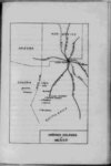
| Show Htfrittf-l- 5 the area varying from a high of 2250 square miles to 1420 square miles® In 1873 the area was 58$ greater than in 1940 1940 level are stated with reference to a gauge the zero reading of which is 419685 feet above sea level Various gauges of different elevations Measurements of the lake all readings of the present time are usually given in relationship to this the Boat Harbor gauge In 1873 the level was 1465 above the zero mark while in but have been used October 1940 a slight rise it fell was to 32 below zero At the end of 1940 registered and each year since then the lake has gained slightly of the lake has not varied as radically as This is because a slight increase in depth spreads The depth the area the water out over an extensive plain Stansbury sounded the lake rather completely and found no place deeper than 36 feet the "Vaterwitch" crew in 1876 reported having found water 48 feet deep In 1935 the deepest water found was 26 feet Grove Karl Gilbert estimated that a ten foot rise in the lake would only raise the mean depth some five feet be- 3 The later figure is the area for the low period of 1935 In 1940 the water wa3 slightly lower but no survey of the 1940 area has been made hence no area computed 4 See Graph I following p 263 |