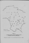
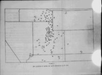
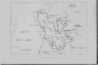
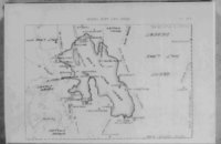
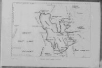
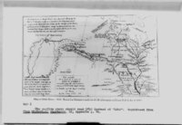
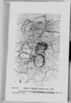
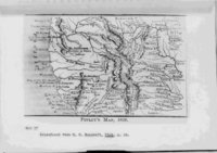
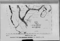
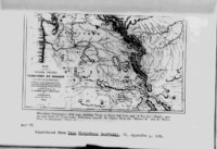
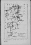
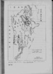
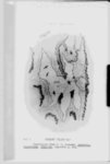
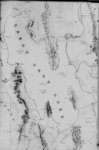
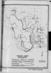
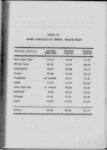
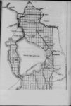
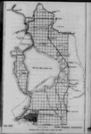
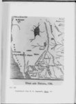
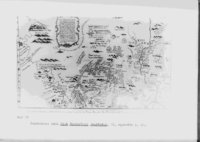
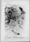
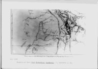
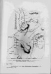
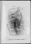
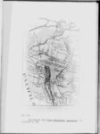
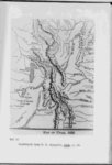
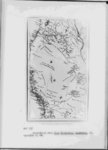
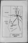
| Show 29 Salt Lake or Lake Bonneville" Weaver’s (Yeber) river and Platte river are shown entering the lake from the east while the American Fur Company post is located on its east shore-- u Upon his visit to Fremont Island in Great Salt Lake John C Fremont took observations from the island peak and from this data drew the first lake map that approaches From his elevated position Fremont could see accuracy with the aid of a spy glass most of the lake although haze limited his vision Fremont’s lake map shows Antelope and Stansbury Islands joined to the mainland from his position he could not tell whether they were peninsulas or islands However the map accompanying the report of his exploring expedition 1843-4- 4 shows the islands completely surrounded This is rather interesting especially in the case by water of Stansbury Island which 'has been a peninsula most of the "Youta or Great " time during the past one hundred years of observation" Fremont of course had not yet seen the south end of the lake where he obtained such relatively accurate information This map concerning the islands is difficult to determine although it shovs the Jordan river as much larger than it 14 See Map VI 15 See Map Z 16 See Map VII 30 p 123 p p 31 |