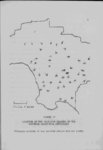
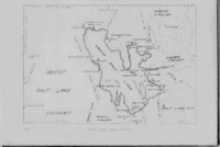
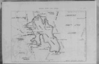
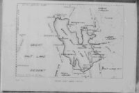
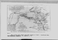
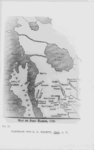
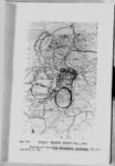
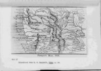
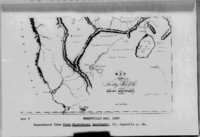
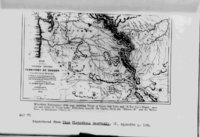
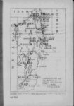
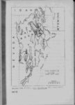
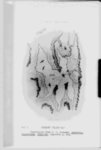
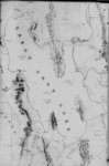
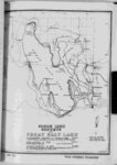
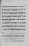
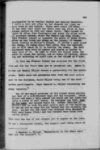
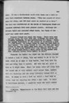
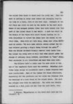
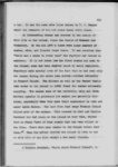
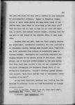
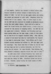
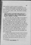
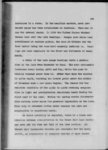
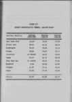
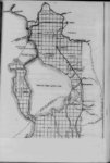
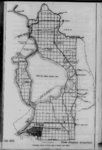
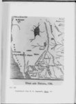
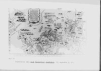
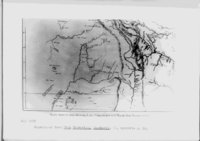
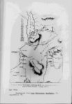
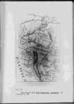
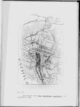
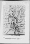
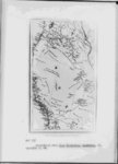
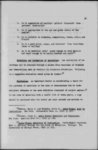
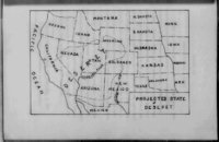
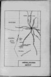
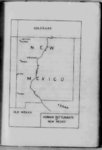
| Show 25 not always the sane river Eventually the name Timpanogos became associated with Great Salt Lake instead of Utah Lake Then one of the rivers that supposedly drained the Great Salt Lake was called the Timpanogos It was often shown as a very 10 San to Francisco across Bay the desert large river flowing On one map two Timpanogos rivers were shown glance at the early maps shows that early map makers had a very hazy idea concerning the shape of Great Salt Lake A as well as the erroneous information concerning the : rivers early Spanish maps show it in about the proper location in relation to the present Utah Lake but fail to show more than a possible southern shore This is to be expected since no white man had as yet seen the lake Mi era’s ”Bearded Indian” map of 1779 shows the Great Salt Lake as part of the Laguna de los Timpanogos (Utah A large river believed to be the Tizon is shown Lake) flowing westward from the northern arm (Great Salt Lake) Furthermore a large number of people were said to inhabit that fed and drained it Some the regions of that river and the northwest territory beThe northern lake is fed by a large river yond the lake from the Comanche country M old Mexican map 10 See Map IV p 11 Cf ante p probably about 1820 26 22 Of Map XDC p shows Lake 306 |