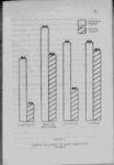
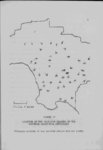
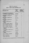
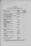
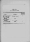
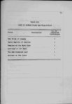
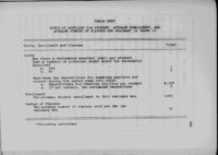
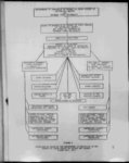
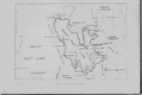
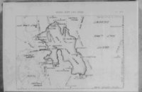
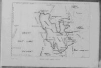
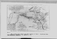
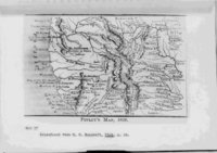
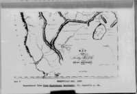
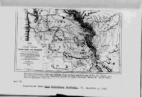
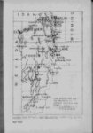
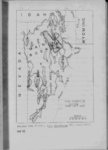
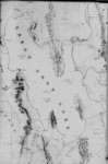
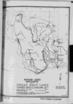
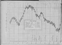
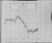
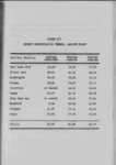
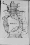
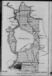
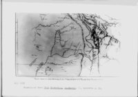
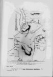
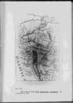
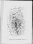
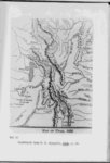
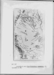
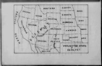
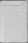
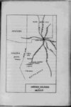
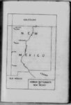
| Show 32 actually is for the first time places the Great Salt Lake and Utah Lake in their proper positions and approximate relative sizes This map also shows a large river entering Great Salt Lake from the east south of the Weber Howard Stansbury's survey of the Great Salt Lake produced the first truly scientific map of that body of water as well as reliable information concerning the lake and its islands17 His findings as published in his report Exploration of the Talley of Great Salt Lake in Utah constituted the first authentic account of any magnitude and has formed a basis for much of the present knowledge of the lake Before this time it was natural for explorers to speak of that "mysterious bocy of water" or that "little known" yet greatly publicized lake Faulty or insufficient information led to many rumors Some of these still persisted and myths concerning the lake long after more or less complete information concerning the lake was available Some people refused outright to accept the validity of the later authentic reports Bonneville for example doubted the validity of the report that four men had circumnavigated the lake and found no outlet in 1826 One of the most common myths concerning the lake was that it communicated with the ocean by a subterranean 17 See Map XI p 146 river |