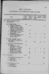
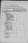
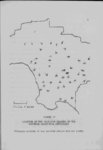
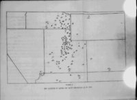
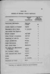
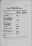
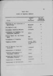
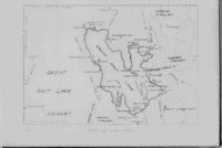
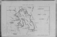
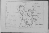
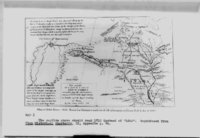
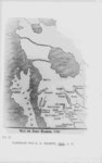
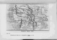
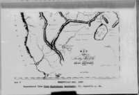
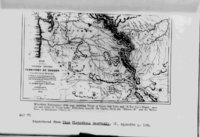
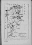
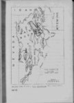
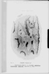
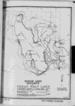
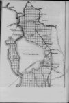
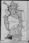
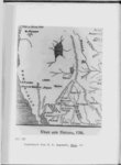
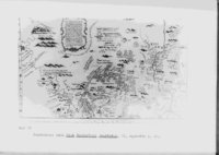
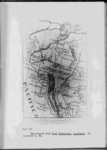
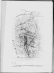
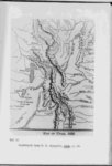
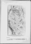
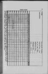
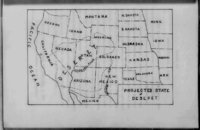
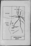
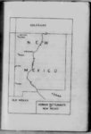
| Show 18 was represented as a it miles in extent narrow long lake twothree or and with outlets four hundred both running into the Pacific Ocean either apparently than the Mississippi river in intelligent man larger with whom I boarded— Elan Brown who had recently lived in California possessed a mapmethat showed these to take tools along rivers to be large and he advised to make canoes so that if we found the country so rough that we could not get along with our wagons we could descend one of these rivers to the Pacific The Great Salt Lake or a lake located in the general Lake now is of water occupied an important place on most of these early maps generations before any white man had laid eyes upon its salty waters vicinity of that hody depicting the first known concept of a great inland salt lake in western America was that of John Senex in 1710® This map portrayed the lake reported by Baron La Hontan who had reported such a lake as early at 1689 although A map to see the lake in question is well supplied with notes concerning rivers he had not gone The Senex map far enough inland lakes and people Since Baron La Hontan ’s time many maps have followed the lead of John Senex and placed a lake in the vicinity of the present Great Salt Lake with large rivers connecting it xith the ocean This in spite of the fact that subsequent exploration proved more and ties in the accuracy of the Baron’s report more impossibili- of the most common features of many of the early maps of the region was the connection of the inland lake with One 3 See Map I p 19 |