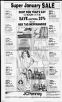
| OCR Text |
Show I I- - I DAVIS COUNTY CLIPPER, DECEMBER 29, 1982 th S 89 deg. 50 W alg sd N In 77.22 fi to beg, corn. 0.386 Acre. Total Tax . . . . $ ,048 98 WEST POINT ABC Dee McFarland, 12:023.0021, Beg on S In of st 95 roda & 33 ft S of NW cor Sec 3, T4N-R2SLM, E 80 ft S 100 ft: W 80 ft; th N 100 ft to beg, cont. 18' Acre. Total Tax S246 42 Risky C. Tvutchell. 12.023 0026, Beg 309 ft N & 743 ft E fr SW cor of NW 4 Sec 3.T4VR2W. SLA1 th S 138ft. 'FT N 39 ft L 20 ft; N 99 ft. th W 8' ft to beg Cont 2s Acres To5404 88 tal! ax 1 eon Peterson. 12 023.0061. Beg at a pt 120 rods F of NW cor of Sec 3, 14VR2W , SI.M Incite of West Point, run th E 195 ft: th S l'5 It. th IV kV FT MOL. TO EXIST FENCE I N T H S 2 114 th F 207 9 It; th S It dec 29 F '23 6' ft. th S FT-T984 Stt.ihWk-jI6l ft to pod. Cont 23 IKl 5890 84 Wes lotal lax l.eon Peteison. 12 023(8162. Beg at a pt I2u rods F A I67l ft S fr NW 40! of SKFC V T4N-K2SIM th S 469 ft mol to S In ot N W 4 ol sd sec 3, th 660 h N 969 It th W 660 ft mol to pub ( out 14 68 acres. otal 5'09 51 l,.x K,i' rt I mil lames. 12 037 0020, lice on the 1 In of a canal ft A a! a pt S alg th sec In 805 I 266 x2 tt o th N W cor of Sec SI 1 run th F. ' I4N-R2'6' o' 0. th S 0 deg IFF 2 'o n It th W 462 88 ft to the F. 'n o! sd th N 22 deg 54 W 2"" 92 ft to pob alg sd R-together vx h right ol aa 3 02 Acres lotal font t H'V' ... lax ....5104.63 Hattie Harris. 12 038 (8)03. Beg at a pt F. 326 9' ft alg sec In fr T4N-R2N 4 cor ol SFEC . SI M Ih E 70 5 ft. th SI deg 32' E 133 03 fi. th E 2ft: th V deg 46' W 134.48 ft; th W ft. th N 0 eg. 02' 3" E 239 32 ft to pob. Cont .404 5200.92 .Wes. Total Tax .lohr, I ee Thurgood. 12 038 0018. Beg N 89 deg. 56' 47" W 1320ft alg the sec In fr th NE. cor of ; SLM. th S 0 Sec '. 1 cleg 03''(l" W1 181 ,50ft: th S 89 deg. 56'47" E 85 ft. th N Odeg. 03 '0" F. 181 50 It. th N 89 deg. '6' 47" W 85 ft alg sd sec In to Also beg at pob. Subj to N W cor sd ppt A run th N 89 deg. '6'47" W 4 0 ft to a cert len In: th S 0 deg. 0350" W' 18 .'0 ft alg sd fen; th S 89 deg. 'h'47" E 4 0 ft alg a In para to the N In of sd sec; th N 0 deg. 0350" E 181 '0 ft the pob. cont. .015 in all 365 acres. To561.41 tal! ax Leon C. Thuigood. 12:038 0019, Beg N 89 deg. 56' W 1150 ft fr SLM ; NLcor Sec 5. th N 89 deg 56'47" W 85 ft: th SOdeg 03'50" W 181.5 ft; th S 84 deg. 56' 47" E 85 ft: th N 0 deg 1)350" E 181.5 ft to the pob. Cont. .355 Acres. Total $60.66 Tax S 2 68 '8 Florence I. Paice, etal, 12 042.0013, Beg on S In of h sx id at a pt 660 ft S & 20chs W' '; li NE coi of NW'i Sec 6: SLM- th E 660 ft. mol, alg sd S In lo W' In sd district; th S 338 25 ft; alg sd W In: th W 627 ft; th S 5 32 chs: th W .50 clis. th N 689 37 ft mol. to pob. Cont. 5.35 Acres. Total 537.91 Tax Hideharu Deb Kawaguchi. 12.044:0019. Beg 80 rds E of SW cor Sec 6, TP 4N RG 2W. SLM N 54 rds 8'6 ft. E 544.5 ft S 54 rds 81: ft. W 544.5 ft to beg. Cont. 11.43 Acres. Total $250.21 Tax W alter B. Flint, 13.0310(8)5, A pt of S W Vt of Sec 29, T5N-R2W- ; SLM: Beg at a pt on N side of 3(8) N st wh is N Odeg. 13' 18" E 33 ft & S 89 deg. 58' 11 E 33 ft fr SW cor of sd SWA; th N 0 deg. 3' 18" E 150 ft: th S 89 deg. 58' II" E 85 ft th s 0 deg. 3' 8" W 150 ft to N In of st: th N 89 deg. 58' 11" W 85 ft alg a sd N In to pob. Cont. .293 $359.82 Acres. Total Tax Wavne L. Everelv. I4 031 0015. Beg at a pi h is N 89 deg. 59' W 234. 5 ft alg th ' sec In fr th cen of Sec 29, T5N-R2SLM: th N 89 deo. 59' W 1(8) 00 ft: th S 0 deg. 25' 20" E 1023 05 ft : th N 46 deg. 06' 40" E 137.78 ft alg th N fence In of F axton Canal: th N 0 deg. 25 20" W 927.50 ft to the pob. Cont. 2.239 Less 50 ft on N side of sd ppty wh is in the road cont. 15 Acr total 2.124 $75.82 Acres. Total Tax Gan Birch. 14:040:18112. Beg at a ft pi S 89 deg. 58' 10" E 186.67 alg th sec In & N 0 deg. 44'33" E par (o W In of sd sec 186.67 ft Ir th SW' cor of the SE'i of Sec SLM: th N 0 ; 3o. deg 44' 33" E 186.63 ft: thS 89 1.0 ft: th S 0 deg '8' 10" E deg. 44'33" W' 186.63 89 ft: th N 89 deg. 58' 10" W 11.0 ft to the poh. Cont. 47 Acre. Total $21.23 lax William 14 Russell Page. 042 (8)19. Beg at a pt 66 rds fr NE cor of Sec 31: T5N-R2': SLM th S 7 rds; th W 22 857 rds; th N 7 rds; th E 22 8'7 rds to beg. cont. 1.00 $248.69 Acres. Total Tax S William Russell Page. 14 044 (8815. BegN Odeg. 04' E 99 55 ft alg sec In fr SE cor of SLM th N ; Sec 31. 89 deg 5"' W 100 ft: th N 72 deg. 30' W' 36.9 ft to E!y In of th N 21 Easton Canal R-deg. 02' W 26 ft alg sd R-th N 68 deg. 56' E 15 ft alg sd 04' W 39.91 ft alg sd R-thE 144.9ft losd 04 ' W78.45ft Sec In : th S 0 ' deg. alg sd Sec In to pob. Cont. .18 Acres. Total Tax $7.58 Arthur R. Lofswold. 14:044 0040. Beg 592 ft N fr SE cor Sec 31. T5N-R2SLM: th N 84.2 ft: W 279.98 ft: S 15 deg. 46' E alg to pt Wof beg ; th E canal R-256.21 ft to beg. Cont. .50 $560.31 Acre. Total Tax Stuart Wheelwright. 14:044 0047, Beg N 89 deg. 43' W 375 ft alg sec In fr SE cor of Sec 3 , T5N-R2SLM: th N 0 deg. 04' E 396 ft. thN 89 deg. 43' W90ft; th S 0 deg. 04' W 396 ft to sd sec In; th S 89 deg. 43' E 90 ft alg sd sec In to pob. Cont. .815 Acres. $125.86 Total Tax Security Title Co of Davis Co., 14:046:0033, Beg at a pt N 662 ft alg sedn&W 1.320 ft frSE cor of NE'A of Sec 32: T4N-R2SLM; run th W 15 ft mol to exist fence In; th N alg exist fence In 688 ft; th E 5 ft mol to a pt N of pob; th S 688 ft to pob. Cont. .24 acres. Total $16.68 Tax- -. x Beg ' lgLV& 244ftNfrSE corof NE'iSec 32;T5N-R2W- PAGE EIGHTEEN ; SLM. th W 250 ft: th N 100 ft; th E 250 ft; th S 1(8) ft to pob. Cont .575 Acres. Total $464. 78 Tax Robert L. Nilson. 14 047:0015, Beg at a pt 355 ft N A 478.5 ft W fr S1- cor of Sec 32.T5N-R2W- ; SLM th W 6.0fl; th N 85 ft: th E 6.0 ft ; th S 85 ft to pob. Cont. 10' Acres. Total Tax ..$3.79 Daniel Dean Moss. 14:047:0045. Beg at apt 192 ft N of the SE cor of th SWA of Sec 32. T5N-R2; SLM A run thN 128 ft. th W 660ft; th S 128 ft; th E 660 ft to the pob Cont. 95 Acres Total Tax $1,046.32 Robert L. Nilson. 14 047:00'6. A pt of SW A of sec 32, T5N-R2SLM; beg 355 ft N IN 0 deg 03 47" W alg th A sec In A N 89 deg 5647" W Pllft wh is the pob. th N 89 deg. 56'47" W' 311 50 ft. mol. th S 0 deg 03 47" E 170 ft; th S 89 deg. 56 47" E II' tt; th S 0 deg. 03 47" E 18' ft. thS 89 deg 56' E 56.5 ft. thN Odeg 03 4" E 185 ft. th S 89 deg 56' 47" E 14(1 ft. th N Odeg 03'47"E 170 It to pob. Cont I 46acres. Total Tax S67 48 deal M Wilson. 14 (148 (88)9. Beg NO deg 0248 W 264 ft fi SE cor of NW 'A of SEA Sec 32; T SLM th N 0 deg 1)2 48" W 99 ft; thN 89 deg. 56' W 1328 39 ft to A sec In; th SO deg. 03'47" E 99 ft alg sd A sec In: th S 89 deg. 56' 1328 36 ft; to pob. Cont. 3 02 Acres. Total Tax $147 09 Darrell W. Perry. 14.048 0013. Begat a pt 1017.5 ft N & I rod E fr SW cor of SEA of Sec 32. T5N-R2SLM th N 120 ft ; th F 708 33 ft; th S 120 ft: th W 708.33 ft to pob. Cont. 2.00 Acres. Total Tax $789 29 Rowena Smith. 14.048:18)14. Beg 17 rds N of SW cor of SEA of Sec 32, T5N-R2SLM. N 73 rds, E rd. S 73 rds. W rd to beg. Cont .47 Acres. Total Tax $16 68 Dale H. King. 14 048 0024. Begat a pt E 280. 5 ft alg sec In & N 27 ft fr SA cor of Sec 32: ; SLM: th N 80 ft: th E 98 ft; th S 80 ft; th W 98 ft to pob. Cont. .18 Acres. Total Tax $12.13 Darrell W. Perry. 14 048. 0027. Beg at a pt E 280.5 ft alg sec In & N 921 .5 ft fr SA cor of Sec ; 32; SLM: th N 96.2 ft; th E 4'2.83 ft; th S 96.2 ft; th W 452.83 ft to pob. Cont. (8) Acres. Total Tax $112.97 Gary T. Lucas Const. Inc., 14:048:18)28. Beg at th NE cor of Lot 17. Skv West EstsNo I. Sec 32. T5N-R2SLM: at a pt S 89 deg. 56'47" F. 733.33 ft & N Odeg. 03'47" W76I ft frth SA cor of Sec 32; th N 0 deg 03'47" W 160.5 ft. thW 452.83 ft; th S 88.95 ft. mol, to th NW cor of lot 7 of sd sub: th N 89 deg. 56 13 E 110 ft: th S 37 deg. 45'28" E 91.58 ft; th N 89 deg. 5613" E 286.83 ft to th pob. Cont. 1.438 Ac. Total Tax $74.30 Glen Whiting. 14:048:18137. Begat apt on th Sin of 8(8) N str. whis N 89 deg. 5442" W 1107 ft &S Odeg. 02' E25 ft frth E A cor of Sec 32; T5N-RISLM: th S 89 deg. 54' 42" E 2(8) ft alg thS In of st th SOdeg. 02' E 210ft: th N 89 deg. 54' 42" W 200 ft: th NO deg. 02' W 2 10 ft to th pob. Cont. .923 Acres. Total Tax $123.59 Darrel R. Page, etal. 14:048 0047, Beg at SE cor of SEA of Sec ; SLM: th N 203 32; ft; th W 72.5 rds; th S 203 ft; th E 7.25 roda to beg. Cont. .426 $233.53 Acres. Total Tax Murray R. E. Dev. Corp.. 14.049:0002. All of Lot 2. Page Estates. Sec 32: T5N-R2SLM: Cont .28 Acres. Total $636.13 Tax Ronald W. Halbert, 14:049 0004, All of Lot 4, Page Estates. Sec SLM: Cont .28 32: T5N-R2$81.89 Acres. Total Tax Ronald W. Halbert. 14:049 0005. All of Lot 5. Page Estates. Sec SLM: Cont .28 32; T5N-R2$78.85 Acres. Total Tax Dick Hirabayashi. 14:049:0011. i All of Lot I . Page Estates. Sec SLM: Cont .35 32; T5N-R2$81.89 Acres. Total Tax Const. Co., M&J Inc., 14.049:0017. All of Lot 17 Page Estates. Sec 32; T5N-R2SLM: Cont .43 Acres. Total Tax $84.16 M&J Const Co. Inc. 14:049 0018. All of Lot 18. Page Estates. Sec SLM: cont .46 ; 32: $84.92 Acres. Total Tax Dale T. Smedley. 14:049:0020. All of Lot 20. Page Estates. Sec 32: T5N-R2SLM: Cont. .28 $78.85 Acres. Total Tax Dale T. Smedley. 14:049:0027, All of Lot 27, Page Estates Sec 32; T5N-R1SLM Cont. .28 $78.85 Acres. Total Tax Dale T. Smedley. 14:049:0034. All of Lot 34. Page Estates Sec 32: T5N-R2SLM Cont. .28 $78.85 Acres. Total Tax Dale T. Smedley. 14:049:0038. All of Lot 38. Page Estates. Sec 32: T5N-R2SLM; Cont. .28 $78.85 Acres. Total Tax 1st Sec Bank of Utah. 14:051 0001. All of Lot , Skv West Estates No. 1. Sec 32, T5N-R2SLM: Cont. .33 Acres. Total Tax $49.28 ofUtah. 14 051 0003, All of Lot 3. Skv West Estates No. 1. Sec 32. T5N-R2W- ; SLM: Cont. .25 AMCRES. $45.49 Total Tax 1st Sec BankofUtah. 14:051 0004. All of Lot 4. Sky West Estates No. I. Sec 32,T5N-R2W;SLCont. .23 Acres. Total $43.98 Tax 1st Sec BankofUtah. 14:051 0005, All of Lot 5, Sky West Estates SLM No. 1 Sec 32, T5N-R2Cont. .24 Acres. Total $45.49 Tax 1st Sec BankofUtah. 14:051:0006. All of Lot 6. Sky West Estates No. 1. Sec 32, T5N-R2SLM: Cont. .23 Acres. Total $43.98 Tax 1st Sec Bank 1st Security Bank of Utah. 14:051:0007, All of Lot 7. Sky West Estates No. 1. Sec 32, T5N-R2SLM: Cont. .23 $43.98 Acres. Total Tax 1st Security Bank of Utah, 14:051:0012, All of Lot 12 Sky West Estates No. I Sec 32 SLM: Cont. .22 T5N-R2- Acres. Total Tax 1st $43.98 Security Bank of Utah, 14 051:0013. All of Lot West Estates No. T5N-R2- 13 Sky Sec 32 SLM: Cont. .27 I Acres. Total Tax $47.01 1st Security Bank of Utah, 14:051:0014. All of Lot 14 Sky West Estates No. I Sec 32 T5N-R2SLM: Cont. .22 $43.98 Acres. Total Tax 1st Security Bank of Utah, 14:051:0015, All of Lot 15 Sky Sec 32 West Estates No. ; SLM: Cont .22 1 T5N-R2W- Acres. Total Tax $43 98 1st Security Bank of Utah, 14:051:18)16, All of Lot 16 Sky West Estates No. 2 Sec 32 ; SLM: Cont. .22 Acres. Total Tax $43.98 1st Security Bank of Utah, 14:051:0018, All of Lot 18 Sky West Estates No. Sec 32 T5N-R2SLM: Cont. .23 Acres. Total Tax $43.98 1st Security Bank of Utah, 14:051:0019, All of Lot 19 Sky Sec 32 West Estates No. T5N-R2SLM: Cont. .23 Acres. Total Tax $43.98 Kermit Brimhall, 14:055:0045, T5N-R2W- 1 Beg at a pt 455.5 ft E & 1019 ft N of SW cor of SE' of Sec 33, T5N-R2SLM: th E 207.5 ft, th S 301 ft: th W 207.5 ft to the pob. Cont. 1.43 Acres. Total Tax $150.88 Brent J. Oram, 14 055:0083, Begat the NE cor of Lot II Stuart Sub, a suh of part of the SE'4 of Sec 33. T5N-R2SLM: run th E 3 ft th S 85 ft th W 3 ft to the E In of sd lot ; th N 85 ft to pob. Cont 0.006 Acres. Out of or W Total Tax $3.79 Kermit Brimhall, 14:060:0002, All of Lot 2. Brimhall Estates; Sec 33 ; SLM Cont. .77 Acres. Total Tax $90.23 Kermit Brimhall, 14:060:0003, All of Lot 3, Brimhall Estates; Sec 33 T5N-R2SLM: Cont. .76 Acres. Total Tax $)$M7 Kermit Brimhall, 14:060:0004, All of Lot 4. Brimhall Estates: Sec 33 T5N-R2SLM: Cont. .75 Acres. Total Tax $88.71 Kermit Brimhall, 14:060:0(8)6, All of Lot 6. Brimhall Estates; Sec 33 : SLM: Cont. .28 $55.35 Acres. Total Tax Kermit Brimhall. 14:060:0008. All of Lot 8. Brimhall Estates; Sec 33 T5N-R2SLM: Cont. .41 Acres. Total Tax $31.84 Kermit Brimhall, 14:060:0010, All Lot Brimhall of 10, Estates; Sec 33: T5N-R2SLM: Cont. .42 Acres. Total Tax $33.36 Kermit Brimhall. 14:060:0011, All of Lot II. Brimhall Estates; Sec 33 T5N-R2SLM. Cont. .42 Acres. Total Tax . . $33.36 Kermit Brimhall. 14:060:0012, All of Lot 12. Brimhall Estates; Sec 33 T5N-R2SLM: Cont. .29 Acres. Total Tax .$35.61 Jon E. Bouwhuis, 14:060:0017, A part of Lot I Brimhall Estates: Beg at SW cor of sd lot & run th E 130 ft th N 94.97 ft; W 127.63 ft to E In of 2300 W str; th S deg. 25' 41" W 95 ft to SLM pob sec 33 T5N-R2Cont .28 Acres. Total Tax $821.13 Victor Bell, 13:064:0005, Beg at a pt 558 ft E of S W cor of Sec 34; th E 6 ft ; th N 208 ft: th W 6 ft; th S 208 ft to pob cont. .03 Acres. Total Tax $3.79 The Real Estate Co. Inc., 14:064 0010, Beg at a pt S 0 deg. 06' 55 W 1300.7 ft fr W'4 cor of Sec 35, T5N-R2W- ; SLM: TH S 89 deg. 5435 E 286.24 ft: th S 0 deg. 06'55" W 25 ft to N In of a st th N 89 deg. 5445" W 286.24 ft thN Odeg. 06'55" E 25 ft to pob cont .16 Acres. Total Tax $8.34 The Real Estate Co Inc., 14:064-0021- Beg at a pt S 0 W 790.7 ft & S 89 E 788.97 ft fr W'4 deg. 06'55 deg. 54'35 cor of Sec 34; T5N-R2E SLM: th S 89 deg. 5435 543.73 ft th SO deg. 06'55" W 535 ft th N 89 deg. 54'35" W 526.73 ft to E In of Frew Estates No. 3 th N 0 deg. 0655" E 364.24 ft th N 15 deg. 4221 W 62.36 ft th N 0 deg. 06'55" E 110 ft to pob cont. 6.73 Acres. Total Tax $350.29 Robert James Perkins, 14:064:0022, Beg at a pt 996 ft N ofth SW cor of Sec 34.T5N-R2W- ; SLM: th E 247.5 ft; thN 88 ft; th W 247.5 ft; th S 88 ft to th pob. Cont. .50 Acres. Total Tax $71.27 Mildred H. (Hill) Burningham. 14:064:0036. Beg at a pt 666 ft E fr SW cor Sec 34 T5N-R2SLM: th E 88 ft; thN 208 ft th W 88 ft: th S 208 ft to pob. cont. .44 Acres. Total Tax $498.90 The Harmston Corporation, 14:064:0067, Lot 5; part of SW'. of Sec 34; T5N-R2- SLM: Begatapt whisNOdeg. E 320ft alg sec In &S 89 deg. 59' 45" E 33ftfr SWcorof sd sec 34 th N 0 deg. 06 55 E 88 ft alg E In of 2000 W str th S 89 deg. 5945" E 2 14.50 ft th SO deg. 06'55" W88ft th N 89 deg. 5945 W 2 14.50 ft to pob cont. .43 Acres. Total Tax . .$65.96 0655" The Real Estate Co. Inc., 14:067:0001, All of Lot 1 Frew Est. No. 3. Sec 34:T5N-R2W- ; SLM: Cont .38 Acres. Total Tax $34.88 The Real Estate Co. Inc., 14:067:0002, All of Lot 2 Frew Est No. 3 Sec 34; T5N-R2SLM: Cont .38 Acres. Total Tax $34.88 Leonard C. Nicholas, 14:067:0013. All of Lot 13 Frew Est No. 3 Sec 34 T5N-R2SLM: Cont .21 Acres. Total Tax $673.28 WEST POINT ABCT Florence I. Paice. 12:042:0008, Beg 20 chs E fr NW cor Sec 6, SLM: th S 105 ft, mol. to N In ppty conv in 517-47th N 89 deg. 47 20" E 26 ft. mol, alg sd N In to NE cor; th S 0 deg. 2220 W 348.48 ft alg sd E In; th S 89 deg. 4720" W 26 ft: th S 206.54 ft; th E 660 ft : th S 338.25 ft; th E 384 ft th N 316.25 ft; th E 276 ft; th N 50ft mol to SE cor of ppty conv in 683-30thN 89 deg. 5301 "W 140 ft alg sd S In; th N 0 deg. 0659" E 10 ft; th S 89 deg. 5301 E 140 ft; thN 262.49 ft; th S 89 deg. 22 W 508.63 ft to N'W'ly In of a concrete lined irrig ditch; th S 38 deg. 49 W 57.78 ft alg sdNWTyln; thN2 deg. 23 W 213.38 ft to Sin of a st; th N 89 deg. 22 E 554.05 ft alg sd S In to Vt sec In; th N 0 deg. 07 E 95.85 ft alg sd '4 sec In th NE cor sd NW4; th W 1320 ft to pob. cont 20.451 $25.86 Acres. Total Tax O. Glen Stanford, 12:042:0020, Beg 3 rds. 12 ft S fr NE cor of SE'A of N W' of Sec 6, T4N-R2SLM: th E2rds, S 100 ft; W 40 rds; N 100 ft; E 38 rds to beg. cont. 1.50 Acres. Total $920.73 Tax Hal L. Hunt. 12:043:0015, Beg on E'ly in of a st SOdeg. 0659" W 3 4.57 ft alg sec In & S 89 deg. 58 16" E 58.59 ft &N Odeg. 1909 E 510 ft fr NW Cor of NE'4 of Sec 6; T4N-R1SLM: run th N Odeg. 1909 E 90 ft alg sd st; th S 89 deg. 58 16" E 134ft: th SOdeg. 19 09 W 90 ft; thN 89 deg. 5816" W 134 ft to pob cont. .28 Acres. T4N-R2- Total Tax $442.73 William C. Murdock, 12:043:0020, Beg on E'ly In of a st S 0 deg 0659 W 1314.57 ft alg sec In & S 89 deg. 58 16 E 58.59 ft fr NW cor of NE'iof Sec 6; T4N-R2SLM: & run th N 0 deg 1909 E 90 ft alg sd st ; th S 89 deg. 58 16 E 134 ft; th SO deg. 1909" W 90 ft; th N 89 deg. 58 16 W 134 ft to pob. Cont. .28 Acres. Total Tax $454.49 Lynn C. Bennett, 14:041:0001, Beg pt 1 100 ft N alg th '4 sec In fr SE cor of the NW4 of Sec SLM: th N 135 31, T5N-R2ft alg th '4 sec In; th W 230 ft; th S 135 ft. th E 230 ft to the pob. Cont. 715 Acres. Subj to R-Total Tax $329.90 Michael K. Moss, 14:042:0005, E In a at of 4500 W st Beg pt on in West Point, Davis Co; wh pt is S 33 ft & E 33 ft fr NW cor of sd NE'iof Sec31;T5N-R2W- ; SLM: run th S 85 ft alg E In of sd 4500 W st; th E 142 ft; th N 85 ft to S In of 1300 N st; th W 142 ft to pob. Cont .28 Acres. Total Tax $305 90 Eunice May Hill, 14:042:0026. Beg at a pt 272.25 ft E of the SW cor of the NE'4 of Sec 31 T5N-R2SLM: & run th E 272.25 ft; th N 876 ft; th W 19.5 ft to a pt 444 ft S & 525 f' E of the N W cor of the SW'4 of NE'4 of sd sec 31 ; th SW'ly to pob. Cont. 2.93 Acres (was WP-33- 0 or remaining) Total Tax $473.29 Robert L. Henderson, 14:042:0041, Part of NE'4 of : Sec 31, SLM begat a ptS 89 deg. 5729 E 954.85 ft fr SW cor of NE'4 of sd sec th N deg. 40 E 410.63 ft thS 89 deg. 57 29 E 100 ft th SI deg. 40' W 435.63 ft to a fen on N In of 800 N st th S 89 deg. 5729 W 100 ft th N 1 deg. 40 E 25 ft 2 to pob cont acres out of or Total Tax $36.05 William N. Smith, 14:043:0011, Beg at a pt 384 ft S of N E cor of SW'4 of Sec 31: T5N-R2SLM: thS 149 ft; W 822.6 ft; S 108 ft; W 497.4 ft: N 257 ft: E 80 rds to pob Cont 5.762 Acres. Total Tax $142.62 Val W. Hinze, 14:044:0008. Beg on E In of a st at a pt S 0 deg. 0606" W 97 ft & S 89 deg. 57' 29" E 33ftfr NWcor ofSE'4of Sec 31 , T5N-R2SLM: th SO deg. 0606" W 95.6 ft alg sd st; th S 89 deg. 5729" E 204.42 ft to W In of Hooper Canal R-th N 4 deg. 49 W 95.95 ft alg sd R-toSlnofast;th N 89 deg. 5729 W 196.2 ft alg sd st to pob. Cont. .44 Acres. Total Tax $325.98 Robert Leon Clements. 14:044:0030, Beg at a pt 330 ft N of S'4 cor of Sec 31: T5N-R2SLM th E 1320 ft; th N 165 ft; th W 1320 ft; th S 30 ft, th E 207.42 ft; th S 105 ft; th W 207.42 ft ; th S 30 ft to pob Cont 4.50 Acres. Total Tax $70.52 WEST POINT AB Florence I. Paice, 12:042:0014, .81 chs S fr NW cor of Beg Sec 6, Tp 4N. Rg 2W. SLM. S 14.61 chs, E 20 chs N 14 61 chs, m orl, to pt due E of beg. W 20 chs to beg cont. 29.364 $161 52 Acre. Total Tax Hideharu Deb Kawaguchi. 12:044:0018, Beg SSW cor Sec. 6, Tp 4N, Rg 2W. SLM. N5I rds 13.5 ft. E 80 rds, S 54 rds X Vi ft. W 80 rds to I Beg. Cont 24.57 Acres. Total Tax$776.79 Charles W. Stoddard. 14: 18:0010, Beg at apt 40 rods W fr the SE cor of SE'4 Sec 36; T5N-R3- NE'i ol SLM. thN 14rods:thW40rods;thS 4 rods: th E 40 rods to pob. Cont. 3.50 Acres. Total $23.49 Tax Florence I Paice, 12:042:0005, Beg at NW cor of Sec 6, 11.81 chs: Ih E 20 chs; th N 326 ft. mol. to S th S In of ppty conv in 517-4789 degrees 4720" W 99 ft. mol. To SW cor sd pptv; th N 0 degrees 2220"E 348.48 ft along sd W In; th N 89 degrees 4720E 99 ft; th N 105 ft: th W 286 ft; th S 83 ft: th W 12 ft: Ih N 83 ft; th W 922 ft to pob. Cont. 22.55 Acres. Total 460.32 Tax Orson J. Davis, 14:040:0028. Beg at a pt 20 chs W fr N E cor ofS E SLM: ; '4 of Sec 30, th W 9.04 chs; th S 0 degrees 15' W 19.35 chs: thW 237.35 ft th S 0 degrees 4433" W 859 6 ft: th S 89 degrees 5810 E 341 .50 ft; th S 0 degrees 4433" W 130.11 ft; th E 385.56 ft: th S 11 degrees W 380.29 ft; th E 177.78 ft; th N 40 chs to pob. Cont. 35.46 Acres less to 844-90- 5 2.52 Acres less to 853-14- 1 1.02 acres balance Cont. 31.92 Acres (was WP-230- ). Total Tax ....$7.60 Randy S. Porter, 14:041:0012. Beg on E In of a rd at apt S 89 degrees 5729" E 73.9 ft along '4 Sec In & N 0 degrees 03 W 390.67 ft along sd rd fr W'4 cor SLM: Ih of Sec 31; T5N-R2N 0 degrees 03W 88 ft along sd rd;thE 250.09 ft; N 100 ft: W 250.09 ft to E In of rd; NO degrees 03 'W 78.03 ft along sd rd; E 1259.695 ft mol, to E In of W'2 of NW'4 of sd Sec 31; S 390.81 ft to apt 297 ft N of N In of a st; S 89 degrees 39'W 2O3.25ft;N0degrees03W 132 ft; S 89 degrees 39 W 1055.1 ft to pob Cont. 8.947 Acres Reserving Life Estate. Total $64.57 Tax Timothy J. Oliver, 14:118:0002. Beg 200 ft N of SE cor of Sec SLM: th S 6 ft 36, T5N-R3th W 217.8 ft thN 6 ft thE 217.8 ft th to pob Cont .03 Acres. $3.80 Total Tax Charles W. Stoddard, 14;118:0011, Beg SE cor of of SE Vi of Sec 36; T5N SLM: N 61 ft: th W 250 ft;thN 170 ft; th W 4109ft; th S 14 rds, th E 40 rds to the pob. Cont. 2.52 Acres. Total N E Vt Tax $749.73 14:1 18 0025. Gordon J. Stoddard, Beg at apt 61 ftNoftheSEcor of the NE'4 of the SE'4 of SLM; th N 170 ft; th W 250 ft; th S 170ft: th E250 ft to the pob. Cont. 0.98 Acres Total out of 14-- 1 Tax $51.65 Davis County Ready Mix Con Co., 06:048:0021, Beg on S In of Hy known as 5th S St & Inter of fence In on E bndy In of Grantors ppty. w pt is E 19.76 chs & S 602.42 ft fr NW cor of Sec 25, T2N R W ; SLM : th S 0 degrees 18'E 663.94ft. mol. To N In of Newport Sub. Plat th S 89 degrees 18 10W 6.28 ft, mol, to E In of 950 West St; th N 0 degrees 18'W 663.94 ft along sd E In to S In of 5th S St; th E 6.28 ft. Mol. Along sd S A; In to pob .095 Acre. Total Tax $15.93 Daws County Ready Mix Con Co.. 06:048:0060, Beg on In cf W.X. town limits 651.46 ft E & 5 552.42 ft &S9degrees 12W 50.69 ft to S In St. Hy. & N 89 degrees 4530E 229.67 ft along sd hy & S 0 degrees 1430'E 282.97 ft, M or L, fr NW cor Sec 25, T2N-R1SLM: S 0 degrees 1430E 365.97 ft, M or L, to S In of Grantors Land; W 337.05 ft to E ly Ln of RR RAV; N 9 degrees 12E along sd RW to pt W of beg. on N In W.X. Tn: th E 275 ft, M or L to beg, Cont, 2.56 Acres. Total Tax $84.71 Dai is County Ready Mix Con Co., 06:048:0061, Beg on n ln of W. X. Tow n Limits & Win of at pt ppty conv in 245-629. 76 chs E & 602.42 ft S & 50 ft W & S 0 degrees 18 E 282.97 ft fr NWcor Sec 25, T2N-R1SLM; S 0 degrees I8E 365.97 ft. M or L, to ditch bank & fence on S In ofGrantors Land; W 360.07 ft M or L. to E ln of 244-68N 0 deppty conv in grees 1430" W 365.97 ft, M or L. along sd E In to point W of beg on N lnof W.X. town; th E '68.07 ft. mol, to beg. Cont. 3.01 Acres. TotalTax$3, 343. 43 M McKay . Loveland, (16:048:0063, Beg on Sin of W. B. town 13.415 chs, m or I, S & 1498.52 ft N 89 degrees 31 E fr NW cor Sec 25.TP2N RG1W, SLM. S 6 degrees 30"E 182.09 ft. S 89 degrees 2030W 188.46 ft N 0 degrees 2 130 W 182.09 ft. m or I, to pt Wof beg, th E 188.46 ft, m or I. to beg. Cont. .78 Acres. Total $54.69 Tax McKay Loveland, 06:048:0064, Beg at SW cor of Grantors Land at apt 13.415 chs. mol. S 6 498 52 ft N 89 degrees 3 ' E S 0 degrees 06'30E 362.09 ft &S 89 degrees 2030W 188.46 ft fr NW cor Sec25,T2N-R- l W; SLM: th NO degrees 21 30"W 180 ft; th E 188.46 ft; th S 0 degrees 06'30"E 180 ft. MOL, to SE cor of sd Grantors Land; th S 89 degrees 20'30"W 188.46 ft. MOL. To pob. Cont. .77 Acres. Total Tax . .$53.79 Donald L. Moore. 06:049:0010, Beg at a pt on E line of a 72 ft St Rd at a pt S 1873.85 ft & W 154.70 ft fr N'4 cor Sec 25; T2N-R1SLM: Th N 89 degrees 12'15"E 109.55 ft; th S 70. 16 ft; th S 89 degrees 2 5 W i()9.6fttoElmeofsd 72 ft rd ; th along E line sd rd N 0 degrees 05 E 70.61 ft to pob. Cont. .175 Acres. Total Tax $346.73 Chad Ere die Beesley, 06:050:0005, Begatapt on thN In of 1175 S Str, sd pt being 212.52 ft W& 209.2! ft S 174 ft W fr th NE cor of th SW'4 of Sec 25; T2N-R- 1 W; SLM: th W along th N ln of sd st 90 ft to th SE cor of Lot 16, Hogan Parks Sub; th N along the E bndy In of sd lot 16. 147.17 ft; th E 90 ft; th S 147.17 ft to the pob. Cont. .304 Acres. Total Tax $709.75 Janice L. Fadel, 06:050:0020. Beg 234 ft S & 15rdsW&N 105 ft fr SW cor of NW'4 of Sec 25, T2N-R- 1 W; SLM & run th N 95 ft : th E 460 ft , m or I to the pob. Cont. 1.00 Acres. Total Tax $115.84 Gary K. O'Brien, 06:050:0030, Beg 62.8 rds S & 15 rds W & 140 ft S fr NE cor of SE'4 of Sec 26 Tp 2N. Rg 1W.SLM, th S 176.8 ft, thE 15.4 rds. thN 10 degrees E 19.5 rds, thW 184.26 ft. th S 140 ft, th W 153 ft to beg and cont. 1.513 Acres. Total Tax $612.66 Dorothy Servoss, 06:050;0036, Beg on N line of 1500 So. St & E'lylnofD&RGWRRatapt E 352.8 ft along monu line & N 9 degrees 17 E 33.44 ft fr monu mark cen lin inter of 500 So. & 1 100 W St, sd monu is W 247.5 ft &S 1358.52 ft frW'4 cor Sec thE 25;T2N-R1W;SL- 100 ft alongN line of sd 1500 So St; th N 6 degrees 08E 215.39 ft; th W para to 1500 So. St. 88 ft to Ely RW ln of sd RR ppty;thS 9 degrees 17'W 217.0 ft along sd Ely RW line to pob, Cont. .50 Acres. Total Tax $579.77 David Claude Moss, 06:050:0072, Beg on W ln of a str at a point S 89 degrees 47T4 W 245.52 ft along sec ln & NO degrees 0438 E 127 ft th S Vt cor of Sec. 25, T2N, R1W; SLM; & run th N 0 degrees 04'38E 88.54 ft along W In of sd str to a certain fence; th N 89 degrees 4416 W 150 ft along sdfence; th SO degrees 0438" W 100.78 ft; thE 35 ft; thN 12 ft; thN 89 degrees 4415" E 15 ft to pob. Cont .31 Acres. Remaining of WX-3- or 9 Total Tax $423.54 Peter John Cahoon, 06:051:0022, Beg 517 ft N & 75.3 ft E fr SW corofSE '4Sec25;T2N-RlW- ; SLM: th 100 ft to fence line; th E'ly 62.2 ft to a pt 61286 ft N & 254.97 ft E & N 88 degrees 5330W 117.45 ft fr S Vi cor Sec 25; th S 0 degrees 06'W 98. 12 ft M or L, to a pt due E of pob, th W 62.1 ft to pob, Cont .145 Acres. Total Tax $264.26 Peter John Cahoon, 06:051:0023, Beg 517 ft N & 3.3 ft E & W 65.5ftofSWcorofSE'4ofSec SLM: th N 55 25, T2N-R1ft; th W 1 16 ft; th S 55 ft; th E 116 ft to pob. Cont. .145 Acres. Total Tax $166.52 Gordon D. Snarr, 06:051:0024, Beg on E ln of a 66 ft Co. Rd. S 0 degrees 07 W 79.46 ft fr SW cor of amended plat of Ruflirt Circle Sub;Sec25,T2N-RlW- , SLM; N 89 degrees 53E 130 ft; 5 0 degrees 07W 70 ft; S 89 degrees 53W 130 ft to E line sd county road,; th N 0 degrees 07E 70 ft to beg, Cont. .21 $405.84 Acre. Total Tax Peter John Cahoon, 06:051:0036, Beg 505 ft N& 138.4 ft E of SW cor of sE'4 Sec 25, T2N-RW, SLM; h n 12 ft; N 0 dgrees .12 ft; S 88 degrees 06E 5330 114.51ft, M or L, to W In 0 ppty conv in book 56 342; th S 0 degrees 1345"E 42.87 ft to pt due E of beg; th Kevin Neil Christensen, 06:052:0019, All of Lot 19 Newport Plat C Sec 25 SLM Cont .73 Acres. Total Tax $72.40 S&W Constr Co. of Tennessee Inc.. 06:052:0022, All of Lot 22 Newport Plat C Sec 25 SLM Cont 1.06 Acres. Total Tax $52.85 T2N-R1- T2N-R1- John Robert McKnight, 06:057:0406, Lot 406, Tangle-woo- d cres Plat IV. Sec 25; T2N-R1SLM: Cont. .195 Acre. Total Tax $461 T. R. Atha, 06:058:0025, Lot 25, A. & K. Sub, Sec. 25, Tp 2N, Rg 1W, SLM. Cont. .263 52 Acres. Total Tax Arjen Jager, 06:062:0032, All of Lot 32, Hogan Park. Sec 25; T2N-R1SLM: Cont .18 Acres. Total Tax $474.22 Brent Earl Ferguson, 06:064:0022, All of Lot 22, Berkshire West. Sec 25 T2N-R1SLM: Cnt. .21 Acres. Total Tax $535.12 Leah J. Reynolds. 06:064:007, All of Lot 27, Berkshire West Plat B. Sec 25; T2N-R1SLM: Cont. .23 Acres. Total Tax $607.53 Otto Rufltn, 06:066:0014, Lot 14, Rufltn Circle Sub, Sec 25, Tp 2N, Rg 1W, SLM, Cont. .20 Acres. Total Tax $641.46 James Allen Cox. 06:069:002 1 , All of Lot 21, Orson Ellis, Sec 25;T2N-RIW- ; SLM: Cont .29 Acres. Total Tax $660.91 K. D. J. Concrete Const. Inc., 06:076:0009, Beg on N In of a 66 ft st at apt wh lies S 1325.65 ft & W 2805.79 ft fr EVt cor of Sec 26; T2N-R1SLM: th W 92.67 ft; th N 350.5 ft mol to S Ino f ppty conv in 736-42th N 89 degres 43E 92.67 ft; th S 350.5 ft mol to pob. Cont .772 Acres. Total Tax $156.56 Peter John Cahoon, 06:076:0014, Beg N 89 degrees 53E 71 ft & N 125 ft fr SW corof SW'4 Sec SLM: th N 0 26; T2N-RIW- ; degrees I5W 105 ft; th N 89 degrees 53E 423 ft: th S 105 ft; th S 89 degrees 53W 423 ft to pob. Cont. .986 Acres. Total Tax $649.43 Stewart Moss, 06:077:0036, Beg on N In of a 66 ft st, at apt 1325.65 ft S & 1125.92 ft W fr E'4 cor of Sec 26;T2N-R1W- ; SLM: run th E along N In N of sd st 100 ft; thN 718.44 ft to N ln of Grantors ppty; th W 100 ft to E ln of tract of Darrell Moss; th S along E In of sd Moss tract 7 18.44 ft mol to pob. Cont. 1.65 Acres. Excepting & Reserving RW. Total Tax $187.99 Clyde C. Tooman, 06:077:0048, $2. Beg at apt N 0 degrees 0025"W 537.26 ft along ' Sec In N 88 degrees 3605"E 117.81 ft fr S Vi cor of Sec 26, SLM: th N 88 dgrees 36'05"E 117.81 ft; th N 2 degrees 1420"W 705.09 ft toS In T2N-R1- of 1500 S st; Th W along sd In 104.05 ft; th SI degree 07 10"E 707.56 ft to pob. Cont. 1.78 Acres. Total Tax $491.60 Barton Brothers Inv. Corp, 06:077:0056. Beg on S ln of a st at apt 1699.5ftW&77.l rdsN, inol, & E 80 ft fr SE cor of Sec SLM: th S 41 26; T2N-R1res; th E 528.3 ft, mol, to cen ln of a drain ditch; thN 13degrees 42'E 696.3 ft mol, to S In of sd st; th W 6983.2 ft, mol, along S In of sd st to pob. Cont. 9.46 Acres. Total Tax $246.69 Bruce W. 06:078:0008, Borrowman, all of Lot 8, Spring Meadow. Sec 26; T2N-R1SLM: Cont. .18 Acres. Total Tax $436.09 John N. Henrie, 06:082:0012, Beg 127 821 rds S & S 432 ft fr NE cor of Sec 34, SLM: th S 431.5 ft; th W 5044.59 ft; th N 431.5 ft th E 5044.59 ft to pob. Cont. 50.00 Acres. Seller retains a RW across & over sd ppty. Total Tax $765.99 Woods Cross Air Park, 06:083:0001, Beg at apt 1471. 70 ft due S& 234.60 ft due E fr NW cor of Sec 35; T2N-R1SLM: run th N Odegrees 4851"W 125.68 ft; thN 88 degrees 3747"E 85.60 ft; th S 0 degrees 4851 E 125.23 ft; th S 88 degrees 23'39W 85.60 ft to the pob. Cont .24 Acres together with & subj to a RW. Total Tax $441.64 Thomas E. Beam, 06:083:0009, Beg at apt 1953.49 ft due S & 83.75 ft due E & N 89 degrees 1109E 90.74 ft fr NWcor of Sc 35; T2N-R- 1 W; SLM: run th S 0 degrees 4851"E 44 ft; th S 89 degrees 1109"W 91.07 ft mol to E ln of a hwy 50 perply dist Ely fr center ln thereof; th N 0 degrees 2318W 44 ft along sd hwy; th N 89 degrees 1109E 90.74 ft mol to pob. Cont .09 Acres. Total Tax $149.87 Jerry Mack Grubbs, 06:083:0012, Hangar Beg at apt 2085.49 ft due S & 84.65 due E & N 89 degrees 1 109E 90.74 ft fr NW cor of Sec 35; T2N-R1- SLM:L runth S 0 degrees 485 1"E 44 ft; th S 89 degrees 1109W 91.07 ft mol toElnof a Hwy 50 perply dist Ely fr center ln thereof; th N 0 degrees 2318W 44 ft along sd Hwy; th N 89 degrees 1109"E 90.74 ft mol to pob. Cont .09 Acres. Total Tax $23.17 Jerry Mack Grubbs, 06:083:0013, Hangar 3- - Beg at apt 2129.49 ft due S & 84.65 due E & N 89 degrees 1 109E 92.05 ft fr NW cor of Sec 35; T2N-R1SLM: run th S 0 degrees 48'51"E 44.33 ft; th S 89 degrees 1 105W 92.37 ft mol to E in of a Hwy, 50 ft perply dist Ely fr center In thereof; th N 0 degrees 23 18W 44.33 ft along sd Hwy; th N 89 degrees 1109E 92.05 ft mol to pob. Cont. .09 Acres. (Was Total Tax $11.58 1 1 W 114.72 ft to beg. Cont. .113 acre. Together with RW desc in 375- -. 5. Total Tax $9.41 Murray 1st Thrift & Loan Co., 06:051:0054, Beg 10.62 chs N 6 2.70 chs W fr SE cor of S W'4 Sec 25, T2N-R1SLM, run thN 1.83 chs, El 15 ft, S 1.83 cs.m W 1 15 ft to beg, Cont. M or L, .32 Acre. Total Tax .' $314.88 S&W Constr. Co. of Tennessee Inc., 06:052:0017, All of Lot 17 Newport Plat C Sec 25 T2N-R1SLM Cont .94 Acres. Total Tax $1,941.04 S&W Constr Co. of Tennessee Inc., 06:052:0018, All of Lot 18 Newport Plat C Sec 25 T2N-R1SLM Cont .88 Acres. Total Tax $44.89 WOODS CROSS ABJ Intermount Skypark, 06:083;0014, Beg at apt wh is due S 2172.72 ft & due E 177.62 ft fr NW cor of Sec 35; T2N-R1SLM: run th S 0 degrees 485 1 E 5.03 ft to N ln of Axtel Const co. ppty; th W along sd In 91.72 ft to E ln of hwy; th N 0 degrees 23T8"W 5.03 ft mol to SW cor of ppty conv in 652-97th N 89 degrees 1 1 09 E 91.72 ft to pob. Cont .01 Acres. Total Tax $3.62 Woods Cross Air Park, 06:083 ;001 5, Beg on th Ely R W ln of Redwood Road at a pt 1349.67 ft S & 80.60 ft E fr th NW corof Sec 35;T2N-R1SLM: th S 0 degrees 2318E 143.38 ft along sd RW ln; th N 88 degrees 2809 E 153.33 ft; th NO degrees 4851"W 142.94 ft; th S 88 degrees 3747 W 152.26 ft to the nob. Cont. .502 Acres together with a desc R $66.61 W. Total Tax Comanche 400, 06:083:0016, Beg on E In of a st hy (Redwood Rd) t apt S 95 ft along sec In & E 7 1 .50 ft, mol, fr N W cor of Sec SLM: & run th 35, T2N-R1N 89 degrees 45E 235.46 ft; th S 0 degrees 15 E 185 ft; th S 89 degrees 45W 235.46 ft toE Ino f sd Hy; th N 0 degrees 15W 185 ft along sd hy to pob. Cont. LOO Acres. Total Tax $55,038.48 Woods Cross Air Park, 06:083:0017. Beg at apt S 0 degrees 23'18"E 95 ft along sd ft fr NW cor sec ln & E 306 SLM: of Sec 35; T2N-R1' run th N 89 degrees 45 E 470.92 ft; th SO degrees 15'E 185 ft; th S 89 degrees 45W 470.92 ft: th N 0 degrees 18" 185 ft mol to pob. Cont 2.00 Acres. Total Tax $264.98 Woods Cross Air Park, 06:083:0021, Beg on the E In of St Hy, 50 ft perp ly E ly fr the Cen Ln thereof, at apt N 89 degrees 40290"E 71 ft mol. fr th NW cor of Sec 35, T2N-RISLM: th N 89 degrees 4029"E 423 ft mol, along the sec ln to pt due S of the pt on th S ln of a st 18.675 chs N & N 89 degrees 53'E 494 ft fr th NW cor of sd Sec 35; N 18.75 chs. mol, to the S ln of sd st ; th N 89 degrees 53E 335 ft along sd S In; th S 18.75 chs, mol, to the N ln of sd Sec 35 at a pt N 89 degrees 40'29"E 829 ft fr th NW cor of sd Sec 35: th S 0 degrees 1629 E 213.91 ft along th chs, mol. to th N ln of sd Sec 35 at apt N 89 degrees 4029"E 829 ft fr th NW cor of sd Sec 35; th S 0 degrees 1629E 213.91 ft along thWIn of Skypark Industrial Pk Sub; th S 89 degrees 43'31W 35 ft; th S 0 degrees 2629 ' E 2030.87 ft along sd W In; th E 35 ft; th S 0 degrees 16 29"E 152.84 ft; th N 89 degrees 560)9 W 46., 72 ft th S 0 degrees 23'18"E 236.09 ft to th S Ino f th N W'4 of sd sec 35 at apt S 89 degrees 5609"E 777.48 ft fr th S'4 cor of sd Sec 35; th S 0 35'E 814.70 ft, mol, to th N In of a st th S 89 degrees 5730" W 100.09 ft along sd st th N 0 degrees 35 W 630.19 ft th S 89 degrees 55 E 47.30 ft th N 0 degrees 35 W 184.58 ft mol to S ln of sd NW'.. at a pt S 89 degrees 5609" E 724.78 ft along Vi Sec ln fr W'4 cor of sd Sec th N 89 degrees 5609 W 131.01 ft th n 0 degrees 35W 162.11 ft th W 71.13 ft th N 0 degrees 35W 200 ft thW 106.5 ft th N 0 degrees 35 W90 ft th W 44.9 ft mol to a pt due S 1913.24 ft &E 173.94 ft to (SW cor of Skypark T" Hanger Plat A) S 0 degrees 4851"E 264.2)8 ft & E 207.52 ft fr NW cor of sd Sec 35 ; th N 0 degrees 4851"W 628.73 ft; thS 89 degrees ll0p9"W 207.50 ft to cen ln of a Taxiway; th N 0 degrees 4851"W 58.55 ft, mol along sd Taxiway to apt 1653.5 lft due S& 170.20 ft due E (to N face extend of a hanger known as bldg. No. w) N 0 degrees 4851"W 163.78 ft along cen of sd Taxiway fr N W cor of sd Sec 35; th N 88 degrees 2909"E 67 ft; th N 0 degrees 4851W 17.71 ft; th N 88 degrees 2339"E 85.6 ft; th N 0 degrees 4851"W 125.23 ft; th 5 88 dedgrees 37 47"W 237.86 ft to E In of a st; th N 0 degrees 15W 860.68 ft along sd E In to apt 489 ft S along sd E In of st fr N ln of sd Sec 35; th N 89 degrees 45 E 624 ft; th N 0 degrees 15W 209 ft; th S 89 degrees 45'E 82.38 ft; th N 0 degrees 15W 185 ft; th S 89 degrees 45'W 706.38 ft to E ln of sd st; th N 0 degrees 15; W 95 ft along sd E In to pob. Excepting; beg at apt 1026.21 ft due S 6 96.37 ft due E fr NW cor of sd sec 35, & run th N 89 de420 ft; th N 0 grees degrees 1736W 140 ft:th S 89 degrees 42'24"W 420 ft; th SO degrees 1756"E 140 ft to the 4224E pob. Cont. 1.34 Acres in all 35.13 Acres. Total Tax $5,475.61 Woods Cross Air Park, 06:083 ;0022, Beg at apt S 2177.57 ft & E 281.20 ft fr NW cor of Sec 35 ; T2N-R- 1 W;SLM: sd pt being on th N bndy ln of th Axtel Const Co. ppty; th E 104.02 ft along sd bndy In; th N Odegrees 4851W628.79 ft; th S 89 degrees llW 628.79 ft; th S 89 degrees 1109"W 104 ft to T th NE cor of Skypark Hanger Plat A"; th S 0 degrees 485 1 E 625.84 ft to th pob. Cont. 1.497 Acres. Total Tax $74.57 Industrial Energy Partners, 06:084:0002, Beg 4.15 chs W, 22.11 chsSfrNEcorofSec 35, T2N-R1SLM, S 5.76 chs, W 1.50 chs, N 5.80 chs, El ch 1 m or to beg. Cont. .72 Acres. Less road. Remainder .58 Acres. Total Tax $254.12 Industrial Energy Partners, 06:084:0002, Beg 1309.25 ft S & 735.1 ftWofNEcor Sec 35, Tp 2N, Rg 1W, SLM, S 150 ft, W 290.4 ft, N 150 ft, th E 290.4 ft to beg. Cont. 1.00 Acre. Subject to easements & RW. Total Tax $59.73 Rigby Keller Partnership, 06:084:0015, Beg onth W ln of Howard St at apt N 89 degrees 4904W 306.22 ft & N 0 degrees 1000E 575.66 ft fr th EVi cor of Sc 35; T2N-R1SLM: th N 89 degrees 46'00"W 138.08 ft to th E RW lnof D&RGW RR; th N 9 degrees 0100"E 242.76 along sd D&RGW RR RW; th S 89 degrees 46 00"E 100.73 fttothW In of sd Howard Str; th S 0 degrees lOW'W 239.91 ft along sd W ln of Howard St to the pob. Cont. .6576 Acres. Total Tax $1,667.37 Wallace N. St Jeor, 06:084:0018, In W th of 1 100 W Beg at apt on str S 89 degrees 4904'E 2329.27 ft along th 'U Sec In & NO degrees 0802" W 52.61 ftfr th SW cor 1 th E'4 of Sec 35; T2N-RW; SLM; & run thNO degrees 08'02W 289.93 ft along th W Ino f sd 100 W str to apt N 0 degrees 08'02W 5. 19 chs frth 'A Sec In; th N 89 degrees 5008"W 168. 26 ft to th E In of the D&RG RR; th S 9 degrees 00'25"W 293.35 ft along th SEly ln of sd RR; th S 89 degrees 4904"E 214.87 ft to the pob. 1.275 Acres. Out of WX-36- 0 or Total Tax $1,002.17 Woods Cross Air Park, 06:085:0002, Beg at a pi S 89 degrees 5609"E 724.78 ft along th Vi Sec In fr th W'4 Cor of Sec 35; t2N-- I W ; SLM: th S 0 degrees 35'E 184.58 ft; th N 89 degrees 55'W 47.30 ft; th S 0 degrees 35 E 630.19 ft to N ln of a st;. th N 89 degrees 5730W 92 ft alnnp sd st- ih N 814.38 ft to th N In of sd Vi Sec; th S 89 degrees 56709'E 131.01 ft along th Vt Sec ln to the pob. Cont. 1 .89 Acres. Tot- $118.74 al Tax Joseph Porter. 06:086:0004, Beg 3 82chsSfrNWcorofSE'4of SLM: W Sec 35, T2N-R14.36 chs. S 36 rds, E 69.60 rds, N 36 rds, W 55.20 rds to beg. 770-24- 7 Con 16.00 Acres. Less to LOO Acere. 15.00 Acres. Total Tax Busk Remainder $1,462.05 Allred Const Co., 06:086:0005, Com on th NEcor of Grantor's Land at apt 3.82 chs S & 55.20 rods EfrthNW cor of te SE'4 of Sec 35, th S 36 rods to the SE cor of Grantor's Land : th W 4.44 rods: th N 36 rods to th N lnof sd tret; th E 4.44 rods to th pob. Cont. 1.00 Acres. Total $108.62 Tax Vance D. Campbell. 06:087:0001. All of Lot 1. Skypark "T" 35:T2N-R1Hanger Plat A. Sec SLM: Cont .051 Acres. $227.34 Total Tax Kent Truscott. 06:087:0002. All of Lot 2, Skvpark "T" Hanger Plat A. Sec 35:T2N-R1W- : SLM: Cont .071 Acres. Total $185.34 Tax William N. Swatscheno. 06:087:0005. All of Lot 5. Skypark "T" Hanger Plat A. Sec 35;T2N-R1WSLM: Cont .046 ; $126.70 Acres. Total Tax J. Wallace. Graham, 06:087:0009. All of Lot 9. Skypark "T" T2N-RIHanger Plat A Sec 35: SLM: Cont .046 Acre. $126.70 Total Tax Lewis B. Price, 06:087:001 1. All of Lot 11, Skvpark "T" Hanger Plat A Sec 35: T2N-R1SLM: Cont .046 Acre. Total $126.70 Tax Woods Cross Air Park. Woods Cross Air Park. 06:087:0019, All of Lot 3. Skypark T Hangers Plat B Cont. .ISAcrsalso: Beg at th NWcor of Lot 1 of sd Sub, Sec 35. T2N-R1SLM th N 89 degrees 109 "E 16 ft; th S 0 degrees 4851"E 11.0 ft; th S 89 degrees 1 1'09"W 16 ft: th N 0 degrees 4851" W 11 ft to th POB. Cot. .004 Total .184 $207.06 Acres. Total Tax 06:087:0020. All of Lot 3. Skypark T Hangers Plat B Sc SLM: Cont. .05 35, T2N-R1$132.49 Acres. Total Tax Woods Cross Air Park. Woods Cross Air Park, Woods Cross Air Park, 06:087:0021. All of Lot 4. Skypark T Hangers Plat B Sc SLM: Cont. .05 35, T2N-RI$132.49 Acres. Total Tax 06:087:0022, All of Lot 5, Skypark "T Hangers Plat B Sc SLM: Cont. .05 35, T2N-R1Acres. Total Tax $132.49 06:088:0014, All of Lot 14, Skypark Ind. Park, Sec 35, SLM: Cont. .49 Acres. Total Tax $65.16 T2N-R1- Woods Cross Air Park, 06:088:0015, All of Lot 15, Skypark Ind. Park, Sec SLM; Cont. .54 Acres. Total Tax $71.68 35T2N-R1- Woods Cross Air Park, 06:088:0016, All of Lot 16, Skypark Ind. Park, Sec SLM; Cont. .49 Acres. Total Tax $65.16 35T2N-R1- Woods Cross Air Park, 06:088:0017, All of Lot 17, Skypark Ind. Park, Sec SLM; Cont. .45 Acres. Total Tax $59.37 35T2N-R1- Woods Cross Air Park, 06:088:0018, All of Lot 18, Skypark Ind. Park, Sec SLM; Cont. .45 Acres. Total Tax $59.37 35T2N-R1- Woods Cross Air Park, 06:088:0019, All of Lot 19, Skypark Ind. Park, Sec SLM; Cont. .45 Acres. Total Tax $59.37 35T2N-R1- Woods Cross Air Park, 06:088:0020, All of Lot 20, Skypark Ind. Park, Sec SLM; Cont. .45 Acres. Total Tax $59.37 35T2N-R1- Woods Cross Air Park, 06:088:0021, All of Lot 21, Skypark Ind. Park, Sec SLM; Cont. .45 Acres. Total Tax $59.37 35T2N-R1- Woods Cross Air Park, 06:088:0022, All of Lot 22, Skypark Ind. Park, Sec SLM; Cont. .45 Acres. Total Tax $59.37 35T2N-R1- Woods Cross Air Park, 06:088:0023, All of Lot 23, Skypark Ind. Park, Sec SLM; Cont. .45 Acres. Total Tax $59.37 35T2N-R1- Woods Cross Air Park, 06:088:0024, All of Lot 24, Skypark Ind. Park, Sec SLM; Cont. .45 Acres. Total Tax $59.37 35T2N-R1- Woods Cross Air Park, 06:088:0025, All of Lot 25, Skypark Ind. Park, Sec SLM; Cont. .50 Acres. Total Tax $65.88 35T2N-R1- Woods Cross Air Park, 06:088:0026, All of Lot 26, Skypark Ind. Park, Sec SLM; Cont. .52 Acres. Total Tax $68.78 35T2N-R1- Woods Cross Air Park, 06:088:0027, All of Lot 27, Skypark Ind. Park, Sec 35T2N-R1SLM; Cont. .46 Acres. Total Tax $60.82 Woods Cross Air Park, 06:088:0028, All of Lot 28, Skypark Ind. Park, Sec SLM; Cont. .46 Acres. Total Tax $60.82 35T2N-R1- Woods Cross Air Park, 06:088:0029, All of Lot 29, Skypark Ind. Park, Sec SLM; Cont. .46 Acres. Total Tax $60.82 35T2N-R1- Woods Cross Air Park, 06:088:0030, All of Lot 30, Skypark Ind. Park, Sec 35T2N-R1SLM; Cont. .46 Acres. Total Tax $60.82 Woods Cross Air Park, 06:088:0031, All of Lot 31, Skypark Ind. Park, Sec SLM; Cont. .46 Acres. Total Tax $60.82 35T2N-R1- Woods Cross Air Park, 06:088:0032, All of Lot 32, Skypark Ind. Park, Sec SLM; Cont. .46 Acres. Total Tax $60.82 35T2N-R1- Woods Cross Air Park, 06:088:0033, All of Lot 33, Skypark Ind. Park, Sec 35T2N-R1- SLM; Cont. .46 Acres. Total Tax $60.82 Woods Cross Air Park, 06:088:0034, All of Lot 34, Skypark Ind. Park, Sec 35T2N-R1- SLM; Cont. .46 Acres. Total Tax $60.82 Woods Cross Air Park, 06:088:0035, All of Lot 35, Skypark Ind. Park, Sec 35T2N-R1- SLM; Cont. .50 Acres. Total Tax $65.88 Woods Cross Air Park, Skypark Ind. Park, Sec 06:088:0036, All of Lot 36, SLM; Cont. .55 Acres. Total Tax $73.12 35T2N-R1- (Continued) ' |