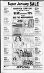
| OCR Text |
Show I DAVIS COUNTY CLIPPER, DECEMBER 29, 1982 0003) - (Was Total Tax $389.66 Ivory & Company, 11:088:0019, Located in a portion of the NE'A of Sec 31, T4N-R1SLM: Beg at a pt of th W'ly In of Angel str, sd pt being N 89 deg. 58 20 E 282.44 ft alg th Sec In & S 40 deg. E 133.43 ft fr thNEcorofSec31 All T4N-R1- T4N-R1- SLM: & run th S 50 deg. W 283.83 ft thS 40 deg. E 60 ft th N 50 deg. E 283.83 ft to th Wly In of sd Angel Str, th N 40 deg. W 60 ft to th pob cont. .39 Acres. Reserving a R-out of now Tax Total now out. . . $34.44 Lotus Dev. Co., 11:155:0002. Lot 2, Spurlock Circle, Sec 21, SLM; Cont. T4N-R1- .21 Acres. Total Tax $41.27 Gary C. Crofts, 1 1: 155:0003, Lot 3 Spurlock Circle, Sec 21 T4N-R1SLM; Cont. .24 Acres. Total Tax $17.46 Corn-Pr- Service Corp., o 11:179:0140, All of Lot 140, Eastview 6, Cont. .24 Acres. 0067 then Out of & Total Tax $34.92 Comp-Pr- Service Corp., o 11:179:0143, All of Lot 143, Eastview 6, Cont. .24 Acres. Out of then & Total Tax $34.92 Corn-Pr- Service Corp., o 11:179:0144, All of Lot 144, Eastview 6, Cont. .25 Acres. Out of then & Total Tax $34.92 Com - Pro Service Corp., All of Lot 147, Easts lew 6, Cont. .23 Acres. 11.179-0147- Frank Hart, .70 $1,151.74 1:026:0026, Beg at NW cor of Lot 23, Femwood Hollow No. 2, a sub of pt of SE 14 of Sec 23, T4N-RISLM; Thence North 150 ft; thence South 83 degs. 48 East 133 ft; thence South 20 degs. 24 40 W 115.26 ft to NE Cor of said Lot 23; thence South 73 degs. 17 49 West 96.08 ft to (r,(,P0.B-- . Cont. .36 Acres. ..." Total Tax $92.17 David P. Trudil, 11:027:0028; All of Lot 28 Femwood Hollow No. 3. Sec 23; T4N-R1SLM: Cont. .459 Acres. Total Tax $929.07 Liston Development Co., All of Lot 1 Sec 24, T5N-R1- SLM, Tang-lewoo- SLM; ewood, Prd Amd. T4N-R1- Total Tax Robert D. Bowker, All Jr. Tangl$246.81 11:034:- - of Lot 96, Sec 24, SLM; Tangl- SLM; ewood, Prd Amd. 11:026:-0022- Acres. Total Tax Total Tax $246.81 Robert D. Bowker, Jr. 11:034:- 0095, All of Lot 95, Sec 24, T4N-R1- Twitchell. ; All of Lot 22 Femwood Hollow New. 2, Sec 23; Cont. Tangl- Tangl- $246.81 Total Tax Robert D. Bowker, Jr. 11:034 0099, All of Lot 99, Sec 24, T4N-R1SLM; Tanglewood, Prd Amd. Total Tax $246.81 Robert D. Bowker, Jr. 11:034:- 0100, All of Lot 100, Sec 24, LAYTON ABCK SLM: SLM; ewood, Prd Amd. SLM; ewood, Prd Amd. 12:108:0007, Beg 120 rods W of NE cor of Sec 23; ; SLM th S 290.4 ft th W 330 ft th N 290.4 ft th E 330 ft to pob Cont. 2.20 acres less str .25 acres remainder cont 1.95 Acres. Total Tax $515.84 Nick Faulkner, 12:109:0038, Beg 1325.6ft E&S33flfrNW cor SLM: th of Sec 34; T4N-R2S 200 ft th E 13.2 ft th N 200 ft th W 113.2 ft to pob cont. .52 Acres. Total Tax $822.17 T4N-R1- T4N-R1- T4N-RI- Green, LaForrest SLM; Tanglewood, Prd Amd. Total Tax .$246.81 Robert D. Bowker, Jr All 0027, of Lot 27, 24, T4N-R1SLM; Tang- lewood, Prd Amd. Total Tax .$246.81 Robert D. Bowker, Jr 0029, All of Lot 29, 24. T4N-R1SLM; Tang- lewood, Prd Amd. Total Tax .$246.81 Robert D. Bowker, Jr 0087, All of Lot 87, 24, T4N-R- 1 W, SLM; Tang- lewood, Pid Amd. Total Tax .$246.81 Robert D. Bowker. Jr 0088, All of Lot 88, 24. T4N-R1SLM; Tang- lewood, Prd Amd. Total Tax .$246.81 Robert D. Bowker, Jr., All 0089, of Lot 89, 24, - ewood, Prd Amd. Total Tax $246.81 Robert D. Bowker, Jr. 11:034:- All 0097, of Lot 97, Sec 24, T4N-R1SLM; Tanglewood. Prd Amd. Total Tax $246.81 Robert D. Bowker, Jr. 11:034:- 0098, All of Lot 98, Sec 24, Total Tax $34.12 Stanley L. Weeks, 12:076:0001, 2 7 W & rds S fr cen of Beg rds sec W 207 ft to W In of Lavton Cit-y- : th S 0 deg. H'05"W 132 ft alg sd W In: th E 207 ft to W In of a st; th N 132 ft alg Win of sd st to pob. Cont. .63 Acres. Total Tax $655.51 Robert T4N-R1- T4N-R1- & Thayne Lot 25 , Sec 24, SLM; Tang- - lewood, Prd Amd. Total Tax .$278.56 Robert D. Bowker, Jr 0025, All of Lot 25 24, T4N-R1SLM; Tang- lewood, Prd Amd. Total Tax .$246.81 Robert D. Bowker, Jr , 0026, All of Lot 26, 24, 0096, Oulof OI PAGE FIFTEEN d Prd Amd. Total Tax $246.81 Liston Development Co., All of Lot 2, Sec 24, T4N-R1SLM; Tang-lewooPrd Amd. Total Tax $246.81 Liston Development Co., All of Lot 3, Sec SLM; Tang-lewoo24, T4N-R1Prd Amd. Total Tax $246.81 Liston Development Co., All of Lot 5. Sec SLM; Tang-lewoo24, T4N-R1Prd Amd. Total Tax $246.81 Liston Development Co., All of Lot 6, Sec 24. T4N-R1SLM; Tang-lewooPrd Amd. Total Tax $246.81 Liston Development Co., All of Lot 7, Sec 24. T4N-R1SLM; Tang-lewooPrd Amd. $246.81 Total Tax Liston Development Co., All of Lot 8, Sec SLM; Tang-lewoo24. T4N-RIW- , Prd Amd. $246.81 Total Tax Robert C. Green, 11:034 0010, All of Lot 10. Sec 24, T4N-R1SLM; Tanglewood, Prd Amd. $31.75 Total Tax Co., Liston Development All of Lot 11, Sec 24. T4N-R1SLM; Tanglewood, Prd Amd. $246.81 Total Tax Liston Development Co., All of Lot 12. Sec SLM; Tang24. T4N-R1lewood. Prd Amd. $246.81 Total Tax Co., Liston Development All of Lot 13, Sec SLM; Tang24. T4N-R1lewood, Prd Amd. $1,357.06 Total Tax Co., Liston Development All of Lot 14, Sec SLM; Tang24, T4N-R1lewood, Prd Amd. $246.81 Total Tax Co., Liston Development All of Lot 15. Sec SLM; Tang24. T4N-R1lewood, Prd Amd. $246.81 Total Tax Liston Development Co., All of Lot 16, Sec SLM; Tang24, T4N-R1lewood, Prd Amd. $246.81 Total Tax Co., Liston Development All of Lot 18, Sec SLM; Tang24, T4N-R1lewood, Prd Amd. $246.81 Total Tax Liston Development Co., All of Lot 19, Sec SLM; Tang24, T4N-R1lewood, Prd Amd. $246.81 Total Tax Liston Development Co., All of Lot 20, Sec SLM; Tang24, T4N-R1lewood, Prd Amd. $246.81 Total Tax Liston Development Co., All of Lot 21, Sec SLM; Tang24, T4N-R1lewood, Prd Amd. $246.81 Total Tax t n , n n I Tangl- Total Tax $246.81 Masaru Hamada, 11:034:0104, All of Lot 104, Sec 24. T4N-R1SLM; Tanglewood, Prd Amd. Total Tax $277.63 Masaru Hamada, 11:034:0114, All of Lot 114, Sec 24, T4N-R1SLM; Tanglewood, Prd Amd. $246.81 Total Tax Masaru Hamada, 11:034:0115, All of Lot 115, Sec 24, T4N-R1SLM; Tanglewood, Prd Amd. Total Tax $246.81 Masaru Hamada, 11:034:0116, All of Lot 116, Sec 24, T4N-R1SLM; Tanglewood, Prd Amd. Total Tax $246.81 Masaru Hamada, 11:034:0117, All of Lot 117, Sec 24, T4N-R1SLM; Tanglewood, Prd Amd. Total Tax $246.81 Masaru Hamada, 11:034:0118, All of Lot 118, Sec 24, T4N-RlSLM; Tanglewood, Prd Amd. Total Tax $246.81 Masaru Hamada, 11:034:0119, All of Lot 119, Sec 24, T4N-R1SLM; Tanglewood, Prd Amd. Total Tax $246.81 Masaru Hamada, 11:034:0121, All of Lot 121, Sec 24, T4N-R1SLM; Tanglewood, Prd Amd. Total Tax $246.81 Masaru Hamada, 11:034:0122, All of Lot 122, Sec 24, T4N-R1SLM; Tanglewood, Prd Amd. Total Tax $246.81 Masaru Hamada, 11:034:0123, All of Lot 123, Sec 24, T4N-R1SLM; Tanglewood, Prd Amd. Total Tax $246.81 Masaru Hamada, 11:034:0124, All of Lot 124, Sec 24, T4N-R1SLM; Tanglewood, Prd Amd. Total Tax $246.81 Masaru Hamada, 11:034:0125, All of Lot 125, Sec 24, T4N-R1SLM; Tanglewood, Prd Amd. Total Tax $246.81 Masaru Hamada, 11:034:0126, All of Lot 126, Sec 24, T4N-R1SLM; Tanglewood, Prd Amd. $246.81 Total Tax Masaru Hamada, 11:034:0127, All of Lot 127, Sec 24, T4N-R1SLM; Tanglewood, Prd Amd. $246.81 Total Tax Masaru Hamada, 11:034:0128, All of Lot 128, Sec 24, T4N-R1SLM; Tanglewood, Prd Amd. $246.81 Total Tax Tanglewood Owners Association, 11:034:0192, Parcel A Beg at SW Cor of Lot 1 amd Tanglewood P.U.D. th N 79 degs. W 30 ft to a pt on a 566.54 ft rad cur to left (rad pt bears S 1 1 degs. W) thence along said cur 113.71 ft th South 89 degs. 30 West 52.78 ft thence N 0 degs. 30' 45 W 638.25 ft thence East 258.68 feet thence South 148.85 ft thence South 18 degs. W 94.78 feet thence South 4 degs. East 119 feet th South 21 degs. East 163.89 ft thence East 100 ft thence North 68 degs. 30' East 47 feet to W side of Blue Sage Lane Thence South 21 degs. 30 East 10 ft to a pt on 1088.9 ft rad cur to right (rad pt bears South 68 degs. 30 West) thence along said cur 66.52 feet thence S 72 degrees West 88.99 ft thence North 82 degs. West 163.94 feet thence South 11 degs. West 95.57 feet to POB Cont. 2.35 Acres. $1 ,698.30 Total Tax Owners AssociaB tion, 11:034:0130, Parcel Beg at Sly most cor of Lot P.U.D. 14 amd Tanglewood th N 68 degs. 30 E 47.21 ft North 36 degs. E thence 298.65 ft to a pt on a 58 ft rad cur to right (rad pt bears N 36 degs. E) thence along said cur 25.44 ft th S 18 degs. East 20.21 ft to a pt on a 686.06 ft rad cur to right (rad pt bears South 72 degs. W) thence along said cur 35.92 ft thence South 75 degs. W 54.82 ft thence South 23 degs. W 182.59Jeet thence Tanglewood thence South 73 degs. W 118.12 ft to a pt on a 1144.9 ft rad cur to right (rad pt bears South 73 degs. W$ thence along said cur 89.92 ft thence N 21 degs. 30 West 10 ft to POB Cont. .62 Acres. Total Tax $140.47 Tanglewood Owners Association, 11:034:0131, Parcel "C Beg at NE Cor of Lot 24 amd Tanglewood P.U.D. th S 14 East 220.71 ft egs. 10 35 thence S 75 degs. 190.28 feet to a pt on a 742.06 ft rad cur to right (rad pt bears South 75 degs. West) thence along said cur 38.85 feet thence N 18 degs. West 20.21 feet to a pt on a 58 feet rad cur to right (rad pt bears n 46 degs. 51 57" W) thence along said cur 56.82 ft thence N 77 degs. East 86 ft thence N 20 degs. E 143.37 feet to POB Cont. .55 Acres. Total Tax $124.60 Tanglewood Owners Association. 11:034:0132, Parcel D Beg at NE Cor of Lot 89 amd Tanglewood P.U.D. til N 79 degs. West 254.07 ft to a pt on a 58 ft rad cur to right (rad pt bears North 79 degs. W) th alg sd cur 37.48 ft thence n 62 East 20 ft (hence S 28 degs. East 41.47 ft thence East 114.66 ft thence S 60 degs. 02 53 E 119.27 ft to POB Cont. .15 Acres. $34.12 Total Tax Tanglewood Owners Association, 11:034:0133, Parcel E" Beg at NW Cor of Lot 92 Amd Tanglewood P.U.D. th N 80 degs West 107.64 feet to a pt on a 58 ft rad cur to right (rad pt bears N 80 degs. W ) thence along said cur 17.21 ft thence N 83 degs East 43 ft thence South 81 degs East 68.02 ft thence East 94.25 ft to a pt on a 58 ft rad cur to right (rad pt bears E) th along said cur 11.14 ft thence South 79 degs. W 101.49 ft to POB. Cont. .11 Acres. Total Tax $24.60 Tanglewood Owners Association, 11:034:0133, Parcel "F" Beg at NW Cor of Lot 98 Amd Tanglewood P.U.D. th 17.77 ft to a N 86 degs East pt on a 58 ft rad cor to left (rad pt bears N 86 degs. E) th along said cur 34 42 ft th S 86 Degs. W 132.79 ft thence South 12 degs. 56; 48" East 32.83 ft to POB Cont. .092 Acres. Total Tax $20.63 52' E 2203.8 ft fr S'A cor of Sec SLM on the E In 1, T1N-RIof Hy, & run th S 69 degrees 55E 300 ft: th N 21 degrees 52W 133.58 ft; thN 69 degrees 55W 300 ft toE In of Hy; th S 21 degrees 52W 133.58 ft along E In of Hy to the pob. Cont .92 Acres ?Out of NSL 52 or Total Tax $2,754.70 James R. Goodrich, 01:050:0002, All of Lot 2, Cobble Creek Est; Sec TIN-RISLM: Cont. .17 cres. Total Tax... $500.79 Lois C. Myers, 01:052:0034. Lot 53, Paul Sub, amended. Sec I, Tp IN, Rg 1 W, SLM, Cont. 265 Acres. Total Tax . . $38.95 Ben E. R. Saunders, 01:052:0040, Lot 59, Paul Sub. Amended, Sec 1, Tp IN. Rg 1W, SLM. Also the Sw ly 1.0 ft of Lot 58, Cont. .26 Acre. Total Tax $530.69 John I. Pamsh. 01:065:0020, All of Lot 101. Garden Grove No. 2. SLM: Sec. 1 & 2; T1N-R1Cont. .165 Acres. Total Tax $202.46 Dale C. Washburn, 01:082:0048, Beg on the S In of a st at apt 747.1 ft N 9 3060.9 ft W to the Win of a st & N 0 degrees 29 W 174 ft along sd st & W 215 ft along the S In of the st fr the S' SLM: cor of Sec 1; T1N-R1& run th W 60 ft along the S In of sd st : th S 74 ft ; th E 60 ft ; th N 174 ft to the pob. Cont. .24 $335.90 Acres. Total Tax Murray 1st Thrift & Loan Co., 01:082:0049, Beg on W In or a st at apt W 3054.8 ft, mol, & N 747.1 ft & N 0 degrees 29 W 103 ft along sd st fr S'A cor of SLM: & run sec 1, T1N-R1th N 0 degrees 29'W 71 ft along sd st; th W 142 ft; th S Odegrees 29E 71 ft par to sd st; th E 142 ft to pob. Cont. .23 Acres. Total Tax $545.73 William F. New land, 01:082:0050, Beg on W In of a st at apt W 3054.8 ft. mol. & N 747.1 ft fr S'A cor ofSec 1, T1N-RISLM. thN Odegrees 29'W 103 ft along sd st; th W 215 ft; th SO degrees 29'E 103 ft par to sd st; th E 215 ft to pob. Cont. .51 Acres. Total Tax $516.12 RayC. Hatch. 01:082:0061, Begat apt 3060.9 ft W& 747.1 ft N& N 0 degrees 29 W 174 ft & W 683 ft fr S'A cor Sec 1. T1N-R1SLM: th S 174 ft; th W 24.62 ft;thN 163 ft; th Ely 19.1 ft along arc of a 45 ft rad cur to left th E 9.62 ft along S line sd st to pob Cont. .10 Acres. Total Tax $10.74 Control Devices Inc., 01:083;0()07. Beg at NE cor of Lot 5, North Salt Lake Indust- NORTH SALT LAKE ABJ Santa Fe Equipment Co., 01:045:0001, A parcel situated in the NW'A of Sec & the NE'A of Sec 2; T I Comm at apt that is 45.42 ft S& 252.5 ft E of the NW cor of Sec 1, as Estab In Dec 1959, sd NW cor being S 68 degrees 54E A Dist of 76.21 ft fr the N W cor of Sec , as set by the Davis Co. Survey - or on . sd pt also being the N E cor of that certain parcel of land conveyed in 410-23th S 89 degrees 52'W along N In of sd deeded parcel 317.57 ft to NWcorofsddeeded parcel ; th S 0 degrees 08'E 1.0 ft mol to apt 16.0 ft Sly. measured at right angles, fr Cen In of Oregon Short Line RR Co lead track No. 9, as now constructed and operated, and true point of beginning; th S 89 degrees 52W par to sd track 83.7 ft to beg of a tang curve, concave SE'ly, having a rad of 271.94 ft; th Wly along sd curve, thru an angle of 38 degrees 38 03, an arc dist of 183.37 ft; to the E'ly In of Howard St (Main St); th S 0 degrees 13E lalong sd Ely In of Howard St 443.58 ft mol to the Nly In of Pacific Ave; th N 89 degrees 37'E along sd Nly In of Pacific Ave 252.84 ft; th N 0 degrees 08W along the W In of said deeded parcel 501.99 ft mol to the true pob. Cont. 2185 Acres. Total Tax . . . $2,983.24 Meguerditchian 1391.2Toros, ft S & 01:045:0007, Beg llftEfrNEcor Sec. 2, Tp IN, Rg 1W, SLM, W 238.7 ft, S 68 ft, E 238.7 ft. N 68 ft to beg. Cont. .37 Acres. Total Tax $371.18 Lindsay Otto Stens, 01:045:0008, ft E fr NE Beg 1459.2 ft S & cor Sec 2. T1N-R1SLM;th W 238.7 ft to Center of a 4 rod E S st; th 70ft; 238.7 ft; th N 70 ft to beg, Cont. .38 Acre. Total Tax $349.55 Robert Brisko. 01:045:0015, Beg ft 256.50ft W& 660.47 S&S31 degrees 10T5"W 603.47 ft fr S 'A cor of Sec 36 th N 31 degrees 10T5"E 107.56 ft; th n 89 degrees 5450"W 278.235 ft; thS 17 degrees 20'25W 96.455 ft; th E to pob. Cont. .57 Acres. Total Tax $282.99 Alvie James Cleverly, 01:045:0016, Beg at apt 256.50 ft W & 660.47 ft S & S 31 degrees I0T5"W 603.47 ft frS'A cor of Sec 36.T2N, RIW, th S 31 degrees 1015" W 107.56 ft; th N 89 degrees 5430pW 224.84 ft; th N 17 degrees 20'25 E 96.455 ft; th E to pob. Cont. .51 Acre. Total Tax $279.92 John R. Ream, Jr.. MD, 01:045:0039. Beg 7.82 chs N & 1.06 chs E fr SE cor of NE'A Sec 2, Tp IN, Rg 1W, SLM, th S 2.0 chs, W 282.40 ft. m or I, to E In of ppty conv to St Rd th N 31 deComm in grees 15'E 154.4 feet, m or 1 along Ely In, th E 210.98 ft, m or 1, to beg. Cont. .75 acres. $419.04 Total Tax R. G. Apgood, 01:045:0043, Bega 1225.1 ft W& 575.1 ft N of Cen Sec. l.Tp IN. Rg 1W. SLM, n 879 degrees 58W 19.3 ft, N 31 degrees 29E 526.5 ft, E 19.3 ft, 5 31 degrees 29 W 526.5 ft to beg. Cont. .20 Acres. Total $40.65 Tax Dean Tolman, 01:047:0049, Beg on N In 60 ft st at pt 3005.2 ft W 6 1335.7ftNalongCo. Road& N 89 degrees 06' E along st 180 ft fr S'A cor sec. 1, Tp IN, Rg 1W, SLM, N 0 degrees 03W 169 ft, N 89 degrees 06E 60 ft, S 0 degrees 03E 169 ft to N In St. S 89 degrees 06W 60 ft along N In st to beg. Cont. .233 $292.19 Acres.Total Tax James W. Hitchens, 01:047:00, Betg at pt 528 ft E of SE cor inter of 2 co. roads, which pt of Inter is 2328.7 ft N 9 366.2 ft W fr SW coir sec 1, T1N-R1SLM: S 165 ft, E 132 ft, No 165 ft W 132 ft to beg. Cont. .50 $675.64 Acres. Total Tax Rock Manor Trust Trustee, 01:047:0217, BegN 89 degrees VU 7 t 9, XT inm.oor rial Park, Plat A. sd pt being also 3967.0 ft N & 384.0 ft E fr SW cor of Sec SLM, & run thS 223.41 ft along Win of 700 W str. thW 388.69 ft to E In of Redwood Road, th N 0 degrees 38 49 W along sd E In of Redwood Road 223.41 ft toS In of 600 N str; th E along sd S In of 600 N str 391.21 ft to the pob. Cont. 2.00 Acres. Total Tax $2,403.46 Carrier Brokers.0l:083:00ll. Beg In on E of 700 W st at apt 400 ft N S of W cor of Lot 6. No. Salt Lake lndust. park Plat A. A sub of pt of Secs 2 & 3. T1N-R1SLM: & pt of Sec 35. T2N-RISLM: & run th E 340 ft; th S 128.12 ft; thW 340 ft; th N 128.12 ft to pob. Cont. 1.00 Acres. TotalTax$4, 532.38 Pride Stables, 01 :083 0022, Part of Lot 12, NSL Ind. Park, Plat A, Sec 2.TIN-R- I W; SLM: Begat apt N 678.44 ft & E 903.04 ft fr th N W cor of Sec 2, sd pt being 50 ft E of th NW cor of Lot 12, NSL Indus. Park Plat A, & run S 1050 ft;thN 1030 ft; th W 1050 ft to the pob. Cont. 24.83 Acres. Total 1030ft;thE Tax $4,897.54 GHB Constr Inc., 01 087:0007. All of Lot 14F, AM. NSL Ind. ; Park Plat A. Sec 2; SLM: Cont .320 Acres. Total Tax $1,686.41 Dennis M. Beck. 01:091:0007, Beg 1240 ft W & S 0 degrees 4030E 257.55 ft fr the NE cor : of SE'A of Sec 3. SLM: run th 40'30E S 0 degrees 37.36 ft to th N line of ppty conveyed to Mineral Ferth S tilizer Co. by Wd 346-288 degrees 44'30E 1164.72 ft along sd N line to the Wlyline of a Hy; th N'ly 73.74 ft along the arc of a 5679.65 ft rad curve to the left along sd hy to the S line of ppty conv to Zions Securities Corp by wd N 87 degrees 10'30W 125.22 ft mol th S 89 degrees 5130W 580.50 ft to apt of a 745.30 ft rad curf to the right; th Wly 21.46 ft along the arc of sd cur; th S 84 degrees 31'W 165.02 ft: thW 275.45 ft to pob. Cont 1.82 Acres. Total $64.42 Tax th (The) Oilgear Company, 3664.84 01:100:0002. Beg at apt ft E & 25 ft S fr N W cor of Sec SLM: sd pt 10; T1N-RIbeing on S'ly RW In of Cudahy Lane; th S 295.16 ft; th F. 295. 16 ft mol to ppty In of Ball Manufacturing Co. Ppty th N 295.16 ft to apt on Sly In of Cudahy Lane; thW 295. 16 ft to pob. Cont 2.00 Acres. Total $141.88 Tax (The) Oilgear Company. 01 : 100:0003. Beg on S side rd N 89 degrees 50 W 1120ft & SO degrees 06E 30.80 ft fr NE cor N 89 Sec 10, degrees 50W along sd S In st 200ft; SO degrees 06E 435.60 ft; S 89 degrees 50'E 200 ft; NO degrees 06W 435.60 ft to beg cont 2.00 Acres. Total Tax $6,851.95 Amer-iInvestment Market Inc. 01 100:0006, Beg on SW cor of NE'A of NE't Sec I0.T1N-R1SLM: th Ely along stock yards ppty In 113 ft; th Nly 156.5 ft; th Wly 171.5 ft; th Sly 150 ft to beg. Cont. .50 Acre. Total Tax $52.92 Inter Mountain Terminal Co., 01:103:0002, Beg on S line of Cudahy Lane at a pt S 89 degrees 50 E 217.43 ft & S 0 degrees 06E 40 ft fr NW cor Sec SLM: th S 89 11; T1N-R1degrees 50E 256.24 ft; th S 0 degrees 06E 300 ft th S 89 degrees 50' E 1 50 ft : th S 0 degrees 06'E 550 ft; th N 89 degrees 50W 406.24 ft; th N 0 degrees 06 W 850 ft to pob. Cont. 6.90 Acres. Total Tax . . . $2,821.43 George A. Sanders Const Co., 01:104:0004, Beg on S In of Cudahy Lane at apt S 89 degrees 50'E 3065.43 ft &S Odegrees 10' 'A 33 ft fr NW cor of Sec 11, T1N-R1SLM: th S 89 degrees 50'E along S In of Oft to Cudahy Lane apt wh Is N 89 degrees 50' W 100 ft fr W In of D&RGW RR RAVMhSb degrees 50'W 212 ft; Th N 87 degrees 34'W 100 ft; th N 1 degree 33 W 95 ft; th N 9 degrees Ar in c , n.. IIIIUWL me JJJIJ,JPJl- ... $2,,95. 35 Investments, Acres Total Tax Gregland 01 104. 0009. All that portion of the former 1250 West Str (now known as 125 W Str) ly ing E of the Ely In of a freeway known as S of the S In of Cudahy In (33 ft. M L. S of the N In of Sec 111 & W of the following desc In. Beg at the SE cor of the Intersec of Cudahy Ln (now know n as Center Str! & the former 1250 W str. at a pt S 89 degrees 56' W 184.51 ft along the Sec In & S 0 degrees 04' E 20 ft & Odegrees 29 12 E 13ft. M L. fr the NE cor of Sec II-- 1 SLM, & run th S 0 degrees 29T2" E 537.33 ft, M L. to the Intersec of sd str & th s In of sd Fly Cont. tieewayknown as 0 3 Acres. Total Tax $167.95 Thomas P. Critchley, Jr.. 01 104 0025. Beg S 89 degrees 5'W 383 82 ft & S 0 degrees 42 E 777.79 ft & W 23.82 ft fr NE cor Sec 11: T1N-R1SLM. th W 70.34 ft; th N 72 degrees 36'W 27.15 ft. th W 44 36 ft. th S 133 06 ft; th E 141.12ft.moi l.toWlnofsttth N 0 degrees 42 W 124 96 ft. or I along sj W In to pob. Cont. 43 Acres Total Tax $198.63 The I ockhart Co. 01 104 0037, Brig at apt S 89 degrees 53' W 40 2 ft & S 0 degrees 42' E 1010.75 ft &S 22 degrees 37'W 1061 3 ft fr NE cor of sec 11. ; SLM: run th S 22 degrees 3'W 27.5 ft: th NW'lv 20 ft. th SW'ly 322 ft along E ln ot Grantors Land: thW 288 9 ft o SW cor of Grantors Land; th NE K along W In of Grantors 460 ft . th E 83 ft : h para to & 55 ft to pob. Cont 1.86 Acres. To- tal! ax Ro $275 63 Lee Miller. 01.10818817, Beg on NW'lv side of a rd at apt 87.75 ft S& 205.08ft E&N 43 degrees 32' E 175 ft along sd rd It the NW cor of Sec 12; TIN-RISLMM: & run th N 43 degrees 32E 150 ft along sd rd; th N 46 degrees 28'W 142 ft. th S 43 degrees 32'W 150 ft. th S 46 degrees 28 E 142 ft to the pob. Cont. ,60 Acres. Total lax $2,349.78 EPWA Company, 01:109:0006, Beg 400 ft S fr N 'A cor Sec 12, Tp IN. Rg 1W, SLM. S 41 degrees 58'E 492.8 ft, E 269.37ft. S 553.59 ft to S In of NW' of NE'A of Sec 12. th W 599.11 ft. N 920 ft to beg. Cont. 9.00 Acres. Total Tax $315.96 Dennis J. Oyler, 01:1 12:0010. All of Lot 10, Orchard Hills Plat SLM: Cont. "A TIN-RI.37 Acres. Total Tax $551.25 George R. Jensen.OLl 1318)29. all of Lot 29, Orchard Hills Plat C. ; Sec 12; SLM: TIN-RIW- Cont. 231 Acres Total Tax $599.72 Gary G. Schliewe, 01:114:0001, All of Lot 1, Hillside Oak Sub. No. 1. amended; Sec 12-TIN-RIW- ; SLM: Cont. .44 Acres Total Tax $175.62 Garv G. Schliewe. 01:114:0002, All of Lot 2, Hillside Oak Sub. No. 1, amended; Sec 12-TIN-RIW- ; SLM: Cont. .46 Acres Total Tax $178.69 Anthony M. Mora. 01:114 0004, All of Lot 4, Hillside Oak Sub. No. 1. TIN-RIW- '; amended; Sec SLM: Cont. .94 12-- Acres Total Tax $1,032.86 Norman H. Barker, 01:114:0012, All of Lot 12, Hillside Oak Sub. No. 1. amended: Sec 12-; TIN-RIW- SLM: Cont. .55 Acres Total Tax $808.31 David D.Cerva. 01:114:0015, All of La 15, Hillside Oak Sub. No. 1, amended; Sec 12-; SLM: Cont. .41 $157.98 Acres Total Tax TIN-RIW- Nikki Dauven. 01:114:0016, All of Lot 16, Hillside Oak Sub. No. T1N-R11, amended; Sec 12-SLM: Cont. .37 Acres Total Tax $1,020.74 Donald M. Halterman, 01:115:0020, All of Lot 20, Lakeview Estates, Sec 12, ; SLM: Cont. .21 $151.08 Acres Total Tax Blacks Title Ins., 01 15:0028, All of Lot 28, Lakeview Estates. Sec 12, TIN-RISLM: Cont. 0.28 Acres Total Tax $160.28 Davis B. Holbrook, All of that parTIN-RIW- 1 cel designated as 0-- 1 Lakeview Estates Cont. .035 Acres. Total Tax $3.83 David B. Holbrook, 01:006:0042. All of Lot 42, Lakeview Estates, Sec 12, SLM: Cont. .32 Acres Total TIN-RIW- ': Tax $2,703.63 David B. Holbrook, 01:116:0051, All of Lot 51 Lakeview Estates, Cont. .25 Acre. Total Tax $35.28 Lee McDonald, 01:116:0055, All of Lot 55 Lakeview Estates. Cont. .19 Acre. Total Tax $477.78 William D. David, 01:116:0065. All of Lot 65 Lakeview Estates, Sec. 12; TIN-RISLM: Cont. .20 Acres. Total Tax $149.55 Lynn L. Ballard. 01:116:0076. Ali of Lot 76, Lakeview Estates. SLM: Sec 12; TIN-RICont. .23 Acres. Also: Beg at the Southernmost corner of Lot 76: Lakeview Est & run th N 52 degrees 30 W 163.04 ft to apt on a 130 ft rad cur to the left (rad pt bears S 84 degrees 0737W Delta 2 degrees th Nly 6.17 ft along the arc of sd cur; th S 51 degrees 00E 167.44 ft along the 6 to Bndy between Lots pob. Cont. .001 Acres. Total .231 Acres. Total Tax $562.90 Nathan Clark. 01:116:0092. All of Lot 92, Lakeview Estates. Cont. .38 Acres. Total 4311); Tax $612.40 Reid Scott Holbrook, 01 117:0020. All of Lot 20, Orchard Hills East Plat 1 Cont. 0.22 Acres. Total Tax $852.79 S. Arthur Gregerson.01: 118 0106, All of Lot 106, Orchard Hills East, Plat II, Sec 12: T1N-R1SLM: Cont. .23 Acres. Total Tax $459.37 Scott Keith Stuart, 01:118:0109. All of Lot 109, Orchard Hills East, Plat 11. Sec 12, T1N-R1SLM: Cont. .19 Acres. Total Tax $614.29 Dale Smith, 01:118:0155, All of Lot 155, Ochard Hills East. Plat II; Sec 12; TIN-RIW- ; SLM: Cont. .25 Acrs. Total Tax $1,009.24 Dale J. Lambert, 01:119:0141. All of Lot 141. Orchard Hills East J- Plat III. Sec 12 SLM Cont. .18 Acres. Total Tax $780.70 Gus Weiser, 01 : 22:000 1. Beg at pt E 417 ft, S3 degrees O. W 24.7 ft fr NW cor of NE'A of Sc 14.TP IN. Rg 1W. SLM. S 3 degrees O, W along E RW OSL RY, 1381.4 ft, E 81.8ft foB ry RW, N 6 degrees 36, E along sd RW 1388 6 ft, W UJiLMlLf! 4 Juul n.. r a s rx $102.76 Acres. Total Tax Ardell H. Jenkins, 01:129 0030. All of Lot 30, Amend; High; lands Plat "A Sec 1. SLM: Cont. .23 Acres Total $24.54 was Tax Consolidated Capital Corp. 01:129:0034, The NWly 20 ft of Lot 34. Amend. Highlands Plat "A", Cont. .03 Acres (was Total Tax $3.83 L. Roger Christensen. 06:082:0005. Beg at a pt 216 21 rods& 10 ft S & 1784.25 ft W of the NE cor of Sec 34. T2N-R- 1 W, SLM; & run th S 374.5 ft . mol, to a pt on th N In of a 50 foot road; th W 72.25 ft along sd road; thN 374.5 ft mol, to a pt W of beg; th E 72.25 ft to the pob. Cont. .621 Acres. Total $22.24 Tax Joseph J. Shook 06:082:0016, Beg 276 21 rods S& 2616.55 ft W 1 fr NE cor Sec 34. T2N-RI. SLM; thW 259 1.45 ft; S 10 ft; E 2591.45 ft; th N 10 ft to beg. Cont. .59 Acre. Total $19.1 Tax Edwin L. Brower. 06:082.0018. Beg 276 21 rds & 384.5 ft S A 3657.25 ft WfrNE cor Sec 34. T2N-R1SLM W 520 25 ft. N 374.5 ft, E 50.25 ft ;thS 374 5 ft to beg. Cont. 4.48 Acres $157.21 Total Tax James W. Hitchens. 06:082 0022. Beg 276 21 rds & 10 ft S A 1856.2 ft W fr NE cor Sec 34. T2N-R1W- . SLM: S 374.5 ft to N In of 50 ft st; W 240 ft. N 374.5 ft; E 240 ft to pob. Coni 2.071 Acres. Total Tax $72.86 Terracor Corp. 06:082.(8)23. Beg 276 1 21 rds & 10 ft S & 1576.25 ft W fr NE cor Sec 34. T2N-R1SLM. S 374.5 ft to N In of ast; W 208ft; N 374.5 ft.th E 208 ft lo beg. Cont. 1.788 $62 12 Acres. Total Tax Joseph J. Shook 06:082:18)24, Beg at apt S 276 21 rods S fr NE : SLM. cor Sec 34; th W 1056 ft; th S 10 ft; th E 1056 ft; th N 10 ft to pob Com .245 Acres. Also beg 276 21 rodsS& 1576.25 ft WfrNE cor W 520.25 ft; Sec th S 10 ft; th E 520.25 ft; th N 10 ft to pob. Cont 12 Acres. Total .365 Acres. Total Tax $13.04 Terrance R. Bland. 06:082 (8)25. Beg 276 121 rods S& 1056 ft W ; fr NE cor Sec 34. T2N-R1SLM: thS 384.5 ft. thW 520.25 ft; th N 384.5 ft: th E 520.25 ft to pob, Cont. 4.60 Acres. Total $161.82 Tax Terrance R. Bland, 06:082 (8)26, Beg 276 21 rods S fr NE cor SLM. th SO Sec 34;T2N-R1W- ; degrees 15W' 192.5 ft: th W 1056 ft; th N 0 degrees 15 W 192.5 ft: th E 1056 ft to the pob. Cont. 4.45 Acres. Except the N 10 ft thereof. Total Tax$815.98 Tracy Collins Bank & Trust Tru. 06:082:0033. Beg 276 '21 rods & 434.5 ft S & 2096.5 ft W fr NE cor Sec 34;T2N-RIW- ; SLM: thS 376.5 ft: thW 520.25 ft: th N 376.5 ft to S line of a 50 ft st (950 North) th E along sd st 520.25 ft to pob. Cont. 4.60 $161.82 Acres. Total Tax Tracy Collins Bank & Trust Tru. 06:082:0034, Beg 276 121 rods & 434.5 ft S & 1576.25 ft W fr NE cor Sec 34; T2N-R1W- ; SLM th S 376.5 ft; th W 520.25 ft; th N 376.5 ft to S side of a 50 ft st (950 North); th E along sd st 520.25 ft to pob Cont. 4.60 Acres. Total Tax . . ..$161.82 James W. Hitchens. 06:082 (8)36. Beg 276 121 rods S & 5208 ft W fr NE cor Sec 34. T2N-RIW- '. SLM; thS 384.5 ft. morl.toN In of a st; th W 72.0 ft. m or I along sd N ln to W ln Sec 34; N 384.5 ft; E 72 ft to beg Cont. $22.24 .635 Acre. Total Tax Joseph J. Shook 06:082:0039. Beg 276 121 rods & 811 ft S & 2616.75 ft W fr NE cor Sec 34, T2N-RISLM: S 11.2 ft; W 1040.5 ft; N 11.2 ft; th E 1040.5 ft to beg, Cont. .26 Acre. Total $27.61 Tax David M. Sc h a u e r hame r , 06:086:0019, Beg at apt on an old fen ln on E R W ln of D&RGW RR: sd pt being N 894.70 ft & E 4441 03 ft fr SW cor of Sec 35; T2N-R1SLM: sd SW cor being W 21 ft & N 126.50 ft fr an old stone sd to be NE cor of Sec 3; TIN-RISLM: run th along sdold fen In & E R'W In N 9 degrees 19E 213.81 ft; th along an old fence ln E 463.07 ft to W In of Howard St; (1100 W St); th along sd W In S 182.20 ft: th W 56. 10 ft: th S 32 ft to an old fen In; th along sd old fence In N 89 degrees 35 W 441.68 ft to pob. Cont. 2.64 Acres. Total $176.39 Tax Makest. 06:090:0021. Beg at NW cor of Lot 18, NSL Ind. Park Plat B Sec 35. T2M-R1SLM: th S 89 degrees 5451E 399.24 ft; th S 559.42 ft; th W 399.24 ft; th N 560.01 ft to the pob. Cont. 5.13 Acres. Total $900.34 Tax Bruce C. Coder, 06:091:0005, Lot 5, Beneficial Business Park I. SLM: Sec 35, T2N-R1Cont. .39 Acres. Total Tax $1,382.72 Bruce C. Coder, 06:091:0006. Lot 6, Beneficial Business Park 1, SLM: Sec 35. T2N-R1Cont. .40 Acres. Total Tax $1,667.20 Bruce C. Coder, 06:091:0008. Lot 8. Beneficial Business Park I, Sec 35, T2N-R1W- ; SLM: Cont. .34 Acres. Total Tax $1,368.15 Brent C. Parsons, 06:094:0003. 12.55 chs S& 1194.8 ft Efr Beg NW comer of SW' Sec 36, E 73 ft; S 150 ft; thW 73 ft; thN 50 ft to pob Cont. .25 Acres. Total Tax $278.69 B. Payne, 06:094:0004. Beg 12.55 chs S & 1 121.80 ft E fr NW cor of SW'i Sec 36T2N-R1W- ; SLM: th E 73 ft th S 150 ft; thW 73 ft; thN 150ft to pob. Cont. .25 Acre. Total Tax $380.38 Hermes Associates, 06:094:0031, A parcel of land sit in SW'4 of Sec 36 T2N-R1SLM: & NW'ASec 1. TIN-RIW- ; SLM: Desc as foils; Beg S 14.02 ft & W 9.94 ft & N 89 derees 52E 13.62 ft frNW cor sd Secl.sd pt being S 68 degrees 54E 76.21 ft frNW cor sd Seel, as set by Davis Co. Sur on ; sd pob also being 16 ft Nly measured at rt angles fr cen In oOSLRR Spur Track & run th N 14degrees34'E603.76fttoS ln of Union Ave; th N 89 degrees 52E along sd S ln 247.21 ft; th S 441.98 ft to pt on cur of Irft.radptofwhisS 16 degrees 5146E 297.44 ft (long chord of sd cur bears S 65 degrees 0007"W 84.18 ft) sd pt being 9.50 ft of rad dist N'ly freen ln of OSLRR Co. spur track; th SW'ly par to & 9.50 ft rd dist .Nlyfrcenlnof sd Spur Track, Stanley rad curve to right (long chord of sd curve bears S 69 degrees 17W' 119.74ft); th SWly par to & 9.50 ft rad dist Nly freen In of sd spur track, along arc of sd curve 120.68 ft to apt of a compound curve to nght. rad pt of wh is N 8 degrees 18'W 487.78 ft. (long chord of sd compound curve bears S 81 5131W degrees 2.70 ft); th SWly along arc of sd compound curve 2.70 ft. th S 89 degrees 52' W 109.45 to pob. Cont 3.898 Acres. Total Tax . . $8,732.69 FMA Financial Corp. 06 094 0033. Beg on W ln of a st (400 E St NSL) at apt wh Is 256.50 ft W&N 829.20 ft along W ln of sd st fr S' cor of Sec 36 T2N-R1; SLM. th W 505 ft. mol. to ETv no access In of thN 34 degrees 03' E 94.32 ft along sd no access In to a st rd Monu & apt ot tang with a cur to right, th along sd cur for an arc dist of 3( ft. mol, (chord bears N 40 degrees 43' 05 " E 365.87 ft) to a st rd monu; th Cont. along the no access In N 49 degrees 24 25 fc 308.20 ft; th SO degrees 22'40'W 197.90 ft to a St Rd Monu & W'ly off ramp th W 8.96 RW In ft to W ln of 400 E St: th S 358.28 ft along sd w In to pob. Cont. 3.00 Acres. Total Tax $10,630.00 Jim P. Mola. 06 09s 0008. Being in SE' 4 of Sec 36. T2N-RIW- ; SLM. Beg at apt S 89 degrees 50' W 831.11 ft & S 0 degrees 09' E 424.59 ft & S 89 degrees 5I W 31.84 ft fi a Davis Co. Monu Marking lntersec ot Center ln of Hwy 91 & 2600 S st fr w h a monu in Center In pt of intersec of s 2600 S st & 500 W bears N 89 degiees 50 E & run th S 89 degrees 51'W 158 16 tt. N 0 degrees 09' W 222.61 ft mol to apt on a 689.62 ft rad cur lo left & S In of 2600 S St. th E'ly along arc of said cur 51 52 ft. N 74 degrees 06'E 13 89 ft mol to Wlv ln of a platted road. American Plaza, irecorded 4 9 4. Dav is Co S 15 degrees 54' h 35 ft. S 4 06' W 13 89 ft to apt on a 724 62 ft rad cur to right: W'K along arc of said cur 46 92 ft. S (I degrees 09'h P5 ft. N 89 degrees 51 E 144 20 ft. S 15 ft to pob. Cont 23 Acres Total $60.59 Tax NSL 11. 06.09s 0050. Beg at apt N (Ml degrees 09' W 1314 Oft along W In of SE1 j of Sec 36; T2N-RW; SLM. N 89 degrees 56' F. 203 ft & S (Ml degrees 40' W 123 ft & N 89deaiees4()'F. 365.51 ft & N 415 58' ft & F. 252 06 ft fr . S' 4 cor of Sec 36. T2N-RISLM run th N 211 588 ft to S ly In of a State Road to apt on a 583.62 tt rad cur to right, th NE'ly 142.523 ft along arc of said cur along S'ly In of sd State Road chord beat N 84 " degrees OR T 5 E 142.169 ft' to apt that lies N 89 degrees 52'W 413.25 fts 00 degrees 08 W 53 ft fr a Davis County Monu at the center ln of 26(M) S str & Main St (State Hwy 1061 th S 89 degrees 52E 67.25 ft; th S 30 degrees 12'05E 49.49 ft to the W'ly In of BERR RW'; th S 26 degrees 18 45 "W 206.90 ft along sd W Ty R W In; thW 141.58 ft to th pob. Cont. .99 Acres. Total Tax . $3,548.45 NSL II, 06:095:0052, Beg at apt wh is N 0 degrees 09'HW 1436.37 ft along the W In of th : SF.'4 of Sec 36. SLM: th N 89 degrees 59'49"E 716.86 ft frth S'4corofSec 36, T2N-R1SLM: th N 0 degrees 33'49"W 172.56 ft; th N 89 degrees 59'49"E 245.85 ft to th W'ly ln of the former BERR R W; th S 26 degrees I8'34"W 192.50 ft along sd W'ly R W th 5 89 degrees 59'29"W 158.83 ft to the pob. Together with RW Cont. .80 Acres. Total Tax $5,808.50 Investicor I, 06:095:0058. Beg at apt N 0 degrees 09 W 1320 ft along Sec In N 89 degrees 567' E 203.01 ft; S 0 degrees 40'W 123 ft: N 89 degrees 40'E 31.81 ft; S 0 degrees 20 E ft fr ; S'iCor of Sec 36; SLM: sd pt is also S 89 degrees 22' W 833 ft: S 701.79 ft: S 89 degrees 40'W 308.69 ft; SO degrees 20'E 25 ft fr Monu MarkS ing Center In Inter of 2600 St 6 Hwy 91 ft wh a monu in sd 2600 S st & 500 W bears N 89 degrees 22 E & run th S 0 degrees 20' E 115.48 ft to th N In of Mos Sub; th S 89 degrees 38'W' 190 ft along sd N In of Moss Sub; th N Odegrees 03' W 84.54 ft; th N 78 degrees 51' 3IE 165.60 ft; th N 89 degrees 40'E 26.92 ft to the pob. Cont. .44525 Acres. Also beg at the NE cor of the demised premises desc in the ground lease between the parties hereto dated Spt 29. 1976; at a pt N 0 degrees 09' W 1320 ft along the sec ln; N 879 degrees 56'E 203.01 ft: thS 0 degrees 40'W 123 ft; N 89 degrees 40'E 31.81 ft & S 0 degrees 20'E 25 ft fr th S'A Cor of SLM: sd pt Sec 36. T2N-R1being also S 89 degrees 22'W 833 ft: S 701.79 fts 89 degrees 40'W 308.69 ft & S 0 degrees 20'E 25 ft fr a monu park the center In inter of 2600 S St & Hwy 91 frwhamonuin sd 2600 S Str & 500 W bears N 89 degrees 22' E & ran th S 0 degrees 20'E 115.48 ft to the N ln of Moss Sub th n 89 degrees 38'E 10 ft along sd N In of Moss Sub; th N 0 degrees 20'W 15.48 ft; th S 89 degrees 40' W 10 ft to pob. Cont .03 Total .475 Acre. Total Tax $4,072.24 J. Gordon Summers. 06:095:0059. Beg at apt N 0 degrees 09'W 1320 ft along Sec ln; N 89 degrees 56'E 203.01 ft; th S 0 degrees 40'W 123 ft: th N 89 degrees 40'E 41.81 ft & S 0 degrees 20' E 25 ft fr S'A cor of Sec 36: T2N-R- I W': SLM: sd pt is also S 89 degrees 22' W 833 ft; 5 701.79 ft; th S 89 degrees 40 W 298.69 ft & S 0 degrees 20 E 25 ft fr a Monu Marking Center Ln lntersec of 2600 S St 91 6 Hwy fr wh a monu in sd 2600 S St & 500 W bears N 89 degrees 22' E & run th S 0 degrees 20'E 115.48 ft to N In of Moss Sub; th N 89 degrees 38 E 163.71 ft mol to SW cor of Tunex pptv. th N 0 degrees 20W' 114. 38 ft toSIn of 50 ft St: Th along sd st S 89 degrees 40 W 163.71 ft mol to pob. Cont .43 Acres. Total Tax $2,588.29 NORTH SALT LAKE ABEJ Marvin A. Blosh, 01:046:0004. Beg on W line of Onion St, a 4 rod st at a pt given as W 256.50 ft and South along said st 225.14 ft fr Davis Co n i i, . W SLM. (Actural 36; T2N-R1St Ln as fenced is W 254 22 ft fr said com) ran th S alg said W In of formerly platted Onion St 437 87 ft to W'ly r w In of former Bern thence N 31 degs 22' 25 E 285.53 ft alg said r w. to a pi given as 40 ft perp dist SW 'ly fr center In of why known as S. R. 131. opposite engineer sta 0 plus 6.7, ihence North 26' 56 W 244 4 tt to POB. (Basis of bearing is Davis Co sec In bearing as published!. Cont 928 Acres Total Tax $l0 6l Charles Earl Hams. 01 04 0010, Beg North 151 9 ft and W 1322.9 ft fr South I 4 cor Sec 1, TP1N, RGIW. SL M thence W 'ly 153 ft. M or 1 to ETv r w In of canal and lo South line of Ballard Acies Sub. thence NE'ly along S In said sub to a pt North 0 deg 50' W of Beg. thence South 0 deg 50' East to Beg ( on: 09 Acres. $8"l Total Tax David B Holbrook. 0104 uulv Beg on ETv In of st rd N 84 ft along degs 52' W 1542 sec line fr S 14 Cor be, 1T1N-RIW- . SLM Then,e F 190 s ft North 21 degs along F. line said rd. theme South 69 degs. 4 V k 82 6 O thence South 19 degs 08 W 15 ft to S line said Sec in N 89 degs. 52' W 9 12 tee' along said sec line lo POB 35 Acr Also beg on Cont E'ly In of si rd N 89 degs 52 W 2542 7 ft along sec In and tt N 21 degs' 52' W 190 along E ly In of rd fr S 14 cor Sec I. ihence South 84 degs. 43' East 82.76 ft. th N 19 degs. 08' F. 5 63 ft 3 64 ft to S'lv In of retain wall ext Th N () degs OF W 82.51 tl along said In ext to E'ly In of st thence S 21 degs. 52' W 8 20 ft along said st lo POB Cont in all 36 Acres T otal Tax $504 6- Belh Gledhilk 01 04 (K124 Beg on E'h In of si N 89 dees 52' W 1248.1 tt and N 44 degs. 18' E 1219 8 ft and South 70 degs 05' E 18 tl from S I 4 cor Sec I . TIN-RIW- . SLM South 44 degs 1" W 88 ft; South 69 degs 55' East 14" ft. thence NTv to pt 120 ft South () degs ()8 East of beg. thence North () degs 05' W 120 ft to beg Cont 245 Acre. $394 09 Total Tax Robert J McClain. 01 04 0121 Beg 1424 86 feet North and 680 9 teet W and N 89 degs 48' W 64' 4 ft fr S 14 col Sec I. TIN RIW. SIM Thence North 248 ft to S line of st; thence W'Ty 165 ft. M or E. along a cur to righi along S line sd st to cen old Bonneville Canal; thence S lx along said cen line approx 200 ft to a pt N 69 degs. 88' W of a pt 10 ft N 89 degs 54 W and 34 ft South 82 degs 45' W of the POB. Thence South 69 degs 55' East 223 2 ft. m or I. thence North 82 48' East 34 feet degs thence South 89 degs 84 East 10 ft to POB Cont 9 Acres. $454 I' Total Tax Eldon L. Martindaie. 01 04' In of si N 0140, Beg on ETv lee! 89 degs. 52' W 1248 s' last and North 43 degs u 1219.8 feet and South degs. 05' East 18 ft to pi 34 It distant SE'ly fr cen in said si fr South I 4 cor Sec . TIN-RIW- ; SLM: N 43 degs 17 East 35 ft; South 49 degs 34' East 56.17 feet, thence 40 South 70 degs. 05' East 50 ft: thence N 34 degs. 55' East 74.54 ft. M or L. thence South 70 degs. 05' East 134 2 feet; thence South 46 degs 45' East 70.2 ft; thence South 27 degs. 53 West 133.5 ft. North 69 degs. 55' West 203.80 feet to a pt 147 ft South 69 degs. 55' East of th E'ly ln of said st; thence N'ly to a pt 120 ft South 70 degs. 05' East of POB Thence N 80 degs. 05' West 120 ft to 815 thence POB. Cont. Acres. Total Tax $739 32 Rockv Mountain State Eank. 01 .048 (8114. Beg at a pt 1137.4 ft E'ly and 87.7 feet South 35 degs. 14' W fr NW Cor of SE 4 of Sec I. TIN-RIW- : SLM: Thence South 35 degs. 14' W 66 ft. thence South 54 degs. 46' East 317.2 ft. thence North 0 degs. 2k West 81.2 feet, thence North 54 degs. 46' West 270 ft. to POB Cont. .48 Acres. Total Tax $163 4(1 Timothy S Evans, 01M8 00I8, Beg 288 6 ft South 0 degs. 05 East and 921.7 feet N 88 degs. 56' E and 34 ft South 35 degs. 14' W and S 54 degs 46' East 17 ft fr NW Cor of SE I 4. Sec . TIN-RISLM. South 35 deg-1W 100 ft. South 54 degs 46' East 405 ft. thence NE'ly 100 ft to a pt South 54 degs 46' E of Beg. Thence North v 84 degs. 46' W 405 ft to Beg Cont. Acre. $599 95 Total Tax Mary G Monson. 01 048 0044. Beg 288.6 ft South 0 degs 05' East and 921 7 feet North 88 degs. 56' East and South 3s degs 14' W 412 53 ft fr NW Cor SE 4 Sec 1. TIN-RIW- . Thence SW Ty along SLM SE'ly In of Orchard Drive ft South 54 degs 46' 115.5 East 190 ft, MOI. N 35 degs. 06' East to pt South 54 degs 54' E of Beg. Thence N 54 degs. 54' West to Beg Cont. .508 Acre Total Tax $'36 92 Stanley T. Berg. 01 048 0046. Beg 288 6 ft South 0 degs. 05' East and 921.7 feet North 88 degs. 56' East and South 35 degs. 14' West along hy 614 feet and South 50 degs. 36' East 17 feet fr NW Cor of SE 14 Sec I. TPIN. RGIW. SLM. thence SW'ly 81 ft. M or L along arc of a 1943.1 feet radius crave to right South 50 degs. 36 East 202.8 feet M or L. thence NEly along In para to SE'ly line of hy 80 ft. M or L. thence North 50 degs. 36" West 202 8 feet M or L, to Beg. Cont. .37 Acres. Total Tax $591.94 Jerry T. Allman. 01:048 0054. Beg at a pt at thence SE Cor of Lot 17, Oak-LeSub Plat D said pt being 264 ft N and 296. 706 feet East from thence SW cor of thence NE 14 of thence SE L4 ofSec 1; 37 degs. TIN-RIW- ; SLM: Thence East 146.68 ft; thence North fC onfmnpHl |