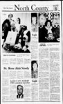
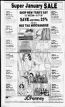
| OCR Text |
Show PAGE FOUR DAVIS COUNTY CLIPPER. DECEMBER 29, 1982 Maple HillbDev. Inc, 05.085 0003, All of Lot 119, Maple Hills No. 3, plat D, sec 33, T2N-R1SLM: Cont. .39 Acres. Total Tax 5213.16 Maple HillsDev. lnc.05.065.mnw. All of Lot 18, Maple Hills No. 3, plat D, sec 33, T2N-Rl- t ; SLM: Com .38 Acres. Total Tax 5210 86 Maple Hills Dev. Inc. All of Lot 17, Maple Hills No. 3. plat D. sec 33. T2N-RIE- : SLM Cont. .46 Acres. Total Tax 5227 f," Maple Hills Dev. Inc. 05 okvikhio. All of Lot 1K). Maple Hills No. 3. plat D. sec 33. ; SLM' Cont .'8 Acres Total Tax 5210 86 Maple Hills Dev Inc, O' 08' (KHP. All of Lot 48 Maple Hills No. 3. plat D. sec 33. I2VR1K: SLM. Cont 39 Acres Total Tax 5213.16 Mapie Hills Dev Inc. 05 08' 0008. All of Lot 99. Maple Hills No 3. plat D. sec 33. T2N-R1K- ; SI M Cont '3 Acies 1 otal lax 5242.19 SIM Out of o n po ra O' 0s'' 0010, Allot I ot 90. Maple Hills No 3, plat I), cec 33 2N-R3" SI M ( ont . I Acrec otal I ax 5208 '7 a n t ace C o t Hiailca. O' 08' 0012. Ml ot 1 ot 94. Mapie Hills No 3 plat I) sec 3 3 12N R L SIM (ont 4' Aacs I otal lax S229 loseph L Scotl. O' 08' 0014. All ot ot 92, Maple Hills No. 3, 2N RIL, plai D. sec 33. SI M ( ont 09 Vies I otal Ronald I lax 5 3 '9 84 Ronald L. Malshall. I'l.' llhhlKU', I nil I'. Rklaewood o! Mapie HillsCond I'hase amend sec 33. 2N-ISLM Total 10 09 Tax SI Gregory It Rice. 05 ORh 0017. I nit 7, Ridgewood of Maple Hills C ond. Phase amend sec 33.2N-IL- . SLM Total S 1.252 96 Tax Sharon P. White. 05, 1)80. 0042. I n t 42. Ridgewood of Maple HillsCond. Phase2amend. sec 33. 2N-1SLM Total Tax 51.107.04 Maple Dev. Hills Inc . nit 4n. Ridgewood of Maple Hills ( ond. Phase 2 amend, sec 33 2N-ISLM. Total lax 5219 27 Llnter L. Hadley. I nit '5. Ridgewood of Maple HillsCond Phase 2 amend sec SI M. Total 33, 2.N-I51 ,2o3 oo lax Mecca Enterpnses. Unit 46, Ridgewood of Maple Hills Cond. Phase amend sec 3.3, 2N-ISLM Total Tax 51.149 06 Eldon E. W'eber, O'. 080 0075. Unit 75. Ridgewood of Maple HillsCond. Phase 3 amend sec 3.3. 2N-l- t. SLM. Total Tax SUM. 35 L ' Maple Hills Maple Hills Dev. Inc., Unit 76. Ridgewood of Maple Hills Cond. Phase 3 amend, sec 33. 2N-- I E. 5617 3 SLM. Total Tax 05 086:0076, Dev. Inc., 05:086 0077, Unit 77, Ridgewood of Maple Hills Cond. Phase 3 amend, sec 3.7. 2N-- I E. 5617.31 SLM. Total Tax Maple Hills Dev. Inc.. Unit 78. Ridgewood of Maple Hills Cond. Phase 3 amend, sec .37, 2N-1SLM. Total Tax $617.31 05:086-0078- Maple Hills Dev. Inc., 0':086:0079, Unit 79, Ridgewood of Maple Hills Cond. Phase 3 amend, sec 33. 2N-15617.31 SLM. Total Tax Maple Hills Dev. Inc., 05:086:0080. Unit 80. Ridgewood of Maple Hills Cond. Phase 3 amend, sec 33. 2N-15617.31 SLM. Total Tax Maple Hills Dev. Inc., 05:086:0081. Unit 81. Ridgewood of Maple Hills Cond Phase 3 amend sec33.2N-IE- . 5617.31 SLM. Total Tax Deseret Fed Sav & Loan Assn. 05:087:0105, Unit 105, Ridgewood of Maple Hills Cond Phase 5 amend, sec 33. T2N-R1SLM. Total 51.307.38 Tax Maple Hills Dev Inc .05 087:0109, Unit 109, Ridgewood of Maple HillsCond. Phase 5 amend, sec 37. T2N-RIE- , SLM. Total Sl.303 38 Tax Maple Hills Dev lire.. 05:087:01 10, Unit 10, Ridgewood of Maple Hills Cond. Phase 5 amend, sec SLM. Total 33, T2N-RIE- , $1,70.7. 8 Tax Maple Hills Dev Inc., 05.087 0114. Unit 114, Ridgewood of Maple Hills Cond. Phase VI amend. sec37.T2N-RlE.SLOut of BO 1572C-4or SI. 08 1.06 Total Tax Ronald L. Marshall. 05:087:0116. Unit 16, Ridgewood of Maple Hills Cond. Phase VI amend, SLM. Out of sec 37. T2N-R1or BO 1572C-45896.94 Total Tax Kent Murdock. 05 087:01 17. L nit 117, Ridgewood of Maple Hills Cond Phase VI amend, sec 33. T2N-RISLM. Out of BO TotS7'C-4or 51.081.06 al Tax Maple Hills Dev Inc, 05:087:01 18, Unit 18. Ridgewood of Maple Hills Cond. Phase VI amend, SLM Out of sec 77. T2N-R1E- , or BO 1572C-451.081.06 Total Tax Maple Hills Dev Inc. 05.087:0! 19. I nit 19. RidgewoodVIof Maple amend, Hills Cond. Phase SLM. Out of sec 33, T2N-R1or BO 1572C-45896.94 Total Tax Maple Hills Dev Inc, 05:087:0120. Unit 120, Ridgewood of Maple Hills Cond. Phase VI amend, SLM. Out of sec 33. T2N-R1BO 572C-4- or $896 94 Total Tax Maple Hills Dev Inc, 05:087:0121. Unit 121. Ridgewood of Maple Hills Cond. Phase VI amend, SLM. Out of sec 33, T2N-R1or BO 1572C-4SI.08I.06 Total Tax Maple Hills Dev Inc. 05:087:0122. All of Unit 122. Ridgewood of Maple Hills Cond. Phase VI amend, sec 33. T2N-R1or SLM. Out of BO I572C-4Total $1,081.06 Tax Maple Hills Dev Inc. 05:087:0123, All of Unit 123, Ridgewood of Maple Hills Cond. Phase VI amend, sec 33, T2N-R1or SLM. Out of BO I572C-4Total $1,081.06 Tax Maple Hills Dev Inc. 05:087:0124, All of Unit 124, Ridgewood of Maple Hills Cond. Phase VI amend, sec 33, T2N-RIor SLM. Out of BO I572C-4Total $1,081.06 Tax Maple Hills Dev Inc, 05:087 0 25, All of Unit 125, Ridgewood of Maple Hills Cond. Phase VI amend, sec 33, T2N-RI- BO I572C-4or I otal Ta$896.94 Maple Hills Dev Inc. 05:087:0126, All of Unit 126. Ridgewood of Maple Hills Cond. Phase VI amend sec 37, T2N-R1SLM Out of BO 1572C-4ATotal TaS896.94 Maple HillsDev Inc. 05 087 0127. All of Unit 127. Ridgewood of Maple Hills Cond. Phase VI amend, sec 37, T2N-RIE- , SIM Out of BO I572C-4or Total Tax $1,198 72 Maple Hills Dev Inc. 05:087.0128, All of I nit 128. Ridgewood of Maple Hills Cond. Phase VI amend sec 37, T2N-R1E- , SLM Out of BO 1572C-4or Total Tax 51,198.72 Maple Hills Dev Inc. 05.087 0129, All of Unit 129. Ridgewood of Maple Hills Cond Phase VI amend, sec 33. T2N-R1E- , SLM Out of BO l'2C-4or Total Tax 51.316.37 Maple Hills Dev Inc. 05 ()87 (II '0, Beg at apt S 0 des 0L20"E 849 62 ft alg the sec In & E 1718 68 ft A S 80 des 20'72"W 120 "Oft A S 61 degs 39'I8''W 140 ft ft th NW cor of sec 33, T2N-RI. SLM thS."degsE 26.31 ft to an angle cor in Ridgewood of Maple Hills I. th S 23 degs Condo Phase 70 W 19'. 72 tt, th S 76 decs 20 W 138 fi th S 42 degs 1)5 ' W 183 SO ft. th N 79 degs 5'' W 12 ft to an angle cor in Ridgewood of Maple Hills Condo Phase IV : th N 19 degs 55'W 081 ft; ih N 3 degs 3('E 217. '0 ft, th N .33 degs 25 E 89 50 ft; th N 18 des 02'E 142 'Oft; th N 8 degs 45 E79ft; th S 46 degs 10 K 81 ft; th S 55 degs F. 30 ft to pub. Being a pt ot Maple Hills No. 1. Condo area Cont 2 62 Acres out of BO l'72C-- A oi Iota! lax 511,784.70 A h u r B a f c be r . 06 039(8180. Beg HI rds 6 ft W li SF orofSF.Gof "010x41! sec 24:T2VR1W: SLM. W 209 ft S 25 ft. th K 209 tt N 28 ft to beg. Cont less st 60 Acres less to 838 1014 mnainder 12 Acies. Total lax .51.693.53 Self Storage Inc. 06:079 0085. Beg 321 ft W A 816 66ft N ofSEcor SLM: W sec 24. T2N-RI142 ft S 102. 3.3 ft E 142 ft th N 102 37 ft to beg Cont .3' Acre together with perpetual R,W. 5287.26 Total Tax 1 Dean Tolman. 06 049 0028, Beg on N In of 600S st at apt S 1040.20 ft par to sec In & S 89 degs 46' 36" W 298,07 ft fra witness cor 65 ft W of N E cor of th S sec 25: T 89degs46'76"W 1(81 ft dig sd N In; th NO degs I4T6"E 152,01 It to apt 749 ft S of cen cor of sec 25. F2N-R1SLM; th S 89 des 46'36"W UK) ft alg sd N In. th NO degs 14' 16"E 152.01 ft to apt 349 tt S ot cen In of 500 5 st, th S 89 degs 54'E 1(H) ft par to 5(H) S st, th SO degs I4'16"W 151.84 ft to the pob. Cont. .35 51 .528.76 Acres. Total Tax Carlos U. Wood.06'049:(K)70. Beg at apt on the W In of a Hyw 14.39ehx S & 2.50 chs W fr NE cor of sec SLM, 6 run th S 90.46 ft to the N In of th W alg pptv conv hy 61)l-'2sd N In 298 07 ft; th N 0 degs 297.44 I4I6 E 151.72 ft to the W In of Hyw; Th S along sd W In 60.86 ft to the pob. Cont. I 034 Acres. Total Tax $1,122.32 ') Jr., BOUNTIFUL ABDEJ Chelsea Dev. Co., 01.005:0001. Beg at a pt N 89 deg. 51V48" E 485.551 ft alg sec In fr NW cor SLM; run of Sec 5, TIN-RIth S 35deg. W 718) ft mol. alg the N VV In of Chelsea Cove Plat No. sub; th N 28 deg. E 147 ft; th N 40 deg F. 155 ft mol. to pob. Cont. .062 Acres. (Out of BO Chelsea Dev. Co.. 01:0(15:0002, Beg at a pt 1428.284 ft S & 724.377 ft WfrNGcor of Sec 5. TIN-RISLM; th S3 deg. 30' E 100.001 ft th S 86 deg. 50' W 252.806 ft th N 84 deg. W 15 ft th S 74 deg. W 134.84 ft th S 57 deg. ILL 101 152 ft th s 3 deg. 06' E 10 ft th S I deg. 53' E 99.6 ft, th SK '.& DEG. ? 7'4 E 217.495 ft thS 47 deg. 14' E 3 16.30 ft thS 81 deg. 05 E 1'4.10 ft th S 60 deg. 37' E 382.20 ft th S 69 deg. 17' E 132 40 ft th S 79 deg. 23' E 80.31 ft thS 60 deg. El 18 ft th N 10 deg. 50' 37" W 179.789 ft th N 60 deg. W 544 ft th N 20 deg. W 700 ft to the pob cont 9.231 Acres. Total Tax$584.21 Chelsea Dev. Co., 01:005:0003, Beg at the NW cor of Sec 5 TIN-RISLM: th S 107.7 ft th S 38 deg. .07' E 95.9 ft, th S 23 deg. 12 F. 82.3 ft th S 13 deg. 33' E 98 I ft th S 55 deg. 58' E 105.111 ft th N 35 deg. E 2(81.222 ft th N 28 deg. E 147 ft th N 40 deg. E 155 ft to apt on S SLM: In of sec 32: T2N-RIE- : th N 89 deg. 5058"W 325.821 ft th N 60 deg. W 73.0.77 ft th N 88 deg W 40 ft th S 2 deg. W 37.675 ft; N 89 deg. 50' 13" W 55.188 ft to pob. Cont 2.75 Acres. Total Taxes . . $426. 19 Douglas Havens, 05:001:0025. Beg 638.33 ft S & 109.83 ft E fr NW cor Lot 2. Sec 31. T2N-RISLM; th N 119.65 ft; W 259 ft. m or 1, to E In of ppty th N'ly conv to st rd in 320-49188 ft. m or I, alg arc of a 785.5 ft rad curve to right to N In Grantors Land: th E alg a In 5.0 ft N of N wall of old house 231 ft; th S 70 ft. E 572 37ft. mor I. to E In of grantors land & old fence; th S 2 deg. 05'30" W alg sd old fence 234.68 ft. m or I, to pt due E OF BEG: TH W 562.98 ft. m or I. to beg, cont. 4.12 Acres. TNOTAL 52.081.95 Tax pob. Com. .63 Acres. Total $68.70 Chelsea Dev. Co., 01:005:0011, Beg at a pt wh is S 89 deg. 50" 58 E alg sec In 2184.593 ft & Du S 233 1 643ftfrNWcorof SLM: sd pt Sec 5; TIN-RIbeing on arc of a 316.218 ft rad cur th cen of wh bears N 44 deg. 12'39" E; th SE'ly alg sd cur to left thru a central angle of 14 deg. 49 39" for a dist of 81 834 ft; th S 60 deg. 37 E 16.979 ft to a pt on Nly In of Indian Springs Rd as a dedic in No Canyon Ests plat C, sd pt being on arc of a 1 5 ft rad cur th center of wh bears N 75 deg. 42' W; th NW'ly alg sd cur to left thru a central angle of 59 deg. 06'49 for a dist of 15 deg. 476 ft; th N 60 deg. 37' W 87.504 ft to pob. Cont. .016 $3.95 Acres. Total Tax R. Reed Jensen. 01:019:0004, Beg at apt on SW'ly R-Inofard, sd pt being S 0 deg. 08' 11 E alg the sec In 627.62 ft fr the N E SLM: & cor Sec 6: TIN-RIE- ; run th S 0 deg. 08 1 E 63.49 ft ; th S 89 deg. 51 '49" W 157.95 ft; thN 162. 50 ft; thW 120 ft; th N 21 deg 53 of 172.78 ft; th S 47 deg. 30' E 134.04 ft to the pob. Cont. .645 Acres. Total $228.22 Tax DelsaG. Hale, 01:019-0006Begat N E cor of S 'A of N F. G of Sec 6 TIN-RIE- ; SLM: th S alg sec In 1320 ft to E G cor sd Sec 6; Th W 1040.412 ft, mol. alg 'A sec In to a pt S 89 deg. 40' E 520.35 ft fr SE cor of Lot 52, Bona Vista Sub; thN 178.26 ft, m-- l to S In th N 89 of pptv conv in 597-7deg. 48 42" E 248. 19 ft; thN 74 deg. 5E20" W 60.0 ft: th N 40 deg. E 357.53 ft; th N 2 deg. E 855.77 ft, m-- l. to a pt W of beg, th E 47.173 ft. m-- l to the pob. Cont. 18.09 Acres less to 616-- 4 6 cont .09 Acres Less to 666-31cont 7.11 Acres remainder 10.89 Acres. Total Tax $1,573.87 Leon Peterson, 01:021:18)04. Beg a pt wh is N 00 deg. 08'42" W 1325.135 ft alg sec In & S 89 deg. 47' 17 W 295 ft alg S In of North Canyon Estates. Plat A; fr EG cor of Sec 6; TIN-RISLM ( Basis of 3 bearing being N 00 deg. 08' 42" W alg E In of sd Sec 6); & run th S 89 deg. 47' 7 W 16.61 ft to thNE cor of North Point Cove Plat C; th S 2 deg. 00' W 981.03 ft: th S 30 deg. 28' W 137.93 ft; th S 69 deg. 41 W 206.64 ft to th ETy In of ppty of So Davis County Water Imp Dist; th S 11 deg. W 83.93 ft alg sd ETy In to the SE cor of sd ppty; th N 82 deg. W 154 ft to th ETy In of a str; th Sly 19 ft, mol, alg the arc of a 287.32 ft rad cur to left th S 4 deg. E 39.30 ft; thS 86 deg. W 245.65 ft alg th S In of sd plat C; thN 18 deg. W 82. 16 ft; th S 70 deg. W 262.14 ft to a pt wh is S 89 deg. 5750"W 1294.802 ft fr sd EG: th S 89 deg. 5750 W 25.198 ft, mol, to th W In of th EG of th SEG of sd sec 6; th S E 250.97 ft alg 00 deg. 25'37 sd Win; thE 712.89 ft; thN 10 deg. 30' W 266 ft ; th N 56 deg. 30' E 380 ft; th N 1 deg. 38' E 1105 ft to th pob. Cont 5.765 $833.13 Acres. Total Tax Chelsea Dev. Co., 01:031:0034, All of Lot 1, North Canyon Estate Plat Sec 6, TIN-RISLM: Cont. .37 Acres. Total Tax $33.17 Chelsea Dev. Co. 01:031:0035, All of Lot 2, North Canyon Est. SLM: Plat D, Sec 6, TIN-RIE- ; Cont. .97 Acres. Total $346.68 Tax Steven L. Nielsen, 01:034:0011, All of Lot ll.North PointCove Sub. Plat A, Sec 6; TIN-RISLM: Cont. .388 Acres. Total $84.50 Tax Steven L. Nielsen, 01:034:0012, Allot Lot 12, North PointCove Sub. Plat A, Sec 6; TIN-RIE- ; SLM: Cont. .374 Acres. Total Tax $81.34 Leon Peterson, 01 :034:0017, All of Lot 17, North Point Cove Sub. SLM: Plat B, Sec 6; TIN-RIE- ; Cont. .248 Acres. Total $217.17 Tax Peterson, 01:034:0018, All of Lot 18. North Point Cove Sub. Plat SLM: B. Sec 6; TIN-RICont. .248 Acres. Total $217.17 Tax Thomas L. Miller, 01:034:0020, All of Lot 20, North PointCove Sub. Plat B, Sec 6; TIN-RISLM: Cont. .36 Acres. Total $236.91 Tax Larry C. Wade, 01:034:0028, All of Lot 28, North Point Cove Sub. Plat B, Sec 6; TIN-RIE- ; SLM: Cont. .28 Acres. Total $221.91 Tax Tax FPSA Investment LTD, FPSA Investment LTD, 01:034.0047, All of Lot 47, North Point Cove Plat C Sec 6; TIN-RIE- ; SLM: Cont, .34 $232.96 Acre. Total Tax Daryl Henry Cook, 01:034:0048, All of Lot 48, NorthPoint Cove SLM: PlatC Sec 6; TIN-RICont. .28 Acre. Total Tax $1,411.19 W. James Morrison, 01:034:0054, All of Lot 54. North Point Cove SLM: PlatC Sec 6; TIN-RIE- ; Cont. .26 Acre. Total $218.75 Tax 01:034:0055, All of Lot 55, North Point Cove Plat C Sec 6; TIN-RIE- ; SLM: Cont. .34 $232 Acre. Total Tax FPSA Investment FPSA Investment FPSA Investment BOUNTIFUL ABEJ 89 deg. 51' E 18" E I. Oft to the W In of a st; th N 0 deg. 0842 W 120 ft alg sd st: th S 89 deg. 5118' W 1.0 ft; th SO deg. 08 42" E 120 ft to the pob cont. FPSA .003 Ac. Total Tax $3.95 01:005:0008. Beg at apt his 0 deg. 08'42" E 1969.32 ft alg sec In & E 1477.44 ft & S 25 deg. 26' 02" E 104.01 ft fr th NW cor of Sec 5, TIN-RIE- ; SLM: & run th S 25 deg. 26'02" E 7.53 ftr; th SN 75 deg. 0UI2"E 30.69 ft; th S 55 deg. 3E42" E 229.12 ft; th N 12 deg. 0138" E 124.16ft; th N 47 deg. 15'57" W 103.17 ft; th N 29 deg. 0012" W 55.84 ft; th S 56deg.29'29" W 173.65 ft to th LTD, 01:034:0061, All of Lot 61, North Point Cove Plat C Sec 6; TIN-RIE- ; SLM: Cont, .33 $231.38 Acre. Total Tax FPSA Western Holding Corp., w S LTD, 01:034:0060, All of Lot 60, North Point Cove Plat C Sec 6; TIN-RIE- ; SLM: Cont. .33 $231.38 Acre. Total Tax Western Holding Corp., N 0 deg. 01:005:0004, Beg 08'42" W 882.47 ft &N 89 deg. ' 51 18 E I220ftfrth WVicorof SLM. run thN sec 5; TIN-RI- LTD, 01:034:0056. All of Lot 56, North Point Cove Plat C Sec 6; TIN-RISLM: Cont. .33 $231.38 Acre. Total Tax Investment LTD, 01:034:0062, All of Lot 62, North Point Cove Plat C Sec 6; TIN-RIE- ; SLM: Cont. .33 $231.38 Acre. Total Tax Investment LTD, 01:034:0063, All of Lot 63, North Point Cove Plat C Sec 6; TIN-RISLM: Cont. .38 $240.07 Acre. Total Tax FPSA Investment LTD, FPSA Investment LTD, FPSA Investment LTD, 01:034:0064, All of Lot 64, North Point Cove Plat C Sec 6; TIN-RIE- : SLM: Cont. .46 $255.07 Acre. Total Tax 01:034:0067, All of Lot 67, North Point Cove Plat C Sec 6; TIN-RIESLM: Cont. .35 ; $234.54 Acre. Total Tax 01:034:0068, All of Lot 68, North Point Cove Plat C Sec 6; TIN-RIESLM: Cont. .42 ; $247.97 Acre. Total Tax FPSA Investment LTD, 01:034:0071, All of Lot 72, North Point Cove Plat C Sec 6; ; SLM: Cont. .24 Acre. Total Tax $214.80 TIN-RIE- FPSA Investment LTD, 01:034:0072, All of Lot 72, North Point Cove Plat C Sec 6; ; SLM: Cont. .25 Acre. Total Tax $217.17 TIN-RIE- FPSA Investment LTD, Investment LTD, 01:034:0076. All of Lot 76, North Point Cove Plat C Sec 6; ; SLM: Cont. .25 Acre. Total Tax $217.17 TIN-RIE- FPSA 01:034:0077, All of Lot 77, North Point Cove Plat C Sec 6; ; SLM: Cont. .23 Acre. Total Tax $213.22 TIN-RIE- FPSA Investment LTD, 01:034:0078, All of Lot 78, North Point Cove Plat C Sec 6; ; SLM: Cont. .25 Acre. Total Tax $217.17 TIN-RIE- FPSA Investment LTD, 01:034:0079, All of Lot 79, North Point Cove Plat C Sec 6: TIN-RIE- ; SLM: Cont. .24 $214.80 Acre. Total Tax FPSA Investment, 01:034:0080, All of Lot 80, N orth Point Cove SLM: PlatC Sec 6; TIN-RICont. .23 Acre. Total $213.22 Tax FPS A lnv., 01 :034:001, AllofLot 81, North Point Cove Plat C SLM: Cont. Sec 6, TIN-RI.23 Acre. Total Tax . . $213.22 FPSA lnv.. 01:034:0083, All of Lot 83, North Point Cove Plat C SLM: Cont. Sec 6; TIN-RI.35 Acre. Total Tax . .$234.54 Leon Peterson. 01:034:0084, An 12 foot R-on the west side of Lot 83, North Point Cove Plat being a 12x154.22 not included in lot 83 sd sub pick-u- p cont. .043 Acres. Total $3.95 Tax DuVal s Fashions, 06:098:0006, All of Lot 6, Colonial Square, SLM. Cont. Sec 36T2N-R1W- ; ,056 Acre. Total Tax$l,336. "C, GTO Enterprises Inc., 06:098:0011, All of Lot 11, Colonial Square, Sec 36 T2N-RISLM: Cont. .045 Acres. Total Tax $1,132.19 KD Craft & Novelty Inc. .Col06:098:0016, All of Lot onial Square, Sec 36 T2N-R1SLM: Cont. .046 Acres. $72.65 Total Tax KD Craft & Novelty Inc.. 06:098:0017, All of Lot 17, Colonial Square, Sec 36 T2N-R1W- ; SLM: Cont. .049 Acres. Total Tax $1,932.40 Rocky Mountain State Bank. 06:098:0029, All of Lot 29, Colonial Square, Sec 36 T2N-R1SLM: Cont. ,038 Acres. $60.02 Total Tax Western Woodlands Inc., 06:098:0032, All of Lot 32, Colonial Square. Sec 36; T2N-R1W- ; SLM: Cont. .037 Acres. $57.65 Total Tax Eugene L. Kimball, 06:098.0033. All of Lot 33. Colonial Square, SLM: Cont. Sec 36T2N-R1W- ; .039 Acres. Total Tax $61.60 Vallis B Pmcock, 06:098:0035, All of Lot 35, Colonial Square, Sec 36T2N-R1WSLM: Cont. .040 ; $63.18 Acres. Total Tax Shirl Shepherd, 06:098:0036, All of Lot 36, Colonial Square, Sec W ; SLM : Cont . .037 36 T2N-Acres. Total Tax . . . $3,485.74 Shirl Shepherd, 06:098:0040, All of the S 20 ft of Lol 40, Colonial Square, Sec 36, T2N-R1SLM: cont. .029 Acres. Total $45.01 Tax Keith E. Gamer, 06:098:0047, All of Lot 47, Colonial Square. Sec Lola C. Smoot, 02:010:0054, The N 43 ft of lot 1, Blk 1, Sunset Sec 5, T2N- Heights Plat R1E; SLM: Cont. .079 Acres Total out of $5.40 Tax A Haws Family Partnership, 02:013:0043, Beg at a pt S 89 deg. 24 30 W 669.28 ft alg the E sec In & S 2 deg. 5830 1 44. 70 ft alg a fence In fr the NE SLM: cor of Sec 6, T2N-R1E & run th S 2 deg. 58'30 263.07 ft; alg a fence In; thS 89 deg. 2430 W 328.03 ft; th N 4 deg. IE W 136. 10 ft alg a fence In; th N 3 deg. 1740 E 127.30 ft to the S In of sd Rolling Hills th N 89 deg. Ests, Plat 24'30 E 316.98 ft alg sd S In to the pob. Cont. 1.971895 Acres. Correct legal. Total Tax $324.13 A, beg. Cont. .72 Acres. Total Tax 'F; C&B Investment Co., 02:014:0028, Beg on W In of 400 W extended at a pt wh is S 89 deg. 52'46 W 66 ft fr N W cor of Lot 1, Chase Lane West, Plat part of Sec 6; T2N- R1E; SLM: run th N 359.10 ft alg sd W In extended; th N 89 deg. 5246 E 9.30 ft to a fence; th S 00 deg. 45'00 E 359.12 ft A, algsdfencetoNlnofsdsub;th 5 89 deg. 5246 W 14 ft alg sd N In to pob. Cont .09 Acres. Total Tax $3.86 Joseph Lynn Ford, 02:014:0033, Beg on W In of 400 W St at N W cor of Chs Ln W, Plat A at a pt 19.40 chs, MOL, N& 1736.3 ft, mol, E of SW cor of Sec 6, T2N, R1E; SLM: & run th N 139.0 ft alg projected W ln of 4110 W St; th W 130.0 ft; th S 139.0 ft par to projected Win of 400 W St; th E 130.0 ft to pob. Cont .41 Ac. Out of CE-58- 1 02-- 0 Total Taxes $997.29 Ford Benchmark lnv. Co., 02:014:0034, Beg at apt on Ely 19.40 chs N & 336 ft E fr SW cor of Sec 6; T2N-R1SLM: ih N 0 deg. 17 E 359 ft; thE 1400.3 ft; thS 5.44 chs; th W 1400.3 ft MOL to E ln of Hy 6 pt of beg. Cont. 12.427 ac. ac total .99 Less to .09 Ac total. Ac less to 822-19- 3 1 1.347 Ac annexed 703-95- 6 .415 Ac. Grant total 10.932 Ac. Total Tax $1,530.67 Richard L. Booth, 02:015:0024, 1 139.82 ft N & Beg at a pt 1423.62 ft W of the SE cor of T2N-R1SLM: & run Sec 6, th N 132 ft; th W 3.75 chs to the ln of a hwy; th S 132 ft alg sd Hwy; th E 3.75 chs to the pob. Cont. .75 Acre. Total Tax $799.69 Leo Clair Williams, 02:015:0041, Beg 15.3 chs W & N 0 deg. 0915" W 77.0 ft fr SE cor Sec InofHy 09T5 W 244.22 ft; th W 1 10ft; thS0deg.09'15E354.22ftto N ln of st; th E 25.0 ft alg sd st; thN Odeg. 09 15 W 110ft th E 85.0fl, to pob, cont .68 Acres. Total Tax $47.86 L. Brent Gardner, 02:016:0001, All of Lot 1, Willow Farm Estates Plat A, Sec 6, T2N- R1E; SLM: Cont. .27 Acre. $169.15 Total Tax Gerald M. Hunter, 02:016:0006, AllofLot 6, Willow Farm Est., Plat "A Cont. .33 Acres. Tot- al Tax $183.86 Brent T. Johnson, 02:016:0015, All of Lot 15, Willow Farm Estates Plat A, Sec6,T2N-RlE;SLCont. .27 Acre. Total $792.07 Tax Jeffrey M. Stringham, 02:016:0019, All of Lot 19, Wil- .064 t. low Farm Est., Plat A Cont. .33 Acres. Total Tax $183.86 Acres. Total Tax . . . $1,837.63 Colonial Square Pty Owners Randy Cushing, 02:016:0020, All of Lot 20, Willow Farm Est, Asc., 06:098:0048, Beg on W Plat A" Cont. .29 Acres. Tot- In of 500 W st, at a pt th is S 89 al Tax $171.46 deg. 13 W 248.64 ft & N Odeg. Michael C. Geisler, 02:016:0021, 27' W alg sd Win 1285. 133 ft fr All of Lot 21, Willow Farm SE cor of Sec 36; T2N-R1Estates Plat A, Sec 6, T2N- SLM sd pt of beg also being S 0 R1E; SLM: Cont. .24 Acre. deg. 27' E alg the monu In Total Tax $166.83 601.029 ft &S 89 deg. 10'34"W Paul A. Smith, 02:016:0032, All of 33.001 ft fr th monu at the inter Lot 2, Willow Farm Est. C. Sec of 500 W st & 2600 S st, th N Od SLM: Cont. .23 6, T2N-R1eg. 27' W alg Win of500Wst Acres. Total Tax . . . $1,006.63 568. 311ft toSlnof2600SSt,th S 89 deg. 40'02" W alg sdSst, Lynn G. Robbins, 02:017:0027, All of Lot 9, Smoot Farm Ests Plat In 658 ft th S 0 deg. 05'30" E SLM: B. Sec 6, T2N-R1317 ft th N 89 deg. 57' W Cont. .34 Acres. Total 233.026 ft th S 0 deg. 27' E Tax $1,082.41 42.005 ft th N 89 deg. 13 E 162.575 ft th S 0 deg. 27' E StevenK. Young, 02:017:0042, All 24 Farm Smoot E of Lot Estates 58.352 ft thN 89 deg. 2032" SLM: Plat B Sec 6; T2N-R1154.957 ft, th S 38 deg. 16' E 19 56" E Cont. .31 Acres. Total 162.181 ft th S 77 deg. Tax 132.163 ft, thN 89 deg. 10 34 $1,117.91 Thomas L. Thomas, 02:017:0046, E 347.324 ft to pob cont. 8.3830 1 thru 47 All of Lot 28, Smoot Farm Acres less lots (2.24 acres) Balance 6.143 Acres. Est., Plat B Cont. .28 $619.99 Acres. Total Tax Total Tax $5,982.77 Western Woodlands Inc. Dennis R. James, 02:021:0032, 06:098:0050, All of Lot 34. CoBeg at a pt on S In of Chase Lane Est, wh is W 1070ft & N 0 lonial Square, Sec 36 T2N-R1SLM: Cont. .190 Acres. deg. 09' 15 W 341.22 ft fr SE SLM: & cor of Sec Except th W 20 ft of sd lot, run th S 89 deg. 5659 W 85 ft remainder .144 Acres. (Was or alg S ln of sd subd; th S 0 deg. $226.64 09' 15 E 20 ft; th N 89 deg. Total Tax 5659 E 85 ft; th N 0 deg. First Security Bank of Kaysvil., 09 1 5 W 20 ft to the pob. Cont 06:098:005 1 , All of Lot 44. Co.04 Acres. Total Tax ...$4.63 lonial Square, Sec 36 T2N-R1David L. Nash, 02:024:0005, Beg SLM: Cont. .042 Acres Plus th S 15 ft of Lot 45 total in on W line of former BERR R- W at pt S 0 deg. 02 W 1728.58 all .066 Acres. Total $285.08 ft & W 17.2 ft & SO deg. 0320" Tax fr NG W 158.29 ft alg Sd R-CENTERVILLE SLM: th Cor Sec 7; T2N-R1N 89 deg. 56 W 859.4 ft alg a ABJ fence to E line of a rd; th S 0 deg. OI' W 160.61 ft alg sd E Sue Richardson, 02:007:0001, Beg line to a fence line; thS 89 deg. at a pt 621.61 ft N 88 deg. 47 50" E 859.29 ft alg sd fence 39'44" E alg G sec In fr SG cor line to sd R-th N 0 deg. SLM: run of Sec 5; T2N-R10320 E 162.65 ft alg sd R-thN 88 deg. 39'44" E 213.92 ft to pob. Cont. 3.189 Acres. Tot- alg G sec In; th S 7 deg. 59' E al Tax $372.83 ft: thS 15 deg. 14 30" W 54. W S P Investment Co Pingree Jo, 715.11 ft to N In of Panorama 02:024:0044, Beg on the Eln of Sub. No. 2; th N 74 deg. 58.33 at a pt N 0 deg. 0533 W ft to E In of sd sub; th N 16 deg. 72.958 ft alg the Sec ln & S 89 E 98.33 ft alg sd st; th N 74 deg. deg. 1927 E 513.686 ft fr the W 67.69 ft; th N 5 deg. 40' E WG cor of Sec 7 TIN-RIo pob. Cont. 2.74 613.1! SLM: th S 0 deg. 0103" E with & Sub to acres 181.705 ft alg sd E In to a R-R-Total desc in 659-88monu & the N ln of Parrish $194.25 Tax Lane; th E 80 deg. 1622 E G. Richard Edwards, 02:009:0046, 46.397 alg sdNlnjthS 89 deg. All of Lot 46, Panorama No. 2 1977" E 185 ft alg sd N ln to amended Sec 5, T2N-R1R-Monu & the W ln of Fron- SLM; cont. .399 Acre. Total tage road; thN Odeg. 24 12 E $916.51 Tax 188.994 ft alg sd W ln; th N 89 Donald Dean Clifford, deg. 1977" W 232.008 ft to the 02:009:0048, All of Lot 48, pob. Cont. 1.00 Acres. Out of Panorama No. 2 amended Sec Total Tax$988.03 SLM; cont. .479 5, T2N-R1Carl P. Allen, 02:025:0030, Beg at $1,104 11 Acre. Total Tax BC SE cor of Lot 2, Blk Robert J. Martines, 02:010:0003, All of Lot 123, Sunset Heights, Plat, Centerville TS sur; & run thN 167.75ftalgWlnofast;th SLM: Plat B, Sec 5, T2N-R1W 172.1 ft to E ln of Meadow Cont. .286 Acres. Total th S 167.75 ft Tax $1,027.40 Springs Plat to S in of sd lot 2; th E 172.1 ft Sherrie B. Kearney, 02:010 0029, to pob. Cont .67 Acres. Total All of Lot 8, Blk 1, Sunset $1,625.62 Tax Heights, Plat A Cont. .27 Dean S. Cook, 02:025:0046, Beg Acres. Total Tax ..$1,001.15. 656.9 ft S & 478.57 ft E fir NW Neldon Smoot, 02:010:0036, All of cor Lot 7, Blk BA, Plat BC, Lot 12, Blk 1, Sunset Heights Cent Ts. Sur; th N 89 deg. SLM: Plat A Sec 5; T2N-R131'40 W 85 ft alg exist fence Cont .31 Ac. Total Tax$750.29 line; th S 69.14 ft; th E 85 ft to Zions First Nat'l Bank, W ln Bonita Verde Plat B; th N 02:010:0052. Beg at NE cor lot 1 Sec alg W line sd sub 5 1.84 ft to NW 19, Sunset Hgts Plat cor lot 19 th N 16.6 ft to pob. 5;T2N-R1E;SLthS 16deg. Cont. 135 Acres. Total 00 E 93.623 ft to SE cor sd lot; $10.03 Tax thW 25.80 ft: thN 89.995 ft to Calvin L. Buttars, 02:025:0063, pob, cont .025 Acres. Total .$3 .86 Beg 769.13 ft W of NECor Lot Tax ..her B, B; B, $446.93 victor Bell, 02:025:0068, Beg at SE cor of ppty conv in 395-- 19, 3 onWlnofaStatpt391ftW& s w 18 deg. 45 E 195.37 ft alg sd !n of s( fr NE cor 0f Lot 7, Blk BA, Plat BC. Cent. Ts Sur; th w 160.93 ft alg S In of sd ppty; th N 185 ft to S In of st; (Chase Lane); th W 5.0 ft alg S In of sd st; th S 19)) ft; th E 167.73 ft, mol, to W In st: th N 18 deg. 45 W alg Win of St 5.28 ft mol, to pob cont. .05 Acres. $3.86 Total Tax Barbara R. Butler, 02:025:0091, Beg S 0 deg. 24'15 W 80 ft fr NW cor of Lot 2, Blk BA, BC Plat, Cent Ts Sur; th S 167.5 ft; th E 2 15 ft ; th N 0 deg. 24 15 E 147.5 ft; th N 86 deg. 57'45 W 145.15 ft; th N 79 deg. 2815 W 71.11 ft to pob. Cont. .755 $483.98 Acres. Total Tax Niles W. Peterson, 02:025:0119, Beg at a pt wh is given as 1571.93ftEofthSWcorofLot 3, Blk BA, Plat BC, Cent TS Sur; sd pt being SE cor of Lot 10 Orchard View, Plat B, th E 190.75 ft, mol, to E In of 400 E st;sdptisE33.16fltoCenlnof st & S 5 deg 38'20 E 29.25 ft alg cen In & S 3 deg. 05 E 385.51 ft fr Center City Monu mark th intersec of 400 E St & 550 N St; N 5 deg. 3820 W 108.03 ft W 180.14 ft S 107.5 ft to pob. Cont .33 Acr. Total $774.99 Tax Ronald R. Kremer, 02:025:0132, Beg 172.1 ft W fr SE cor of Lot BC Plat, Cent Ts 2 Blk Sur; run th N 9.05 ft mol to S ln of Meadow Springs Plat B; th W 90.31 ft; MOL, to the NE th cor of ppty conv in 710-47S 9.05 ft to S In of sd lot 2; th E 90.31 ft, mol, alg sd S In to the pob. Cont. 0.02 Acres. Total $3.86 Tax Kay M. Telaroli, 02:026:0023, Beg 1. 90 chs N & 12.52 chs EfrSW SLM: th cor sec 7; T2N-R1N 6.72 chs; thW 479.22 ft, mor 1, to E line ppty conv to St Rd th S 7 deg. Comm in 408-3108 E 1 17 ft alg sd E line; th S 2 deg. 51 W 340 ft alg sd E line to S line of grantors land; th E 478.22 ft m or to pob, cont. 4.73 Acres. Total Tax $947.89 Rex S. Sessions, 02:027:0013, Beg 6.865 chs N of SE cor of Lot 5, Blk 21 , Plat NMC, W 150 ft , N 71.5 ft, E 150 ft, S 71.5 ft, to beg. cont. .25 Acres. Total $534.93 Tax Lyle O. Wright, 02 027:0034, All of Lot 3, Blk 36, Plat A, Cont. .74 Acres. Also W G of Lot 4, Blk 36, Plat A. Cent Ts Sur Cont. .295 Acres. In all 1.035 $536.47 Acres. Total Tax "B, Kennard Dean Machol, 02:027:0039, All of Lot 1, Blk 36, Plat A, Cent Ts Sur; Cont. .59 Acres. Total Tax $442.30 Ruby N. Tillotson, 02:028:0025, Beg on S ln of a St 290 ft W of NE cor of Lot 8, Blk D, Plat NMC, Cent Ts Sur, thW90ft, S 112 ft, E 90 ft, th N 112 ft to beg. Cont. .23 Acres. Total $586.45 Tax Ruby N. Tillotson, 02:028:0026, Beg 290 ft W & 112 ft S fr NE Cor lot 8, Blk D, Plat BC, Cent Ts Sur, W 90 ft S 100 ft M or L to N In Florece Sub; S 89 deg. 46 E90ftalgsdNlntoptSof beg; N 100 ft M or L to beg, cont .21 Acres. Total $14.67 Tax Kibbe & Company. 02:029:0017, Beg NW cor Lot 3, Blk 35, Plat A,CentTs,S2.1875ChstoSln Lot 3, E 100ft, N 2.1875 chs to N In, lot, W 100 ft to beg. Cont. .33 Acres. Total Tax $261.67 Kibbe & Company, 02:029:0018, Beg 100 ft E of NW cor of Lot 3, Blk 35, Plat A, Cent Ts Sur, & Run th S 2.1875 chs; th E 128.3 ft; th N 2.1875 chs; th W 128.3 ft to POB. Cont. .41 $109.61 Acres. Total Tax David K. Richards, 02:029:0033, Beg at SW cor Lot 2, Blk 21, Cent Ts Sur; th N 0 piat eg. 10 E 103.03 ft to a pt on old fen in pro; th N 89 deg. 42' 42 Ealg sd oldfen ln 121.61 ft;thS 0 deg. 1134W 103.63ft; th S 89 deg 5656W 121.56 ft to pob. Cont. .285 Acres. Total Tax $782 71 Dorothy Streeper, 02:030:0005, Beg NE cor Lot 3, Blk 34 Plat A, Cent. Ts; SO deg. 1430 W 139.78 ft to SE cor sd Lot 3; N 89 deg. 5446 W 84.45 ft; N 0 deg. 14 5 E 139.90 ft to S ln st; s 89 deg. 50 E 84.45 ft to Beg. Cont. .27 Acres. Total Tax $99.58 Clark C. Graves, 02:030:0016, All 0f Lot 2, Blk 32, Plat Cent Ts Sur; Desc as foils: beg at sw cor of sd Lot 2, & run th N 144.37 ft; th E 181.50ft; th S 144.37 ft; thW 181.50 ft to pob. Except the East 80 ft thereof com. .33 Acres. Total $551.14 iax Kenneth R. Leaio, 02:032:0020, All of Lot 20, Deuel Creek Est. SLM: No. 1, Sec 7; T2N-R1Cont. .20 Acre. Total $601.31 Tax James A. Ruoti, 02:032:0040, All of Lot 40, Deuel Creek Ests A, PlatII;Sec7,T2N-RlE;SLM- : Cont. .24 Acres. Total $109.61 Tax Milan D. Allred, 02:032:0041, All of Lot 41, Deuel Creek Ests SLM: piat II Sec 7, T2N-R1Cont. .22 Acres. Total $106.52 Tax Busk Allred Construction, 02:032:0052, All of Lot 52, Deuel Creek Est Plat II Sec 7, T2N-R1SLM: Cont. .21 $105.75 Acre. Total Tax Busk Allred Construction, 02:033:0002, All of Lot 2, Ap-plewood Estates No. 1, Sec 7, T2N-R1SLM: Cont. .20 $105.75 Acres. Total Tax Busk Allred Construction, 02:033:0003, All of Lot 3, Ap- plewood Estates No. 1, Sec 7, T2N-R1SLM: Cont. .20 $105.75 Acres. Total Tax Busk Allred Dev. Co., 02:033:0018, All of Lot 18, Ap-plewood Estates No. 1 Sec 7, T2N-R1SLM: Cont. .23 Acres lese the W 4 fl of sd lot .01 Acres, remainder cont. .22 $578.15 Acres. Total Tax Busk B Blk BA, Plat BC, Cent Ts Surv. Cont. .23 Acres. .23 Acres. $743.34 Total Tax J. Kent Weir, 02:041:0058, All of Lot 58, Bonita Verde Plat C SLM: Also Sec 7; T2N-R1Beg at N E cor lot 59, sd sub; th W'ly 1 .6 ft alg arc of a 550 ft rad cur to right alg S line of a st; th 5 5 deg. 27' W 109.23 ft to S line sd lot 59; th S 89 deg. 5031 E 1.92 ft; thN 5 deg. 17' E 109.05 ft to pob cont in all .20 Acres. $521.80 Total Tax M Y Enterprise Inc. 02:043:0006, The west 3.0 ft of Lot 2, Smith SLM. Subd Sec 7, T2N-R1Cont. .008 Ac. Out of now or $3.86 0005. Total Tax Bogdanich Brothers, 02:045:0001, All of Lot 1, Parrish Heights, Blk BA, BC Plat, Cent Ts Sur; Cont. .23 Acre. Total $105.75 Tax D&B Dev Co., 02:045:0002, All of Lot 2. Parrish Heights, Bik BA, Plat BC, Cent Ts Sur; Cont. .23 Acre. Total $105.75 Tax Kent T. While, 02:045:0004, All of Lot 4, Parrish Heights; Blk BA; Plat BC, Cent Ts Sur; Cont. .23 Acre. Total $986.49 Tax D&B Dev. Co., 02:045:001 1 , All of Lot 11, Parrish Heights. Blk BA Plat BC, Cent TS Sur; Cont. .20 Acre. Total $104.21 Tax W. Jeffry Dahl , 02 : 049 0007 . Ali of Cedar Springs Cond. Unit A-Blk 21, Plat BC Cent Ts Sur. $203.78 Total Tax Roy R. Grosh, 02:049:0148, All of Cedar Springs Cond. Unit Q-Blk 21, Plat BC; Cent Ts Sur. $203.78 Total Tax Sam Lee, 02:049:0165, All of Unit Cedar Springs Cond. Blk 21, Plat BC; Cent Ts Sur. Total $394.44 Tax Victor Bell, 02:050.0028, Beg 16.5 ft N & 191.3 ft W&N Odeg. 17' 13 E 123.5 ft frSE cor Lot 2. Blk E Plat BC, Cent. Ts. Sur; thN Odeg. 17' 13 E 107.5 ft; th E 16.31 ft; th S 107.5 ft; th W 16.31 ft, mol, to pob. .045 $6.95 Acre. Total Tax John B. Marshall, 02:052:0012, Beg 106 G ft S of N W cor of Lot 4, Blk DA, Plat NMC, S 106 G ft, E 170 ft, N 106 G ft, W 170 ft to beg. Cont. .415 Acres. Total $278.66 Tax 16, Bonito Verde Plat 7,BlkBA,PlatBC,CentTs,W 75 ft, S 420 ft E 75 ft, N 420 ft to Allred Dev. Co., 02:033:0026, All of Lot 26, Ap-plewood Estates No. 1, Sec 7, T2N-R1SLM: Cont. .20 Acres. Total Tax $644.35 Pheasantbrook, 02:034:0079, All of Lot 79, Pheasantbrook VI, Sec 7; TGN-R1SLM: Total Tax $560.40 Pheasantbrook, 02:036:0140, All of Lot 140 Pheasantbrook VIII SLM: Total Sec 7 T2N-R1Tax $795.06 Kart R. Mann, 02:037:0014, All of Lot 14, Pheasantbrook, Sec 7, T2N-R1SLM: Total Tax $553.45 Jack M . Cargeeg, 02:040:0040, Lot John C. Hollingshead, 02:052:0054, Beg 1604.25 ft E 6 752.5 ft N fr SW cor Sec 8, T2N-R1SLM; SO deg. 22 E 34.25 ft fr SE cor Lot 9, Valley View Hgts Sub; th alg E ln sd lot9;N0deg. 22 W 164.25 ftto S In Center St; th agl S ln N 78 deg. 04 E 81 .67 ft m or to NW cor Lot 12, Valley View Hgts Sub, Plat B; Sag! Win lot 12; S 0 deg. 22 E 181.64 ft to SW cor Lot 12 & to pt due E of beg; th W 80 ft to beg cont. .33 Acres. $827.29 Total Tax Joyce M. Green, 02:053:0044, Beg ft 166.4 NW E of cor on S ln st Lot 3, Blk 27, Plat A, Cent Ts. S 138.5 th E 78 ft alg S ln sd st; 1 ft, mor to Sin lot 4, Sd Blk 27; th W 78 ft N 138.15 ft mor to beg. cont .25 Acre. Total $106.52 Tax Joyce M. Green, 02:053:0045, Beg on S ln of st 244.4 ft E of NW cor Lot 3, Blk 27, Plat A, Cent Ts,E 129.5ft,morl,algSlnsd W IE; SLM: th N 45 deg. 16 18.64 ft; thN Odeg. 08 E 36ft; thN 76 deg. 18 E 65.75 ftto N cor sd lot 16; th S 38 deg. 0545 W 82.20 ft alg sd NWly .055 In of Lot 16 to pob. cont. $3.86 Acres. Total Tax 7. ONeil Smith, 02:080:0007. Lot T2N-R1Streeper Park Sub, Sec 6, SLM: Cont. .29 Acre 264.76 Total Tax DaleS. Perry, 02:081:0001, Loti, Deuel Crk Hgts Sub, in Sec. 8 TP 2N R IE, SLM, Cont. .255 $768.04 Acres. Total Tax David A. Gleed. 02:090:0002, Ail of Lot 2, Willow Farm Estates R PlatBSec31:T3N-RlE;SLM- : Cont. .23 Acres. Total $300.34 yax Willis Stephenson. 02:090:0017, All of Lot 17, Willow Farm T3N-R1Estates Plat B. Sec 31, SLM: Cont. .23 Acres out of CE-57- 8 $161.40 Total Tax Michael S. Done. 02:090:0024, All of Lot 24. Willow Farm Estates Plat B. Sec 31: T3N-R1SLM: Cont. .23 Acre out of Total $139.90 Tax Valley Corp.. 02:090:0032, All of Lot 3. Willow Farm Estates Plat D Amd Sec 6. T2N-R1SLM: Coni. .47 Acres. Total 50.52 Tax of Valley Corp., 02:090:0043. All Lot 14 Willow Farm Estate Plat D Amd Sec 6 T2N-R1SLM Cont .37 Acres. Total $138.47 Tax Harry M. Weir. 03:002:0010, Com 562.92 ft E 275.42 ft S fr NW cor of NEG of Sec 18: T2N-R1ft. E SLM: S 103 1 14'; ft, N 103 - ft W 114; ft to com cont .27 Acres. Also ft beg 677.52 ft E and 379.75 S fr NW cor of NEG. Sec 18; T2N-R- 1 E:S 206 3 ft, W 114.6 ft, N 206 3 ft, E 14.6 ft to beg. cont. .55 Acres. Cont in all .82 Acres. Total Tax $382.86 Richard K. Harrison. 03:002:0026, Beg on W line of 80 ft st at a pt S Odeg. 1418W 213.25 ft frNE cor Blk II. O.M. Deuel Sur: wh pt is also 13.23 chs W & 5.921 chs S fr NE cor Sec 18; T2N-R1SLM: th S 0 deg. 14 18" W 103.36 ft alg W In sd st; th N 89 deg. 40'30 W 165.40 ft to pt 1 rod E of Cen In sd Blk 11; thN Odeg. 1430"E para with & 1 rodEofCenlnsd blk 11; 102.63 ft, th S 89 deg. 55 36" E 165.40 ft to pob. Cont. .3911 Acres. Total $324.97 Tax Enid Rae Lewis, 03:002:0039, Beg 1798.9 ft N & 1450.7 ft E fr SW cor of NE G, Sec 18, T2N-R1SLM: N 223.4ft E 83.2ft, S 223.4 ft. W 83.2 ft to beg, cont. .43 Acres. Total $303.36 Tax Calvin R. Tingey, 03:002:0049, Beg 1531.2 ft N & 941 ft E fr SW cor of NEG, Sec 18, T2N-R1SLM; E980ftN 267.7 ft, W 980 ft , S 267.7 fl to beg. cont. 6.00 Acres. Total Tax $44.00 Clinton S. Barber. 03:002:0080, Beg at a pt 100 ft S fr NE cor Blk 10, O.M. Deuel Survey T2N-R1being in the NEG Sec 18, SLM: th S 57.71 ft m or 1, to NE cor ppty conv in 378-43th N 89 deg. 5030 W 81.40 ft alg sd S ln: th S 0 deg. 322 W .70 ft; th N 89 deg. 51 30 W 44.33 ft mor to apt 58.4ft S & 127 ft W of beg; thN 58.4 ft; thE 127 ft to pob. Cont. .17 Acres. Total Tax $352.76 Gregory E. Naylor, 03:002:0090, Beg at pt 9.77 chs S of NE cor E of Sec 18 T2N-R1.84 chs, S 1.775 d-- s W 1.674 chs, N 1.775 chs, L .834 ch to beg, cont .30 Acres. Total $212.27 Tax Dorothy Streeper, 03:002:0099, Beg on E In of Hy no. 91 , at pt 1910.6 ft N & 941 ft EfrSW cor st to pt due S of a pt 838.05 ft E of NE cor of Monu of Cent. Twn Survey; S 138. 15 ft, mor 1, to S in sd lot 4, extended; W 130 ft, m or 1, alg S ln sd lot 4, to pt due S of beg; th N 138.15 ft, m or 1, to beg. cont. .40 Acre. Total Tax $1,042.84 Dago Klein, 02:056:0014, All of Lot 14, Rockwood Estates Plat SLM: B. Sec 8, T2N-R1Cont. .24 Acres. Total Tax $1,249.71 ofNEGSecl8.TP2N.RGlE, R. Eric Peterson, 02.056:0016, All SLM, E 138.5ft, N1 1 1.7 ft toS of Lot 16, Rockwood Estates ln of 4 Rod st, th W alg sd S ln SLM: Plat B. Sec 8.T2N-RIE- ; 138.5 ft to E ln of sd hy, th S alg Cont. .23 Acres. Total E ln sd Hy 1 1 .7 ftto beg, cont. $974.91 Tax .354 acres. Total Tax $247.01 Newell K. Brown, 02:056:0020, Harvey D. Gillespie, 03:002:0110, All of Lot 20, Rockwood Com 20.32 chs E 2.63 chs S fr Estates Plat B. Sec 8, T2N-R1NW cor of NEG of Sec 18, SLM: Cont. .26 Acres. T2N-R1SLM: S 150 ft W 60 $115.79 Total Tax ft, N 150 ft, E 60 ft to com. Cont. .21 Acre. Also beg 20.32 Dorothy Streeper, 02:058:0005, All of the N 90 ft mol, of Lot 5, chs E & 2.63 chsS fr NW cor of th S Valley View Hgts Addn Sub. NEG Sec 18, T2N-R1SLM: Cont. Sec 8, T2N-R1150 ft; thE 33 ft; thN 150 ft: th .25 Acres. Total Tax $124.28 W 33 ft to pob. Cont. .113 Ac, in all .323 Acres. Total Dorothy Streeper, 02:058:0010, Beg at SW cor of Lot 5, Valley Tax $355.85 View Hgts, Addn & run th N 0 World Savings & Loan Assn., E 22 100.37 thE 120ft; ft; deg. 03:002:0126, Beg on Win of a th S 75 ft; th S 78 deg. 04' W 50 ft st which is N 0 deg. 16 122.65 ft to the pob. Cont. .24 38 W 1108.37 ft & W 440.52 ft $124.28 Acr. Total Tax fr WG cor sec 17, T2N-R1Robert Floyd Rose, 02:068:0009, SLM; th SO deg. 08 E 150 ft; W 135.02 ft; N 7 deg. 28 E Beg on S ln of a st 660.66 ft S & 1 5 1 .38 ft to an 667.24 ft E fr NW cor Sec 17, existing fence; th T2N-R1SLM E 85 ft, S 3.31 S 89 deg. 57 E 115 ft to beg. cont. .43 Acre. Total chs, W 85 ft N 3.31 chs to beg, cont. .425 Acre. Total Tax $552.68 $308.76 Tax Charles Edward Everett, Ronald V. Pettey, 02:068:0014, 03:002:0127, Beg 2.77 chs S & ft S fr NW cor of 80.84 ft W fr NW cor Sec 17, Beg 428. T2N-R1Blk 7. of John Evarts Sur of the SLM: th S 100 ft; S WG of NWG of Sec 17, T2N-R180 ft; E 100 ft: thN 80 ft to beg, SLM: & th S 89 deg. 57 E cont. .185 Acre. Total 158 ft to NT cor of Lot l,ofB& Tax $278.66 Bsub;thS0deg. 2.355 W 110 Arthur E. Lifferth, 03:002:0138, 57 158 89 W th thN fl; N ft; 0 deg. 1638 W deg. Beg at pt N 0 deg. 2355 E 1 10 ft to pob. 1108.37 ft alg sec In &W 440.52 Cont. .40 Acres. Total ft & N 89 deg. 57' W 115ft &S7 Tax $747.20 deg. 28 W 55 ft fr the EGM Haven Day Hart, 02:070:0013, COR OF Sec 18, T2N-R1SLM: th S 30 deg. 02 W 29.50 Beg on N ln Pages Lane 285.78 ft S & 3. 1 ft E fr WG cor Sec ft; th SI deg. 49 E 70.05 ft to pt T2N-R1SLM: S 89 deg. 17; S 7 deg. 28' W of the pob; th N 7 52' E 89.05 ft; NO deg. 14 15 deg. 28 E 96.38 ft m or to the W 130 ft N 89 deg. 52 15 W pob. 0.012 Acres. Total W 100 ft; SN ? DEG. GGG3 Tax $3.86 130 ft; S 89 deg. 52 15" E 10.95 Cal Eugene Christensen, ft to beg. Cont .30 Acres. Total 03:002:0162, Beg on the E ln of Tax $491.70 Main Str & at the SW cor of Michael Graham, 02:072:0008, All Grantor's land at a pt wh is of Lot 3, Island View C Sec given as 14.32 chs E & 2.63 chs SLM: Cont. .25 17; T2N-R1S&SOdeg. 10 W 252.59 ft alg $609.03 Acres. Total Tax sd E ln of main str, fr the NW LACO Dev. Inc., 02:073:0016, All cor of the NEG of Sec 18.T2N-R1E- ; Island View Plat H. Lot 16, of SLM; sd pt being also S SLM: Cont. Sec 17;T2N-R1E- ; 89 deg. 5536" E 33 ft & S 0 Total Tax $115.79 .247 Acres. deg. 10' W 282.59 ft fr a monu Dan J. Workman, 02:073:0029, All marking the center ln intersec of Lot 29, Island View Plat H. of 300 S & Main str. in accordT2N-R1SLM: exSec 17; ance with the Centerville Ts Resur recorded cept the foil beg at NW cor of run th Lot 28, Island View Plat H, th alg the S ln of grantors land & alg A 50 ft rad cur to rt an arc para to 400 S str S 89 deg. dist of 73.08 ft; th SEly to a pt 40'30 E 165 ft. mol, to the E ln on S ln of Lot 29 at a pt 66.8 ft N of grantors land; th alg sd E In 89 deg, 26 W fr SE cor of sd N 0 deg. 10 E 80 ft; th N 89 Lot 29; th S 89 deg. 26 E 66.8 deg. 4030 W 165 ft to the E ln ft; th N 4 deg. 35 30 E 83.6 ft; of main str; th alg sd E ln S 0 thN Odeg. 1230 W 104 ft; th deg. 10 W 80 ft to the pob. S 71 deg. 3715 W 95. ft to Cont. .30 Acres out of Cent 228 pob. Cont. .14 Ac. Total or Total Tax$53.26 Tax $10.03 American Savings & Loan Ass'n., Ronald J. Trump, 02:073:0037, all 03:005:0001, All lot 1, Pitford of lot 37, Island View Plat H Acres, Sec 18; T2N-R1Amd. Sec 17;T2N-R1E- ; SLM; SLM; Cont .23 Acres. Total Cont. .335 Acre. Total Tax $74.87 $2 429 41 American Sav & Loan Assn., jax Grace H. Goff, 02:075:000l', All of 03:005:0014, All of Lot 14, Pit-foLot 1, Sheridan Sub. Sec 17, Acres, Sec. 18;T2N-R2E- ; T2N-R1E- ; .27 SLM: Cont. SLM: Cont .20 Acres. Total 17.33 $1 Acres. Total Tax Tax $74.87 American Sav & Loan Assn., Joseph LeRoy Scharffs, 02:078:0036, Beg at W cor Lot 03:005:0025, All of Lot 25, Pit- 16, Amended Plat of Circle View Hgts Sub: Sec 17; T2N- (Continued) |