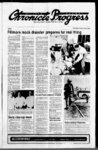
| Show " laJ:IUre cnsnraBa NOTICE TO WATER USERS The Stale Engineer receded Ihe Applications) to Appropriate or Change Water in Miitard County (Locations in SLBAM) Persons objecting to an applicason must a Protest stating the reasons tor the protest To have a hearing before the State Engineer persons must request a hearing in the Protest Protest must be filed n duplicate with the State Engineer 1636 West North Temple Salt Lake City Utah 84116 on or before JUNE 10 1990 These are informal proceedings as ol the Division of Water per Rule Rights (LEGEND: POD Pomt(s) of Diversion of POU USE Place Nature of Use - USE) TO APPROPRIATE APPUCATKDN(S) file DEFAULT TO R point of beginning (A64528) Brant George 0015 cfs SOURCE: 6 in wel 56 ft deep POD: (1) N 44 W 110 from SE Cor Sec 31 T22S R6W (9 miles west of Meadow) USE: Stockwatenng: 107 head of livestock POU: SW14SW14 Sec 30 T22S R6W Inc Seven (A64543): Springs Ranch a Corp QUANTITY: 0 cfs SOURCE: Dewal Spring POD (1JN850W 460 (2) S 600 E 265 from S14 Cor Sec 32 T23S R5W (3 miles South of Kanosh) USE: Stockwatering: 1020 head of livestock POU: SW14NW14 Sec 29 NE14 Sec 30 T23S R5W APPUCATION(S) TO CHANGE WATER Mardel D Topham propose(s) to change the POD POU USE of water as evidenced by (U22725) HERETOFORE: QUANTITY: 20 cfs SOURCE: Underground Water Well POD: (1) S 1950 E 2600 from NW Cor Sec 33 T20S R5W USE: Irrigation: trom Apr to oct 3 total acreage 80 00 acs Stockwatering: 100 head of livestock Domestic: POU: S12NW14N12SW14 Sec family 33 T20S R5W HEREAFTER: QUANTITY: 20 cfs SOURCE: 16 to well 400 It deep POD:(1) S 660 W 2640 from NE Cor Sec 34 T20S R5W (55 miles NW of Fillmore) USE: Irrto Oct 31 total acreage igation: from Apr 8108 acs sole supply 8108 acs POUN1 2N12 Sec 34 T20S R5W Robert L Morgan P E QUANTITY icle NOTICE and Mefva J Fmknson WHEREAS on toe 4to day of May 1S81 Berras R Finfinson and Mefva J Fnlmson as trustors executed and delivered to Seamy Title Company of Southern Utah as trustee a Deed of Trust (toe "Trust Deed") to certain real properly described toerem as securrty tor toe of a note "Note") promissory (toe executed and delivered by said Bus tors on May 4 1981 to Evans Financial Corp beneficiary under toe Trust Deed which Trust Deed was duty recorded in toe Office of the County Recorder Millard County State of Utah on May 14 1961 to Book 152 Pages with Recorder's N° 38281 The Trust Deed covered toe toHowmg described property located in Ml lard County State of Utah Beginning South 79 4 feet and East 5221 teet Bom the West quarter comer of Section 5 Township 17 South Range 4 WesL Salt Lake Base and Meridian thence South 582(7 East 257 4 teet thence South 1988 feet thence North 582(7 West 2574 feet thence North 198 8 feet to toe WATER STATE Bum ENGINEER Published Progress in Ihe Millard Apr 26 May County Chron3 10 1990 NOTICE OF PUBLIC HEARING REGARDING SALE OF DESERET FAIRGROUNDS PROPERTY The Board of Commissioners ol Millard County Utah will hold a public hearing on June 5 1990 at2:00p m at the Commission Chambers of the Millard County Courthouse located at 60 South Main Fillmore Utah for the purpose of receiving public comment on whether the property described below also known as Ihe Deseret Fairgrounds shall be declared surplus real property and sold The properly is located in Millard County Utah and is described as follows: Beginning 20 feet West of the Southeast corner of the Southwest quarter of Section 33 Township 17 South Range 7 WesL SLBAM thence North 760 feet thence West 903 feet thence South 45 West 300 feet thence South 572 feet thence East 1150 feet to the place of beginning interested persons should be present in person to present comment or submit written comment to the Millard County Clerk at the above address before the time for the WHEREAS Fourth February 14 1990 the J corporation et as Defendants and bearing Civil No 8303 entered an Order reforming toe Trust Deed to cover toe following described property South 794 teet and Beginning East 490 feet trom toe West quarter comer of Section 5 Township 17 South Range 4 WesL Salt Lake Base and Meridian thence South 5820" East 2574 feet thence South 198 8 teet thence North 582(7 West 257 4 feet thence North 196 8 feet to the point of beginning WHEREAS Steven D Peterson 57 West 200 South Suite 400 Salt Lake City Utah 84101 as been substituted as trustee and WHEREAS a breach of toe obligation which toe Trust Deed was given to secure has occurred in that toe trustor has failed to pay toe sums owed to toe beneficiary at toe time and in toe amounts as required by toe terms of the Note and toe Trust Deed toe entire unpaid balance of Specifically and interest in toe amount of principal $14436615 has not been paid despite written demand therefor In accordance with the provisions of toe Note and the Trust Deed the entire outstanding balance of toe Note is now due and payable in full The undersigned does hereby demand toe payment of ail such sums together with aH other amounts now or hereafter owing under toe note and Trust Deed plus interest thereon late tees costs and trustee's and attorneys' fee6 THEREFORE NOTICE IS HEREBY GIVEN that the undersigned successor trustee has elected pursuant to Title 57 Chapter Utah Code Annotated 953 as amended) to consider toe Note and Trust Deed in default and has elected to sell or cause to be sold the property described in the relumed Trust Deed consisting of afi rel property subject to the above referenced court order to satisfy said obligations DATE April 12 1990 D STEVEN PETERSON Successor Trustee Published In the Millard County Chronicle Progress May 10 17 & 24 1990 NOTICE NOTICE is hereby given that a public hearing to change the Millard County Zonbe held on Tuesday ing Ordinance June 5 1990 in the County Commission Chambers Millard County Courthouse 60 South Main SL Fillmore Utah at toe hour affect of 2:00 pm Proposed change to the property listed below from Commercial) (highway belonging to Hugh LeFevre: Legal Description: Beginning NW NW 14 Sec: 9 T 21S to R: 4W SLM East 590 feet SWLY West line H5 HWY to 1220 feet along said West Boundary SW 14 NW 14 N to Beginning 1050 feet interested persons are invited to be attendance Marlene Whicker comer SE 14 hearing DATED tors 1st day of May 1990 s Mtohael R Styter Chairman In the Millard County Published Chronicle Progress May 3 and 10 1990 on Judicial District Court of Millard State of Utah in toe case ol Bums County R Fmlmson and Melva FnBnson and Evans Financial Corporation a Washington Plaintiffs vs John Doe in Clerk Millard Published In the Millard County 24 Chronicle Progress May 10 17 1990 GENERAL NOTICE TO CONTROL NOXIOUS WEEDS Weed Notice is hereby given this 1st day ol May 1990 pursuant to toe Utah in Millard County Utah that Act Section 7 to every person who owns or controls land the spread noxious weeds standing being or growing on such land shall be controlled and or treating with tillage cropping pasturing of same prevented by effective cutting chemicals or other effective methods or combination thereof approved by the County from blooming and Weed Supervisor as often as may be required to prevent the weed root stalks or other means maturing seeds or spreading by rooL notice the owner or person in possession ol property Upon failure to comply with to deemed negligent and enforced control upon which noxious weeds are present shall be of control measures may be imposed at the discretion of county authorities Expenses or person in measures employed by toe county shall be paid directly by the owner a Ben on the property and become collectible possession oI toe property or shall constitute by taxes ol Utah and the county of Millard The following are declared noxious weeds for Ihe State Cynodon dactyton (L) Pers Bormudagrass Convolvulus spp Bindweed (Wild morning glory) laotolium L Lepidium white top) (Tall Peppergrass Cirsium arvense (L) Scop Canada This tie diffusa Lam Centaurea Diffuse Knapweed ba6s 600003 L Dyers Woad Perennial Sorghum spp Including but not limited to Johnson Grass AJmum (Sorghum almum Parodi) (Sorghum halepense (L Pers ) and Sorghum Euphorbia ula L Leafy Spurge Taenia the rum Medusahead (L) Nevski Carduus nutans L Noxious Musk Thistfe Agropyron repent (L) Beauv Quack grass Centaurea repens L Russian Knapweed Onopordium acantolum L Scotch Thistle (Cotton to Be) Cantaurea maculosa Lam Spotted Knapweed Centaurea squarrosa Roto Squarrosa Knapweed Cardaria spp White top Centaurea solstitial is L Yeflcrw Starthatie weed in Washington County and shall not be Bermudagrasa shall not be a noxious Act within toe boundaries of toe county subject to provisions otfoeUtah Noxious Weed deadline tor In addition toe Millard County Weed Board has set May 29 1990 as the are Infested with whitetop harvesting st crop alfalfa hay on forage toat 10 A 17 1990 Published to the Millard County Chronicle Progress May 3 NOTICE OF TRUSTEE’S SALE The following described real properly be sold at pubic auction to the Nghest bidder payable in lawful money of toe United States at toe time of sale at the Mrflard County Courthouse 60 South Mam Street FiBmue Utah 84631 in AMard County State of Utah on May 30 1990 at 10:00 o'clock am of said day for toe purpose of foreclosing a tost deed executed by CLINTON STEVEN NIELSON as Trustor in tavu of GEORGE W Ml LLS as Beneficiary covering real property cated within Millard County State of Utah and more particularly desorbed as follows: Beginning 1235 chains North and 1106 chains West of the Southeast comer of the Southwest quarter of toe Northeast quarter of Section 10 Township 15 South Range 4 WesL Salt Lake Base and Meridian and running thence West 221 chains thence North 324 chains thence North 812Z30 East 230 chains more or less to a point rectly North of the point of beginning thence South 349 chains to toe point of beginning In Leamington Town Less Town Road and Sidewalk Said Deed of Trust was recorded on March 28 1989 as Entry No 72556 in Book 225 at Pages of toe recuds of the Millard County Recorder State of Utah DATED this 30th day of April 1990 KINGHORN PETERS STYLER PROBST GREGORY L PROBST Trustee Published In the Millard County Chronicle Progress May 10 17 A 24 wil 1990 NOTICE TO WATER USERS The following applications have been fifed with the State Engineer to extend water in Mllard County throughout the entire year unless otherwise designated Locations in (SLB4M) Persons objecting to an application must file a Protest stating the reasons tor the protest To have a hearing before toe State Engineer persons must request a hearing in toe Protest Protest must be filed in duplicate with toe State Engineer 1636 West North Temple Salt Lake City UT 84 6 (801 on u before June 16 1990 These informal proceedings as of the Division of Water per Rule Rights (a3756b) Cona A Jensen has filed for extension of time within which to on 005 cfs submit Proof of Appropriation of underground water to be used tor irrigation and stockwatering purposes Additional time is needed to finish project and submit proof Robert L Mugan P E State Engineer Published In the Mlllerd County Chronicle Progress Mey 3 10 A 17 1990 RESOLUTION 9 NO A RESOLUTION OF THE CITY OF UTAH REVISING DELTA SERVICE CHARGES FOR DITCH TAX USER IRRIGATION WATER FEES AND RENTAL FEES RECITALS The City Council of the City (X Delta Utah referred to herein as the “City Council" hereby recites toe following as the basis for adopting this resolution A Delta City has experienced significant increases in the maintenance and operation costs associated with the delivery of water tor irrigation purposes Therefore the City Counci has determined that an increase in user fees wil be necessary to cover the costs associated with the delivery of such water B The City Council has heretofore established a ditch tax user fee and irrigation water rental tee whereby each user u class of leers of such services are required to pay an equitable amount for the benefits received by them based on the cost ol operation maintenance and delivery of such water C The City Coundl has determined through records and other information on file in the Delta City offices that Delta City should establish a rate schedule for a ditch tax users fee and an irrigation water rental fee NOW THEREFORE BE IT RESOLVED by the City Council of the City of Delta Utah Previous Rate Schedules Repealed Rate schedules heretofore established and adopted by the City Coundl tor the purpose of providing water to Delta City irrigation system users are hereby repealed 2 Ditch Tax User Fee and Water Rental Fee Adopted The fees charged to Delta City Irrigation system users are fixed in accu dance with the followhereby ing schedule: Service Charge Subject $3000 a Ditch tax user fee b Irrigation water rental fee $2500 per acre foot 3 Payment Annual payments tor toe of water to Delta City irrigation system users shaH become due and payable on u before Ihe 1st day of June 1990 on aid u before toe st day of Apr! of each and every year thereafter according to the rate schedule set forth above and shai continue until such time as said rate schedule Is changed by toe City Coundl 4 Effective Data This resolution shal become effective upon adoption 5 Severability In toe event that any provision of this resolution less than the entire resolution is held invalid by a oourt of competent jurisdiction to resolution shal be deemed severable and such finding of shal not affect toe remaining invalidity portions of this resolution 6 Repeal of Conflicting Resofotions To Ihe extern that any resofooons or policies of toe City of Delta conflict with toe provisions of to resolution they are hereby amended to be in accordance with the provisions hereof PASSED AND ADOPTED this 23rd day ol April 1990 delivery GAYLE Mayor Pro BUNKER Tempore Attest DOROTHY JEFFERY City Recorder Pubttshed In toe MU turd County Chronicle Progress May 10 1990 Millard County Chronicle ORDINANCE An Ordinance of kAiard County Utah to amend toe Zoning Map ol MAard County a portion of toe by area heretofore classified as to THE BOARD OF COUNTY COMMISSIONERS OF THE COUNTY OF LARD State of Utah Ordains as foffows: Section The Zoning Map of Mftard County is hereby amended by described portion of toe ing toe following unincorporated area heretofore classified as Agricultural Five Acres to Highway Commercial Legal Description: Commencing at a point located South 43732 teet and West 274520 teet trom toe Southeast comer of Sec: 8 T 21S R: 4W Salt Lake Base and Mendian thence North 89 45 40" West 549 51 feet thence Norto 32 02- 47 West 20046 teet to a point on toe East side of a difch easement toence Norto 70 4' 33 East 88 47 teet more or less to an existing fence line thence along said fence the following three courses: South 06 19" 45” West 5755 leet toence South 18 331 09 West 54 90 feet toence South 22 16" 08 West 39030 teet to the point of beginning Containing 5 04 Acres This Ordinance shall take Section effect fifteen days after its passage an upon publication PASSED AND ADOPTED and Ordered Published by toe Board of County Commissioners of Ml lard County this 1st day of May 1990 Commissioner Styter Voting aye Commissioner Baker Voting aye Commissioner Brinkerhoff Voting aye Signed: Mkhael R Styter Chairman Board of County Commissioners Attest Marlene Whicker Clerk Published In the Millard County Chronicle Progress May 10 1990 ACCEPTING BIDS East Millard Recreation District wil accept bids by 10:00 am May 15 tor labor and some material on the electrical plumbinsulaing heating mechanical roofing tion concrete masonry painting glazing and etc on the East Mtflard swimming pod construction Jensen Contact Wilford manager for plans and specifications East Mllard Recreation District reserves the right to accept or reject any or al bids Published In the Millard County Chronicle Progress April 26 Msy 3 A 10 1990 NOTICE OF FINAL TAX SALE hereby given that on toe 23rd 1990 at 1000 o'clock AM at the Millard County Courthouse in Fillmore Utah will offer for sate at public auction and sell to the highest bidder for cash pursuant to toe provisions of section Utah Code Annotated 1953 as amended toe following described real estate situated in said county and now held by it under preliminary tax sate No bid for less than the total amount of taxes interesL penalty and ccet which are a charge upon such real estate wil be accepted CYNTHIA LEE ANDERSON Oak City Utah 84649 Beg at pt 440 ft S of NECorSE 14 SE 14 of Sec 8 T 21 S R 5 W SLM N to 440 ft W 400 ft S 220 ft SETy 345 ft beg 303 ac(7159-1- ) SHERWOOD PROP INC co KEITH H ARCHIBALD 4245 S 2200 W Salt Lake City Utah 84119 Lot 554 and Lot 557 Sherwood Shores Subdiv11 ) Notice is of May the front of day S NANCY C BENNETT Rt Delta Utah 84624 The El 20 ft of Delta Twnst Svy Less S 685 ft sd Lot Less Beg 67 ft S NE Cor Lot W 115 ft S 93 ft E 115 ft N 93 ft to beg 025 ac(D617) 1024 S JOHN WANDA BUSHNELL Dr East SL George Utah Bloomington 84770 Beg 2 91 chs W 225 chs N SE Cor NE 14 SW 14 Sec 20 T23S R5W SLM N 675 chs E 284 02 ft S 675 chs W 28402 ft to beg Less portion lying in Kano6h Town Svy 210 ac 1024 S JOHN WANDA BUSHNELL Dr East SL George UT Bloomington 84770 That portion of following Desc Lying in Kanosh Town Surv Beg 291 chs W A 225 chs N of SE Cor NE 14 SW 14 Sec 20 T23S R5W SLM N 675 chs E 284 02 ft S 657 chs W 284 02 ft to Beg 0 80 a& (K ZANE Box 1096 Lot Blk 15 P CHARLES CAVE 520 E Topaz Blvd Suite 106 Delta Utah 84624 Beg at pt bears S 0 deg 5 V 3 W 4 4 28 ft aig Sec Ln S 89 deg 08'47 E 456 93 fr W 4 Cor Sec 8 TITS R6W SLM N 0 deg 5 ri3- E 200 ft S 89 deg 06'47 E 435 64 ft Ln Manzanita Ave S 0 deg 5 '58 to W W 200 ft alg Sd W RW N 89 deg 06'47 W 435 60 to beg 200 ac(D C CARTER 525 N 260 W LLOYD Circle SI George Utah 84770 Lots 3 4 Beg 243210 ft S NW Cor Sec 7 T25S to SW Cor NW R10W SLM S 207 9 ft W 14 Sd Sec7 E 15985 ft N 2079 ft 1598 5 ft to beg Less Beg W 14 Cor sd Sec 7 S 1220 84 ft E 1320 ft N 1220 84 ft W 1320 ft to beg 5110 ac (8761) JOHN E CORBETT Box 162 Delta Utah 84624 Lot 4 being SW 14 SW 14 Sec30T17S R6W SLM Less E 1587 ft of 5 12 SW 14 sd Sec 30 Less Beg SW Cor E 1587 ft of S 12 SW 14 Sec 30 S 89 deg 57"W alg Sec Ln a dist of 466 69 ft N 466 69 ft N 89 deg ST E 466 69 ft to W bdry of toe E 587 ft S 12 SW 14 Sd Sec 30 S 466 69 ft g sd W bdry to beg 3 65 ac (DO 40 2) ETHEL CECIL PRIESTLEY COY cto Peter Coy 134 Norto Shore Dr WA 98226 S 12 NW 14 Sec 25 T25S R10W SLM 80 ac 13 Inf each George S Priestley Cecily Ethel Pnesfiey Coy Gregory W Coy (8823) MRS WHEELER COY co Peter Coy 134 Norto Shore Dr Bellingham WA 98226 SE 14 SW 14 Sec 8 T25S R9W SLM 40 ac (8699) CECILY ETHEL PRIESTLEY COY CAj Peter Coy 134 Norto Shore Dr BeAngham WA 98226 W 12 NW 14 Sec 9 T25S R9W SLM 80 ac etaf George Priestley which Cecily Coy 13 Ethel Priestley Coy Inf ea (8703) Gregory Progress W CECILY ETHEL PRIESTLEY COY c Jo Peter Coy 134 North Shore Dr Bellingham WA 98226 NW 14 SW 14 Sec 7 T25S R9W SLM 40 ac etai George S GrePnesfly Cecily Ethel Pnestty Coy gory W Coy 13 Int ea (8696) GEORGE S PRIESTLEY co Peter WA Coy 134 North Shore Dr BeAngham 98226 S 12 NW 14 Sec 19 T25S R9W SLM 80 78 ac 13 lot ea to GEORGE S PR:ESTL£Y CECILY ETHEL PRIESTLEY COY A GREGORY W COY (8722) DANIEL J DELANEY Box 19452 Sacramento CA 95819 S 12 NW 14 SW 14 NE 14 Sec 24 T23S R7W SLM 5 ac etiti CAROLYN ANN DELANEY OAK MO NT DEV A Pace 11 bes WALLACE A KARRJN 8128 Deercreek Rd Salt Lake CityUt 84121 Beg at pt on 4 Sec Ln toat bears 693 71 ft E ol W 14 Cor SLM N 266 ft E 64 ft Sec12T16SR8W 5 266 ft W 64 ft lo pt ol Beg VOOac (HD UNION 44 So 1st WesL 222 Fillmore UT 84631 Lot 5 Blk Estates Sub Sec7T17S R6W SLM 33 ac NE Annex (D DE MEA CREDIT MANAGEMENT CORP co Gordon Daskowski Box 664 Buena Park CA 90621 Beg 1056 ft E SW Cor N 12 SE 14 Sec 9 T1 8S R7W SLM E528NN 155 ft W 528 ft S 55 ft to Beg 14 ac (HD BOBBY LEE ELY 21 15 Las Palmas La Habra Hts C A 90631 Beg W 736 3 ft of NE Cor Sec 7 T25SR10W SLMW736 3ftS 2640 ft MLto S Ln NE 14 Sd Sec E 736 3 ft N 2640 ft ML to Beg 44 625 ac ) GALE BAILEY FALK 6409 Intertachen Blvd Edina MN 55424 SE 14 Sec 33 T15S R8W SLM 160 ac (MA 2664 C) Trustee 1255 E E BENNION LEORA Almeodra Dr Fresno CA 93710 Beg NE Cor SE 14 NE 14 Sec 7 T1 7S R6W SLM S 80 rds W 80 rds N to E Bdry Hwy 6 50 NETy aig Sd Hwy N Bdry SE 14 NE 14 Sec 7 to pf ol Beg Less Beg N 16 7ft AW 632 4 ft at E 14 Cor Sec 7 Sd Pt being N R W Bdry fence Hwy 50 S 88 deg 34' W 497 6 ft 5ftW190tt alg sd Hwy NOdeg53‘E304 ML S 0 deg 53' W 1303 3 ft to Beg Less Beg N 22 6 ft W 395 6 ft from E 14 Cor Sec Ut 7 Sd pt being N Hwy 26 S 88 Bdry N deg 34' W 236 4 ft alg Sd Hwy 13033 ft ML to N Ln SE 14 NE 14 Sec 7 E 236 4 ft S 1297 4 ft to Beg Less Beg N 325 ft from E 14 Cor Sec 7 Sd pt being N Ln Ut Hwy 26 N 12875 ft ML NE Cor SE 14 NE 14 Sec 7 W396 ft S 1297 4 ft to N Bdry Sd Hwy 26 N 88 deg 34' E 396 ft to Beg Being in NE annex to Delta City 229 ac (D 3871) REED P NESSON co Reed's Mobile Homes 3875 S Redwood Rd Salt Lake City Ut 84119 Lot 8 Blk 2 Phase one Ranchettes Sub (in Hinckley Twn Hinckley Svy) 0 373 ac (H HR 2 8) REED P NESSON co Reed's Mobile Homes 3875 So Redwood Rd Salt Lake 9 Lot 7 Blk 2 Phase one HinckCity Ut 84 ley Ranchettes Subdv in Hnckley Twn Svy 373 ac (H HR REED P NESSON co Reeds Mobile Homes 3875 S Redwood Rd Salt Lake City Ut 84119 Lot 6 Blk 2 Phase One of Ranchettes Subdrv in Hinckley Hinckley Twn Svy 373 ac (H HR 2 6) REED P NESSON co Reed's Mobile Homes 3875 S Redwood Rd Salt Lake City Ut 84119 Lot 5 BA 2 Phase One Ranchettes Sub In Hinckley Twn Hinckley Svy 0373 ac (H HR REED P NESSON co Reed's Mobile Homes 3875 S Redwood Rd Salt Lake City Ut 84119 Lot 4 Blk 2 Phase one Ranchettes Sub In Hinckley Twn Hinckley Svy 0373 ac (H HR REED P NESSON co Reed's Mobile Homes 3875 S Redwood Rd Sait Lake City Ut 84119 Lot 3 BA 2 Phase One Ranchettes Sob In Hinckley Twn Hinckley Svy 0373 ac (H HR REED P NESSON co Reed's Mobile Homes 3875 S Redwood Rd Sait Lake City Ut 84119 Lot 2 Blk 2 Phase One Hinckley Ranchettes Sub In Hinckley Twn Svy 0369 ac (H HR REED P NESSON co Reed's Mobile Homes 3875 So Redwood Rd Salt Lake BA 2 Phase One City Ut 84119 Lot Hinckley Ranchettes Sub In Hinckley Twn 373 ac (H HR Svy REED P NESSON co Reed's Mobile Homes 3875 S Redwood Rd Sait Lake Phase One City Ut 84119 Lot 5 BA Hinckley Ranchettes Sub In Hinckley Twn 285 ac (H HR Svy REED P NESSON co Reed's Mobile Homes 3875 S Redwood Rd Salt Lake Phase one City Ut 84119 Lot 4 Blk Ranchettes Sub In Hinckley Twn Hinckley 285 ac (H HR Svy REED P NESSON co Reed's Mobile Homes 3875 S Redwood Rd Salt Lake Phase one City Ut 84119 Lot 3 Blk Hinckley Ranchettes Sub In Hinckley Twn 285 ac (H HR Svy REED P NESSON co Reed's Mobile Homes 3875 S Redwood Rd Salt Lake Phase one City Ut 84119 Lot 2 Btk Twn Hinckley Ranchettes Sub In Hinckley Svy 0285 ac (H HR REED P NESSON co Reed's Mobile Homes 3875 S Redwood Rd Salt Lake Blk Phase one City Ut 84119 Lot Hinckley Ranchettes Sub in Hinckley Twn 376 ac (H HR Svy PHILGILLiN 1901 Avenue of Ihe Stars Suite 1600 Los Angeles CA 90067 N 12 Sec 33 T15S R8W SLM 320 ac (MA PHILGILLIN 1901 Avenue of toe Stars Suite 1600 Los Angeles CA 90067 E 12 Sec 32 T15S R8W SLM 320 ac (MA 2664 A 1) ERNEST D GILL 301 Vta Rd Bishop CA 93514 SW 14 NW 14 Sec 2 T16S R7W SLM 40 ac (DO 3139) TOM A BETTY HORLACHER 935 E 9 Rooseveft Ut 84066 Beg 250 N Box W 735 383 ft S ML NE Cor SW 14 Sec R7W SLM T17S ft 34 S 40 ML N 64 deg W 246 ft N 26 Deg 4' E 179 ft E 62 ft ML S 24 deg 15X2 E 180 ft ML S 68 deg 49 50 E 165 ft MLto Bog 0 37acML(DO ) TOM BETTY HORLACHER PO Box 19 Rooseveft Ut 84066 Beg 4573 ids Cor SW 14 Sec 34 T17S R7W SLM S 20 ft ML W 37 5 ft ML S 2 deg 5V Or W 128 ft ML W 12 5 ft ML N 16 deg tZ E 154 75 ft ML E 37 6 ft ML to pt of Beg 0 03 ac ML (DO 4531 2) JEAN R HATCH co LaMar Wasden PO Box 17 Scipio Ut 84656 Lot Blk 59 Plat A Scipio Twn Svy Less SW 14 Sd Loti Less N 12 Sd Lot 36 ac (S 25 ) LEONIDAS F HAMEL 4368 34th St 4 San Diego CA 92104 NE 14 NE 14 Sec 7 T22S R5W SLM 40 ac (7494) WALLACE A KARRI N 0128 Deercreek W NE 10 1990 Mav Rd Salt Lake City Ut 84121 Beg at px on 4 Sec Ln toat 102171 ft E of W 14 Cor Sec 2 T1 6S R8W SLM N 386 ft E 314 29 ft S 133 6 ft W 31 429 ft to Beg 100 ac (HO WALLACE A KARR1N 8128 Deercreek Rd Salt Lake City Ut 84121 Beg at pt on 4 Sec Ln toat bears 857 71 ft E of W 14 Cor of Sec 12 T16S R8W SLM N 266 ft E 164 ft S 266 ft W 164 ft to pf of Beg 00 ac (HD Box Delta LEROY W NORMA E MCMULLEN May St Salt Lake City Ut 84119 222 224 Sherwood Shores Sub 0 27 ac (DO SS 222 224) DONALD F VESTA W MALBY 7686 Mulholland Dr Los Angeles CA 90046 Beg 19 39 chs S NE Cor Sec 28 T21S R4W SLM N73deg30'W10178ftS70 ft M L to fence on S of Chalk Creek Rd SEty toSowng Sd fence Ln to pt approx 30 ft W of E Sec Ln S 3 deg 24 5' E aig fence Ln 60 99 ft E alg fence Ln 4 51 ft S3 deg 3' E 30 ft ML where fence crosses E Sec Ln N 300 ft ML to Beg Chalk Creek Rd portion aig fence on E Ln of Sec Beg N 0 deg 07 50 W 340 9 ft S 89 deg 4720 E 1650 ft N 2954 ft ML Of S 14 Cor sd Sec 28 N 73 deg 3CW 71 2 ft 90 deg 56' W 350 ft ML to area where description crosses existing fence on S of Chalk Creek Rd E alg Sd fence Ln to pt 70 ft ML S of pf of beg N 70 ft to Beg (Chalk Creek Rd) Less Beg at pt N 599 70 ft W 1020 57 ft from E 14 Cor Sec 28 N18deg1708E 15 ft N 71 deg 42 52 W 200 ft S 18 deg 1708" W 115 ft S 71 deg 42 52 E alg fence Ln on N side Co rd200fttoBeg 2 35 ac (7029) Trustee 12 JOSEPH OSTROWICKI Int 3555 Aero Ct San Diego CA 92123 T20S R4W NE 14 SE 14 SE 14 Sec SLM 10 ac RICHARD REED PETERSEN co Harold Peterson Box 307 Wendover Ut 84064 Beg at pf S 89 deg 33 39 W 206 71 ft trm SE Cor NW 14 Sec 23 T16S R8W SLM sd pt being on S Ln of Sd NW 14 Sec 23 S 89 deg 3339" W 208 71 ft 0 deg 26'21 W 206 71 ft N 89 deg 33 39" E 71 to Beg 208 71 ftS0deg26'21‘E2O8 ac (HD SHERWOOD PROP INC co Eugene Partridge 16 Jermery SL Salt Lake Oty Lots Ut 84104 Sherwood Shores Subdrv 372375 (DO 375) JEFF PARKER 573 Mariano Dr Sonoma CA 95476 Lot 132 Deseret Estates Unitone (in Sec (HD DES 132) ANNA MAE QUARNBERG PO Box Blk 25 Plat 84 Gunnison Ut 84634 Lot A Scipio Twn Svy 43 ac (S 184) EVELYN JOHN HARVEY 241 E Maxi St Delta Ut 84624 Beg 376 ft W NW Cor NE 14 SE 14 Sec 9 T1 7S R 7W SLM W 94 ft S 2 3 ft E 94 ft N 213 ft to Beg 0 46 ac (H 2184 2) EVELYN JOHN HARVEY 241 E Main St Delta Ut 84624 Beg 282 ft W NW Cor NE 14 SE 14 Sec R7W SLM W 94 ft S 21 3 ft E 94 9 T1 7S ft N 213 ft to Beg 46 ac (H RUTH REUBEN MORRIS 18 Int 300 Mercy Dr Orlando Fla 32808 NE 4 Sec 6 T25S R10W SLM 160 01 ac 4202 Lots (8759) DON H SMITH PO Box 6506 Mesa 85028 Beg N 1362 99 ft ml to toe S boundary of Industrial Way Road and W 87510 ft mt from toe SE Cor ol Sec 25 T2 S R5W SLM W along S bdry ot Industrial Way Road 53105 ft ml to around toe arc of a curve to Rt alg S bdry Industnal 99 ft 1 Way Rd 54357 ft 69 ft) N 38 deg OB' W alg S deg 52" bdry Industrial Way Rd103 01 ft ml S 640 ft ml E 1085 ft ml N 300 ft m1 to beg (F AZ FE RODNEY JANETT SESSIONS 3319 N Carriage In Chandler AZ 85224 Beg at pt on 14 Sec Ln 365 71 ft E W 14 266 ft E Cor Sec 12 T16S R8W SLM 164 ft S 266 ft W 164 ft to pt of Beg lOac (HD DONALD BRYON SMITH Rt Box 84624 Beg SW Cor Sec 3 N 0 deg 51'54 W 146 2 ft alg W Bdry Sd Sec 3 N 89 deg 21 49" E 600 ft S 0 deg 51'54 E 146 2 ft to S Bdry Sd Sec 3 S 89 deg 21'49" W alg Sd S Bdry 600 ft to pt of Beg 201 ac (DO 1052 Delta T16S R7W DONALD Ut SLM BRYON SMITH Rt Box 1052 Delta Ut 84624 Beg NW Cor Sec E 10 T16S R7W SLM N 89 deg 2V49 600 ft alg N Bdry Sd Sec 0 S 0 deg 5 '54 E 173 8 ft S 89 deg 21 49" W 600 ft to W Bdry Sd Sec 10 N 0 deg 51'54 W 173 8 ft alg Sd W Bdry to pt of Beg 2 39 ac (DO B ROESNER DONALD co Faun Staples Box 1844 St George Ut 84770 E 22 ft of S 12 Lof Sec 2 T16S R8W SLM 33 ac (HD MILDRED H SMITH 12 frit 353 W 200 S Box 4 17 Delta Ut 84624 S3375H Lot 4 Blk 13 Plat A Delta Townst Beg 5 ft N 59 deg 0? NECorLot1Bik13S60 W 121 ft E 105 5 ft to Beg LassRRRW 012 ac etai Leoyd Level 12 (D ALLEN L PETERSON etai cto Myrtle O Sorensen Scipio Ut 84656 Beg 155 ft E 655 ft S NW Cor SW 14 Sec 29 T18S R2WSLM S 5 ft E 165 ft N 5 ft W 165 ft to Beg 018 ac etai Lorene Peterson Fisher Clifford D Peterson Rex B Peterson CONNIE PERKINS THEOBALD JT 494 S 380 W Tooele Ut 84074 N 12 of S 12 Lof 2 Blk 50 Plat A Delta Twnst Less N 6 ft 0 32 ac etai Dean J Perkins A Connie Perkins Theobd (0 795) JAMES H JANICE KT1PPETTS Box 873 Cedar CityUt 84720 N 12 Lot 2 B 23 Plat A Hinckley Twn Svy 60 ac (H DEWAYNE WARNOCK PO Box 35 Leamington Ut 84633 W 12 SE 14 SE 4 SE 14 Sec 23 T23S R7W SLM 5 ac Published icle Progress 1990 in toe Apr Mard County Chron26 May 3 10 A 17 |