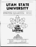
| OCR Text |
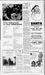
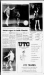
Show 8 Vernal Exprm Pimfiory NOTICE OF TRUSTEES SALE The following described property will be sold a ABSTRACTOR Registered Abstractor ation) have been filed Searle Gas Co. Inc. Vernals only locally owned propane dealer. For the most competative price along with prompt and courteous sevice give us a call at: public auction to the highest bidder, payable in lawful money of the United States at the time of sale, at the front door of the Uintah County Courthouse in Vernal, Uintah County, State of Utah, on the 10th day of December, 1985 at 10:00 oclock a.m., for the purpose of foreclosing a Trust Deed executed by ROBERT L.BLOXHAM and PAMELA S. BLOX-HAhusband and wife, as trustors, in favor of Vernal Abstract Company, as Trustee and John Wallace Allred and Patricia Ann Allred, husband and wife, as joint tenants, as beneficiary, covering real property north line of said SWy4, thence EAST 30 feet to the point of beginning. y No. 2 A road beginning at the Southeast Corner of the Northwest Quarter of Section 5; Township 5 South, Range 23 East, Salt Lake Base and Meridian, and running thence right-of-wa- NORTH along the with the State Engineer to appropriate or change water throughout the entire year unless otherwise designated. Location in SLB&M unless otherwise designated. EAST 369.55 feet; thence NORTH 600.00 feet to a point which is N 8930 E 1583.72 feet along the section line and SOUTH 238.70 feet from said Ny4 Corner. UINTAH COUNTY APPLICATION ( S) TO APPROPRIATE Dated this 8th day of November, 1985. WATER (A61285) APPLICANT: Dale W. Snyder, 3766 South 3rd East, Salt Lake City, UT. QUANTITY: 0.015 cfs. SOURCE: 6 in. well 100 to 500 ft. VERNAL ABSTRACT COMPANY, Trustee JUDY ROBERTS, quarter section line 50 For Uintah, Duchesne feet; thence southwesterPresident ly 58.3 feet, more or less, and Daggett Counties Published in the VerOF to a point on the south nal Express Nov. 13, 20 deep. POINT(S) Abstract & Title DIVERSION: (1) N 150 line of said NWy4 ; thence 789-319- 8 and 27, 1985 E 1420 from SW Cor, Sec EAST 30 feet to the point Insurance of beginning. 30, T3S, RlE, USB&M. (7 miles S.E. from Myton) 55 East Main Ph. 789-166- 4 No. 3 A 33 foot wide USE: Irrigation: from road the FOREST Apr 1 to Oct 31, total west line of which being NATIONAL SALE TIMBER acreage 0.25 acs; the Vi section line beginStockwatering: 10 head Seccenter of the at ning NATIONAL FOREST .Sequoia of livestock; Domestic: 1 tion 5, Township 5 South, Goldenstate Royal Oaks TIMBER SALE, family. PLACE OF 23 Salt Lake East, Range Mobile homes' NATIONAL ASHLEY USE: SEy4SW4 Sec 30, Base and Meridian and Hot Soups ALLEN T3S, RlE, USB&M. FOREST, N thence located in Uintah County, running Hot Chocolate CREEK SALVAGE, W 610.07 feet to (A61312) APState of Utah, and more 05348 within T2N, PLICANT: Mike Huber, Cfillili Complete Coffee Service the beginning of a 60 foot located as described particularly R21E, SLM. Initial and 133 South Nye Street 48-y wide road follows: Fresh, clean tasting mounoral bids will be received and utilities easement. Roosevelt, UT. QUANTItain spring water by the Forest Supervisor TY: 0.015 cfs. SOURCE: No. 4 A 60 foot wide or - Lot DESCRIPTION his authorized 6 in. well 50 ft. to 150 ft. Mt. Olympus Waters y road and 14 representative at the ofdeep. POINT(S) OF utilities easement, the fice of the Forest SuperDIVERSION: (DN1504 PIT LIVER COMPACT Beginning on the centerline of which visor, Ashton Energy of 60 foot a Centerline E 1145 from SW Cor, Sec Box P.O. 1076 beginning on the west Center, 1680 West wide road and utilities 16, T2S, RlE, USB&M. (5 Utah 84078 Secof line of Vernal, the NEy4 VETERINARY SUPPLIES Highway 40, Vernal, y at a point East of Roosevelt) miles tion 5, Township 5 South, Utah, 84078, at 2:30 p.m. which is S 0 5848 E USE: Irrigation: from 23 East, Salt Lake local time December 17, Range 325.00 feet along the Vt Apr 1 to Oct 31, total and Meridian at Base a Liners 1985, for an estimated VERNAL DRUG CO. section line and East acreage 0.25 acs; point which is S 053 48 1075 MBF (Gross volume Materials in Stock 570.00 feet along said Stockwatering: 2 head of E 2053.22 feet from the less woods defect) of centerline from the north North Drilling rigs water disposal livestock; Domestic: 1 y4 corner of said dead ponderosa and V4 corner of Section 5, Can field splice for family. PLACE OF said section, point being pine USE: NWy4SWy4 Sec 16, Township 5 South, Range also N 0"5848 W 610.07 lodgepole any size pit. sawtimber marked or 23 East, Salt Lake Base T2S, RlE. the center from of feet otherwise designated for Wayne Xelion Harden Nelson and Meridian and runn- said (A61253) AP8 section, and running cutting. The right to reCheck diseases before they get a ing thence EAST 300.00 thence PLICANT: Michael R.& the arc of a along bids is all and foothold in your stock. We have a feet said 155.791 foot radius curve ject any along Sue Adams, P.O. Box reserved. Full informacomplete line 0 Veterinary Supplies. thence to the centerline; 1483, Vernal, UT. QUAN238.816 feet tion the right concerning "A Registered Pharmacist SOUTH 643.73 feet; & TITY: 0.015 cfs. (central of angle being timber, condition the thence S 29 10 W 571.74 on Duty at All Times" SOURCE: 6 in. well 50 ft. chord bears N sale, and the submission 87"4948, feet to the centerline of a to 280 ft. deep. POINT(S) Phone 789-310- 6 42"5606E 216.111 feet); of bids can be obtained 60 foot wide road and OF DIVERSION: (1) S thence N 8651 E 194.033 from the Forest Superutilities 80 W 2380 from Ey4 Cor. feet; thence along the visor, Ashton Energy thence along said right Sec 23, T3S R20E. (9 OPTOMETRIST West 1680 centerline' three arc of a 300 foot radius Center, Miles NW of Vernal) (3) courses as follows: N curve to the right 169.21 Highway 40, Vernal, USE: Irrigation: from 1 or 6050 W 76.40 feet; feet (central angle being Utah, (801) Apr 1 to Oct 31, total District the S bears chord Ranger, thence along the arc of a 3219, Truck Mounted System 0.25 acs; acreage 765930E 166.976 feet); Flaming Gorge Ranger 300.00 foot radius curve 2 head of T Tf O K Stockwatering: Ifotlllo 789-922- 5 789-302- 9 170.00 S E 6050 thence to the left 169.21 feet or livestock; Domestic: 1 (central angle being feet; thence along the (801)784-344call For Quality, us first family. PLACE OF a 377.469 of foot arc 3210, chord bears N USE: SWy4NEy4 Sec 23, Vernal in the 765930 W 166.976 feet; radius curve to the right Published T3S, R20E. 1985. Nov. 27, thence S 8651 W 344.03 367.834 feet (central Express (A61287) APfeet to the Vi section line angle being 5550, chord PLICANT: Elaine Cor-lesCleaning 353.452 S at a point which is S bears 3255 E SEITZ OPTICAL 3356 West 1000 650 sq. ft. for the thence along 1903.22 feet); feet 05848 E North, Vernal, UT. arc of a 126.454 foot from Vi Corthe North Complete Analytical $gg95 NATIONAL FOREST QUANTITY: 0.015 cfs. ner ; thence N 42 E 824.29 radius curve to the left TIMBER SALE With this ad. : 6 in. well 50 ft. Eye Examinations SOURCE feet; thence NORTH 192.012 feet (central OF POINT(S) chord deep. 465.50 feet to the point of CONTACT LENSES angle being 8700, R&D Carpet Cleaning NATIONAL FORES1 DIVERSION: (1) N 110 S 4830 E 174.09 bears Contains beginning. 789-139- 5 Dr. Jack A. Seitz SALE, E 770 from Wy4 Cor Sec or 789-978- 2 10.016 acres. feet); thence along the TIMBER of a 50.953 foot radius ASHLEY NATIONAL 17, T4S, R21E. (Maeser) arc Free Estimates. Together with and subPhone 789-155- 2 curve to the left 112.051 FOREST, BURNT MILL USE: Domestic: 1 famiWe also meet or beat other to the above menject SALVAGE, ly. PLACE OF USE: 185 North Vernal Ave. feet (central angle being WEST tioned Carpet Cleaning Prices! located with T2N, R4W, NWy4SWy4 Sec 17, T4S, N bears 12600, chord Professional Plaza Together with and sub2500 E 90.798 feet); USM. Initial and oral R21E. ject to a 16.5 foot wide thence N 3800 W 99.173 bids will be received by (A61313) AProad and new irrigation feet; thence along the the Forest Supervisor or PLICANT: Nile Holmes, canal the arc of a 205.898 foot his authorized represen- 4751 South 500 IT COSTS JUST East, VerCLASSES centerline of which being radius curve to the right tative at the office of the nal UT. QUANTITY: described as follows: 241.37 feet (central angle Forest Supervisor, 0.015 cfs. SOURCE: Now on Vi the Register being 6710, chord bears Ashton Energy Center, Seep. POINT(S) OF Beginning N 425 W 227.784 feet) to 1680 West Highway 40, DIVERSION: (DS200E section line and the norPer Issue Uintah Basin Area therly bank of an existing a property line; thence Vernal, Utah 84078, at 150 from N4 Cor Sec 23, y ad in canal company For a Vocational Center along said property line, 1:30 p.m. local time T2S, R24E. (22 miles NE at a point which is S N 2910 E 107.90 feet to a December 17, 1985, for an of Vernal) USE: (supthis Directory estimated 792 MBF of plemental) StockwaterThird Floor West State & County Bldg 058 48 E 1652.55 feet point which is N 831023 For a 3 Month Vernal 152 East 100 North from the north V corner E 993.95 feet from the live Ponderosa Pine and ing: 240 head of of Section 5, Township 5 point of beginning, and other sawtimber marked livestock. PLACE OF contract Computer training - Accounting the centerline of a 60 foot or otherwise designated USE: NEy4NWy4 Sec 23, South, Range 23 East, Office Occupations Short Typewriting Call 789-351- 1 y to for cutting. The right to T2S, R24E. Salt Lake Base and Meriwide road hand ManagementMarketing - Comdian and running thence the east; thence continu- reject any and all bids is munications - Math - Basic Skills APPLICATION ( S) TO ing N 2910 E 394.16 feet; reserved. Full informaparallel to said canal Power Plant Operation and diesel tion concerning the CHANGE WATER 765.51 right-of-wa- y NORTH thence two (2) program. courses as follows: S 50 feet to the centerline of timber, condition of the Day and evening classes available. sale, and the submission 60 foot wide 185.20 E an east-we11 APPLIS thence feet; to a.m. 8 4 p.m. Open of bids can be obtained right-of-wathence CANT: Roosevelt City E 125.00 feet to the 789-194- 2 centerline of a 60 foot along said centerline from the Forest SuperCorp., P.O. Box 248, WEST 1200.00 feet to the visor, Ashton Energy Roosevelt, UT. proposes wide road and utilities 1680 West to change the point of y at a point west line of said Nor- Center, which is S 5 5052 E theast Quarter to a point Highway 40, Vernal, diversion, place and or nature of use of water as 1903.07 feet from the which is N 05848 W Utah, (801) The number you need & 1228.22 feet from the the District Ranger, d evidenced by north for your financial needs. Roosevelt Ranger (a3363). Vi corner. point of beginning. Painting & Remodeling District, Roosevelt, Utah Theres one simple source for taking No 5 A 60 foot wide Also subject to the HERETOFORE: care of your business and personal y Call Ron Lankford and (801) d 0.244 cfs or road exQUANTITY: financial needs. Call Manny Padro at the 89.1ac-ft- . UinSOURCE: utilities easement, canal isting company 789-042- 3 Published in the Vernal 781-143- 8 ta River. POINT(S) OF centerline of which Nov. 1985. 27, on the Express DIVERSION: (1) S 2080 beginning Free Also subject to the exy of W 235 from NE Cor, Sec centerline Jensen isting Culinary No. 4 at a Estimates which is 10, TlS, RlE, USB&M. point Water Pipeline S 05848 E 2053.22 feet USE: Municipal: In Personal Financial Planner 22 The best investment you ever make along the V section line NOTICE OF An American Express Company Together with and subRoosevelt Ctiy and N 831023 E 993.95 BUDGET MEETING ject to those Municipality. PLACE feet from the Ny4 Corner allowing access to of Section 5, Township 5 OF USE: SVtSWVi, At the regular board SWy4SEy4 Sec 15; SSfc the Brush Creek county South, 23 East, Range road as described on the Salt Lake Base and Meri- meeting of the Ouray Sec 16; NyESEy4 Sec y sheets. NOTICE dian and running thence Park Water Improve- 21; SWy4NWy4SWy4 Sec EAST 803.70 feet; thence ment District, to be held 22, T2S, RlW, USB&M. DESCRIPTIONS Sealed bids will be HT-OF-WAYS SOUTH 500.00 feet to a Dec. 9, 1985, the 1986 received by the Fiscal NOTICE OF MEETING HEREAFTER: PUBLIC NOTICE budget will be reviewed QUANTITY: 0.244 cfs or of Notice is Tridell-Lapoipoint which is S895305 1 Section, Department hereby given No. A road The feet along the y4 and any member wishing 89.1 ac-f- t. SOURCE: UinEmployment Security, to the residents of the Improvement way beginning at the W 906.01 and NORTH to go into budget matters ta River and 4 Wells, Line Section and Water 174 Social Hail Avenue, anAshley Valley District will hold its Northeast Corner of the from the Ey4 will be welcome to POINT(S) OF DIVERSalt Lake City, Utah, Sewer Improvement nual budget hearing for SWy4 of Section 5, 224.54 feet attend. Section 5. of said Corner District: 2:00 until Box SION: (1) S 1945 W 855, P.O. 11249, the 1986 Budget, on Township 5 South, Range will begin at 7 16 in. well 185 ft. durMeeting A 1985 foot 60 6 23 wide December P.M., December 10, 1985 11, Salt Lake No Base deep (2) The Board of Trustees East, y for janitorial services at of the Ashley Valley ing its regularly schedul- and Meridian, and runnand p.m. at the regular place S 1677 W 399, 16 in. well road 1050 West Market Drive ed meeting. The 1985 ing thence SOUTH along utilities easement, the of business, the Harold 190 ft. deep (3) S 700 W Water and Sewer Im1055, 20 in. well 200 ft, Vernal, Utah. Bid forms provement District will Budget will also be re- the Vi section line 311 Centerline of which Dudley residence. and specifications may hold a meeting. Thurson the deep (4) S 200 W 200 from Any necessary adjustopened at this time. The feet, more or less to the beginning be obtained from Jean C. day, December 5, 1985 at meeting is scheduled for centerline of the existing ment of the 1985 budget NE Cor, Sec 27, TIN centerline of Burbidge at 174 Social 7:00 p.m. in the Districts 7:30 p.m. at the District Uintah County Brush No. 4 at a point which is will also be explained RlW, USB&M, 20 in. well 200 ft. deep (5) S 2080 W E 825.00 feet and discussed. S 05848 Hall Avenue, Salt Lake office located at 85 South Office. Creek Road ; thence nor235 from NE Cor, Sec 18, City, Utah or Judy Burns 200 East, Vernal, Utah, thwesterly 49.8 feet, along the y4 Section Line more or less, to a point and EAST 1200.00 feet LULA C. DUDLEY, TlS, RlE, USB&M. at 1050 West Market for the purpose of ap- JANET SIMMONS Source: Uinta River. (3 of Clerk Corner the on is which from Cierk N4 said the Drive, Vernal, Utah. for Budget proving Mi. NE Neola) USE: centerline and 30 feet Section 5, Township 5 the year 1986. 23 Vi in Published Vernal in the the west from section Vernal the South, Municipal: In Roosevelt Published Range East, Published in the VerHydro-Powe- r, Dec. line; thence NORTH 271 Salt Lake Base and Meri- - Express Nov. 27, 29, Dec. City; Nov. 29, 27, in the Vernal Published 27 Express Nov. 22, nal Express 4 Power Plant Name: and 1985. thence or to and the dian more 1985. 4 6, and 1985. running less, Nov. 6, feet, 27, and 29, 1985. Express Serving Home Dealer with the Dynamite Deals! or Office 1E7 right-of-wa- right-of-wa- J3E right-of-wa- right-of-wa- 801-789-15- Pit 789-079- 789-404- 9 Carpet Upholstery Specialists Pro Carpet right-of-wa- 789-118- Special s, right-of-way- s. right-of-wa- y, $642 right-of-wa- right-of-wa- st y; right-of-wa- Lankford 789-118- Martin above-mentione- 722-501- above-mentione- right-of-wa- right-of-wa- y. right-of-wa- Right-of-Wa- years experience in the Basin! II right-of-wa- right-of-wa- -RIG- right-of-Wat- er right-of-wa- right-of-wa- y I ) AN- NEXING ADJOINING poses to change the point of diversion and nature of use of water as evidenced by A21747, Cert. 5214. (DON HERETOFORE: QUANTITY: 0.849 cfs or 614.65 SOURCE: ac-f- t. Underground Water Well. POINT(S) OF DIVERSION: (1)S10W 44, 12 in. well 52 ft. deep (2) S 29 W 473, 12 in. well 54 ft. deep (3) N 497 W 43 from Ey4 Cor, Sec 19, TlS, RlE, USB&M, 12 in. well 58 ft. deep. USE: Municipal: In City of Roosevelt. HEREAFTER: QUANTITY: 0.849 cfs or ac-f- t. SOURCE: 7 AND LANDS A PRESCRIBING ZONE. SHOWALTER ANNEXATION) BE IT ORDAINED BY THE CITY COUNCIL OF VERNAL CITY, UTAH: SECTION 1. Description. That the following lands adjoining the limits of Vernal City, plats of which have been filed in the office of the Vernal City Recorder and by this reference made a part thereof, all of which land is located in Uintah County, State of Utah, is hereby annexed, taken into and made a part of Vernal City, Utah, to-w- 614.65 OF Wells, POINT(S) DIVERSION: (1) S 1945 W 855, 16 in. well 185 ft. deep (2) 1677 W 399, 16 in. well 190 ft. deep (3) S 700 W 1055, 20 in. well 200 ft. deep ( 4) S 200 W 200 from NE Cor, Sec 27, TIN, RlW, USB&M, 20 in. well 200ft. deep (5) S10W 44, 12 in. well 52 ft. deep (6) S 29 W 473, 12 in. well 54 ft. deep (7) N 498 W 43 from Ey4 Cor, Sec 19, TlS, RlE, USB&M, 12 in. well 58 ft. deep. (3 Mi. NE Neola) USE: Municipal: In Roosevelt Hydro-Powe- r, City; Power Plant Name: Unnamed. PLACE OF USE: as Same Heretofore. Protests resisting the granting of these applications with reasons therefore must be filed in duplicate with the State Engineer, 1636 West North Temple, Salt Lake City, Utah 84116 on or before DECEMBER 27, 1985. Beginning on the P.E. st line of Section 21, T4S, S SLB&M, R21E, 883235 W 33 feet from the East Quarter corner of said Section; thence S W along said 88"3235 Quarter Section line 597 feet; thence N 21152 W 169 feet; thence N E 249.42 feet; N 21152 W 53 thence feet; thence N 883235 E 258 feet; thence N 442-3- W 2"1152 69 thence N 21152 W 69 feet; thence N 883235 E 375 feet to the East line of 1500 West Street; thence S21152E along street line 488.66 feet to the North line of Main Street; thence S 875739 W 33 feet to the East line of said Section 21 ; thence S 883235 W 33 feet to the West line of 1500 West Street; thence S 2"1152 E along said street line 50 feet to the point of beginning. Contains 7.549 relative to the Official Map of Vernal City dated 1966. State Engineer Published in Vernal Express on Nov. 13, 20 and SECTION 2. Annexation. That on the taking effect of this ordinance, the corporate limits and boundary lines of Vernal City shall include all the 27, 1985. property ADVERTISEMENT FOR BIDS Vernal City CorporaEast Main, is accepting separate sealed bids for the construction of the Vernal City (Ashley Area) 2000 North and 1500 East waterline projects. Bids will be received by Vernal City at the above address until 2 p.m. Thursday, December 5, 1985. The bids will be publicly opened and read immediately following the closing date and time. Major items of work include the supply and installation of approximately 5,300 feet of 8 waterline on 2000 North Street between 500 East and 1500 East, as well as, the supply and installation of approximately 3,600 feet of 8 waterline on 1500 East between tion 495 1500 East-We- Quarter Section acres. Bearings are ROBERT L. MORGAN, 5. Fall 2 PLICANT: Roose velt City Corporation, P.O. Box 248, Roosevelt. UT. pro- f-way Cleaners ORDINANCE AN ORDINANCE 85-1- AP- The following applic- Business and Professional VERNAL ABSTRACT CO. Unnamed. NOTICE TO WATER USERS Wednodoy, November 27, 1985 North and 2200 North. This includes tings, services, fit- and hydrants. Copies of the plans and specifications may be obtained at the Vernal City Public Works Department, 78 North 500 East, Vernal, Utah at a cost of $10.00 per set. All bidders are required to have payment and performance bonds underwritten by a surety company that has been approved by the U.S. Department of Treasury described herein and shall all be deemed and held to be a part of Vernal City, and the inhabitants thereof shall thereafter enjoy the privileges of such annexation and be subject to the ordinances and regulations of said Vernal City. SECTION 3. Zone Designation. The entire area annexed as above described shall be a RA-- 1 Residential Zone. SECTION 4. Repealer. former ordinances, or parts thereof, conflicting or inconsistent with the provisions of this ordinance or of the code All hereby amended are hereby repealed. 5. SECTION Severability. The provisions of this ordinance shall be severable; and if any provision thereof or the application of such provision under any circumstance is held invalid, it shall not affect the validity of any other provision of this ordinance or the application in a different circumstance. PASSED AND ADOPTED AND ORDERED PUBLISHED the 20th day of November, 1985. SECTION 6. Effective Date. This ordinance shall take effect the day after publication, the 28th day of November, 1985. No. 570 Published in the Vernal dated July 1, 1977. Such Express Nov. 27, 1985. bonds are to be submitted with the bids. All biders must compthe .prely with qualifications of bidders per circular and insurance provisions, as well as all other provisions, as required by the Vernal City Standards Specifications for Construction of Public Works in the performance of the work. All bidders must obtain permits from Uintah County for street work and from Canal Com- panies for canal crossing. Vernal City reserves the right to reject any or all bids. KAY OVERSON Director of Public Works NOTICE Board of Trustee E. Jensen, Utah, for all registered voters living in the Jensen Water Improve5950 S. 8500 ment 1985. District boundaries. Two trustees elected from the ing list: to be follow- A.D. Marr Dudley, incumbent; Lewis G. Vincent, incumbent; Kenneth W. Jennings; Thomas M. Murray; B. Milo Snow; Corwin Barton Snow; and Harlan Scoot Published in the Vernal Express Nov. 27 and 29, Elec- tion, Dec. 4, 1985 to be held at the Water Office Wilkins. Published in the Vernal Express Nov. 27, 1985. |