| OCR Text |
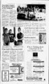
Show Emery County NOTICE TO CREDITORS Probate No. 2072 Public Notice NOTICE TO CREDITORS Probate No. 903800061ES 1 USDA MANTI-L- A - FOREST SERVICE SAL NATIONAL FOREST George Moms, Forest Supervisor, made a decision to share operation and maintenance responsibilities for Forest Service-owne- d dams on the Manti-L- a Sal National Forest with other qualified entities to the extent partnerships can be developed. Until this decision is fully implemented, Mr. Morris has also decided to retain the 14 existing Forest Service-owne- d dams and maintain them at a safe operational condition and to reconstruct 2 dams that are presently breached (as funds become available) and maintain them at a safe operational condition. The Forest Service-ownedams include: Lake Oowah Dam, Moab Ranger District, Grand County, Utah; Warner Lake, Moab Ranger District, Grand County, Utah; Medicine Lake, Moab Ranger District, San Juan County, Utah; Lower Gooseberry, Price Ranger District, Sanpete County, Utah; Benches Pond, Price Ranger District, Sanpete County, Utah; Boulger, Price Ranger District, Sanpete County, Utah; Potters Dam 1, Ferron Ranger District, Emery County, Utah; Potters Dam 2, Ferron Ranger District, Emery County, Utah; Academy Mill, Ferron Ranger District, Sanpete County, Utah; Grassey Dam, Ferron Ranger District, Sanpete County, Utah; Petes Hole, Ferron Ranger District, Sanpete County, Utah; Soup Bowl, Ferron Ranger District, Sanpete County, Utah; Yearns Reservoir, Sanpete Ranger District, Sanpete County, Utah; New Canyon Lake, Sanpete Ranger District, Sanpete County, Utah; Upper Six Mile Pond, Sanpete Ranger District, Sanpete County, Utah; Blue Lake, Ferron Ranger District, Sanpete County, Utah. The associated Decision NoticesFinding of No Significant Impacts and Environmental Assessments are available upon request from the Supervisors Office, Manti-L- a Sal National Forest, 599 West Price River Drive, Price, Utah 84501, Telephone 801 This decision is subject to appeal pursuant to Forest Service regulations at 36 CFR Part 217. Appeals must be filed within 45 days from the date of publication of this notice, November 27, 1990. Notices of Appeals must meet the requirements of 36 CFR 217.9. Published in the Emery County Progress November 27, d 637-281- 7. 1990. IN THE SEVENTH JUDICIAL DISTRICT COURT, IN AND FOR EMERY COUNTY, STATE OF UTAH In the matter of the Estate of STELLA J. MCKINNEY, aka STELLA J. MOR-TENSE- Deceased. All persons having claims against the above estate are required to present them to the undersigned or to the Clerk of the Court on or before the 12th day of April, 1991, or said claims shall be forever barred. Mark H. Tanner Attorney for the Estate P.O. Box 1148 Castle Dale, Utah 84513 Published in the Emery County Progress November 27, December 4andll,1990. IN THE EIGHTH JUDICIAL DISTRICT COURT OF UINTAH COUNTY STATE OF UTAH. Estate of Darlene Cox, Notice is hereby given that Intermountain Power Agency, co Los Angeles Department of Water & Power, P.O. Box 111, Los Angeles, California 90051, has submitted a complete application to the State of Utah, Division of Oil, Gas & Mining (DOGM) to mine and reclaim the Horse Canyon Mine, Permit Number ACT007013. A copy of the complete application is available for inspection at the DOGM, 355 WestNorth Temple, III Triad Center, Suite 350, Salt Lake City, Utah 84180-120and at the Emery County Recorders office, Emery County Courthouse, Castle Dale, Utah 84513. The mine permit area is located as follows: Beginning at the SW comer of the SEVi SE' of Section 5, T16 S, R14E, SLBM; and running thence North 660 feet; thence East 2640 feet; thence North 660 feet; thence East 1980 feet; thence North 660 feet; thence approximately N 45 East 4800 feet, more or less; thence approximately N 70 W 1250 feet more or less; thence West 250 feet; thence approximately N 28" W 1320 feet more or less; thence approximately 65 E 580 feet more or less; thence approximately 13" E 600 feet more or PUBLIC NOTICES BECAUSE THE PEOPLE MUST KNOW; nPPPDQPfl Probate No. 903800061ES All persons having claims against the above estate are required to present them to the undersigned or to the Clerk of the Court on or before the 25th day of February, 1991, or said claims shall be forever barred. Lamb Huber BEASLIN & ANDERSON John C. Beaslin Attorney for Estate 185 North Vernal Avenue, 1 Vernal, Utah 84078 Telephone: 801789-120- 1 Published in the Emery County Progress November 13, 20 and 27, 1990. By NOTICE TO CREDITORS Probate No. 2071 IN THE SEVENTH JUDICIAL DISTRICT COURT IN STATE OF UTAH In the Matter of the Estate of DEANN BLACK JENSEN, aka DEANN B. JENSEN and as DEANN JENSEN, Deceased. All persons having claims against the above Estate are required to present them to the undersigned, who has been appointed as Personal Representative of the above Estate, to the undersigneds attorney of record, Michael R. Jensen, or to the Clerk of the d Court, within three months after the date of first publication of this Notice, or said claim shall be forever barred. KERWIN F. JENSEN Box 339 Cleveland, Utah 84518 phone Michael R. Jensen FRANDSEN, KELLER & JENSEN Attorneys for Personal Representative NOTICE TO THE PUBLIC EMERY COUNTY UTAH THE OFFICE OF THE TREASURER OF EMERY COUNTY WILL CLOSE NOVEMBER 30th, 1990. THIS OFFICE WILL REMAIN CLOSED UNTIL THE FIRST DAY OF BUSINESS ON JANUARY 2nd, 1991. This is in compliance with the UTAH STATE CODE 1953 annotated SECTION replacement volume 6 B page 146. All taxes, except those otherwise specifically provided for, unpaid at 12:00 noon on the 30th day of November, or if that day falls on a Sunday or a holiday, tnen at 12:00 noon on the 29 th day of November, of each year, following the date of levy are delinquent, and the county treasurer shall then close his office for the receipt of taxes until he has prepared his delinquent list for publication. All delinquent taxes shall be subject to a penalty of two percent of the amount of such taxes, and unless the delinquent taxes and penalty are paid before the 15th day of January, the amount of taxes and penalty shall bear interest at the rate of six percent above federal discount rate per annum from the 1st day of January following the date of delinquency until paid. 59-10-- P. Wilson Emery County AND FOR EMERY COUNTY, above-name- 653-223- 3 NOTICE Progress Tuesday, November 27, 1990 13A 90 West 100 North Price, Utah 84501 637-124- 5 Published in the Emery County Progress November 27, December 4 and 11, 1990. Treasurer Published in the Emery County Progress November 20, 27 and December 4, 1990. PUBLIC NOTICE NOTICE TO CONTRACTORS Huntington City is accepting bids for the Irrigation System at the Huntington City Cemetery. Bids wifi be received at the City Hall from September 25, 1990 to December 31, 1990. Specifications at City Hall. Councilwoman Gayle McDonald Published in the Emery County Progress November 20 and 27, 1990. NOTICE 3, less; thence approximately N 82" W 100 feet more or less; thence approximately N 10" E 1650 feet more or less; thence approximately S 88" E 1030 feet more or less; thence South 260 feet; thence approximately S 88" E 550 feet more or less; thence approximately S 09" W 1940 feet more or less; thence East 300 feet; thence approximately S 20" E 1550 feet more or less; thence approximately N 68" E 100 feet more or less; thence approximaltely S 20" E 250 feet more or less; thence approximately N 20" W 1120 feet more or less; N 68 E 2170 feet more or less; thence approximately N 20" W 1120 feet more or less; thence approximately N 68" E 600 feet more or less; thence East 200 feet; thence approximately S 20 E 2800 feet more or less; thence approximately S 68 W 300 feet more or less; thence South 500 feet; thence West 1200 feet; thence South 300 feet; thence East 450 feet; thence South 380 feet; thence West 400 feet; thence approximately S 22 E 1310 feet more or less; thence East 1240 feet; thence approximately S 45 E 660 feet more or less; thence South 1000 feet; thence West 2650 feet; thence approximately S 22 E 2140 feet more or less; thence approximately N 68 E 101Q feet more or less; thence approximately N 22" W 700 feet more or less; thence approximately N 68" E 540 feet more or less; thence approximately S 22" E 500 feet more or less; thence approximately S 63 W 300 feet more or less; thence approximately S 22" E 600 feet more or less; thence approximately S 68" W 400 feet more or less; thence approximately N 22 W 110 feet more or less; thence approximately S 68 W 850 feet more or less; thence approximately S 22 E 1 150 feet more or less; thence approximately S 89 E 350 feet more or less; thence South 100 feet; thence East 450 feet; thence South 2600 feet; thence approximately S 77 W 300 feetmore or less; thence approximately N 2 W 1270 feet more or less; thence approximately N 22 W 1120 feet more or less; thence approximately S 68" W 2150 feet more or less; thence approximatley 22 W 200 feet more or less; approximately S 68" W 1950 feet more or less; thence approximately S 22 E 650 feet more or less; thence approxiS mately S 8 W 560 feet more or less; thence approximately 68 W 50 feet more or less; thence approximately N 22 W 1480 feet more or less; thence approximately N 68" E 2250 feet more or less; thence approximately N 22 W 5410 feet more or less; thence West 2000 feet; thence South 520 feet; thence West 1350 feet; thence South 1320 feet; thence West 660 feet to the NW comer of the NE 'A NE' of Section 9, T 16 S, R14E, SLBM; thence South 1320 feet; West 5280 feet; North 1320 feet to the point of beginning. LESS the following portions thereof: (a) Beginning approxLot 11, Section imately 700 feet South from the NW corner of North 800 thence 700 East feet; thence 3, T16S, R14E, SLBM; feet1 thence approximately S 22 E 1600 feet more or less; ' thence approximately S 48 W 300 feet more or less; thence West 870 feet; thence approximately N 22 W 300 feetmore or less; thence North 650 feet more or less to the point of beginthe center of Section 3, ning (b) Beginning 590 feet North of1120 feet more or less; North thence T16S R14E, SLBM; thence W 750 feet; thence aproximatelyN 22 W 660 feetmore or less; thence approximately N 75 E 1460 feet more or less; thence approximately S 22 E 2080 feet more or less; thence less; thence approxiapproximately S 75 E 100 feetormore orthence West 1730 feet; less; feetmore 2500 S E 22 mately or less; thence more feet 2320 W 22 thence approximately N of (c) Beginto the begmnig. or less more point feet 300 East of Section 11, T16b, ning 350 feet East of the NW corner thence R14E, SLBM; thence S 22 E 2720 feet more or less; less; thence approxiapproximately S 68 W 1650 feet more orthence approximately mately N 22 W 4800 feet more or less;East 1400 feet more or N 10" E 500 feet more or less; thence or less to more feet 2020 E 22 S less; thence approximately ' the point of beginning. The described areas are contained on the following U.b. Lila Geological Survey 7.5 minute quadrangle maps; Cedar; PWritten comments, objections or requests for informal conferences on the application may be submitted by anyone affected by this proposal. Such comments should be filed within the next thirty (30) days with: State of Utah, Department of Natural Resources, Division of Oil, Gas and Minin? 355 West North Temple, III Triad Center, Suite 350, Salt Lake City, Utah 84180-120Published in the Emery County Progress November 6, 13, 20 and 27, 1990. 3. Consolidation Coal Company, 12755 Olive Blvd., St. Louis, MO, has filed an application for a permit renewal (ACT015015) for its Emery Mine with the Utah Divison of Oil, Gas and Mining. The permit area, as shown on the map below, is located on U.S. Geological Survey 7.5 minute quadrangle maps as follows: Sections 19, 20, 21, 28, 29 and 30, Township 22S, Range 6E, of the Emery West Quadrangle; Sections 21, 22, 27 and 28, Township 22S, Range 6E, of the Emery East Quadrangle; Sections 28, 29, 30, 31, 32 and 33, Township 22S, Range 6E, of the Walker Flat Quadrangle; Sections 27, 28 and 33, Township 22S, Range 6E, of the Mesa Butte Quandrangle. five-ye- ar Ferron City is now accepting applications with resume for the position of City Treasurer. Must have general knowledge of accounting, bookkeeping and office procedures. Skill in operating ten key adding machine, typing ability,, including word processing and some computer experience, must pass typing test. Ability to deal effectively with general public. Additional training or experience in accounting or business preferred. Must be Bondable. If interested apply through Job Service in Castle Dale, Utah. All applications must be in no later than the close of business on Decem- ber 7, 1990. Ferron City is an Equal Opportunity Employer. Dated and posted this 21st day of November, 1990. Behling Ferron City Recorder Published in the Emery County Progress November CMC, 27, 1990. NOTICE OF SALE OF STATE LANDS Notice is hereby given that on Tuesday, December 4, 1990, at 11:00 a.m., at the Emery County Commission Chambers, Emery County Courthouse, 95 East Main Street, Castle Dale, Utah, the State will offer for sale the following described lands located in Emery County: Township 17 South, Range 9 East SLB&M Section 32: N2N2SE4NW4 Containing 10.00 acres, more or less Property is located approximately two (2) miles southeast or Huntington, Utah in Emery County, on Huntington-Lawrenc- cut- e off road. Copies of the application for this permit are available for inspection at: Emery County Recorders Office, Emery County Courthouse, Castle Dale, Utah 84513. Division of Oil, Gas and Mining, 355 West North Temple, 3 Triad Center, Suite 350, Salt Lake City, Utah 84180-120Written comments, objections or requests for informal conferences on the application should be addressed to the Division of Oil, Gas and Mining at the above address. Published in the Emery County Progress November 13, 20, 27 and Dec. 4, 1990. 3. Further information about this sale, including any know geological hazard information, may be obtained by contacting the Division at 89 East Center Street, Moab, Utah 84532 (8017259-6316By order of the Direction, Division of State Lands and Forestry, October 1, 1990. Published in the Emery County Progress November 13, 20 and 27, 1990. ). San Rafael Bulldogs SCIENCE OF THE MIND Kara Childs and Marcus Bolinder have been chosen as San Rafael Junior High School's JACK students of the week. LYTHGOE MASTER HYPNOTIST Kara, a ninth grader, is the daughter of Vernon and Susan She is a very outgoing, energytic Childs of Orangeville. She loves to play all sports and is on S.R.J.H. person volleyball team. She loves to water ski. She has excelled in Drama, winning many awards. She loves music and plays the piano and the flute. She was a member of the Emery Co. High Marching Band last summer. Kara is an excellent student and enjoys school. Her favorite subjects are Drama, Math, and Athletics and she loves to read. Emery.County High School Auditorium Dec. 12 at 7:30 pm - STUDENT OF THE WEEK Students (with cards) $3.00 Marcus is the 1 5 year old son of Marv and Leslie Bolinder Ferron. He enjoys playing football and baseball, reading, and Nintendo. His favorite classes hunting, include Alegebra II and Mr. Larson's discussions. He is an honor student and member of the National Jr. Honor Sociof ety. He was named "Entrepreneur of the Week" twice by the Bulldog Bite. He has met many friends since moving from Grantsville two years ago. He was also 8th grade class President Adults $4.00 : Sponsored by PTSA |