| OCR Text |
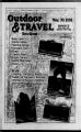
Show Pq 10 Outdoor & Travel May 2002 Bryce Canyon leaves much to the imagination There is no doubt that Utah's five national parks are spectacular places of beauty. Each has a personality per-sonality of its own. There is the towering sandstone walls of Zion's Great White Throne, the orchard in the middle of Capitol Reef, the knife edge ridge of Angel's Landing in arches and the Maze district in Canyonlands. Yet for all the amazement amaze-ment these areas offer, nothing has the "Wow" factor of Bryce Canyon. Bryce Canyon National Park is in a league of its own. Other than its sandstone, it shares few if any common features with its National Park Neighbors. No other park can match the unusual collection of hoodoos, formations, and sculpture that defines Bryce's character. Mormon pioneer Ebenezer Bryce finally gave up trying to define the geology and define it as "a hell of a place to loose a cow." Even today, people use metaphors to define their particular interpretation of the landscape rather than struggle to define the park in absolute terms. A landscape in transition. - Logically speaking, Bryce Canyon really isn't a canyon, but an amphitheater shaped by the forces of erosion. nARQI list mHJ I 1 r ti Orthopedic Beds Cable TV Covered Private Porches pr7 Plush, Quiet Rooms $8? Great Homemade Food Close to Canyon Trails 3066 Hwy. 12 Panguitch, UT 84759 435676-2350 fax 435676-281 0 e-haroldcolorcountry.net When the Colorado Plateau began to rise 16 million years ago it created three distinct plateaus: the Markagunt (that formed Cedar Breaks), the Aquarius (that created the Table Cliffs) and the Paunsaugunt that gave birth to Bryce. Over time the Paria River gnawed its way through the Paunsaugunt exposing the fissures, or joints, in the sandstone. sand-stone. As the seasons changed the freeze and melt cycle cut its maze of patterns in the sandstone creating creat-ing the pillars, or hoodoos that symbolize Bryce Canyon. Even today the landscape is in transition. Over 200 temperature cycles per season etch the park's south facing aspects. An examination examina-tion of historical photos clearly shows the effect of even a decade of change, a mere fraction of a second Bryce Canyon Hwy 12 Your Headquarters for Dxyce Canyon FLP. Ct Grand Staircase Escalante National Monument 65 Deluxe Rooms Air Conditioning Direct Dial Phones Gift & Antique Shop Restaurant & Steakhouse 199 N. Main Street Tropic, Utah 84776 1-800-442-1890 435-679-8811 Fax 435-679-8846 www.brycevalleyinn.com L i "Your National Park Vacation Headquarters' Heated Pool Hot Tub Continental Breakfast Family Suites Non-Smoking Rooms BEST WESTERN RED HILLS 125 WEST CENTER KANAB, UTAH 84741 1-8G0-83G-2675 www.redhillsmotcl.com e-mail: rcdhillsxpresswcb.com in geologic time. Exploring the Park. Bryce Canyon's terrain ranges from the badlands to the alpine,, and a well maintained road gives visitors access to nearly all the park's features. Near the North end of the park, youH find Fairyland Point, where you can use your imagination to pick shapes from the hoodoos. At the south end you can find the lofty climes of the Bristlecone Pine, a tree that began its life as a seedling over 1,800 years ago. Between this span lies over 50 miles of hiking trails. Some trails meander along the amphitheater's lip, between scenic viewpoints. Others require a bit more effort and drop into the foundation of the spectacular landscape. The Rim Trail is the least strenuous path in the park. Though it covers 11 miles end to end, visitors can pick up the trail at most every auto pullout. The Rim Trail's Sunrise to sunset point section is wheelchair accessible. The short but strenuous Navajo Loop trail requires better conditioning, but offers a far greater reward. Over its length, the trail provides unique views of the formations that create the park's maze-like Qi appearance. The trail also Hftjl lease visitors down the Qjf I aptly named "Wall Street" section where sheer forma-, tions rise so abruptly they nearly obscure the sky. Hikers in search of overnight adventures will find the Under-The-Rim and Riggs Spring Loop trails to their liking. The Under-The-Rim trail covers over 22 miles of Bryce back-country back-country and usually takes two to three days. The Riggs Spring Loop covers nearly nine miles and works well as an extension of the Under-The-Rim trail or makes a pleasant overnight trip. Backcountry camping is limited to designated areas and requires a free backcountry permit, available avail-able at the Visitors Center. On any hike you should plan on carrying water. Though many hikes are short, daytime temperatures tempera-tures can skyrocket during warm summer months. Another factor Visitors frequently overlook is Bryce Canyon's altitude. Situated at the top of the plateau, Bryce's viewpoints lie between 7,700 and 9,000 feet above sea level. Visitors that keep altitude, alti-tude, pace, and personal limitations ia mind will find their imaginations run wild in the land that will forever be in transition. i |