| OCR Text |
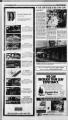
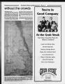
Show Summer Sports & Recreation Page 10 Highway 12 offers Utah's red rock country continued from page 5 that I'm giving away some closely guarded secret and that others should be forced to discover these places on their own, know that Coyote Gulch is already out-of-the-bag, so to speak. On weekends during the spring, Coyote Gulch will seem crowded with the numbers of hikers present, including family, scout and church groups. In spite of this fact, Coyote Gulch still presents nothing less than an ultimate canyon hike. Within the confines of Coyote Gulch, you can find arches, a natural bridge and Anasazi pictographs. You will also not have to worry about dying of thirst as there is plenty of water in Coyote Gulch, including seeps and springs that don't require purification. Finally, good campsites abound along the length of Coyote Gulch. Most hikers access Coyote Gulch from the Hurricane Wash trailhead, located approximately 33 miles down the Hole-in-the-Rock Road. At the trailhead there is a large parking area on the left side of the road (heading south) in the bottom of the draw. The trail follows a 4X4 road that is passable to high-clearance vehicles and will get you another hundred yards closer to the actual trailhead. However, there is only room for three or four cars and as such it is probably better to park in the larger area on the road. There is a trail register at the beginning of the Hurricane Wash route and those who don't sign in at the Bureau of Land Management (BLM) office in Escalante should do so at this point. Permits are free, but required, and if you run into a National Park Service ranger down in the gulch (which is on National Recreation Area land), he will ask to see yours. v At this point, hikers should just follow the well-worn trail down the gulch. Spurs break off at various points until the gulch gets high enough to prevent easy exit. Just continue Jo follow the dry stream bed if you have any doubts about being on trail. About two and a half miles from the Hole-in-the-Rock Road, you'll come to a sign announcing the boundary of the Glen Canyon National Recreation Area. At this point, national park-like rules take over from the relative freedom of the BLM lands above, and in a canyon as popular as Coyote Gulch, meeting a ranger is a fairly good bet. Thus, have your permit, keep your dog leashed and don't plan on having a campfire. In some other canyons, rangers, and other hikers, are far less likely and a little leeway is probably possible. As you progress down canyon, the depth of the gulch and the water will begin to increase. At approximately the five-mile point, the Dry Fork of Coyote Gulch will join Hurricane Wash from the left (north). At this point, you're in Coyote Gulch, and good campsites can be found at almost every bend in the canyon. The wonders (as if the sheer beauty of the area weren't enough) begin just a r " SfcC i: - tiVx .i0 y 4 '" PHOTO BY LUKE SMITH Think about it: Utah's world-famous red rock canyons, arches, a natural and plenty of water; Escalante's Coyote Gulch, under five hours drive from Park City, has everything you could want in a canyon experience without the crowds that are common to the Moab area. few bends downstream with Lobo, or Jacob Hamblin, Arch. Several more bends in the canyon and you'll come upon Coyote Natural Bridge. Finally, after still more bending this way and that, high up on the north wall of the canyon you'll spot Jug Handle, or Cliff, Arch. Before anyone hollers that I'm giving away some closely guarded secret and that others should be forced to discover these places on their own, know that Coyote Gulch is already out-of-the-bag, so to speak. One bend below Coyote Bridge, also on the north side of the canyon, trails lead up to a sandy bench overlooking the stream below. There, on the wall, you can find pictographs from the ancient Anasazi culture that inhabited this region almost 1,000 years ago. Look and take photos, but do not disturb as federal law prohibits the disturbance of antiquities such as pictographs. For practical concerns while camping in Coyote Gulch, a couple other facts should be noted. First, there are seeps in the north wall literally in the afternoon shadow of Lobo Arch. The water will fill your water bottle rapidly and if you're camping nearby, you shouldn't need to treat the water you use; simply keep refilling here. Also, there is a pit toilet located a bend upstream of the arch so again, if you're camped nearby, sanitation need not be a concern. This pit toilet, being of the open-air variety, may well provide the most scenic, uh, squatting location on earth. A pair of guidebooks to the region will be helpful in planning a trip to the canyons of the Escalante. The first is Hiking the Escalante by Rudi Lambrechtse and the second, Canyon Hiking Guide to the Colorado Plateau by Michael R. Kelsey. However, be forewarned that these books are merely overviews of potential hikes and that they are notorious for inaccurate distances and vague descriptions. Your best bet is to prepare with a topographical map which can be purchased at the BLM office in Escalante. They'll also give you tips and advice that might prove helpful. Since you've got to register for your trip, you might as well do so at the office and get the latest information at the same time. The next area to mention heading east along Highway 12 is the Boulder Mountain area. After crossing the Escalante River at Calf Creek, the road begins climbing and runs along razor sharp ridges that drop precipitously on either -side. This is some of the most scenic area along the drive as well as some of the most frightening. Highway 12 then runs into the town of Boulder, home of the Anasazi Indian Village State Park. The park contains artifacts and a replica of an Anasazi village excavated on that site in 1958-59 by the University of Utah. After seeing the real locations and actual pictographs down in the canyons, explanation (as much as is known at this time) can be found in the state park. After Boulder, the road climbs into the forest on the flanks of Boulder Mountain. Boulder Mountain reaches almost to an 11,000-foot elevation, and Highway 12 gets up as high as 9,400 feet as it makes its way northeast toward Torrey. It is here, on the heights of Boulder Mountain, that one can escape the desert heat of summer. Likewise, the elevation provides incomparable views out over the red rock country below, including that southeast over Capitol Reef National Park toward the Henry Mountains near Hanksville. There is excellent fishing in high-elevation lakes and streams on Boulder Mountain, as well as hiking and camping in an alpine environment with the aforementioned red rock vistas below. For the mountain bike enthusiasts, numerous trails and Forest Service roads line Boulder Mountain and are excellent for riding. Trails can be ridden that begin at the 9,000-foot level, among the aspen forests of Boulder Mountain, that then wind down into the red rock and desert environment below before arriving at Capitol Reef National Park's paved scenic drive. For information on continued on page 15 |