| OCR Text |
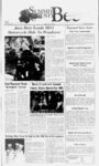
Show T The Summit County Bee Page B8 NOritE OFINTF.NTION CONTAINING PUBLIC NOTICE IS HEREBY GIVEN that on the 23rd day of May. 2U01. the City Council of Coalville City. Summit County, Utah (the City), adopted a revolution declaring ill intention to create a special improvement district to he known as Coalville. It is the intention of the Utah Special Improvement District No 2001 I (the "District") City Council to make improvements within the District and to levy special assessments as provided in Title IU, Chapter 3, Part 3. Utah Code Annotated 1933. as amended, on the real estate lying within the District fnr the benefit of which such assessments arc to be assessed in the making of such improvements DESCRIPTION OE DISTRICT The District will be located in Sections 4 and 9 of Township 2 North, Range 3 East, Salt Lake Base and Meridian and will be bounded on the North by the Northernmost Coalville City boundary, on the west by the toe of the western ndgelinc of Allen Hollow, on the east by the toe of the eastern ndgelinc of Allen Hollow, and on the South by paved Allen Hollow access road on the southeastern comer and southwestern comer of the existing Coalville City owned property. ' The District will be assessed in four zones, each bearing a different rate assessment. The descriptions of the rones arc as follows ZONE I (Flare) BEGINNING AT A POINT WHICH IS NORTH 4142 II FF.ET AND EAST 1109 IS FEET FROM THE SOUTHWEST CORNER OF SECTION 9. TOWNSHIP 2 NORTH. RANGE 3 EAST, SALT LAKE BASE AND MERIDIAN AND RUNNING THENCE N 44 0T 40 E 27.14 FEET. THENCE N 21 IT 30" E 21 32 FEET. THENCE N 27 3ff 32 E 347.09 FF.F.T; THENCF. N 30 301 10 E 1 1 3.32 FEET: THENCE N 34 32 10 E 108.74 FEF.I; THENCE N 29 24' 20 E 221.86 FEET; THENCE N 84 41' SO E 73 64 FEET; THENCE S 50 56' 10 E 96.07 FEET. THENCE S 43 Off 34 E 57.23 FEET. THENCE S 30 56' 10 E III- 47 FEET. I HENCE S 20 32' 00" W 649.44 FEET. THENCE N 12 07- 33 W 309 72 FEET; THF.NCE N 45 24' 29 W 107.24 FEET TO THE POINT OF BEGINNING. ONE 2 (Jade) SEC 4 T2NR5E SLBM CONT 40.0 ACRES LESS 4.02 AC 994-31- 6 BAL 33.71 ACRES M WD-- 1 76 Q--1 56 324-59- 0 N W I 4 SE ZONE 3 (Allen Hollnwl A part of ihe iuuih halt of Section 4 and in the north half of Section 9, Township 2 North, Range 3 Last. Salt Lake Base and Meridian Beginning at a point which is N8846'24"W 450.32 feet from the North Quarter Comer of Section 9. Township 2 North, Range 5 East, Salt Lake Base and Meridian (Said point located o n the northerly section line of above said Section 9, and also on Ihe southeasterly boundary line of Cedar Crest Subdivision) and running thence; I7I5'06" N 3339'13" E 1"E 420.73 feet, along said boundary line; thence 580.03 feet, along said line, thence 201.26 feet, along said line to Ihe westerly line of the Southwest Quarter of the Southeast Quarter of Section 4; thence 214.59 feet, to the Northwest Corner of the Southwest Quarter of the Southeast Quarter of Section 4; thence 1.329.33 feet, in the Northeast corner of the Southwest Quarter of the Southeast Quarter of Section 4. thence 1.320 3 feel, to the Southeast Comer of Ihe Southwest Quarter of the Southeast. Quarter of Section 4. thence 539 07 feet, to the crest of a Cedar Ridge; thence 245 46 feet, along said crest; thence 307.89 feet, along uid crest; thence 471.75 feet, along Hid crest; thence 301.69 feet, to the Northeast boundary comer of CRA Enterprises, thence 188.47 feet, along the northerly boundary line of CRA Enterprises, thence 57.25 feet, along said boundary line; thence 96.07 feet, along Mid boundary line, thence 73.64 feet, along Mid boundary line to the Northwest Comer of above Mid boundary; thence 221.86 feet, along the westerly boundary line of CRA Entcrpnses; thence 108 74 feet, along said boundary line: thence 1 15.32 feet, along Hid boundary line, thence 327.46 feet, along said boundary line to the northerly line of an existing road nght of way (which is 30 00 feet perpendicular from the centerline); thence 296.43 feet, along said right of way line to a nontangent curve to the left; thence along the arc of a curse to the left and Hid right of 1 Delta-- 89 way line 6'24, 1 CH-67- 9.5 '. CHB-- S 6606'08 W); thence 29.69 feet, along said right of way line to the southerly line of the Northwest Quarter of the Northwest Quarter of Section 9; thence 687.48 feet, along said line to the edge of a rock ledge; thence 64.40 face along said ledge; thence 57.35 feet, along Hid ledge; thence 176.08 feet, along Hid ledge; thence 650.31 feet, along Hid ledge; thence 334.86 feet, along said ledge; thence 257.91 feet, along said ledge to the northerly line of E Section 9 (uid line also being the southerly boundary line of Cedar Crest Subdivision); thence 1.021.86 feet, along said line to the point of E N 0043'44M E 8832'37 S E S0023'40W 884625 N W S2635WW W S 1816-04- " S 3109'4I W N 5056 01 "W NaiNrsrw N4254'I5W N4849-sr- S 864809 W S 3I3039 W S S658'29 S 5656 W 29 W S2937llW N 6334-0- W 753 44 feet S IS4S'06" W N 8849-4- W N 4338'3S" E N 3I10'07"E N l753-0rN 36I6'43" E N N 1930-- S 8846-2- beginning. Contains: 99.956 acres ZONE 4 (Cedar Crest) All property within the District that lies with the below described property A TRACT OF LAND LOCATED IN THE SOUTH HALF OF SECTION 4. TOWNSHIP 2 NORTH. RANGE 5 EAST. SALT LAKE BASE AND MERfDIAN DESCRIBED AS FOLLOWS: BEGINNING AT A POINT " E 399.83 FF.ET AI.ONG THE SECTION LINE WHICH IS N 89 FROM THE SOUTHWEST CORNER OF ABOVE SAID SECTION 4. (SAID POINT BEING ON THE SOUTHEAST CORNER OF DEED NO. PWD-440AND RUNNING THENCE N 02 Iff 00 E 439 48 FEET ) ALONG SAID DEED LINE, THENCE S 89 48' 00 W 186.38 FEET ALONG SAID DEED LINE TO A LINE WHICH IS THE EASTERLY THENCE N 24" AND MI9-I4LINE OF DEEDS NO. SWD-45E 368 85 FEET. THENCE N 88 33 00 W 383.19 FEE I ALONG SAID DEED LINE TO THE WESTERLY LINE OF SAID SECTION 4. THENCE NORTH 447.80 FEET ALONG THE SECTION LINK TO AN EXISTING FENCE LINE. THENCE S 72 391 50 E 318 13 FF.ET. ALONG SAID FENCE LINE. THENCE NORTH 185.27 FEET. TO AN EXISTING FENCE LINE. THENCE N 83 4T 20 W 305.00 FEET ALONG SAID FENCE LINE TO THE EASTERLY LINE OF COALVILLE MAIN STREET. THE NEXT FIVE COURSES ARE ON LINE OF SAID STREET. THENCE THE EASTERLY RIGHT-OF-WAN 06 2ff 20 E 69.07 FEET. THENCE N 22 33 38 E 768 16 FEET. THENCE N 23 Sr 21 E 40.03 FEET. THENCE N 14 40 35 E 216.73 FEET. THENCE N 00 9 46 E 281.80 FEET MORE OR LESS TO THE 1.4 SECTION LINE. THENCE S 89 43' IS E 2266.29 FEET MORE OR LESS ALONG SAID LINE TO THE CENTER OF SAID SECTION 4. THENCE S 89 451 IS" E 416 06 FEET, THENCE S 48 49-4W 196.24 FEET. THENCE S 30 35' 45 W 347.82 FEET. THENCE N 89 43- 15 W 84.48 FEET MORE OR LESS TO THE EASTERLY LINE OF THE SOUTHWEST QUARTER. THENCE S 00 4ff 43 E 1 109.71 FEET ALONG SAID LINE TO DEED NO. 363-39THENCE S 34 11 09 W 202.81 FEET, THENCE S 21 0T 24 W 580.03 FEET, THENCE S IS 48- 49 W 420.73 FEET MORE OR LESS TO THE SOUTHERLY LINE OF SAID SECTION 4. THENCE S 89 4T 19 W 1623.69 FEET ALONG SAID SECTION LINE TO THE POINT OF BEGINNING. i 8 2001 umtsi of property to be assessed in esses where an assessment is proposed to be made according to connection (equivalent residential units); and residential 139 87 ACRES TOTAL INTENDED IMPROVEMENT The improvement to be conatructed and their location within the District arc as (b) assessed in one-ha- lf of the acres of property to be where an assessment is proposed to be made according to area. Protests representing cam Inllowt Culinary Water System Improvements will include a 450,000 gallon buried concrete reservoir. The reservoir will be located approximately 500 feel north of the northernmost Coalville City boundary on property to be provided to Coalville City for that puipon A 10 watci line with services and fire hydrants will be A 10 water main from and provided through Ihe proposed subdivision development electrical service line from the city bourn. ary to the reservoir will be located in an A booster pump station will be easement provided to the City for that purpose constructed to pump waier from existing city wiier lines to the new reservoir I approximate I Secondary Water System Improvements Improvements will include a proposed 2.S (approximate) acre-foopen secondary reservoir It will be located approximately 200 feel north of the northernmost Coalville City boundary on property to be provided to Coalville City for that purpose A secondary irrigation line and services will be provided through the proposed subdivision. A secondary irrigation line from Ihe city boundary to the reservoir will be located in an easement provided to the City for that purpose. A boaster pump station will be constructed in pump water from city secondary lines to fee new reservoir. Storm Dramaxe Improvements will include an "Upper Debris Detention located in the mouth of a 126 acre drainage area at the northernmost Coalville City boundary on property to be provided to Coalville City lor that purpose. There win also be "Lower Detention Basin" located near the entrance to the business path property, across the street from the City Cemetery. Storm drain pipes will connect the two basins with an open ditch extending from the lower basin to Chilk Creek. The system will be designed to control flooding from the drainage area above the business perk and control drainage associated with improvements within the business park. Sanitary Sewer System Improvements will include the construction of an 8 sewer main from the northernmost boundary of the proposed business park to connect with an existing city mam line on Chalk Creek Road. BY ORDER OE fHF Cl I Y COLSCIL OF COALVILLE CITY. UTAH Maria R. Clark City Recorder 'v Published in the Summit County Bee Publication Dam; June I, June 8, June 15, and June 22, 2001 Bssin - - CONTAINING 8.97 ACRES N 2233'4IH E N 3537 26 E of June Interior Roadway Improvements will include a 39 fool wide paved roadway y with 30" curb on each side in a 60 fool extending through the interior of the business park from the entrance into the proposed business park to (he northernmost boundary of the proposed park. Additionally a graveled road will be provided from the northernmost business park boundary to the detention basin, irrigation reservoir and culinary water reservoir located in an easement provided to the City for that purpose. Extenor Roadway - Improvements will include a "full width street improvement" of the existing road west of the proposed business park entrance and aouth to the Interaection with Chalk Creek Road, a distance of approximately 1,350 feet The improved rood will consist of a 39' asphalt road with 30" curb on each aide. ta COUNTRY BEADH FOODS 1680 Ute Bhrd. Ste ( Plaza-timb- P.0. Box 882017 C J& ) al Park City. UT 84098 (4351 65S-979- 8 Largest Selection of Supplements, Natural Foods, Health & Beauty Products 1 Health 6 Nutrition Naturally ESTIMATED COST OF IMPROVEMENTS The total cost of improvements in the District as estimated by the Coalville City Engineer, including costs is S3.IS6.000, of which the City will pay SO, leaving a remainder of 33,156.000 which shall be paid by a special assessment to be levied against 10.71 Acres in Oakley 24- - hr recorded Information call ad 306 Marilynn Jung (435) 640-250- 6 Gnat Home - 5 Acres $209,900 41 30 S. 24- - Woodland View hr recorded information call ad 306 Marilynn Jung (435) 640-250- 6 and Wasatch Counties "Ths Gateway to the uintaw" Swing Summit 112 South Maun P.O. Box 219 Kamas, Utah 840 '46 Office (435) 783-435- 3 www.hlghcountrypropertles.net LEVY OF ASSESSMENTS It is die intention of the City Council to levy assessments as provided by the laws all parcels and lots of real property to be benefitted by the proposed improvements widun die District. The purpose of the assessment and levy is to pay (hose costs of the improvements which the City will not assume and pay. The method of assessment shall be by lineal from foot, square foot, connection, or acreage as set forth herein. of Utah on The assessments may be paid by property owners in not more than fifteen (IS) annual installments with interest on the unpaid balance at a me or rates fixed by the City Council of Coalville City, Utah, or the whole or any part of die assessment may be paid without interest within fifteen (15) days after the ordinance levying the assessment becomes effective. The assessments shall be levied according to the benefits to be derived by each property within the District. Other payment provisions and enforcement remedies shall be m accordance with Title I7A, Chapter 3. Part 3. Utah Code Annotated 1953, as amended A map of the proposed District, copies of plana, profiles and specifications of the proposed improvements and other related information are on file in the office of the Coalville City Engineer who will make such information available to all interested persons. a TIME FOR FILING PROTESTS Any person wljp is die owner of record of property to be assessed in the District desenbed m this Notice of Intention Aiall have die right to file irf writing a promt against the creation of the District or to make aqy other objections relating thereto. Protest! shall describe or otherwise identify the property owned of record by the person or persons making the protest and shall indicate die total front footage andor square footage represented by Hid protest Protests shall be filed with the City Recorder of Coalville, Utah, on or before 5:00 p.m on Ihe 20lh day of June. 2001. Thereafter at 7:00 pa. on die 9th day of July, 2001, the City Council will meet in public meeting at the offices of die City Council to consider all protests so filed and bear all objections relating to die After each consideration and determination, the City Council shall adopt a resolution cither abandoning ihe District or described in this cresting lh District either Notice of Intention or with deletions and chanjps made as authorized by law; but die City Council shall abandon the District and not creaM the same if the necessary number of promts as provided herein have been filed on or before the time specified m this Notice of Intention for die filing of promts after eiratinating from such filed protests: (i) pi ousts relating to property or telating to a type of improvement which hae beat deleted from the District end (ii) promts which have been withdrawn in writing prior to the conclusion of the hearing. The necesaaiy number of pretests ihoU meat the aggregate of dw following; u (a) Protests representing one-ha- lf of the connections (equivalent s i (poor |