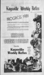
| OCR Text |
Show I t I DAVIS COUNTY CUPPER. DECEMBER 31, 1980 FARMINGTON (CONTINUED) 1 alg sd line; th S 3 deg. 39E 39.4 ft alg sd In to SW cor sd lot 17; th S 68 deg. 1858"E 111.26 ft to W line of st; the N'ly 47.48 ft alg a 50 ft rad cur to right alg sd st; th N 12 deg. FRUIT HEIGHTS PAGE ELEVEN WEEKLY REFLEX DAVIS NEWS JOURNAL, JANUARY 1, 1981 2013W rial No. beg on E line of ppty conv to st rd comm in 405-47- 8 at pt S 89 deg. 54E 422.9 ft & S 3 deg. 39E 1322.4 ft & S 89 deg. 54' E 92.1 ft fr NW cor Sec. 36 T4N-RISLM: thN 3 deg. 39W!13ft; th NEly 375 ft. mol to a pt which isN85 deg. 2lE28t ftfr SW cor of Gordon Thurman Ward ppty; th N 85 deg. 2I'E 565.9 ft, mol to E line of Grantor's Land; the S 372.59 ft to SE cor Grantor's ppty; th N 89 deg. 54 W 717.9 ft to pob. cont. 5.64 acres. Total Tax $196.76 Curtis M. 4 Susan B. Tingey, SeAll of lot 8. rial No.FH-18-Quail Ridge. Sec. 36; T4N-RISLM: cont. .49 acres. Total Tax $123.46 Ernest Edward Spendlove, Serial No. Beg N 89 deg. 58'50 E 9.1 ft & N 25 deg. 1 1 1 .8 1 ft 66, all of lot 66, Somealg line sd lot to pob. cont. . 35 acres. Total rset Hollow, Pud. Sec. 12. T3N-R1Tax $655.48 SLM. Total Barton Bros. lnv. Co., Serial No. Tax $155.68 Somerset Hollow Ltd., Serial No. beg at NE cor of lot 16 Barton Manor No. I. amd; all of lot 67, Someth N 3 deg. 26'I3"W 138.95 ft, rset Hollow, Pud. Sec. 12. T3N-R1mol, to center In of creek; th N SLM. Total 79 deg. 4330"E 94.9 ft alg sd Tax $155.68 cent In; th S3 deg. 39E 155.50 Somerset Hollow Ltd.. Serial No. 1 ft. mol. to N In of lot 13. Barton FA-5- 7 68. all of lot 68. SomeManor No I . amd; th N 89 deg. rset Hollow, Pud. Sec. 12. T3N-RI46'W 95 ft alg sd N In to pob. SLM. Total cont. .30 acres. Total Tax $155.68 Tax $20.30 Somerset Hollow Ltd.. Serial No. Jack D & Elaine H. Palmer, Serial FA-5- 7 -- 69. all of lot 69. SomeNo. beg 1501.7 ft E rset Hollow. Pud. Sec. 12. of NW cor SW1 Sec. I.T3N-RIT3N-RI. SLM. Total SLM: the E 21 1 ft; th S 55'W338.2ft&N73deg. I3'E Tax $155.68 406.80 ft 4 N 15 deg. 23 W 35 deg. 30' W 129.0 ft; th S 54 Somerset Hollow Ltd.. Serial No. 206.34 ft &S 74 deg. 0430W deg. 30' E 275.75 ft to the NW all of lot 70. Some16.4 ft fr S A cor of Sec. 36: side of rd; th S 35 deg. 30W rset Hollow. Pud. Sec. 12. T4N-RISLM: th S 74 deg. 50.0 ft alg sd rd; th N 54 deg T3N-R1SLM. Total 30'W 275.75 ft th S 35 deg. 0430"W 108.20 ft;thN I5deg. Tax $155.68 23'W 192.8 ft: th S 74 deg. 30' W 50 ft; th N 54 deg. 30W Somerset Hollow Ltd.. Serial No. 195. 25 ft; th N 41 deg. 30E 04'30W 11.2 ft: th S 15 deg. Fa-5- 7 7 1, all of lot 71. Some109.5 ft to the pob. cont. 1.00 23E 350.49 ft to Nly In of rset Hollow. Pud. Sec. 12. th N 73 deg. I3'E 101.24 ft to acre. Total Tax T3N-R1$2,334.03 SLM. Total intersec of N'ly 4 WTy lines of Jack D. 4 Elaine H. Palmer. Serial Tax $155.68 the N 08 deg. 45W sd No. beg E 1501.7 ft Somerset Hollow Ltd.. Serial No. 157.4 to pob. cont. .45 acres fr NW cor of SW'A of Sec. I; all of lot 72. SomeT3N-RIalso: a RT of ing and erg to A 50 SLM: th E 412.5 ft; rset Hollow. Pud Sec. 12. N 89 deg. 5850"E9.I ft ft th S 02 deg. 00W 197.5 ft: th S T3N-RISI M I olal & N 25 deg. 55'W 338.2 ft frS 35 deg. 43W 335.4 ft: th N 45 Tax Sl'5.68 A cor Sec, 36 T4N-RIdeg. I7'W 502 ft; th N 48 deg. Somerset Hollow Ltd.. Serial No. SLM: thN 73 deg. 13E 416.8 20E 258.1 ft to pob. cont. all of lot 73. Someft: N 08 deg. 45W 207.82 ft; th 3.675 acres, except: that ppty rset Hollow, Pud. Sec. 12. S 74 deg. 04'30"W50.4ft;S08 desc as folconv in 487-38- 7 1 SLM. Total lows: beg 1502.7 ft E fr NW cor deg. 45'E par to Ely In of sd lax $155.68 & to a pt N 08 deg. 45'W of SW'A sd Sec. I ; the E 21 ft: Somerset Hollow Ltd.. Serial No. th S 73 50.5 ft fr STy In of sd theS35 deg 30W 129 ft:thS54 1 74. all of lot 74. SomeFA-5deg. I3W par to 4 50 ft dist fr deg. 30E 275.75 ft to NW side rset Hollow. Pud. Sec. 12. to cen In of of a rd;th S 35 deg. 30W50ft STy In of sd UN RIW. SI M. Total road; thS 25 deg. 55E 50.64 ft alg sd rd; th N 54 deg. 30W $155.68 lax 275.75 ft; the S 35 deg. 30'W50 alg cent In of road to pob. Total Somerset Hollow Ltd.. Serial No. Tax $20.30 ft S: th N 54 deg. 30W 195.25 1 75. all of lot 75. SomeFA-5D. Clayton Fairboum. Serial No. ft; th N 41 deg. 30E 109.5 ft to rset Hollow. Pud. Sec. 12. Lot 8. Ruby Acres pob. cont. 1.00 acres, balance UN RIW. SI M. Total Sub. Sec. 36. TP4N-RGI1.675 acres. Total Tax $18.79 $155.68 lax SLM. cont. .453 acres. Total Jack D 4 Elaine H. Palmer. Serial Somerset Hollow l td.. Serial No. Tax No. $618.65 Beg E 1015 ft 4 FA-5all of lot 76. SomeS 17 deg. 34W 218.2 ft: S 35 Junior D. Larson. Serial No. rset Hollow. Pud. Sec. 12. All lot of II. Carrie deg. 43W 372.3 ft fr NW cor of T3N-R1SLM. Total Hts. Sec. 36;T4N-RIW;SLSW' of Sec. 1; T3N-RI$155.68 Tax cont. .275 acres. Total Tax$266. SLM: 4 the S 35 deg. 43W Somerset Hollow Ltd.. Serial No. Junior D. 4 Karen H. Larson, Se327.5 ft: thN 54 deg. 17W570 F all of lot 77, Somerial No. All of ft; th N 48 deg. 20E 337.5 ft; S rset Hollow, Pud. Sec. 12, lot 12, Carrie Hts. Sec. 36; 54 deg. 17'E 502 ft to pob. cont. T3N-R1Total SLM. T4N-R1SLM: Cont. .275 3.675 acres. Total Tax $26.31 $155.68 Tax acres. Total Tax $115.76 William F. & Paulena L. Ward. No. Serial Somerset Hollow Ltd., William C. 4 Robin C. Gayler. SeSerial No. Apt 8. all of lot 79, Somerial No. of lot 15. Unit B. Somerset Place Cond. rset Hollow. Pud. Sec. 12. Park Hts, plat A. Sec. 35: T4N-R1Sec. I, T3N-R1SLM:. TotT3N-RI-SLM. Total SLM: cont. .302 acres. al Tax $157.11 SI 55.68 Tax Total Tax $450.27 Neal Kent 4 Jill S. Green, Serial Somerset Hollow Ltd.. Serial No. No. , beg 43 ft S & N Stephen Seeley Morgan. Serial 1 Fa-5- 7 80, all of lot 80. SomeAll of lot 6 The No. 75 deg. 40'E 534.50 ft fr the rset Hollow, Pud. Sec. 12. Orchards Unit No. 2 Sec. 35: NW cor of the NE'A of the T3N-R1SLM. Total T4N-RIslm: cont. .515 NW'4 of Sec. I; T3N-RI$155.68 Tax $146.58 acres. Total Tax SLM: run the N 75 deg. 40E 90 Somerset Hollow Ltd., Serial No. ft: thS 21 deg. 20E 133.33 ft; Floyd B. & Eldora B. Parkin, Seall of lot 81, Somerial No. the S 75 deg. 40 W 90 ft; th N 21 beg at the rset Hollow Pud. Sec. 12, NE cor of lot 2. Grand Oaks: deg. 20W 133.33 ft to pob. T3N-R1SLM. Total cont. .27 acre. Total plat A Sec. 35: T4N-RIW- : $155.68 Tax SLM: th S 53 deg. 47'39W Tax $538.97 Somerset Hollow Ltd., Serial No. 1.51 ft: th S 40 deg. 572IE Barton Bros. lnv. Corp. Serial No. all of lot 82, SomeFH-8-35.36 ft; the S 22 deg. 4800E beg at NW cor of SE'A rset Hollow. Pud. Sec. 12: 76.70 ft; th N 67 deg. 56'39E of NW'A of Sec. 1;T3N-R1W- ; T3N-RISLM. Total 1.51 ft to the SE cor of sd lot 2, SLM: the E 700 Ft, thS 15 deg. $155.68 Tax th N 22 deg. 48'00W 76.02 ft: 30'E 23.53 ft mol to projected W 36.46 ft to th N 40 deg 572 Somerset Hollow Ltd. Serial No. Nly line of Barton Manor No. the pob. cont. .004 acres. Total 3 sub: the S 88 deg. 14'W all of lot 83, Some$3.01 Tax 706.89 ft alg sd N'ly line to a pt rset Hollow, Pud. Sec. 12; T3N-R1S 45.43 ft for the pob. th N SLM: Total Scott Bagley Const. Inc. Serial 45.43 ft to beg; cont. .558 acre. Tax $155.68 No. all of lot 36, $49.61 Total Tax Somerset Hollow Ltd. Serial No., Grand Oaks plat A, Sec. 35; Herbert Serial James SomeT4N-R1all of lot 84, Hammons, SLM: cont. .26 All of lot 329 No. rset Hollow, Pud. Sec. 12; acres, Total Tax $769.74 Sec T3N-RI1; 3. No. Manor SLM: Total Barton Intermountain Homes Inc., Serial .34 T3N-R1cont. JJ Ta SLM; $155.68 No. All of lqt 45, acre. Total Tax ......$113.51 Somerset Hollow Ltd. Serial No. Grand Oaks plat A, Sec. 35; FH-9-at K. Arles Steiner, beg T4N-RIall of lot 85, SomeSLM: cont. .259 apt 12 ft S fr NE cor of SE'A of rset Hollow, Pud. Sec. 12; acres. Total Tax $514.16 T3N-RISec. T3N-R1NW'4 of I; SLM: Total Donald H. and Sheree Snarr, Se12 115 W the SLM: thN ft; ft; Tax $155.68 rial No. All of lot the S 8.36 ft: the S 88 deg. Somerset Hollow Ltd. Serial No. 206. Grand oaks plat B, Sec. 35 ft 17.01 155.14 thS ft: 1244W all of lot 86, SomeSLM: cont. 4 36; T4N-RImol. th 27.82 ft; th N II deg. rset Hollow, Pud. Sec. 12; .23 acres. Total Tax . . $581.06 ft NE the cor 49.98 20'42"E to T3N-RISLM. Total Paradise Builders Inc., Serial No. the E of ppty conv in 370-29Tax $155.68 all of lot 220 Grand 141 ft .5 sd In N mol of Somerset Hollow Ltd, Serial No. alg ppty Oaks plat B. Sec. 35 and 36; Is : N In hw sd of th to WTy alg T4N-RIall of lot 87, SomeSLM: cont. .23 W In 105.25 ft. mol. to pi due E rset Hollow, Pud. Sec. 12; acres. Total Tax $620.90 W ft 57 to pob cont. of pob: th T3N-R1SLM. Total Golden West Dev. Inc., Serial No. SVI9.65 .51 acre. Total lax. Tax $155.68 all of lot 228 Grand James Herbert & Sher Hammons. Somerset Hollow Ltd. Serial No. Oaks plat B. Sec. 35 and 36; Serial No. beg at T4N-RIall of lot 88, SomeCont. .35 acres. apt 198 ft S 4 56 V 6 ft W of the rset Hollow, Pud. Sec. 12; .Total Tax $127.04 NE cor of the SI 4 of the T3N-RISLM. Total A. 4 B. Const., Ser. No. NW'A of Sec. I; UN RIW; Tax $155.68 all of lot 237 Grand Oaks SLM: th S 15 deg RTF 103.77 Somerset Hollow Ltd. Serial No. plat B, Sec. 35 and 36; T4N-R1ft: the K 149 7 ft: th N l deg. FA-5- 7 89. all of lot 89. SomeSLM: cont. .28 acres. 30W 103.77 ft: mol th W rset Hollow, Pud. Sec. 12; Total Tax $732.16 149.57 ft to the pob. cont. .34 T3N-RISLM. Total Douglas R and Anne Ma Anderacres reserving water rights. Tax $155.68 all son, Serial No. $30.82 Total Tax Somerset Hollow Ltd. Serial No. of lot 238 Grand Oaks plat B, Juanita M. Bell. Serial No. all of lot 90. SomeT4N-RISec. 35 and 36, Lot I Park View Fst. No. SLM: cont. .31 acres. Total rset Hollow. Pud. Sec. 12; SLM: 1. Sec. I. TJN-KIW- . T3N-R2SLM. Total Tax Tax $853.18 cont. .26 acre. Total $155.68- Merrill 4 Kathleen Sheriff, Serial $632.93 Tax Somerset Hollow Ltd.. Serial No. No. all of lot 239 all of lot 92, SomeGreg L. Wingel. trustee. Serial Grand Oaks plat B, Sec. 35 4 All of lot 50. No. T4N-R1rset Hollow, Pud. Sec. 12; SLM: cont. .24 36; Parkview Est. No. 4; Sec. I. T3N-R1SLM. Total Tax acres. Total Tax $339.77 .45 cont. $155.68 Golden West Dev. Inc., Serial No. Tax Total $556.26 acres. Somerset Hollow Ltd., Serial No. all of lot 251 Grand Merlin R. Oetken. Serial No. all of lot 93. SomeOaks plat B, Sec. 35 4 36; Oaks 19. Fast T4N-RIrset Hollow. Pud. Sec. 12: SLM: cont. .34 T3N-RIPlat B. Sec. I T3N-RIW- : SLM. Total Tax acres. Total Tax $126.29 Total .479 SLM: acre. cont. $155.68 Junior D. and Karen Larson. Se$139.06 Tax Somerset Hollow Ltd., Serial No. rial No. all of lot James W. & Genevieve R Barnes. FA-5- 7 94. all of lot 94. Some-- i 252 Grand Oaks plat B, Sec. 35 FH-- I All of No. Serial rset Hollow, Pud. Sec. 12: SLM: cont. 4 36; T4N-RIlot 42. Fast (Faks Plat (.Sec. I: T3N-RISLM.Total Tax .25 acres. Total Tax . . $653.23 T3N-RI.29 SLM: cont. $155.68 A. Kirk & Dalene M. Francis, Seacre. Total Tax $117.27 rial No. All of lot J Michael 4 Raiutan Roderick. 253 Grand Oaks plat B, Sec. 35 I1MI-C-49. All Serial No of SLM: cont. 4 36; T4N-RILot 49. East Oaks Plat C. Sec. .27 acres. Total Tax . . $1 17.27 T3N-RISLM: cont. .50 I. Olesky Const. Corp., Serial No. $891.52 acres. Total Tax all of lot 255 Grand Robert R. 4 Marion G. Runnels. Oaks plat B. Sec. 35 & 36; FH-I5-- I. Beg N 1073.56 ft alg T4N-R1SLM: cont. .28 sec In & S 79 deg. 46'30W acres plus the following; beg at 178.66 ft alg Sin of a rd&S 82 SW cor of lot 156. Grand Oaks Larry W. Pulsipher Etal, Serial deg. W 86.5 ft alg S In sd road fr Plat B. run th N 62 deg. No. FH-- I. begat apt S 81 deg. E A cor sec 2. T3N-RI42I7W 151.513 ft to apt on a 37IO"W 106.46 ft fr the NE SLM: the S 82 deg. W 191.5 ft 60 ft rad cur to left ( rad pt bears cor of lot 9, Green Mts. Est. alg S In sd road; th S 76 deg. N 62 deg. 42 I7W) the alg arc SLM: Sub. Sec. I. T3N-RI07'W 65 ft alg S In sd toad; S 16 of sd cur 10 047 ft; th S 62 deg a sub of part of the NW'A of S 82 ft: 583.94 46'30"E deg. 42'17"E 161.87 ft; th S 70 Sec. 1: & run th S 81 deg. deg. 4130" E 134.41 ft. N 49 5246 W 13.805 ft to pob. cont. 27 10" 45 ft mol to the E'ly In W E 8 45.2 I6 thN ft; deg. deg. .03 acres except the following: of a st : th SE'ly 27 ft mol agl the 594.89 ft to beg. cont. 2.92 beg at SE cor of sd lot 254, arc of a 100 ft rad cur to the Total Tax $957.67 acres. Grand Oaks, plat B, and run th right to a pt S 48 deg. 0807W of N 06 deg. 3247W 96.977 ft to Robert R. 4 Marion G. Runnells, the pob. th N 48 deg. 08'07"E Serial No. apt on a60 ft rad cur to left (rad beg at a pt 34.14 ft to the pob. cont. .010 N 61 .82 ft alg sec In fr E A cor pt bears N 06 deg. 3247W); $3.01 acres. Total Tax th alg arc of sd cur 10.047 ft; th ofsec2.TeN-RIW.4runthSerial Green, Bette L. Dale 4 Lyn 5 06 deg. 32'47"E 95.586 ft th S 265.91 ft alg sec In: the W all of Lot 3. No. 70 deg. 52'46W 10.246 ft to S 8 deg. 00E th 240.11 ft; I;T3N-RIW; Sec. Green Oaks East. pob. cont. .02 acres cont. .29 441. 32 ft; thN 46 deg. I4'30E SLM: cont. .24 acres. acres. Total Tax $684.80 247.40 ft to pob. cont. 1.75 $104.49 Total tax Gary T. Lucas Const. Co. Inc., $248.06 acres. Total Tax David N 4 Tamara J. Phelps, SeSerial No. all of lot S. Lee & Sandra D. Bumingham, Lot 9. rial No. 258 Grand Oaks plat B, Sec. 35 Serial No. FH-17-beg Tamara Est. Sub. Sec. I. T2N-RIT4N-RISLM: cont. 4 36; 842.90 ft E fr the NW cor of SLM: cont. .50 acre. .37 acres. Total Tax.. $129.29 Sec. 12. $592.34 Total Tax Golden West Dev., Inc., Serial 88 deg. 54E 201.73 ft; th S 47 David N. & Tamara J. Phelps, SeNo. all of lot 261 deg. 23'I5E 120 ft; th S 62 Lot 10, rial No. Grand Oaks Plat B, Sec. 35 4 deg. II'20"E 174.12 ft; th S 51 Tamara Est. Sub. Sec. I . T3N-RISLM: xont. .32 36; T4N-RIdeg. I240W 286.76 fl;thN52 SLM: cont. .25 acre. acres. Total Tax $134.55 th N 66 320.49 ft; 5I'W deg. $105.24 Total Tax I, Pamela Stucki, Serial No. 137.93 ft to the 5850W deg. B.E. Jensen, M. Boyd 4 Margaret all of lot I, Country Place In of ppty conv to Richard E FH-I-Ily lot All of Serial No. T4N-RINo. I. Sec. 35-3J, White Etux as entry No. 17, Green Mts. Est. Sec. I, SLM: cont. .535 acres. Total 189.51 ft alg the 315423; NEly T3N-RISLM: CONT. Tax $147.33 sd ppty to the pob. cont. 2.54 .269 4 acres. Total Tax Michael A 4 Dorothy Burnett, and together ac subject to all of lot 3, Country Total Tax $564.39 John D.& Connie L Dalilstet, SeTrN-RIPlace No. I, Sec. 35-3R. Harold 4 Karen L. Huemiller, rial No. beg at NE SLM: cont. .39 acres. All of lot 3, Serial No.FH-18-cor lot 17, amended Barton Total Tax $581.06 Quail Ridge, Sec. 36; T4N-RIManor No. 1; Sec. I; T3N-- R Robert D. & Carol H. Olsen, SeSLM: cont. .41 acres. I W; SLM: th N 89 deg. 46W all of lot 17, rial No. $713.38 Total Tax L of a 88.72 ft to Ely Country Place No. 1, Sec. 35- B Ward. Se Sharon D Russell 4 ft 70.08 14 deg. 37W hy; th S FA-5- 7 I i 36: SLM: T4N-R1- cont. .565 acres. Total Tax $481.84 Irene F White, Serial Mark G 4 No. all of lot 39, Country Place No. I, Sec. 35-3- 6; T4N-RISLM: cont. .648 acres. Total Tax $160.86 Thomas A. 4 Judith A. Schuller, Serial No. Beg on N In of 50 ft st 615.90 ft E & ft 370.24 N of SW cor Sec. 25; T4N-R1SLM: th N I deg. 56'10"E 144.24 ft; thN 89 deg. 30W 82.35 ft mol to NE cor lot 3; th S 7 deg. 1930W 135 ft to the N In sd st; th S 80 deg. 48E 95.76 ft alg N In sd st to pob. cont. .29 acres. Total Tax $888.18 Thomas A 4 Judith A Schuller, Serial No. beg on E In of a hwy at apt N 82 deg. 10T0E 25.07 ftfr the NW cor of lot B. Oakmont Acres, Sec. SLM: and run 25; T4N-R1the S3 deg. 39E 58.36 ft alg sd hwy th S 89 deg. 52E 124.7 ft; th S 86 deg. 30' E 82.35 ft ; th N 9 deg. 08' E 92.55 ft to the N In of sd lot B: th S 82 deg. 10'!0"W 212.82 ft to the pob. cont. .175 acres. Total Tax $33.53 Lupe Jr. 4 Duse P. Nora, Serial No. beg at NW cor lot 3, Oakmont Sub; Sec. 52E 110 ft th S 3 deg. 39E 109.05 ft; thN 89 deg. 52'W 10 ft; thN 3 deg. 39' W 109.05 ft to pob. cont. .275 acres. Total Tax $514.09 Leonard E and Merry Werner, SeFH-55-all of lot F, rial No. Oakmont Acres, Sec. l.lacresex-cep- t the following: beg at apt 100.18 ft NO deg. 18,'E fr the SE cor of lot F sd sub 4 the NO deg. 18E 125.22 ft; thN 89 deg. 42W 173.8 ft to the E In of a st; th STy 126.37 ft, mol alg sd st to apt N 89 deg. 42'W of the pob; this 89 deg. 42E 192.65 ft to the pob. cont. .44 acres. Total Tax $152.53 Jack 4 Elaine Palmer, Serial No. FH-5beg N 89 deg. IO22E 815.54 ft fr NW cor of NE'A of Sec. 13: T3N-RISLM: th S I deg. 2253W 382.86 ft; th S 20 deg. 3 135E 209.11 ft; thN 89deg. IO22"E427.44ftparto Nsec In; th N 0 deg. 0826W 579.49 ft to sec In; th S 89 deg. I022)V490.1I fttopob.cont. 6.24 acres. Total Tax. . .$3.13 Floyd B 4 Eldora Parkin, Serial No. all of lot 4 Creek View Est. Sec. 2, T3N-R- l W; SLM: except: beg at the NW cor of lot 4, Creek View Ests. and run th N 89 deg. 07"E 100 ft; th S 0 deg. 08'53E 110.9 ft to a fen; thN 89 deg. 165IW 100.01 ft alg sd fen; th N 0 deg. 08'53W 109.4 ft to pob. cont. .03 acres. $3.01 Total Tax Ralph N. & Phyllis D. Moriey, Sealloflot 16, rial No. Creek View Est. Sec. 2; T3N-RISLM: cont. .28 acres. $799.81 Total Tax Mont 4 Gloria Rosenberg, Serial all of lot 24. No. Creek View Est. Sec. 2; T3N-R1SLM: cont. .28 acres. $100.73 Total Tax Roland F 4 Karen L. Clift, Serial all of lot 66, No. Creek View Est. II, Sec. 2 T3N-RISLM: cont. . 33 $105.24 acres. Total Tax FH-60- -' Ivory and Co., Serial No. 68, all of lot 68, Creek View Est. II, Sec. 2 T3N-R1- SLM: cont. .35 acres. Total $106.74. Tax COUNTY G 4 Peggy Lee Morgan, Serial No. a part of the SW', of Sec. 1; T4N-RISLM: desc as beg at apt wh is N 77.48 ft; S 89 deg. 33E 1110.12 ft 4 N 0 deg. I9 E 1475.57 ft fr the SW cor of the NW4 of the SWA of sd Sec. 1; th N 89 deg. 33W 294.82 ft ; the 5 5 deg. 15'50"W 538.7 ft to a pt wh is the pob for a 16 ft th S 89 deg. 33E 341.27 ft; th N 0 deg. 19E 536.80 ft to the pob. cont. 4.00 acres together with a Total Tax $580.66 P Frank 4 Peggy Lee Morgan, Serial No. A part of R. Frank theNW'.ofSec. I.T4N-RIW- ; SLM: as foils: beg at apt wh is N 777.48 ft. S 89 deg. 33E 768.85 ft. & N;0 deg. I9E 938.77 ft fr the SW cor of the NW4 of the SW4 of sd Sec. I; run the N 83 deg. 2248"W 56.91 ft to the center of the dirt rd; th 3 courses alg sd dirt rd as follows; alg the arc of a 82.53 ft rad cur to the right 108.34 ft. N 62 deg. 09'55" W 46.51 ft. & alg the arc of a I7256 ft rad cur to the left 69.97 ft to the E In of Hwy 89; the 3 courses alg sd E In as follows: th N 4 deg. 00'E 168. 19 ft. N 48 deg. 46'EIOf). 6 N 4 deg. 00 E 328.28 ft to a fen cor; th N 89 deg. 09 deg. 30E 270.95 ft alg sd fen: thS 5 deg. I5 05"W 538.70 ft to the pob. cont. 3.27 acres. Total Tax $232.62 Thomley Investment Co.. Serial No. SE'4 of SEAof Sec. 3. 4 N. I W. SLM; cont. 40.00 acres. Total Tax $1,658.00 First National Bank of Layton, Serial No. beg SW4 of SW'4 Sec. 3. T4N-RI-SLM: cont. less to Layton City 38.11 acres. Less to Layton City in the amount of 1 .40 AC. remainder 36.71 acres also: SE'A of SWA Sec. 3. TP4N, Rg-- I W, SLM cont. 40.00 acres total in all 76.71 acres. Total Tax 160.06 Lon M. 4 Kenneth F Halls, Beg 36.92 chsE of SW cor NW4 Sec. 9TP4N-RGISLM. E6.96chs, N 474. 14 ft. W6.96 chs, S 474.14 ft to beg cont. 5.00 acres. Total Tax $167.74 Thomely lnv. Co., Serial No., Beg at NW cor of NE'A Sec. I0;T4N-RIW- ; SLM: thS 758.9 ft mol. to Nly In of St. Hy; th Ely alg arc of 5654.58 ft rad curve to left alg sd hy 4 N 63 deg. 02' E alg sd ny to N In of Sec. 1 1 ; th W 3266. 1 ft. mol. alg N In sd Sec. II 4 HO to pob. cont. 40.922 acres. Total Tax $2,377.95 Ted V. 4 Janet R Wall, Serial No. 1 16 ft alg sec In & S 0 deg. 22W 245 ft fr NW cor Sec. I0;T4N-RIW- ; SLM: the S 89 deg. 52'E 125 ft; th SO deg. 22W 131.33 ft para T W In sd SEC TON In of hy; thN 79 deg. 58W 126.8 ft alg sd N In of hy; th N 0 deg. 22' E 109.53 ft to pob. count. .33 acres. Total Tax . . $276. 18 J. Michael No. 4 Hope Adams, Serial Beg at apt S 89 deg. 52E 16 ft alg th sec In frill NW cor of Sec. 10.T4N-RISLM: th S 89 deg. 52E 1 125 ft alg the sec In; th S 0 deg. 22W 245 ft pr to the W In of sd sec; th N 89 deg. 52'W 125 ft; th N 00 deg. 22'E 245 ft to the pob. cont. .70 acres. Total Tax $55.10 John Michael 4 Hope M. Adams, Serial No. beg. S 89 deg. 52'E 241 ft alg sec In fr NW cor of Sec. !0;T4N-RISLM: th S 89 deg. 52'E 100 ft alg sd sec In; th S 0 deg. 22 393.76 fit to N In of cert st; th N 79 deg. 58'W 101.76 ft alg sdsl to apt S 0 deg. 22'W of beg: th NO deg. 22E 376.33 ft to pob. cont. .89 acres. Total Tax $45.92 Maw Brothers Aluminum Const. LSerialNo.G-2370-3-3.beg- S 89 deg. 52'E 341 ft alg sec In fr NW cor of Sec. 0;T4N-R1SLM: th S 89 deg. 52E 100 ft alg sd sec In: th S 0 deg. 22 w par to the W sec In 41 1 .2 ft to the N In of a hy; th N 79 deg. 58'W 101.44 ftalg theNln of sd hy: th NO deg 22'E 393.76 ft to the pob. cont. .92 acres together with 4 subj to desc in 702484. Total Tax $108.90 Leonard 4 Dorothy Blackner, Serial No. beg at SE cor of SWA of Sec. 23. T4N-R1SLM: th W alg sd sec In 1399.48 ft M or L, thNOdeg. 22W 287.53 ft; thS 72 deg. W 266.14 ft: th N II deg. 05'E 126.28 ft thN 53 deg. 20'E 3.77 SLM: beg at pt on a tence In sd pt being N 89 deg. 43'50" W alg sec In 2001.28ft 4 N 175.89ft 4 N 87 deg. 0633E 130.94 ft 4 N 47 deg. 47'2 " E 26. 1 3 ft 4 N63deg.58E 109.16ft 4 N 17 deg. 0220" W 13.65 ft 4 N 59 deg. 34'50E 202.54 ft 4 N 57 deg. 3808E 181.11 ft fr SE cor of Sec. 27: T4N-RIwslm: th N 54 deg. 5035 E alg sd fence In 170.99 ft th N 59 deg. 4004"E alg sd fence In 17.5 ft thS 30 deg. 20E 345.92 ft to a pt in center of a creek th 5 75 deg. 59W alg sd creek 85.65 ft th S 53 deg. 59W alg sd creek 23.06 ft th S60 deg. 26'W alg sd creek 83.20 ft th N 30 deg. 20 W 311.92 ft to pob. cont. 1.39 acres. Total $263.06 Tax Robert M. 4 Cleone A. Whitman. Serial No. beg at pt 363 ft W 4 249.48 ft NfrSE cor NE'A Sec. 28. TP4N-RG1SLM: S 25 deg. 27 E 29 ft. S 53 deg. I2'W 183 ft mol to pt S 44 deg. 08' W of beg. N 44 deg. 08' E 190 ft mol to beg. cont. .065 $2.62 acre. Total Tax Guy E. 4 Flossie Miller. Serial No. beg 1839.5 ft W4 1445ft S A 145 ft S 41 deg. 32'E4 218ftN49deg. 13E fr NE cor SE'A Sec. 28. N 49 deg. I3 W82 ft N 41 deg. 32'W 165 ft to beg. cont. .305 acre. Total Tax$7.87 Edythe B. Allred. Serial No. beg on W In of A St at pt 813 ft S 33 ft WofNEcor Sec.30.TP4N-RGIW.SLM:- R. 4 Grace Painter. Serial No. Beg. at apt 36 ft E alg Sec In fr N'A cor of Sec. 18. T4N-R2; SLM: 4 run the E 100 ft alg sd sec In; the S 218 ft: th W 100 ft par to sd sec In: th N 218 ft to pob. cont. .50 $551.04 acres. Total Tax Kathryn B. Byrd. Serial No. Beg. 156 ft NfrSE cor SLM: N Sec. 18. T4N-R2176 ft; W 65 ft; th SWly 195 ft. mol. to pt W of Beg: th E 187 ft mol. to beg. cont. .50 acres. $137.76 Total Tax John Ray 4 Michelle Godfrey. Serial No. Beg. on W In cert st. N 954 ft 4 W 32.2 ft fr John SEcorSec. I8.tp4N.RG2W. SLM. W 231.7 ft. N 188 ft. E 231.7 ft to W In st. S 188 ft to beg. cont. 1.00 acre. Total Tax $179.09 Steven L 4 Jolene R Andersen. Serial No. Beg at apt wh is S 877 ft alg sec In 4 W 33 ft fr NE cor of Sec. 20: T4N-R2SLM: run th W 217.8 ft: th S 100 ft: th E 217.8 ft: th N 100 ft to pob. cont. .50 acres. Total Tax $338.50 Kiplin 4 Susan Rasmussen. Serial No. Beg. at apt on the W In of A 66 ft wide st wh is S 1077.5 ft alg the sec In 4 W 33 ft fr the NE cor of Sec. 20. T4N-R2SLM: th W 217.8 ft : th S 100 ft: th E 217.8 ft:th N 100 ft to the pob. cont. .50 $63.63 acres. Total Tax William D. 4 Sharon Nelson. Serial No. Beg. 732 ft S alg sec In fr N W cor of Sec. 21 : 192 ft alg sec In thE 440 ft; thN 192 ft: th W 440 ft to the pob. cont. 2.07 $20.34 acres.Total Tax Edward 4 Louise Lore. Serial No. All of thN': of SW'A of NW'A of Sec. 22.T4N-R2W- : SLM: except the folio; beg 1650 ft S 4 248 ft E of the NW cor of Sec. 22, th S 330 ft: th E 92.5 ft. W 231 ft. N 80.5 ft. W 132 ft. N 46 ft. E 209 ft. S 34 ft. E 154 ft to beg. cont. .59 acres. sd sec In 958.98 ft to pob. cont. $236.82 Total Tax 24.03 acres. Total Tax $294.49 Edythe B Allred. Serial No. Provo Music Center, Inc., Serial beg 779ft S 4 187 ft W No.. , beg on sec In fr NE cor Sec. 30. TP4N-RG1N 89 deg. 4055"E 621.55 ftfr SLM: th W 209 Ft. N SW cor Sec. 23; T4N-RI166.84 ft E 209 ft. S 166.84 ft to SLM: th N 89 deg. 40'55E ' 319.61 ft: thN II deg. 05 E2IO beg. cont. .89 acre. Total -- l32ft;thN330ft:thWI32ftto $20.99 Tax ft: th N 71 deg. 50 E 267.45 ft; the pob. less str to coutny cont . IhSOdeg. 22E 287.81 ft tosec Carydon T. Dee Ann T. Nokes. 18.55 acres less to 773-17Serial No. beg In: at pt N 89 deg. 4055" E 1.65 acres re612. 16 ft S & 187ft WfrNEcor 615.95 ft fr the pob; the S 0 deg. Sec. 30. TP4N-RG1SLM. mainder 16.90 acres. Total 22E 495.91 ft: th S 89 deg. W 209 ft. N 208.41 ft. E 209 ft. $352.93 Tax 40'55W 619.12 ft: the due N Gale Kenneth 4 Cynthia Norman. th S 208.42 ft to beg. cont. .00 495 ft to pob. cont. 9.00 acres. $27.55 Serial No. acres. Total Tax Beg. 1650 Total Tax $267.77 Grant R. 4 Beverly Larsen. Serial FtS4 248ftEoftheNWcorof Virgil & Alice Steel. Serial No. T4N-R2SLM: th S Sec. 22. No. beg S 825 ft alg beg at apt E 290.99 ft. N the sec In 4 W 264 ft fr the N E 330ft;thE 132ft:thN330ft:th 0 deg. 32'55W 305.82 ft & N W 132 ft to the pob. cont. 1.00 cor of Sec. 30. T4N-RI78 deg. E 497.44 ft fr WA cor of $9.84 SLM: th W 145 ft: th S 495 ft: th acre. Total Tax Sec. 25: T4N-R- I W; SLM: thN E 145 ft: th N 494 ft to the pt of Kenneth A. 4 Arva G. Price. Se78 deg. El 17.58 ft thNodeg. rial No. Beg. at apt beg. cont. 1.65 acres. Total I259 "E 189.43 ft the S 78 deg. $248.62 Tax 3.20 chs E4S 203 ftfr the NW W 117.58 ft the S 0 deg. Marv 4 Marilyn Bennett. Serial cor of Sec. 24. T4N-R2I2'59"W 189.43 ft to pob cont. SLM: thS 622 ft: thE 107.3 ft: No. .50 acres. Total Tax $1,091.58 beg S 825 ft alg th N 622 ft: th W 107.3 ft to pob. the sec In 4 W 264 ft frthe NE Frank 4 Marian H. Storey, Serial cont. 1.53 acres. Total cor of Sec. 30. T4N-RINo. beg 929.8 ft S of Tax $108.24 SLM:thW 145 ft: th S495ft;th NE cor of NWA of Sec. 25. E 145 ft; th N 495 ft to the pt of W Reed 4 Viola Bennett, Serial T4N-RISLM: run the S No. H 3133. Beg at apt S 89 390.2 ft alg 'A sec line; th W beg. cont. 1.65 acres. Total $43.30 Tax 2300.52 ft mol alg Sin of N 'A of deg. 5902E 560.34 ft alg sec In fr N'A cor of Sec. 27: T4N-R2NW'A of E In frontage road as Wayne A 4 Ruby H. Taylor. Serial No. G2785-3- . beg on W'ly SLM; run th S 89 deg. the conv by 408-30- 6 4 409-58In of a road at apt S 89 deg. 59 02" E 560.34 ft alg sec In: th N Odeg. 26 W 100 ft. mol. alg sd SO deg. 1730W 500 Ft; th N 54'W 237.53 ft alg 'A sec In 4 S frontage rd to pt on S In of 89 deg. 5902W 559.66 ft;th N 32 deg. 55E 1605.50 ft alg sd MHID; th E 357 ft, mol. alg sd 0 deg. 1248" E 500 ft to pob. S In to SE cor of sd ppty; th N 0 road fr cent of Sec. 32. T4N-RIcont. 6.43 acres together with SLM: wh pt is also S 89 deg. 26'W 290.2 ft to apt 929.8 ft S of N In sd sec: th E 1946.47 4 subj to a R-- 60 ft wide, deg. 5320" W 432.89 ft alg the It. mol. to the pob. cont. 18.24 being 30 ft on either side of foil sec In and N 38 deg. 22'W acres. Total Tax ...$1,041.62 desc cent In: beg. at apt S 89 330.50 ft 4 N 51 E 1644.25 ftfr Frank 4 Marian H. Story. Serial S'A cor os sd Sec. 32 4 run the deg. 5902"E 560.34 ft fr N'A No. cor sd Sec. 27, run th S 0 deg. beg on E In of S 51 deg. W 305 ft: thN 33 deg. 1248"W 500 ft. Total ppty annexed to MHID at a pt 04'W 444.34 ft: the N 53 deg. 929.8 ft S & 1946.47 ft. mol. W Tax $8.53 40' E 305 ft to Wly In of sd W. Reed 4 Viola Bennett, Serial &S0deg. 26E l22ftfrNEcor road: th S 32 deg. 55 E 430.20 ft ofNW'AofSec.25,T4N-RIW- ; No. Beg. at apt S 0 alg sd road to pob. cont. 3.0507 SLM: th W 357 ft. mol. to E In $438.19 Total Tax deg. 1248W 3540 ft alg 'A sec acres. - of a In fr N'A cor of Sec. 27; T4N-R2frontage road: th S 0 deg. Lester E 4 Rhea Blanchard. Serial V 26E 168.2 ft: th E 357 ft to SE SLM: th S 0 deg. No. beg on E ly In of cor of ppty so annexed; th N 0 ; 12'48W 420 ft mol to S In of 66 ft co road, sd pt being N N 'A of SE'A of sd Sec. 27; the E deg. 26'W 168.2 ft alg sd E In to 899.97ft 4 E 2240.97ft 4 S22 16.98 chs mol alg sd S In ; th N 0 pob. cont. 1.37 acres. Total deg. 5525"E 300 ft fran exist Tax $117.42 deg. 17'30E 420 ft; th W mark th SW cor of Sec 33. Allen & Dorothy Evershed, Serial 1115.84 ft mol to pob. cont. T4N-RISLM: thN 30 deg. No. 10.76 acres together with 4 beg at apt S 0 I9E 450 ft alg an exist fence: th deg. IIW 929.8 ft alg the sec S 22 deg. 55'25"E 150 ft: th S subj to a beg. 530.34 ft E In; NO deg. I IE 3.97 ft alg th alg sec In fr NW cor of NE'A of 39 deg. 19' W 450 ft to E'ly In of sec In & thN 89 deg. 4340 W sd Sec. 27 4 th E 60 ft: th S 0 sd co. road: th N 22 deg. 19.5 ft fr NW cor of Sec. 25 150 ft alg sd road to deg. 12'48W 3540 ft: the W 60 5525"W T4N-RISLM: thNOdeg. ft: thN Odeg. I248 E 3540 ft the pob. cont. 1.55 acres. Total 1 to pob. Total Tax lE 415.3 E ft par to sec In; th $4.40 $60.36 Tax W. Reed 4 Viola L. Bennett, SeNI3degllW36fttoSlylnof E. Elwynn 4 Nina Rue Olsen. Sea rd; th S 76 deg. 49'W 130.83 rial No. Beg 889 ft rial No. beg at apt ft. mol. to the W Ino of GraSOdeg. l248"Walg'Aseclnfr 223.39 ft SO deg. OlW alg the ntor's Land; T S 13 deg. N'A cor of Sec. I7;T4N-R2W- ; sec In 4 282.80 ft S 74 deg. 1130 E 150.37 ft. th S 0 deg. slm: th S 0 deg. I248W 1140 41 'W fr th NE cor of Sec. 35: 16'20W 274.26 ft; thS 89 deg. ft alg 'A sec In; th E 560.34 ft; th T4N-RISLM: 4 run the N 4340"E 100.54 ft. mol. to pob. N 01 deg. 1248E 1 140 ft; to W 77 deg. 16 I8"W 190.08 ft: thN count. 1.01 acres. Total 560.34 ft to pob. cont. 14.64 42 deg. 05'38W 92.59 ft th S Tax $92.50 acres together with 4 sub to a 61 deg. I7 W 57.59 ft: th S 31 Layne W. 4 Lucille A Stephens. beg. 530.34 ft E alg sec In deg. I6'0I"E 224.1 ft: th N 72 Serial No. 17 fr NW cor of NE'A of sd Sec. beg on N deg. 30E 206.32 ft: th N line of a rd at a pt N 382 ft 4 S 27. run th E 60 ft; th SO deg. 12 deg. 57'W 49 ft to the pob. 85 deg. 27'W 356.6 ft & S 63 de deg. 48"W 2020 ft; th W 60 ft; cont. .687 acres. Total 35W 10 27.5 ft & S 85 deg. 15 th N 0 deg. I2 48E 2020 ft to Tax W 503.3 ft & N 2 deg. 33W $156.78 pob. Total Tax E. Elwynn 4 Nina Rue Osen. Se275.5 ft 4 N 66 deg. 30E 19 ft W. Reed 4 Viola L. Bennett, Serial No. beg at apt from SE cor of NWA of NE'A rial No. Beg E. 223.39 ft SO deg. 02'W alg sec sec 26; T4N-R- I W; SLM: th N 560.34 ft alg sec In 4 S 0 deg. In 4 282.80 ft S 74 deg. 41' W 4 66 deg. 30E 155 ft alg sd st: th I2'48"W ft fr NW cor of NE'A 49 ft S l7deg.57'EfrNEcorof N 30 deg. 23W 312 ft: th S 66 of Sec . 27, T4N-R- 2 W; SLM : th SLM: th S Sec. 35.T4N-RIW- : deg. 30'W 125 ft: th S 24 deg. S 0 deg. 1248"W 760 ft; th E 72 deg. 30' W 207 ft : th S 3 1 deg. 52E 309.84 ft to pob. cont. 557.58 ft; th N 0 deg. I730E 16 10" E 1 26.89 ft to th N In of a 1.13 acres. Total Tax $384.42 760 ft; th W 558.62 ft to pob. road: the N 72 deg. 30'E 175 ft Layne William Stephens. Serial cont. 9.76 acres together with alg th N In of sd rd: th N 17 deg. No. beg on ppty 4 subj to a beg. 530.34 ft E 57'W 32.04 ft to the pob. cont. line a9 ft N E of ppt y cor sd pt of of NW cor of NE'A of sd Sec. .58 acres. Total Tax . . . $48.92 beg also N 136.3 ft W 1744.4 ft 27 4 run th E 60 ft: th S 0 deg.- fr S W cor of N E 'A of NE'A Sec. I2'48W 2020 ft; th W 60 ft; th 26: T4N-RISLM: th N 6t N 0 deg. I248"E 2020 ft to 56' E 155 ft deg alg ppty line $51.17 pob. Total Tax (equals N 66 deg. 30'E by 1936 James H. 4 Linda Hilton, Serial survey) thS 30 deg. 57'E 30.55 No. Beg. 2780 ft ft alg ppty In to N side of rd Kenneth 4 Phyllis Nebeker, Sethe 'A sec I248"W alg SOdeg. . called mutton Hollow Rd: th S rial No. Beg on S Sec. 27: N'A of In cor the fr 75 deg. 37W 160.55 ft In of a co road at apt E 993.60 ft algsdrd: T4N-R24 run th S 0 deg. thN 24 deg. 52'W 3.34 ft to pob 4 S 33 ftfr N'A cor of Sec. 3; l2'48W380ftalgthe'Asec In; T4N-R2count. .06 acres. Total SLM: 4 run th S the E 560.34 ft: th N 0 deg. Tax 462 ft: th E 194.3 ft to a fen In as $3.28 I248"E 380 ft: th W 560.34 ft Erma Alice P & Layne Stephens. desc by bndy In agree in to the pob. cont. 4.90 acres Serial No. 593.912: th NO deg. 08E 462 ft beg at together with 4 sub to a ppty com. 1792.3 ft W& 128.5 alg sd fen In to S In of sd road; over; beg. 530.34 ft E alg the ft N of NEcoros SWA of NE'A th W 194.3 ft alg sd S Im to pob. sec In fr the NW cor of the ofSec.26.T4N-RIW;SLM:s- d cont. 2.06 acres. Total NE'A of sd Sec. 27 4 run the E $639.60 Tax beg cor is on N side of Mutton 60 ft: the S 0 deg. 12'48" W Hollow Rd: th N 66 deg. 30' E James D. 4 Jeanette Starks, Serial 3160 ft; th W 60 ft; th NO deg. 19 ft. mol. alg th N sd dr: th N No. Beg at NE cor of I248"E 3160 ft to the pob. 24 deg. 52'W 309.84 ft: thN 66 SE'A of SE'A of Sec. 7; T4N-R2subject to a 10 ft easement alg SLM: th S 234.64 ft; th S deg. 30E 125 ft; th N 30 deg. the Ely In of sd ppty for irriga23'W 29 ft alg W In of 20 ft 76deg. 07W 194 ft; th S 115 ft; tion ditch. Total Tax . .$25.58 th N 32 deg. 1 lW 267.8 ft; th S th N 76 deg. 07 deg. E 195 ft: th 7 1 deg. 20' W 72.57 ft mol to N E 5 115 ft. mol to N In of RR Douglas J. 4 Randi Ann Smith. R-cor of ppty conv in 455-4- 1 ; th S Serial No. th S 72 deg. 06'W 21.09 Beg. E 18 deg 22'E 300 ft; th S 25 deg. 1319.39 ft 4 N 1378.83 ft 4 W chs; th N 13.55 chs; th E 20 chs 2330rE 311.03 ft to the pob. 50 ft 4 N 73 .3 1 ft fr the SW cor to beg. cont. 19.74 acres. Total SLM: th of Sec. 36.T5N-RIW- ; cont. 1.01 acres. Total Tax $1,493.41 Tax E 500 ft; thN 225.94 ft: thS 70 $53.14 Donald L. 4 Doris Rhoades, Serial No., JamesC&CarolynH. Kaiserman, Beg. 115 ft deg. I3E 167.58 ft: Ih N 72.7 ft; Serial No., the S 89 deg. 3520"W 349.6 ft; N of N In of former 99 ft R-of beg on N In of Mutton Hollow Rd at a pt th N 58 deg. 20 W 40 ft. mol. to Syracuse Branch ofOSLRR at 5 1405.61 ft 4 W 1226.1 ft fr E In of Lincoln Ln: th S alg sd E a pt 973 ft N. mol. alg sec In fr N'A Sec. 26. T4N-RIIn 1 20 ft. nol . to apt on a 50. 32 ft SLM: SE cor of Sec. 7. T4N-R2rad cur to left; th alg the arc of a SLM: 4 run th N 15 ft; th S 76 6 run th N 4 deg. 0320W 206.66 ft: thN 73 deg. 5206"E sd cur (central ang 43 deg. 26) deg. 07'W 195 ft; th S 15 ft; th 52.02 ft: th N 0 deg. 0750W N 76 deg. 07' E 195 ft to pob. 38. 14 ft to apt on a 100.32 ft rad 140 ft thN 73 deg. 52'I0EI20 reverse curve to right: th alg cont. .50 acres. Total ft; th S Odeg. 07'50 E 140fl: th the arc of sd cur (central angle $558.45 Tax S 73 deg. 5206 W 72.02 ft: th S 43 deg. 26) 76.05 ft; thS 32.85 Douglas L. 4 Barbara S. Lovell, 4 deg. 0320"E 306.66 ft to N In ft to pob. cont. 2.80 acres. TotSerial No. Beg. N al Tax of sd road; th S 73 deg. $206" $565.65 268 ft fr th S'A cor of Sec. 7, W 100 ft alg sd rd to pbo. con. T4N-R2Lois J. Atkinson, Serial No. SLM: th N 100 ft; 1 .09 acres togehter with & subth W 220 ft; S 100 ft; th E 220 ft Beg.W354 ft frNEcor of SE'A of SE'A Sec. I9;T5N-R2W- ; Total to the pob. cont. .5 1 acres. T ject to 1 Tax SLM: thW alg old fence $23.62 $1,018.33 In and Grantor's N ppty In Mark G 4 Kathy Hammon, Serial Provo Music Center, Inc. Serial 200.7 ft; th S para to E 'n of sd No. No. , Beg on E'ly In of beg 0.25 chs 4 ' sec 1040 ft. mol. to N In of road 4 N'ly In of an old RR 1.25 chs W 4 S 0 deg. 22E R-N 854.7 ft mol. 4 E 33 ft 14.75 chs fr SW cor Sec. 33. county rd; the SE'ly alg N In sd TP4N-RG1fr SW cor of Sec. 8, T4N-R- 2 W; SLM. N 495 ft. county rd 221 ft to pt S of the SLM: thN 72 deg. 03'E 315.35 E 1320 ft mol S 495 ft. W 1320 pob; the N alg fence In 1 139 ft ft alg sd RR R-to pob. cont. 5.00 acres. Total th N 120.91 ft. mol. to beg. cont. 15.00 .$64.29 Tax $50.84 acres. Total Tax ft;thS80deg.48W 303.91 ft to E In of sd rd; th S 169.5 ft alg sd Violet H 4 Maud A. Ross, Serial Alan M. 4 Susan V. Carabine. Seof a part No. rd to the pob. cont. 1.03 acres. rial No. Beg. lOchsWfr Total Tax SE cor SW'A Sec. 19. TP5N- $288.64 SE'A of Sec. 27; T4N-RI- chs:thN7ldeg.42'E22.89chs M or L. to the 'A sec In; th S alg COUNTY H RG2W. SLM. N 5.44 chs. W 2.86 chs N 8.43 chs. W 8.85 chs. S 10.71 chs. E 10.03 chs. S .192 chs. E 1.67 chs to beg. cont. 11.12 acres. Total $150.53 Tax Brent J 4 Karen K. Jones. Serial No. Beg. at apt on N In of A st. E 663.35 ft alg sec In 4 N 33 ft S'A cor Sec. 34; T5N-R2SLM: thE 100 ft alg sd rd: th N 287 ft: th W 100 ft; th S 287 ft to pob. cont. .66 acres. Total Tax Edwin M. 4 Afton C. Higley. Serial No. Beg. E 663.35 ft alg sec In 4 N 320 ft fr SW cor of SE'A of Sec. 34: T5N-R2SLM: run th N 513 ft; the E 100 ft: th S 5 A ft : th W 100 ft to pob. cont. 1. 18 acres. $107.58 Total Tax Lamar R. 4 Barbara Crosby. Serial No. pt of SE'40f : SLM: beSec. 23: gat a pt 10.64 chs N 4 4.61 chs W 4 1229.86 ft N of SE cor of sd Sec. 23: thW 208.72 ft: thS 104.36 ft: the E 208.72 ft: thN 104.36 ft to pob. cont. .50 $315.10 acres. Total Tax Carl A. 4 Maxine H. Isaacson. Beg. at Serial No. apt on 6500 West St. S 8.69 chs 4 W 6.02 chs 4 S 959 ft frT5N-R3-N E cor of SW'A Sec. 23: SLM: E 100 ft: S 25 ft: E 295.8 ft: S 66 ft: W 395.8 ft: N 91 ft to pob. cont. .63 acres. $16.73 Total Tax Carl A. 4 Maxine Isaacson. beg. at pt in 6500 West St at apt 8.69 chs S 4 6.02 chs W 4 S 1050 ft fr NE cor of SW'A Sec. 23: T5N-R3W- : SLM: thE 395.8 ft. th S 314.2 ft: th W 395.8 ft: thn 314.2 ft to pob. cont. 2.86 acre. Total $62.22 Tax Arthur A Fowers. Serial No. H- 3383. N'A of S': of SW'A of Sec. 23. 5N. 3W SLM. cont. less in Weber Co. 22.62 acres. $3.15 Total Tax Beth R Robinson. Serial No. H- 3384. Beg SE cor of SW'A of Sec. 23. 5N. 3W. SLM. N 10.42 chs. W 6.30 chs. N 9.58 $5. chs.WI3.70chs.S20chs.E20 chs to beg. cont. 33.97 acres. .$6.02 Total Tax Johnny B. 4 Jolene SM Smith. Serial No. beg on S In of A St at apt 825.5 ft E 4 565 ft mol N of SW cor of NE'A of SLM: run Sec. 25: T5N-R3the S 146 ft: the E 284 ft mol to WlnofASt:thN 146 ft alg sd st to S In of A St: thW 284 ft mol to pob. cont. .95 acres. $278.97 Total Tax COUNTY I Eula D. Royall, Serial No. No. 2 beg 23 10 ft E 4 2508 ft S of N W cor of NW'A of sec SM: run thence 5; T2N-R1Ely 330 ft; thence S 132 ft; th W'ly 330 ft to a pt due S of beg: thence N 132 ft to pob. Cont. 1.00 acres together with a Total descr in 664-45$2.64 Tax Eula D. Royall. Serial No. ft E No. 3 beg 1980 4 2376 ft S of NW cor of NW'A of sec T2N-R1SLM: run th E'ly 5; 330 ft; th S 132 ft; th ence W'ly 330 ft to a pt due S of beg; thence N 132 ft to pob. Cont. 1.00 acres together with a Total descr in 664-45$2.64 yax Eula D. Royall, Serial No. No. 6 beg 23 10 ft E 4 2244 ft S of NW cor of NW'A of sec 5;T2N-RIE- ; SLM: ninth E ly 330 ft; thence S 132 ft; thence Wly 330 ft to a pt due S of beg; thence N 132 ft to pob. Cont. 1.00 acres together with a Total desc in 664-45$2.64 Tax Eula D. Royall. Serial No. No. 7 beg 1980 ft E 4 21 12 ft S of N W cor of N w2 of sec 5 ; T2N-RISLM: run thence E'ly 330 ft; thence S 132 ft; thence Wly 330 ft to a pt due S of beg; thence N 132 ft to pob. Cont. .0 acres together with a Total descr in 664-45Tax $2.64 John W. and Gordon S. Crofts, Serial No. Begat a pt wh is 1980 ft E 4 1980 ft S of the NW cor of thence Nw'A of sec SLM: thence 5, T2N-RIE'ly 330 ft; thence S 132 ft; thence Wly 330 ft to a pt due S of the pob. Thence No 32 ft to the pob. Cont. I.OOacre. Total Tax $2.64 Zions First Nat'l Bank, Serial No. Beg at SE cor of SW'A of sec 5. T2N-RISLM: thence S 88 degs. 47'W 911.5 ft alg sec In to E In of Weber Basin Aqueduct In as conv by easement in thence along sd easement N 13 dels. 27'W 331. ft 4 N I6dets. 59'W 491 ft 4 N 73 degs. OLE 65 ft 4 N 16 degs. 59'W 300 ft, mol, to cen of Barnard Crk; thence Ely following cen of sd crk to E In of sd SWA th4nce S 1600 ft mol, alg sd A sec In to pob. Cont. 33.56 acres. Total Tax $271.04 Zions First Natl Bk Trustees, Serial No. Beg S 88 degs. 4434"W 1274.14 ft 4 N 2105.63 ft fr SA cor of sec 5; T2N-RISLM: run thence S 74 degs. 56 46W 422.06 ft to W In of Weber Basin Water Easements; thence along sd Ease N 10 dels. 38 00 W 170 ft; thence N 14 dets. 5300" W 290.50 ft; thence N 7 degs. 59 00"W 183.63 ft mol to N In of SWA of sd sec 5, th N 88 degs. 3944" E 389.17 ft along sd N In: thence S 15 dets. 49 33" E 550 ft to pob. Cont. 5.54 acres Total Tax$257. 10 Subj to a Zions First Natl Trustee, Serial No. Begat a pt wh is S 88 dets. 4434"W 1599.08 ft 4 N 1614.71 ft fr SA cor of sec 5;T2N-RIE- ; SLM: run thence W 189.91 ft; thence N 0 degs. I9'E 318.57 ft; thence N 74 degs. W 187.40 ft: thence N 15 ft to Win degs. of Weber Basin Water Easement; thence along sd easement S 7 degs. 59 E 128.67 ft; thence S 14 degs. 53"E 290.50 ft; thence S 10 degs. 38E 480.60 ft; thence S 16 degs. 59E 86.96 ft to pob. Cont. 3.27 acres together with subj to a Total Tax $157.55 Western States Title Co. of D. Serial No. Beg on E ln of Bountiful City at a pt 30 rds E fr NW cor sec 2LT2N-RISLM: thence W 130 rods; thence S 441.53 ft; thence W 295.16 ft, mol, th S 713.47 ft, mol, thence E 500 ft; mol, to a pt on Btfl City In annexed in 767-76thence N 595 ft, mol, alg sd In; th N 0 degs. 5639"E |