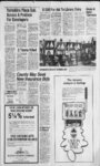
| OCR Text |
Show PAGE TWO BOUNTIFUL (CONTINUED) J. B. M. Associates, Serial No. BO-8- 1 Beg at apt S 1966.80 ft & W 175 ft fr NE comer of blk K, NMC plat Btfl ts sur; thence W 25 ft th S 9 degs 44' W 40.20 ft to apat on a 246.69 ft rad cur to left thence along sd cur for an arc dist of 27. 21 ft; th N 9 degs 44E 155.92 ft mol to th pob. Cont. .08 acres.Total Tax. . . $38.01 LaMar and Dorothy A. Fordham, All of loti, Serial No.80-836-Fordham Commercial Park, SLM: Cont. sec 25:T2N-RIW- ; .20 acre. Total Tax. . . $60.49 L.eGrand and Nora H. Parkin, All Etal, Serial No. of lot 15, Fordham Commercial Park, section 25; T2N-R1SLM: Cont. .24 acres. Total Tax $67.99 Clyde and Geraldine H. Williams, Serial No. , All of lot 21 Fordham Commercial Park, SLM: section 25; T2N-RICont. .20 acre. Total Tax $60.49 Thomas D. and Janice A. Jones, Lot 93 Serial No. Meadow Lane plat D sec 30 tp 2N, rg IE. SLM. Cont. .182 acre. Total Tax $479.07 David M. and Victor M. Kimball, .Serial No. Beg at apt N 75 ft fr a concrete mark set at apt 75 ft E fr inter of N In of 500 S st & E In of main st wh ' inter pt is approx SW cor of lot 2 block "L NMC, plat, Btfl ts sur (cor not in place), sd pt of beg alos desc as being 209.83 ft E & 100 ft N fr a nail mark cen In inter of 1500 S st 4 200 W st 4 running thW 128.30 ft toEln of main st, to a nail monu set in sidewalk mark W bndy ; th N 3 1 degs 54'44E 138.95 ft to S In ; of property conv in 358 237; thence E along sd S In 128.30 ft to a pt W 35.72 ft mol, fr a monu mark W bndy of property owned by Hal Ross Belmap; thence : S 31 degs 5444W 138.95 ft along a In para to E In of Main ' St, to pob. Cont. .335 acres. Total Tax $122.70 Larry L. and Sigrid M. Eggett, Se- rial No. Beg 110.10 ' ft N 1409.5 ft E fr SW comer of ; lot 3, blk I. plat NMC, Btfl ts,S 89degs58'E85ftN 128.58 ft W 85 ft S 128.65 ft to beg. Cont. .25 acres thence E 298 ft, m or I, to W line of st; th N 0 degs " 06'W along sd st to pt due E of beg: th W 38.3 ft, m or I, to pob. Cont. 1.51 acres. Total Tax : $228.08 Gail S. and Carolyn Eskelson, SeBo-87rial No. Beg on N side of 3rd st 1 10.16 ft N 1324.5 ft E " fr SW comer of lot 3, blk L plat " NMC. Btfl ts, S 89 degs. 58'E 7 85 ft N 128.65 ft W 85 ft S 128.72 ft to pt of beg. Cont. .25 $219.31 acres. Total Tax Bonneville Estates, Serial No. " Beg on Sin of 2 rdst (1050 S) apt N 518.38 ft & E 180 ft fr SW comer lot 3, blk L, NMC plat, Btfl ts sur; sd pt being 213 ft E & 16.5 ft S of Btfl 7 city sur monu at int of 1050 S st : 4 200 W st; run E along S In of ; sd 1050 S 199.28 ft; S 181.50 ft; " thence E 301 .79 ft to Wly In of ' S Main St; th SW'ly alg Wly In " of S Main St 155.09 ft to N In of running th ppty conv in W along N In of sd Boog prop- erty 220.29 ft; th S 65 ft to N In ' of th W ppty conv in 426-63199.40 ft alg N In of sd LDS ' property to apt wh is N 139.92 " ft & E 180 ft fr sd SW comer of Tot 3, thN 387.46 ft to Sin of sd 1050 S st 4 pob. Cont. 1.80 ' acres. Total Tax ..$11,293.06 E. Delyle and Nelda W. Jones, ' Serial No. BO-88Beg 7.125 chs N 800 ft E fr SW comer of ' lot 3. blk L, plat NMC W 210.7 ft S38W 181.5 ft E 93.2 ft N 32 degs 50'E 215 ft mol to beg. ; Cont. .63 acres. Total ' Tax $224.42 Barbara J. and Leon D. Burrows, Serial No. BO-89Beg 5.6 chs ' N& 12.2 chs EfrSW comer lot 3, blk L, plat NMC Btfl is E along S side 3 rd st 136.5 ft S 58.91 ft W 181.35 ft mol to E side st hyN 32 degs. 30' E along hy 70.02 ft mol to beg. Cont. ; .208 acres. Total Tax $333.88 Keith D. and Ellen M. Love, Se-- ;. rial No. Beg 8.3 chs ... N & 1693.82 ft E from SW cor - lot 3. blk L, plat NMC Btfl tsS : 128.5 ft mol to N In st E 70 ft ; along N In N 128.5 ft to S In ... cooper sub W 70 ft to beg. Cont. .205 acres. Total Tax $345.58 Douglas M. and Cresente R. Mer-- ! Lot rill. Serial No. 38. Park View Sub., section 30, ... tp 2N. rg IE. SLM. Cont. .17 acre. Total Tax $395.73 American Savings 4 Loan Assn, Serial No. Beg 1287 ft E of NW comer of lot 4. blk L, ;; plat NMCS 104.6ft W 104.85ft .... N 104.6 ft E 104.85 ft to beg. Cont. mol .255 acres. Total Tax $4,586.92 American Savings 4 Loan Assoc. , - Serial No. Beg on W . side of hy at pt 78 rds E 12.40 ;;; rds SfrNW corner of lot 4, blk ... L plat NMC W 157.85 ft to Sin of LD Pace N 100 ft E 157.85 ft ; : to hy S 100 ft to beg. Cont. .36 acres. Total Tax ....$763.16 Mary E. Gore, Serial No. BO-94- j 3. BegonNlnofstll9.9lrdsS &5l.84ftS89dets52EofNW corner block L, NMC plat; Btfl ts S 89 degs 52E 66.5 ft alg N In sd st N 0 degs 10'E 144 ft N 89 degs 52W 66.5 ft SOdegslO'W .... 144 ft. Cont. .219 acre. Total Tax $333.34 Roger A. Brown, Serial No. Bo- -, 945, Beg at E sd of Hy 1 , 22.69 rds W 9.20 rds S of NEE comer ; of lot 4, blk L plat NMC S 50 ft E 9 rds N 50 ft W 9 rds to beg. . . : Cont. .17 acres. Total Tax $287.54 ... . - -, "Roaer A. Brown, Serial No. Boft S 946, Beg 22.69 rds W 201.8 fr N E comer of lot 4, blk L, plat ' . NMC S 101.8 ft S 88 degs E ' 32.20 rds N 10.40 rds W 23.16 rds S 50 ft W 9 rds to beg. Cont. ' 1 .80 acres. Total Tax $1,025.43 Winfield S. and Anna 1 Lemon, ' Beg 49 Serial No. BO-96... rds N4 216 rds E of SW comer lot 2, blk L plat NMC, Btfl ts, .. N 8.5 rdw 19 rds, S alg cen hy No. 2, 8.5 rds, E 19 rds to beg. '! Cont. 1.00 AC. Total Tax f .,...$369.98 Jacob C. Smith. Serial No. of Beg 80 ft N 89 degs 21E NW corner lot 18. Duerden ft N sub, which pt is 1301 .5 W t ; 1063.1 ft W &Ji 0 degs 02 .: 2ll.8ft,morl,frSEcorsec30; SLM: th N 89 degs ,21-245.3 ft to W line of right .of way of Bonneville Irrig Co. Canal 10 ft Wly fr cen line T2N-RI- : thereof; th S 26 degs 49W 181.1 ft alg sd right of way; ths 12 degs 38 W 45.87 ft along sd right of way to N line of st th S 89 degs 58W 153.43 ft alg sdN line of st to a pt S 0 degs 02E of pob; thence N 0 degs. 02W 203.69 ft to pob. Cont. 1.10 acre. Total Tax $513.20 Philip L. Vivian Grindstaff, Serial No. Lot 23, Colonial Sub. blk 39, plat NMC Btfl ts. Cont. .23 acres. Total Tax $112.61 Edwin F. and Ann M. Smith, Serial No. Lot II, Sunnyslope Sub. blk 39, plat NMC. sec30,T2N-RlE;SLCont. .225 acres. Total Tax $120.62 Verlie D. and Clyde F. Smith, Serial No. Lot 12 Sunnyslope Sub, blk 39, plat T2N-R1NMC. section 30, SLM: Cont. .225 acres. Total Tax $364.04 Elmer G. Lillian Waldron, Serial No. Lot 14, Sunnyslope Sub. blk 39, plat NMC. Also W 3.5 ft lot 15, section 30, T2N-R1SLM: Cont. 011 acres. Total in all .236 acres. Total Tax $372.08 Thane and Lynne Atwood, Serial No. Lot 24, Sunnyslope Sub. blk 39, plat NMC. section 30, T2N-R1SLM: Cont. .225 acres. Total Tax $32.90 Elvira P. and Dianne Gustaveson, Serial No. Lot 25, Sunnyslope Sub., Blk 39, plat NMC. Section 30, T2N-R1SLM: Cont. .225 acres. Total Tax $32.90 J. B. Jr. and Arlie E. Hancock, Serial No. Sunnyslope Sub., Blk 39, plat NMC. section 30, T2N-R1SLM: Cont. .225 acres. Total Tax $364.04 Clyde Wiliiam Mills, Serial No. Beg 103.25 rds S 4 106.6 rds W of NE corner blk 38 plat NMC Bo ts, E 7.5 rds S 4.375 rds, W 7.5 rds N 4.375 rds to beg. Cont. .25 acres. Total Tax $483.20 Laurene H. Bourland, Serial No. Beg at pt on S In st called Mill St. 105.625 rds S & 20.1 rdsW&N 1 degs 55'E 521 ft & S 76 degs. 10E 87 ft fr NC comer blk 39, plat NMC, Btfl ts, S 1 degs 55W 1 17.5 ft E 87 ft mol to W In Hy No. 2 (also called Orchard Drive) NEly alg W In Hy 90 ft mol, to S In Mkll St N 76 degs 10W 100 ft mol, to beg. Cont. .224 acres. Total Tax $556.84 Lucille P. and Clyde Har Routh, Serial No. Beg 30.4 ft W & 8.09 ft N 8 degs 36 E of concrete monu marking the E1, comer sec 30 2N, IE SLM as set by US Dadastral Surv Bureau of Land Management 1951,N8degs36'E 12.14 ft W 153.5 ft to E In of st, th S 10 degs 28 W 12.2 ft along sd st, th E 153.83 ft to beg. Cont. .04 acres. Total Tax $6.58 Ernest C. and Dora A. Jeppsen, Bo-040-1 1 , Beg at pt Serial No. 2.11 chs N 27.50 chs E fr SE corner of lot 3, blk L, plat NMC; Btfl ts sur; N 105 ft W 4.25 chs to cen In of 4 rd st known as hy 2 SW on cen In of sd hy 10.1 ft to pt directly W of beg; thence E 4.75 chs to beg. Cont. .67 acres. Total Tax $900.37 Kenneth Bywater Morton, Serial No. Beg at SW corner of Grantees existing premises, 1941.1 ft N 4 581.87 comer sec 30, T2N-R1SLM; th N 24 degs 30' 15 E 97.21 ft along Wly In of Grantees premises to N W'ly comer thereof; th W 49.25 ft, m or 1, to W'ly In of Grantors land; S 20 degs 01W 64 ft, m or I, to pt N 47 degs 31T5W 40.23 ft fr beg thence S 47 degs. 31T5E 40.23 ft to beg. Cont. .085 acres. Total Tax . . $6.58 Timothy R. and Mary Michael Langan, Serial No. , Beg on S In of a st at apt 54.25 rds S 4 31.10 rds Eof the NW comer of lot 6, blk 37, NMC plat, Btfl ts, sur; running th S 9 rods to th N In of Shamrock Dr Sub; th E 70 ft alg th N In of sd sub; thence N 9 rods to th pt on th S In of sd st; thence W 70 ft alg th S In of sd st to the pob. Cont. .24 acre. Total Tax $120.62 Robert L. and Coleen M. Brown, Lot Serial No. 20, plat B, Shamrock Drive section 30, tp2N,rg IE, SLM. Cont. .25 acres. Total Tax $529.25 Alan Earl and Susan M. Wardell, All lot Serial No. 13, Shamrock Drive Sub in blk 37, plat NMC, Btfl ts. Cont. .26 acres. Total Tax .... $337.97 Royal Jay and Ann W. Swenson, Lot 3, Serial No. Franz Sub, section 30, T2N-R1SLM: Cont. .235 adres. Total Tax $500.74 Firm Bilt Const. Inc., Serial No. Lot 5. Franz Sub, section 30, T2N-RISLM: Cont. .21 acres. Total Tax $466.20 R. D. S. G. Co., Serial No. Beg on th E In of Hwy 91 an 80 ft str ata point S 264 ft fr th S In of 500 S str; Btfl, wh point is due S 836.05 ft 4 S 89 degs. 33'46W 90.24 ft fr thence NE comer of sec 25, T2N-R1SLM: thence S 0 degs 0004E 141.84 ft alg sd hwy; th N 89 degs 3346E 256.05 ft to th approx N bank of Mill Crk thence N 61 degs. 095I E 262.48 ft along sd bank, th N 17 ft to a pt 2 ft N & 0.5 ft E of a metal post in the E end of a concrete wall, th S 89 degs 3346 W 485.99 ft to th pob. Cont. 1.273 acres. Total Tax $750.65 Leland W. Brown, Serial No. Beg on W In of st at pt S 0 degs 07E 1472.13 ft along sec In & E 162.74 ft fr NE corner sec 25; T2N-R1SLM: thence S 56.37 ft along W In sd st; th W 259.64 ft to E In of st hy, thence N 0 degs. 04 E 156.3M ft along E In sd hy, th E 259.44 ft to pob. Cont. 1.084 acres. Total Tax ... $2,1 1 1.86 ft W fr SE Jay Lamont and Martha Smith, Serial No. BO-- comer of lot 1 100, Beg at SW 2, Meadowlane Sub. plat A, section 25; T2N-RISLM: thence S 0 degs 07'W 17 ft th S 89 degs 56W 149.30 ft to E In of Hy 91; thence N 0 degs 07'E 67 ft alg sd E In of sd hy, thence N 89 degs 56'E 149.21 ft th SO degs. 02'W 50 ft to pob. Cont. .23 acres. Total tax $326.03 Karl H. Erika Buervenich, Serial 10 No. at ptS89degs56W 820.08 ft fr SE corner sd lot lOblkKNMC plat; Btfl ts sur, th W 259.04 ft to hy, th N 84. 15 ft mol, alg sd 539-94ly to S In property conv in thence N 89 degs. 56E 263.5 ft to W In lot 3 of Meadow Lane Sub; thence S 8 degs 0946W 29.48 ft to SW comer lot 3, sd sub; thence S 56ft mol, to pob. Cont. .50 acres. Total $778.52 Tax Jay M. Della Smith, Serial No. BO-- 1 101-Beg SO degs 07'W 17 ft fr SW comer of lot 2, Meadow Lane Sub., plat A, SLM: section 25; T2N-R1running thence S 89 degs 56W 149.3 ft mol to E In of US Hy 91 ; th S 0 degs 07 W 67.15 ft th N 89 degs 56E 149.40 ft th NO degs 02E 67. 15 ft to pob. Cont. .23 acres. Total Tax $1,755.13 Carlos D. Lorraine Wood, Serial No. Beg at pt 14.39 chs S& 2.02 chs WfrNE corner sec 25, T Tp 2N, rg 1W SLM S 103.14 ft W 428.34 ft N 164 ft E 396.66 ft S 60.86 ft E 31.68 ft to beg. Cont. 1.034 acres. Total Tax .... $938.60 Seng John Randolph, Serial No. BO-111. .all of lot 34, Freestone acres plat C section SLM: Cont. 17; T2N-R1.329 acres. Total Tax $823.73 Gregory D. and Gayle R. Hanks, Lot 15, Serial No. BO-- 1 119-1Crestwood Sub. plat C, section 17 Tp 2N, rg IE, SLM. Cont. $502.01 .21 acres. Total Tax 4 Joyce Thomas, Serial No. BO-- 1 119-1beg at NE cor lot 18, Crestwood Sub Plat C SLM: th S Sec. 27.T2N-RIE- , 72.33 ft, th S 75 deg. W 123.38 R. Earl, fttoElylnofwst;thN35deg. W 43. 13 ft alg sd Ely In to pt of T and G with a 120 ft rad cur to right; the Nly 73.30 ft alg arc sd sur to SW cor lot 34, Freestone Acres Plat C; th E 163-1- 2 ft mol alg N In sd lot 18, to pob. cont. .33 acres. Total Tax $1,238.20 Evan N. 4 Micheline Bird, Serial lot 23, CrestNo. BO-- 1 119-2wood Sub, Plat C. Sec. 17, T2N-R1- SLM, cont. .21 acre, also, beg at NE cor lot 29, Crestwood Sub, Plat C, S 21 ft alg E In sd lot 29; W 53.70 ft to Wlnsdlot;N9deg. 37E 48.04 ft to SW cor lot 23 sd sub; th S 60 deg. E 52.74 ft alg Sin Lot 23 to geb. cont. .25 acres. Total $525.10 tax Ronald Glen 4 Judith George, Seall of lot rial No. 35, Crestwood Sub., Plat B, situated in Sec. 17, TP2N-RG1SLM. cont. .197 acres. Total tax $422.34 Jetta B. 4 Dan E. Whyte, Serial all of lot 25, No. The Hills No. 2, Sec. 17;T2N-R1SLM. cont. .211 acres. $141.63 Total Tax Elton Ted 4 Margaret Bunn, SeLot 9, rial No. Crestwood Sub, Sec. 17, TP2N-RG1SLM. cont. .22 acres. Total Tax .... $377.74 Lyman and Joy Tracy, Lot 15, Crestwood sub, sec 17, tp 2N rg IE, slm.Cont. .22 acres. Total Tax $31.25 Lavon B. Higley, Serial No. Lot 22, Hillside sub. sec. 17 TP 2N RG lE.slm. Cont. .20 acres. Total Tax $31.25 Gerald G. and Norma G. Wilson, Serial No. Lot 23, Hillside sub, sec 17 TP 2N RG IE, slm. Cont. .20 acres. Total Tax $478.62 Jos Richard and Jeanette Smith, Serial No. BO-- 1 128-2- 7, Lot 27, Hillside sub, sec. 17, TP 2N RG IE, slm. Cont. .215 acres. TotaLTax $510.79 Steve S. and Carolyn L. Porter, Serial No. BO-- 1 128-6Lot 63, Hillside sub, sec 20, TP 2N, RG IE, slm. Cont. .212 acres Total Tax $472.04 Geraldine Williams, Serial No. Lot 102, Hillside sub, sec 20 TP 2N.RG lE.slm Cont. .26 acres. Total Tax $763.41 Richard B. and Sandra Lortsher, Serial No. BO-- 1 151-5Lot 53, Bay View Park plat D, sec 18, TP2N.RG1E, slm. Cont. .195 acres. Total Tax $330. Charles H. and Esther R. Cook, Serial No. BO-- 1 15 Lot 64, Bay View Park plat D, sec 18, TP 2N, RG IE, slm. Cont. .20 acres. Total Tax $395.29 Carl W. and Mary L. Archibald, Serial No. Beg on W In of st .52 of A ch E and . ' 389.5 ft N fr SE cor of sec 18 tp 2NTg IE, slm W 140ft S 82.5 ft E 140 ft N 82.5 ft to beg. Cont. .264 acres. Total Tax $244.40 David R. and Carolyn B. Rodgers, Serial No. Begat apt 1410.38 ft E and 20.41 ft S of the W'i cor of sec 18; th E 91.30 ft; th N 90 ft; th S89 deg. -- 14: W 91.31 ft; thS 88.78 ft to the pob. Cont. .185 acres together with a R-over and across; beg at the N W cor of sd property and run th N 89 deg. 14 E91.31 ft; th E 180ft, mor I, to the Win of a st ; th N 20 ft m or 1 alg sd st ; th S 89 deg. 14W 271.3 ftmorlto a pt due N of the pt of beg. th S 20 ft m or I to th pob. Total Tax $223.69 Demar Dean and Dalane Evansen, Serial No. Beg 14 chs E and .3 1 Iks S fr SW cor of NWVi of sec 18. tp 2N, rg IE, slm: E 1.285 chs, S 3.92 chs, W 1.285 chs, N 3.92 chs to beg. Cont. .50 acres. Total Tax $303.37 Jeffery M. and Cathy J. Johnston, Serial No. BegatSE cor lot 3, blk 13, nmc plat sec 2N-1N 140 ft, W 18, slm, 145.42 ft, S 140 ft, th E 145.42 ft to beg. Cont. .478 acres. Total Tax $1,557.22 Fritz J. Jr., and Donna S. Urbanek, Serial No. Beg 8.335 chs E fr SW cor of SE sec. 18, TP2N, RG IE, slm, N 117.02 ft, E 208.61 ft,S 2.58 ft, S 85 deg. 4440 E 94.26 ft, m or I, to W In of hy, S 107.44 ft, W 302.61 ft to beg. Cont. .77 acres. Total Tax $368.86 Properties Limited, Serial No. Bldg 3 unit 13. Lemontree cond. sec 18; T2N-RIslm: Total Tax $231.88 James Blain and Chris Martineau, Serial No. Bldg 5 unit 19, Lemontree cond. sec slm: Total Tax 18; T2N-R1$231.88 Robert S. and Annette Hosking, Serial No. Bldg 7 unit 29, Lemontree cond. sec slm: Total Tax 18; T2N-RI$231.88 William B. and Joann M. Bagley, Lot Serial No. 18, Woodmere sub, plat B, sec 20. T2N-RIslm; Cont. .187 $29.50 acre. Total Tax Earl Kenneth and Bet Fleishman, Lot Serial No. 27, Woodmere sub, plat C, sec slm; Cont. .18 20, T2N-R1$29.50 acre. Total Tax David C. and Mary M. Odgen, Se- Lot 5, rial No. Bountifuls Lake Hills plat A, sec 20, tp 2N , rg 1 E, slm. Cont. .19 acre. Total Tax ..$518.83 Jerold F. and Barbara Flannery, Lot 88, Serial No. Bountifuls Lake Hills plat B, sec 20, TP 2N, RG IE. slm. Cont. .25 acre. Total Tax ... ; $619.89 Kent L. and Marcia E. Russon, All oflot Serial No. 7, Mountain Park plat WB slm: Cont. sec 20, T2N-R1.37 acre. Total Tax $1,286.24 Velton S. and Muriel L. Casler, All oflot Serial No. 8, Mountain Park plat WB slm: Cont. sec 20, T2N-R1.447 acre. Total Tax $1,107.47 John W. and Carol L. Doramus, Serial No. Beg on N In of property conv in book 527 at page 48, sd pt being N 89 deg. 36E 12.72 ft and N 9 deg. 36 W 83 ft fr N W cor oflot 21 , amended and extended plat of Ellis Park sub, block A, sec slm: N 89 deg. 20; T2N-R1- E 36E lOOfttothNEcorofsd property; N 9 deg. 36 W 83 ft 1 ; to S In of ppty conv in th W alg S In of sd property 100 ft; th S 9 deg. 36 W83ftmorl to pob. Cont. .20 acres. Total $48.79 Tax James F.G. and Patti Lynn Bell, Beg Serial No. at th NW cor of lot 21, amended and extended plat of Ellis Park sub, block A A sub of ; ptofNE'.ofsec20,T2N-RIEslm: th N 89 deg. 36E 12.72 ft; th N 9 deg. 36E 12.72 ft; th N 9 deg. 36'W 83 ft: th S 89 deg. 36 W 12.72 ft; thS9deg. 36E 83 ft to th pob: Cont. .024 acre. $2.92 Total Tax John C. and Mary West Miller, Serial No. Beg at SE cor lot 109 Hillside sub, sec slm E 94.89 ft m or I 20, 2N-1to cent In Weber Basin aqueduct, N 9 deg. 36W 86.49 ft W 78.95 ft m or 1 to pt N of beg S 85 ft to beg. Cont. .18 $44.85 acres. Total Tax Lorenzo M. Spencer, Serial No. Beg at SE cor of lot 25, Orchard Heights plat sec 20; T2N-R1slm; run th S3 deg. 5020E 93 ft; th S 86 deg. 3453W 116.89 ft to E In of Davis Blvd, at a pt on a 690 ft rad cur (rad pt bears S 86 deg. 59 13W); th Nly 80 ft alg sd cur to SE cor of sd lot 25; th N 80 deg. 2039 E 121 ft alg S In of sd lot 25 to pob. Cont. .23 $133.78 acre. Total Tax Lorenzo M. Spencer, Serial No. Beg at a pt wh is S 3 deR. 5002 E 93 ft fr SE cor oflot 25, Orchard Heights, plat slm: sec 20 T2N-R1run th S 3 deg. 5002 E 88 ft; th N 89 deg. 35'27 W 123 ft to E In of Davis Blvd at a pt on a 690 ft rad cur (rad pt bears N 86 deg. 22 1 3 W)th Nly 80 ft alg sd cur; th N 86 deg. 3453E 1 16.89 ft to pob. Cont. .23 acre. $133.78 Total Tax Gary E. Reed, Serial No. All of lot 7 Reed sub, amended, sec 20, T2N-R1slm: Cont. .22 acre. Total Tax B, B, $1,048.07 Thomas A. and Cheri A. Webster, All Serial No. of lot 19, Orchard Heights plat slm: D, sec 20, T2N-R1Cont. .195 acre. Total Tax ...$627.02 Gerald T. and Catherine Swain, All Serial No. of lot 27, Orchard Heights plat slm: E, Sec 20; T2N-R1Cont. .22 acre. Total Tax $618.97 Donald D. and Barbara S. Alfred, Serial No. Lot 12, Orchard Heights plat G sec 20, T2N-R1slm; Cont. .195 $31.25 acre. Total Tax Glen M. and Afton C. Anderson, Serial No. Beg on S In of A 60 st (Turkey Shoot Drive) S 0 deg. 05'E 330 ft to center lane sd st and N 86 deg. 0030E 79.89 ft and N 82 deg. 3830E 145.80 ft alg sd cen In and S 5 deg. 07E 30.05 fr NW cor SE'i sec 20, T2N-RIslm; S 5 deg. 07E 113.48 ft alg remains of old fence; S 9 deg. 40E 26.60 ft; S 82 deg. 38'30W 177.11 ft, m orl (o E In of property conv in 264-27th N'ly 19.25 ft, m or I, to SW cor of property conv in 306-62N 82 deg. 3830E 80.08 ft N 122 ft, mor I, to Sin sd st ; th N 82 deg. 38'30E 80.25 ft to beg. Cont. .33 acre. Total Tax $160.71 Transland Corp., Serial No. Begat NEcorof lot II, Holmes Estates No. I . a sub of pt of S W Vi of sec 20; T2N R I E ; slm: run thS4deg. 13W 79 ft; th N 87 deg. 07 W 563.63 ft th S I deg. 10 12 W 1.0 ft to an old fen In, th S 87 deg. 07E 564.63 fta!gsdfenln,thN4deg. I3'W 80 ft th N 87 deg. 15Wl.Oftto pob. Cont. .015 acre. Total Tax $1.46 Transland Corp of Salt Lake City, Ut.. Serial Beg on W In of 650 E st at a pt N 760.27ftandE 1180.14ft andN 87 deg. 12 W 27 ft frSW cor of sec 20, T2N-R1slm; run the S 2 deg. 48 W 103. 19 ft alg sd W In to pt of tang of A 79 ft rad curve to the left, th SW'ly 1 23 .82 ft alg arc of sd curve, th S 87 deg. El 36.67 ft alg Sin of a st, th S 3 deg. W 1 .0 ft, th N 87 deg. W 137.41 ft to pt of tang of a 80 ft rad curve to right, th NW'ly 125.41 ft alg arc of sd curve, th N 2 deg. 48 E 103.17 ft, th S 87 deg. 12 E 1.0 ft to pobl. Cont. .008 acre. Total Tax $2.92 Lorin C. and Mary K. Peck, Serial No. Lot 8, blk A, Central Heights, sec 20 TP 2N RG IE, slm. Cont. .24 acre. Total Tax $510.97 Jed R. and Nancy H. Allen, Serial No. Lot 19, Central Heights blk B, sec 20, TP 2N.RG lE.slm. Cont. .28 $730.5i acre. Total Tax Charles Larry and Karen B. Hyde, Serial No. Lot 43, Central Heights, blk C, sec 20, TP2N.RG IE. slm.Cont. .217 acre. Total Tax $569.27 Fred M. and Alice H. Nichols, Serial No. Lot 88A Central Heights, blk E, sec 20 TP 2N, RG IE, slm. Cont. .035 acres., except the following: Beg 1 1.82 ft of arc of a circle having a rad ov 8.28 ft and N 8 deg. 30E 50 ft fr SW cor lot 88A, N 8 deg. 30'E 24.64 ft N I deg. 30E 20.83 ft S3 deg. 53W 45.40 ft to beg. Cont. .001 acre leaving .034 acre. Total Tax $2.92 J. Russell and Joy W. Scott, Serial No. Beg on E In st at pt 559.5 ft and S 99.98 ft Efr NW cor SW Vi sec 20, TP 2N fr SW cor of sec 21, slm; th N 0 deg. 59E 210.02 ft; th N 89 deg. 16.5 ft RG IE. slm N 0 deg. 06 W 175.40 ft alg E In st to S In Bum-inghasub, N 89 deg. 2530E 250 ft alg S In sub, S 0 deg. 06E 177. 16 ft W 250 ft to beg. Cont. i .03 acres. Total Tax $ 1 ,3 1 8.09 William R. and Deann A. Barton, Serial No. Ut 18, blk 2, Bountiful Heights plat C sec 20 TP 2N, RG IE, slm. Cont. .273 acre beg NE cor lot 17; blk 2 Bountiful Heights plat C sec 20 TP 2N, RG I E, slm S 22 deg. 40 E 5 ft S 70 deg. 3630W 140 ft N 22 deg. 40 W 5 it N 70 deg. 3630 E 140ft to beg. Cont. ,0l7acre. Total .29 acre. Total Tax T2N-RI- 2435E 59E ppty; Cont. 1.92 acres. Total Tax $1,072.43 John Edward and Norma Jacob- son, Serial No. Beg on E In road at pt 132 ft N 88 deg. 53 E 13 ft andN 0 deg. 25 E 370 ft alg E In sd rd fr SW cor sec. 21, TP 2N, RG IE, slm, N 88 deg. 53 E 150 ft. E 173.5 ft m or I to pt 336.5 ft E of W In sec. 21, N 158 ft mor I andN $606.97 W 140 ft m or I to pt 183.5 ft E of E In road, S 0 deg. 25 W 98 ft parallel to E In road, to pt N 0 deg. 25 E 60 ft and 1 83.5 ft Eof beg, W 183.5 ft to E In road, S 0 deg. 25 W 98 ft parallel to E In road, to pt N 0 deg. 2 'E 60 ft and 183.5 ft Eof beg, W 183.5 ft to E In road, S 0 deg. 25 W 60 ft to40rdsNofSlnsec21, alg road to beg. Cont. .758 over N 1 rod of E acres. R-140 ft thereof. Total Tax $773.10 Clark M. and Marsha K. Harrison, All Serial No. oflot 20, Granada Hills No. 2, slm: Cont. sec 21; T2N-R1.29 acre. Total Tax ..$5.89 John E. and Norma Jacobsen, Serial No. BO-- 1 340-Beg at a pt NO deg. 5539E 668.44 ft alg' sec In and N 89 deg. 3720 E 16.75 ft fr SW cor of sec 21; T2N-R1slm: run th N 89 deg. 3720E 248.45 ft; th Ely 71 .62 ft alg th arc of a 461 .59 ft rad cur to the left; th S 0 deg. 5539W 7.64 ft; th S 89 deg. 37'20W 323.5 ft to the E In of a si; th N 0 deg. 5539E2ftto the pob. Cont. .02 acre. Total $2.92 Tax $40.21 Wolfgang Weseman, Serial No. BO-13- 1 Beg at NW cor lot 27, Glen Oaks sub, sec 20, 2N, IE slm, S 2 deg. 38 W 85.61 ft alg W In sd lot, S 89 deg. 45'30W 10.50 ft N 3 deg. William L. and Marjorie J. Smith, All of Serial No. lot 7, Granada Hills No. 4, sec slm: Cont. .56 21; T2N-R1$81.16 acres. Total Tax Western States Title Co of D, Serial No. Beg at a pt on the Bountiful City bndy In wh is S 0 deg. 56'39W alg sec In 495 ft and S 89 deg. 0321E 495 ft fr th NW cor of sec 21; T2N-R1slm: th S 89 deg. 0321E 1013.22 ft; th SO deg. 5639W 100 ft; th S 33 deg. 37 49 E 595 ft, moil, to Sin of ppty; th S alg sd S In 1203 ft, m or I, to a pt on the Wly In of th N Quailbrook sub plat 17 deg. 4450W 444 ft, m or 1, to apt due S of th pob; th N 0 deg. 5639E 230 ft to th pob. Cont. 14.95 acres. Toal Tax $87.72 Development Associates, Serial No. Beg at NW cor sec 21.T2N3R1E; slm; th E 30 rds; th S 495 ft; th N 89 deg. 03'2 1 W 495 ft m or I to apt S of beg; th N 495 ft m or I to pob. Cont. 5.63 acres. Total Tax 58E91.llftN89deg.45'30E 8.38 ft, S 2 deg. 38W beg. Cont. .015 acre. Total Tax 5.38 ft to $2.92 Commerce Financial Inc., Serial All of lot 24, No. Northern Hills, plat B, sec 20 T2N-RIslm: Cont. and 21; .27 acre. Total Tax . .$190.30 Commerce Financial Inc., Serial All oflot 33, No. Northen Hills, plat B, sec 20 and 21; T2N-R1slm: Cont. .38 acre. Total Tax ..$205.82 Northern Hills Dev. Corp., Serial No. All of lot 37, Northern Hills, plat B, sec 20 and 21; T2N-RIslm: Cont. .54 acre. Total Tax ..$230.28 Commerce Financial Inc., Serial No. All oflot 41, Northern Hills, plat B, sec 20 and 21, TKViN-RlE- ; slm: Cont. .37 acre. Total Tax A, $147.29 34.30ftthS80deg.59E 159.16 ft th S 0 deg. 59W 49.30 ft th S.. 69 deg. I5W 215.27 ft, thS 0 deg. 59W 27.76 ft m or I to pob. Cont. 5.68 acres. Total Tax $103.42 Bruce G. and Linda R. Pitt, Serial No. BO-- 1 334-9- , Beg at a pt E 512.5 ft fr the NW cor of the SWViofsec21;T2N-RIE;slm- : and run th E 120.50 ft; th S 386.25 ft; th S 80 deg. 59W 122.01 ftth N 405.37 ft to the pob. Cont. 1.07 acres. Total Tax $338.89 John Edward and Norma Jacobson, Serial No. Beg 10 chs N and 13 ft Eof SWcor sec. 21, TP 2N, RG IE, slm.S 98 ft, E 183.5 ft. N 98 ft, W 183.5 ft to beg. Cont. .415 acre. Total Tax $290.90 M. Jack and Maxine Heslington, Serial No. Beg on E In of 3 rod st at a pt N Odeg. 59' E 132 ft and S 89 deg. Ol'E to a fence marking N ppty In; th N 89 deg. 2535 E 110.04 ft m or 1 to W In of I property conv in 655.967; th S I deg. 0420 W 370.02 ft m or alg sd W In to S In of Grantors William E. and Sharon A. Peffer, Serial No. Begat NW cor of lot 2, blk 3, BountiN 70 C th ful Heights, plat sub, deg. 36V) E 135.0 ft th S 22 deg. 40E 85 ft th S 70 deg. 36V4 W 135.0 ft th N 22 deg. 40 W 85 ft to beg. Cont. .262 acres. Total $566.04 Tax Val M. and Jolaine P. Randall, Serial No. Beg 28 ft S 9 deg. 06E of NW cor lot 35, Foothill Acres sub plat D, Bountiful ts, run N 0 deg. 06 W 80 ft, S 89 deg. 54E 100 ft, SO deg. 06E 80 ft, N 89 deg. 54W 100 ft to beg. Cont. .197 acre. $527.31 Total Tax Robert N. and Natalie N. Pratt, Serial No. Beg at a pt on N side of a 50 ft st, S 89 deg. 58' E 1 26.7 1 ft fr SE cor lot 188, Hillside sub; sec 20, T2N RIE; slm; IN 144.50 ft; thS 89 deg. 58 E 61 .67 ft to McMas-ter- s property; th alg sd property S 70.59 ft; th S 1 1 deg. 37E 75.47 ft to N In sd st; th N 89 deg. 58W 76.37 ft to pob. Cont. .25 acre. Total Tax Commerce Financial Inc., Serial No. All of lot 44, Northern Hills, plat B, sec 20 and2l;T2 RIE; slm: Cont. .48 acre. Total Tax $220.80 J. Wayne and Carolyn See, Serial No. All of lot 45, Northern Hills, plat B, sec 20 T2N-R1and 21; slm: Cont. .49 acre. Total Tax . .$295.36 Commerce Financial, Serial No. All of lot 49, Northern Hills, plat B, sec 20 T2N-R1and 21; slm: Cont. .28 acres. Total Tax $191.03 Commerce Financial, Serial No. All of lot 50, Northern Hills, plat B, sec 20 T2N-R1and 21; slm: Cont. .26 acre. Total Tax ..$188.84 Commerce Financial, Serial No. All of lot 51, Northern Hills, plat B, sec 20 T2N-R1and 21; slm: Cont. .37 acre. Total Tax ..$205.09 Commerce Financial, Serial No. All of lot 52, Northern Hills, plat B, sec 20 T2N-R1and 21; slm: Cont. .37 acre. Total Tax . . $205.09 Commerce Financial, Serial No. All of lot 53, Northern Hills, plat B, sec 20 and 21; T2N-R1slm: Cont. .41 acre. Total Tax . . $210.49 Commerce Financial, Serial No. All of lot 56, Northern Hills, plat B, sec 20 and 21; T2N-R1slm: Cont. .25 acre. Total Tax . . $186.41 Commerce Financial, Serial No. All of lot 57, Northern Hills, plat B, sec 20 and 21; T2N-RIslm: Cont. .31 acre. Total Tax ..$195.61 Commerce Financial Inc., Serial No. All oflot 61. Northern Hills, plat B, sec 20 and 21; T2N-R1slm: Cont. .32 acre. Total Tax . . $197.07 Commerce Financial Inc., Serial No. All of lot 63, Northern Hills, plat B, sec 20 and 21; T2N-RIslm: Cont. .33 acre. Total Tax . . $199.45 Commercial Financial Inc., Serial No. All of lot 64, Northern Hills, plat B, sec 20 T2N-R1and 21; slm: Cont. .32 acre. Total Tax . . $197.07 C. Clay and Doris J. Crowlev. Serial Lot 35, Ellis Park B, sec 20, T2N-- IE, slm. Cont. .26 acre. Total Tax $581.39 Daniel P. 4 Joyce W. Jones, Serial No. All of lot 12, Vistaview Plat A, sec 20; T2N-- R IE; slm: Cont. .31 acres. Total Tax $158.33 John A. Bowen, Serial No. Beg at a pt on E In of a st 16.5 ft E and S 0 deg. 59W 572.58 ft fr NW cor of SWVi of sec 21, T2N-R1slm, th E 1 15.5 ftthN 44.58 ft thNE 5.71 rds, th NE 67.62 rds m or I to apt 22 rods S and 80 rds E fr N W cor of S W ' of sd sec 2 1 ; th N 22 rds, th W 423.50 ft m or to E In property conv in 180ft, thW220ftthN 180 ft th W 63.5 ft thS 386.25 ft th S 80 deg. 59W 269.84 ftthN 1.30 ft; th N 0 deg. 160 ft $608.01 Development No.. ' Serial Associates, All of lot24, Quailbrook plat A, sec 20-2slm: Cont. .24 acre. T2 Total Tax $180.56 Development Associates, Serial All oflot 27, No. Quailbrook plat A, sec 20-2- 1; T2N-R1slm: Conti .23' acre. ,..$173.98 Tqtjd. Tax Development Associates, Serial All of lot 28, No. Quailbrook plat A, sec 20-2T2N-R1slm: Cont. .25 acre. Total Tax $186.41 Development Associates, Serial All of lot 29, No. Quailbrook plat A, sec 20-2T2N-RIslm: Cont. .21 acre. Total Tax $159.91 Development Associates, Serial All of lot 44 No. Quailbrook plat A, sec 20-2T2N-R1slm: Cont. .32 acre. Total Tax $197.07 Development Associates, Serial All of lot 45 No. Quailbrook plat A, sec 20-2T2N-R1slm: Cont. .31 acre. Total Tax $195.61 Development Associates, Serial All of lot 47 No. Quailbrook plat A, sec 20-2T2N-R1slm: Cont. .26 acre. Total Tax $188.84 Development Associates, Serial All of lot 48 No. Quailbrook plat A, sec 20-2- slm: Cont. .49 T2N-R1- acres. Total Tax $222.26 Development Associates, Serial All of lot 49 No. Quailbrook plat A, sec 20-2T2N-R1slm: Cont. .58 acre. Total Tax $235.29 Development Associates, Serial All of lot 50 No. Quailbrook plat A, sec 20-2T2N-R1E- ; slm: Cont. .46 acre. Total Tax $217.11 Development Associates, Serial No. All of lot 51 Quailbrook plat A, sec 20-2- slm: Cont. .62 T2N-R1- acres. Total Tax $241.12 Development Associates, Serial All of lot 52 No. Quailbrook plat A, sec 20-2- slm: Cont. .37 T2N-R1- acres. Total Tax $205.09 Development Associates, Serial Al of lot 53 No. BO-- 1 344-5Quailbrook plat A, sec 20-2T2N-R1slm: Cont. 25 acre. Total Tax $186.41 Randall N. and Shauna W. Johnson, Serial No. All of lot 55 Quailbrook plat A, sec 20-2- T2N-RI- slm: Cont. .24 acre. Total Tax $180.56 Mildred B. Eggett, Serial No. Beg S 89 deg. 3830 E 27 ft fr N W cor of SW Vi of sec 28, thSOdeg. I8E 170 ft ; th S 89 deg. 3830 E 115 ft; thSOdeg. 18E90fttoNln of Canyon Crest No. 1; th S 89 deg. 38 30 El 18 ft alg sdN In; th N 0 deg. 18W 260 ft; th W 233 ft, m or I. to pob. Cont. 1.157 acres. Total Tax $392.21 Candland L. and Alice T. Olsen, Serial No. Beg at N cor of lot EL-- a md plat Bountiful Hills est; N 104.39 ft to N In oflot EL-1in sd sub; W 121.54 ft to pt 648.65 EL-1ft E of NW cor of sd lot S 286.41 ft; S 63 deg. 2702 E 252.63 ft to a cert st; Nly 84.82 ft alg sd st alg arc of a 60 ft rad cur to right to E cor of sd lot EL-7th N 30 deg. 2504 W ; 256.61 ft to pob. Cont. 1.15 acres. Total Tax ...$4,721.46 Richard W. and Ingeborg Clayton, Serial No. Canyon Crest A, sec 29, TP 2N, RG IE, SLM. Cont. .522 acre.TotalTax $951.99 Sara M. Bishop, Serial No. Lot 3, Canyon Crest A, sec 29, TP 2N, RG I E, slm, Cont. .555 acre. Total Tax $1,164.50 C. Scott and Joyce T. Hansen, Se Lot 32, rial No. Canyon Crest C, sec 29, TP 2N, RG IE, slm. Cont. .416 $832.57 acre. Total Tax James M. and Sandra A. Harrison, Lot Serial No. 160, Canyon Crest No. 6, sec 28 T2N RIE, slm. Cont. .275 acres. Total Tax . . . . $173.49 Ben W. and Kathleen Lindsay, Serial No. Beg 24.0ft S Odeg. 39E of NWcor lot 17, Bountiful Hills sub; sec slm; th Ely 98.2 29, T2N-R1ft to a ptS 78 deg. 39E 100 ft fr NW cor fr NW cor lot 17; th S 78 deg. 39E 44.30 ft; S 60 deg. 30E 69.23 ft; S 19 deg. 59E 41.67 ft; S 82 deg. 46 W 204.02 ft to SW cor sd lot 17, th Nly 109 ft alg E line of st to beg. Cont. .40 acre. Total Tax $739.74 Bobbie L. and Vincenzin Waters, Lot Serial No. 21, Bountiful Hills sub, sec 29, TP2N.RG IE, slm.Cont. .43 $787.98 acre.TotalTax Willard L. & Maxine J. Nelson, Serial No. beg N 82 deg. 5520W 8.05 ft fr NE cor lot 56. Btfl. Hills addn A,Sec.29;T2N-R!E;SLM.t- h 42W 390.95 ft to cen of Mill Creek, th S 84 deg. S 17 deg. 4130W 65.88 ft th N 12 deg. 4830E 400.38 ft th S 82 deg. 5520E .43 ft to pob. cont. 17131 acres. Total Tax $1,090.42 Erma Van Tassell, Serial No. Lot 67, Btfl. Hills addn A. Sec. 29, TP2N-RG1- SLM. xont. .275 acres. Total Tax $908.15 A Curtis Page, Serial No. beg E 1011.75 ft AS 519.86 ft & S 89 deg. 4930W 64.90 ft & S 45 ft & S 76 deg. 58E 12.0 ft fr NVi cor sec 29. T2N-R1SLM. th S 13 deg. 02W 159.0 ft; so 0 deg. 56W 174.83 ft; th alg arc of 12 ft rad curve to right 18.65 ft; W 29.84 ft; th alg arc of a 56 ft rad curve to left 67.94 ft; N 20 deg. 29E 254.98 ft; th N 17 deg. 27E 145.78 ft to beg. cont. .21 acres, except th N 60 ft thereof. Total Tax $16.81 D.- B. Enterprises Etal, Serial No. beg at apt S 89 deg. 4320W 667.81 ft alg sec In fr NE cor of NW1. of sec. 29; T2N-R1SLM: WH PT IS ALSO S 89 deg. 4320W 132 ft fr W In of 800 E st & run th N 3.28 ft; th N 88 deg. 48W 175.37 ft mol, to NE cor of ppty th S 0 deg. conv in 609-50540E 218.66 ft; thS 89 deg. 15 04E 111.10 ft to apt S 89 deg. 5641W 178.48 ft fr W In of sd 800 E St; th N 89 deg. 5641E 46.48 ft; th N 4 deg. 46E 213.80 ft par to and 132 ft W of W In of sd st to pob. cont. .840 acres. Total Tax $202.98 Natnl Society of S. Davis Ch., Serial No. beg at apt on E In of a 4 rd rd wh pt is 423.44 ft N 498.59 ft WfrSW cor of NW' sec. 29; T2N-R1SLM: N 11 deg. 09'E200.2 ft pob. alg E In sd rd way N 11 deg. 09E 181 ft mol, to S'ly In of mill st th S 74 deg. 28E alg sd S'ly In of Mill St. 200 ft, thS 12 deg. W 165.36 ft; th N 78 deg. 57W to pob. cont. .83 acres. Total Tax $148.39 Alice Sparenberg, Serial No. beg on S In of 2 rd st 502.5 ft N 4 S 78 deg. 57E r 108.65 ft; N 12 deg. E 165.36 ft 4 S 74 deg. 28E 186.5 ft frSW cor of NWVl Sec. 29, TP2N-RG1SLM.S 74 deg. 28E 93 ft SI deg. 38W 165.1 ft, N 74 deg. 20 W 93 ft, N 1 deg. 37E 164.88 ft to beg. cont. .352 k acres; beg on Nly side of 324.04 ft N 4 558.66 ft E 4 N. 8 deg. 4630W 136.84 ft 4 N 2 deg. 3430W 16.9 ft 4 N 74 deg. 55W 108 ft 4 S I deg. 38W 30 ft, mol. fr SW cor of N WVi Sec. 39, 2N-- 1 E, SLM: th NWly alg N bank of crk to pt S 74 deg. 55E 25 ft mol. for NW cor Sparenburg ppty; th S 74 deg. 55E 68 ft, mol. to SE cor sd ppty; th S I deg. 38' W 30 ft to beg, cont. .025 acres in all, .377 acres. Total Tax $278.19 J.G. Stephenson, Etal, Serial No. beg on N side of Millcreek at pt N 324.04 ft 4 E 558.66 ft 4 N 8 deg. 4630W 134.5 ft mol. frSW cor of NWVi Sec. 29, T2N-R1SLM: thN 8 deg. 4630W 11.5 ft, mol;N 2 deg. 3430W 16.0 ft; N 74 deg. 55W 108 ft; SI deg. 38W 30 ft, mol. to N bank ofcrk; the Ely alg sd N bank to beg. cont. .09 acres. Total Tac ... $8.04 M.K.C. Constr. Co. Serial No. all of lot 17, Holbrook Heights Plat A. Sec. 29; T2N-R1- SLM. cont. .21 acres. Total Tax $792.95 Glen Everett, trustee, Etal, Serial No. all of lot 19, Holbrook Heights Plat A, Sec. SLM. CONT. 29, T2N-R1.22 acres. Total Tax $86.08 Frank Granato Import Co., Serial No. BO-1- 3, beg on S In of A 66 ft wide st, at apt 544.5 ft mol. 5 4 346.5 ft E of N ' cor of Sec. ft S of S In of an exist sidewalk 4 run th S 174 ft thE 82.5 ftth N 174 ft to S In of sd st, th W 82.5 ft alg sd st to pob. cont. .33 acres. Total Tax $259.39 Bradd Crouch 4 Corinne Hayes, beg on S In of a str at NW cor of Lot 1 cottonwood Heights sub. at a pt S 0 deg. 06' E 549.86 ft 4 N 89 deg. 4730E 1598.53 ft fr NW cor of Sec. 29;T2N-RIE- ; SLM: 4 runSOdeg. 1230E 181.70ft; thN 78 deg. I230W 67.475 ft th N 0 deg. I230W 167.67 ft to S In of sd str; th N 89 deg. 47'30E 66 ft alg sd str to pob. cont. .265 acres. Total Tax $259.75 American Savings and Loan Ass'n, Serial No. all oflot 8 Woodland Hills Est. Sec. 29;T2N-RIE- ; SLM. cont. .25 acres, Total Tax $826.04 Bruce A 4 Sharol T. Jackson, Serial No. all oflot 16, Woodland Hills Est. Sec. SLM. cont. .33 29; T2N-R1acres. Total Tax .... $242.58 Frank H. 4 Celia A. Cutler, Serial No. Cottonwood Acres B, Sec. 29, T2N-R1SLM. cont. .36 acre.TotalTax $457.49 David C. 4 Phyllis N. Piggott, Serial No. cor of NWVi of SE' of Sec. 29, T2N-R1SLM; th S 50 ft, mol. to Nly In of Bountiful Hills C th S 87 deg. E 48.24 ft; th E'ly 81.47 ft alg arc of a 1 18. 12 ft rad cur to the right ; th 5 87 deg. E 52.26 ft N 1 deg. 00'E90R;thN deg.0030W 238.46 ft; thN 89 deg. 3545E 84 ft; thN Odeg. I2'44E 76.62 1 ft; W 262.36 ft; th S alg Vi sec In 379.5 ft to the pob. cont. 1.89 acres. Total Tax . . . $1 ,259.00 Charles Taggart Mills, Serial No., Beg on Nly In Lot 8, Larson Heights Sub, sd pt being 1115 ft E 4 710.5 ft S mol. fr MW cor Sec. 29 TP2N-RGISLM, S 14 ft mol to pt 1 1 15 ft E 4 724.5 ft Sof NWcor Sec. 29, N 65 deg. W 74 ft mol topt 1048.7ft EofWIln of Sec. 29, N to N In of Lot 8, S 86 deg. E alg In of Lot 8 to beg. cont. .016 acres. Total Tax . . $2.92 Chloe Davis Gordon, Serial No. all of lot 12 Larsen Hgts situated in Sec. 29, 2NIE, SLM. cont. .278 acres. Total Tax .... $465.89 Charles Taggart Mills. Serial No. beg 544.50 ft S 4 981.97 ft E fr NW cor Sec. 29. TP2N-RG1SLM E 125.90ft S 163.20 ft mol to N In Larsen Hgts. Sub. N 68 deg. W 136.20 ft mol. to pt 1 12 ft due S fr beg. N 112 ft to beg. cont. .399 $421.75 acres. Total Tax Lela R. Smith. Serial No. beg on N In of 5th S St.. 453.42 ft E of E In 4th E. St. 554.38 ft E 4 S 0 deg. 07W 483.86 ft fr relocated NW cor N 0 deg. Sec. 29. T2N-RI07E 377 Ft E 15.5 ft S 0 deg. 07'W 377 ft to N In of 5th S. St.. W 1 15.5 ft alg sd st to beg. cont. 1.00 acres. Total Tax $199.66 Dee H. 4 Susan G. Talbot. Serial all of lot 79 No. Btfl. Acres No I sub situated in SLM. Sec. 31. TP2N-RG1cont. .225 acres. Total Tax $381.59 Elven H. Nisson. Serial No. Lot 123. Btfl. Acres Sub. No. 2. Sec. 31. TP2N-RG1SLM. cont. 225 acres. $516.09 Total Tax Homer F 4 Margaret Taylor. Serial No. beg. 370$ ft E and 823.61 ft Sfr the NWcor ofSec.31,TP2N-RGlE.SLM- , S 1 1 deg. 46 W 64.36 ft : th N 74 deg. 3814W 104.383 ft. N 15 deg. 2146E 119.09 ft; to the SEly in of a st; th S 40 deg. 1507E 106.241 ft;thS 74 deg. 38 14E 68.54 to the pob. cont. .21 acres. Total Tax $472.77 Janice Lloyd Fadel, Serial No. beg on W In of 200 E ext. at pt 877.43 ft mol W 4 126.78 ft S fr NE cor Sec. 31, T2N-R1SLM: th N 14.31 ft thN 68 deg. 0450W 205.72 ft, th SW'ly 24.42 ft alg arc of a 15 ft rad curve to left Ely In of Orchard Dr. th SWly 88.0 ft mol alg E'ly In sd st to a pt due W of beg. th E 240 ft mol to pob cont. .30 acres. Total Tax $144.44 Jack P. 4 Karma H. Balling, Serial No. Lot 79, Millcreek Hgts Plat A, Sec. 32, TP2N-RG1SLM. cont. .20 acres. Total Tax $579.50 Rulon E 4 Mary W. Bright, Serial No. Lot 36, Millcreek Hgts. Plat B, Sec. 32 TP2N-RG1SLM. cont. .24 $448.84 acres. Total Tax Alden P 4 Eleen Rigby, Serial No. Lot 1, Millcreek Hgts Plat C, Sec. 32, TP2N-RGISLM. cont. .26 acres. Total Tax $503.17 Janice Rooklidge, Serial No. Lot 58, Millcreek Hgts. Plat D, Sec. 32, TP2N-RG1SLM. cont. .23 acres. Total Tax $186.85 Joseph C. 4 Sue D. Thompson, Serial No. beg - at a pt 2.5 ft N 89 deg. 50'45E '.. fr NW cor lot .147, Mitlcreek Hgts. plat F Sec. 32:T2N-RIE- ; SLM: th N 89 deg. 5045E 80 ft thSOdeg. 09 15E 120ft th S 89 deg. 50'45W 80 ft th N 0 deg. 09'15W 120 ft to pob. cont. .22 acres. Total Tax $493.97 Margery Horsley, Serial No. lot 162, Millcreek Hgts. plat G, Sec. 32, TP2N-RG1SLM. cont. .187 acres. Total Tax $539.01 William D. 4 Sharyl Bennett, Serial No. Lot 335, Millcreek Hgts. plat Q, Sec. 32.T2N-R1E- ; SLM. cont. .195 acres. Total Tax $627.02 Gerald E. 4 Caroline Deters, Serial No. Lot 12, Oak Haven Village Sub. except the following, beg. S 0 deg. 07'E 87.89 ft fr NE cor sd lot 12, Sec. 30, T2N-RI- E N 89 deg. 56'E 89.90 Ft S 0 deg. 0724W 41.14 ft W 89.23 ft S 89 deg. 56W .50 ft thN Odeg. 07W 41.14 ft to beg. cont. .25 acres. Total Tax $576.03 Jay H. Jeppson, Trustee, Serial No. Beg at apt 89.23 ft W of the SE cor of Lot Haven Oak 12, Village Sub. amended plat at apt N 0 deg. 03W 420.76 ft fr the SWcor of Sec. 29, T2N-R1SLM: 4 run th E 89.23 ft th N 0 deg. 0724E 50.24 ft alg the W In of a st. th W 89 deg. 90 ft mol to the E In of sd lot 12 th S 0 deg. 07'E 50.24 ft to the pob. cont. .105 acres. Total Tax $19.74 Chelsea Dev. Co., Serial No. BO- 1487-1beg at apt 1428.284 ft S 4 724.377 ft W fr NVi cor of Sec. 5, T1N-R1SLM. th S 3 deg. 30E 100.001 ft thS86 deg. 30W 252.806 ft thN 84 deg. W H5ftthS74deg. W 134.84 ftth S57deg. HE 101 .152 ft th S 31 deg. 06 E 1 10 ft th S I deg. 53'E 99.6 ft, th S 29 deg. 08'02E 217.4 ft th S 47 deg. I4E 316.30ft thS 81 deg. 05E 154.10 ft th S 60 deg. 37E 382.20 ft th S 69 deg. I7E 132.40 ft thS 79 deg. 23E80.3I ft th S 60 deg. E 118 ft thN 10 deg. 5037W 179.789 ft th N 60 deg. W 544 ft thN 20 deg. W 700 ft to the pob cont. 9.231 acres. Total Tax ....$467.84 Robert Charles Lesser 4 Comp. Serial No. , beg at apt that isS89 deg. 5058Ealg the sec In 485.551 ft fr the SW cor of Sec. 32; T2N-RIE- ; SLM: sd pob being the SW cor of the Stuart Winegar ppty, th alg W6y In of sd ppty N 17 deg. 05 W 173.174 ft 4 N 0 deg. 35W 64 ft to NW cor of sd Winegar ppty, th N 9 deg. 4733 466.645 ft to an angle pt in Sly In of lot 15, Chelsea Cove No. 1, th alg bndy of sd sub S 76 deg. W 256.482 ft thS 41 W 79.248 ft 4 S 15 deg 30'W 243.366 ft thS 60 deg. E 73.037 ft to sd sec In, th S 89 deg. 5058E 325.821 ft to the pob. cont. 2.529 acres. Total Tax $303.18 Chelsea Dev. Co., Serial No. BO- 1488- - A-beg at the NW cor of Sec. 5 T1N-RISLM: th S 107.7 ft the S 38 deg. 07E 95.9 ft, th S 23 deg. 12E 83.2 ft th S 13 deg. 33 E 98.1 ft thS 55 deg. 38E 105.111 ft thN 35 deg. E 200.222 ft thN 28 deg. E 147 ft th N 40 deg. El 55 ft to apt on S In of Sec. 32; T2N-RISLM: th N 89 deg. 50'58W 325.821 ft th N 60 deg. W 73.037 ft thN 88 deg. W 40 ft th S 2 deg. W |