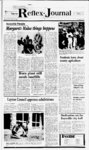
| OCR Text |
Show Page 8 4 Salt Lake City. UT. QUANTITY: 0.1 cfs. SOURCE: 4 in. well 300 ft. to 500 ft. deep. POINT(S) OF DI- VERSION: (1) N 3600 E 200 from SW Cor, Sec 30, T4N, R3W. (Antelope Island) USE: Domestic: 500 persons. PLACE OF USE:E'2Sec25,T4N, R4W. Protests resisting NOTICE OF HEARING UPON THE REALLOCATION OF ALLOTMENTS OF WATER AND OF ITS ACCOMPANYING TAX LIENS BY WEBER BASIN WATER CONSERVANCY DISTRICT To all owners and lienholders interested in any portion of lands in: Sections I, 23, 24 and 25, Township 3 North, Range I West, Salt Lake Base and Meridian. Sections 2, 4, 5, 6, 10, , 14, 15, 24, 25 and 36, Township 4 North, West, Salt Lake Base and Meridian. Range Section 10 and 36, Township 5 North, Range West, Salt Lake Base and Meridian. Section 31, Township 3 North, Range I East, Salt Lake Base and Meridian. Sections 13,23, 24,25, 35, and 36, Township 2 North, Range West, Salt Lake Base and Meridian. of this application with reasons therefore must be filed in duplicate with the State Engineer, 1636 West North Temple, Salt Lake City, Utah 84116 on or before JULY 4, 1986. 1 1 Robert L. Morgan, 1 P.E. STATE ENGINEER 1 Published in Weekly Reflex on MAY 21, 28, & JUNE 4. 1986. Issue No. 20 DAVIS COUNTY UTAH. The Board of Directors of Weber Basin Water Conservancy District has heretofore made, entered and recorded its orders alloting amounts of Class D water in DAVIS County, Utah, upon petitions which include but are not limited to the original petitions hereinafter described. Since the entry of orders making the allotments of water, the tracts of land to which the allotments were made have been divided or subdivided into small tracts, and the ownership of some or all thereof have changed, and it is in the best interest of the District that each of the allotments of water hereinabove specified be reallocated to the several tracts into which each larger tract has been divided or subdivided substantially proportionately to the area size of each smaller tract to the larger tract. The names of the original petitioners, the amount of water allotted under the original petitions, the names of the owners as of January , 1986, of the smaller tracts into which the large tracts have been divided, and the amount of water reallocated to each smaller tract is as follows: All in AMENDED NOTICE OF TRUSTEES SALE The following de- scribed property will be sold at public auction to the highest bidder, payable in lawful money of the United States at the time of sale, at the North front 1 door of the Davis County Courthouse, 50 East State Street in Farmington, Utah, on June 20, 1986, at 4:45 p.m. of said day, for the purpose of fore- closing a Trust Deed executed by Howard C. Johnson and Babara Y. Johnson, husband and wife, as Trustors, in favor of Bonneville Title Co., Inc. a trustee, and The Citizens Bank, as Beneficiary, which said Trust Deed was recorded in the office of the County Recorder of Davis County, State of Utah, as Entry No. 655269, in Book 964, at Page 1079, covering real property located at 1472 Scott Circle, Layton, Utah, and mroe particularly described as follows: All of Lot 159, Holt Subdivision No. 3, Layton City, Davis County, Utah, according to the official plat thereof. DATED this 12th Dated this 15th day of May, 1986. day of May, 1986. W, Clark Burt Successor Trustee Associated Title Company a Utah Corporation Successor Trustee By: Blake T. Heiner Its: Vice President Published in the Davis Reflex Journal First publication May 21, 1986 Last publication June Published in the Davis Reflex Journal First publication May 4, 1986 Issue No. 20 21, 1986 NOTICE OF TRUSTEES SALE Last publication June 4, 1986 Issue No. 20 The following The following de- scribed property will be sold at public auction to the highest bidder, June 17, 1986, payable in lawful money of the United States at the time of sale, at the front steps of the Davis County Courthouse, Farming-ton- , Utah, at 12:00 Noon of said day, for the purpose of foreclosing a trust deed executed by MICHAEL A. POULSON and WANITA POULSON, as trustors, recorded August 18, 1983 as Entry No. 649058 in Book 955, Page 660, of the official records of Davis County, State of Utah, in 1 SUBDIVISION NO. 4, in Layton City, Davis County, Utah, according to the official plat thereof. Commonly known as 1463 Everett Avenue, Layton, Utah 84041. The Trust Deed being foreclosed by favor of UTAH HOUSING these nonjudicial trust deed proceedings FI- NANCE AGENCY by October 31, 1983 and recorded November 4, 1983 as Entry No. 656421 in Book 966 at 928 of said official records, covering real 1144 West 2450 North, Layton, Utah, and de- The purchase price payable in lawful money of the United States of America. Dated this 2nd day of May, 1986. Paul M. Halliday Successor Trustee 455 East 400 South, Suite 202 Salt Lake City, Utah is 84, AMENDED PLAT OF LAKELAND SUBDIVISION NO. 1 , MICHELLE and TUBBS, husband and wife, as Trustors, and in favor of WESTERN MORTGAGE LOAN CORPORATION, the Beneficiary. The present owner is reported to be CHEER property located at Lot according to the official plat thereof, records of Davis County, Utah. Notice of Default was recorded February 5, 1986, as Entry No. 726228 in Book 1073, Page 80 of said official records. Said sale will be made without covenant or warranty, express or implied, regarding title, possession or encumbrances. 84111 6 Telephone: File No. 6513 355-288- Published in the Davis Reflex Journal First publication May 14, 1986 Last publication May 28, 1986 Issue No. 19 R-1- NOTICE First Interstate of Utah First Interstate Bank 11.7 Bank 1.5 of Utah Wilcox Family Ltd. Partnership 0.4 a.f. ea. Wilcox Family Ltd. 5 2.0 lots Partnership Generation New 6.3 Homes Notice is hereby given that the Board of Directors of the Weber Basin Water Conservancy District will meet at the general offices of the District, 2837 E. Highway 193, Layton, Utah, on Friday, May 30, 1986, at 9:00 a.m., for the purpose of hearing objections to assessments to be levied by the Board of Directors of the Weber Basin Water Conservancy District in the year 1986 to pay the amount due to the Weber Basin Water Conservancy District for the year 1987 under Class D Petitions and Orders by the Conservancy District thereon affecting lands in the following area in DAVIS COUNTY, UTAH; The lands so assessed are situated as follows: Sections 34, 35 & 36, Township 5 North Range 1 West. Section 1, 11, 13, 14, 15,22,23,24, 25,26, 27, Township 3 North, Range West Sections 5 & 6, Township 2 North, Range East Sections 12, 13, 14, 22, 23, 24, 25, 26, 27, 35 & 36, Township 2 North, Range 1 West Sections 2, 3, 11 & 14, Township 1 North, Range West Sections 30, 31 32, Township 3 North, Range 1 West Sections 3, 10 & 11, Township 4 North, Range West. SALT LAKE BASE AND MERIDIAN. The following subdivisions are among those within the above described lands: Copies of the applications for reallocation as above set out containing the description of the land covered by the allotment under each original petition, and the description of the smaller tracts into which the larger have been divided and subdivided with proposed reallocations to each smaller tract are on file in the office of the Weber Basin Water Conservancy District, 2837 E. Highway 193, Layton, Utah, and may be inspected by any interested person. Notice is hereby given that at 9:00 a.m. on Friday, May 30, 1986, or at such subsequent time to which the hearing may be adjourned, the Board of Directors of the Weber Basin Water Conservancy District will meet in public session at the office of the District as aforesaid to consider the applications for reallocations and to consider making its orders reallocating the water and the liens covered thereby in accordance with the applications for reallocation of such other order or orders as it deems in the best interest of the District. All persons interested are invited to attend such hearing and will be heard in support or opposition thereto. 1 1 1 1 A&K Ivan W. Flint, Secretary Aurura Acres Avion Vista Berkshire West Briarwood Acres Bridle Acres Canyon Cove WEBER BASIN WATER CONSERVANCY DISTRICT Casa Loma Casa Verda Cahoon Acres Chase Lane village Published in the Davis News Journal First publication May 14, 1986 Last publication May 28, 1986 Issue No. 19 Clarinda Country Oaks Cond. Country Oaks Est. Published in the Davis County Clipper First publcation May 15. 1986 Last publication May, 29, 1986 Issue No. 19 Dale Green Construction 2.7 lots 0.9 a.f. ea. L. Dale i Bette L. Green 7.2 8 lots 0.9 a.f. ea. L. Dale I Bette L. Green 2.0 2 lots 1.0 a.f. ea. 3 Michael D. Greenhalgh 0.9 Notice of Default EXHIBIT A NOTICE OF TRUSTEE SALE The following described property will be sold at public auction to the highest bidder on the 16th day of June, 1986, at 11:00 a.m. at the North Front Door of the main entrance COUNTY of the Court- house, Corner of State and Main. Farming-ton- , in the County of Davis, State of Utah by THE RICHARD GILL COMPANY, as Margaret T. Williams 1.8 38.0 Koodside Corp. Margaret T. Williams Margaret T. Williams Woodside Corp Woodslde Corp. Woodside Corp. 19 lots 0.4 Woodside Corp. 16 lots 0.5 Service Amcor , Inc. Corp. 6.0 Benefici- ary, under the Deed of Trust made by DARRELL A. RUST AND 16.0 6.6 7.6 MARIE T. RUST, a.f. ea. 8.0 a.f. ea. Acra-fe- Petitioner, Original Credit the current 0.9 0.9 et as ReaOwner of Record aa llocated of January li 1 986 Service Cred It tor p . Chris L. Martlneau Const. 1.2 1.3 Marcel J. 6chwaqer 1.3 Robert 8. Kiyomura 1.2 Robert 8. KlyomurS 1.1 PVH Inc. Clarence D. Leffler, Jr. 1.1 1.1 Meredith Construction 11 Brad C. Rabe 1.1 Timothy H. Wriqht 1.1 James W. Johnson , n husband and wife, as Trustor, recorded July 7, 1978, as Entry No. 501507, in Book 717, at Page 391 , of the official records of Davis County, Utah, given to secure an indebtedness in favor of GLENN JUSTICE MORT- GAGE COMPANY. INC., by reason of cer- tain obligations cured thereby. se- was recorded January 28. 1986, as Entry No. 0725426. in Book 1071, at Page 1093, of said official records. Trustee will sell at public auction to the highest bidder in cash, payable in lawful money of the United States, at the time of sale, without warranty as to title, possession or encumbraces, the following described property: Lot 55, CLEAR-FIEL- D VILLA SUBDIVISION, Clearfield City, Davis County, said Deed of Trust with interest thereon as is in said note and by law provided. DATED this 13th day of May, 1986. Bryan C Robinson Successor Trustee 180 South 300 West, Suite 120 Salt Lake City, Utah 84101 Published in the Davis Reflex Journal First publication May 21, 1986 Last publication June 4, 1986 Issue No. 20 thereof. The following Property Address: for the purpose of paying obligations secured by said Deed of Trust including fees, charges and expenses of Trustee, advances, if any, under the terms of said Deed of Trust, interest thereon and the unpaid principal of the note secured by Knighton LaDonna Mesa Lakeview Mobile Home Est. Maryan Est. Mount Air Est. Manna Acres Marlinda West Meadow Crossing Pip Mt. Lebanon Acres Morgan Farms Natural Est. Nelhoca Place Norager Acres Oak Forest Oakmont Acres Old Farm Estates Orson Ellis Overlook Acres Panorama Quail Ridge Pleasant Hills Rachels Place Ridge View Est. Rolling Hills Ruflin Circle Ruflin Acres Rosedale Sorrento Est. Stephens Summertree Sunny View Est. Susie Ranch Surrey Downs Tanglewood Tanglewood Acres Telford The Mills Tiffany Park Tri Oaks Vallee Villa Valley Hi Walker Wheat Ridge Willow Brook Farms Willow Farm Rolling Hills Meadows Heather Glen Indian Hills Mount Air Estates Pilly Green Quail Point Robinwood Victorian Oaks Weber Basin Water Conservancy District appli-cation(- s) have been filed with the State Royal Oaks Smoot Farm Est. Spring Meadows The names of the owners of record as of January 1, 1986, of the lands so assessed, a particular description of each tract of iand so of water allotted to each such tract assessed, the number of acre-feand the dollar amount of assessment thereon is of record in the general office of the Weber Basin Water Conservancy District and may there be examined by any interested party. Attention is particularly called to the fact that the assessments as made do and will constitute a lien upon the lands to which the water covered thereby has been allotted notwithstanding that the Class D Petitioner may since the filing of this petition have sold some or all of the land for which water was petitioned and allotted. Accordingly, all persons now owning or interested in lands within the above described area should give heed hereto. NOTICE TO WATER USERS Utah according to the official plat 48 Villa Drive, Clearfield, Utah 84015 Deerfield Deer Run Est. Diamon Oaks East Layton Hills Eggett Acres Fackrell Fernwood Hollow Hidden Hollow Hillside Estates Hill West Hogal park Jones Sub. Kays Creek Ivan W. Flint, Secretary En- gineer to appropriate water in Davis County throughout the entire year unless otherwise designated. Locations in SLB&M. (A61630) APPLICANT: State of Utah Division of Parks Published in the Weekly Reflex First publication May 21, 1986 Last publication May 28, 1986 Issue No. 20 31-48- & Recreation, 1636 West North Temple, Published in the Davis County Clipper First publication May 22, 1986 Last publication May 29, 1986 Issue No. 20 is dated August 22, 1980, and was executed by WAYNE A. TUBBS an Assignment of Trust Deed dated more particularly scribed as: de- scribed real property will be sold at public auction to the highest bidder without warranty as to title, possession or encumbrances, at the north front door of the Davis County Courthouse, State and Main Streets, Farmington, Utah, on the 10th day of June, 1986, at 1:15 oclock a.m. of said day: Lot 99, HOLT NOTICE OF TRUSTEES SALE r.77t i |