| OCR Text |
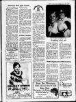
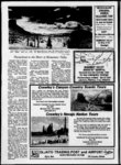
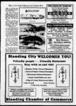
Show of The Ancients Headquarters Blanding-Tra- il Blanding Blanding, one of the youngest towns in San Juan, was settled in 1902. By June 11, 1905, there were six families and the settlement was large enough to be called a town. It was named Grayson after Nellie Grayson Lyman, an early settler. In at the cut blasted through Comb to improve the highway Ridge between and Lake Blanding Powell. . The old road can be seen to the north where it climbs an 800-fo- ot cliff. Comb Wash, a principal San Juan drainage, cuts through the valley west of the ridge. 1908 frame buildings re- Pioneer Trail placed the tent schoolhouse and church. the town name was changed to Blanding, taking the maiden name of the wife of a certain Thomas Bicknell who promised a good library of fine books to any town that would adopt his wifes maiden name. On March 30, 1915, Blanding became an official town. Population is now approximately 4,000. The oil and uranium industries, Indian education and welfare activities have changed the village into a bustling community. History permeates the air in the desert silence at Cave Towers 32 miles southwest of Blanding. Marsha Keele Color TV a Westwater Indian Ruins are situated four miles southwest of Blanding on a paved road. Main attractions are the ruins and a stone bridge. Picnic tables. ar built in a pattern to afford protection for a water source. They are perched on a semi-circul- canyon rim overlooking a permanent spring in a cave. It is believed the site was used during 1050 A.D. to 1150 A.D. Associated with the towers are granaries, a kiva and several high Electric Heat shower Sit-dow- n Westwater Ruins Cave Towers, situated in Mule Canyon, are seven round towers Air Conditioning Phones 84512. Cave Towers THE BEST FOR LESS! Master Charge and Visa accepted drive vehicles are to see Hole in the Rock needed a Trail, rugged trail which begins in Parowan in central Utah and ends at Bluff on the San Juan River in San Juan County. The trail takes its name from a portion of its route chiseled out of the face of a cliff by Mormon pioneers sent to colonize southeastern Utah, The trail drops 2000 feet at this point to reach the Colorado River. "A guided tour is recommended. Write the Blanding Chamber of Commerce, Blanding, Utah, Four-whe- el later Bears Ears Bears Ears, two buttes resembling bears ears, are in the Manti-L- a Sal National Forest. There are a number of roads into the Bears Ears area, most of them passable without a drive vehicle. Consult a local map or call the National 4-w- Forest Office, or 2114. Murphys Point In an Indian uprising during 1923, an ambush took place at Murphys Point in connection with the trial of two young Piutes accused of robbing a sheepherd-er- s camp. the noon recess, the During Piutes escaped with the help of Posey, a Piute leader. The men were pursued by the Blanding sheriff and a posse. At the deputy Murphys Point, sheriffs horse was shot out from under him and a Ford touring car carrying members of the posse was shot up as bullets from rifle blew out Poseys a tire and pierced the back seat of the car. long-ran- ge full account of this incident is available upon request from the Blanding Chamber of Commerce. A dwellings. Cave Towers, accessible by drive vehicle, is approximately 32 miles south and west 678-226- 4 4-w- 132 South Main Blanding, Utah of Blanding. Chervon Gateway Center and Main in Comb Ridge Comb Ridge, a bending of the Blanding Charon Minor auto repair Oil changes earths crust in Chevron Air conditioners recharged Tires and tire repair SER VICE OUR SPECIALTY 678 - 2671 J one an direction, is eroded monocline that has historically been a serious barrier to east-we- st travel in San southern Juan County. It begins near the Aba jo Mountains in northern San Juan and extends south approximately 80 .miles to Kayenta, Arizona. Travelers on will marvel U-- San Riders follow the Trail of the Ancients in a ride back into history in a popular spring event that begins in Blanding. Alvin Reiner 95 Juan-Uta- h's largest San Juan County -- 7,884 square miles big is the largest county in Utah and considered by many to be the most scenic. It is part of the giant erosion-gutte- d section of Four Corners country where Utah, New. Mexico and Arizona meet. . S-- W PARTS and SUPPLY PARTS FOR AUTOMOBILES TRACTORS . TRUCKS Monday thru Friday 8 a.m. to 6 p.m. Saturday 8 a.m. to 3 p.m. 23 678-213- ' Center 7 Blanding i - see-towerin- g , attraction. Some and MINE EQUIPMENT E. visitor will sandstone pinnacles, winding canyons, natural bridges, mountains and farming mesas. Abundant evidence of early Basket Maker and Cliff Dweller a major tourist Indians is The ruins are maintained. designated Others are tucked away in canyons and cliffs waiting to be discovered. San Juan County was colonized in 1880 when Brigham Young, president of the Church of Jesus Christ of Latter-da- y Saints, sent to members establish farms and trade with the Indians of south- eastern Utah. E3 During a year-lon- g journey, a band of hardy pioneers chiseled a trail through rock, sand, forests, over mountains and through desert from western Utah to the San Juan River where they established a town they called Bluff. Dexter Moustache, a White Mesa Ute, wears a ribbon shirt and new felt hat for the May Headstart Days parade, a colorful day-locelebration with traditional Indian food and ffanHngl a. Reiner ng |