| OCR Text |
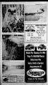
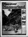
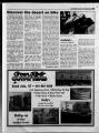
Show Fall 9CXY) Hkmvpr ninrvitrlanri 23 yomitialh) B as Dims Yireasaaire Lamidl off UJtialh) A treasure land of history, nature's beauty, and dedicated people, the Uintah Basin has a unique lifestyle. A timeless past is well preserved with dinosaur fossils, ancient ruins and pctro-glyphs. pctro-glyphs. A more recent past, filled with gold mines and ghost towns, stands beside early outlaws, and early settlers. These all sharing a part of the Basin's history with the Ule Indian Tribe. In such a unique state, the Uintah Basin holds its own in natural beauty. With over 500 lakes, 400 miles of rivers and streams, three national forests, and Utah's largest wilderness area, many outdoor enthusiasts claim that they've found heaven in the Basin. From pristine forests to desert landscapes with colorful and intriguing formations; forma-tions; from snowy mountaintops in winter to inviting water sport locations in the summer; from modem comforts to serene solitude; soli-tude; the Basin is a wonder in "A Whole Lot Of Mexican" WSW.Bnj49 fh M?k 1141 iAU7 ggj ihy 40 BURGERS UNLIMITED diversity. Isolated in the tiny community of Tabiona on the west side of Duchesne County, you will find citizens who work their farms and ranches with as much gusto as they ride in their amateur rodeos. Right on the Green River, Jensen citizens pursue their chosen life-many as cattle and sheep ranchers in the rocky crags and grassy meadows that surround Dinosaur National Monument with the same enthusiasm enthu-siasm as the early settlers they followed. The people in these communities, communi-ties, and all the communities in between, whether large or small share a common thread: a determined deter-mined dedication to the varied elements of life that bond them to the Uintah Basin. V'-'of -HpN Over SO Flavors Of Shakes, Sundaes, Cones & Banana Splits 1175 W. 'Hwy '40 DeSert-Continued DeSert-Continued from page 21 lotion can also damage the ecosystem. The desert is covered with the remains of an ancient civilization. The ruins and rock art in the desert are at least 5,000 years old. To have these outdoor museums are fortunate but can be easily destroyed by touching or leaning against them. Two options exist on most bike trails in the desert, pack it out or bury it. These are the best methods for preventing contamination of water resources and in keeping solid waste from animals and other humans. Holes must be at least 6-8 inches deep and at least 200 feet from water, trails or camp and covered thoroughly with soil, rocks and twigs. "Mountain bikers who camp on the desert or in the high Uintas use panniers, racks hooked on the front and back of their bikes that can hold from 40 to 60 pounds," said Lupcho. "They take water filter systems, dried food, energy bars, energy sources and powdered pow-dered drinks. There are still a lot of people that hotel motel it but they still have to carry a lot of equipment" Mountain biking at Dinosaurland includes eight routes that provide a variety but there are still dozens of others still waiting to be discovered. The eight routes include one in Dinosaur National Monument, three routes can be acquired from the Bureau of Land Management, three routes from Ashley National Forest and one from the Flaming Gorge area. Route I -The Dinosaur National Monument begins 20 miles east of Vernal at the lower parking lot just beyond the monument entrance station. It's a 24 mile loop, 15.9 miles on pavement and 8.1 miles on dirt This in considered consid-ered an intermediate ride, with some short, steep sections w hich could be walked. Route II - From the center of Vernal, ride SE on Highway 40 to the City of Naples, four miles. Turn right at Naples City sign which is Highway 45. Upper loop is 47.8 miles round trip and lower loop is 78 miles round trip. Both loops are on paved roads. Because of length, hills and some long grades, this route is considered consid-ered advanced. Route III VemalLapoint Loop. Route begins at the information infor-mation center at 235 E. Main in Vernal. This paved loop is 49.2 miles and is considered an advanced ride due to distance, as well as hills with moderate to steep grades. Route IV - Asphalt Ridge Loop. Route begins at scenic viewpoint on Highway 40, five miles SW of Do you need to be reached while you're on vacation? IRcnt a frtcfoacd celt ftftane inwt Wireless Cellular PCS .Paging UBTA COMMUNICATIONS For information: Call 1-800-926-CELL Or Visit Our Offices: 609 West Main Vernal, Utah 84078 3843 S West Hwy. 40 Roosevelt, Utah 84066 Vernal. This route is a seven mile loop, mostly on a good graded dirt road. Two miles of loop is paved and follows Highway 40. With no major grades, route is considered easy. Route V - Range Study Loop. Route begins 24 miles north of Vernal on Highway 191. Notice a trail head sign on fence back from the highway on right. Turn right and park. Route is a 10-mile loop, all on dirt road. First four miles of trail are a gradual descent; one steep ascent of about .33 mile can be walked. The rest of trail is a steady, gradual ascent and can be ridden with moderate exertion. Route is considered intermediate in difficulty. Route VI - Basset Springs Loop. Begins 24 miles north of Venial of Highway 191. Park is same location as Range Study Loop. Route begins across the highway, to the west Look for the trail head sign. Trail is a four mile dirt loop and has a steep ascent and descent Down grade on loop return has sharp rocks, is rough and requires good control of bike. Because of these factors, this route is rated advanced. VII East Park Loop. Route begins 18 miles north of Vernal, at the junction with the Red Good Loop and forest service road 018. Turn left at junction and pari. Entire loop is 32.5 miles, with 9.5 miles on pave- .J K I) o i |