| OCR Text |
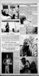
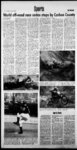
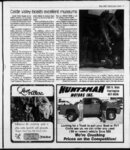
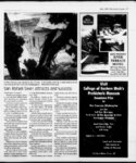
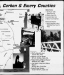
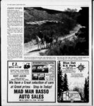
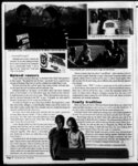
Show May 2002 Recreation Guide 29 Canyon contains rock art: r rock faces on both sides of the snake. To the right is arock covered with' figures. There are trees, birds and humans with distinct hands and feet Visitors should travel slowfy and watch carefully because (Continued from page 2) the low ridge to the right are pit houses. Proceed along the road and watch carefully, particularly in the black patina on the rock faces, and spot petroglyphB of sheep and deer. Continue 1.0 miles to the remains of the ghost town of. Harper. Travel 1.4 miles to where the road curves around a balanced rock near the left edge. Stop just around the corner from the balanced rock. To the left of the road just above the car is an excellent panel withavariety of figures. Examine the rocks on both aides of the main panel for more art Visitors can climb up to the ledge, but Bhould be extremely careful ofknee rock. there are hundreds of individual petroglyphs on the smooth rock feces of the hillside. After 3.5 milw, the re-ctearly visibly. Stop the car; get out and look back at a 45-degr- ee angle upward. The front ofthe granary has been washed away, but the floor, ceiling and walls are visible. At a location I mile further into the canyon, people can see the first intact granaxy. While crossing the cattle guard, look to the left Locate the large cedar tree at the base of the rock pictographs. diffi There is a lot of sagebrush. Continue 0.5 of a mile to a Proceed 1.4 mites, then look carefully at the smooth sections of rock to the left covered with black patina about halfway up the hill There are carvings all along the section. In particular, note the excellent panel with unusual figures - human shapes with headdresses, lines . ' stands out rather distinctly. hinnmlw, Mamina tha With ;? ,r7 t i i 1 i Vi v i T'7 ;.r77,r v7"ri r i i t j i y t Vi n the cliff base. The tree is to the right about halfway across the fece of the difil The granary is nestled in the area of rock above the ledge. It has mortar and to be perched on the rock face. Drive 1.5 miles, focus directly up the road to the high cliff face and locate a long, rather greenish slit in the rock. Look slighter below and to the right for a hole in some The granary can be seen with binoculars in the light-color- of deer, and designs with squares created from dots. Binoculars will give a better view ofthepetrogfyphs or people can rlimh ip to the pwnpla. Continue 1.4 miles and stop next to aline oftall cottonwood trees. Look left halfway up the hfllawfa wt. thw HTrvWi hlurlr Txy4r faces. A design of a large snake Rassmussens Cave, the location of excellent pictographs. . The road forks after one mile. Take the right fork and drive 0.9 of a mile around a ridge. On the ridge is the remains of a Fremont village. Walk west up the hillside to the rocks that outline where several pit houses once stood. Other structures were built around the large boulders. To the north across the canyon is a long greenish ledge. With binoculars, discover the ledge is lined with structures Continue 0.3 mite. On the rock outcropping to the right about 10 feet above the road is a famous hunting scene. Return to the forks in the road, turn right and drive 0.5 mite. On the main road is an alcove of white rock about a third ofthe way up the hilL To left, there are petrocdypha and ed petroglyph panel of men, women, a, turkey, a scorpion, a bird and abstract sketches. Proceed 21 mites until reaching a butte on top of square-toppe- d the hill to the left. Use binocu- ruins, dwellings and structures. Visitors should leave Native lars to wnminw the top of the butte and view rock work left American rock art, ruins and by the ancient inhabitants of artifacts untouched. The oil from a handprint the canyon. Continue 0.1 of a mile and can chemically affect rock art watch for a little dirt road turnClimbing on ruin walls can ing to the left Take the turn destroy a structure that has surand go around the outcropping vived for 1,000 years. of rock near the right-han- d Moving artifacts destroys the side of the road. The cliff face scientific value of sites. Chalkbecomes a Bmooth half circle. ing or wetting rock art is proStop, look carefully about one-thi- hibited. Travelers visiting Nine Mite ofthe way up the cliff face and locatea graCanyon should report susnary perched an a small ledge. pected vandalism incidents to Return to the main road and the BLM office in Price. The continue in same direction of office may be reached at travel for 0.4 ofa mite. Just before rounding a curve, lock to camping is perthe left at apetrogfyph of abird mitted on the flat benches in flight. above the canyon known as the ifest Tavaputs Plateau and Bad After another 0.1 mite, the county road ends. Permission Land Cliffo- ParmiwMnn miiafchanhfainnri must be obtained prior to conlandowners to camp on from and tinuing entering private property. private property. Nine-Mil- e All horseback riding, biking Canyon is provehicle activitected by the Antiquities Act and The federal statute prohibits ties are restricted to existing rd well-preserv- ed 0. ay individuate from appropriating, excavating, damaging or destroying historic or prehistoric roads. Utahs OHV regulations are applicable and enforced in Nine Mite Canyon. ligfitv-nTnrp- ri If your Roots are in Emery County! If your Heart is in Castle Country! light-coloredroc-k. ' crevice. Proceed another 2.5 miles to i i t i '1 v i ;yr 4 4 1 1 Valuable Coupon PER GALLON DISCOUNT with this coupon Not valid H copied Visit us at the Museum of the San Rafael and the Pioneer Museum For Information call 381-52- Castle Dale , 1 10:00-4:0- 0 Mon.-Sa- t. - 52 r- - |