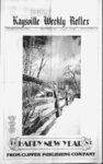
| OCR Text |
Show t' DAVI3 COUNTY CLIPPER. DCCEWDCR 29, 1982 Jackson Desclopmr nt ne., W, SI M, (oni. .41 Acre. t Or.) Oil, AU oil u ?u, Vl-Ulotal t $I7 01 pagetwfi.ve la IW Ok) Uuw, beg on Ih I R LN OF A IlY AT A FT 1144 6 ft S A 74 ft F-- (f Ih N W tor of th S W of Sec D. 14N KIW; SLM runlhfc 172 ft.lh N 77 4 0; th W 1)9 9 ft, out), to the F la ot id hy; th S I leg JV' W 77 7 ft alg d by to P4iiie Hfon, tw 07) uuil, ad 4C, overtook acre uh, Sec II, W S M Coni. 17 1F4N.RU w Jaeksoa Development Inc., Aire AlsobrgalSW'cofofsd kd 4C and run th S twdrg )) W 74 M ft, Ih N I deg M P 14) 6 ft; th N 89 deg )) F 74 14 ft; ih S I deg 2i W 4) 5h ft to pob. I uni .J4) Acre M alt ,4 1 Acte Total IWtJrilUlW.AIMlut M.VaF ley Hi, see HI; MS RIW; MM CoM ,Jg Acre. lotal la Jackson Development I ), nc., or.) null, Allot I tM Val. ley III, See I II; 4N KIW, M Cuni 2 Acre Total si la Jackson Development tUMUil2.AUufi Sl.sj. low la I II; l4W nc . I?, Val- 4N KIW; I old ,11 Acre Jackson Development $16)70 ne-- , tw w.l out). Allot ot H, VaS ley III, See I II; 14N KIW; Sl.M Coni .41 Acte lotal la Utah Title A ..,,,.,$141 09 074 of ooil, (hmimd Oak. Amd. AH 41) lo Abstract loot. 0 It I acre out of LL I I A annexed to Ih pub. DfrK la lot II, Sec II A S0ft4 Pcka Investment ,11646 Llah Title A Abstract lo, Got H fttenon INW4IIIUI.AH 09 074 oot). AH of l ot 1. tf I ot lii. Inna Sec II; Ibmtmd flak. See II A , 14VKIW; St M Coni .14 14N RIW; SLM COM. )4 Ai.iC lold la 1447 $20 6 Aife. lotal Dennis A Sullujn, IN (It, MU. Utah Title A la.,.., Abitrait Co , All ol lad Oak I No. 4. iMf! SIM fa Vn (14 John 1 , lionon, in lit, in on, All ol frirt 46, Oak I oiesl No. 1, See ll;T4N KW;SI M com, Acte. fold Ta$l,IM 2 JJ Ralph M Smith, in no lead. All of lad 6H. Oak I OfCst No. . ( oni. ,4 Acre. Total J J I ec S I cum, IN 066 0444. iein pari id M 416, Ouk Forest No. 6. Sec II. 14N KIW; Sl.M lley at Ih STeood mI ld 4 16. A run ih lo ih nyht alg ih arc of a 216 04 i mil mi 1 4 It, ih long chord of tth hear N 70 deg, 4i nl" W 1 4 ft; ih N 22 deg, 2r4l" E KO ft, ih S H deg 2740" W (Ml ft lo ih pob Com. ,01 la ...11,97 Acre, lotal Ivory Company, IN 067 0191. All of lad 191. Oak Forest No. 7, Sec II:14N RIW:SI.M font 09 074 0014, All of Lot 14. Ifcmnnd Oak, lei beg at the N W cor of I id 14, A run ih N 7 89drg 49 WF-2'ft.thfl.lh N 87 deg 04 07" W 2 04 ft mol. to W In of d kd 14, th N I 7 ft to he pob. Coot ) Acre, lotal! ,,..$207 20 Garry L. I tvec.09 074 oot. All of Lol Tidal Ta 1221,2 Ivory Company, (N 067 0194. All 1 Oak Torevl No. 7. of lad 94, Sec ll;T4N RW; SCSI font .44 Acre. Total Ta $202.58 Ivory Company, 09 067.019. All Oak Forest No. 7. f lad 19. Sec ll;T4N RW:SI.M font 120.19 .59 Acre. Total Ta Ivory Company. 09 067.0199. All of lad Tore! Sec ll;T4NRW;SI.M font .28 Acre. Toial Ta 1175.70 199. Oak No. 7. Ivory Company. 09 067.001. All of I ad lo. Oak forevl No. 7. Sec Acre. Total Ta 1217.54 Ivory Company. 09.067.010. All of lad 3o5. Oak Forest No. 7. : Cont Sec ll:T4N-RIW;SLM- Acre. Total Ta 1207.35 Ivory Company. 09 067.0106. All of lad 306. Oak Forest No. 7. SL.MrCont Sec ll;T4N-RIW- ; $190.40 .36 Acre. Total Ta Ivory Company. 09:067:0309, All of Lot 309. Oak Forest No. 7. .47 Sec .36 Acres. Total Tax SI92.27 Ivory A Company, 09:067:0314. All of Lad 314, Oak Forest No. SLM: 7, Sec II; T4N-RIConi .43 Acres. Toial $202.72 Tax .Ivory Company, 09:067:0319. All of Lot 319, Oak Forest No. 7. SLM: Coni Sec ll:T4N-RIW- ; .47 Acres. Total Tax $186.33 Ivory Company. 09:067:0327. All of Lot 327. Oak Forest No. 7. Coni Sec .43 Acre. Total Tax S2II.II Ray L. Barney. 09:068:0222. All of Lot 222, Oak Forest No. 8 Sec 1, T4N-R- I W; SLM. Coni. .45 Acres. Also: a pi of lot 223, Oak Forest No. 8, Beg at N most cor of lot 222, Oak Forest No. 8, wh is in NEVkofSec II; T4N-RISLM: Th N 60 deg.00 E 50.73 ft; th S 17 deg. ll;T4N-RIW;SL- 1 04I5"E95 ft: thS3l.65 ft; th N 36deg. 2920 W 120.78 ft to pob. Cont. 08 Acre. Total .53 $980.38 Acres. Total Tax David K. Fahncke, 09:068:0226, All of Lot 226, Oak Forest No. SLM: 8, Sec II, T4N-RICont. .34 Acres. Total $212.59 Tax David K. Fahncke, 09:068:0227, All of Lot 227, Oak Forest No. SLM: 8, Sec II, T4N-RICont. .35 Acres. Total $192.68 Tax David Fahncke. 09:068:0229, All of Lot 229, Oak Forest No. 8 SLM: Sec II, T4N-RICont. .35 Acres. Total $192.68 Tax David K. Fahncke, 09:068:0230, All of Lot 230, Oak Forest No. SLM: 8, Sec 11, Cont. .41 Acres. Total $202.20 Tax Dick G. Geisler, 09:069:0148, All of Lot 148, Oak Forest No. 9, SLM Cont Sec 1: .28 Acres. Total Tax$l, 146.35 Jeannie E. Gilbert, 09:069:0157, All of Lot 157, Oak Forest No. SLM: 9, Sec II; Cont .28 Acres. Total $1,199.52 Tax Craig C. Nelson, 09:069:0164. All of Lot 164. Oak Forest No. 9, SLM: Cont Sec 1; .28 Acres. Total Tax $944.77 Society For Savings. 09:069:0832, All of Lot 183, Oak Forest No. SLM: 9 Sec It; Cont .28 Acres. Total $1,075.72 Tax . Ivory & Company, 09:070:05 T4N-R1- 1 T4N-R1- T4N-R1- 1 T4N-R1- T4N-R1- 1 of Lot 511, Sec 1,14, T4N-R1SLM; Oak Forest No. 10 Cont .29 Acres. Total $29.02 Tax All Country Wide Homes Inc., All of Lot 525, SLM: Sec II, 14, Oak Forest No. 10, Cont .30 $31 1.62 Acres. Total Tax Ivory & Company, 09:070:0553, AllofLot533,Sec 11,14, SLM: Oak Forest No. 10, Cont .26 Acres. Total $26.51 Tax James C. Kaiserman, 09:070:0545, All of Lot 545, Sec 11,14, SLM: Oak Forest No. 10. Cont. .24 Acres. Total $23.98 Tax Country Wide Homes Inc., 09:070:0554, All of Lot 554, SLM: Sec II, 14, Oak Forest No. 10. Cont. .23 $317.61 Acres. Total Tax Charles W. Jones, 09:071:0006, All of Lot 6, K AYS Creek Sub, Sec Cont. .44 Acres. Total $1,520.83 Tax Fred A. Swertfeger, 09:073:0001, ft FR WM SE cor Beg 25.24 SLM: th S Sec 11, 89 deg. 53 W 263.63 ft, m or I, to SWF COR LOT Ms, OVERLOOK Acres Sub N deg. 29 09:070:0525, T4N-R1- T4N-R1- T4N-R1- T4N-R1- 11;T4N-R1W;SL- T4N-R1- 1 E 143.56 ft; N 89 deg. 53 E 263.63 ft, m or I, to Wly line to hy; th SI deg. 29 W 143.56 ft alg sd hy to beg cont. .87 $225.64 Acres. Total Tax Kenneth L. ft Bickmore, 09:073:0005, Lot 5, Overlook Acres Sub. Sec II. TP4N. RG Pcka If W 25jr deg. 50 16.35 ft; th N 9 WHO 3ft;lhS I S deg 52 F, 03 ft; Ih S 88 deg. Ob W 55 ft alg the N end of vd frontage road lo the pob. Cont. 1 .977 acre subject lo a nghl of b Anne to way out of t.l.-6ton. Toial Ta ...$143,64 4' la $1,115)0 I'lah Idle A Abstract Company, 09 074 0024, All of Lol 24. Dimond Ouk. Sec It A 14, T4.N.RIW; SLM: Corn .34 5 ly Inveitment Pcka I'tah 1 slle A Abstract Company, 09.074:0026. All of Lot 26. Dimond Ouk. Sec It A 14; ; SLM: Cont .)4 $204.68 Acre. Total Ta Utah Title A Abstract Company. 09.074,0028. All of Lot 28. Dimond Oak. Amd. Sec II A 14. T4N RIW, SLM; com. .50 Acre. Total Ta $231.29 Utah Title A Abstract Company. 09.074 0029. All of Lol 29. A Dimond Oaks, Amd. Sec I4.T4N RIW. SLM; com. .54 Acre. Total Ta $26 85 L. Dwight Iincock. 09 074 002, All of lad 31. Dimond fhiks. : Sec II A T4N-RIW- 1 1 I4;T4N-RIW;SI.M- 09:074:0038, All of Lot 38. Dimond Oaks. Sec II A 14; T4N-RISLM: Cont .34 Acre. Less the following: beg at SE cor of sd lot 38. sd pi also being on N In of Coumry Oaks Condo, run th N 83 deg. 45 W 125 ft to SW cor of sd lot 38, th N 76 deg. 28I8E 36.98 ft; th S 82 deg. 2043" E 90.23 ft to a pt on E In of sd lot, th S 6 deg. 15 W 10.30 ft to pob. Cont .03 Acres. Total .31 Acres. Total Tax $204.68 James C. Edwards. 09:074:0042. A part of Lots 14 A 15. Dimond Oaks Sub; Sec JI.T4N-RIW- ; SLM: Beg at th NW cor of sd lot 14 & ninth 5 89deg.49'30" E 25 ft : th S 3. 17 ft; th N 87 deg. 04'07" W 58.50 ft to th N In of sd lot 15; th N 89 deg. 4930" E 33.42 ft to th pob. Cont. .002 $3.97 Ac. Total Tax Mark Lynn Walton, 09:076:0003, Beg on E In of old Mtn. Rd 44 rds E A NW'ly 15.5 rds alg sd rd fr SW cor NW', Sec 12, TP 4N, RG 1W, SLM. N 71 deg. 30 E 19 rds, th NWly II rds para to E In sd road, S 71 deg. 30 W 3 rds. SEly 5 rds, th S 71 deg. 30' W 16 rds, th SEly 6 rds to beg. Cont. .805 Acres. $505.88 Total Tax Kenneth M. Strong, 09:077:0046, Beg N 0 deg. 29' E 1551 ft alg sec In AS 89 deg. 56 E 1045.99 ft & S 3 deg. 16 E 233.21 ft fr SW cor Sec 12, T4N-RISLM; N 89 deg. 56 W 177.68 ft; S3 deg. 39 W 332.10 ft to th S 86 N'ly In of a 50 ft R-; deg. 04 E 2 1 9. 10 ft alg sd R-th N 3 deg. 16 W 346.79 ft to beg. cont. 1.53 Acres together Total Tax $184.41 with R-Jay S. McDonald, 09:077:0076, Beg on E'ly In of a 50 ft rd, at a pt S 89 deg. 56 E 2150.50 ft alg sec In fr SW cor Sec 12; T4N-R1SLM: th S 89 deg. 56 E 489.50 ft alg sec In to SE cor of SW'i sd sec 12; N 0 deg. 29 E 177.0 ft alg E In sd SW'i; th N 89 deg. 56 W 511.48 ft mol, to E In sd rd; th Sly 98.96 ft alg arc of a 741.17 ft rad curve to right alg sd rd; th S 4 deg. 30 E 80.30 ft alg sd rd to pob. Cont 2.03 Acres. Total Tax$3, 383.91 Darrell Litz Dalton, 09:079:0006, All of Lot 6, Walker Sub, Sec SLM: Cont .39 12; T4N-R1$750.51 Acres. Total Tax Lynn A. Wright, 09:081:0015, Beg on E In of a hwy at pt being S 89 deg. 56 E 161. 5 ft alg sec In &S 1 deg. 29 W 248.13 ft alg sd E InofahwyfrNWcorofSec 13; SLM: Run th S 89 deg. 56 E 185 ft; th St deg. 29 T4N-R1- W 1 8 ft ; th N 89 deg. 56 W 1 85 ft to E In of sd hwy; th N 1 deg, 29 E 1 18 ft mol alg sd E In to pob. Cont .50 Acres Subject to Total Tax.... $144.65 a R-John C. Moss, 09:081:0017, Begat a pt S 3 deg. 56 E 1979.21 fttoa pt on E In of a hwy & E 107.28 ft fr NW cor of Sec 13; T4N-R1SLM: run th N 83.81 ft; th El 10.0 ft to Win of Mtn Rd; th S 9 deg. 36 W 85.0 ft alg sd rd; th W 95.82 ft to pob. Cont .19 Acres. Total Tax $405.64 James Ray Chidester, 09:081:0018, Beg at apt ah isS 23.345 chs & E 1632 ft fr NW1, SLM: of Sec 13; T4N-R1run th E 18 ft to a pt wh is S 23.345 chs &E 25 chs frsd sec 13; th S 3.333 chs; th W 18 ft; th N 3.333 chs to pob. Cont .09 $6.35 Acres. Total Tax Estates Enterprises, 09:082:0007, A part of the SW'i of Sec 13; T4N-W; SLM: beg at a pt on E In of a frontage rd, sd pt being S 89 deg. 3456 E 90 ft. N 1 deg. 52 W 152 ft. S 89 deg. 50 45 E 68.03 ft, N 7 deg. 30T0 W 138.64 ft & N 1 deg. 52 W 589 ft fr SL cor sd sec 13; 4N-1run thNIdeg. 52 W 80 ft alg E Inof sd frontage rd; th S 89 deg. 5045 E 1 10 ft; th S deg. 52 E 80 ft; th N 89 deg. 5045 W 110 ft to pob. Cont. .20 Acres. Total Tas $770.83 Inc., 09 082,00)3. beg on th Lly In of a frmage rd S 0 deg. 1 1 20" W 764.52 ft alg th tec In A E 115.28 ft fr th NW cor of the SWV. of Sec I) T4N RIW; SLM' A run ih alg th exist fen In S 85 deg. I8'40T E 102.81 ft; th S 40.08 ft alg th fen In; th N 87 deg. 38 10" E 26,88 ftalgth fen In: th S 81 deg. 4940" Fj 47.20 ft alg th fen In; Ih N 87 deg. 5320 E 77. 10 ft alg th fen In; thN79deg.4920"F: 39.04 ft alg th fen In; Ih N 89 deg. 7'40" E 44.56 ft alg th fen In; th E 3.2 ft; thN 140.20 ft toth fen In: th N 89 deg. 4245" E 120.5 ftalgth fen In; Ih S 356.91 ft: thW 467.39 ft to the Elv In of th frontage rd: Ih N I deg. 3250"E 257.98 ftalgth Ely In of th frontage rd to pob. Com. 2.62 Acre Subj lo desc R-- T4NKIW; SLM; corn .) $206.27 Acre. Total Ta Country Oaks Partnerhip, Inc., on the 5lftlgdl I; Cont .34 Acre. Total $227.11 Ta Utah Title A Abstract Company, 09:074:0037, All of Lol 37. Dimond Oak. Sec II A 14; T4N-RIW- ; SLM: Cont .34 $204.68 Acre. Total Tax ...$) 17 Inmeomenli Total! 09 n2 ti22. beg at a pt L R W In of Hy 9 at a pt S 9 deg )4 56" E 99 IK ft A N I In deg 52 W toot (nheScorof Sec D.14N-IW- ; SLM ; (dpt being at the N end of the Frontage Road, run Ih N I deg. 52 W 16)9 ft; th Nly alg the arc of a I deg. curve to I 6 2 ft; ih S 89 (tw right deg, 51' F: )ll ) ft- - Ih S 0 deg. JO" W276 7ft;thSH6dcg. deg 04 07" p. 3) 46 ft mol, lo FI In of d kd ih N 1.71 ft to poh, Cont. ,42 Acre. Toial 2. OF LotthNWcorof 19 I 02 acre. I. $204 68 Acre, loial la Utah lute A Abstract Company, 09 074 0025. All of Lol Dimond Oak Sec It A 14; F. 11446 IhSWV.ofSec I1.14N RIW; SLM, ih S 10 7 ft; th E IM 9 ftithNn 9ft NthW Mi9ft, ml, to the pt of beg: th S 121 6 ft mol, to th pob, Com. Dimond, Osmond Oak. Le the M, beg at th NLcoroflid ,ArunihSX9 deg 49' 0" W )) 42 ft, Ih S 87 ..4 Acre. .54 litS AFin ufahwynispt ft I 1. Sec II; 1 4N KIW; ( oni .17 Aire. Total Inc-- , tw (12 oujd, beg 122 ft $28)7 m A Iw 02 unit), beg o f hwy at pt 1144 ft SA fc 74 ft fr N w cor of S w v, of Sec I); T4N RIW, SIM iht 122ft, ih th W 121 bftnuilioL Inuf vdhwy. ihN Iy lUtftmul alg 4 hwy la pob. Together w,ih a R)W, Cont, ,42 Acre. $ 27.76 lotal Ta lo la ....ID W Invttimtal C lac., In layiofl. Total Ta , 14, 4.N- - W; SLM, torn .)! Aire Total T IJttTJO Utah Title A Abstract , 09 074 0012, All of Lol 12, Osmond Oak. AmJ. Set 12 A 14, 4N RIW; SIM, loot, ,4 Acre, lotal c, Dfka Investment y Ml, See HI; IN RIW; NLM: Com 2 Aee Toed ley Hi, See I 4 Out or EL and EL J Total Ta 8-- or or 09 082-001- $263.48 James Vincent Spencer, 09:084:0014. All of Lot 14. Natural Estate NKO. Vi, Sec SLM: Cont. 13; T4N-RI- Acre. Total Tax $978.11 Walter W. Ludlow, 09:084:0020, AH of Lot 20, Natural Estates No. 2, Cont. .558 Acre. Total $180.85 Tax .257 Fete ingaruoJay loapt S9dr M)'1 AWH9halNtnuf 7 SO wc ) 1145 460 deg F. Vjfc HfE A N 9 deg 55 1 149 4ft ft par to N In uf Sec U fr NF. eor of d ec 5 ih S W dr pb la )5 ki"W cont 7,71 wr75ftm.il to Acte. Total 15): Rolling Oak Inc , 09 05 IX)JI, beg at a pt S M 9 ft A S )5 drg 04 W 17 h ft ft ft of the NW v, of See 14 KIW; SIM AKunthS)5lr 04' W ) 19 J6 ft Ih N t deg 40' W J50 55ftthS Rjj MfttoiM N In of Country Oak No, 5 th N 19 deg 1 159 09ft lotheNW cor of Country Oak No. 2. ih N 7) deg OU'E 9 4) ft th NM deg F SO I) ft Ih S 66 deg F )u 69 ft 10 apt due Suf the pub. Ih N 4n 9 ft to the poh. Com. ) II Acre Out ottw 09541 Total Ta $444 25 irv Richard A, Chritientea. 09(j4uu?,lhcS'ly A fc'ly I ft of the following dcic traei of Land, meaiured alg a In par to A adjaicm lo ih W ly A F. ly Inof d iracT beg at pt S I K7.0 ft A W St fclnfrihNCieoruf ee U;14N KIW; St Mwhpt It also S 74 deg, X 40 W $4:ftAS5der,.30W ,27 ft fr the NW cor of Lot 5iw, Coumry Oak No. J, ih S 52 deg WW 171 9KftihS4Kde( et'HWeil 59 ft thN 79 deg J505 WJ74 77 ft th N 47 ikg 0I2HE 49 24 ft Ih N M deg )8'5KF. 4(7.41 ft thS HI drg 32 01" E 571,76 ft to th p-- b Cont. 0 02! Acre. Gut of 09 0X54X1) I, Total T $97 Great State Service Corp . 09 0K6 (xm4, beg at NVI cor of Sec 14, T4N-KIW- ; SLM: tb S 295.59 ft alg W tec In to NW ly In of ppty conv to Layton City : th NLly 210 486 ft alg arc of a 441.614 ft rad cur lo the ngHi through a central angle ol 27 deg. H to 1 pi ofa reverve cur; thNE'ly 181,95 ft alg arc of a 382.56 ft rad cur to left who central angle i 72 deg. 15' to a pt of tang; th alg d tang N ) deg. E 50 98 ft to tcc In; th S K9 deg. 49'30"W 421.04 ft alg vcc In lo pob. Cont. 1.09 acrev. Total Tax $66 85 Ralph Bccvlcy, 09:086:0055, Beg fen In of a hy at a pt on W R-SO deg, 06 E 1111.52ft algiec In AS 89 deg. 54' W 15.40 ft fr NE cor of See I4.T4N RIW; SLM A run thS89drg. 54' W 16.0ft; thNOdeg. 06 W 106 0 ft:thN89deg.54EI6ft;thS0 deg. 06' E 106.02 ft lo poh. Cont. .04 Acres. Total $3 97 Ta Country Oaks Partnership. 09:086:0006, Beg at a pi E 776.63 ft A S 72.25 ft A N 8 deg. 33 W 274.99 ft A N 84 deg. W 15.25 ft fr NVI cor of SLM: thN Sec I4;T4N-RIW- ; 84 deg. W 68.17 ft; thS 20 deg. W 79 ft mol to W'ly In of Counth N try Oak Cond Phase 36 deg. E 41 ft mol to an angle cor therein; th N 80 deg. 40' E 73.8 ft; thN It deg. W23 ft mol to pob. Com .054 Acres. Total Tax $7.94 Great Stale Service Corp., Feciio,tr u7 uu9, begun S In ot i berry I ane A t In of Gilman W ay at a pt N 340 07 ft alg c In A 1 1414 81 ft hr SW cor of Sec 14, 14N Ml W; SIM thN 67 deg 5) 74 ft alg Sin utl hen y If t I aue.th SO deg !)'50"F.UOttthS87deg, W W 48. 16 ft to f In ot Gilman W'ay; th N 2 deg. 20 W luo 42 ft alg k In of d ro pob. font .1) Acre, loial Ta ..$19 05 Piik D. Iyer, ouim7ia,I, beg 87) 2! ft E A N 2F W imut ft A W42 8ft;S IDftfrSWcor Scc4,14N KIW.SLM SHU ft; S 6) deg. 52 F-- 98 5 ft; N 3) I Id (XI ft; N 70 deg. deg W )) )5 W 18 18 ft. m or I tu beg cont ,)2 Acre, loial $845.18 la Warren 1. Myen, 09 087,0103, beg on N ly In of a rd at 1 pt S 77 deg. 26' L 74 48 ft AS 66 F 61) 5 ft A N Odrg, deg. t ,f 2lWI66ftfrW'.corolSec I4.14N KtW.Sl S 66 deg. 51 F. M 12 AKumh 13 ftalgth N'ly In of d rd, th N Odeg. 2f w t:o Oft: th S 66 deg. 51' E 2)2.5 ft.lh NO deg 2lr W )0 0 fl.lh S 66 deg. 51' It8t ft, m or F- - I. to a pt N 0 deg. 21' W of a pt 16 67ch F of S W cor of d vcc; thN odeg. Wltxi, Oft loapt 0 ft N of th Nly Inof d td; W 4)2,37 ft th N 66 deg. 2f 20 Jf 09 mol. th S 23 deg. W 1 19.22 ft; S 0 deg. 21 H 120 ft tom of beg. Com. 1.785 Acre. Total 1 $849,15 Stanton A. Smith, 09 087:0106, part of the SW Vi of Sec I W; SI M; Begun pi S 1018) I4-4- If W ft E IXJO.Jft A N 89 deg. 100 ft fr the WVi cor of id vcc A W to D; th runthN89drg. S 200 ft, mol, to the N In of a road; Ih N 65 deg, 44' E 10 ft, mol, alg d road; th N 193.0 ft, If mot. to the poh. Cont. .05 Acre out of 09 08 7 003 1 . Total Ta $6.35 John F. Gallcgo. 09:088,0009. In S Road a pt at of Co. beg on 312 ft S A N 88 deg. 4 W 242 ft A S 85 deg. 26 W 32 ft fr NE cor of WVi of SEVi of See 14. El 19.97 ft, mol. to Win of a road; th N 98.76 ft, mol, 10 S In id road; th 84 85 ft alg 26' W 32 ft, pob. Cont. Tax John N 88 deg. 45' W d Sin: thN 8 deg. mol, alg d S In to .275 Michael Acre. Total $100.79 Adam. 09 088 0013. Beg 354 ft W A I250SA 106ft WofNEcorof WViofSE Ya of Sec I4.T4N-RISLM: th S 2 deg. 17 E 163 ft mol to N In of a st; th S 85 deg. 30 W 106.8 ft. mol. alg d t; thN 1 18 ft; th W 710 ft th N 56 ft; th E 1 1 1 ft mol to pob. Cont. .38 Acres. Total $841.22 Tax John W. Gallcgo. 09:088:0017, Bcg200ftSofSlnoftapt3ll ft , mol. S A N 88 deg. 45 W 242 ft, S 85 deg. 26' W 32 ft alg sd st, S 200 ft fr NE cor of Vi'i of SEVa of Sec 14. T4N-RISLM: S 225.33 ft. mol, to apt due W of a pt 60 ft, N of Angle cor in 50 foot atr conv to East Layton City; E 1 19.79 ft, mol, to sd st; N 225.33 ft, mol; alg sd st to a pt due E of the pob; W 1 19.79 ft, mol; to the pob cont .62 Acres. Total Tax . . $89.68 Oakifond phase No. 14; T4N KIW; M M: Sec LM) lotal la ,,$77 67 Country Oak Fartnertbip, (W tw) Ou7, Unit 7, Country bit. O'. Oaks Cond Phase No. hc( UND mi. 14, MS KIW; M-I 058, Total la VUJ Country Oak Partnership, I. tw) (XI38, Unit Iounuy Oak Cond. Phe No. Sec 14; 14N KIW; SLM: CM) bil. I 08. Total la .,$77 67 (W Country Oak Partnership, (w iwl txi.'v. Unit 19, Coumry Mobile Home, Coot- - II $17.7) Acre, Toial la Ponald J. Hansen, 09 100 0211, All of lot 211. Lakorew Mobile Home. Cont. . 1 1 .... $17.73 Tola) Ta. Ponald J. Hansen, 09 I Do 0212, All of I ol 212. I akeview Mobile Home. Coni. ,11 $17.7) Acre. Total Donald J. Hansen, 09 100 021). All of I 01 21), l akeview Acre. Mobile Home. Cont. .11 Acre. Total Ta. .... . $17,73 Partnership, tw tw wilt), Unit 20. Coumry Sec OaklConJ Phase No. 14; T4.N KIW; SLM: UND lilt. 106, Total Ta .,$74 6 Country Oak $17.7) Total la Ponalil J. Han sen, 09 ( 00 Otd. All of I 01 210, Lakeview Acre. la...,.. Oaks Cond Phase No. 72. Sec 14; 14N KIW; SLM: UNO Ini. 106. loialla ,.$74)6 Country Oak lAmald J. Ilaivcn, tw iuu 02U9, All of l ot 2o9, Lakeview Mobile Hume, Cool. .1) 0 0214, Donald J. Hansen. (W All of Lot 214, l akeview Mobile Home, Cont. .11 Partnership, Acre. Toial la...... $17.7) (wtw)OUJI, Unit 21, Country Oak Cond Phase No. Sec 14; T4N.RIW: SLM: UNO lm. 106. TotaJla ,.$74 )6 Donald J. Hansen, 09 IOO02I. All of Lol 215. Lakeview Mobile Home, Cont, ,11 being on N In of Coumry Oak Sub, run th S 72 deg, 30 E 248 81 ft alg d N In ol Coumry Oak Su. Ih N 2 0 ft alg W In of d Coumry Oak Sub; th S 89 deg. 00 W 20 54 ft A thS 10 deg, 00 W 155.25 ft lo pob. Cont .98 Acre. Total $224 4) Ta Donald J. Hansen. 09 00 0217. All of Lot 217, Lakeview Mobile Home. Cont. ,11 $17,7) Acre. Total Ta Great State Service Corp., Donald J. Hansen. 09 loo 0216. All of t ot 216, l akeview two'll (Xrt1. beg at pi 841,17 Mobile Home. Com. .11 ft S 127 72ft f. of N'. cor of Acre. Total Ta, ..... $17,73 see 14; 14N RIW; Sl.M; d PI Donald J. Hansen. 09:00 0l7. All of Lot 171, Lakevicw Mobile Home Cont. . I! Acre. 717.73 Total Ta Donald J. Hansen, 09 I (HI 0172. All of Lot 172, Lakevicw Mobile Home. Cont. .12 Acre. Total Ta $17.73 Donald J. Hansen. 09 100 0173. Alt of Lot 173, Lakevicw Mobile Home. Cont. .11 $17.73 Acre. Total Ta Donald J. Hansen. 09:100 0174, All of Lol 174, Lakevicw Mobile Home. Cont. .11 $17.73 Acre. Total Tax Donald J. Hansen. 09:100 0175, All of Lol 175, Lakevicw Mobile Home. Cont. .11 $17.73 Acres. Total Tax. Donald J. Hansen, 09:100:0176. All of Lot 176, Lakevicw Mobile Home. Com. .11 $17.73 Acres. Total Tam Donald J. Hansen. 09:100:0177, All of Lot 177, Lakevicw Mobile Home. Cont. .11 $17.73 Acre. Total Tax Donald J. Hansen. 09:100:0178. All of Lot 178, Lakevicw Mobile Home. Cont. .11 $17.73 Acre. Total Tax Donald J. Hansen. 09:100:0179, All of Lot 179, Lakeview Mobile Home. Cont. .11 $17.73 Acres. Total Tax Donald J. Hansen. 09:100:0180, All of Lot 180, Lakeview Mobile Home. Cont. .11 , Acres. Total Tam $17.73 Donald J. Hansen. 09:100:0181, ..... All of Lot 18., Lakevicw Mobile Home. Cont. .11 $17.73 Donald J. Hansen, 09:100:0182, All of Lot 182, Lakeview Mobile Home. Cont. .11 Acres. Total Tam $17.73 Donald J. Hansen, 09:100:0183, All of Lot 183, Lakeview Mobile Home. Corn. .11 $17.73 Acres. Total Tax Donald J. Hansen, 09:100:0184, All of Lot 184, Lakeview Mobile Home. Cont. .11 Acres. Total Tax $17.73 Donald J. Hansen, 09:100:0185, Lot All of 185, Lakeview Mobile Home. Cont. .11 Total Tax $17.73 Acres. Donald J. Hansen, 09:100:0186, All of Lot 186, Lakeview Mobile Home. Cont. .11 $17.73 Acres. Total Tax Donald J. Hansen, 09:100:0187, All of Lot 187, Lakeview Mobile Home. Cont. .11 $17.73 Acres. Total Tax Donald J. Hansen, 09:100:0188, All of Lot 188, Lakeview Acres. Total Tax 1 Acre. Tola) Ta $17,7) Donald J. Hansen. 09:100 0218. All of Lol 218, Lakeview Mobile Home. Coni. .11 $17,7) Acre. ToiutTax Donald J. Hansen. 09 100 0219. All of Lot 219, Lakevicw Mobile Home, Cont. .11 $17.7) Acres. Total Tax Donald J. Hansen. 09:100 0220. All of Lol 220, Lakeview Mobile Home. Cont. .11 $17.7) Acre. Toial Tax Donald J. Hansen. 09:100:0221. All of Lot 221, Lakeview Mobile Home. Cont. .11 Acre. Total lax $17.73 Donald J. Hansen. 09:100 0222. All of Lot 22, Lakevicw Mobile Home. Cont. .11 Acre. Toial $17.73 Tax Donald J. Hansen. 09:100:022). All of Lol 22), Lakeview Mobile Home. Cont. .11 $17.73 Acres. Total Tax Donald J. Hansen. 09:100:0224. All of Lol 224, Lakeview Mobile Home. Cont. .11 $17.73 Acres. Total Tax Donald J. Hansen. 09:100:0225, All of Lot 225, Lakevicw Mobile Home. Cont. .11 $17.73 Acres. Total Tax Donald J. Hanren. 09:100:02:6. All of Lot 226, Lakeview Mobile Home, cont. .11 Acres. $17.73 Total Tax Donald J. Hanen. 09:100:0227. All of Lot 227, Lakeview Mobile Home. Cont. .11 $17.73 Acres. Total Tax Donald J. Hansen. 09:100:0228. All of Lot 228, Lakeview Mobile Home. Cont. .11 $17.73 Acres. Total Tax Donald J. Hansen. 09:100:0229, All of Lot 229, Lakeview Mobile Home. Cont. .11 $17.73 Acres. Total Tax Donald J. Hansen, 09:100:0230, All of Lot 230, Lakeview Mobile Home. Cont. .11 $17.73 Acres. Total Tax Donald J. Hansen. 09:100:0231, All of Lot 231, Lakeview Mobile Home. Cont. .11 $17.73 Acres. Total Tax Donald J. Hansen. 09:100:0232, All of Lot 232, Lakeview Mobile Home. Cont. .!! $17.73 Acres. Total Tax Donald J. Hansen, 09:100:0233, All of Lot 233, Lakeview Mobile Home. Cont. .11 $17.73 Acres. Total Tax Donald J. Hansen, 09:100:0234, All of Lot 234, Lakeview Mobile Home, Cont. .11 $17.73 Acres. Total Tax Donald J. Hansen, 09:100:0235, All of Lot 235, Lakeview Mobile Home. Cont. .11 $17.73 Acres. Total Tax Donald J. Hansen, 09:100:0236, All of Lot 236, Lakeview Mobile Home. Cont. .11 $17.73 Acres. Total Tax Donald J. Hansen, 09:100:0237, All of Lot 237, Lakeview Mobile Home. Cont. .11 $17.73 Acres. Total Tax Donald J. Hansen, 09:100:0238, All of Lot 238, Lakeview Mobile Home Cont. .11 Acres. $17.73 Total Tax Donald J. Hansen, 09:100:0239, All of Lot 239, Lakeview Mobile Home. Cont. .11 $17.73 Acres. Total Tax Donald J. Hansen, 09:100:0240, All of Lot 240, Lakeviess Mobile Home. Cont. .11 $17.77) Acres. Total Tax Donald J. Hansen, 09:100:0241, All of Lot 241, Lakeview Mobile Home. Cont. .11 $17.7'3 Acres. Total Tax Donald J. Hansen, 09:100:0247, All of Lot 242, Lakeview Mobile Home. Cont. .11 $17. 73 Acres. Total Tax Donald J. Hansen, 09:100:0243, All of Lot 243, Lakevi-eMobile Home. Cont. ..11 $17'.73 Acres. Total Tax Donald J. Hansen, 09:100:0744, All of Lot 244, Lakeview Mobile Home. Cont. .11 $1 7.73 Acres. Total Tax Donald J. Hansen, 09:100:0245, All of Lot 245, Lakeview Mobile Home. Cont. .11 $17.73 Acres. Total Tax Donald J. Hansen, 09:100:0246, All of Lot 246, Lakeview Mobile Home. Cont.. .11 $17.73 Acres. Total Tax Donald J. Hansen, 09:100:0247, All of Lot 247, Lakeview Mobile Home. Cont. .11 Acres. Total Tax $17.73 Donald J. Hansen, 09:10'0:0248, All of Lot 248, Lakeview Mobile Home. Cont. .11 Acres. Total Tax $17.72 Donald J. Hansen, 09:100:0249, (Common area and private streets of Lakeview Mobile Home Sub) Common airea A cont. .28 Acres. Common area B cont. .83 Acres. Common area C cont. .83- Acres. Common Area D Cont. .95 09:086:0008. Beg at a pt E 776.63 ft A S 72.25 ft A N 83 All of Lot 28, Natural Est. No. deg. 33 W 200 ft fr NVi cor of SLM; 3. Sec 13; T4N-RISec I4;T4N-RIW- ; SLM: thN Maury James Coonradt, 09:088:0019, Beg on th S In of Cont. .402 Acres. Total 83 deg. 33 W 74.99 ft; th N 84 SLM: at a $133.32 Sec 14. T4N-RITax deg. W 15.25 ft; th Sit deg. E Paul S. Walton. 09:084:0034, Part 23 ft mol to Nly In of Coumry pt S 89 deg. 55 10 W 716.43 ft fr SE cor of Sec 14, A run th S of Lot 29, Natural Estates No. Oaks Condo Phase 7-- th N 80 89 deg. 55 10 W 174.31 ft; th 3 as follow: beg at SW cor of deg. 40 E 86.2 ft to pob. Cont Lot 29, Natural Estates No. 3, .022 Acres. Total Tax ..$3.97 NOdeg. 04"50 W 213.16 ft; th th S 78 deg. 03' E 9.2 ft; N 10 Great State Service Corp., N89deg.55 10 E 174.31 ft; th E 213.16 ft. S 0 deg. 04'50 09:086:0009. Beg at a pt N 89 deg. 22 E 39.89 ft; N 78 deg. 03 W 8.1 ft; thS II deg. 57 W mol, to tb pob. Cont. .85 deg. 49 30 E 502.95 ft fr N' $291.88 Acres. Total Tax 39.87 ft to pob. Cont .01 Acres. cor of Sec 14; T4N-RI$3.97 Total Tax SLM; th S 89 deg. 4930 W Maury James Coonradt, 09:088:0055. Beg on S In of Sec 108.506 it to E'ly In of ppty Rolling Oaks Inc., 09:085:0002, SLM: ataptS 14, T4N-R1conv to Layton City; th S 35 Beg at a pt S 1353.90 ft A W S 80 deg. 28'40 W 89 deg. 55 10 W 510.83 ft fr 144.97 ft deg. W 93.27 ft to pt of tang of a SE cor of sd sec 14 A run th alg 228.53 ft A N 78 deg. 30 W 442.56 ft rad cur to right; th sd sec In S 89 deg. 55 10 W 101.583ft AW 343.908 ft frth S Wly 210.48 ft alg arc of sd cur 197.6 ft to SE cor of ppty conv N Vi of sec SLM;th through a central angle of 27 th N 0 deg. 0450 in 751-47S 52 deg. 30 W 26.03 ft; thN 81 deg. 15' to a pt of reverse cur; W 3 ft, mol, to N In of granth SW'Iy 182.001 ft alg arc of a deg. 32 01 W 573.16 ft; th E 634.8 ft to a pt N 34 deg. 2230" tors land th alg sd N In N 89 383.614 ft rad cur to left whose Mobile Home. Cont. .13 E Of beg; th S 34 deg. 22'30" W deg. 55 10 E 271.47 ft th SO central angle is 27 deg. 1 1' to a $17.73 Acres. Total Tax 89 256.55 thS ft; 83.04 ft to pomb. Cont. .62 04'50E S 35 th sd deg. of Donald J. Hansen, 09:100:0189, pt tang; alg tang S 0 73.87 th W $85.38 5510 ft; ft Acres. Total Tax W 04 deg. 85.447 to th sec In; All of Lot 189, Lakeview deg. N 104.433 ft; thS 35 deg. 04 W Clair H. Black, 09:085:0003, Beg deg. 04'50" E 139.45 ft to th Mobile Home. Cont. .13 Total 144.97 1.86 AW Acres. cont. 1353.90ft In ft 37.6 281.06 to pob. thS ft; $17.73 Acres. Total Tax ataptS Nly Tax $211.57 ft A S 80 deg. 2840 W 228.53 of Country Oaks Condo phase Donald J. Hansen, 09:100:0190, ft & N 78 deo. 30' W 101.583 ft th S E 88 0257 All of Lot 190, Lakeview Paul J. Larson, 09:089:0046, Part deg. 73; A W 99.63 ft fr the N'i cor of 280.68 ft mol to W In of Counof Lot 38, Country Oaks; beg at Mobile Home. Cont. .11 Sec 14; TV'zN-R- I W; SLM; & Oaks Condo N Phase th Acres. Total Tax $17.73 the SE cor Lot 28, Country 72; try run thW 244.28 ft; thN 34 deg. 15 ft mol; thW 33.5 ft; thN 20 Oaks & run th S 45 deg. W Donald J. Hansen, 09:100:0191, 2230 E 83.04 ft; th E 178.36 ft 101.8 ft E mol to sd All of Lot 191, Lakeview 98.91 ft; thN 35 deg. W 26 ft; th deg. phase toaptN 15 deg. 3120Wofth Mobile Home. Cont. .11 72; th N 173.16 ft mol to an NEIy 99 ft, mol, to the pob. 15 3120E N th deg. 36 cor therein; Acres. Total Tax pt ofbeg;thS $17.73 angle Cont. .03 Ac out of Lay deg. 71.129 ft to the pob. Cont. .33 E 199 ft mol; thN 20 deg. E 79 Donald J. Hansen, 09:100:0192, or 09089-003- 8 now 09089- $63.15 Acres. Total Tax ft mol; th S 84 deg. E 83.42 ft; th All of Lot 192, Lakeview 0045. Total Tx $3.97 N 0 deg. 1810 E 48 ft mol to Ralph D. Brinton A Assoc., Mobile Home. Cont. .11 Thayne R. Green, Jr., 09:085:0009, Beg S 295,9 ft & S 2.331 Cont Acres. Total Acres. Total Tax $17.73 pob. 09:090:0221, All of Lot 221, 35 deg. 04 W 37.6 ft fr N 'i cor Tax $342.55 Donald J. Hansen, 09:100:0193, Oaks No. 2, Sec 14; Country SLM: th of Sec 14, T4N-R1T4N-R1Lot All of 193, Lakeview SLM: Cont. .69 Country Oaks Partnership, S 35 deg. 04 W 339.76 ft AN 81 Mobile Home. Cont. .11 09:086:0038, Beg. at a point Acres. Total Tax . ..$1,196.28 deg. 40 W 250.24 ft; th N 81 Total East 776.63 feet and South Tax Acres. $17.73 Richard A. Hicks, 09:090:0228, deg. 40 W 253.69 ft thS 42 deg. 72.25 feet & N 83 degrees Donald J. Hansen, 09:100:0194, Beg at the SW cor of Lot 210, 52 W 906.18 ft th S 30 deg. 33W 200 ft & S 80 deg.40W All of Lot 194, Lakeview Country Oaks No. 2, Being a 2858 W 125.3 ft mol to Sin of 160 ft & S 36 deg. W 240 ft & S Mobile Home. Cont. .11 part of the NEVi Sec NVi of NW'i sd sec 14, th E 173.16 ft alg W In of Country Acres. Total Tax $17.73 thN 187.94 ft; 634.8 ft to W In of ppty conv in Oaks Condo phast 72 fr NVi Donald J. Hansen, 09: 100:0195, th S 86 deg. 2349 E (chord 653-26- 3 th N 34 deg. 2230 E T4N-R11 1 Sec All cor of of Lot 195, Lakeview 14; .98 ft; th S 189.46 ft; bearing) 224.70 ft mol to the NW cor of SLM: th S 91.5 ft mol; th W th N 79 deg. 00 W 12.18 ft to Mobile Home. Cont. .11 Lot 501 of sd sub th N 15 deg. 33.5 ft; thN 20 deg. E 101.8ft . Acres. Total Tax $17.73 the pob. Cont 0.05 Acres. Out 3 1 20 W 123 ft th N 48 deg. 30 to pob. Cont .035 Acres. Total Donald J. Hansen, 09:100:0196, of 090900210 now E 192.411 ft th N 89 deg. E Tax All of Lot 196, Lakeview $5.56 0227. Total Tax $7.14 64.472 ft thN 73 deg. E 191.43 Mobile Home. Cont. .11 Richard A. Hicks, 09:090:0229, Ralph Beesley, 09:086:0048, Beg ft th N 64 deg. E 80.83 ft th S 66 on th W In of a 40 ft R-a Acres. Total Tax at pt Part of Lot 212, Country Oaks $17.73 SO deg. 06 E 1111.52 ft alg th deg. 70 ft mol to a pt S of beg. th T4N-R1Donald J. Hansen, 09:100:0197, No. 2, Sec 14, N 302.29 ft mol to pob Cont sec In & S 89 deg. 54 W 15.4 ft All of Lot 197, Lakeview SLM: Beg at the SW cor of Lot 7.278 Acres. Total & S 89 to th W In of a hwy R-Mobile Home. Cont. .11 211, Country Oaks No. 2 & $1,010.03 Tax In W W to ft th 54 40 sd of Acres. Total Tax Run th N 0 deg. 08 4 out of LA $17.73 deg. 1 R-17 N 106.03 & E ft Donald J. Hansen, 09:100:0198, Clair H. Black, 09:085:0010, Beg or Total deg. R-15 & ft sd th N Sec W 99.63 fr NE cor of All of Lot 198, Lakeview at a pt Tax alg deg. $3.97 SLM: & run th 3 1 20 W 71. 129 ft fr S W cor of 14, T4N-R1Mobile Home. Cont. .11 Country Oaks Partnership, 1 ft 106.02 W 5 No. der. Oak 54 89 ; th N Lot 509, Country $17.73 Acres. Total Tax 5, 09:093:0018, Unit 8, Country 17 16 W E 89 Sec Donald J. Hansen, 09:100:0199, ft; thN Oaks Cond. Phase No. Sec deg. deg. 54 In W 34 ft th E T4N-R1SE to 106.02 178.36 ft; thN of All of Lot 199, Lakeview deg. 2230E SLM: UND 14; R-th SI deg. 17 W 16.0 ft 224.70 ft to N W cor of Lot 501 , Mobile Home. Cont. .11 Int. 1.036. Total Tax ..$95.86 R-S 15 sd E to pob. Out of EL of sd sub; th Acres. Total Tax $17.73 alg deg. 20 Country Oaks Partnership, 1 92.48 ft mol to a 29A-1 or cont. .04 Donald J. Hansen, 09:100:0200, pt E of beg th 09:093:0019, Unit 9, Country ft Ac. Total Tax W 178.36 mol to pob cont. .37 All of Lot 200, Lakeview $3.97 Oaks Cond. Phase No. Sec $40.86 Pete Pessetto, 09:087:0004, Beg on Acres. Total Tax Mobile Home. Cont. Ml 14; T4N-R1SLM: UND Acres. Total Tax $17.73 Int. 1.036. Total Tax ..$74.36 Rolling Oaks Inc., 09:085:0011, Sly line of prop widening of Donald J. Hansen, 09:100:0201, Cherry Lane at ptN 2188.04 ft Beg at a pt which is S 1353.90 ft Country Oaks Partnersnip, All of Lot 201, Lakeview A W 144.97 ft & S 80 deg. 6 E 1246.8 ft & S 83 deg. 09:093:0020, Unit 10, Country 2245 E 1 8.7 ft & N 67 deg. 1 1 Mobile Home'. Cont. .11 Oaks Cond. Phase No. 72. Sec 2840 W 228.53 ft &N 78 deg. E 108.37ft &S2deg. 20' E8.54 Acres. Total Tax $17.73 30 W 101.583 ft & W 343.908 14; T4N-R1SLM; UND 11 E 217.62 ft fr ft AN 67 deg. Donald J. Hansen, 09:100:0202, Int. 1.058. Total Tax.. $76.74 ft; th S 52 deg. 30 W 26.03 ft fr N-IT4N-R1SW cor Sec 14; All of Lot 202, Lakeview NVi cor of Sec 14 4 Country Oaks Partnership, Mobile Home. Cont. .11 SLM; th SO deg. 2350 E 120 09:093:0021, Unit 11, Country SLM; th S 52 deg. 30 W Acres. Common area E Acres. Total Tax 172.921 ft; th S 48 deg. 4314 $17.73 Oaks Cond. Phase No. ft; th S 67 deg. 11 W 100 ft; th Sec Cont. .93 Acres Comr non Area N 0 deg. 2350 W 120 ft th N . Donald J. Hansen, 09:100:0203, W 412.04 ft; th N 79 deg. SLM: UND 14; T4N-R1F cont. .63 Acres Total 67 deg. 1 1 E 100 ft to pob. Cont All of Lot 203, Lakeview Int. 1.058. Total Tax ..$76.74 3505" W 375.99 ft; th N 47 common area 4.45 Acres. All .254 Ac. Total Tax... $567.42 Mobile .11 Home. Cont. Oaks deg. 0I'28 E 50.49 ft; th N 30 Country Partnership, Private streets 5.85 Acres. Acres. Total Tax $17.73 09:093:0022, Unit 12, Country deg. 3858 E 417.41 ft, mol, to Ralph R. Rohde, 09:087:0016, Beg Donald J. Hansen, 09:100:0204, Altogether 10.30 Ac res. Total on a N-- S fen In N 2188.04 ft alg Oaks Cond. Phase No. Sec aptN81deg. 32 01 Wofbeg; Tax $507.13 sec In &E 1246.80 ft &S2deg. All of Lot 204, Lakeview th S 81 deg. 32 01 E 573. 16 ft SLM: UND 14; T4N-R120 E 300.0 ft alg a fen InfrSW Ivory & Co., 09:101:0001, All of Mobile Home. Cont. .11 Int. 1.058. Total Tax.. $76.74 to pob. Cont. 4.629 Acres. TotLot 1, amd. Lakeland No. 1, Acres. Total Tax cor Sec 14; T4N-R1$17.73 al Tax $655.92 SLM; Country Oaks Partnership, Sec 7, 8 T4N-R- 1 W; SLM: thN 87 deg. 40 E 120ft; th S 2 Donald J. Hansen, 09:100:0205, Beecher D. Adams, 09:085:0013, 09:093:0023, Unit 13, Country Cont. .14 Acres. Out of Oaks Cond. Phase No. All of Lot 205, Lakeview Sec deg. 20 E 100 ft; th S 87 deg. Beg at a pt S 0 deg. 13 W & or was 40 W 120 ft to sd fen; th N 2 174.20 ft alg sec In & S 89 deg. Mobile Home. Cont. .11 14; T4N-R1SLM; UND & 0002( Total . Int. 1.058. Total Tax ..$76.74 Acres. Total Tax 4835 W 169.21 ft & S 0 deg. deg. 20 W 100 ft alg sd fen to $17.73 Tax $18.25 13 W 975.26 ft & N 89 deg. Donald J. Hansen, 09:100:0206, pob. Cont. .275 Acres. Total Country Oaks Partnership, Tax $610.28 All of Lot 206, Lakeview 5 1 05 E 149.71 ft frNE cor of 09:093:0024, Unit 14, Country & Co., 09:101:0002, All of Ivory Brant M. Wiser, 09:087:0035, Beg th SK Oaks Cond. Phase No. sec I5;T4N-R1W;SLSec Mobile Home. Cont. .11 Lot 2, Amd. Lakeland No. I, N 89 deg. 28 W 101.5 ft alg Vi DEG. E 180.20 ft alg an Acres. Total Tax. SLM: UND 14; T4N-R1$17.73 Sec 7, 8 T4N-R1SLM: In & S 1 deg. 05 W 100 ft fr sec In of East Layton Hills Int. 1.058. Total Tax ..$76.74 Donald J. Hansen, 09:100:0207, Cont. .16 Acres. fiVas Ely Vi T4N-R1Sec 56 cen of All of Lot 207, Lakeview 14, NKO. THS deg. 5538E & 0002) Total Tax$19.05 Country Oaks Partnership, SLM: th N 89 deg. 28 W 145 ft; 85.40 ft thS 2 deg. 15E50ftth Mobile Home. Cont. .11 09:093:0025, Unit 15, Country Ivory & Co., 09:101:0088, All of 1 05 W th S deg. 150.14 ft to N 550.24 ft th S 14 Oaks Cond. Phase No. Acres. Total Tax S 74 deg. Sec $17.73 Lot 88, Amd. Lak eland No. 1, In of S st; th S 88 deg. 55' E 145 SLM: UND Donald J. Hansen, 09:100:0208, 14; T4N-R1deg. 59 43 W 141.59 ft th S 75 Sec 7, 8 T4N-FUSLM: 1 ft alg sd st; th N deg. 05 E Int. 1.058. Total Tax ..$77.67 All of Lot 208, Lakeview deg. 0017E 116.67 ft thN70 Cont. .13 Acres. (Was 151.53 ft to beg. Cont. .50 Mobile Home. Cont. .11 deg. 24 E 145.6 ft mol th N 15 & 0057) Total Tax $18.25 Country Oaks Partnersnip, Acres. Total Tax $36.51 Acres. Total Tax 09:093:0026, Unit 16, Country deg. 15 E 570.35 ft mol cros- $17.73 Ivory A Co., 10:001.0006. Beg on Neil C. Morris, 09:084:0028, '& ..... ol ppty fvnv W I MJ tint 9) ft S alg lily for a id at 2apt ice in A 227 n alg d td u NWcurofvec I5.14N SIM Ih F J 20 ft alg d id, th S 34 )! ft, th S 70 deg IP 127. 1 pob. ft; Ih N )9 0 ft lu I' Coni. UlAcre lPti h t Kl; 1018 la IkciherP. A Jams. 10 0)2 0012, fr. beg at s pt N 0 dr If l) 9t) 26 ft fr F Vigor of See 1$; UN KIW; SLM kdpt'xm on Sly In of fast Fayt'Jfl Hot No. 2 th N 6) deg. 0 02" W J6 20 ft Ih N 67 drg f 0'47 W 9 9 ft ih N 7) drg 1.8 02 w SOM ft th N 69 deg. 0 W fr. 40 06ft 5)9 24 ft IhN 14 drg Ih N 70 drg W 1 14 ki ft thN 59 drg 08 34 W 51 9,: ft th N 81 drg. 5 W 99 76 ft .h S 8 drg W 20 ft to SE enrol I ot 21 4 toy ton Hills Flo. I IhN 8 1 W )10 ft Ih SI drg 45 drg W 214 49 ft ih S )) drg. 08 1 1 E 76 50 ft Ih S 8 drg 45 W 4 6) ft Ih N 66 drg W 217.27 ft to a angle cor o'! NE'ly In of Heather Hills No. 4(hSI9drg. 1 5' F JooftalgF In td Heather it, IN No, 4 10 N Iri of a si ih F ly 7,5 ft alg are of It 628 42 ft tad curve to right ale, sd st Ih S 18 drg, 34 F I 88,7k ft alg F In of Heather Hills Nd. I to N In of Parkd.de sub pl.yt "B th N 3 deg 30' FI 46.75 ft th N 85 deg. 1I S'4SE95 4KSftlhS64drg. 4) (leg, 30 E 290ft th E 627.2) ft id a pt N 0 deg, 7'50" E 206,32 ft alg ec Infr F', cor of d sixft 15 IhNec Odrg. In to !g 750 E 3n5 center of S M k of Kays Creek thS88 deg. 2T E 390 86 ft alg center of sd ct eck to E'ly In id aa rd IhN 51 tieg. 20 E 162.86 08' K ft alg d rd th IN 31 dcKR ft ih S 155 41 ft mol to apt on In Sly of Kay Cret k Drive in East Layton Hill No. 2 Ih N 75 deg. OQ'I? W 52.26 ft th SWIy alg are of a 267.92 ft rad curve to left 101.18 It (1.C bear S 37 deg. 0657 W 100.58 filth S 26 deg. 17 48 W 13.0 ft th SW'Iy alg arc of a 1)0.16 ft radius curve to left 6 49 ft (LC bear S W 6.49 ftl th N 70 deg. 30' W 284.81 ft th N 63 deg. 05 02' W 260.0! ft to pob Cont. 30.9 Acre. Total $2,102.42 Ta 27 deg. 31 Barbara Holland. M. 10 002:0013, Beg at apt 16.5 ft SWIy down center ot a creek pt of intereec NW'i of Sec 15; fr it with E In of T4N-RI- Odea. 08I5" SLM: E 255. 5 6 ft to center of sd creek & NE'ly alg center of td creek fr NW cor of Lot 17, Heather Hill N o. 3. run th N 6 deg. 34 E 310 ft mol to a pt N 53 deg. 40' W frW cor of Heather Hill No. r.thS53 deg. 40 E 320 ft mol to center of sd creek; th SW'Iy alg center of sd creek to pob. Cont 1.066 Acres. Total $57.93 Tax Mike Adam. 10:003:0022. Beg at a pi N 982.46ft &E 339.87 ft fr IhSHcorofSec I6.T4N-RIW- ; SLM: thN 104.64 ft; thW 301 ft, mol. to th E In of Fairfield rd; rh S 104.64 ft alg th E In of sd rd: th E 301 ft, mol, to th Cont. .723 Acres. Total ?ab. $92.06 Mike Adams, 10:003:0023, Beg at a pt N 89 deg. 2340" W 167.64 ft A N 837.74 ft A 339.87 ft fr this SE cor of Sec 16 T4N-W; SLM: th N 144.72 ft th W 30 1 ft. mol, to th E In of Fair-fie-ld RdthS 144.72 ft alg th E In of sd rd; th E 301 ft, mol. to th pob. Subj to a private road R-cont. 1.0 Acre. Total $126.98 Tax Elm Inc., 10:003:0035, Beg 204.6 ft W alg S In of Sec fr S'corof Sec 15;T4N-RIW- ; SLM: run th N 0 deg. 18 W 152.81 ft alg a fence In; th N 89 deg. 55 W 130ft; thSOdeg. 18 E 244.42 ft to N In of a rd; th N 88 deg. 36' 40 E 130 ft alg sd rd; thN Odeg. 18 W 88.8 ft to pob. cont. .73 Acres. Total Tax $541.24 Hope Adams, 10:003:0040, Beg at a pt N 89 deg. 2340 W 167.64 ft & N 410.9 ft fr the NE cor of SLM; & run th N 45.63 ft; th E 164 ft; th S 45.63 ft; th N 89 deg. 4630 W 264 ft; to the pob. Cont. 2.451 - less to acres less to 872-86- 4 6 Fairfield annexed out of remaining .66 remainAcres less to 914-98- 4 ing .24 Acres. Total Tax $138.88 Petroleum HAS at a 10:003:0041, Beg Inc., pt N 89 W 167.64 ft & S deg. 2340 89.10 ft fr the NE cor of Sec-- 2 thN 170 ft; th E 150 ft; th S 170 ft; th W 150 ft to th pob. Except that pord tion within the bounds of Road alg the W In there of. Cont, .42 Acre. Out of 0027. Total Tax $121.42 Maxxon Petroleum, 10:003:0043, Beg at a pt N 89 deg. 2340 W 167.64 ft &N 80.90 ft fr the SE SV; SLM: A cor of Sec Fair-fiel- run th N 330 ft; th E 264 ft; th S 330 ft; th W 264 ft to the pob. Except there fr that portion within the bounds of Fairfield Road alg the W In thereof. Cont. 1 .70 Acres out of 0040. Total Tax $221.41 Larry Regis Jr., 10:003:0044, Beg at a pt N 89 deg. 2340 W 167.65 ft & S 89.10 ft & S 89 deg. 4030 E 150 ft fr the NE cor of Sec-2- 1 N-1W; SLM: & run thN 170 ft; th E I14ft;th S 1 70 ft, mol , to a pt S 89 deg. 46 30 E of the pob; th N 89 deg. 46 30 W 114 ft to the pob; except therefor any portion within the bounds of Rainbow Drive alg the S In thereof. Cont. 44 Acres out of 0040. Total Tax $365.85 Harriet P. Barnes, 10:004:0022, Beg 13.84 chs W& 2.92 chs Sfr NE cor of SE'i Sec 15, T4N-R1SLM; thW 78.56 ft S 200 ft; E 78.56 ft ; th N 200 ft to beg, cont. .38 Acre. Total Tax $226.97 Kirton Adams Dev LTD 10:005:0004, All of Lot 4, East Layton Hills No. 1 Sec SLM: Cont. .27 Acre. Total Tax $143.24 Paul D. Colton, 10:005:0024, All of Lot 24, East Layton Hills No. 1. Sec 15; T4N-R1SLM: Cont. .23 Acres. Total Tax $793.84 Elahe Azizsoftani, 10:005:0041, AH of Lot 4i East Layton Hills No. 1 Sec 15;T4N-R1W;SLCont. .52 Acres. Total Tax $173.70 Moshen Azizsoltani, 10:005:0043, All of Lot 43, East Layton Hills No. 1 Sec 15;T4N-RIW;SLCont. .54 Acre. Total Tax $175.29 Kirton Adams Development LTD, 10:006:0047, All of Lot 47, East Layton Hills No. 2, Sec (Continued) ' |