| OCR Text |
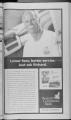
Show New Utah! - Wednesday, November 17, 1999 - Page 20 Health professional team up Dr. Ryan Campbell and Todd Ohelius, both former collegiate football players, have established estab-lished thriving businesses in American Fork and have decided decid-ed to begin hosting free lectures to the general public. Dr. Campbell is the owner and clinical director of Campbell. Chiropractic and Whiplash Treatment Center, located across from K-Mart in American Fork. Todd Chelius is the owner and operator of World's Gym Fitness Centers of Utah Valley, located in American Fork and Spanish Fork. Campbell and Chelius have decided to help the community through free seminars geared towards helping the everyday person gain improved physical and mental health for the new millennium. The first in a series of lectures for the public will be entitled, "Why Maintaining a Healthy Spine is Vitally Important to Our Health, and What You Can Do To Maintain It." This lecture Eagle Mountain schedules public hearing The Town Council of Eagle Mountain, Utah, will hold a public hearing at a Special Town Council Meeting on Nov. 30, 1999, at 6 p.m. at the Eagle Mountain Community Center, 1668 E. Heritage Drive, Eagle Mountain, Utah. The hearing will be held on a proposed revised Capital Facilities Plan for public infrastructure facilities, facili-ties, such as public municipal munici-pal water, sewer, storm drainage and flood control, parks, roads and electric power systems are the facility facil-ity plan which are the basis for the imposition of impact fees for funding the construction con-struction of such facilities by Notice of intent to annex -- The Ranches I Notice is hereby given that an Annexation Petition was received by the Town of Eagle Mountain proposing to annex the are described in this notice to the town. The petition was certified as being complete on Nov. 4, 1999. A copy of the petition is available for inspection and copying at the Town Offices, 1680 E. Heritage Drive, Eagle - Mountain, Utah. The Town may grant the petition unless a written protest is filed with the Town, 1680 E.- Heritage Drive, Eagle Mountain, Utah 84043, and with the Utah County Boundary Commission, 2855 S. Center Street, Provo, Utah 84606, by Dec. 14, 1999. Private Real Property Owners may protest. Any protest iiiust contain the signatures sig-natures of the owners of pri Notice of intent to annex - The Ranches II Notice Is hereby given that an Annexation Petition wus received by the Town of Eagle Mountain proposing to annex the are described in this notice to the town. The petition was certified as being complete on Nov. 4, 1999. A copy of the petition is available for inspection and copying at the Town Offices, 1680 E. Heritage Drive, Eagle Mountain, Utah. The Town may grant the petition unless a written protest is filed with the Town, 1680 E. Heritage Drive, Eagle Mountain, Utah 84043, and with the Utah County Boundary Commission, 2855 S. Center Street, Provo, Utah 84606, by Dec. 14, 1999. Private Real Property Owners may protest. Any protest must contain the signatures sig-natures of the owners of private pri-vate real property that is located in the unincorporated unincorporat-ed area proposed for annexation; annex-ation; covers at least 25 percent per-cent of the private land area located in the unincorporated unincorporat-ed area within Vi mile of the area proposed for annexation; annexa-tion; and is equal in value to at least 15 percent of all real property located in the unincorporated unin-corporated area within Vi m,le of the area proposed for Notice of intent to annex -- The Ranches Notice is hereby given that an Annexation Petition was received by the Town of Eag'e Mountain proposing to annex the are described in this notice to the town. The petition was certified as be ng complete on Nov. 4, 1999. A copy of the petition is available for inspection and copying at the Town Offices, 1680 E. Heritage Drive, Eagle Mountain, Utah. The Town may grant the petition unless a written protest is filed with the Town, 1680 E. Heritage Drive, Eagle Mountain, Utah 84043, and with the Utah County Boundary Commission, 2855 S. Center Street, Provo, Utah 84606, by Dec. 14, 1999. Private Real Property Owners may protest. Any protest must contain the signatures sig-natures of the owners of private pri-vate real property that is Eagle Mountain Utah the Town. Persons interested in the Proposed Revised Capital Facilities Plan may comment on the plan at the hearing. Copies' of the Proposed Revised Capital Facilities Plan will be available for review at the Town Office Nov. 16, 1999, 1680 E. vate real property that is located in the unincorporated unincorporat-ed area proposed for annexation; annex-ation; covers at least 25 percent per-cent of the private land area located in the unincorporated unincorporat-ed area within Vi mile of the area proposed for annexation; annexa-tion; and is equal in value to at least 15 percent of all real property located in the unincorporated unin-corporated area within Vi mile of the area proposed for annexation. Boundary description of area proposed to be annexed Commencing at the Northwest Corner of Section 13, Township 5 South, Range 2 West, Salt Lake Base and Meridian; thence as follows: South 89 deg. 4920" East 1875.98 feet along section line; thence South 10 deg. 28'00" East 719,81 feet; thence South annexation, Boundary description of area proposed to be annexed Commencing at the Northwest Corner of Section 18, Township 5 South, Range 1 West, Salt Lake Base & Meridian: thence as follows: South 89 deg. 58'29" East 1866.44 feet along section line; thence North 13 deg. 38'28" East 85.00 feet along section line; thence South 89 deg. 42'32" East 549.51 feet along section sec-tion line; thence South 00 deg. 26'31" West 2641.23 feet along 14 section line; thence North 89 deg. 32'10" West 2446.84 along 14 section sec-tion line; thence South 00 deg. 41 '39" West 2303.47 feet along section line; thence South 74 deg. 43'48" West 269.88 feet along Cedar Pass Ranch North lying boundary; thence South 53 deg. 17'00" West 576.92 feet along Cedar Pass Ranch boundary; thence North 89 deg. 19'12" West 1733.41 feet along Cedar Pass Ranch boundary; bound-ary; thence North 74 deg. 43'48" East 1340.34 feet along Cedar Pass North boundary; thence North 17 deg. 30'00" West 276.07 feet along Cedar Pass North located in the unincorporated unincorporat-ed area proposed for annexation; annex-ation; covers at least 25 percent per-cent of the private land area located in the unincorporated unincorporat-ed area within Vi mile of the area proposed for annexation; annexa-tion; and is equal in value to at least 15 percent of all real property located in the unincorporated unin-corporated area within Vi mile of the area proposed for annexation. Boundary description of area proposed to be annexed Commencing at the Northwest Corner of Section 17, Township 5 South, Range 1 West, Salt Lake Base & Meridian; thence as follows: South 88 deg. 2401" East 2685.04 feet along section line; thence South 00 deg. 1714" West 3657.68 feet along 14 section sec-tion line; thence South 78 deg. 1403" West 146.41 for lectures will be taught by Dr. Campbell Today, Nov. 18, from 6:30 to 7:30 p.m. at World Gym, 350 E. State Road in American Fork, next to Wendy's. The lecture is free to the public pub-lic and Campbell promises to give individual several pieces of information that can make immediate, dramatic, positive changes. Following the lecture, there will be a 15 minute question ques-tion and answer session. The two former athletes teamed up late last spring, when Chelius thought it would be beneficial ben-eficial to offer chiropractic services ser-vices to the patrons of his gym. Campbell has been offering individual advice to World Gym members and is excited to be able to share his knowledge with others in the community. Dr. Campbell started his chiropractic chi-ropractic rehabilitation center two years ago this August in American Fork. He graduated from the University of Utah in 1989 with a degree in exercise physiology. Heritage Drive, Eagle Mountain, Utah, Monday through Friday, 8 a.m. to 4 p.m. Janet Valentine ClerkRecorder Published in New Utah! Nov. 10, 17 and 24,1999. 44 deg. 06'04" East 224.46 feet; thence South 15 deg. 44'08" East 211.55 feet; thence South 43 deg. 13'17" East 247.56 feet; thence South 30 deg. 3315" East 432.03 feet; thence South OOdeg. 11'34"West 3714.52 feet along 14 section line; thence North 89 deg. 21 '24" West 2671.33 feet along section line; thence North 01 deg. 07'36" East 2635.52 feet along section line; thence North 00 deg. 10'28" ' East 2676.33 feet along section sec-tion line; to the point of beginning. Contains 305.1642 acres. Dated this 5th day of November, 1999. Janet B. Valentine ClerkRecorder Published in New Utah! Nov. 10, 17 and 24,1999. boundary; thence North 05 deg. 16'30" East 387.00 feet along Cedar Pass North boundary; thence North 15 deg. 15'00" West 175.00 feet along Cedar Pass North boundary; thence North 34 deg. 42'00" West 483.00 feet along Cedar Pass North boundary; thence North 51 deg. 20'00" West 344.00 feet along Cedar Pass North boundary; thence North 27 deg. 11 '00" West 830.00 feet along Cedar Pass North boundary; thence North 59 deg. 35'00" West 142.00 feet along Cedar Pass North boundary; thence North 49 deg. 05'44" West 21 6.30 feet along Cedar Pass North boundary; thence North 89 deg. 43'47" East 1030.00 feet along Cedar Pass North boundary; thence North 00 deg. 2638" East 2576.20 feet along Cedar Pass North boundary; thence South 89 deg. 50'16" East 1360.14 feet along section line to the point of beginning. Contains 317.5177 acres. Dated this 5th day of November, 1999. Janet B. Valentine ClerkRecorder Published in New Utah! Nov. 10, 17 and 24, 1999. feet; thence along the arc 11 deg 0000" radium 5654.70 feet length 1085.60 feet (CO South 83 deg. 4403" West 1083.93 feet) along State Road 73, Range 1 West; thence South 89 deg. 1402" West 135.47 feet; thence North 1272.03 feet along existing Eagle Mountain Town Boundary: thence South 89 deg. 3041" West 1320.05 feet along existing Eagle Mountain Town Boundary: thence North 00 deg. 3353" East 262.81 feet along Section line and existing Eagle Mountain Town Boundary to the point of beginning. Contains 196.8122 acres. Dated this 5th day of November, 1999. Janet B.Valentine ClerkRecorder Published in New Utah! Nov. 10. 17 and 24. 1999. From American Fork City Hall American Fork PflTTMPTT. TVnTVTRTTl'R Keith S. Blake R. Kent Evans Tom Hunter Grant Parker Judy Price Ricky Storrs PROPOSITION r.vi y-mw. il r 1 1 1 1 m mnr Kfrw mm imwwi ywKwu niitijMg i TiTfrTTi inTi rTrrr i 1 1 1 ii i i i im 111 11 n rui i i hit 1 1 ii i i ii i iii 1 1 ii ii i i ii mm m rarmn Tiwrwr lmminr uiu mm nm m i niiwiinrtmiim r--- - - - - - Total Voters Total Registered Voters Percentage of Voters City Council plans work session Thursday Notice is hereby given that the American Fork City Council will meet in a work session on Thursday. November 18, 1999, in the American Fork City Hall, 31 North Church Street, commencing com-mencing at 4:00 p.m. The agenda shall be as follows: American Fork City Council Notice is hereby given that the American Fork City Council will meet in regular session on November 23, 1999, in the American Fork City Hall, 31 North Church Street, commencing at 7:30 p.m. The agenda shall be as follows: PUBLIC HEARINGS 6:00 p.m. Receiving of public comment com-ment regarding a proposed Ordinance restricting large vehicles including trucks and buses from parking on City streets in residential zones. 6:30 p.m. Presentation and Public Hearing to receive public comment regarding the proposed pro-posed plans for the Developmental Center Park. 7:00 p.m. Receiving of public comment com-ment regarding the preliminary prelimi-nary plan for Broadstone V Commercial PUD at 852 East State Street. 7:10 p.m. Receiving of public comment com-ment regarding the placement place-ment of the property in the Max Searle Annexation at 600 West 1000 North in the RA-1, Residential Agricultural zone. 7:20 p.m. Receiving of public comment com-ment regarding the site plan for Deseret Industries at 185 North West State Road. REGULAR SESSION 1. Prayer by invitation; invita-tion; roll call. 2. Twenty minute-public minute-public comment period limited lim-ited to two minutes per person. per-son. Public hearing Notice is hereby given that the American Fork City Council will meet in a public hearing on December 14, 1999, at 6:50 p.m. in the American Fork City Hall, 31 North Church Street, to receive public comment regarding the placement of the property in the Harbor Citizens may Notice is hereby given that the American Fork City Council will hold a public hearing on November 23,. 1999, in the City Hall, 31 North Church Street, commencing com-mencing at 6:00 p.m. to Eagle Mountain seeks proposals The Town of Eagle Mountain is soliciting Request for Proposals (RFP's) from qualified Design Build firms to provide pro-vide design, engineering and construction services for the addition of a telephone tele-phone building onto an existing building. Design, engineering and construction work, in general, gener-al, consists of the following: Addition of an approximately approxi-mately 1.200 square foot building with basement onto an existing building. The building will be used to house telephone equipment OFFICAL RESULTS AMERICAN FORK MUNICIPAL GENERAL ELECTION NOVEMBER 2, 1999 Councilmember Races As Per Recount On 111599 CP 1 CP 2 101 182 93 150 81 168 99 160 99 206 144 219 217 379 557 1071 38.96 35.39 1. Discussion of items for the upcoming November 23, 1999, City Council meeting. 2. Presentation by American Fork Hospital Administrator Keith Alexander. 3. Other business. 3. Report of the City Administrator. 4. Council reports. 5. Mayor's report. ACTION ITEMS 1. Review and action relating to the American Fork Neighbors in Action program. 2. Review and action on the preliminary plan for Broadstone V Commercial PUD at 852 East State Street. 3. Review and action on the Max Searle Annexation at 600 West 1000 North including the Ordinance of Annexation, zone designation to the RA-1 RA-1 zone, -and also" the Annexation Agreement. 4. Review and action on a Resolution increasing the compensation compensa-tion of the Mayor and City Councilmembers, 5. Review and action on the site selection for a proposed Park & Ride at 1500 South 820 East. 6. Review and action on subdivisions, commercial com-mercial projects, condominiums, condomini-ums, and PUD's including 1) plat approval; 2) method of satisfaction of water rights requirements; 3) posting of an improvement bond or . setting of a time frame for improvement installation; and 4) authorization to sign the final plat and acceptance accep-tance of all dedications to the public and to have the plat recorded. a. Review and action on an Ordinance approving the site plan for Deseret Industries at 185 FOR: 52 82 77 46 149 124 63 84 36 125 64 83 985 AGAINST: 164 294 308 175 374 348 223 193 109 287 237 174 2888 is planned for Harbor Village Village Annexation, a portion por-tion of the Harbor Road Annexation, at 650 South 100 West consisting of 10.55 acres in the R1-9000, Single Family Residential zone. Copies of the petition are on file in the City Offices, 31 North Church Street, and are available for public comment on truck parking receive public comment regarding the restricting of large vehicles including trucks and buses from parking park-ing on City streets in residential resi-dential zones. All interested persons and offices. Copies of the RFP in its entirety will be on file at the office of the Town of Eagle Mountain, 1680 E. Heritage Drive. Eagle Mountain, 84043, and are open for public inspection and use. A site tour will be held Wednesday, Nov. 24, 1999, at 3 p.m. for those interested. interest-ed. Please meet at the Town Office in Eagle Mountain, Utah. RFP's will be received until 4 p.m. on Tuesday, Dec. 2, 1999. RFP's submitted after this deadline will be placed in the file unopened shows general I CP 5 I CP 6 CP 3 215 110 313 191 94 216 176 102 257 178 113 216 175 123 242 190 94 393 227 524 861 488 1337 45.64 46.52 39.19 4. Adjournment. Dated this 16th day of November, 1999. Richard M. Colborn City Recorder Published in New Utah! Nov. 17, 1999. lists agenda North West State Road. 7. Review and action on the awarding of the bid for the weight room equipment at the Fitness Center. 8. Review and action on an Ordinance adopting various building codes. 9. Review and action on a development agreement with Richard & Lillian Rea for property at 290 South 500 East. 10. Discussion in eneral regarding rdinance Enforcement, 11. Report and action on construction projects pro-jects items including change orders. 12. Report and action on Planning Commission items, 13. Review and action on the October 26, 1999, minutes. 14. Review and action on the October 28, 1999, public hearing minutes. min-utes. 15. Review and action on the November 9, 1999, minutes. 16. Review and action on the November 18, 1 999, work session minutes. 17. Finance Committee Report including action on the approval of City bills for payment. 18. Adjournment. Dated this 16th day of November, 1999. Richard M. Colborn City Recorder Published in New Utah! Nov. 17, 1999. inspection. All interested persons are invited to attend. Dated this 16th day of November, 1999. Richard M. Colborn City Recorder Published in New Utah! Nov. 17, 1999. are invited to attend. Dated this 15th day of November, 1999. Richard M. Colborn City Recorder Published in New Utah! Nov. 17, 1999. and will not be considered. There will be no exceptions. For additional information, contact Mr. John Newman at (801)766-5990. The Town of Eagle Mountain reserves the right to accept or reject any or all submittals or any part of a submittal. The Town of Eagle Mountain is an equal opportunity oppor-tunity employer. Town of Eagle Mountain By: Robert E. Bateman Mayor Published in New Utah! Nov. 17 and 24, 1999. PUBLIC NOTICES Public Notice Advertising Protects Your Right to Know CP 7 I CP 8 I CP 362 156 135 300 148 138 249 156 141 138 89 121 170 145 120 481 292 281 950 609 720 50.63 47.95 39.03 219 169 143 151 85 192 114 103 1823 Notice issued to water users The State Engineer received the following Application(s) to Change Water in Utah County (Locations in SLB&M). Persons objecting to an application must file a CLEARLY READABLE protest stating FILING NUMBER, NUM-BER, REASONS FOR OBJECTION, PROTESTANTS' PROTES-TANTS' NAME AND RETURN ADDRESS, and any request for a hearing. Protest must be filed with the State Engineer, Box 146300, Salt Lake City, UT 84114-6300 (801-538-7240) on or before Dec. 14, 1999. These are informal proceedings proceed-ings as per Rule R655-6-2 of the Division of Water Rights. (LEGEND: Point(s) of Diversion POD; Place of Use POU; Nature of Use USE) 54- 598 (a22847): Gerald Kinghorn, Town of Eagle Mountain propose to change the POD, POU & USE of water as evidenced by Water Right Numbers 54-598, 54-598, 54-744 and 54-745. HERETOFORE: QUANTITY: QUAN-TITY: 305.25 ac-ft. SOURCE: Underground Water Wells. POD: (1) S 10 E 860, 6 in, well 139 ft, deep (2) S 715 E 1030 from W14 Cor, Sec 17, 6 In. well 225 ft. deep (3) S 590 W 1320 from E14 Cor, Sec 18, T5S, R1W, 10 in. well 750 ft. deep. USE: Irrigation: from Apr 1 to Oct 31, total acreage 73.7050 acs; Stockwatering: 10 head of livestock; Domestic: 23 families. fami-lies. POU: W12SW14 Sec 17; N12SE14 Sec 18, T5S, R1W. HEREAFTER: QUANTITY: QUANTI-TY: 305.25 ac-ft. SOURCE: Underground Water Wells. POD:(1)S123W125 from NECor, Sec 1,8 in. well 750 ft. deep (2) S 10 E 306 from NW Cor, Sec21,T5S, R1W, 16 in. well 471 ft. deep (Eagle Mountain) USE: Municipal: In Town of Eagle Mountain. 55- 9421 (a23176): Robert Curtis, Carol C. Beverly propose to correct the POD, POU & USE of Notice of intent to annex - The Ranches IV Notice is hereby given that an Annexation Petition was received by the Town of Eagle Mountain proposing to annex the are described in this notice to the town. The petition was certified as being complete on Nov. 4, 1999. A copy of the petition is available for inspection and copying at the Town Offices, 1680 E. Heritage Drive, Eagle Mountain, Utah. The Town may grant the petition unless a written protest is filed with the Town, 1680 E. Heritage Drive, Eagle Mountain, Utah 84043, and with the Utah County Boundary Commission, 2855 S. Center Street, Provo, Utah Eagle Mountain sets hearing The Town of Eagle Mountain, Utah, hereby gives notice that the Town Council will hold a Public Hearing on the Capital Facilities Plan Financial Analysis and Proposed Amendment of the Impact Fee Ordinance on Nov. 30, 1999, at 6 p.m. at the Eagle Mountain Community Center. 1668 E. Heritage election 9 IcP locP llcP 73 209 169 62 157 142 74 203 152 54 245 103 76 179 162 148 418 303 422 936 729 35.07 44.66 41.56 water as evidenced by 55-9421 55-9421 (which is a portion of 55-3086, a1 8360). HERETOFORE: QUANTITY: QUAN-TITY: 0.044 cfs. SOURCE: 2 in. well 60 ft. deep. POD:(1) N 152 W 33 from SE Cor, Sec 13, T5S, R1W. USE: Irrigation: from May 1 to Sep 30, total acreage 3.0000 acs. POU: SE14SE14 Sec 13, T5S, R1W. HEREAFTER: QUANTITY: QUANTI-TY: 0.044 cfs. SOURCE: Underground Water well. POD: (1) N 125 E 172 from SW Cor, Sec 18, T5S, R1E, 6 in. well 179 ft. deep (2) N 152 W 33 from SE Cor, Sec 13, T5S, R1W, 2 in. well 60 ft. deep (3 miles southwest of Lehi) USE: Irrigation: from Apr 1 to Oct 31, total acreage 0.8500 acs; Domestic: 1 family. POU: SW14SW14 Sec 18, T5S, R1E; SE14SE14 Sec 13, T5S, R1W. 54-771 (a23734): Gerald Kinghorn, Town of Eagle Mountain propose to change the POD, POU & USE of Mer as evidenced by 54-771, 54-771, 781, 782, 819, 840, 841, 856, 862, 921, 923, 929, 930, 940, 941, 942, 956, 959, 962, 983, 992, 1046, 1047, 1048, 1049, 1050, 1051, 1052. HERETOFORE: QUANTITY: QUAN-TITY: 31.491 ac-ft. SOURCE: Underground Water Wells (3). POD: (1) N 1 000 E 900, 6 in. well 100 ft. to 500 ft. deep (2) N 1000 E 300 from SW Cor, 3c17,6 in. well 100 ft. to 500 ft. deep (3) S 1700 W 2550, 6 in. well 100 ft. to 500 ft. deep (4) S 2250 W 3800, 6 in. well 100 ft. to 500 ft. deep (5) S 2250 W4100, 6 in. well 100 ft. to 500 ft. deep (6) S 3700 W 1100 from NECor, 6 in. well 100 ft. to 500 ft. deep (7) N 350 E 3200, 6 in. well 100 ft. to 500 ft. deep (8) N 2000 E 2350 from SW Cor, 6 in. well 100 ft. to 500 ft. deep (9) S 5100 W 250 from NECor, 6 in. well 100 ft. to 500 ft. deep (10) N 1700 E 2200, 6 in. well 100 ft. to 500 ft. deep (11) N 1700 E 1300, 6 in. well 100 ft. to 500 ft. deep (12) N 2200 E 1200, 6 in. well 100 ft. to 500 ft. deep 84606, by Dec. 14, 1999. Private Real Property Owners may protest. Any protest must contain the signatures sig-natures of the owners of private pri-vate real property that is located in the unincorporated unincorporat-ed area proposed for annexation; annex-ation; covers at least 25 percent per-cent of the private land area located in the unincorporated unincorporat-ed area within Vi mile of the area proposed for annexation; annexa-tion; and is equal in value to at least 15 percent of all real property located in the unincorporated unin-corporated area within Vi mile of the area proposed for annexation. Boundary description of area proposed to be annexed Drive, Eagle Mountain, Utah. The purpose of this meeting is to receive comments com-ments concerning and take action on Impact Fees for Water, Sewer, Electricity, Storm Drainage and Roads owned and to be constructed construct-ed by the town. The public is invited to attend the hearing. Copies ;iltl . res' result :heiap: Lchi ' t0 rv rue atioi iety MVS f 12lcP 13! TOTALS ' dec 148 2173 h 108 179S,3''nia -here. 187t rvone 117 112 1628 says her 4me IJISS': 112 1809 'roup of tli herap: iatha ;r ac -Iran 258 3921 552 9232 46.74 42.47 year Vreli and c .Tarn jath ;le on ret to (13) N 2200 E 1750 fro -h th' SW Cor, 6 in. well 100 ft.-iheb 500 ft. deep (14) S 150 M; 600, 6 in. well 100 ft. to 5C ;are ft. deep (1 5) S 650 E 21 00, lng in. well 100 ft. to 500 tt.de ' s (16) S 575 E 950 from N- , Cor, Sec19,T5S, R1W, 6iiJ c well 100 ft. to 500 ft. dee ne. (17) N 100 W 120 from S ohysi Cor, Sec 1 3, 6 in. well 1 00 1 to 500 ft. deep (18) S 14C W 2400, 6 in. well 100 ft. I 500 ft. deep (19) S 200 Vean 2000, 6 in. well 100 ft. to 50 ff, ft. deep (20) S 50 W 1400,)- I in. well 100 ft. to 500 ft. dee (21) S 25 W 800, 6 in. we' 100 ft. to 500 ft. deep (22) '56-51 400 W 400, 6 in. well 100 f-0. to 500 ft. deep (23) S 900 re' 1700, 6 in. well 100 ft. to 50 'ooi ft. deep (24) S 1 900 W 1401 6 in. well 100 ft. to 500 I deep (25) S 300 W 240 from NE Cor, Sec 24, T51fl R2W, 6 in. well 100 ft. to 50 ft. deep (26) N 1400 E 260 from SW Cor, Sec 7, 14irfJT well 100 ft. to 600 ft. dee (27) N 2600 E 2600, 14 ir! well 100 ft. to 600 ft. dee.5: (28) N 2600 E 200 from SVl Cor, Sec 18, T7S, R1W, I in. well 100 ft. to 600 ft. dee:::kkec (29) S 1395 W 1032, 12'iw well 290 ft.deep (30) S 1J9i'"rtLf W 74 from NE Cor, Sec T9S, R1E, 12 in. well 323 : deep. USE: Irrigation: frorr--Apr 1 to Oct 31, totaAHC acreage 5.8488 acs. Stockwatering: 32 head oo livestock; Domestic: 16 famb;sra lies. POU: SW14 Sec 17- SW14NE14,NW14,N12;0O W14,SE14SW14,SE1'; Sec 19, T5S, RlW.v.i80l SE14SE14 Sec 13-2,; NE14.E12NW14 Sec 24...., T5S, R2W; Lot 3 Sec 7; Lo 3, Lot 2 Sec 18, T7S, R1W NE14Sec23,T9S,R1E. HEREAFTER: QUANTl Ty TY: 31.491 ac-ft. SOURCE Underground Water WellJr (4). POD: (1) N 840 W27E." from S14 Cor, Sec18,T6S, " R1W (Town of Eaglt, Mountain) USE: Municipal.. In Town of Eagle Mountain. Robert L. Morgan, RE. State Engineer Published in New Utah.;.;,.;f Nov. 17 and 24, 1999. w- Commencing at the-lJE South 14 Corner Sectior 20, Township 5 Southsir-Range Southsir-Range 1 West, Salt Lakeiiif! Base & Meridian; thence asMji follows: North 00 deg. 1038' West 2665.33 feet along 14! section line; thence Soutrjf 89 deg. 1720" East 1222.951 feet along 14 section lmeW thence South 2670.57 feetW2 thence North 89 deg. 0212'. West 1214.77 feet alontiP section line to the point ot;i beginning. Contains 74.6424 acres. - Dated this 5th day ol.. "f November, 1999. s Janet B. Valentine ClerkRecorder Published in New UtahSJ Q . Nov. 10, 17 and 24, 1999. on plan i nf tho Prnnnsed Impact 'Ov Fees Enactment will be.;! available for review ai '.;; . . -i OQQ . Town uttice nov. id, , 1680 E. Heritage Drive, ; ? Eagle Mountain, Utan.s Monday through Friday, 8 a.m. to 4 p.m. " Janet Valentine Town Clerk Published in New Utah! Nov. 17 and 24, 1999. v- 1 |