| OCR Text |
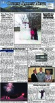
Show Page 10 The Ogden Valley news Volume XVII Issue XV January 15, 2010 AIR QUALITY cont. from page 1 throughout the United States. The Governor designated the Wasatch Front Regional Council (WFRC or Regional Council) as the Metropolitan Planning Organization for the Salt Lake and Ogden Areas in 1973. The Regional Council has established several committees to guide the development of transportation plans. A Transportation Coordinating Committee (Trans Com) serves as a policy advisory body to the WFRC for the short range six year Transportation Improvement Program that allocates funds to individual projects. Trans Com includes elected officials from the five counties, representatives of the major transportation agencies in the area, including the Utah Transportation Commission (UTC), the Utah Transit Authority (UTA), and the Utah Air Quality Board. The Federal Highway Administration and the Mountainland Association of Governments are non-voting members. In addition, Transportation Technical Advisory Committees have been established to provide technical advice to Trans Com and the WFRC, concerning transportation programs for the region. The Technical Committees are made up of engineers from each of the jurisdictions, as well as from the Utah Department of Transportation, the Utah Transit Authority, the Division of Air Quality, and others. A second principal committee of the Regional Council is the RGC (Regional Growth Committee). The Regional Growth Committee is composed primarily of elected officials along with representatives from UTA, UDOT and non-voting representatives from the Federal Highway Administration and the Mountainland Association of Governments. The RGC acts as the policy advisory committee for the development of the 30-year long range Regional Transportation Plan (formerly known as the Long Range Plan). The RGC has technical advisory committees made up of local planners, UDOT and UTA representatives, and other interested parties. Transportation planning in the Salt Lake Area has been a continuing effort for over three decades. In the 1960s UDOT developed the first Long Range Plan for the area. Since 1973, the WFRC has developed Regional Transportation Plans and updated them regularly. The process is comprehensive in nature, addressing all modes of transportation, including highways, transit, trucking, rail, air, bicycle and pedestrian. Transportation Plans are also part of the comprehensive planning for the overall development of the region. Two main products are developed through the transportation planning process. The first is a Regional Transportation Plan, which recommends improvements to highways, transit, and other modes, to meet the transportation needs of the area over a 20-year period and beyond. The second is a Transportation Improvement Program or TIP. The TIP is a six-year capital improvement program for highway and transit projects contained in the Regional Transportation Plan. The Regional Transportation Plan is updated every four years, while the TIP is approved annually. Two Federal Statutes establish various requirements that MPOs must address during the transportation planning process. They are the current transportation authorization act, the Safe, Accountable, Flexible, Efficient Transportation Equity Act: A Legacy for Users (SAFETEA-LU) and the Clean Air Act Amendments of 1990 (CAAA). SAFETEALU outlines the issues that need to be considered in developing a Regional Transportation Plan and a Transportation Improvement Program. Also, both CAAA and SAFETEALU require that transportation plans and programs conform to state air quality plans. Additionally, SAFETEA-LU requires that both the Transportation Plan and the TIP include financial plans outlining how the recommendations of each component of the plan will be funded. The WFRC works with UDOT and UTA to estimate the revenues likely to be available for transportation improvement in the region. The WFRC then evaluates the long range, management systems, enhancement, and other needs, to determine the most financially feasible projects for incorporation into the Plan and the TIP. In addition to the TIP and the RTP noted above, the Regional Council also: 1. Provides a forum for discussion and cooperation among elected representatives of local jurisdictions concerning region-wide problems, primarily transportation and growth planning, and to provide professional services for these areas of concern. 2. Assists with the coordination of local programs, plans, and projects with Federal and State programs, and provides a mechanism to more firmly represent the official and unified thinking of these local jurisdictions to both State and Federal Agencies. 3. Provides a more effective organizational structure for local governments to coordinate local transportation plans and programs that overlap county boundaries or are regional in nature. 4. Promotes regionally adopted growth principles among the member municipalities and counties to guide development. These growth principles were adopted by the Regional Council after considerable study and deliberation. They represent optimal methods of cost effective, environmentally responsible development. 5. Sponsors and/or participates in other studies to establish transportation needs and solutions such as the State Street Livability Study, the North Legacy Corridor Study, and many others. 6. Manages the Community Development Block Grant (CDBG) program for cities with populations less than 50,000 for Davis, Weber, Morgan and Tooele Counties. 7. Updates the Natural Hazard Pre-Disaster Mitigation Plan for the Wasatch Front Region. The Plan is the standard set by the Federal Emergency Management Agency for area cities and counties to prepare for natural disasters by implementing mitigation measures that will lessen the impacts of such events. All municipalities must adopt the Plan prior to any presidentially declared natural disaster in order to be eligible for federal assistance. 8. Fosters radio and other wireless interoperability among public safety agencies along the Wasatch Front at the request of the Utah Division of Homeland Security. This effort will ensure that in the event of a natural or man-made emergency that public safety agencies from various jurisdictions can communicate freely. Dear Ogden Valley Residents, We at Grass Plus lnc. want to THANK YOU for your business this last summer and now it’s time to think SNOW! Let us help you with all your Snow Removal needs Driveways ~ Walks ~ Roofs and More! When experience matters Call for a free quote today. Thanks again from all of us at Grass Plus lnc. HISTORICAL cont. from page 9 Carol Renstrom, Helga Peterson, Fred Berlin, Frank Lofgreen, Mattie Stone, Thelma Stevens, Louise Browning, and Myrtle Felt. On July 24, 1915, a big celebration was held in the town. The official program indicated the party was in honor of three important events in the town’s development— (1) The advent of the Utah pioneers; (2) Completion of the electric railroad; (3) Artesian wells for Ogden’s water supply. There was a program in the pavilion, at which Mayor A.G. Fell of Ogden was to talk. The Industrial Band was there. There was a lunch provided, two baseball games, horse racing, bronco busting, and all the sports popular at that time. There also was a parade. There was to be a handcart company represented by Hans Scow and Anna Slater, both of whom came to Utah by that method; then there was an ox team driven by Parry A. Bingham, an 1848 pioneer. There were mule teams and a white tops, horse team and surries, a 1915 auto, etc. Jens Winter fired the morning salute, Arnold Renstrom, the Scoutmaster, raised the flag, Angus McKay was Chaplain. I was chairman in the pavilion, W.H. Wattis officially opened the road, Bishop John Halls gave the speech of welcome. M.S. Browning gave the response, and T. Samuel Browning also gave an address. President George H. Brimhall eulogized the pioneers, and thus passes another development in the town’s history. In the beginning of building a town, water, as always, is an important item. The creeks and irrigation ditches used at first for that purpose became polluted and then wells had to be dug. Lars Larsen got to be a professional in that trade, and he became so popular in that trade that he finally became known as “Well-digger Larsen.” The old wooden buckets, the well ropes, and the old iron pulleys were anything but handy, especially on washday. When the pump came along, that improved the situation somewhat, but even that was inconvenient. I frequently felt that it would be wise and try and get water in the homes in pipes under pressure. In about 1920, I had talked to some prominent people around town about the matter, but I had not got much encouragement. I knew where was a nice spring east of town that would more than supply the needs of the people here. I finally tried a second group to join in such an effort. I even got a contractor to go over the ground with me, and he offered to put the main line in for $15,000. That fell through. Finally, in 1923, we got a group together who were willing to get water for themselves, anyway. They were Louis Wangsgard, Albert Engstrom, E.R. McKay, A.W. Schade, D.D. McKay, Sam Lofgreen, Hyrum Jensen, James G. McKay, Arthur Wangsgard, Harvey Wangsgard, Frank Thurston, Samuel Wangsgard, Jed McKay, Jake Wangsgard, Niels Wangsgard, Frances McDonald, Arthur Grow, Dan Felt, Vernal Nielsen, Charles Felt, James Surrage, and Horace Aldous. James G. McKay, Sam Lofgreen ,and myself each were elected as the Committee in charge. On January 30, 1923, a 5-rod piece of ground for a reservoir, right-of-way for a road, and his right in a spring in Hawkins Creek Canyon, were all bought on contract from Peter M. Jensen for the sum of Five Hundred Dollars, one dollar down, and the balance when the deed was cleared and delivered. On the same day, his rights in the spring in Hawkins Canyon and right-of-way for a pipeline was bought on contract from David Wangsgard for the sum of Two Hundred Dollars, and one dollar down and the balance when the title was cleared and delivered. Work was begun at once on titles and also to see if the State Utilities Law would affect a corporation such as the one we had in mind to create. A company was formed. The County Commissioners issued a franchise to put the pipeline in all the streets and roads of the town, and everything was ready to go. Then an argument arose. Everyone in town wanted to get in the deal. Well, it was finally agreed that if the town wanted to incorporate again, we would be glad to sell out to it. This was done, and on January 18, 1924, the committee, consisting of myself, Sam Lofgreen, and J.G. McKay, acting for the corporation, entered into a contract with the town to sell the franchise granted by the County Commissioners, also the contract with Peter M. Jensen for Five Hundred Fifty Dollars and to assume and pay Mr. Jensen the sum of Four Hundred Ninety -Nine Dollars owing on his contract with the corporation. Also, the town had to pay David Wangsgard the sum of Four Hundred NinetyNine Dollars on the contract with him by the corporation. The town also agreed to hold an election to approve the issuance of bonds to build the necessary pipelines and reservoir, and that was the second trial of operating a town in this valley. The town corporation was finally completed on November 5, 1924, when the county appointed Joseph L. Peterson, Mayor; E.R. McKay, C.A. Engstrom, Louis Wangsgard, and Charles I. Grow as councilmen; D.D. McKay as Justice of the Peace; Edward Jesperson as Treasure; Hyrum A. Jensen as Clerk; and Joseph Felt as Marshall and Poundkeeper. This water system, when completed, cost the town in the neighborhood of Forty-Five Thousand Dollars. It was not long, however, until there was some expense in improvements for it. Not so many years after the first system was completed, it became necessary to look for more water. The Board investigated many springs. Finally, it was determined that there was surplus water in Bennett Canyon. Several filings were made in that locality but they were not too encouraging. Finally, on February 21, 1936, one spring was bought from the Fullers in Bennett for Six Thousand Dollars. Thatcher and Young were retained as lawyers for the town, and on August 7, C. I. Coray was employed as Engineer and he began to survey the 3.6 miles from the pipelines from the spring to town. An application was made to PWA for a loan and grant to help build the pipeline. That organization made a survey and appraisal of the cost of such a line and figured that would be about Fifty Thousand Dollars. That organization offered to pay forty-five percent of the cost, or not to exceed Twenty-Two Thousand Nine Hundred Dollars, and to buy Nineteen Thousand Dollars of their revenue bonds. Eleven Thousand Dollars of general obligation bonds would have to be issued and sold to some other concern. On November 19, the voters gave the Board authority to issue that amount of bonds, and the contract was finally let for the 3.6 miles of pipe. Then, on September 18, 1940, Braxton and Opal Fuller sold to the town 0.4 of a second foot of water from the big spring, just above the smaller one. There had been a lot of controversy about the water in this spring. Finally, on December 5, 1947, a contract was entered into with the Fullers and between the town and the Monastery, so the town gets 0.4 cfs from the big spring and the entire flow of the little spring, with some modifications. The town board members in 1936 were Fred W. Wood, President; and Jed McKay, Henry Burrows, Arnold Berlin, and Clarence Olsen, Board Members. The new town board were Fred Wood, President; Jed McKay, A.W. Schade, Otis Fuller, and Chester Engstrom. Beginning in 1950 it was evident that the pipes leading from the reservoir into town were not large enough to carry the water available. The pipe leading from the big spring to the little spring had broken and a large part of the water was lost. So that was repaired by laying a new and larger pipe between them and laying it at a proper slope the whole distance. Then it was decided to replace the pipe between the reservoir and the town with a new and larger pipe so as to make the enlarged amount of water available to the system in town. This new line came into town a block east of where the old one came in, and thereby connected with all the feeder lines running west. This new line was not only larger, but it ran right into town and the old line was used for an overflow to carry excess water down to the river. These additions and changes, including several new hydrants, cost about Thirty-Three Thousand dollars. As a consequence of these improvements, the pressure in the lines is equalized in all the lines, and there is no contamination. The engineer for this project was Winn Templeton. I was Mayor. The Board was Horace Aldous, Chester Engstrom, Harold Newey, and Harold Wangsgard. Lester Felt was Clerk. |