OCR Text |
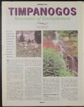
Show TIMPANOGOS Mountain of Enchantment fe Story By Christopher Smart Photos By Steve Lewis You can see her from Utah Valley, sleeping peacefully, her beautiful face turned to the sky. She is, the legend says, the Indian princess of Timpanogos. VW Yith her ward, head her pointing silhouette northis the ridgeline of the giant mountain that overlooks Utah Lake. She has been sleeping there since anyone can remember. The year the Founding Fathers declared that the original 13 colonies were the United States, a Catholic priest, remembered in 8th-grade Utah history books as Father Escalante, led an expedition of Spanish explorers northward into Utah Valley. They were the first Europeans in the area and named the indigenous people living around the lake, the Luguna Indians. But those native people called themselves the Timpanogotzis. And so Escalante and his band of explorers’ mamed the... lake, “Lago Timpanogo, and the giant mountain to its east, La Sierra Blanco de Los Timpanois — or White Mountain of the Timpanogos Indians. From almost any vantage point, Timpanogos is one of the most landscape. The Swiss-Mormon settlers of Heber Valley saw its graygranite eastern cliffs and cirques as the Alps of Utah — its sight, no doubt, relieving some of their homesickness. Snowbound since last November, the hiking trails of Timpanogos have just cleared of deep snow — yielding royal springtime bouquets of wildflowers in late August and early September. Timpanogos has finally awakened from her deep winter slumber. But the season will be a short one because her high elevations also will bring an early autumn, closely on the heels of spring. As for summer — well except for a few, brief days you can just about forget summer on Timpanogos. In the era since Brigham Young and his troop of Mormon settlers arrived to homestead Utah in 1847, Timpanogos has enjoyed a rich history among residents of Utah Valley. Similar, perhaps, to its place among the Indians, who were driven out of if the rich Utah Valley and into the dry not the most breathtaking. Its smaller but picturesque and rocky eastern face stands out in Heber Valley perhaps as much as its smoother western face dominates the Utah Valley by the settlers. Although it towers in the cold, western sky at 11,700 feet, climbing Timpanogos became an annual pil- breathtaking mountains in Utah, Uintah Basin, 100 miles to the east, grimage for Utah Valley residents. The annual “Timp Climb” continued until 1970, but was ended because it was, literally, too popular. Thousands — as many as 7,000 — people would participate in the one-day event, grinding down the mountain’s fragile vegetation and posing a public safety nightmare for the thousands of casual hikers strung along rocky cliffs and steep slopes, often covered with snow. winter June or host to hikers snows clear by the end of early July, Timpanogos plays hundreds and hundreds of each weekend. With easy access from American or from Sundance, Fork Canyon off Provo Canyon, the “urban forest” is in danger of over use. Although it was designated as a federal making “Wilderness Area” in 1984, its use more restrictive (no Urban forest in danger of motorized vehicles or mountain bikes), the U.S. Forest Service may be faced with implementing more over restrictions in the coming use Today, Timpanogos is still one of the most traveled mountains in Utah. During most summer seasons, when PAGE 10 years. About 24,000 people made day hikes on Timpanogos during 1994, Continued on page 11 |