| OCR Text |
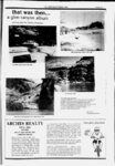
Show THE ZEPHYROCTOBER 1990 grasses cover the southern and eastern slopes. MONTICELLO, 88.4 m. (7,066 alt., 665 pop.), seat of San Juan County, is a cool green town on the east slope of the Abajo Mountains. It was named for Thomas Jeffersons home in Virginia, but the name is pronounced instead of as in the East. Temperatures here rarely reach 90 degrees the highest ever recorded was 98 the lowest, 21 below zero. Hof days are followed by cold nights, and the temperature may drop as much as 50 degrees after sunset. The growing season is short one year it was only 78 days. The community derives its livelihood principally from sheep and cattle. Topographers with the Hayden Survey found no white men here in 1874. and it is probable that a cattleman named Patrick ODonnell, who built a cabin here in 1879, was Monticellos first resident. Monticello was founded in 1887, when the Mormon Church called five families to settle the site. Among the first settlers was Parley Butt, still alive in 1939, when Ernie Pyle, Scripps-Howartraveling columnist, visited Monticello: Hes a character if Ive ever seen one. He was in the Mormon scouting party that first penetrated southeastern Utah. He was a member of the fated group that made Mormon history by their experiences at The Hole in the Rock. . . . Parley Butt was in Bluff in 78. He must be close to 80 now a lovable rascal. Ugly as a mud fence (aw, dont get nervous; he wont mind), with huge, queer gold teeth in his lower jaw. He doddles around with a fly swatter. . . . When I said good-b- y to him he said, Well, give my regards to all the people in the world. I kinda doubt if a guy like that will ever die. In 1892 Monticello was caught in the San Juan River gold rush (see Tour 10). Prospectors, disappointed with their luck, came north to the Abajo Mountains. Most of them found nothing. The following year two prospectors found placer gold in Johnson Creek, and soon gold ore was found at the head of the stream. News of the discoveries precipitated a rush. Three hundred claims were staked, but the deposit was soon exhausted and the boom collapsed. In 1894, a group of Coloradoans, under the leadership of David F. Day, Indian agent, influenced the U. S. House of Representatives to pass a bill awarding land in San Juan County to the southern Ute Indians in exchange for land in southern Colorado. A House committee was told that San Juan County was desolate desert, inhabited only by a small colony of Mormons and roving outlaws, and that it was unfit for anyone but Indians. After the House approved the bill, and without awaiting action by the Senate and President Cleveland, Day instructed the Indians to move into the county. Eight hundred came, bringing goats and ponies, taking over springs and water holes, and driving settlers cattle from water and forage. Residents of the county sent a protest to the Territorial governor, Caleb W. West, who referred the problem to Washington. No immediate action was taken, and the settlers circulated a letter notifying all men in the county to prepare to drive the Indians out. A copy of the letter fell Hold back into the hands of Day, who wired Governor West: d Armenians until I can get my squaws and papooses your out of your Day, with Governor West and country. officers of the Utah State Militia, met with the settlers and Indians at Monticello. The Indians refused to go. Our grandfathers owned and hunted buckskin here for many hundred years; Washington mon-ti-SELL- -o mon-ti-CHELL- -o 1 PAGE 29 Big Chief say all right for Indians to set down in San Juan. We Word was sent for soldiers to make ready to entrain from stay. Salt Lake City. C. L. Christensen, interpreter, pleaded with the Indians through the night. By morning most of the Indians had agreed to return. A Jew remained, and they and their descendants still live (1940) on the reservation south of the San Juan River (see Tour 10), in Allen Canyon (see Natural Bridges National Monument), and on Montezuma Creek. Between Monticello and the Colorado Line, US 160 makes the only crossing of SAGE PLAIN, 1,200 square miles of level country deeply gashed by a network of canyons. At 105.5 m. US 160 crosses the Colorado Line, 51 miles west of Cortez, Colorado east-we- st brush-cover- ed ds MOUNTAIN GOAT CTCLES IBIS CYCLES ... good-looki- ng OCTOBER 23-2- 8. 1 990 - Contributors: J3L tTbwe saw- - - FIBBlS BCOTT'JZA long-haire- God-forsak- en unoul biI.oimpnd.. once again ... WERE OPEN FOR BREAKFAST b no-1-1 (Monday-Saturday- ) main street broiler 606 so. main 259-590- 8 now espresso machine new booths now featuring: FULL FOUNTAIN SERVICE including old fashion shakes and malts italian sodas and creams monday-saturda- y Boy, Do HAVE MY x G6 TflCE y Of) |