| OCR Text |
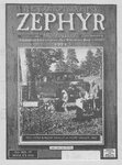
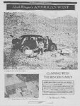
Show THE ZEPHYR/ nes SEPTEMBER 2003 After Kellogg departed, having left us maps of the project area, we had visions of our lands being enveloped in flames if we didn’t follow the government plan. He gave us no alternative and we definitely stood between a rock and a hard place. Having a burr under my saddle, I searched out further information. This has been a déja vu experience for me. Up on the adjacent Amasa’s Back a few years ago, the government chained out large blocks of land—tearing out all vestiges of trees and vegetation in order to grow new grass for cattle and deer. (Not much was said then of fire control.) A weird harmony as heard in hell, the huge dozers gouged out thousands of pinyon and juniper trees many that stood for over a century. Also gone were many shrubs, cactus and native grasses. Grass-root demonstrations and my horse shenanigans didn’t change the outcome. Now we face a similar fate. It seems ridiculous to me that operations would begin before essential studies have been completed. Granted, there is indeed a hazard from wild fire. Knowing this, Pack Creek residents took initial steps to reduce the hazard around their homes. Our plans were based on common doings —-plain and understandable. We disked out the dry cheat grass, cut out or trimmed some of the pinyon/juniper trees, and took other sensible, but conservative, safety measures. Much still remains to be done however. San Juan County provided Pack Creek with two small fire trucks capable of fighting small brush fires. Larger fires would require the aid of the Grand and San Juan County fire departments. Their plan would indeed affect our watershed and increase the possibility of further erosion. Deep gashes, gullies and gulches have already cut through the land. Stream banks have been altered and our bridges taken out. Many old-growth junipers and pinyons, some over a hundred years old, that cover the hillside, benches, and terraces would be cut down. This cutting and burning, making the slopes vulnerable to mud and rockslides would affect the vegetation on these slopes. In the riparian area, hundred-year-old Fremont Cottonwoods may be destroyed, as would much sagebrush and native grasses and bushes. In most areas, the soil has become stable and has become resistant to wind and storms. Huge mechanized tractors and machines would break up this soil and allow it to flood to the creek. The existing vegetation destroyed, the cheat grass weed would invade the disturbed areas, which in turn would invite wildfires. It would take many years for the land to recover. Though reseeding has been proposed, sprouting may not take hold because of the drought itself. ee Ken Sleight FIRE CONTROL AND DEFORESTATION AT PACK CREEK RANCH... This Zephyr column treats of Pack Creek Ranch and the areas surrounding it. I have a very personal interest in them. But I hope that other communities, which could also be affected, like ourselves, would take heed. Much of what I write may also be applicable to the pending burning of the forest front of the La Sal Mountains. Pack Creek Ranch lies in the most beautiful of lands~-a most beautiful peaceful land, on the southwestern flank of the LaSal Mountains. Forestlands surround the ranch stretching out on all sides. The 14 years that Jane and I have lived here have been glorious years---in a truly Godendowed area. It is a "cherished place," as Edward Abbey described it, when he lived here. Recently however, (July 5) Forest Service representative Danny Kellogg came to the community of Pack Creek and made a presentation to our homeowners group of the forest plan to reduce the threat of wildfires. Hundreds of communities were proposed eligible for the program as published in the January 4, 2001 Federal Register. Pack Creek needed "special attention” in this “urban wildland interface," even though it’s hardly urban. Entitled "Pack Creek Ranch Fuels Reduction Areas," it would include the "mechanical treatment” of 882 acres on Forest Service lands to the north and east and adjacent to Pack Creek Ranch and lands surrounding the Brownell property. To the south and on top of Amasa’s Back, a “prescribed burn" would encompass 880 acres. Its purpose is to reduce the number of trees and to chop down or burn the vegetation to ash in order to prevent major fires. Huge tractors would gouge the land and pulverize the trees. The only real dense stands of vegetation are along the riparian area of Pack Creek itself. The burning would reduce excessive undergrowth but leave the burned black trunks of larger trees. In some places there would not be one juniper tree left, not one pinyon, not one cactus, not one plant. Work would begin this September. When I asked Kellogg, "Could you send us each a copy of the EA?" (An EA is an environmental assessment.) He explained that no EA had been prepared because it was "categorically excluded." This means that the Forest Service itself could make most decisions without public input. Hardly justice. I told Kellogg of my concerns. A few years back, we had a tremendously large flash flood that lowered the streambed of Pack Creek another 4 to 6 feet in places and took the county bridge out. It threatened our water supply and water table. In my concern at that time, I called together officers of the State, the BLM and the Forest Service and showed them the evidence of the effects of the flood. In asking for aid in controlling the erosion problem, the Forest Service indicated that it would press for a hydrological study of the watershed and basin in the following budget year. This was never done and were still waiting for that study. When I asked Kelloggs, "Could you send me a copy of the EA?" (environmental assessment) he explained that no EA had been prepared because it was "categorically excluded." This means the Forest Service could make most decisions without public input. Hardly justice. Temporary roads would further gouge out the lands, even though the passage of vehicles over private lands has not been granted. Birds that inhabit the area would have less refuge space. Bluebirds often nest and flourish in what I call "Bluebird Wash." Wild turkeys frequent these lands, roosting in the tall Cottonwood trees along the creek. It’s all a winter sanctuary for the numerous mule deer and occasional elk. There are a number of cultural and ancient archeological sites that need protecting—on and off the ranch property. The Anasazi Bench, to the north of Pack Creek is especially important. Huge pieces of petrified wood stand in harms way. Dinosaur bone lay scattered over the surface. The operation is scheduled during our busy tourist season and would negatively affect our commercial operations. Our historic horseback trails that comb the forest area may be destroyed. It may result in substantial loss of economic value to the residents and to the land. The extremely pleasant "line of sight" from the ranch would be severely affected. In the short term, our quietness and air quality would certainly deteriorate. Z| aay LITTLE WEASEL ADS, INC. PRESENTS: MIDDLE EASTERN CUISINE... THE DESERT RAT COMMANDO #2 in a series of profound observations about the state of the world. This month's topic: anew e eS: yf © | \ FAUX ADOBE C IS THE ONLY WAY TO ENSURE A ® U Vy, iY atti, ly ) DELICIOUS MIDDLE EASTERN FLAVOR "Faux A'dough is for people who want fo feel good about themselves, who have no reason to." 1515 SOUTH 1500 EAST EADY! PAGES \ if } SALT LAKE CITY, UTAH OPEN 801.484.9259 MONDAY-SATURDAY. MAM TO 9PM | I, oe |