| OCR Text |
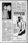
Show Eureka, Utah, Friday Dacamber 18, 1964 Continued fran proceeding p g. S. 545 W. 234.25 ft, S. 2 10 E. 145.59 ft S. 7938' W. 165J25 ft to NWly along R. of W. to pt which bears S. 304 ft. from Wly corner 85E of Lot 1, N. 720 W. 243.45 ft. 7953' W. 104.25 ft, N. 1027' W. 39.7 ft to beg. 32.71 John R. Sullivan care of Raymond Sullivan 29 interest in the following: Com. at pt N. 4527' EL 313.36 ft. from Wly comer of Lot 1, Blk. 1, Flat C, Eureka City Survey, N. th. N. 4527' E 511.29 5113 1 314.85 ft, S. ft, 6339 E. 216.45 ft, S. 830 EL 310.90 S. 29E. 338.95 ft, S. 5 ft, 43 W. 234.25 ft, S. 210' E. 145.59 ft, S. 7938' W. 165.25 th. NWly along R of W. ft, to pt which bears S. 85 E 304 ft from the Wly comer S. Plat D, Eureka City Survey, Less .032 acres M. or L for 32.26 State Road Ada H. Peay Com. at NWly comer of Lot 5, Blk 2, Plat D, Eureka City Survey, th. N. 7139' E 159.75 ft th. N. 71E 82.25 ft. to pt of beg., and being the NWly comer of the land herein described and N. 71 E. 50 ft., conveyed th. EL th. S. 2456' 100 ft., th. S. 71W. 50 ft, th. N. 2456 W. 100 ft to pt of beg. 32.26 Harry Randle care of Brooks and Lois Randle Baker at pt. on N. bdy line of Beg. Lot 5, Blk. 2, Plat D, Eureka City Survey, 292 ft Ely from NW. comer of same, th. N. 71 E 50 ft, S. 2456 E. 100 ft! W 50 ft- - N-- 2456 5v W. 100 ft. to beg. Full rights of survivorship 32.26 Martha Long That of 'part Lot 18, Blk. 1, Plat E, Eureka City Survey described as beg. at comer number 7, North Extension Zulu, Valley & Ridge Mining Claim, U. S. Lot 231, S1-- S 7440 w. 65.2 ft, th. S. 51 W. 3.2 ft to NW. corner of Sub. CL and place of beg. th. S. 51W. 38.3 ft, th 1, . ner number 10, North Eureka Reporter Exten- sion Zulu, Valley A Ridge Mining Claim, U. S. Lot 231, th. N. 526 W. 956.3 ft., th. S. 6349' W. 104.6 ft., th. S. 57 41' W. 91.5 to NW comer of land herein described, th. S. 3241' E. 139.5 ft, th. N. 57 16 E. 23.7 ft., th. N. 3256 W. 139.5 ft., th. S. 5741' W. 22.5 to beg. Otherwise known as Lot 16, blk. 3, plat ft ft cor and place of beg. Cont. 11 S., R. 20 W S.L.M. Cont. 120 Ac. 314.34 Intermountain Land & Dev. int Philip S. Knight and int. Richard Knight SW. 30.60 Co., Inc. NW. of East Road- Sec. 3, T. 12 8 R. 8 W., SLM., Jay G. Bennett way, Tract B. Beg. at a pt Cont. 40 Acres $4.78 toe SE comer of Electator Lot, Lots Glynn Colin Bennion common also to U. P. Railroad 1, 2, 3 and 4 of Sec. 3, T. 12 R. of W. on N. side af Tract S R. 8 W., SLM. Cont. 164.96 to. N. 2033 E. 66 ft, to. S. Acres 319.71 6508 E. 1432.4 ft, th. S. 63 Intermountain Land A Dev. 04 EL 620.3 to the fence Co Inc. All of Sec. 4, Twp. bearing Nly and Sly on the 12 S., R. 8 W S.L.M. Cont E. side of Knight Farm, th. S. 645.76 Ac. 371.97 2033 W. 49.5 ft. to UP. RailIntermountain Land & Dev road R. of W th. N. 6304 Co. Inc. E. of NW. ; W. 620.3 ft, th. N. 6508 W. NR U of SW. U and E. of 1432.4 along said R of W. Sec. 9, Twp. 12 S., R. 8 W to beg. Cont. 3.02 ac. This S.L,M. Cont 440 Ac. 326.28 Intermountain Land & Dev. property is situated in Sec. 21, All of Sec. 16, T. 12 int- Co. Inc. T. 10 S R. 3 W SLM. erest Philip S. Knight and 14 5., R. 8 W., SLM., Cont. 640 3.906 Ac. Total Ac. 6.311. ft Eureka, Utah, Friday December 18. 1964 in book 158 page 103 bears the rds. 13 Iks. N. of SE comer Recorders No. 86850 in the of- of NE of sec. 32, T. 12 S fice of toe Juab County Re- R. 1. E S.LM. to W. 13 rds., corders Office In Nephi, Utah 20 Iks., N. 20 rds W. 4 rds., 311.954.18 N. 20 rds. E. 17 rds. 20 Iks., S. 40 rds. to beg. Cont 3 144 BOOK B 160 Ac. 3H.02 JUAB SCHOOL DISTRICT William F. Pay and Fay C. Blaine N. Ingram Com. 20 Joint Tenants Beg. 1612 ft. N. of SE. comer of Pay, rds. 6 Iks. S. of the NW. corNW. of Sec. 17, T. 12 S., ner of toe NW. of Sec. R. 1 E., S.LM, to. W. 130 T. 12 S R. 1 E S.LM., 32, to. to. S. 802 ft to. W. 2510 E. 17 rds. 12 Iks S. 40 rds., ft, ft to W. line of said NW W. 17 rds. 12 Iks N. 40 rds. to. N. 888 ft, to. E. 160 to beg. Cont 4.37 acres 37.04 rds. to E. line of said NW. Blaine M. and Luienna N. to. S. 84 ft. to beg. Cont. 51..30 Ingram, Joint Tenants Ac. Less R. of W. covered by 62 rds. 12 Iks. W. and 7 Beg. rds. Railroad 3109.40 15 Iks. S. of toe NE comer of Raymond H. Ostler and Von-e- toe SW. of Sec. 32, T. 12 L Ostler, Joint Tenants S R. 1 E, S.LM., th. S. 20 Beg. at pt of intersection of rds. 12 Iks W. 40 rds. N. 20 W. line of R. of W. for U. S. rds. 12 Iks E. 40 rds. to beg. Highway No. 91, and S. line Cont 5 19160 Ac. 313.77 of Sec. 17, T. 12 S R. 1 E., Lamar Bowles and Shirley C. S.- L.M. which is E. 666.5 Bowles, Joint Tenants, care of M or L. from toe SW. cor. ft of Lloyd Kendall Beg. 50 rds. of sd. Sec. 17, th. NWly 10 Iks., N. and 14 rds. E. of SE. (Approx. N. 8W.) 328 ft toe SW. comer of toe NW. along sd. R. of W. line to a of Sec. 33, T. 12 S., R. 1 E pt. which is 325 ft N. of S S.L.M., to. E. 10 rds. S. 15 rds., line of sd. sec. 17, th. W. 508 W. 10 rds N. 15 rds. to beg. to. S. 325 to the S. line Cont. 150160 Ac. .... 3150.31 ft, of sd. sec. 17 ft, th. E. 540 ft to Lamar Bowles and Shirley C. beg. Cont 3.91 Ac. M. or L. Bowles, Joint Tenants care of ........ ........ ........ ........ 851.49 Lloyd Kendall 10 rds. Walter and Ruth P. Hansen N. of SW. comer Beg. of NW. Beg. 50 rds. 12 Iks. E. of of Sec. 33, T. 12 S., R. 1 E the SW. cor. of toe SE. of SLM., to. N. 40 rds. 10 Iks Sec. 20, T. 12 S., R. 1 E S. L. E. 14 rds., S. 15 rds E 10 M., to. N. 13 W.along toe E. rds. S. 25 rds. 10 Iks W. 22 side of toe Railroad R. of W rds. 14 Iks. to beg. Cont. 4 26 rds. th. E. 33 rds. M or L 127160 Ac. 37.96 to W. side of State Highway, Wendell Hansen N. SE. to. S. 8 E. 26 rds. M. or L to of Sec. 1, T. 13 S., R. 1 E, toe S. line of sd. sec. 20, to W. S.LM. Cont. 80 acres 39.79 30 rds. M. or L to place of Elmer Hill, Ruth A. Hill comer between 36.12 Beg. at. the beg. Cont. 5 Ac Blaine M. and Luienna J. secs. 3 and 4, T. 13 S R 1 Ingram, Joint Tenants Beg. E S.LM to. N. 18 rds. 23 Iks. 80 rds. S. and 93 rds. 10 Iks. E. 31 rds. S. 18 rds. 23 Iks E, Eureka City Survey 39.93 Fred Garbett and Lola L. Garbett Com. at comer number 1, North Extension Zulu, Valley & Ridge Mining Claim, U. S. Lot 231, th. N. 635 W ft 763.3 ft, th. N. 6432 E. 196 th. N. 475 W. ft, ft, to N. 4430 E. 40.537.5 to ft. SW corner of land herein described, th. N. 4430 E. 60 4 interest Richard Knight 30.60 Acres 440.67 G. E. Phil Clarence and ft., th. N. 4019 W The. E Hogan Margaret to. S. 4711' W. 31.6 ?t, ft of SW. E. and the SW. Rowe, Joint Tenants All of th S. 4741 W. 31 of SW. Sec. 28, T. 10 toe W. of Lot 1, N. 720 W. 243.45 of Sec. 29, T. 12 S., S S. 7953'' W. 104.25 ft., N. 4219 E 54 ft. to &g. thAlso S.- ,R . 3 W S.L.M. Cont 120 R. 19 W S.L.M. Cont. 320 ft, known as Lot 31, Blk. 3, Plat acres. County Road 100 ft. by Acres 1027 W. 39.7 ft to beg. 31.80 $33.23 care Phil E. and Margaret E. C. of Eureka City Survey ....39.02 3438 ft. over S. side of this Sullivan F. E, Mary 29 interGeorge W. and Pearl Forsey, tract and extends into Sec. 29 Rowe, Joint Tenants All of Raymond Sullivan est in the following: Com. at Joint Tenants 327.77 the SE. U of Sec. 30, T. 12 S From comer Clarence G. Hogan The R. 19 W., S.L.M. Cont. 160 4527 E. 313.36 ft. from number 4, Last Chance Min-pt N. corner SW. NE. of Blk. of and Lot of Ac. 1, all 1, S. U. Claim, 319.11 Lot 261, th. Wly toe N. 920' W. 513.6 SE. of 10 Sec. Plat C, Eureka City Survey, A. Alder T. 29, Com. 1280 to Edgar NE ft, th. N .4527' E. 511.29 ft, N. S. 537 W. 23.6 ft, to N comer of land herein describ 5., R 3 W. S.L.M. Cont. 200 ft. E. and 290 ft. N.. of S. 5113 E. 314.85 ft. S. 6339 88 50 E. 105 ft. M. or L et th. N. 815 W. 117 ft, th ac. .......... ........ .... .... .... 332.85 comer of Sec. 14, T. 13 S R. Eileen McKean care of 18 W., S.LM., th. S. 20 E. S. 830 E. 310.90 to E. side of Lot lfc, and S. S. 725 W. 51.8 ft, th s' E 216.45 ft, Bennion 29 S. 338.95 of Sub. 8110 Lots 2, 3, 240 ft., N. 77 E. 180 ft., S. 40 5 C S. 120 bdy. George N.' th. E N. 750' E ft 4 ft., th. ft-- , 43' W. 234.25 ft S. ft, SW. of Sec. ft S. 33 W. 90 ft S. 26 J th. S. 8850 W. 18 E. 52.15 ft .to beg. Other- 4 and SE. E. 210' 146.59 ft, S. 7938' W. 165.25 48.5 ft, th. E. 29 W. 44 ft. wise known as Lot 9, Blk. 1 7, T. 11 S R. 8 W., SLM. E. 100 ft N. 80 E. 90 ft, N. 317,92 17 W. 140 ft., N. 73 E. 50 ft., th. NWly along R. of W. to beg. Together with R. of Plat F, Eureka City Survey Cont. 151.78 acres to pt. which bears S. 85 E W. through Lot 18 Lenore Bennion care W. of ft., N. 17 W. 280 ft, N. 60 310.38 .... .... 378.95 Mrs. Leo Sparrow 304 ft from the Wly comer Bennion Neno SW. E. 120 ft N. 17 W. 100 ft SE. Schena George Com.at a pt That SE. 34 f Sec. 18, S. 60 W. 400 ft., M. or L. to , SW. of Lot 1, th. N. 720 W. 243.45 portion of North Extension which bears S. 3558 E and 34.18 ft., S. 7953' W. 104.25 ft., Ridge Lode Claim U. S. Lot dist 125 ft. from comer num- T. 11 8 R. 8 W SLM. Cont. beg. Cont. 2.4 Ac. N. 1027 W. 39.7 ft to beg. No. 231. Com. at a pt. which ber 2 of Last Chance Mining 80 Acres 39.56 George E. and Mary L. Lenore W. Bennion care of Prince, Joint Tenants care of 31.80 bears N. 5820' E and distant Claim, U. S. 261, th. N. 8416 NW. E. A. Alder William John Bate and Nor- 279.01 ft. from Cor. No. 3, W. 95.4 ft., N. 159W. 49 NE. The W. George Bennion of ft, S. N. , ma A. Bate toe SE. SE. sd. NE. Lot of Sec. 14, T. 13 S 8624' No. 231, th. S. 56 E. 101.6 ft, S 2 Beg. at a pt. NE., on Nly bdy. line of Lot 10, 39 W. 61 ft. identical with SE. 42 W 52.5 ft to pt'of beg. of Sec. 19, T. 11 S., R. 8 W R 18 W., S.LM. Cont. 80 Ac. Acres 319.11 Blk. 1, Plat C, Eureka City cor. said Lot 13, th. N. 623 otherwise known as ........ .... ..... ........ ....377.65 Lot 20 SLM. Cont.W.160Bennion care of Leonard cor. of Sec. W. 31 rds. to beg. Cont 3 107 Survey, being 14 ft. S. 7954 th. N. 6656 E approximately Blk. 1, Plat F, Eureka City George E. and Mary L. W. of toe E. W. M NW. Prince, Joint Tenants care of 29, T. 12 S R. 1 E., SLM, 160 Ac W. of NE. comer of Lot 10. 53 ft M or L th. S. 2227' Survey ... 325.26 George Bennion 318.05 S. 1143 E. 110.65 ft M. or E. 19 ft to beg. The E. of to. S. 60 rds. th. W. 51 rds Maggie B. Hannifin Otherwise James H. and Georgia Carter Com. M of Sec. 20, T. 11 S., R. 8 W. E. A. Alder Cont. 80 Acres.... 39.56 SW. of Sec. 14, Twp. 13 S 14 Iks., to a pt. 15 rds. 1 lk. J.T. Beg. at NW cor. of SW L to pt on S. bdy line of Lot known as part of Lot 25, Blk. at a pt from which comer SLM. Owen Bennion care of George R. 18 W S.LM. 10, S. 7841' W. 60.76 ft M. 1, Plat E, Eureka City Sur- number 4, Last Chance Mining Cont. 80 E. of toe W. line of the SE of sec. 3, T. 13 S., R. 1 E N. 4 SW. U, SEVt Acres or L th. N. 5W. 112.6 ft. to vey 318.52 of sd. Sec. 29, to. N. 41 rds., S.L.M., to. E 51 rds. 9 Iks., 30.90 Claim, U. S. Lot 261, bears S Bennion of Sec. 20, SE. a pt on Nly bdy line of Lot Frank Peart Alice Peart, ;j.50' E 277.7 ft, to. S. 24 swu, s. NW. quar- 5 Iks to a pt. 18 rds. 20 Iks. to. S. 19 rds to. S. 75 W. A. Alder Edgar 44-8 11 SLM. Cont. R. T. S., W., 10, N. 7954 E. 47.6 ft, M Joint Tenants Com. at a th. N. of ter SE. Sec. 30, S. of toe S. 16th line of sd. 39 rds. 12 Iks th. N. 18 rds. of 8819' ft, 323.89 T. 13 S., quarter or L to beg. 315.34 pt on the side line of North W. 80.5 ft, to. N. 12 W. 41.6 200 acres R. 19 W S.LM. sec. 29, to. W. 39 rds. 21 Iks., M. or L. to center of ditch, Susan Ann Vivan All Extension Zulu, Valley and ft to. S. 88 19 E. 69.5 Glynn S. Bennion care of Cont. 40 acres 34.78 th. N. 43 rds. 13 Iks., to a pt. to. S. 85 W. 6 rds. 3 Iks., to 34 NW. SW. Bennion that portion of Lot 1, Blk. 2, Ridge Mining Claim, U. S. Lot to beg. Otherwise known ft. George Phil E. Rowe and Margaret 24 rds. 20 Iks. W. and 24 rds. S. 8530 W. 6 rds. 5 Iks. M. as SW. W, SE. U SW. E. Rowe, Joint Tenants Plat C, Eureka City Survey, 231, S. 623 E. and 31.9 ft Itot 27, Blk. 1, Plat F, Eureka U, W. All 18 Iks. N. of the SE. cor. of or L to section line, to. N. 15 of Sec. 28, T. 11 S., R. 8 of Lot 4, of Sec. 12. T. 13 S., NE. known as Lot 4, Blk. K. of E distant from comer number 8 City Survey of toe SW. of sd. rds. 4 Iks. M. or L. to beg. 32.26 W S.L.M. Cont. 160 acres R. 20 W S.LM. Cont 44.20 sec. 29, to N. 8730 E. 91 Cont. 7.27 Ac. Park Sub. being 50 by 100 ft. of said Lot 231, th. N. 8232 B. Hannifin 333.66 Maggie Com. 319.11 35.41 E. 42.5 ft, th. N. 6956 E. at a pt which bears N. 79 Alvie L Thorvaldson care of .......... .... ........ .... 32.69 rds. 12 Iks. to a pt due N. of 35.65 ft, th. S. 204' E. 39.4 52' W, 208.2 Owen Bennion care of George Charles Kay, Mildred Kay Phil E. Rowe and Mararet the place of beg., th. S. 27 rds. Bemetha Bland Beg. 66 rds. ft. from comer N. NE. , SE. E. Rowe, Joint Tenants All 6 Iks. to beg. Cont. 40.19 Ac. W. and 264 ft N. of SE. cor. Beg. at a pt which bears S. ft, th. S. 6656' W. 90.1 ft, number 4, Last Chance Mining Bennion NEU of Sec. 29, T. 11 S of Lot 1, of Sec. 13, T. 13 S. M. or L 7925 W. 75 ft from SE. cor- th. N. 623' W. 54.9 ft to Claim, U. S. Not 261, th. S. 385.68 of NE of SW. of Sec. 8 R. W SLM. Cont. 120 acres. R. 20 W., S. L. M., Cont 44.20 ner of Lot 2, Blk. 2, Plat C, beg. Otherwise known as Lot Rulon H. and Tacy S. Brack- 3, T. 13 S R. 1 E S.LM, W. 76 ft th. N. 330 314.35 Ac. ........ .... ........ .... ........32.69 en, Joint Tenants care of Dwain to. N. 100 Eureka City Survey, th. S. 79 26, Blk. 1, Plat E Eureka City W, 13.4 ft to post number 7, to. W. 200 ft ft, Intermountain Land A Dev. Com. 25' W. 75 ft, th. N. 1105' W. Survey 63 11 Bracken rds. Iks 300 N. to. 36.77 Tallisman Mining Claim, U. S. th. Peterson E. E. 200 ft., to. H. ft., of NE. of Wesley The SW. 100 ft. th. N. 7925' E. 75 SE. H of Sec. 5, Twp. 12 W. from the NE comer of toe N. 425 ft M. or L to N. bank Adren Ray Underwood and Lot 104, th. N. 12 W. 72.6 Co. Inc. of SE. U of Sec. 5., R. 8 W., S.LM. Cont. 80 SE W. of Sec. 31, T. 12 S., of Salt Creek, th. Wly 108 ft., th. S. 1105' E. 100 ft to Vicky Diane Underwood, Joint ft, th. S. 8819 E. 80.5 ft, U. the 11 8 W. R. S.L.M. 1 T. describR. S., 33, This land also S4 is 78 S.L.M., to. S. 21 rds. ft along N. bank of sd. creek, Ac E., Tenants beg. That of Lot 28. to. S. 836 E 72 ft. to beg. Cont 120 Acres 342.11 10 ed as Lot 5, and Wly of Blk. 1, Plat E, part W. 34 rds., 10 ft., to. S. 40 ft. to S. bank of sd. th. ft., Otherwise known as Lot 28, City Blk. care of C. Bennion 17 22 rds. 10 ft., creek, to. SWly Ly 200 ft. M. W. th. Lot 6, Blk. G, E Park Sub. Survey described Eureka N. Glynn BOOK H as beg. at 1, Plat a F, Eureka City George Bennion S. of 43 to rds. E. th. 318.05 pt which bears N. 5820 E Survey ASSESSMENTS BY STATE beg. Cont. 5 or L along a line running to a 5 41 11 Sec. T. of NW. , 33, Ac. SWU 317.75 pt. which is E. 1023 ft. and N. Wilfred 32160 Farren 279 iUiTe TAX COMMISSION Joseph Beg. Frank Peart," N. 5723' E. 90.5 ft, th. Peart, 5., R. 8 W S.L.M. Cont. 240 BrackL Rulon at a pt on the W. bdy line ft from H. and 14 E 655 ft from toe SW. EurM. cor. no. 3, North Ex- Joint Tenants Christison Paul Tacy at a pt Acres less deed to Riverbed Iren care of at S. 650 E. 50.11 ft. from tension Zulu, Valley A Ridge on the E. side Com. Tenants Joint Dwain cor. of NW. of of SW. 2.75 Acres No. 38, eka, Survey line of Co. for well 328.67 23 11 NW. comer of Lot 8, Blk. 2 Mng Claim, U. S. Lot No Chance Mining Claim, U.Last Bracken Iks. Com. rds. sd. Sec. to interrigation the of 30.86 3, S. pt S. Plat C, Eureka City Survey, 231, th. N. 5723 E. 17.66 Lot 261, at N. 628' W. 57.50 Mona W. from toe NE comer of toe section of sd. line with a line Glynn Colin Bennon H. Eastmond Frank of SW. U and the SE. of sec. 31, T. 12 S., running N. from pt 255 ft. W. th. N. 7925' E 126.21 ft to ft., th. N. 3954' E. 16.2 ft., ft. from comer number 4 of of SE. Mining District Lucky Boy, R. 8 SLM 11 1 T. R. EL Sec. S., W., 78 34, S. 1052' S.L.M., to. S. 4 rds. of the place of beg., to. S. to th. E., th. Lot 5.0 Acres said No. 31.53 .... N. Lot 1602 37, 76.1 ft W. to th. pt on S. line of Lot 8, th. S. townsite 261, S. 8226 W. ft 328.67 240 5 Acres Cont th. W. 40 rds., th. N. 440 ft. M. or L. to a pt which Iks., Bar X Mining Company th. S. 7444' W 7.3 ft., to. N. 543 W. 61.64 pt Bennion McRae 4 5 Mrs. rds. th. E. 40 rds. is N. 100 ft and W. 255 ft. 8412' W. 130.8 ft to pt on 35 ft., th.line, Iks., Joye S. 1602 E. 91 ft! ft., to. N. 8232 E. 6.45 ft Spring Creek Mining District Lots 1 Bennion to 3, Geo. care of Cont. 8160 Ac. 34.59 from toe place of beg th. SW. comer of Lot 8, th. N. M. or L. to beg. beg. No. 13.93 Lot. Muldoon, 40, ... 316.24 th. S. 628 E 61.63 ft. t and NW. L. 6 S. Alan Ostler and and Margean SEly 120 ft. M. or L. to a pt. 5, 4, 1 Boston No. No. 650' W. 68.83 ft to beg. Less Donald J. Franks and and Acres; Lc Kenbeg. Otherwise known as T. Section of 1, SW. C. N. Tenants Joint a ft strip of land on the W. neth B. Franks, Joint Tenants 42, Ostler, Beg. 200 ft. W. of place of beg., to. 2, Evening Tempest Temple, Blk. 1, Plat F, Eureka Cit Cont. cor- E. 200 ft to beg. Cont. 2.09 9 W 24.42 SLM. 11 of N. SW. 8 rds. the side of said Lot 8, deeded to R 88.94 No. Acres 38, Com. at Comer number 2, Survey Survey $0. Ac. 0.03 Less Acres. ner SE. T. Ac. M. or L of toe 325.25 of Sec. 31, 32.45 Eureka 34.06 North Extension Zulu, Valley 326.58 ; aaaaa aaaaaaa aaaaaaaa Mrs. Leo Sparrow Pai deeded to Riverbed Irrigation 1 12 R. E N. th. S., & S.LM., CL A Co. OstAlan Giles and Last D. Chance Donna and Eclipse Mining Lode Minin Milling L J. Ridge Mining Claim, U. S. Margean Jerry 3627.96 care of Max 26.8 rds., E. 1430.5 ft. to cen- ler Joint Tenants R. Mangum Com. That Lot 231, th. S. 635' E. 602.4 Claim, U. S. Lot 261, Eurek Co. for well. Giles, Joint Tenants S. 4 Jessamine, Lot No. 3857, 10.55 ter of Udall Ditch, to. S. 347 NW. cor. of NE. C. Bennion of Sec. 6, part of Lot 10, Blk. 2, Plat ft to NW. comer of premises City Survey, Com. 26.12 f of George of U Acres W. SE. , SW. 33.17 E. following ditch to pt. due T. 13 S., R 1 E SLM to. E. C, Eureka City Survey, known herein described, th. S. 635' from SEly cor. No. 4 of si of beg. W. 101 rds. M. or 80 rds. S. 40 rds., W. 80 rds., Sec. 1, T. 11 S R. 9 W., as Lots 9 and 10, Blk. J, of E 9 ft., th. S. 4710 E. 86 lot ,th. S. 628 E 26.12 f of Benjamin F. Fuller care of E. Less 160 to S.Ac. Cont. L.M. L beg. Cont. 16.76 Ac. 361.20 N. 40 rds. to beg. Cont. 20 Walker Bank A Trust Co. Park Sub. 32.26 ft th. N. 4250' E 15 ft, th. to sd. SEly cor. No. 4 c EJohn Co. for Irr. L. and Margean C. Ost- Acres Riverbed Alan deed for interest in: Happy Jack, Underwood 361.20 E Beg. N. 4710' W. 92 ft., th. S. Lot 261, U. S. Mining Clain well 382.43 Tenats Joint ler, Beg. at a 2.944 30.48 No. Ac. Sur. Ost6423, Alan at a pt N. 8150 E 1.22 ft. 4010' W. 9 ft to beg. Other- to. S. 8258 W. 7.82 ft., tl C. and L Margean care of Eileen McKean Little May Mining Company pt. 845.2 ft. N. of toe SW. ler, Joint Tenants from SW. comer of Lot 12, wise known as Lot 1, Blk. 3, N. 558 W. 26.12 ft., th. J Com. at NE. cor. of toe SE. of sec. 31, toe NE. comer of NW. SE. Tintic Mining District Block 2, Plat G, Eureka City Plat E, Eureka City Survey 8226 E. approximately 7.6 f George Bennion of SE. Madaline, Madalin No. 1, 2, A T. 12 S R. 1 E, SLM, to. E. toe NE. , SB. SE. , N. 1 13 T. of Sec. Otherwise known a S., 31.80 to beg. 6, Survey, th. N. 38' W. 114.61 Sec. 12, T. 11 S., R. 9 3, Survey No. 6616, Located in 1430.5 ft to toe middle of toe R. 1 E., S.LM., to. E. 41 rds. M or L to N. line of said Donald J. Franks and Ken- part of Lot 43, Blk. 1, Plat 1 W., ofSLM, ft, Cont. 160 Acres NW. Udall Ditch, to. N. 3407 W. 18 Iks., S. 31 E 58 rds. 12 of Sec. 5, and NE. Lot 12, th. N. 8425' E. 50 neth B. Franks, Joint Tenants Eureka Survey 30.4 319.11 of Sec. 6, T. 11 S R. 2 W., 46.9 ft., to. E. 818 ft, th. N. Iks W. 149 rds 12 Iks., N. 12 ft., S. 38' E. 114.61 ft M or Com at comer number 2, Neno Schena and Shirley C care Jr. McKean L. Franklin 58.388 Acres; Little May, Lot 887 ft to. W. 1089 ft. to toe rds. E. 80 rds. N. 40 rds. to L. to S. line of said Lot 12, North Extension Zulu, Valley Schena, Joint Tenants Sui of George Bennion NE. No. 4052, 12.475 Acres 321.14 middle of Udall Ditch, to. S beg. Cont. 24 39160 Ac. Exth. S. 8150' W. 50 ft to beg. A Ridge Mining Claim, U. S. face rights only to the follow NE. R. S 11 T. Sec. 1749 E. 497.3 .ft, to. W. cept R. of W. for County road of 13, Orlando Munding care of 1291.3 316.24 Lot 231, th. S. 635 E. 602.4 ing parts of the Red Bird Lod acres 40 Cont SLM 9 ft to. S. 453.8 ft. to 1 rd. wide along W end of W., Edmond D. Moon North TinJerald Drussel and Gail L. ft, th. N. 4010' E. 9 ft to Mining Claim Lot No. 96, an 34.78 33.511 Ac. 3183.60 above Cont beg. tic Mining District Part of Drussel 3103.73 Cbm. at NW. cor- NW. comer of land herein de- the Talisman Lode Minin ; property care McKean F. L. Jr. William Franklin 5 Numbers National and Pay and Fay C. 3, 4, 6, Alan ner of Lot 15, Blk. 2, Plat C, scribed, th. S. 4910 E. 92 ft, Claim, Lot. No. 104, describe C. Ostand L Margean Lots 1, Survey No. 7128, described as Pay, Joint Tenants Bennion Beg. 106 ler, Joint Tenants Eureka City Survey, th. N. th. N. 4250' E. 18.7 ft., th. as follows: Beg. at toe SW of GeorgeNW. Beg. 52 NE. 20 SW. W. rds. 7 rds S. of the NW. comer 6 , and Iks. E. follows: Beg. at the NE. cor rds. of 8412 E. 49.92 ft, th. S. 17" N. 4739 W. 32.8 ft th. N. comer of the surface are 2, and and NW. ner of Buckeye Mining Claim Iks. S. from NE. comer of NE. toe NE. SW NE. 18 E. 35 ft, S. 8412' W. 49.92 4221' E. 8 33 T. of Sec. 6, th. N. 4739' aforesaid, from which pt. th of Sec. 31, T. 12 S R. 1 E S R 1 E S.LM., to. E. of Sec. 18, T. 11 S., whence toe Quarter Sec. CorSE. th. N. 17 35 W. 35 ft. M. W. 62.7 ft, ft, th. S. 4010 W. U. S. Mineral Monument No. ft, S.291.93 Cont. 9 W., SLM. ner between Sections 28 and 33, LM., th. E. 43 rds. 22 Iks 149 rds. 12 Iks SE 31 16 rds. or L to beg. 335.19 25.8 ft to beg. Otherwise in Tintlc Mining District bear R. 335.24 S. 20 rds., 14 Iks., W. 75 rds. S. 4 rds. 19 T. 9 S., R. 3 W., S.LM S. Jerald A. Drussel and Gail L known as Lot 2, Blk. 3, Plat S. 954W. 494.0 ft. distanl Acres Iks., W. 147 rds., W. 14 W. 20 rds. 4 Iks M. or WN. 3713 rds. Bennion N. C. 681.7 comer and W. 8955 ft George N. 14 rds. 12 Tenants Drussel, Joint Beg. Eureka Survey 33.16 to. S. 7545 E. 150.0 ft, tl of NE. L. to pt. 366.4 ft. S. of sec. Iks., to beg. Cont of NW. U numbers , N. No. 16 Ac. ExSurvey at NE. comer of Lot 16, Blk. E,Donald J.City 1415 E. 80.0 ft., N. 75 of Sec. 12, T. 11 S R. 9 W 7128, National No. 3, No. 4, line E. 590.5 ft, N. 28.48 ft. Franks and Ken- N. R of W. road for 2, Plat C, Eureka City Survey, neth B. cept county 45 W 150.0 W. S. 1415' ft., 5.- L.M. Cont. 160 Ac. ....319.11 No. 5 and No. 6 Lodes, Bears to beg. Cont. 11.24 Ac. 372.03 1 rd. wide Franks, Joint Tenants 80.0 ft. to W. end of th. S. 8412W. 120.67 ft, S. 1 along Lot Blk. 46, Com. beg. at a pt on W. side Plat William F. Pay and Fay C. above property Leo L. Lee and Meama Lee, S. 3017 W. 130.2 ft and th. 324.48 2411' E. 53.12 ft to pt, th. line of North 32.2! Joint Tenants F, Eureka Extension Zulu, Com. 22 Beg. 2.13 chs. S. 714 W. 1500.0 ft., to SE. Pay, Joint Tenants Alan L. and Margean C. OstN. 8412E 114.32 ft to pt Valley A 1 SE. 14 of 6 comer and rds. W. Iks. Iks. rd. 30 NE. E. of Claim, 600.0 S. N. Ridge W. 7916 Mining th. comer, Com. at th. N. 1736 W. 51.55 ft to U. S. Lot 231, 602.4 ler, Joint Tenants BOOK MF from 1, T. 11 ft to SW. comer th. N. 714 S. of the NE comer of Sec. the NE comer of the NW. Sec. of ft. SE. of 33.16 comer number 2 of said beg. SCHOOL DISTRICT 5., R. 17 W S. L. M th. S. E. 1500.0 ft. to NW. comer, th. 31, T. 12 S.. R. 1 E S.LM, Lot, TINTIC 6, T. 13 S R 1 E., Charles Jamison Maria Lot 1, Blk. 71E. 3.25 chs., S. 30 E. 21 S. 7916 E. 600.0 ft to NE. to. S. 19 rds. 12 Iks., W. 40 of Sec. th. at Beg. Berry th. N. 4010' E 35 ft to NW. S. 40 rds. 13 Iks., S.LM, NW comer of Lot 1, Blk. 3, comer of property herein de- A, Robinson Townsite, Mam- 13 rds., N. 71 W. 7.50 chs., comer to toe Ex- rds N. 19 rds. 12 Iks. E. 40 W. 9 ids. 10 Iks, to. meanderof beg. place moth 31.79 N. 30 W. 21 Plat C, Eureka City Survey, scribed, th. S. 4739' E. 62.7 City Survey rds. S. 71 clusive of its conflict with Lot rda to beg. Cont 487 Acres ing down Big Hollow 49 All of Lot E. 4.25 chs. to13 Neloa Stephens th. N. 7139' E. 50 ft, th. S. ft ,th. S. 4221' W. 8 ft., th. Cont. 4 No. 281-37.34 rds. 15 Iks., th. E 35NWly Lode Cloud Iron and beg. 10 rds. 1441'E. 100 ft, th. S. 7139 S. 4739 E 18.4 ft. th. N. 42 8, Blk. J, O.S.L Plat, Mam- Ac. Includes parcel in Sec. 6, expressly excluding however William F. Pay and Fay C. Iks. to beg. Cont. 5 85160 Ac. W. 50 ft, th. N. 1441' W. 21' E 26 ft., th. N. 4739 W. moth City Survey 36.57 T. 11 S R16W SLM. 3167.24 the portion of said Buckeye Pay, 10Joint Tenants 43 Beg. 97 Except R. of W. for Co. rd. 1 100 ft to beg. Lot 23, Bert C. Wheelock 34.89 4.5 ft, th. N. 4221 E. 12.8 500 Iks. N. and L. rds. W. rd. wide along E side of deLeah Claim within the Limits of Lot rds Beg. Layland Lot 1, ft, th. N. 4739' W. 23.5 ft, Blk. D, Mlddeltown, Mammoth ft N. of the SW. cor. of the No. 281A Iron Cloud Lode. of S. E. Cor. of toe N. E. Ruby H. Robinson 37.65 scribed property of Sub. of Lot 1, Blk. 1, Plat th. S. 4221W. 9 ft, th. N. City Survey 33.29 NE. of Sec. 1, Cont 20.60 Acres of the SE. 36.15 of Sec. 31, T. 12 S., R. 1 E, 14 T. Harmon Milton Beg. Lot 24, T. 11 S R. 17 W., S.L.M. th. Bert C. Wheelock 34.51 4729' W. 53.6 ft, th. S. 40 D, Eureka City Survey Showers Standard Mining Co. S.LM th. W. 20 rds. to. N. rds. 18 Iks. E. and 67 rds. 6 Normal Larrabee and Stella 10 W. 21.8 ft to beg. Other- Blk. D, Middletown, Mammoth E. 125 ft, th. S. 500 ft, th. care of Bartlett Wicks Tintic 41 rds. 15 Iks., to. E 19 rds., Iks. N. of the SW. cor. of the 33.58 Larrabee, Joint Tenants Cbm. wise known as Lot 3, Blk. 3, City Survey 1195 ft to the SE. cor. of Mining No You 22 Iks., to. S. 39 rds. 11 Iks., NE. District of sec. 8, T. 13 S., at SSL comer of the Franke Plat E, Eureka City Survey Mrs. Delora Foster care of E. , th Dont, Survey No. 3929, 0.19942 th. E. 20 rds. 3 Iks, to. S. 2 R. 1 of sd. SE. NE. the SLM., to N. 18 rds., E., Lot 39, N. 80 rds. to the NE. cor. of Acres; SV6 Silver Spar Lode, rds. 4 Iks., to. W. 20 rds. 3 10 Lot adjoining w. th 50 ft Ely 34.51 Roy M. McIntyre 35 rds. S. 18 rds. E. Iks., on line of Lot 12, Blk. 1, Flat Blk D, Middletown, Mammoth the NE. ii of toe sd. SE. , Lot. No. 102, 5.596 Acres; Sil- Iks to beg. Cont. 5 acres 37.65 10 Donald J. Franks and Ken35 W. Iks rds. to beg. Cont 31.79 th. W. 80 rds. to toe NW. cor. ver D, Eureka City Survey, th. N. neth B. Franks, Joint Tenants City Survey C. 4.025 acres. Undivided F. William and 5.70 No. Lot 47, Spar, Pay Fay int Lots 39 of the NE. to Rio Grande Railroad, paralAlbert McIntyre of the sd. SE. U, Acres; Shower,' No. 48, 3.30 Pay, Joint Tenants Com. at comer number 2, 20 Beg. 3101.59 lel with E. side line th. SW. North Extension Zulu, Valley and 40, Blk 3, Moss Add., Mam- th. S. 820 ft. to the place of Acres; Walker, Lot. No. 191, rds. 3 Iks. S. of toe NE. comer Lunt Beg. 14 rds. 31.79 beg. to NW comer, th. S. on Wly and Ridge Mining Claim, U. S. moth City Survey 38.57 Ac. M. or 5.60 Acres; Summit Joe Bow- of the NE. Cont. 12 18Morgan T. of Sec. 31, Iks. 67 and rds. 6 Iks. E SW. cor. of All line to pt. of beg. Conveying Lot. 231, th. S. 635' E 602.4 345.69 ers, Lot No. 229, 2.43 Acres; S R. 1 E., S. L. M., th. S. N. o fthe George CL Hedenborge the NE. the W. 50 ft of said Lot 12. ft and N. 4010 E. 119.5 ft. of Lot 17 and part of Lot 18, Leo "l. Lee and Meama Lee, Southerly Extension of Joe 39 rds. 11 Iks., W. 42 rds. 9 1 E, 13 T. of Sec. 8, S., Less 0.076 Ac. ML or L for to pt on S. side of Main St Blk. 24, Silver City Survey of toe Bowers, Lot No. 60, 1.486 Ac- Iks., N. 39 rds. 11 Iks., E. 42 SLM., to N. 18 rds. R NE. Tenants Joint 10 Iks. 35.97 SE. 312.18 being the NE. comer of land State Road Highway of Sec. 12, Til S., R. 17 res; None Such Lot. No. 190, rds. 9 Iks to beg. Cont. 10.44 E. 35 rds., S. 18 rds. 10 Iks., Elevator W S.L.M., Cont 40 Ac. 312.84 2.52 Acres. Non Such Amd., acres All of Lot herein described, th. S. 45 E. Ella Donnelly Jay G. Bennett 315.61 W. 85 rds. to beg. Cont 4.025 14, Blk. 1, Plat D, Eureka City 95.1 ft, th. S. 4221 W. 33.7 Lot. beg. at a pt. on toe SW Orlando Tanner care of Her- Lot No. 190, .74 Acres; Joe and William F. Fay C. ac. Undivided Pay int 3130.36 34.51 ft., th. N. 4739 W. 94 ft, Comer of Elevator Lot in Sec. bert Phelps of the Bowers, Lot No. 41, 3.90 Acres Pay, Joint Tenants SE. Survey at Beg. undivided Lunt, Morgan 3 10 R W S. T. S., LM SW. U of Sec. 28, T. 11 S., R. Jeanette W. McArthur Beg. th. N. 4010 E. 39.2 ft to said 20, ........ ........ ........ 39.50 a pt. 57 rds. 10 Iks. N. of the interest Beg. at a pt. 86 rds. 50 ft Wly from NE. comer NE. comer, and same being th. N. 2033 E. 100 ft from 17 W., S. L. M. Cont 40 Ac. comer Uranium of of NE. SE the Company 6 Topaz 14 rds. 12 Iks. Iks. N. and 34.78 care of Richard D. Moody of Lot 16, Blk. 1, Plat D, Eur- the NE. comer of the Keystone NW. comer of S. Roadway, sec. 31, T. 12 S R. 1 E, S. L. E. of the SW. cor. of the NE eka City Survey, th. S. 7336' Hotel Building, the place of Tract A. Also common pt. to Leon M. Frazier and Ruth Being upon mining rights on M.- , th. W. 63 rds., 6 Iks., th. N. of sec. 8, T. 13 S R. 1 E W. 38 ft to NW. comer, th. S. beg. Otherwise known as Lot R. of W. of U.P.R.R. on N. M. Frazier, Joint Tenants the Yellow Chief unpatented 40 rds to. E. 80 rds. th S. 40 SLM to W. 575 ft, th. S. of Sec. mining claim situated in the rds., th W. 17 rds. M or L 130 ft to E. 575 E SE. of the SE. parallel to E side line of Lot 6, Blk. 3, Plat E, Eureka City side of track, th. N. 2033349.7 N. ft,1.5 toacres th. 33 13 ft M. or L to pt, Survey 36.77 300 ft, th. S. 6654 E. be- to beg. unknown district includes 12, T. 11 S., R. 20 W S.L.M., mining 130 to Description, Cont beg. ft 34.78 ginning at toe S.W. comer No. th N. 83 E. 38 ft. M. or L. George W. Forsey, Pearl L ft, th. S. 2033 W. 306.2 ft Cont. 40 Ac. in Sec. 32, T. 12 S., R. 3217.26 ... to pt, th. N. 856' W. 40 ft. Forsey, Com. to U. P. R. R R. of.W to. Leon M. Frazier, Ruth M. 1 of said claim (which comer pared Joint Tenants 1 E, S. L M Cont 20 Ac. Undivided Harmon Milton T. M. or L. to beg. All of is located and described at that 38.12 at a which bears N. 217 N. 6654 W. 349.7 ft. along Frazier, Joint Tenants 367.32 at a pt. 86 interest N. S. Sanderson care of Lie- - E. andptdistant 1031.6 ft. from said R of W. to beg. Cont. the W. of point arrived at by beginning of the SE. Rulon H. Bracken and Tacy rds. 6 Iks. N. Beg. 14 rds. 12 and land Sanderson Com. at NE. comer number 1, North Ex- 2.405 Ac. South Roadway Tract Sec. 12, Til S., R. 20 W S. at the NW. Comer of Sec. 1, L Bracken, Joint Tenants Iks. cor. of the SW. the of comer of Lot 17, Blk. 1, Plat tension Zulu, Valley A Ridge A. Beg. at SE. corner of sec. L M., Cont. 80 Ac 39.56 T. 12 S., R. 12 W S.LM 78 Beg. 23 rds. 16 Iks. W. of the NE E of Sec. 8, T. 13 S R. D, Eureka City Survey, th. S. Mining Claim, U. S. Lot 231, 20, T. 10 S., R. 3 W S.. L. M Leon M. Frazier and Ruth 16 E. 1200 feet; thence North SE. comer of the NE of 1 SLM, to W. 575 ft of M. Frazier, Joint Tenants 422' EL 131.50 ft, th. S. 79 th. S. 4239 E. 83.7 ft th. S. th. Nly along E bdy line E. 2271 feet, and run- Sec. 31, T. 12 S., R. 1 E., S. th. E, 1144 S. 130 to E. 575 ft Rail54' W. 55 ft, th. Nly about 4711 W. 16 ft., th. N. 4239 Sec. 20, 3094.6 ft. to U. P. of the NE. All of the W. thence N. 1144 E. 2271 LM. to. W. 40 rds. N. 15 rds. to N. 130 ft, to Ac. ning ft ....... beg. 1.5 125 ft M. or L to N. bdy W. 83.7 ft, th. N. 4711' E. road R of W. S. side of track, of Sec. 13, T. 11 S R. 20 W.. ft. and running thence North 14 Iks., E. 40 rds., S. 15 rds. .26 3217 ...... line of said Lot, th. N. 7428 16 ft. to beg. Otherwise known to. N. 6654 W. 392.7 ft. along SLM. Cont 80 Ac 39.56 1144' E. 1500 ft., to. S. 78 10 Iks. to beg. Cont 3 142 care B. of Bertha Greenhalgh 318.50 as Lot 9, Blk. 3, Plat E, Eur- U. P. Railroad R. of W., to. S. Leon M. Frazier and Ruth 16 E. 600 ft, to. S. 1144 160 Ac. E, 40 ft. to beg. 30.00 at Leland Beg, Greenhalgh W. 49.5 ft th. S. 66 M. Frazier, Joint Tenants to. N. 7816 W. W. 1500 LaMar Bowles and Harry S. Ruppelius, Ike W. eka City Survey care of 34.51 2033 the SW. comer of the SW. of NE. and 600 ft to ft, Ray- 54 E. 343.2 ft, th. Sly 3045.1 All of the E. J. C. Sullivan, the point of beginn- C. Bowles, Joint TenantsShirley Kusisto, Lisa M. Vogley, Joint care of Sec. 8, T. 13 S., R. 1 E An of Lot 21, Blk. mond Sullivan Tenants Com. at cor ft, th. Ely 49.5 ft to sec. NE. of Sec. 13, T. ing. This claim is recorded of Lloyd Kendall of SE. Beg. 12 SLM th. N. 9 rds. E 34 & 8-- 7 -- 4-- 4-2-- al rds. 10 Iks S. 23 rds. 7 lie. rds. 10 Iks N. 14 rds. to beg. Description inparcel in Sec. 17, T. 13 W. 34 7 Iks. cludes S R. Ac. E 1 SLM Cont 5 313.77 Milton T. Harmon Beg. of SE of Sec. 9, T. 13 S., R 1 E.j SLM., th. N. 557 ft th. E 965 ,to S. to a pt 954 due E. of pt of beg. 557 M or L to W. 954 ft. to beg. Cont. 12.27 Ac. 30.92 Milton T. Hannon at the SW. cor. of the SE.Beg. of Sec. 9, T. 13 S., R. 1 E SLM to E. 970 ft, to N. 280 at SW. cor. of NW. ft ft ft th. ft, to ft, E. 7 ft, th. N. 1040 W. 977 ft th. S. 80 rds. to beg. Cont 29 acres 3248.78 Rulon N. Broadhead 24 rds. 18 Iks. E. and 16 Beg. rds' 9 Iks. S. of NW. cor. of SWs of Sec. 9, Twp. 13 S R L E., SLM, th. E 9 rds 19 Iks th. S. 24 rds. 6 Iks., th. W. 9 rds. 19 Iks., to N. 24 rds. 6 Iks. to beg. Cont 1.479 Ac. 3413.71 Rancho Trailers, Inc. 407.88 of E of NW. cor.Beg. SW. of Sec. 9, T. 13 S., ft R to E. 617.76 269.94 S. to to ft, W. 617.76 ft to N. ft, 369.94 to 3.828 SubE SLM, 1 th. Ac. ft beg. Cont ject to R. of W. over S. 20 ft of West 190 ft. of said prop3676.57 erty Nephi Chamber of Commerce Beg. 34 rds. 12 Iks. E and 16 rds. 9 Iks. S. of NW. cor. of SW. of Sec. 9, T. 13 S R. 1 E., SLM, to E. 27 rds., 17 Iks th. S. 55 rds. 16 Iks., to the irrigation ditch, th. SW ly following sd. ditch to a pt due S. of beg th. N. 82 rds. 16 Iks. to beg. Cont. 11.961 Ac. M or L. together with R of W. beg. 24 rds. 18 Iks. E. and 16 rds. 9 Iks. S. of NW. cor. of SW. of sd. sec. 9, to E. 190 ft. to N. 20 ft to W. 190 ft to S. 20 ft to beg. 318.36 Milton T. Harmon Beg. 1 rd. 8 Iks. W. of SE. cor. of NE. of SW. of sec. 9, T. 13 S.- , to R. 1 E., SLM W. 6 rds. 17 Iks., th. N. 80 rds., E. 6 rds., 17 Iks., th. S. to 80 rds. to beg. Cont. 3.34 acres. 3136.17 Milton T. Harmon Beg. at the SE. comer of the SW. of Sec. 9, T. 13 S., R 1 E, S.LM., th. W. 8 rds. N. 80 rds E. 8 rds S.' 80 rds. to beg. Cont. 4 Ac. 30.61 Milton T. Harmon Beg. cor. of Sec. 16, T. 13 at N. S R 1 E SLM, to N. 89 25 E. 660 ft. along sec. line to S. 975.9 89 25 E. 659 to S. 46 36 ft, S. 8857 W. to ft, 1059.9 ft M. or L, to a pt which is 1981 ft E and 1221.6 S. of NW. cor. of sd. sec. ft 16, to N. 1089.6 ft. to a pt 132 ft S. of Sec. line, th. N. W. 354 ft M or L to ft sec. line to N. 132 to beg. Cont 33.87 acres M or L 36.32 Franklin P. Greenhalgh Beg. 72 rds. W. and 23 rds. 23.5 Iks. S. of NE. cor. of NE. of Sec. 17, T. 13 S., R. 1 E S.LM to running W. 41 rds., to S. 7 rds 24.5 Iks., to E 41 rds. to N. 7 rds. 24.5 Iks. to beg. Cont 2.04 Ac. 340.95 State of Utah care of All of Vickers Barrett of of the SW. the SW. Sec. 4, T. 13 S., R. 2 E, S. LM Cont 40 Ac. Undivided Ar-lie- an int 316.52 State of Utah care of Com. Vickers Barrett Ar-lie- at the SE. comer of Sec. an 5, T. 13 S R. 2 E., S. L M to Iks N. 80 rds. D. 32 rds. 13 S. 27 W. 36 rds., N. 66W. 7 rds N. 25 W. 8 rds N. 52 W. 27 rds., S. 73 rds. 10 Iks., E. 80 rds. to beg. Cont 35 Ac. 37.96 Undivided int State of Utah care of The Vickers Barrett of Sec. 8, of the NE. N. T. 13 S R. 2 E., SLM. Cont Ar-lie- an 80 Ac. Undivided int 32.45 . State of Utah care of All of the V. Barrett of Sec. 9, of the NW. N. Ar-lie- an -- T 13 S., R 2 E SLM. Cont 80 Ac. Undivided int 33.98 A Why Not Give A Shcre In America This Christmas? Asks Mrs. America of 1964 Mm Dim J Irina ef Cabm-hU.&C- L, Mm America af 19C offers a choice of sues ef UJS. Saving Bond a Christmas gifts. Whatever she you choose,. she reminds you that when we give UJS. Savings Bonds as gifts at Chrirt-maor at anytime, we give car very best to our families and to. our country! s, |