| OCR Text |
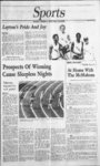
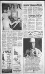
Show I WEEKLY REFLEX DAVIS NEWS JOURNAL, NORTH DAVIS LEADER, MAY 20, 1982 NOTICE OF that is S 89 degrees 5058E alg th sec In 485.551 ft fr the SW cor of Sec 32; T2N-R1SLM: sd pob being th SW cor of the Stuart Wine-ga- r ppty, th alg Wly In of sd ppty N 17 degrees 05W 173.174 ft & N 0 degrees 35W 64 ft to NW cor of sd Winegar ppty, th N 9 degrees 4733 466.645 ft to an angle pt in Sly In of Lot 15, Chelsea Cove No. 1, th alg bndy of sd sub S 76 degrees W 256.482 ft, th S 41 degrees W 79.248 ft & So 15 degrees 30W 243.366 ft thS 60 degrees E 73.037 ft to sd sec In, th S 89 degrees 5058 E 325.821 ft to the TRUSTEES SALE The following described property will be sold at public auction to the highest bidder on the 27th day of May, 1982, at 9:00 a.m., at the front entrance of the County Courthouse at Farmington, Utah, in the County of Davis, by KAY M. LEWIS, Trustee, and Transamerica Financial Services, as Beneficiary, under the Deed of Trust made by Ricky J. Adams, as Trustors, recorded October 8, 1980, as Entry No. 57643 in Book 843 at Page 189 of the official records of Davis County, Utah, given to secure an indebtedness in favor of said Beneficiary by reason of certain obligations secured thereby. Notice of Default was recorded January 12, 1982, as Entry No. 607301 in Book 890, Page 143 of said official records. Trustee will sell at public auction to the highest bidder in cash, payable in lawful money of the U nited States at the time of sale, without warranty as to title, possession or encumbrances, the following described property at 413 Morgan, Layton, Utah: A part of the Northeast Quarter of Section 28, Township 4 North, Range 1 West, Salt Lake Meridian, U.S. Survey: Beginning on the North line of a County Road at a point 3056 feet East, South 0 degrees 14 West 2153.9 feet and South 87 degrees 04 West 125 feet from the Northwest corner of said Section 28, running thence South 87 degrees 04 West 60 feet, thence North 2 degrees 56 West 180.8 feet; thence South 84 degrees 47 East 60.6 feet; thence South 2 degrees 56 East 172.3 feet to the point of beginning, for the purpose of paying obligations secured by said Deed of Trust including fees, charges and expenses of Trustee, advances, if any, under the terms of said Deed of Trust, interest thereon and the unpaid principal of the note secured by said Deed of Trust 31 with interest thereon as in said note and by law provided. ' DATED this 26th day of April, 1982. KAY M. LEWIS, Trustee . 320 South 300 East, Suite 1 Salt Lake City, Utah 84111 Published m the Davis County Clipper First publication May 5, 1982 Last publication May 19, 1982 Issue No. 16 Published in the Weekly Reflex First publication May 6, 1982 Last publication May 20, 1982 7 Issue No. 14 C-1- pob. Cont. 2.529 acres. Amount Due: jected Nly - of Barton beg; Cont. .558 acres. Amount Due $253.22 INEZ A GAST, Beg in Cent of St 11.8 chs S & 0.31 chs 50 degrees 30E of NW Cor Sec 5, T3N-R1SLM: S 37 degrees 15W 28 chs: S 40 degrees El 1.27 ft: N 37 degrees 15 E 1850.06 ft to cen sd st: N 50 degrees 30W 1 lft alg st to beg. Cont. .46 Acres. Amount Due $49.81 GARY D.& CAROL L NEL- SON, A 50 ft wide RW the West & No Lines Desc as foils: Beg N 606.59 ft &W, 87.46 ft & N 70 degrees 36E 454.17 ft fr the SW cor' of Sec 10; T3N-R- 1 W; SLM: th N 6 degrees 3514W 1514.12 ft: thN 79 degrees 44E 639.12 ft MOL to Wly In of cdunty rd. Cont. 2.44 Acres. Amount $415.63 Due 1 INEZ B OTTLEY, Beg 420.75 ft W & 49.5 ft N of SE cor of NW1 of SW Sec 7, T4N-R- 1 W, SLM, N 220 ft, W 1 32 ft, S 1 10 ft, E 66 ft, WHO ft, thE 66 ft to beg. Cont. .486 Acres. Amount Due: $1,363.52 BROOKHURST LTD, All of Lot 9, Brookhurst, Sec SLM. Cont. 29, T4N-R1.258 Acres. Amount Due: $720.67 BROOKHURST LTD, All of Lot 19, Brookhurst, Sec SLM. Cont. 29, T4N-R1.250 Acres. Amount Due: CF-21-- -9 -- - g,DQ SCHOMBURG, Beg at pt 128 ft S of NW cor of Lot 5, blk 15, Plat A, Kays TS,S 64 ft, E 256.35 ft, MOL. to E In of Lot 6, N 64 ft, W 256.35 ft to KA-102- beg. Cont. .376 Acre. Amount Due: . . $1 ,608.29 D CLAYTON FAIRBOURN, Lot 8 Ruby Acres Sub, Sec SLM, Cont. 36, T4N-R1.453 Acres. Amount Due: $3,715.76 RALPH R & SHERILYN F MARCHANT, Beg at apt 363 ft E of NW cor of Sec SLM: th S to 22, T4N-R2cen In of Old Bluff Rd: th NWly alg sd cen In to cem In of Co. Rd: th E to pob. Cont. .350 Acres. Amount $3,086.17 Due: RICHARD P & DIANE P NOTICE IS HEREBY GIVEN that on the 26th day May, 1982, at 10: oClock A.M. at the front door of the County Courthouse in Farmington, Utah, I will offer for sale at public auction and sell to die highest bidder for cash, pursuant to the provisions of Utah Code Section Annotated, 1953, as amended, the following described real estate situated in said County and not held by it under preliminary tax sale. No bid for less than the total amount of A 4, FRONGNER, SY78-11- 6 All of Lot 116, Marilyn Acres No. 4, SLM. Sec 10, T4N-R2Cont. .195 Acres. Amount $1,916.35 Due: MERLIN EDGAR & taxes, interest, penalty and costs, which are charged upon such real estate, will be accepted. Delinquent taxes GERALDINE DAINES, from 1977 tax sale books: Nly RW In of St Rd at pt N 89 degrees 42W 2209.59 ft algS sec In &N0 degrees 08E 133.94 ft para with E sec In fr SE cor sec SLM: th N 3 27;T5N-R1degrees 19W 212.12 ft to SE cor ppty conv in th N 0 degrees 3240 E 185.63 ft to apt on Sin of Canyon Drive Sub; No. 2; th S 89 degrees 4140E 12.38 ft alg sd S In th S 0 degrees 08W 403.95 ft to POB, Cont. .09 Acres. $36.97 Amount Due: IN WITNESS WHEREOF, I have hereunto set my hand and official seal this 23rd day of April, 1982. Beg on LEON PETERSON, All of Lot 17, North Point Cove Sub. Plat A, Sec 6; T1N-R1- SLM: Cont. .248 . $1,171.76 402-22- LEON PETERSON, All of Lot 18, North Point Cove Sub. Plat A, Sec 6; T1N-R1- SLM: Cont. .248 Acres. Amount Due: $1,171.76 All of Lot 28, North Point Cove Sub. Plat B, Sec 6; In Manor No. 3 Sub; th S 88 degrees 14W 706.89 ft alg sd Nly In to a pt S 45.43 ft fr the POB. Th N 45.43 ft to NOTICE OF FINAL TAX SALE LEON PETERSON, $2,092.32 BARTON BROS INVCORP, FH8-- 1 Beg at NW cor of SE'i of NWVi of Sec 1;T3N-R1SLM: th E 700 ft, th S 15 degrees 30E 24.53 ft mol to pro- R-5- Acres. Amount Due: . . . T1N-R1- SLM: Cont. .28 Acres. Amount Due; $1,199.93 RAY F. AND LAREE H. CROSHAW, Beg at apt 1410.38 ft E & 88.78 ft N fr SW cor of NW'd of Sec 18, T2N-R1SLM: th N 89 degrees 14 E 91.31 ft; th E 180 ft mol, to the W In of a st: th N 20 ft moi, alg sd st: th S 89 degrees 14 W 271.3 ft, mo! to apt due N of the pob: th S 20 ft, mol, to the pob. Cont. .125 acres. Amount due: $57. ROBERT CHARLES LESSER & CO., Beg at apt 4; LUDEEN G. GIBBONS Davis County Auditor Published in the Davis County 1982 First publication April 28, 1982 19, Last publication May Issue No. 15 C-1- Published in the Weekly Reflex First publication April 29, 1982 Last publicatoitt May 20, 1982 ...R-5Issue No. 13 felrJ s I I Ksl 399 South State, Clearfield |