| OCR Text |
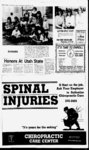
Show I I WEEKLY NEWS JOURNAL, NORTH DAVIS LEADER. MAY 27, 1981 REFLEX-DA- VIS of the petition for the transfer containing the description of lands to which such water has heretofore been allotted and the lands to which it is proposed the said w ater be transferred and the terms and conditions of which the transfer is petitioned for is on file in the office of the Weber Basin Wa- ing or abutting on or adjacent to the streets or alleys to be NOTICE OF INTENTION improved or especially degrees 5030 NOTICE OF INTENTION TO CONSTRUCT CONCRETE SIDEWALKS, AND TO CREATE SPECIAL IM- PROVEMENT DISTRICT NO 15 IN THE CITY OF LAYTON, DAVIS COUNTY. UTAH. PUBLIC NOTICE IS HEREBY GIVEN that on the 16th day of April, 1981, the Mayor and City Council of the City of Layton, Davis County, State of Utah, passed and adopted a resolution declaring the intention of creating in such city, a special improvement district to be known as Special Improvement District No. 15 (Sidewalk). NOTICE IS HEREBY GIVEN by the City Council of the City of Layton of its intention to make the hereinafter described improvements within said special improvement district and of the further intention of said Council to levy special taxes as provided in Title 10, Chapter 16, Utah Code Annotated. 1953, on the real estate lying within said district for the benefit of which such taxes are to be expended in the making of such improvements. The improvements proposed to be made are: To construct concrete sidewalks, and do all other miscellaneous work necessary to complete the improvements in a proper and workmanlike manner on the east side of the following Street: 425 EAST STREET (FORT LANE), running south from ELM STREET which is loin the following de- scribed area of the city; A part of the NE 'A of Sec. 28, T.4N., R.IW., SLB & M, U.S. Survey. Beginning at the intersection of the centerlines of Fort Lane and Elm Street, said point lying East 452 feet and South 960 feet, more or less, from the North Quarter corner of Section 28 and running thence N. 64 degrees 41E., along centerline of Elm Street, 33 1.9 feet, to a point 300 feet East of centerline of Fort Lane; thence South, parallel to Fort Lane, 576.6 feet, to the projected south line of parcel No. Lay thence N. 89 degrees 46W., along said line, 300 feet, to the centerline of Fort Lane; thence North, along said centerline, 433.5 feet, to the point of beginning. NOTICE IS ALSO GIVEN that said improvements shall be completed in a proper and workmanlike manner according to plans, profiles and specifications qn file in the office of the Layton City Recorder and in the office of the City Engineers, Templeton, Linke, and Associates, 40 West 2950 South, Salt Lake City, Utah. Estimated Cost. The total estimated cost of all the improvements is $7,000.00 to be paid by a special assessment or tax to be levied against the property fionting or abutting upon or adjacent to the streets or alleys to be improved, according to the benefits to be derived by such property. The estimated cost per front foot abutting property is $19. 10 for the sidewalk constructed. The abutter's portion of the cost and expense of said improvements shall be paid by a special tax or assessment to be levied against the abutting property to a depth of 300 feet from street centerline, or if the property is of a lesser depth to the entire depth thereof insofar as said property lies within the boundaries of the district. Said assessment is to be levied according to the linear front footage abutting upon all property, lots, pieces or parcels of land, which are benefited or 28-1- . Aa, affected by said improvements. The special taxes or assessments may be paid by the abutting property ow ners in the full amount thereof without interest within 15 days after the levy of the tax or if not so paid within such period, then the same shall be payable in ten equal annual installments with interest on the unpaid balance at a rate to be determined by the City Council but not to exceed lOpercent per annum until paid. A plat of the proposed district and drawing of the improvements to be made are on file in the office of the Ci Recorder and all persons interested are hereby referred to the City for further information in regard to said improvements and said special improvement district. Protests. Any objections to the proposed improvements or to the creation of the said Special Improvement District shall be in writing signed by the ow ner or owners of the property front affected or benefited by such improvements, shall describe or otherwise identify the property owned, and shall be filed with the City Recorder of Lay ton City, Utah on or before 5 00 P.M., Wednesday, 3 June 1981. On Thursday, 4 June 1981, at 8.00 P.M , in the Layton City offices, the City Council will conduct a public heanng at, which it will consider any protests or objections so filed to said proposed improvements or the creation of said special improvement district. THIS NOTICE IS GIVEN by order of the City Council of Layton City, Davis County, Utah this 16th day of April 1981. I EUS G. SHIELDS Mayor Attest: Randall J. Heaps Recorder Published in the Davis News Journal First publication May 6, 1981 Last publication May 27, 1981 Issue No. 14 Layton, Utah, for public inspection. The name of the petitioners and the amount of wafor which the ter, m transfer applies is as follows: 2.0 acre-feNorma A. Ward acre-fee- t, The Board of Directors of the District will meet in public session at the office of the District at 9.30 a.m., Friday, May 29. 1981, to consider said petition and any and all objections that may be presented m writing by any person showing cause why said petition for transfer should not be granted. All persons interested may appear at such hearing and show cause in writing why said petition, or any thereof, should not be granted. Failure of any person to show cause in writing as aforesaid, shall be deemed an assent on his part to the granting of said petition. The Board will at such meeting, or at a subsequent meeting adjourned therefrom, accept or reject the petition. KEITH G. JENSEN, Secretary Weber Basin Water Conservancy District 6 NOTICE OF TRUSTEES SALE Published in the Davis News Journal First publication May 13, 1981 Last publication May 27, 1981 ..R-10Issue No. 15 0 The following described property situated in Davis County, State of Utah will be sold at public auction to the highest bidder on the front steps of the Davis County Courthouse, Farmington, Utah, on Wednesday, June 10, 1981, at the hour of 12.00 Noon, by W. CLARK BURT, the Successor Trustee under the Deed of Trust executed by DELL J. LARKIN and DOROTHY G. LARKIN, as Trustors, and THE LOCK- HART CO., as Beneficiary, recorded on the 3rd day of December, 1979, in Book 804, Page 156, of the official records in the office of the County Recorder of Davis County, State of Utah, as Entry No. 552094: The following described tract of land in Davis County, State of Utah: PARCEL I: Beginning at a point 43 feet South from the Northwest corner of the Northeast quarter of the Northwest quarter of Section 1, Township 3 West, North, Range 1 thence South 429.70 feet; thence South 04 degrees 55'04" East 5 .376 feet, thence North 75 degrees 40' East 227.521 feet; thence North 482 feet; thence South 75 degrees 40 West 232 feet to the place of beginning. PARCEL II: Beginning on the West line of a Highway at a point 96.5 feet West of the North quarter corner of Section , Township 3 W'est, North, Range Salt Lake Meridian, and running thence South 81 degrees 49 0 West 1 1 1 244.87 feet; thence South 19 degrees 30 East 261 83 feet; thence North 85 degrees 0345 East 187.86 feet to the West line of said Highway; thence North 6 degrees 55 West 267.54 feet along said Highway to the point of beginning. Subject to 50 feet wide along and parallel to the North line of said property. Notice of Default was recorded December 3, 1979, in Book 855, Page 543 of said official records. Purchase price payable in lawful money of the United States of America. Said sale will be made without covenant or warranty, express or implied, regarding title, possession or encumbrances. and will be for the purpose of paying obligations secured by said Trust Deed and expenses of sale as provided for by law. right-of-wa- y DATED this 8th day of May, 1981. NOTICE TO BIRT, Successor Trustee Published m the Davis News Journal First publication May 13, 1981 Last publication May 27, 1981 Issue No. 15 NOTICE OF FILING OF TRANSFER OF CLASS D ALLOTMENT BY WEBER BASIN 5 ATER CONSERVANCY DISTRICT All persons interested will please take notice that there has been filed with the Board of Directors of the Weber Basin Water Conservancy District, a petition applying for the transfer of an allotment of Weber Basin water from lands in Section 36, Township 4 North, Range West, Salt 1 Lake Base and Meridian, Davis County, Utah. A Copy Clinton City, Davis East County, Utah: 10.0 feet from the Southwest comer of said Section 21, which point is also South 58 degrees 50 30 West 5.0 feet and North 31 degrees 0930 West 2.0 feet from the Northwest comer of a motel building, and running thence South 31 degrees 0930" East 31.43 feet; thence South 60 degrees 16 40 West 119.8 feet, more or less, to the East line of Main Street; thence North 32 degrees 19 West 10.0 feet along said street line; thence North 60 degrees 16 40 East 1 10.0 feet, more or Jess, along a line 0.5 of a foot Southerly from the Southerly line of a building; thence North 31 Beginning at the South quarter comer of said section 29, running thence South 89 degrees 5811 East 664.65 feet along the Section lme to the East line of the West Half of the Southeast Quarter of said Section 29, thence along said East line North 0 degrees 0004 East 2645.5 feet to the Quarter Section line; thence North 89 degrees 58 44" W'est 664.79 feet along the Quarter Section line; to the monument at the center of said Section 29; thence South 0 degrees 0007 East 2645.39 feet to the point of beginning. Contains 40.37 acres. Ex- cepting the Highway right of way on the West degrees 0930 21.4 feet; thence North 58 degrees 50 30" East 10.0 feet to the point of North 50.0 feet thereof, and the street on the South 33.0 feet thereof. ALSO: A part of the beginning. TOGETHER WITH Southwest quarter of A RIGHT OF WAY for ingress and egress on a strip of land 20.0 feet wide running from the South line of said property, Southerly across the adjoining land and continuing Southerly on tne existing right of way to Gentile Street, for the purpose of paying obligations secured by said Deed of Trust including fees, charges and expenses of Trustee, advances, if any, under the terms of said Deed, interest thereon and the unpaid principal of the Note secured by said Deed of Trust with interest thereon as in said Note and by law. provided Dated: May 5, 1981 WATER USERS SECURITY TITLE Donald H. Fraser, 389 S. East Oaks Dr., Fruit Heights, UT has filed with the State En-nee r A ppl . 56118(31 468 3 ) to appropriate 0.015 sec. ft. of water m Davis County. The water is to be diverted from a 0 ft. deep, at well, a point S. 250 ft. E. 50 ft. from W4 Cor. Sec. 10, T3N, R1W, SLB&M (2 mi S. of Kaysville); and used from Jan. to Dec. 31 for the domestic purposes of family in NWiSW'i Sec. 10, T3N, R1W, SLB&M. Protests resisting the granting of this application with reasons therefore must be filed in duplicate with the State Engineer, 231 E. 400 S..SLC.UT 84111, on or before June 27, COMPANY Trustee By Gordon Gurr Its Owner and -- 100-50- 1 Sole Proprietor Published in The Weekly Re- flex First publication May 13, Last publication May 27, Issue No. 15 1981 1981 1 1981. DEE C. HANSEN, P.E. State Engineer Published in The Weekly Re- flex First publication May 13, Last publication May 27, Issue No. 15 1981 1981 NOTICE OF TRUSTEES SALE The following described property will be sold at public auction to the highest bidder on the 9th day of June, 1981 at 11:00 A.M. at 11:00 A.M. at the North front door of the Davis County Court House at Farmington, Utah in the County of Davis, by SECURITY TITLE COMPANY, as Trustee under the Deed of Trust made by Danny Clair Bnden-stin- e & B & E Investment Co., a partnership, as Trustors, and recorded July 26, 1979 as Entry No. 539267 in Book 781 at pages 997 of the Official Records of Davis County, Utah, given to secure an indebtedness in favor of David M. Faer-be- r and Fred R. Faerber, (now owned and held by Fred R. Faerber and Gloria R. Faerber, his wife, jointly and to the survivor, by reason of the breach of certain obligations secured thereby. Notice of Default was recorded January 30, 1981 as Entry No. 584980 in Book 856 at page 30 of said Official Records. Trustee will sell at public auction to the highest bidder for cash, payable in lawful money of the United States at the time of sale, without warranty as to title, possession br encumbrances, the following described property in the City of Layton, County of Davis, State of Utah: 'Beginning at a point North 255.18 feet and East 794.77 feet from the Southwest corner of Section 21, Township 4 West, Salt Lake Meridian, said point being also South 58 degrees 5030 West 15 feet and North 31 degrees 0930 West 2.0 feet from the Northwest North, Range W. CLARK S. Survey, located in 794.77 feet and North 58 ter Conservancy District, cated V i ) 1 corner of the motel building, and running thence North 58 degrees 5030" East 225.95 feet along a line parallel to the Northerly line of said motel building to the W'esterly line of a Highway; thence South 42 degrees 32 10 East 55.08 feet along the Westerly line of said Highway; thence South 58 degrees 5030" West 236.82 feet; thence North 31 degrees 0930 West 54.0 feet to the point of beginning. TOGETHER WITH AND SUBJECT TO a right of way over: Beginning at a point North 255.18 feet and East NOTICE OF TRUSTEES SALE The following-describeproperty will be sold at public auction to the highest bidder, payable in lawful money of the United States at the time of sale, at the North door of the Davis County Courthouse in Farmington, Davis County, Utah, on June 15, 1981, at 12:00 noon of said day, for the purpose of foreclosing a trust deed executed by Stanley E. Thompsen, dba S. E. Thompson Company, as trustor, in favor of MountainWest Savings and Loan, covering real property located at 741 East 425 South, Layton, Utah, and more particularly described as follows: All of Lot 2. WHITE-SIDEESTATES, a subdivision of part of Section 28, Township 4 North, Range West, Section 29, Township 5 North, Range 2 W'est, Salt Lake Base and Meridian, U.S. Survey, located in West Point City, Davis County, Uah: Beginning at a point which is North 0 degrees 0707 West 250.00 feet from the South Quarter cor of sd Sec. 29, running thence North 89 degrees 58 W'est 600.00 feet; thence North 0 degrees 0007" 1 Salt Lake Meridian, according to the official plat thereof. DATED May II. 1981. MOUNTAINWEST SAVINGS AND LOAN Trustee By Thatcher, Glasmann & Davis 1000 First Security Bank Bldg., Ogden. Ut 84401 Attorneys for Trustee and Beneficiary Published in The Weekly Re- flex First publication May 20, 1981 Last publication June 3, 1981 Issue No. 16 NOTICE OF HEARING I PON THE REALLOCATION OF ALLOTMENTS OF W ATER AND OF ITS ACCOMPANING IFS TAY I BY WEBER BASIN WATER CONSERV ANCY DISTRICT To all owners and lienholders interested in any portion of lands in Sections 4,8,9,11, 14, 23, 24, 25,27, & 36, Township 4 North, Range 1 West, Salt Lake Base and Meridian (North Davis area), and Sections 23, 24, 25 & 26. Tow nship 3 North, Range West, Salt Lake Base & Meridian (W'est 1 degrees 43 W 372.3 ft fr NW cor of SW 'A of Sec 1; T3N-R1SLM: &ThS 35 degrees 43 W 327.5 ft; TH N 54 degrees 17 W 570 ft; TH N 48 degrees 20 E 337.5 ft. S 54 degrees 17 E 502 ft to POB. Contains 3.675 Acres. All persons present will be given an opportunity to be heard concerning the proposed rezoning actions, either for or against the propositions. W'ntten comments are also requested and will be considered by the City Council. NOTICE Kaysville City Corporation is now accepting applications for the position of Justice of the Peace. Duties include the handling of cases involving' incivil and criminal action, cluding summons, warrants, appeals, hearings and trials. Justice must be willing to keep all court related records. Apunplications will be accepted til June 15, 1981. DEAN STEEL City Recorder BELVA M. PROVOST City Recorder Published in The W'eekly Re- flex Published in The Weekly flex on May 27, 1981 Issue No. 17 R-- Rel 18 Farmington area). The Board of Directors of W'eber Basin Water Conservancy District has heretofore made, entered and recorded its orders alloting amounts of Class D water in DAVIS County, Utah upon petitions which include but are not limited to the original petitions hereinafter described. Since the entry of orders making the allotments of water, the tracts of land to which the allotments were made have been divided or d into small tracts, and the ownership of some or all thereof have changed, and it is in the best interest of the District that First publication May 27, 1981 Last publication May 3, 1981 Issue No. 17 each of the allotments of water hereinabove specified be reallocated to the several tracts into which each larger tract has been divided or subdivided substantially proportionately to the area size of each smaller tract to the larger tract. The names of the original petitioners, the amount of water allotted under the original petitions, the names of the owners as of January 1, 1981, of the smaller tracts into which the larger tracts have been divided, and the amount of water reallocated to each smaller tract is as follows: 1 West 1 425.00 Reallocations (North) feet; thence South 89 degrees 58 11 East 600 00 feet to the Quarter Section line; thence South 0 degrees 00 0 7 East 1425.00 feet to the point of beginning. Contains 19.63 acres. for the purpose of paying obligations secured by said Deed of Trust including fees, charges and expenses of Trustee, advances, if any, under the terms of said Deed .interest thereon and the unpaid principal of the Note secured by said Deed of Trust with interest thereon as in said Note and by law provided. Dated: May 14. 1981 SECURITY TITLE COMPANY, Trustee d S degrees 45 curve to left) 684 ft, MOL; N 48 degrees 21 E 179.3 ft; Th S 54 degrees 17 E 570 ft to POB. Contains 7.35 AC Metes and Bounds description of Property belonging to James S. Harvey: Beg E 1501.7 ft &S48 degrees 20W 1204.3 ft & S 33 degrees 17E 755 ft fr NW cor SW A Sec 1 T3N-R1SLM: N 33 degrees 17 W to Ely side of State Hwy; th Sly 389 ft alg Ely side of Hwy along arc of a 7554.5 ft rad curve, tangent bears S 12 degrees 13 W; th S 78 degrees 54 E 52.5 ft; th alg W ln of old Hwy to pt of beg. Contains .345 Acre. Metes and Bound description of property belonging to Palmers: Beg E 2015 ft &S 27 degrees 34 W 218.2 ft; S 35 By Gordon Gurr Its Owner and Sole Proprietor Published in The W'eekly Re- flex First publication May 20, 1978 Last publication June 3, 1981 Issue No. 16 R14 -l NOTICE OF TRUSTEES SALE The following-describeproperty will be sold at public auction to the highest bidder, payable in lawful money of the United States at the time of sale, at the North door of the Davis County Courthouse in Farmington, Davis County, Utah.onJune 15,1981, at 11.55 a.m., of said day, for the purpose of foreclosing a trust deed executed by Stanley E. Thompsen, dba S. E. Thompsen Company, as trustor, in favor of MountainWest Savings and Loan, covering real property located at Lot 31 Whitesides Estates. Layton, Utah, and more particularly described as follows: d All of Lot 31, WHITESIDES ESTATES, a subdivi- sion of part of Section 28, Township 4 North. Range W'est, Salt Lake Meridian, in the City of Layton, according to the official plat thereof. DATED May II, 1981. 1 MOUNTAINWEST AND LOAN, Trustee SAYINGS NOTICE OF TRUSTEE'S SALE The following described property will be sold at public auction to the highest bidder on the 16th day of June, 1981 at 1:00 A.M. at the North front door of the Davis County Court House at Farmington, Utah in the County of Davis, BY SECURITY TITLE COMPANY, as Trustee under the Deed of Trust made by W. Allen Jackson, Inc., a corporation, as Trustors, and recorded August 7. 1979 as Entry No. 540325 in Book 783 at pages 978 of the Official Records of Davis County, Utah, given to secure an indebtedness in favor of The Citizens Bank (now owned and held by The Citizens Bank) by reason of the breach of certain obligations secured thereby. Notice of Default was recorded February 11. 1981 as Entry No. 585905 in Book 857 at page 361 of said Official Records. Trustee will sell at public auction to the highest bidder for cash, payable in lawful money of the United States at the time of sale, without warranty as to title, possession or encumbrances, the following described property at 3500 West 1300 North. in theCity of West Point and Clinton. Coun1 ty of Davis. State of Utah. Part of the Southeast quarter of Section 29, Township 5 North. Range 2 West, Salt Lake Base and Meridian. U. By Thatcher, Glasmann & Davis 1000 First Security Bank Bldg., Ogden. UT 84401 Attorneys for Trustee and Beneficiary Published in The Weekly Reflex First publication May 20. 1981 Last publication June 3, 1981 Issue No. 16 NOTICE OF PUBLIC HEARING Notice is hereby given of a public hearing before the Fruit Heights City Council at 9:15 p.m. June 16, 1981, at the City Offices, 281 South Mountain Road, Fruit Heights, Utah. The hearing will concern the request of property owners: Scott F. & Marilyn Lloyd, Michael L. & Helen Hough, James S. & Beverly Harvey, Jack D. & Elaine Palmer to rezone the property which is described by metes and bounds Agridescription from Acultural to Commercial Highway Property de scribed as follows: Metes and Bounds description of property belonging to Hough's and Lloyd's: Beginning E 2015 ft. S 27 degrees 34 W 218.2 ft., S 35 degrees 43 W 699.8 ft from N W comer of S W 'A of Sec 1, T3N-R1SLM: -l Running 35 degrees 43' W 641.3 ft; So 51 degrees 28 W 210 ft; N 33 degrees 17 W 214 Ft. MOL to E Ln of Hwy No. 89; NLY Alg E Arch in (of a 0 Copies of the applications for reallocation as above set out containing the description of the land covered by the allotment under each original petition, and the description of the smaller tracts into which the larger have been divided and subdivided with proposed reallocations to each smaller tract are on file in the office of the W'eber Basin Water Conservancy District at the intersection of Hill Field Road and Highway 89 in Davis County, Utah and may be inspected by any interested person. Notice is hereby given that at 9:30 a.m. on Friday, May 29, 1981, or at such subsequent time to which the hearing may be adjourned the Board of Directors of the Weber Basin Water Conservancy District will meet in public session at the office of the District as aforesaid to consider the applications for reallocations and to consider making its orders reallocating the water and the liens covered thereby in accordance with the applications for reallocation or such other orderor orders as it deems in the best interest of the District. All persons interested are invited to attend such heanng and will be heard in support or opposition thereto. . vain, Published in the Da' Journal First publication Maj Cast publication May Issued No. 15.... |