| OCR Text |
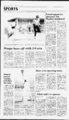
Show 8A Emery County 1990 T uesday, April 10, Progress PUBLIC NOTICES PUBLIC NOTICE LEGAL NOTICE AND DESCRIPTION It has been decided that management alternative will be implemented on the Reeder Ridge Sheep Notice is hereby given that Intermountain Power Agency, P.O. Box 111, Los Angeles, California 90012, has submitted an application to the Division of Oil, Gas and Mining for transfer of a completed application to reclaim the Horse Canyon Mine under the provisions of UMC 788.18. The previous permitttee of the Horse Canyon Mine was Kaiser Coal Corporation, Permit Number ACT007013. The mine pemit area is located as follows: Beginning at the SW comer of the SEX SEX of Section 5, T16S, R14E, SLBM; and running thence North 660 feet; thence East 2640 feet; thence North 660 feet; thence East 1980 feet; thence North 660 feet; thence approximately N 45 East 4800 feet, more or less; thence approximately N 70 W 1250 feet more or less; thence West 250 feet; thence approximately N 28 W 1320 feet more or less; thence approximately N 65 E 580 feet more or less; thence approximately N 13 E 600 feet more or less; thence approximately 82 W 100 feet more or less; thence approximately 10 E 1650 feet more or less; thence approximately S 88 E 1030 feet more or less; thence South 260 feet; thence aproximately S 88 E 550 feet more or less; thence approximately S 09 W 1940 feet more or less; thence East 300 feet; thence approximately S 20 E 1550 feet more or less; thence approximately N 68 E 100 feet more or less; thence approximately S 20 E 250 feet more or less; thence approximately N 20 W 1 120 feet more or less; N 68 E 2170 feet more or less; thence approximately N 20 W 1120 feet more or less; thence approximately N 68 E 600 feet more or less; thence East 200 feet; thence approximately S 20 E 2800 feet more or less; thence approximately S 68 W 300 feet more or less; thence South 500 feet; thence West 1200 feet; thence South 300 feet; thence East 450 feet; thence South 380 feet; thence West 400 feet; thence approximately S 22 E 1310 feet more or less; thence East 1240 feet; thence approximately S 45 E 660 feet more or less; thence South 1000 feet; thence West 2650 feet; thence appoximately S 22 E 2140 feet more or less; thence aproximately N 68 E 1010 feet more or less; thence approximately N 22 W 700 feet more or less; thence approximately N 68 E 540 feet more or less; thence approximately S 22 E 500 feet more or less; thence approximately S 63 W 300 feet more or less; thence approximately S 22 E 600 feet more or less; thence approximately S 68 W 400 feet more or less; thence approximately N 22 W 110 feet more or less; thence approximately S 68 W 850 feet more or less; thence approximately S 22 E 1150 feet more or less; thence approximately S 89 E 350 feet more or less; thence South 100 feet; thence East 450 feet; thence South 2600 feet; thence approximately S 77 W 300 feet more or less; thence approximately N 2 W 1270 feet more or less; thence approximately N 22 W 1120 feet more or less; thence approximately S 68 W 2150 feetmore or less; thence approximately N 22 W 200feetmore or less; thence approximately S 68 W 1950 feet more or less; thence approximately S 22 E 650 feet more or less; thence approximately S 8 W 560 feet more or less; thence approximately S 68 W 50 feet more or less; thence approximately N 22 W 1480 feet more or less; thence N 68 E 2250 feet more or less; thence N 22 W 5410 feet more or less; thence West 2000 feet; thence South 520 feet; thence West 1350 feet; thence South 1320 feet; thence West 660 feet to the NW comer of the NEK NEK of Section 9, T16S, R14E, SLBM; thence South 1320 feet; West 5280 feet; North 1320 feet to the point of beginning. LESS the following portions thereof: (a) Beginning approximately 700 feet South from the NW comer of Lot 11, Section 3, T16S, R14E, SLBM; thence East 700 feet; thence North 800 feet; thence approximately S 22 E 1600 feet more or less; thence approximately S 48 W 300 feet more or less; thence West 870 feet; thence approximately N 22 W 300 feet more or less; thence North 650 feet more or less to the point of beginning. . . (b) Beginning 590 feet North of the center of, Section 3, T16S, R14E, SLBM; thence North 1120 feet more or less; thence W 750 feet; thence approximately N 22 W 660 feet more or less; thence approximately N 75 E 1460 feet more or less; thence approximately S 22 E 2080 feet more or less; thence approximately S 75 E 100 feet more or less; thence approximately S 22 E 2500 feet more or less; thence West 1730 feet; thence approximately N 22 W 2320 feet more or less; thence East 300 feet more or less to the point of beginning. (c) Beginning 350 feet East of the NW comer of Section 11, T16S, R14E, SLBM; thence S 22 E 2720 feet more or less; thence approximately S 68 W 1650 feet more or less; thence approximately N 22 W 4800 feetmore or less; thence approximately N 10 E 500 feet more or less; thence East 1400 feet more or less; thence approximately S 22 E 2020 feet more or less to the point of beginning. Published in the Emery County Progress April 10, 1990. C-- Allotment. This alternative calls for initiation of a deferred rotation grazing system with range improvement practices to improve unsatisfactory range conditions. This decision was made April 4, 1990 by John Healy, Acting District Ranger. A copy of the Decision Notice and Finding on No Significant Effect is available at the Ferron Ranger District Office, Box 310, Ferron, Utah 84523 or by calling 384-237- 2. This decision is subject to appeal pursuant to Forest Service regulations, 36 CFR Part 217. Appeals must be filed within 45 days from the date of publication of this notice. Notices of Appeals must meet the requirements of 36 CFR 217.9. Published in the Emery County Progress April 10, 1990. PUBLIC NOTICE will be implemented on the Ridley Ridge Sheep Allotment. This alternative calls for initiation of a deferred rotation grazing system with range improvement prac- tices to improve unsatisfactory range conditions. This decision was made March 27, 1990 by John Niebergall, Ferron District Ranger. A copy of the Decision Notice and Finding on No Significant Effect is available at the Ferron Ranger District Office, Box 3 10, Ferron, Utah 84523 or by calling This decision is subject to appeal pursuant to Forest Service regulations, 36 CFR Part 217. Appeals must be filed within 45 days from the date of publication of this notice. Notices of Appeals must meet the requirements of 36 CFR 217.9. Published in the Emery County Progress April 10, 1990. 384-237- On April 5, 1990 it was decided that reconstruction of 2 mile of allotment boundary fences is necessary to secure livestock control near McEwan Flat and Brush Reservoir. Attempts to use natural barriers have failed and existing fences must be extended. This decision was made by John Healy Acting District Ranger. Copies of the decision document are available at the Ferron Ranger District Office, Box 310, Ferron, Utah 84523. This decision is subject to appeal pursuant to Forest Service regulations, 36 CFR 217. Appeals must be filed within 45 days from the date of publication of this notice. Notices of Appeal must meet the requirements of 36 CFR 217.9. Published in the Emery County Progress April 10, for various County will be done through Job Service. Anyone interested in County employment must test with Job Service in Castle Dale. Applicants interested in improving the prospect of being hired by the County are bound by Job Service's posi-Eme- ry policies and regulations regarding testing. In addi- tion to test scores, skills, experience, education, and other abilities will be considered when rating applicants in order of preference. Emeiy County does not discriminate against race, color, creed, religion, age or handicapped persons, and is an equal opportunity employer. Published in the Emery County Progress April 10 and 17, 1990. 1990. 2. NOTICE OF MEETING hereby notified of the annual meeting of the members of the Emenr County Farmers U 'ion Telephone Association, to be held on On April 5, 1990 the decimade to initiate a tarweed control project in the head of Reeder Canyon. This undesirable plant is retarding more desirable plants from becoming established in the area. Treatment will be an by applications of EPA registered herbicide. This decision was made by Acting District Ranger John Healy. Copies of the decision document are available at the Ferron Ranger District Office, Box 3 10, Ferron, Utah sion was Thursday, April 26, 1990 at the hour of 7:00 oclock p.m. at the LDS Church House auditorium in Elmo, Utah. This meeting has been called by the Board of Directors pursuant to Article III, Secof the tion I of the association for the purpose of conducting the regular business of the association which includes the election of three members to the Board of Directors: one from District No. 1, Elmo; one from District No. 3, Cleveland and Lawrence; and, one Director-at-Larg- e to be elected from the membership of any district; and, to conduct any This decision is subject to appeal pursuant to Forest Service regulations, 36 CFR 217. Appeals must be filed within 45 days from the date of publication of this notice. Notices of Appeal must meet the requirements of 36 CFR meeting. Published in the Emery County Progress April 10, D By-la- 84523. 217.9. other business that may properly come before the R-- selec-tion- s. Bun-derso- tri-me- tri-me- et ll et 3-- 0 tri-me- et SPONSORED BKs Stop-n-Sho- BY p Dated this 15 day of March, 1990. B. Boyce Successor Trustee BACKMAN, CLARK & MARSH 800 McIntyre Building 68 South Main Street Salt Lake City, UT 84101 0 Telephone: Published in the Emery County Progress March 27, April 3 and 10, 1990. 1. -8 Valley Camp of Utah, Inc., wishes to advise the public that it has filed an Underground Mine Permit Renewal Application with the State of Utah Department of Natural Resources, Division of Oil, Gas, and Mining, and the Office of Surface Mining Reclamation and Enforcement, United States Department of Interior. Valley Camp of Utah, Inc. further advises the public of the following: 1. The full name and business address of the applicant is: Valley Camp of Utah, Inc., Scofield Route, Helper, Utah 84526. 2. The Valley Camp of Utah, Inc. Mine Permit Area is located in Carbon and Emeiy Counties, Utah, approximately 2 miles south of Scofield, Utah; 20 miles (50 miles by road) northwest of Price, Utah, and 110 miles southeast of Salt Lake City, Utah. Scofield is situated in Pleasant Valley and is accessible by an road, State Highway 96. This highway connects with U.S. Highway 6 at Colton Junction, approximately 15 miles northeat of Scofield, Utah. From Colton Junction, U.S. Highway 6 extends to the northwest to Interstate 15 at Spanish Fork, Utah. From Colton Junction U.S. Highway 6 extends to the southeast to Price, Utah. The Valley Camp of Utah, Inc., property extends from Green Canyon on the north to Cox Canyon on the south. 3. The land contained within the Mine Permit Area is described as follows: T14S R7E SLB&M, Section 7 NW X , and NW X of NE K , Section 6 W X , and W X of E '. , T14S R6E SLB&M, Section 1 E X NE K , and NE X of SE X , T13S R7E SLB&M, Section 31SWK , and W K ofNWK .Section 30 WK W'. ,SEK SW X , and NE X NW X , Section 21 Parts of NW K NW X , Section 20 Parts of NE X NE X , Section 19 S X SW X , NE X SW X , and parts of W X E X , E X NW X , and NE X NE X , Section 17 NE X excluding parts of SW X NE X and NE X NE X , N X SE X , Section 16 W X W X , NE X NW X , NW X NE X , Section 9 W X SW X . Section 8 E X SE X , and a Part of SW X SE X , T13S R6E SLB&M, Section 36 All, Section 35 Parts of E X EX ,andSWX ofSEX .Section 25 EX , and parts of WX , Section 24 SE X and parts of S X NE X , NW X NE X , and E X SW X 4. A copy of the Mine Permit Renewal Application is available for public inspection at the Carbon and Emery County Recorders Offices and the Utah Division of Oil, Gas and Mining, 3 Triad Center, Suite 350, S.L.C., Utah 84180-120er 4 Sec. 22, all; Sec. 23, all; Sec. 24, W12W12; Sec. 25, N12NW14; Sec. 26, W12SW14NE14.NW14, N12SW14, W12NW14SE14.N12NE14; Sec. 27, Nl2, N12S12; Sec. 28, all; Sec. 29, E12SE14; Sec. 32, El2; Sec. 33, all. Containing 4,459.8 acres Any party electing to participate in this exploration program must send written notice of such election to the Bureau of Land Management, Utah State Office, P.O. Box 45155, Salt and to David Smaldone, Utah Lake City, Utah 84145-015Power and Light Company, P.O. Box 26128, Salt Lake City, Such written notice mustbe received withUtah 84126-012in thirty days after publication of this notice in the Federal Register. Any party wishing to participate in this exploration program must be qualified to hold a lease under the provisions of 43 CFR 3472.1 and must share all cost on a pro rata basis. A copy of the exploration plan, as submitted by Utah Power and Light Company, is available for public review during normal business hours in the BLM office, (Public Room, Fourth Floor), 324 South State Street, Salt Lake City, Utah under Serial Number Published in the Emery County Progress April 3 and 10, 1990. 5 3 8. (801)538-543- 0. 5. Written comments, objections or request for an informal conference concerning the Mine Permit Renewal Application may be submitted to: State of Utah, Department of Natural Resources, Division of Oil, Gas and Mining, 3 Triad Center, Suite 350, Salt Lake City, Utah 84180-120Western Field Operations, Office of Surface Mining, Reclamation & Enforcement, Brooks Tower Second Floor, 1020 15th Street, Denver, Colorado 80202 Published in the Emery County Progress March 27, April 3, 10 and 17, 1990. 3 UTU-6652- 4. Huntington ace A. Petty. Permit Renewal Application Utah Power and Light Company is inviting all qualified parties to participate in its proposed exploration of certain Federal coal deposits in the following described lands in Emery County, Utah: T. 17 S., R. 6 E., SLM, Utah Sec. 21, El2, E12W12; n This property is now reported to be owned by Hor- PUBLIC NOTICE NOTICE OF INVITATION TO PARTICIPATE IN COAL EXPLORATION PROGRAM UTAH POWER AND LIGHT COMPANY meter meter in Player of the Week relay team. The Player of In softball, Misti the Week selections were Jensen had one hit, scored made by coach Nancy Martwo runs and played excel- tinez in softball, Jim Jones lent defense in the outfield in baseball, Dean Nelson in against Moab. In baseball, boys track and Kent in girls' track. The Lyle Everett also played excellent defense as catch- selections represent a er and had two singles junior (Misti), a sophoagainst Wasatch. In boys more (Kris) and two track, Jeff Guymon had seniors (Lyle and JefO.The personal bests in winning boys and girls track teams with the 110 and 300 hurdles in a each won in a where he also ran Union and Uintah; the soft-bateam split a double-heade- r on the winning 400 and with Moab; and the 1,600 meter relay teams. In to girls track, Kris Wilstead baseball team lost in Wasatch. placed first at a of Section 9, Township 20 South, Range 7 East Salt Lake Base Meridian. Thence running West 12 rods, South 13 13 rods, thence East 12 rods, thence North 6 rods, thence East 6 rods, North 7 13 rods, thence West 6 rods to point of beginning. This description includes a part of fractional lot 25 Ferron Town site Survey. For Filing Underground Mining Structure UTU-6652- Beginning 53 13 rods South of the Northeast Corner of the Southwest quarter City Recorder Published in the Emeiy County Progress March 27 and April 3 and 10, 1990. 17, 1990. 200 400 par-ticular- ly described as Joanne Ekker Board Chairman Published in the Emery County Progress April 3, 10 and Softball, baseball and the 100 meter, track are all represented and with her executed by Tony M. Gunderson and Janet K. Gunderson, as Trustors, covering real property located at 80 North 400 West, Ferron, Emery County, Utah and more 29-14- -2 Prospective bidders may assemble at the office of Johansen & Tuttle Eng., on Apr. 17, 1990 at 10:00 a.m., for the group showing of the work site. Mandatory attendance at site showing required for submittal of bid. Die owner reserves the right to reject any or all bids or to waive any formality or technicality in any bid in the interest of the Owner. Emery County Special Service District 1 Merrill Swasey Misti The following described property will be sold at public auction to the highest bidder, payable in lawful money of the United States at the time of sale on the front entrance of the Emery County Courthouse, Castle Dale, Utah, on April 24, 1990, at the hour of 11:00 a.m. of said day; for the purpose of foreclosing a trust deed dated January 4, 1979 April 12, 1990 7:00 P.M. City Hall 145 West Green River GREEN RIVER PLANNING AND ZONING has scheduled a public hearing to discuss: 1. A request to change the present zoning of Clines Subdivision from l to RM-2. Request: Section of ordinance la, the City Zoning Ordinance, be amended to include a new subparagraph j as follows: (J.) Such other uses not permitted herein, provided that a conditional use Permit has been granted pursuant to Article IV herein. Such Conditional Use Permits are not transferable from one site to another, and are not transferable from one individual or entity to another. Unless approved by the City Council and upon showing that said transfer will not create any adverse impacts upon the City or its residents. (5) Multi-Plat- e AMENDED NOTICE OF TRUSTEES SALE PUBLIC HEARING Sealed bids will be received by Emery County Special Service District 1 for the construction of the Mforhland Coal Haul Road, Section 3 & 4. Bids will be in accordance with the drawings and specifications prepared by Johansen & Tuttle Engineering, Inc., 90 South 1st East, Castle Dale, upon receipt of $50.00 deposit per set each made payable to the Engineer. Bids will be received by Emery County Special Service District 1, at the office of the Engineer, in Castle Dale, Utah. Bids will be opened and read aloud at 10:00 p.m., Apr. 24, 1990. A bid bond in the amount of five percent of the bid, made payable to the Owner, shall accompany the bid. The Major items of work are as follows: 1. Roadway Excavation (24,000 Cu.Yds) 2. Granular Borrow (19,000 Cu.Yds) 3. Bituminous Surface Course (34 Max. 9,500 Cu.Yds) 4. Loose Rock RipRap (400 Cu.Yds.) 5. Enzyme treated Base Course G max. 8,000 Cu.Yds) 6. Exercise Ypur Legal Rights Read the Public Notices 531-830- 1990. Scott Johansen Secretary Published in the Emery County Progress April 10 and 17, 1990. INVITATION FOR BIDS NOTICE TO CONTRACTORS Emery High School Player of the Week PUBLIC NOTICES foPows: PUBLIC NOTICE You are It has been decided that management alternative 2 Your Legal Rights Read the Public Notices EMERY COUNTY HIRING POLICY PUBLIC NOTICE A EktcIm N ( mrn.i -- a 'rm)nr4. ip |