| OCR Text |
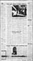
Show Allen's Super Save Markets Weatlierline A Current Time, Temperature and Weather Forecast 0 344-600- Alien's Super Save Markets Weatherline The Daily Herald Temperatures fall in Florida -- 344-600- Bands separate high temperature zones for the day. 40s Codt brisk winds whipped By The Associated Press UTAH SALT LAKE, OGDEN AND PROVO: Tonight low clouds and fog with a few snow flurries. Lows Thursday low clouds and fog with a few snow flurries. Some breaks in the low clouds during the afterr noon with partly cloudy skies above. Highs lower 30s. NORTHERN UTAH: Tonight low clouds and areas of fog western valleys and deserts. Otherwise fair. Lows Thursday low clouds and areas of fog western valleys and deserts. Otherwise partly cloudy. Highs Friday and Saturday partly cloudy with areas of low clouds and fog in the western valleys. Lows near 20 along the Wasatch Front, elsewhere. Highs Sunday mostly cloudy with a chance of snow. through,the Great Lakes region this niorning.'while snow was falling in parts of, the Northeast. Unseasonably cold temperatures in Florida had citrus growers and other farm- 15-2- 5. 5. 25-3- ?TW' V L. 20- sI 20syAy& , 5 Lows A3uTM20s : Highs 25-3- 5. SOUTHERN UTAH: Tonight and Thursday partly cloudy. Patchy fog and low clouds in Millard and Beaver counties. Lows Highs 5 except lower 50s in extreme southern Utah. Friday and Saturday mostly sunny. Patchy fog and low clouds in Millard and Beaver counties. Lows 5 except 20s in extreme southern Utah. Highs except lower 50s in extreme southern Utah. Sunday increasing clouds. Lows 5 Highs except 50s in extreme southern Utah. DIXIE: Tonight fair. Thursday partly cloudy. IDAHO NORTHERN IDAHO: Tonight areas of valley fog and low clouds mainly south. Mostly cloudy above the valleys. Lows in the teens and 20s. Thursday cloudy with a slight chance of snow. Areas of morning s to lower valley fog and low clouds mainly south. Highs in the 5. 60s ' 7S -v- 50s --1 yf V j60s (fe 35-4- 5. 50s FRONTS: 35-4- 5-- 40s 30s mid-20- 30s. WARM COLD Pressure Via H L HIGH LOW STATIONARY B S O SHOWERS Inc. 1995 AccuWeather, RAIN EZ3 E3 FLURRIES SNOW S & ICE PT. CLOUDY SUNNY Q CLOUDY a.m. Friday. That meant Friday was also the shortest day of the year. Technically it's what we call the winter solstice, when the sun is at its lowest point in the sky in the Northern Hemisphere. Friday the sun rose in the southeastern sky and set in the southwest. This short path across the sky made it the shortest day of the year, meaning less daylight. As a result we received four times less solar energy on this day than on the summer solstice in June, the longest day of the year and something to (warmly) look forward to. 6-- 1 15-1- START OF WINTER It's official winter is here! It started at 2: 7 2-- 1 ,THmrmmWmwmmmwmm - mid-20- As the ice thickens to 8 inches it's probably safe to take a snowmobile across it. Cars are typically safe to drive on frozen lakes when the ice is 2 inches thick. Trucks should stay off until the frozen thick8 inches. ness reaches If "thin ice" signs are posted stay off completely! DECEPTIVE ICE As the temperatures fall, ponds and small lakes have been sealed with a thin layer of ice .a layer that can be deceiving and deadly. How do ;you know when the ice is safe? There's no sure answer but here are some guidelines: Ice should be at least 4 inches thick before you walk out on it. , CENTRAL IDAHO: Tonight areas of valley fog and low clouds mainly west. Increasing higher clouds with a slight chance of light snow west toward morning. Lows 5 above to 15 below zero east zerc to 15 above west. Thursday mostly cloudy. Chance of light snow west. Areas of morning valley fog and low clouds mainly west. Highs in the teens to s . ; east 20s to lower 30s west. SOUTHERN IDAHO: Tonight fog and low clouds western and cen- Associated Press Newspapers y.T.aaag:yKfr 15-2- 5. 35-4- By REBECCA KOLLS er 5. 25-3- 5. ake sure ice is safe before venturing out Knight-Ridd- Wednesday, December 27, 1995 The AccuWeather forecast for noon, Thursday, Dec. 28. By TJie Associated Press ers worried. Hard freeze warnings were issued in northern Florida. Florida temperatures were 20 to 30 degrees below normal, with morning temperatures at 28 degrees in Jacksonville. 37 in Orlando, 45 in Tampa and 49 on Miami Beach. In Hillsborough County, strawberry grower Carl Grooms said he turned on sprinklers to coat the fruit with ice. which kept the plants at a steady 32 degrees and protected them from colder temperatures. An' inch of new snow fell .overnight in Syracuse, N.Y., while Charleston, W.Va., received 2 inches.' Snow tlurries were expected today from the Great Lakes region to the Appalachians and into the northern half of the East Coast. Up to 3 inches was possible in the Appalachians from the Virginias to Pennsylvania. 0 12 itm iujim iiiiiiiiiiii ill ir mi ill null wiin lillllini nullum tral snake basin. Local dense fog in the magic valley. Increasing higher clouds. Slight chance of snow toward morning west. Lows zero to 15 east teens to lower 20s west. Thursday fog and low clouds western and central Snake basin. Mostly cloudy above the valleys. Chance of snow west. Highs in the mid- - to upper 20s in the valleys to lower 30s at higher elevations. NEVADA NORTHERN AND CENTRAL NEVADA: Tonight mostly cloudy north with a slight chance of snow west. Partly cloudy east. Lows 0-and east, elsewhere in the mid-teeto mid-20- s. Thursday mostly feet. cloudy with a slight chance of showers. Snow level 4,500-5,00- 0 '. Highs in the 30s to lower 40s. SOUTHERN NEVADA: Tonight partly cloudy. Lows in the upper 20s to lower 40s. Thursday mostly cloudy. A chance of mountain show-- 1 ers. Snow level near 5,500 feet. Highs 50-6ns 0. : ARIZONA STATEWIDE: Tonight increasing mainly high clouds f8rom the west. Lows from near 5 degrees in the mountains to the upper 40s southwest deserts. Thursday variable clouds north with a slight chance for showers. Mostly sunny south. Snow level around 6,500 feet. Highs from the upper 30s in the mountains and northeast to the lower 70s deserts.' Low clouds ' hni mtm ill i mi ii mmm tSssw mi "':Tg?' racyaFfffsfSymiar.xJl! .kwmjynwFi ii'iwi. m nii urn i iiiwimiiiiii ii i u u wmm9mtwmMvmmmMHwmrmmBmrtrftmsmmwm By Jacob Painter, 8, of Brookside Elementary national Temperature By The Associated Press Wednesday Temperatures indicate previous dav's high and overnight low to 7:30 a.m. EST. Hi Lo .Pre Otlk 19 .01 29 sn Alhany.N.Y. 46 25 clr Albuquerque 21 54 Amarillo cdy 43 26 Anchorage cdy 24 34 Asheville cdy 41 29 clr Atlanta 33 20 cdv Atlantic City 38 56 Austin cdy 21 32 Baltimore cdv 21 45 clr Billings. 40 25 Birmingham cdy 13 26 Bismarck cdv 22 20 cdv Boise 36 26 Boston cdy 51 48 Brownsville .26 cdy 47 .01 II Buffalo sn 28 17 .08 sn Burlington.Vt. 40 13 clr Casper 45 32 Charleston.S.C. clr Va. 26 24 .07 Charleston. cdy ' 40 22 clr Charlotte.N.C. 12 46 clr Cheyenne 16 28 .01 sn Chicago 27 25 sn Cincinnati 23 12 sn Cleveland 44 20 clr Columbia.S.C. 19 .11 25 Columbus.Ohio sn 31 19 Concord.N.H. sn 31 Dallas-F- t 53 Worth cdy 18 24 sn Dayton 13 48 clr Denver 26 36 Des Moines cdy 25 .01 9 Detroit cdy 21 12 .05 Duluth cdy 32 El Paso 55 clr 31 37 Evansville cdy -- 3 22 Fairbanks , cdy , 1 t ii 1066 S. State Orem, Utah Across From University Mall LEATHER FURNITURE , l. Financing Available rK MW) V WORKS lEnssssS! visa 90 Days Same As AMffiuumiMaaa rm nn imti nmir, m i rtmvr n j rrfS 23 Cash O.A.C. i - Fargo Flagstaff Grand Rapids Great Falls Greensboro.N.C. Hartford Spgfld Helena Honolulu Houston Indianapolis Jackson.Miss. . 31 39 23 46 35 34 28 86 53 30 43 13 8 4 26 24 23 0 70 34 23 30 cdy clr .02 clr cdy 28 42 26 cdy 31 clr cdy clr Memphis Miami Beach 41 31 cdy 64 58 23 30 47 25 cdy clr 13 .02 .02 Midland-Odess- a Milwaukee Mpls-StPa- 20 29 39 41 59 29 30 36 Philadelphia Phoenix 31 21 69 22 44 9 24 37 25 24 Pittsburgh Portland.Maine Portland.Ore. Providence Raleigh-Durha- Rapid City Reno Richmond Sacramento St Louis Salt Lake City San Antonio San Diego San Francisco SanJuan.P.R. Santa Fe St Ste Marie Seattle Shrevcport Sioux Falls Spokane Syracuse Ptrshg Washington.D.C. Wichita cdy 29 52 30 26 Nashville New Orleans New York City Norfolk.Va. North Platte Oklahoma City Omaha Orlando Topeka Tucson Tulsa cdy cdy 50 44 44 56 43 76 33 58 Tampa-S- l cdy cdy clr clr .03 Jacksonville Juneau Kansas City Las Vegas Little Rock Los Angeles Louisville Lubbock Wilkes-Itarr- e Wilmington.Dcl. 46 33 38 53 59 41 31 43 35 38 45 42 37 59 41 31 56 68 59 89 45 13 44 47 31 25 25 60 46 66 58 34 46 25 29 21 25 13 13 20 18 40 33 22 33 48 46 74 m 1 .18 ; ; sn cdy cdy cdy . cdy cdy clr clr 1 i; sn cdy cdy clr ' .02 .13 s)i n cdy cdy X '. cdy clr cdy cdy cdy cdy cdy cdy clr '. '. ;! i. . cdv .08 , clr cdy ! .01 cdy 19 cdy .10 21 . clr cdy cdy cdy 42 25 36 26 23 26 II - ' sn 34 30 20 17 rn cdy '. sb cdy cdy clr '. cdy cdy cdy sn cdy : ' t: |