| OCR Text |
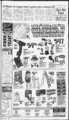
Show Direct deposit of gov't checks required Jan. federal government has of business on the statutory requirement date, or sometimes it'spayment even a all of social day earlier. that payments security and any other recurrWhy is the government ing federal payments, such as doing this? According to the imvernment anH pensions Financial Management Sersalaries, welfare and veterans vice, this method will be safer, benehts, De made by Direct cheaper and more reliable. Deposit, beginning Jan. 1, 1999. An electronic payment for The government beean noti costs the government example fying check recipients in Sep- - about two cents compared with temper mat uy mis nine next an average cost of 43 cents per vear people should have their check. directed to an payments The money saved remains in account 01 ms or ner cnoice. the Social Security Trust Fund Payments are sent electronicand is available for future payally to the designated receiv ments. ing account, which eliminates With more than 31 million the need to print and mail recipients, millions of dollars checks. will be saved monthly. Direct The money is in the account Deposit should also prevent and available at the beginning more than 100,000 crimes per The new Ia year involving mail theft and check forgery, and eliminate millions of inquiries regarding lost, damaged or delayed checks. Social Security has been making payments by Direct Deposit since 1976, and these years of experience have shown that these payments are much safer and more reliable than payments made by check. "Lately we have been helping customers make the transition to using direct deposit and once they get started with it they love the convenience," said "D'Le Borg, Marketing Specialist at the Bank of American Fork. "Now that we're approaching the bad weather months, it really makes sense ditnpanayaA, Mauntain ap he ad 'a 3tau&e Produced by. Photography by... Music by. . h Bill Cox 1 II she said. Bank of American Fork has also signed on with the govern- ment's Quick$tart program which allows them to immediately get a person started on Direct Deposit if he or she signs up by the 20th of the month. To get started with Direct Deposit, visit your bank or local Social Security Office. Most importantly, if you know people who do not have a bank account but who receive government payments, do them a favor. Tell them about direct WIC office 4. of Taste! JCWs Metric Siies have a program to FIT! Price Each 155R12 $32.95 155R13 J3.95 165R13 37.95 17S70R13 18570R13 18570R14 19570R14 20570R14 44.95 Performance 46.95 47.95 49.95 54.95 t 377-343-8 Domestic Sizes P15580R13 P16580R13 P17580R13 P18580R13 P18575R14 P19575R14 P20575R14 P20575R15 P21575R15 P22575R15 P23575R15 Eagle Mountain seeks contractor bids Notice that Notice is hereby given Lehi City Corporation has adopted a resolution indicating its intent to annex real property owned by located at approximately 2900 N. 300 West, Lehi, Utah, and further described as follows: South Commencing 1661.72' and West 657.87' from the East quarter corner AMTRA, of Inc., Section 32, Township 4 South, Range 1 East, Salt Lake Base and Meridian; thence as follows: S 89' 5310" W 660.00' along Lehi City limits; thence N 00' 06'50"W 348.66' along is hereby given that the Town of Eagle Mountain will receive sealed bids from certain invited contractors for: Installing approximately 2.5 miles of 24 strand fiber- AMTRA Lehi City Limits, thence East 15.06; thence North 225.37'; North thence 225.37'; thence West 16.50; thence North 527.58'; thence East South thence 406.00'; 902.20'; thence S 23'28'36" W 1.44 to the beginning. acres Containing 11.33 more or less. Basis of Bearing: Utah State Plain Coordinate System. A public hearing has been scheduled before the Lehi City Council, on the 12th day of January, 1999, at 7 p.m. for the purpose of receiving public comment. The Lehi City Council will annex the d parcel unless, at or before the public hearing, written protests to the annexation are filed by the owners of real property located within the area proposed for annexation covering a majority of the total pri-- . vate land area within the proposed annexation and also equal to at least 13 of the value of all private real property within the area pro- posed for annexation. Published in New Utah! Nov.4, 11 and 18, 1998. Eagle Mountain optic cable, and connecting to existing communications system. Bids will be received at: . The Town of Eagle Mountain Office, 1680 E. Or from the town office listed above upon payment of $40.00 for each set Drive, Heritage Eagle Utah 84043 Mountain, until 12 (phone noon on Friday, Nov. 20, to Tasco payable Engineering, Inc. The Owner reserves the right to reject any and all bids. None of the fees will be refundable for either a bidder or 1998. Copies of the bid requirements, plans and be specifications may obtained from the office of Tasco the engineer: Engineering, Inc., 887 N. 100 East, Suite 4, Lehi, Utah 84043 (phone 766- 9600) No Bid Bond is required. A 100 percent performance and payment bond will be required. (RBAN) of PUBLIC NOTICE IS HEREBY GIVEN that on the 27th day of October, 1998, the Town Council of Eagle Utah Mountain, County, Utah (the "Town"), a adopted resolution declarinq its inten tion to create a special improvement district to be known as Eagle Mountain, Utah Special Improvement District No. 98-- 2 (Cedar Pass) (the "District"). It is the intention of the Town council to make the improvements described herein within the District and to levy special assessments as provided in Title 17A, Chapter 3, Part 3, Utah Code Annotated 1953, as amended, oh the real estate lying within the District for the benefit of which such assessments are to be expended in the making of such improvements. DESCRIPTION TRICT IMPROVEMENTS DIS- Mountain, Utah. INTENDED IMPROVEMENTS The improvements (the consist "Improvements") will of a natural gas distribution system to provide natural gas distribution to the 235 lots platted within the boundaries of the District. The distribution system will include approximately 22,000 feet of polyethylene gas main, 42,000 feet of 2" polyethylene gas main, 20,000 feet of W polyethylene gas main, and all associated valves and fittings required to render the system complete. The proposed location of said Improvements is shown on the map attached hereto as Exhibit "B" and incorpo OF ' of total cost The Improvements in the District the estimated as by Engineer is $477,000, of which the Town will pay $0, leaving a remainder of $477,000 which shall be paid by a special assessment to be levied against the property which may be affected or specifically benefitted by such Improvements. The Town Council has determined that the platted lots within the boundaries of the proposed District shall be benefitted by the proposed Improvements as indicated on the map attached hereto as Exhibit "B". The property owners' portion of the total cost of the estimated be may Improvements financed during the construction period by the use of interim warrants, OF The boundaries' of th proposed District shall coincide with the legal description set forth in Exhibit "A", all being located within the Town of limits Eagle 4" rated by reference. ESTIMATED COST in which case the interest on said warrants will be assessed to the property owners. In lieu of utilizing a guaranty fund, the Town intends to create a' special reserve fund to secure payment of the special assessment bonds (the "Bonds") the Town anticipates issuing to finance the Improvements. proposed The reserve fund will be initially funded with proceeds of the Bonds in an amount to approximately equal $47,700. The Town antici-patapplying moneys remaining in the reserve fund to the final payment on the Bonds which, in turn,, would offset the final assessment payments to be made by the owners of property benefitted by such Improvements, all of which will be further described in the assessment ordinance to be adopted by the Town. In addition, the estimated costs of assessment include estimated overhead costs 17A, Chapter 3, Part 3, Utah Code Annotated 1953, as amended. A map of the proposed District, copies of plans, profiles and specifications of the proposed Improvements and other related information are on file in the office of the Engineer who will make such information available to all interested persons. which the Town projects to incur in the creation and administration of the District. The estimated cost to be assessed against the properties within the District and the method of assessment shall be as follows: Improvements Area within District Estimated TIME Mountain. The Notice the Town, funding of the RBAN, and approval of the easements. Pre-Bi- d Meeting Method of Assessment Natural Gas Improvements Cedar Pass Ranch : Per lot $2,580 Cedar Pass North Per lot' $1,705 LEVY OF ASSESSMENTS It is the intention of the Town Council to levy assessments as provided by the laws of Utah on all parcels and lots of real property to be benefitted by the Improvements proposed within the District. The purpose of the assessment and levy is to pay those costs of the Improvements which the Town will not assume and pay. The method of assessment shall be based on a per lot basis, as set forth ed by the 1998 Revenue Bond Anticipation Notes December, 1998, the Town Council will meet in public meeting at the offices of the Town Council at 41 14 North 1680 East, Eagle Mountain, Utah to consider all protests so filed and hear all objections relating to the proposed District. After such consideration and determination, the Town Council shall adopt a resolution either abandoning the assessments may be paid by property owners in not more than fifteen (15) with annual installmentsinterest on the unpaid balance at a rate or rates fixed by the Town Council, or the whole or any part of the assessment may be paid the assessment levying The becomes effective. assessments shall be levied according to the benefits to be derived by each property within the District. Other payment . provisions ' and enforcement remedies shall be in accordance with Title protests after eliminating from such filed protests: (i) protests relating to property or relating to a type of Improvement which has been deleted from the District and (ii) protests which have been withdrawn in writing prior to the conclusion of the hearing. The of number necessary FILING at7:00p.m.onthe8thdayof herein. The without interest within fifteen (15) days after the ordinance FOR protests District ' or creating the District either as described in this Notice of Intention or with deletions and changes made as authorized by law; but the Town Council shall abandon the District and not create the same if the necessary number of protests as provided herein have been filed on or before the shall mean protests repreof the total senting one-ha- lf lots to be assessed. BY ORDER OF THE TOWN OF COUNCIL EAGLE MOUNTAIN, UTAH Janet Valentine Town Clerk Exhibit "A" - Boundary of the District The proposed District include the following described property: . Cedar Pass Ranch at the Beginning Corner of Southwest Section 19, Township 5 South, Range 1 West, Salt Lake Base and Meridian; thence North 00 deg. 48'00" East along the section line 2589.67 feet; thence North 88 deg.37'09"West 2669.58 feet; thence North 00 deg. 45'19" East 2413.67 feet; thence North 74 deg. 04348" East 919.08 feet; thence South 89 deg.19'12" East 1187.56 feet; thence North 53 deg. 20'46" West 147.95 feet; thence North 53 deg. 17'00" East 576.92 feet; thence North 74 deg. 43'48" East 635.27 feet; thence South 21 deg. 18'44" East 471.75 feet; thence South 15 deg. 24 49" West 6.66 feet; thence South 12 deg. 11 '54 East 116.21 feet; thence South 12 deg. 01 '05" East 57.32 feet; thence South 89 deg. 1823" East 1890.84 feet; thence North 00 deg. 3140" East 172.16 feet; thence South 89deg.29'31" will ' $39.95 Am. Fork . $59.95 62.95 46.95 47.95 64.95 82.95 77.95 67.95 71.95 89.95 94.95 Price Each 21570R14 20570R15 21570R15 22570R15 41.95 43.95 45.95 57.95 56.95 59.95 6195 47.95 51.95 54.95 56.95 59.95 I J2.95 I ; 66.951; SNOW TIRE CHANGEOVER Thn axwv not miia wi ny ottw ttrtrtnrt tocl. i DAYS SO SAME AS CASH of Award will be issued pending approval of the RBAN by A 70 Series Siies Price Each I I OAC will be held at the Fire Station Town Office located at 1680 E. Heritage Drive, Eagle Mountain, Utah, at 12 noon on Wednesday, Nov. 11, 1998. PAYS0N 318 E. 100 N AMERICAN FORK 748 MEM 703 N. PROV0 1595 E. State Rd State 75W000 7 N. 200 W. 374-- 1 177 SPANISH FORK 570 N. Main LEW 144 N. SI EH This project will be fund- time specified in this Notice of Intention for the filing of PROTESTS Any person who is the owner of record of property to be assessed in the District described in this Notice of Intention shall have the right to file in writing a protest against the creation of the District or to make any other objections relating thereto. Protests shall describe or otherwise identify the property owned of record by the person or persons making the protest and shall indicate the total acreage represented by said protest. Protests shall be filed with the Town Clerk of Eagle Mountain, Utah, on or before 5:00 p.m. on Monday the 7th day of December, 1998. Thereafter Assessment Rd WE NOW ACCEPT: RC WILLEY CREDIT CARDS the Town of Eagle 850 E. 6 Uli) Published in New Utah! Nov.4, 11 and 18, 1998. Eagle Mountain gives notice of intention to form Special Improvement District NOTICE OF INTENTION State Price Each 18560R14 19560R14 18565R14 19565R14 19565R15 20565R15 21565R15 19560R15 20560R15 20555R16 22560R16 FAX- or We will come to your home or office! 377-346- 4 - E. deposit and take them with Comstock Financial Services, Inc. 226 West 2230 North, Suite 200 Provo, Utah 84604 Notice of intent to annex 530 you. 1999 will be here sooner than you think. y f to 3 p.m.). 2 A Gift Are you: buying a home? building a home? Kent Evans buying a building lot? refinancing to consolidate bills? buying an investment property? Come in or call us about your financing needs. We Hite?(M) in AF open The Women, Infants and (closed for lunch Children (WIC) program has a clinic located at 321 N. 300 1, American Fork; East, phone The North County WIC Office is open Monday, Thursday and Friday from 8 a.m. to 5 p.m. (closed for lunch hour from noon to 1 p.m.) and for extended hours on Wednesdays from 10 a.m. to 7 p.m. 763-199- 1 1 B Hurry! Limited time j to make as few trips outside as possible, and Direct Deposit eliminates having to do that," Page Financial Services, Inc. A Mortgage Lender Curtis MacPherson Steven Kapp Perry Lehi Free Press New Utah! - Wednesday, Nov. 18, 1998 - 1 East 2658.32 feet to the Northeast Corner of Section 5 South, 19, Township Range 1 West; thence North 00 deg. 141 7" East 1166.62 feet; thence North 89 deg. 1650" East 1156.16 feet; thence South 00 deg. 14'ir West 2394.52 feet; thence South 89 deg. 05'47" West 1131.69 feet; thence South 00 deg. 5413" East 1466.45 feet; thence South 00 deg. 1858" East 2654.18 feet to the Southeast Corner of Section 19, Township 5 South, Range 1 West; thence North 89 deg. 1839" West 2795.83 feet; thence North 00 deg. 3141" East 1279.11 feet; thence South 88 deg. 1910" West 1135.48 feet; thence South 08 deg. 3000" East 853.01 feet; thence South 35 deg. 4000" West 535.26 feet; thence South 34 deg. 1608" West 74.04 feet; thenee North 89 deg. 4321" West "1135.80 feet to the point of beginning. (Containing 144 Lots, 834.31 Acres) North Ranch Beginning at the North Quarter Corner of Section 13, Township 5' South, Range 1 West, Salt Lake Base and Meridian; thence South 89 deg. 5016" East along section line 1360.15 feet to the Northeast corner of the Northwest quarter of the Northeast quarter of Section 13: thence South 00 deg. 2638" West along the East line of the West half of the Northeast quarter of Section 13, 2576.20 feet to the Southeast corner of the Southwest quarter of the Northeast quarter of Section 13; thence South 88 deg. 4347" West along the South line of the Northeast quarter of Section 13; 1030.00 feet to the West bank of a wash; thence the following eight courses and distances along said West bank: South 49 deg. 0544 East 216.30, 98-- 2 to finance public improvements South 59 deg. 3500" East 142.00 feet, South 27 deg. 1100" East 830.00 feet, South 51 deg. 2000" East 344.00 feet, South 34 deg. 4200" East 483.00 South 15 deg. 1500" 175.00 feet, South 05 1630" West- 387.00 South 17 deg. 3000" feet, East deg. feet, East said North line 1691 .50 feet; thence North 00 deg. 4519" East along the West line of the Northeast quarter of Section 24, Township 5 South, Range 2 West 96.50 feet to the South quarter corner of Section 13; thence North 00 deg. 1134" East along the West line of the 2640 feet South and 2640 feet East of the Northwest corner of Section 13; thence North 870.78 feet; thence North 25 deg. 0000" West 1945.89; thence South 89 deg. 4920" East along section line 811.51 feet to the of point beginning. 101 Lots, (Containing i V A " 276.07 feet to the North line of a highway: thence South 74 deg. 4348" West along - mm ml East half of Section 13, 2701.34 feet; thence East 19.72 feet to a point being ' ) 168.04 Acres) Published in New Utah! Nov.4, 11, 18 and 25, 1998 |