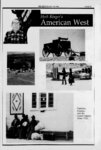
| OCR Text |
Show PAGE 4 THE ZEPHYRJAN-FE- F B 1996 a SENES report I also deduce they figured in a more expensive way of loading and worked from, based on his experience unloading rail cars than the model Mr. Anderson WORLD NEWS ROUND UP The ROUNDUP is compiled by Jim Stiles except where noted. THE ATLAS URANIUM MILL TAILINGS RECLAMATION... An appropriate topic for the Lame Issue By Lance Christie In the December Zephyr. Robert S. Pattison disputed a number of points I made in my Zephyr Roundup article on Atlas Mill Tailings reclamation. Mr. Pattison's response left me scratching my head. Most of his letter put what I had said out of context, or confused one thing with another. I'll try to make sense of the main points in this technical morass: First, Mr. Pattison claims that the alternative tailings reclamation site at Klondike Flats would require rock armor to be hauled there as well as to the current tailing site. If this were the case, the longer haul route to Klondike would represent even more risks, costs, and environmental impacts than the current tailings site. Mr. Pattison is correct about rock armor being required on the Klondike Flats reclamation plan which appeared in die SENES risk analysis. He is not correct about rock armor being required on the different reclamation proposal prepared for Klondike Flats by the Grand County Atlas Mill Reclamation Task Force. The Canonie Environmental analysis (1994) of the costs of capping the pile in place of the tailings above d versus moving it apparently proposed a design which put Flats. s This design has two obvious below grade on Klondike grade and disadvantages: first, it doesn't meet the Nuclear Regulatory Commission (NRC) criterion that tailings be reclaimed entirely below grade, and second, that slopes above grade require rock armor to resist erosion. This design appeared in the SENES Consultants risk analysis report. Lany Anderson (then Director of the Radiation Control Division of the Utah Department of Environmental Quality), Mel Swanson (mining engineer who designs tailings piles; former Atlas employee), and I proposed a different design for Klondike Flats. We proposed putting the tailings entirely below grade, rollercompacting the bottom of the 230 acre pit to meet liner specifications, and putting the excavated Mancos Shale back over the below-grad- e tailings at a slope of less than .005, the threshold of sheet erosion. When have don't gullying possibilities because you have a slope where water spreads out in you Mancos Shale, then you don't a uniform sheet, and you have resistant of the for That's one reasons our proposed design, which erosion. to rock resist need armor was not used in the SENES analysis (probably because they weren't told about it). Another reason for our design was that our calculations indicated the tailings could be contained in the Mancos Shale for 1,000,000 years, not just 1,000 years, before leachate hit groundwater at the site. The alternative reclamation proposal by the Task Force folly meets all NRC reclamation criteria, with no ifs, ands, buts, or rationalization required, and places the tailings in a site which the Utah Deparment of Environmental Quality (DEQ) described as also seem to have included moving the Vitro tailings by rail out of Salt Lake City. They some expensive upgrades to the railroad line that none of the Task Force engineers thought were needed. These dues suggest the Canonie 1994 work analysis overestimates die cost of moving the pile and underestimates the cost of capping it in place Until we can take the models apart piece by piece and examine all assumptions, we can't determine whether there actually is over-- or underestimation in the Canonie model and how large a difference in total cost any disputed assumptions would make This leads to the third point Mr. Pattison cites the $33 million cost of moving the Monticello tailings. That $33 million includes not only the co6t of moving the pile, but of slopes. We used $5.50 per lining its new site and putting rock armor on the above-grad-e Rifle of cost the was that because ton for moving the pile tailings 14 miles by truck moving of the which Mel Swanson got from Energy project budget in 1993. Mr. Department II Pattison dtes average costs for capping Title piles, per ton. The capping plan for the Adas pile is not typical or average. Because of die steep slopes and exposure to the Moab Wash and Colorado River, half the armor for Atlas is much larger, and therefore more expensive to quarry, transport, and place than other Title II reclamations. If you're using existing projects to estimate costs, you need to separate out the costs of the work components and adjust them to fit the differences in the project you are estimating Mr. Pattison didn't do that in his letter; the Task Force did a more differentiated cost analysis in order to test assumptions about reclamation costs. Fourth, the SENES report did not cite or refer to the new water and seismic studies then under way. Mr. Pattison says SENES was in communication with the contractors. I wouldn't know, but being an ethical firm, surely SENES would mention it if they were using preliminary information from Incomplete research. They certainly did not have the Park Service critique of the WestWater river study or the study Itself, since both were produced after the SENES report was released. They certainly did not have the Lawrence Livermore Laboratories study of seismic stability of all Title II sites which was released to Atlas on September 21, 1995, or the Smith Engineering seismic study, which has not been released at this writing It will be interesting to see whether Oak Ridge's DEIS incorporates and addresses these issues. In order to prepare to review the DEIS, it may be useful to review our current one-thir- two-third- roller-compact- 'almost ideal Second, regarding risk, Mr. Pattison misattributed my comments in several ways. He took my interpretation of SENES risks for deaths from radiation exposure and construction accidents per year during reclamation and applied it to the risk to public health and the environment for the pile after reclamation. The SENES risk analysis assumes no risk to public health or the environment from either reclamation once it is complete. The Task Force, Utah DEQ, and Uix Department of the Interim: questioned this assumption in writing in 1994. We all asked this assumption be analyzed in the Draft Environmental Impact Statement (DEIS), which the NRC now predicts will be released in January, 1996. Mr. Pattison also took me to task for a point I did not make: I used figures and before how sits the article. How reclaimed, in long it being pile long my exclusively takes to reclaim it, have no effect on the points I was making. Merv Lawton and I remain of the opinion that the environmental and fiscal costs of getting rock armor to the tailings site for capping have been significantly underestimated, particularly for the half of the river road from Round Mountain in the Town of armor which is to come down the Castle Valley. Letters from the Utah DEQ, EnviroCare Inc., and a variety of other agencies indicate they share this suspicion. I was oonfrgted recently by the professionals at Oak Ridge National Laboratories who are actually preparing die DEIS on Atlas. They are under contract to the NRC for the work, and are not part of the NRC They were very concerned that they had folly grasped EIS. community scoping issues, and seemed to be earnest about doing a good job on the the of full some information of on to a had access It wasn't clear to me whether they scope could it information into account, points they need to analyze. If they don't take relevant bias their fwnrhwtnns in the DEIS. That is why the DEIS needs careful review when it comes out work and cost analysis for While talking to Oak Ridge staff, I was told a was prepared by Canonie Flats Klondike to the and in pile moving capping the pile place been have members 1994. Force Task in Environmental publically commenting on the need the it 1994 turns for this analysis since out, when, analysis was done but not announced or offered for public scrutiny. The Task Force needs to see the analysis in order to determine what assumptions were used in the models. After learning the analysis exists from Oak asked far a copy. I Ridge, I wrote Atlas Corporation the third week in November and haven't heard a thing yet I gather from the SENES report that the Canonie costing model assumes no extraordinary cost or risk gervjig capping rock to the site, and poses an above-grad- e reclamation on Klondike Flats which would require rock armor also. From the risk-perye- ar U-1-28 line-by-li- ne The Atlas Tailings Pond understanding of Atlas tailings pile impact on the Colorado River, and the seismic stability of the current tailings site. National Park Service hydrologists designed what they believed to be the minimum study of sediment and lifeforms in the Colorado River which could, with confidence, answer the scoping questions about whether there were significant cumulative impacts on the Colorado River system from the Atlas tailings pile leaching into it We know that there are levels of radioactivity of up to 5600 picoCuries per liter of water from the test wells between the pile and the river, versus the background level of 33 picoCuries liter. Several heavy metals also exceed Environmental Protection Agency (EPA) maximum concentration limits in the test well water. What nobody knows is what volume of leachate fa coming nut of the pile, and whether these materials are accumulating in wdimewt due to binding to organic material or are being concentrated (bioaccumulated) in the river food chain. Unfortunately, according to the Park Service adentists, we still don't know. The NRC cut out two thirds of the samples, and four out of seven Investigations, in the Park Service research design before it was given to WestWater Engineering to perform. WestWater got here at high water in the river, and could not access some of the remaining sites. One key sampling site's alleged sample does not even appear to be a sample of river sediment Despite the flaws in sampling, elevated levels of several likely pile leachates were found in sediments and fish below the tailings pile in the river, relative to the levels measured in similar samples taken in the river above the pile. Because of the limited number of samples and screwy results in some of the few taken, the Park Service hydrologists and biologists say in their written review that there is cause for concern, but no scientifically sound conclusions can be drawn that there is or is not a problem with fatting, leachate Impact on the river. As far as the Task Force can tell w are in the same place as we were at the in 1994, some sort of confident April closure that the pile is or scoping hearing obtaining is not significantly affecting the Colorado River. However, we now have some suspicious findings, where we had no data at all in 1994. The Lawrence Livermore Laboratory study of seismic issues was commissioned by the NRC for all Title II uranium tailings sites in the United States. to it seems Interestingly, have been started after local state, and federal seismic agencies brought up stability problems in the 1994 Atlas scoping hearings. The authors state that the Atlas site is the most problematic of all Title II sites. The key information appears to have been discovered since the Atlas scoping hearings in 1994. In essence, the Livermore Laboratory found evidence that the Moab Fault splits under the tailings pile. The branch of it which continues down the base of the Moab Rim on the west side of Spanish Valley is apparenly Inactive, and probably never extended below the Paradox Formation. The other branch, which apparently nobody knew about before 1994, runs down the Colorado River. The Livermore Laboratory dtes evidence that this fault runs into bedrock below the rminmAn Plateau sediments, and shows signs of becoming more active scismically. The authors conclude that this fault may be competent to produce a seismic event which would cause |