| OCR Text |
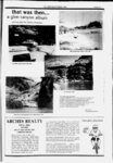
Show PAGE 28 A THE-ZEPHYROCTOB- 1990 Cane Springs R), 48.2 m., was for many years a watering place Looking Back travelers. In the cliff on the opposite side of the highfor early-da- y is a cave, converted into a ranch house by construction of a wall way UTAH GUIDE highway crosses a wide, deep wash. The topography of southeastern Utah makes curves of this type necessary in many places. At LA SAL JUNCTION, 55.9 m.t is the junction with State 46. TO THE STATE Compiled by W orkers of the Writers Program of the Work Projects Administration for the State of Utah across its opening. The Big Mule Shoe, 51.3 m., is a sharp curve by which the Left on this gravel -- surfaced road to LA SAL, 8j9 m. (7,125 alt., 280 pop.), a ranching community settled in the early 19308, when Old La Sal, twelve miles east, was abandoned. Ranchers graze their sheep and cattle in the mountains in summer and on the sagebrush plains in winter. OLD LA SAL, 195 m. (7,500 alt.), was settled by cattlemen in 1877 n abandoned in the early i93o's because of frequent floods. In 1940 only a few ramshackle buildings remained. At 22.8 m. State 46 crosses the Colorado Line, 90 miles west of Montrose, Colorado. Looking Glass Rock .(L), 59 1941 South of Moab, US 160 traverses a rolling semiarid strip of land, thinly vegetated with greasewood and prickly pear. A few miles east of the highway are the LA SAL MOUNTAINS (L), second highest range in the State. The La Sals (Sp., the salt) were formed by doming, caused by the intrusion of igneous rock between the lower sedimentary beds. The range is roughly 15 miles long and 6 miles wide, but high mesas radiating from the main mass cover a much larger area. Mount Peale, the highest peak, has an elevation of 13,089 feet. Forests of pine, fir, and aspen cover the higher slopes; cedar, scrub oak, and sagebrush grow on the lower slopes. Thousands of sheep and cattle are grazed here each summer. US 160 crosses MILL CREEK, 33.4 and PACK CREEK, 34.3 m., the streams from which Moab gets its water. m., on US 160, is a salmon-colore- d sandstone wall pierced by an opening 25 feet high and 50 feet wide. It is so named because the view through the opening seems to be a reflection of the opposite wall. In dry weather US 160 crosses HATCH WASH, 60.6 m.; in wet weather Hatch Wash crosses US 160. There is no bridge. The wash comes out of a deep rocky gorge (L), crosses the highway, and drops a sheer 150 feet into another gorge (R). Near the road (R) the torrential flood waters have gouged a well, 75 feet deep. Sugar Loaf (R), 73.3 ., is a red mound resembling a gigantic loaf of bread. Its top is hollowed out by erosion, and in pioneer day's teamsters stretched tarpaulins inside the depression to catch rain water for their horses. In this vicinity in the early 1900's lived Rimrock Annie, noted for her ability to work like a man. She broke her own broncos, roped her own mavericks, and branded her own livestock. Then one day romance got her, and she gathered to her bosom a widower with seven children and left the valley. Her last act was the breaking of four wild horses for work. Rimrock Annie was quite a character, She was a good woman in her way, but she remarked one oldtimer. was as wild as the horses she broke. At 74 m. is the junction with a dirt road. Right on this road to the Home of Truth Colony, 06 m., a religious community founded in 1933 by Mrs. Marie M. Ogden, formerly a prominent welfare worker in New Jersey. At first membership in the colony totaled almost one hundred, but it has since dwindled to less than ten. Members are required to transfer ownership of all property to the leader for use of the entire group, and are thereafter entitled to food, clothing, and shelter. Should a member leave the colony, none of his property is restored, and he can take nothing with him except the clothes he wears. Mrs. Ogden claims that she founded the colony under divine guidance and that she receives revelations regarding its management. The doctrine of the sect allows members no meat, except fish and chicken, and forbids the use of tobacco and alcoholics. Mrs. Ogden owns the countys only newspaper, the San Juan Record, printed at Monticello. The Home of Truth Colony is divided into three sections the Outermost Point, the Middle Section, and the Outer Portal. The Outermost Point, 0.6 m., consists of a group of unpainted frame buildings for the use of and visitors. The colony has no electrical nor sanitary conveniences; light is s. and water is obtained from outdoor provided by candles and non-membe- oil-lam- At 41.7 m. is the junction with a gravel-surface- d road. Left on this road to the junction, 1.1 m., with the La Sal Mountain Road in winter) ; R. on this improved dirt road. At 42 m. is the junction with an improved dirt road; R. here to Pack Creek Campground, 3 m., in La Sal National Forest. East o this junction the main road follows a steep, winding dugway ascending the western slope of the LA SAL MOUNTAINS. There are spectacular views from here (L) across the broken red country of the Colorado Plateau to the hazy blue Henry Mountains, nearly 100 miles southwest. At 6.6 m. the road crosses the west boundary of LA SAL NATIONAL FOREST (North Division), and the sharp crest of MOUNT TUKUHNI-KIVAT- Z (Ute, place where the sun shines longest; 12,004 alt.) pierces the sky (R), hiding MOUNT PEALE (13,089 alt.), highest of the La Sal peaks. At 11.1 m. is the junction with an improved dirt road; R. here to GEYSER PASS (10,750 alt.) 7 m., named for Al Geyser, who grazed cattle in this region in the i88o. The road runs between HAYSTACK MOUNTAIN (11,500 alt.), on the left, and MOUNT MELLENTHIN (12,750 alt.), on the right. The view from the summit stretches eastward into Colorado, to the Continental Divide, and westward across the Colorado Plateau. North of this junction the main road descends into HORSE CREEK CANYON, 12 m., where there is a Forest Service campground in a grove of aspens. At 142 m. is the junction with an improved dirt road; R. here, across Bald Mesa, to Warner Campground and Warner Ranger Station, 4 m., near the summit of the La Sal Mountains. North of this junction the main road again runs along the mountainside, with a succession of green peaks (R) sweeping upward from the road. At 192 as. there is a view downward through Porcupine Draw (L) to the red sandstone statues of, Castle Valley. In the background are towering red cliffs flanking the Colorado River. At CASTLETON, 2fl as. (,750 alt.) (tee above), is the northern terminus of the La Sal Mountain Road. From this point the Castleton Road continues 9.4 as. to the junction with State 128 ( closed rs hand-pump- ps, The Middle Section, 1.7 m., is another group of unpainted frame buildings, used by members. In one corner of ah unfinished cobblestone church is a small chapel for Sunday worship. The Outer Portal, 3 m is a third group of unpainted frame buildings in PhotdcrapH 'Gap, so called because of the vista between its walls. This unit has community buildings, and five or six houses, one of them occupied by Mrs. Ogden. The cult leader has prophesied that the grazing land beyond the gap will eventually be populated by thousands of Home of Truth colonists, and that the faithful will live in peace and prosperity while the of the world is caught in the destruction and misery of war. Shay Mountain (9,987 alt.), 15 miles southwest of the colony, is the sacred peak of the Home of Truth. During the summer the colonists make frequent trips to this mountain, remaining at its base while their leader ascends to the summit to receive revelations. North of Monticello, US 160 skirts the west edge of the SAGE PLAIN, 1,200 square miles of monotonously level country sweeping eastward to the Dolores River in Colorado. Visible across this immense plain are the San Miguel, La Plata, and Ute Mountains in Colorado. The ABAJO MOUNTAINS (R), known locally as the Blue Mountains, are a prominent feature of the landscape for many miles. The formal name, when used, is pronounced These mountains, like the La Sals ( see above), are of laccolithic origin. Herbert E. Gregory of the U. S. Geological Survey describes them in The San Juan Country: The Abajo Mountains rise from Sage Plain to eight independent summits. Below 8,000 feet the mountains constitute a single mass about 16 miles long and 10 miles wide scalloped by radial valleys except on the west, where the Elk Ridge abuts against its flanks. Above 9,000 feet . . . are four groups of peaks . . . much alike in form and structure. Their tops are rounded, some of them nearly flat; their sides slope steeply and evenly and not far from the summit develop long spurs, which likewise have broad tops and smooth sides. oe. ... flat-topp- ed The Abajo Mountains give rise to many permanent streams. . . . jiIfjS!!iiSISl2SLL!!!!!SDLj!ljj!9Ill!ycstcrn slopes; |