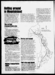
| OCR Text |
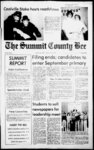
Show NOTICE OF FINAL TAX SALE NOTICE IS HEREBY GIVEN THAT on the 24th day of May, 1978 at the front door of the County Court House, Coalville, Utah, at 10:00 a.m.,1 will SERIAL NO. olfer for aale at public auction and sell to the highest bidder for cash, pursuant to the provisions of Section Utah Code Annotated 1953, as amended, the following described real estate situated in said Summit County and now , 4, held by it under preliminary Tax Sale. No bid for leu than the total amount of taxes, interest, penalty and costs which are a charge upon such real estate will be accepted. Sale will affect property found in the sales for the year 1973, sold to Summit County January 15, 1974, and not redeemed. DESCRIPTION AMOUNT delinquent list of tax PROPERTY ASSESSED TO PCI SA 146 D.B. Finance 3886 Park View Circle Salt Lake City, Utah West 5 ft lot 2 and lot 31 Blk 1 Park City Survey Kim Ewig A Mary C. Whitesides 437 E. 87th St. 2 New York, N.Y. 10028 Com at NW'ly cor Lot 18 Blk 14 SA th N 5401 E 45.9 ft; N 40I9' W 12.5 ft; to bes of land to be desc; th S 40 19 E 12.5 ft; S 4448 E 25.2 ft; S 5401' W 49.7 ft N 3559' W 37.5 ft N 540r E 45.0 ft to beg (S'j lot 17 A 18) also strip 15 ft wide being that part of Empire Ave abutting land also Nly 5.0 ft Lot 19 Blk 14 SA A a strip of land 15 ft wide alg Nly 5 ft lot 19 a portion of Empire Ave also the N'ly 5 ft of Lot 19 S146.95 74.43 ch Blk 14 SA TL2229 AP2 155 KEA29 KEA29A Briant G. A Wanda Lot 229 Badger 2487 Skyline Dr. Salt Lake City, Ut 84108 Subdivision cont 0.46 Seven Assoc. Inc. 9k Robert R. Rudy 1232 Breken ridge Dr. Salt Lake City, Ut Meridian Prop. Inc. Bill R. Hughes 4379 Jupiter Dr. Salt Lake City, Ut. Meridian Properties 9k Joseph B. Wirthlin 932 Military Dr. SLC, Utah KEA49 OF, I have set my hand and official seal this 26 day of May, 1978. 12 149.02 acres Lot 155 Aspen Acres Plat 2 Sub. cont 0.34 acres Vk Lot 29 Kamas East Plat A Sub Sec 3 A 4 T 2 So. R 6 E. SLBM cont 0.945 acres 92.62 S N Vi Lot 29 Kamas East Sub Sec 3A4 T 2 So R6 E SLBM Cont 0.945 acres Meridian Properties, Inc. 9k E. M. Haws 426 So. 275 East Farmington, Utah 84025 IN WITNESS WHERE- Timberline W Vk Lot 49 Kamas East Plat A Subdiv. Sec. 3 A 4 T2SR6E SLBM Cont 0.86 acres Reed D. Pace County Clerk and UT seeks the right to 3.0 ac. ft. of exchange -- NOTICEwater from Summit to Morgan County as eviNOTICE TO denced by Appl. 27611, WATER USERS U.S. Bur. of Reel. A Contract with Weber ' The following applica- Basin Water Cons. Distions have been filed with trict. The water has been the State Engineer to diverted from East Canexchange water in Moryon Reservoir, at a point gan County throughout S. 1820 ft. and E. 1930 ft. the entire year unless from the NW Cor. Sec. otherwise designated. 10, T2N, R3E, and used Locations in SLBAM. for miscellaneous purExch. 1256 (35 area) poses. Mountain Green SubdivisionHereafter, 3.0 ac. ft. of -Water Association. water is to be released 5772 W. 5900 N., Morinto East Canyon Creek, gan, Utah seeks the right at a point same as to exchange 10.0 ac. ft. of heretofore; and 3.0 ac. ft. water from Summit to of water is to be diverted Morgan County as evi- from a well, denced by Appl. 27609, 100-30-0 ft. deep, at a U.S. Bur. of Red. A point S. 1930 ft. and E. Contract with Weber 504 ft. from the NW Cor. Basin Water Cons. DisSec. 20, T1S, R4E, (1 mi. trict. The water has been SE of Kimball Junction); diverted from Wanship and used for the domestic Reservoir, at a point N. purposes of 3 families, 1760 ft. and E. 3023 ft. stockwatering of 31 cattle from the SW Corner and from April 1 to Section 29, TIN, R5E, October 31 for the irrigaand used for miscellantion of 0.75 acs. in the eous purposes. SWV4NWy, Sec. 20. Hereafter, 10.0 ac. ft. T1S, R4E. of water is to be released Exch. 1271 (35 area) into Weber River, at a Jerran T. Flinders, Copoint same as heretofore; vered Bridge Canyon and 10.0 ac. ft. of water is P.O. Box 407, Spanish to be diverted from an Fort, UT seeks the right well, 163 ft. deep, to exchange 2.0 ac. ft. of at a point S. 92 ft. and E. water from Morgan to 351 ft. from the WVi Summit County as evidCorner Section 26, T5N, enced by Appl. 27611, R1E (Mountain Green); U.S. Bur. of Red. A and used from the supContract with Weber plemental domestic pur- Basin Water Cons. Disposes of 16 families and trict. The water has been used from Apr. 1 to Oct. diverted from East Can31 for supplemental irriyon Reservoir, at a point gation of 9.0 acs. in the S. 1820 ft. and E. 1930 ft. WVkNW, Sec. 26, EVk from the NW Cor. Sec. NE', Sec. 27, T5N.R1E. 10. T2N, R3E, and used Exch. 1267 (35 area) for miscellaneous purSnyderville Development poses. Co. Box 1598 Park City, Hereafter, 2.0 ac. ft. of Utah seeks the right to water is to be released exchange 150.0 ac. ft. of into East Canyon Creek, water from Summit to at a point same as heretofore and 2.0 ac. ft. Morgan County as evidenced by Appl. 27611, of water is to be diverted U.S. Bur. of Red. A from a well, Contract with Weber 100-30-0 ft. deep, at a Basin Water Cons. Dis- point N. 2490 ft. and W. trict. The water has been 1143 ft. from the SE Cor. diverted from East Can- Sec. 20, T1S, R4E, (2 yon Reservoir, at a point miles SE of Kimball S. 1820 ft. and E. 1930 ft. Junction) and used for from the NW Corner, the domestic purposes of Section 10, T2N, R3E, 2 families and stockwaand used for miscellan- tering of 20 cattle; and eous purposes. from Apr. 1 to Oct. 31 for Hereafter, 150.0 ac. ft. irrigation of 0.50 acs. in of water is to be released the NEVkSE, Sec. 20. into East Canyon Creek, T1S, R4E. at a point same as Exch. 1272 (35 area) heretofore; and 150.0 ac. Thomas E Flinders, Star ft. of water is to .be Route Old' Ranch Road, diverted from h Pari: City, UT seeks the wells, 100 to 400 ft. deep, right to exchange 2.0 ac. at the following points 1 ft. of water from Morgan N. 2070 ft; 2 N. 1600 ft. to Summit County as and W. 2300 ft; M N. evidenced by Appl. 2400 ft. and E 750 ft; 4 27611, U.S. Bur. of Red. N. 1100 ft. and W. 1290 A Contract with Weber ft. from the SE Corner Basin Water Cons. DisSection 36; 5 N. 500 ft. trict. The water has been and E. 2090 ft. from the diverted from East CanSW Comer Section 35, yon Reservoir, at a point S. 1820 ft. and E 1930 T1S, R3E, N. 2500 ft. N. from the SW Corner ft. from the NW Cor. Sec. Section 36. T1S, R3E, N. 10, T2N, R3E; and used 1500 ft. and E. 2000 ft. for miscellaneous purfrom the SW Corner poses. Section 31. T1S, R4E, S. Hereafter, 2.0 ac. ft. of 570 ft. and W. 450 ft. water is to be released from the NE Corner into East Canyon Creek, Section 1, T2S, R3E (Vk at a point same as mile SW of Snyderville; heretofore; and 2.0 ac. ft. and used for the domestic, of water is to be diverted purposes of 200 femilies from a well, 0 in the NWttSWy. Secft. deep, at a tion 31. T1S, R4E, point N. 1445 ft. and W. NE VISE Vi, Section 36. 885 ft. from the SE Cor. Sec. 20, T1S, R4E, (2 T1S. R3E Exch. 1261 (35 area) miles SE of Kimball Junction and used for the Aspen Mountain, LTD. Parley's Lane, 1899 domestic purposes of 2 Longview Dr., Salt Lake families, stockwatering City, Utah seeks the right ' for 20 cattle and from to exchange 150.0 ac. ft. Apr. 1 to Oct. 31 for the of water from Summit to irrigation of 0.50 acs. in the NEV&SEVi Sec. 20, Morgan County as evidenced by Appl. 27611, T1S, R4E U.S. Bur. of Red. A Protests resisting the Contract with Weber granting of this applicaBasin Water Cons. Distion with reasons theretrict The water has been fore must be filed in diverted from East Canduplicate with the State yon Reservoir, at a point Engineer, 442 State CapiS. 1820 ft. and E 1930 ft. tol. SLC, UT. 841 14. on or from the NW Corner before June 17, 1978. Section 10, T2N, R3E and used for miscellanDee C. Hansen eous purposes. State Engineer Hereafter, 150.0 ac. ft. of water is to be released Published in the Suminto East Canyon Creek, mit County Bee May 5, 12 at a point same as and 19. 1978. heretofore; and 150.0 ac. ft. of water is to be diverted from 6 wells 100-50- 0 -- NOTICEft. deep, at the following points: 1) E 1050 ft. and S. 100 ft. 2) PETITION TO VACATE E 1000 ft. and S. 500 ft. CITY STREETS 3) E 1500 ft. and S. 550 ft. 4) E 600 ft. and S. TO THE CITY COUN1450 ft. 5) E 650 ft. and CIL OF COALVILLE S. 1650 ft. 6) E 2100 ft. cmr. SUMMIT COUNand S. 1450 ft. all from TY, STATE OF UTAH: the NW Cor. Sec. 10. The undersigned, T1S. R3E (1 ml. E of MELVIN EUGENE Parleys Summit); and BLONQUIST and AFTON ed for the domestic W. BLONQUIST. his purposes of 120 families wife, KEITH R. BUCK and used from Apr. 1 to DAWN REA and Oct.. 31 for the irrigation his wife. EDBUCK, of 30.0 acs. in the NWV4, WARD LEROY DISTON Sec. 10, T1S, R3E and MAXINE C. DISExch. 1270 (3S area) TON, his wife, and George T. Flinders, 3611 ESTELLA L. DISTON, S. 2445 E Salt Lake City, being the ownen of lots 73.45 17.36 58.93 --Countyj State of Utah and real property in the SUMMIT COUNTY BEE vicinity of Center Street 11 CeahrtMe, Utah MMT between Third and Fifth Friday, May 1. 1IHI East Streets and Fourth Auto-Bod- y Shop oh apEast Street between Cen- sworn upon oath, deposis he That and es says: proximately three acres ter Street and First South the for the located about 1,000 feet attorney Street in Coalville City, above-name- d west of the Parleys Summit County, State of Plaintiffs exercised due Summit Resort on the Utah, pursuant to Chap- and has ter 8 of Title 10, Utah diligence in discovering same side of the frontage Code Annotated, 1953, as that the Defendant, Oli- road as the aforemenLockhart, died on tioned resort. amended, respectfully ver C. 19th the day of October, petition the City Council 1960 Weber County, in of said Coalville City, and Published in the SumState of Utah. That your it vacate that by request mit County Bee May 12, ordinance said streets, to Affiant has exercised due 1978. to in attempting diligence wit: determine whether any All of Center Street between Third East and interest in the property Fifth East Streets and which is the subject of -- NOTICEall of Fourth East Street this action attached to the between Center Street said estate of Oliver C. and First South Street in Lockhart. That your AffiORDINANCE NO. A1 Coalville City, Summit ant has found that no with the rests interest County, State of Utah. same; however, your AN ORDINANCE VAAffiant desires to publish CATING THAT PORappropriate notice to TION OF FOURTH EAST RESPECTFULLY SUBMITTED this 1 day determine if there are STREET LYING BETany heirs of the estate of WEEN BLOCKS 47 and of May, 1978. Oliver C. Lockhart who 48. PUT B", COALmay claim an interest in VILLE CITY SURVEY. Melvin Eugene Btonqulst the property which is the Afton W, Blonqulst subject of this action. Keith R. Black WHEREAS Alan DATED this 4 day of Rea Dawn BUck and Lynette Spriggs May, 1978. Edward LeRay Diston Spriggs, having filed a. Maxine C. Dlstou herein to vacate peititon Snaw John Speaeer EstellaL. Diston that of Fourth portion Attorney for Plaintiff East STreet, lying; betSUBSCRIBED AND ween Blocks 47 and 48, Published in the SumSWORN to before me this Plat B", Coalville; Gty mit County Bee May 12, Survey, according to the 5 day of May, 1978. 19, 26 and April 2. 1978. tiib -- -- NOTICEIN THE THIRD JUDICIAL DISTRICT COURT OF SUMMIT COUNTY STATE OF UTAH SUMMONS BY PUBLICATION Civil No. 5301 NEAL BERNSON, DAVID W. HATTON and AUNE BRUNYER MORROW, aka AUNE BRUN- YER, Plaintiffs, vs. GREATER PARK CITY COMPANY, a Utah Corporation; ESTATE OF OLIVER C. LOCKHART, Trustee for Park City Townsite Company; ROBERT B. POTTER AND ROBERTA D HART: You (8)8-inc- io Published in the Summit County Bee April 28, May 5. 12, and 19. 1978. Auditor of Summit from the NW Co. Sec. 3023 ft. from the SW Cor. of the following points 1) 30, T3N, R5E; and used Sec. 29. TIN, R5E, and S. 1075 ft. W. 475 from -- NOTICEfor miscellaneous pur- used for miscellaneous NW Cor. Sec. 31. T1S, purposes. R4E; 2) S. 185 ft. E 1568 poses. 1.0 ac. ft. of Hereafter, 1.0 ac. ft. of ft. from NW Cor. Sec. 31, Hereafter, NOTICE OF water is to be released water is to be released T1S, R4E; 3) N. 83 ft. E. TRUSTEE'S SALE into Weber River, at a into Weber River, at a 2258 ft. from SW Cor. Sec. 19, T1S, R4E; 4) S. point same as heretofore, point same as heretofore; The following describand 1.0 ac. ft. of water is and 1.0 ac. ft. of water is 1155 ft. E 370 ft. from ed real property will be to be diverted from an to be diverted from a NW Cor. Sec. 31. T1S, sold at public auction to well, 100 to 400 ft. R4E; 5) N. 949 ft. W. well, 100 to 300 ft. the highest bidder at the deep, at a point S. 425 ft. deep, at a point N. 1400 1196 ft. from SE Cor. Sec. front door of the County and E. 1350 ft. from the ft. and E 700 ft. from the 31, T1S, R4E; 6) S. 1008 Courthouse, in Coalville, NW Cor. Sec. 16. T3N, SW Cor. Sec. 36, T1S, ft. and W. 524 ft. from Utah on the 30th day of. R6E, (9 miles NE of R8E, (in Holliday Park); NE Cor. Sec. 36, T1S, May, 1978 at 11:00 Coalville); and used for and used- for ' 1domestic R3E; and used for domesdomestic purposes for purposes for family tic purposes of 4,000 o'clock a.m. of said day: one The South half of Lot family stockwatering stockwatering of 2 horses families and from Apr. 1 23 and all of Lots 20, 21, of 2 hones, and from in the SWV&SWM, Sec. to Nov. 1 for irrigation of R8E. 325.13 acs. of land in Sec. and 22, Block 77, Millsite Apr. 1 to Oct. 31 for 36, T1S, 0.25 acs. in 30, 31. T1S, R4E. of irrigation Reservation, Park City, NVkNWVk Sec. 16, T3N, De Wayne E. Barker, Hereafter, 2.5 sec. ft. Utah. P.O. Box 525, Evanston, or 990 ac. ft. of water is R6E. The Trust Deed being Exch. 1264 (35 area) WY 0.015 sec. ft. of water tob e diverted from foreclosed by these nonErwin M. Sletta or is to be diverted from a springs and streams of judicial proceedings is Marjorie S. Sletta, 3333 ft. the following points: 6 well, 100-30dated February 24, 1976, South 2nd a point N. 50 ft. same as heretofore; 7) N. at Salt Lake deep, East, was executed by Leo G. City, Utah seeks the right and E 250 ft. from the 3950 ft. and E 859 ft.; 8) Bateman and Gladys M. to exchange 2.0 ac. ft. of SW Cor. Sec. 16, T5N, N. 2206 ft. E 843 ft.; 9) Bateman, his wife, who water as evidenced by R8E and used for the N. 2056 ft. E 888 ft.; 10) are the present owners of Appl. 27609, U.S. Bur. of domestic purposes and N. 1852 ft. E. 962 ft.; 11) N. 1122 ft. E. 1201 ft.; all the real property. Red. A Contract with stockwatering of 30 from Apr. 1 to from NW Cor. Sec. 36, and tie; Weber Basin Water is The purchase price Cons. Distric. The water Oct 31 for the irrigation T1S, R4E 12) N. 8917' payable in lawful money has been diverted from of 0.25 acs. in SWV4 43" E 3093 ft. from the of the United States. SWkk, Sec. 16, T5N, NW Cor. Sec. 31, T1S, Dated this 20 day of Wanship Reservoir at a R8E. R4E Sec. 30, Sec. 31, 32, N. 1760 ft. and E point April, 1978. T1S, R4Eand Sec. 25, 35, 3023 ft. from the SW Cor. Sec. 29, TIN, R5E; and O.- 015 sec. ft. of water is A 36, T1S, R3E The CM E. Ktagstan used for miscellaneous to be diverted from a water will be stored from ft. Apr. 1 to Oct. 31 by well, 100-30- 0 Attorney for United Baak purposes. Hereafter 2.0 ac. ft. of deep, at a point N. 1050 means of an earth filled 53 West Angels Avenue water is to be released ft. and E 250 ft. from the dam 5 ft. high with a 300 ac. ft. capacity inundatSuit Lake City, Utah into Weber River, at a SW Cor. Sec. 16, TSN, miles SW of ing 30.0 acs.; and used (12 84115 R8E same as heretofore; point and 2.0 ac. ft. of water is Evanston); and used for from Ap. 1 to Oct. 31 fo Riblished in the Sumto be diverted from a domestic purposes of one the domestic purposes of 1500 families, small busmit County Bee April 28, well, 100 to 300 ft. family aiid stockwatering 30 cattle; and from and resort servicinesses of 350 ft. N. 1978. 5 at a point May and 12, deep and E 750 ft. from the Apr. 1 to Oct. 31 for the es and the irrigation of 50 SW Cor. Sec. 25, TIN, irrigation of 0.25 acs. in Retests resisting the -- NOTICER8E (in Holliday Park); SWV&SWVi, Sec. 16. R8E TSN. of this applicagranting and used for domestic tion with reasons there(35 area) Parin the 2 for use cabins NOTICE TO Investment of fore must be filed in SWkkSWkk, Sec. 25 TIN, tnership WATER USERS Colorado, Inc. co Walter duplicate with the State R8E P. Faber, 606 Newhouse Engineer, 442 State Capi1268 Exch. area) (35 Exch. 1263 (area 35) UT SLC, tol. SLC, UT 84114 on or proposes Bldg. 1960 W. E Emery Smith, Loran W. Robots, 2773 4675 S. Salt Lake City, to change the nature of before June 17, 1978. Morgan Drive, HoOaday, use of 2.5 sec. ft. or 990 UT aeeks the right to Utah seeks the right to ac. ft. of water out of a exchange 1.0 ac. ft. of exchange 1.0 ac. ft. of water as evidenced by total of 12.18 sec. ft. high Dee C. Hansen water aa evidenced by U.S. Bur. of and 3.60 sec. ft. low 27609, Appl. Bur. of U.S. Stale Engineer 9568, Appl. A Contract with water. As evidenced by Red. A Contract with Red. ' Decree Nos. River Weber Water Weber Basin Water Weber BasinThe water 411, 412, 416 and change District. Cons. Cons. District. The water The - Published in the Sumdiverted from applkatkmA-750has been diverted from has been diverted has water been mit County Bee May 5, at a Echo Reservoir, at a point Wanship Reservoir, from streams and springs 12. and 19. 1978. and 1760 ft. N. E S. 2640 ft. and E. 1400 ft. point (21-137- 0 A'-509- (21-137- 2) ch 0. t 100-30- S. POTTER, his mother, individuals; ROBERT B. POTTER, Trustor; and PARK CITY, a Municipal Corporation, Defendants. STATE OF UTAH TO THE ABOVE-NAMEDEFENDANT, ESTATE OF OLIVER C. LOCK- . are hereby summoned and required to file an Answer in writing to the attached Amended Complaint with the Clerk of the Court and above-entitle- d to--, serve upon or mail to John Spencer Snow, Attorney for Plaintiffs. 1408 South 1100 East, Salt Lake City, Utah 84105 a copy of said Answer within twenty (20) days after service of this Summons upon you. If you fail so to do, Judgement by Default will be taken against you for the relief demanded in said Complaint which has been filed with the Clerk of said Court and a copy of which is hereto annexed and herewith served upon you. DATED this 4 day of May, 1978. John SpeacerSnaw Attorney for Plaintiffs Published in die Summit County Bee May 12, 19, 26 and June 2, 1978. -- NOTICEIN THE THIRD JUDICIAL DISTRICT COURT OF SUMMIT COUNTY STATE OF UTAH AFFIDAVIT IN SUPPORT OF SERVICE BY PUBLICATION QvRNo.5301 NEAL BERNSON, DAVID W. HATTON and AUNE BRUNYER MORROW aka AUNE BRUN- YER, Plaintiffs, vs. GREATER PARK CITY COMPANY, a Utah Corporation; ESTATE OF OLIVER C. LOCKHART, Trustee for Park City Townsite Company; ROBERT B. POTTER and ROBERTA S. POTTER, his mother, individuals; ROBERT B. POTTER. Trustor; and PARK CITY, a Municipal Corporation, Defendants. STATE OF UTAH ) : St COUNTY OF SALT Daniel E. Hadley Notary Public Residing la Salt lake Qty, Utah official records of the Summit County Recor- ders Office; and WHEREAS notice of pendency of the petition of Alan Spriggs and Lynette Spriggs having Published in the Sum- been given as required by mit County Bee May 12, law, and the date for 19, 26 and June 2, 1978. hearing said petition having been scheduled for May 1, 1978 at the hour NOTICEof 7:30 p.m. at the scheduled regularly NOTICE meeting place for the Gty Notice is hereby given Council of Coalville Gty; and that the Board of DirectWHEREAS the City ors of the Weber Basin Council of the City of Water Conservancy District will meet at the Coalville, Utah, upon the general offices of the hearing, being satisfied District, 2837 E. Highway that Alan Spriggs and 193, Layton, Utah on Lynette Spriggs are the Friday. May 26, 1978, at owners of land adjoining said Fourth East Street, 9:30 a.m. for the purpose of hearing objections to lying between Blocks 47 Coal-vilassessments to be levied and 48, Plat by the Board of Directors Gty Survey; and WHEREAS the Gty of of the Weber Basin Water Conservancy DisCoalville, Utah, being trict in the year 1978 to satisified that there is pay the amount due to good cause for vacating the Weber Basin Water that portion of Fourth Conservancy District for East Street, lying betthe year 1979 under Class ween Blocks 47 and 48, D Petitions and Orders by PUt B", Coalville Gty the Conservancy District Survey, and that said thereon affecting lands in vacation will not be the following area in detrimental to the general interest; Summit County, Utah. The lands so assessed NOW, THEREFORE, be it ordained by the Gty are situated as follows: Section 29, Range 1 Council of the Gty of North, Township 5 East, Coalville, Utah: Section 1. That portion Salt Lake Base and of Fourth East street Meridian. The names of the lying between Blocks 47 Coalowners of records as of and 48. Plat ville of the 1, 1978, City January Survey, in lands so assessed, a Coalville Gty, Utah acparticular description of cording to the oficial each tract of land so records of the Summit assessed, the number of County Recorder's Office acre feet of water allotted be, and the same hereby to each such tract and the is, vacated and abandondollar amount of assessed, and the City of ment thereon is of record Coalville, Utah, relinin the general office of quishes its interest in that portion of Fourth the Weber Basin Water East Street, lying betConservancy District and ween Blocks 47 and 48, may be there examined PUt B", Coalville Gty by any interested party. Attention is particularly Survey. called to the fact that the Section 2. The remainassessments as made do ing portion of Fourth East and will constitute a lien Street, in Coalville Gty, Utah, shall, remain as upon the lands to which the water covered therededicated Gty Street Section 3: This ordinby has been allotted, ance shall take effect notwithstanding that the Class D Petitioner may upon its first publication. since the filing of this Adopted and passed by the City Council of petition have sold some or all of the land for Coalvilte, Utah thU 1st which water was petiday of May, 1978. tioned and allotted. AcCity of CsaMlo Utah cordingly, all persons now owning or interested Alton Bag, Mayor in lands within the above Blon-qui- st - "B. le B, described area should give heed hereto. Wayne M. Wlnegar Secretary Weber Basin Water Conservancy District Published in the Summit County Bee May 12 and 19. 1978. -- NOTICENOTICE PUBLIC HEARING The Planning Commission of Summit County will hold a public hearing on Tuesday, May 30, 1978 at 6:30 p.m. in the Courthouse in Coalville UKE ) Utah to consider granting JOHN SPENCER a Conditional Use Permit SNOW, being first duly to Ted Maedel for an Attest: Marjorie First Publication May 12, 1978. ACKNOWLEDGEMENT STATE OF UTAH COUNTY OF SUMMIT On the 1st day of May, 1978, personalty appeared before me Alton Ball and Marjorie Blooquist who being the Mayor and Gty Recorder of Coalville Utah, respectively, did acknowledge to me that they signed the foregoing Ordinance on behalf of the City Council of Coalville, Utah. cont. on pg 12 |