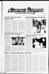
| Show County Chronicle Progress 12 Millard Page May 16 2002 to tract sand gravel rocks the subject property Tax5enaLNg33i-The Southeast Quarter of Section 14 23 South Range 6 West Salt Township Lake Base and Meridian Tax§?nal Ng ?429 Commencing 1905 75 feet South from the Northeast corner of Section 26 Township 23 South Range 6 West Sad Lake Base and Meridian thence SouHi 7430 Wes! 2 730 75 feet more or less thence South 867 0 feet to the Northeasterly side of old HWY 91 and continuing North 8022' East along Northeriy side of said HWY 2 712 3 feet more or less to the east section line thence North along said 50 feet more or less to the section line ter of the Southeast quarter of Section 23 South Flange 5 West 19 Township Salt Lake Base and Meridian men! rights from Notice of Trustee’s Sale 12th duy of June "‘O'X'Slj 2V2 Jl trie hour of ten o dock a m ol j !j jt the rest entrance of the at 765 South Highourtr- Writ! Court On ti'ft Millard Count Fiilrnotc Utah asTrustee to the highest at puhic a icfron ")ef 'or )' h m lawful money of the ti") Sta'r s an payable at the time ol sae the hjlmwing rtesr nheij real propel’ e County of Utah Stale situated it Utah and der bed as lollows to CESS a INC COMPANY TlTL See A'la' tied xtiitji' A" covhe made without Said sale enant or auu inly regarding 'die posses mil ra era iie'hunces to su'isfy ttie ohle h and pursuant to ttie gal on sei ijie power ol si'e or le'red m tti Trust ee'uied to RICHARD !) CUH DS and e CHil US asTrusliyr toACCFSS M rMI'ANY INC as Trustee lof the heneht arid security of ED and PAM FAMILY TRUST WITH ED UP JAf PAM AND UPIED Dt rPAf D OP THEIP SUCCES UP lif fPAI S as Beneficiary SOPS t Pi JS1 2 IWf as Entry No feoemtx-l’h 4 m fi'ioF (4 at Page 78? V) ol ttie irtViui re' ords of Itie Millard County n County Stale nt Utah Pe oi ter f ehru fioii' e of iJefaull AJS recordru) aiS OS’ as nit No 001 1S832 in Hook 1o 722 til the othrial it Pagn rer ords ot the Mill ml Counly Pecordrir St lie of IJfiti ttil! nd Ount Dated this day of M ly 2002 !' A' COMPANY SS I4S) state South C IS S') Beginning 20 frets West No 8166 Southeast IJuarter ot Sec of the ot the Northwest ieer lim Pi 2 South ParigeSWesI township e and Mend in Itienu North Itelli SiMl rods theme West South 20 inds then' e asl 20 ol hi ginnm No 8354 point Ta Serial Soothe roils thence rrxls to ttie A (aimer of the Soulhwesl (Juir 2i South Sail ate Base and MeridA" e South tect them e West theme North 000 teet them at the Northeast Beginning ist Ouar'ei ol Ihn of Ser lion Parigeo ian them 0S0 feel Township act 0S0 feel to the point of heginnmq ess and eneptinq any and all prop nil on asl side of till County Poad Tax Serial No 8354 A 2 al Ihn Southeast (aimer ot The Beginning Southeast On liter ol the Southwest Ou ter of !ei Imn 2 Soulh Township P int’e o West Salt Lake Base and Mend in theme North 720 feet llientc West 'iStl feel them e North t00 leet thence rods West f’O feet them e South them e ast rods to the point of begin mug less and exeptmg any and all prop i'ity on Hie asl side of the County Poad Tax Serial No 8164 4 (aimer of Set al the Wesl Beginning Imn 'I Township 23 Smith PangeSWesI Sail I ake Base and Meridian them e East t')7 leet them e South 102 Feel to Center line ul Count Poad them e South tH‘42' West V)0 feet thence North ISO feet to ttie point of hegimmtq less Beginning at a point 240 feet South more or less from Hie Norttiwest Corner of ttie Southwest IJuarter of ttie Southwest Quartet of Section 10 Township 21 South Range 5 West Salt lake Base and Meridian said poiril being on right of way line of ttie county triad them e North 700 feel along the ser lion line theme Southeasterly 0H0 feet ttie North more or less to Hie North tioundiry line of the County road to a point 40H feel Northeasterly along ttie North houridaty of Hie Count Poad from the point ol he them e Southwesterly along the ginning uunty mail 40H leet mote or less to Hie tieginnim pi ait Tax Serial No 83'38 Tim Smith half of ttie Southwest Quarter amt Hie Southwest Quarter ot ttie South east Quarter of Sertion 2 Township 23 'viij'h Pange f West Sad Lake Base and Meridian Tax Serial The Norttiwesl Quarter No h Quarter ol ttie Northeast t ast half ol Hie ast halt 2 South Township Range ake Base and Meridian and Hie ot Sm lion 2 West Salt Serial No Tax South 8399 4 Norttiwesl Mange Menda'i Tax Serial No The West hall s Section 23 West Salt 8358 23 Township ike Base and Meridian Serial No at a point 240 feel South more Beginning or less from the Northwest corner of the Soulhwesl quarter of the Southwest quarSection 19 Township 23 South Pange 5 Wesl Sail Lake Base and Meridian said point being on Hie North line of ttie county road thence North 700 feel along Hie section hoe thence Southeasterly 6H0 feet more or less to ttie North boundary line ol ttie county road to a point 408 feel Northeasterly along the North boundary of !he county road from ttie point of beginning thence Southalong the county road 408 feet westerly more or less lo ttie point ot beginning Tax Sonal Nq 840§ The Wesl one half of the Southeast Quarter and the Southwest Quarter of Section 24 Township 23 South Pange 6 West Sail Lake Base and Meridian Less and excepting any and all property lying southeasterly of the County Road Excepting Therefrom description of a parcel of land in the Southeast 14 of Section 24 Township 23 South Range 6 West Salt Lake Base and Meridian more particularly described as follows al the Southeast CorBeginning ner ol said sertion 24 and using as j basis of beaung Soulh 00 00' 50 Wesl between the found Southeast comer of said Section 24 and ttie lound Souttieast corner ot Section 25 Township 23 South Range 6 West Salt Lake Base and Meridian thence North 84 14' 11 West 1792 14 feet to a set rebar and cap said point being Hie Hue point ot beginning Hienre North 56 11' 00 West 466 69 feet lo a set rebar and cap m a fence line thence North 33’ 49' 00 East 466 69 feet to a set rehar and cap thence South 56 00 East 466 69 teet to a set rehar and cap thence Soulh 33’ 49' 00" West 466 69 feet to the and containing point of beginning 5 00 acres more or less with the following Together easement In So frVl each side ot the following nhed centerline for the purpose of gress and pgress more particularly nhed as follows at Hie Southeast corBeginning ner of said Section 24 and using Also A above said basis of bearing fhenre North 84 14' 11" West 1797 14fret thence North 33’ 49' 00 East 16 50 feet to a point on Hie easlerly line ot the above nted parcel tfience South 56’ 00 East 72 70 feet to a point in a fern e The side lines ot the easement are to be lengthened or shortened to terminate al the side line ot the above descnbed parcel and said fence Tax Serial No 8417 The North one half ol the Northwest quarter ot Section 25 Township 23 South Range 6 Wesl Salt Lake Base and BJ of the Southwest Quarter 23 Smith Pange Township ake Base and Memtum Less 4 50 a res lo State road Tax Serial No 8418 A Northeast 4 ol ttie Northeast 4 of Sec tion 2h Township 23 South Ranges West Salt Lake Base and Meridian Less tie ginning of the Northeast Corner said Sec lion 25 theme Soulh 1320 teet to the Southeast Corner of said Northeast 4 Salt the Northeast 4 thence West 26 feel thence North 52fl feet parallel to the East Sectronlme thence West 634 leet theme North 792 teet to the North line sad Section 26 thence East 660 feet to the beg n of nmg Tax§eoai Nq541J Beginning at the Northwest Comer of the Northeast Quarter of Section 26 Township 23 South Range 6 West Salt Lake Base and Mendian thence East 80 rods thence South 80 rods thence Northwesterly to the pcxnt of beginning Tax5enaLN?L5451AJ The Southwest Quarter of the Northwest Quarter of Section 24 Township 23 South Range 6 West Sait Lake Base and Merid- Less and excepting any and all lying Southeasterly of the County Poad Tax 5erialNOj8388 South halt ot Ihe Northeast quarter South half of Ihe Northwest quarter and the Southwest quarter of Section 20 Township 23 South Range 6 West Salt Lake Base and Meridian Together wilh any and all water well rights appurtenant theieto la Serial NgJHQl 20 rods Wesl of the Southeast Beginning corner of the Northeast quarter of Section 24 own ship 23 South Range 6 West Sait Lake Base and Mendian thence North 53 rods thence West 60 rods thence Sooth 53 rods thence East 60 rods lo the pcxnt of beginning EXCEPTING THEREFROM Alt oil and mineral rights Also The Northeast quarter of the Southeast quarter of Section 24 Township 23 South Range 6 West Salt Lake Base and Mendian EXCEPTING THEREFROM TheSouT31 feet of said land EXCEPTING THEREFROM and mineral rights ian Less and excepting therefrom ( THERE FROM Begnmng20 corner of the the Southeast Northwest quarter of the Southeast quarter of said Section 19 thence West 50 feet thence North 240 feet thence North 51’ 25 3' West 990 feet more or less to the Soulh boundary of a county road thence Northeasterly along said county road 790 teet more or less to the East line of said Northeast quarter of Hie Southeast quarter thence South along said boundary line 950 feet more or less to the point of beginning feet North of EXCEPTING within THEREFROM the boundary of the That portion road county IxJSensiNQcMSS 18 17 chains East and 5 chains Beginning Soulh of the Northwest corner of Ihe Northeast quarter of Section 19 Township 23 Sooth Range 5 West Salt Lake Base and Mendian thence South 18' East 10 chains thence West 10 chains thence North 18' West 10 chains thence East 10 chains to the point of beginning I? lS erial N o 8156 at the Southeast corner of the Beginning Southwest quarter of the Northeast quarter of Section 19 Township 23 South Salt Lake Base and Merid5 West Range ian thence West 24 53 chains thence North 20' West 40 chains thence East 22 97 chains thence South 18' East 5 chains thence West 10 chains thence South 18' East 10 chains thence East 10 chains thence South 18' East 25 chains to the point of beginning ALSO Together with 30 shares ot Corn Creek Water Together with water rights as specified in certificate number and Together with Eighty (80) hours of water in Dry Wash Together with a grazing permit for the grazing of 24 catlle on the public domain during the period set out in certain Term Special Use Permits and other permits sued by the United Stales Forest Service and the Bureau of Land Management In the Millard County Published Chronicle Progress May 16 23 and 30 2002 Invitation for bids East Millard County Maintenance Depart- ment serin accepting bids for janitorial vices at the Millard County Courthouse (old court house) and the Millard County PubBids will be based on the job description that can be obtained at the Auditors or Clerks fices or from Gary Hone Maintenance Supervisor Bids must include proof of being able lo be bonded with a $2500 00 security bond and must be able to maintain bond awarded bid A business icence is also required if awarded bid on Contact payments will be or around the 5 and the 201 of each lic Safety Building information in month and signed bids must be sent delivered to the Millard County Clerk South Highway 99 Suite 6 Fillmore UT 84631 Bids must be received before 5 00 p m May 31 2002 Please mdicale "Bid on the outside of the sealed bid Bids will be opened at the reguvelope larly scheduled commission meeting on June 3 2002 at 30 a m Millard County reserves the right to accept or reject any and all bids Published in the Millard County Chronicle Progress May 9 16 23 and Written or 765 30 2002 Announcement Vacancy Millard School District ease- - The Wesl of the Southeast quar would like lo QUALIFICATIONS: of a a currenl Salary will be based on Ihe Millard District Salary Schedule School LOCALE: School District is totaled in the central part of Utah has two high schools two middle schools and four elementary schools Major population centers are the cities of Delta and Fillmore Millard DATE: 2002 August APPLICATIONS Letters of application should include all placement papers any available biographical data including teaching major and minor and a completed application form which will be supplied by Millard School District Applications be accepted until May 31 2002 Address applications to Dr Raymond J Timothy Supenntendent Millard School District PO Box 666 Della Utah 64624 (435) School District Is an Equal Opportunity Employer and does not discriminata on tha basis of raca sax or handicap Publiahsd In tha Millard County ChronicleProgrtsa May II and 21 2002 f NAME and any request a hearing Protest must be filed with me Slate Engineer Box 146300 Salt Lake on City UT or before JUNE 5 2002 These are inforof mal proceedings as per Rule the Division of Water Rights LEGEND POD Pomt(s) of Diversion Race of Use POU Nature of Use USE) Richfield Distncf USA Bureau of Land Management propose(s) to change the POU of water as evidenced Cert 12678 (A58537) by HERETOFORE: QUANTITY: 0015 cfs SOURCE 6 in well 355 ft deep POO: (1) N 3383 E 344 from S'A Cor Sec 25 T22S R7W USE' Stockwatenng-10head of livestock Wildlife POU25 T22SR7W HEREAFTER QUANTITY: 0 015 USE Same cfs POD Same as Heretofore POU: as Heretofore Same as Heretofore but adding the following Sec 24 Sec 25 T22S R7W Peter C and Lynell Vander Meide propose(s) to change the USE of water as evidenced by which is a portion of HERETOFORE SOURCE: 8 in S 1645 W 1950 R7W USE: QUANTITY: well from 7 0 t 426 ft deep POD(1) Sec 26 T25S 250 head of Stockwatenng- The Utah Department of T ransportation is advertising for bids for the following projects To bid these projects the contractor must purchase specifications proposal forms plans and electronic bid system data from the Utah Department of Trans(4 th Calvin L Rampton Complex portation 4501 South 2700 West SLC UT Floor) 64119 Phone for file on review are The project plans at the UDOT Region offices and at the locations Pnce Distnct RT 3 following Box 75C5 Price UT 84501 P O Box 700 District Richfield Ce- UT 84701 Richfield dar City P0 District 009 Cedar Box City UT 84721 (435) can be All project related information viewed on UDOT's home page (http www dot state ut us) Directions from the Conhome pate select ’Consultants select tractors’ ’Construction Division’ desired item All contactors proposing to bid UDOT with heavy highway construction projects an advertised estimate of $500000 or more must file and gam prequalification approval pnor to receiving bid documents For further information from the UDOT contact Project No: Sealed proposals will be received at the above address until 2 o'clock p m time Tuesday June 4 2002 and at that publicly opened for Resurfacing of the same being idenin Millard County tified as Federal Aid Project No livestock HEREAFTER QUANTITY 70 USE Imgation: Same as Heretofore to Oct 31 total acreage 0 5300 acs sole supply 05300 acs of 90 head livestock RecStockwatering: reation Recreational Campground - see comments POU: Same as Heretofore Corporation of the President Aaronic Order proposes to correct USE of water as evithe POD POU denced by (A26595) HERETOFORE QUANTITY 6 0 cfs SOURCE Water Well POD Underground N W 50 2280 (1) (2) N 80 W 810 from E 4 Cor Sec 14 T19S R19W 16 in well 99 ft deep USE from Mar 20 to IrngationOct 10 total acreage 320 0000 acs of 326 head livestock Stockwatering DomesticN 12 Sec 14 POU family T19SR19W HEREAFTER 2 565 cfs Of QUANTITY: SOURCE: 16 in well 77 ft 507 24 deep POD (1) N 2682 W 2414 from SE CorSec14T19SR19W (Eskdale)USE from Mar 20 to Ocf 10 total acreIrrigation age 126 8100 acs sole supply 126 8100 SW W acs POU 14 12 SE 14 Sec 14 T19SR19W POD from Apr Jerry D Olds PE STATE ENGINEER Published In Progress Millard County 16 on MAY 9 Notice of Trustee’s Sale The following described property will be sold at public auction lo the highest bidder without warranty as to title possession or encumbrances payable in lawful money of the United States at the Main Entrance Millard County Courthouse 765 South Highway 99 Fillmore Utah on May 30 2002 at 12 00 p m for the purpose of foreclosing a Trust Deed dated July 1998 executed by Randy D Johnson and Kelli A Johnson as Trustors in favor of South Town Mortgage a Corporation as Beneficiary covering real properly cated in Millard County as descnbed as follows Beginning 11 chains West and 3 5 chains North of the Southeast corner of the Northwest quarter of Section 34 Township 17 South Range 7 West Salt Lake Base and Meridian thence North 3 5 chains thence West 2 chains more or less to the Easterly line of the railroad nght of way thence South 26 degrees OV West 3 9 chains more or less along the Easterly line of Ihe railroad right of way thence East 3 70 chains more or less to the point the improvements hereafter erected on the property and all easements appurtenances and fixtures now or hereafter a part of the property All replacements and additions shal be covered Instrument All of the by this Security is referred to In this foregoing Instrument as the ’Property’ The street address of the property is purported to be 3935 South 2675 West Oasis UT 84650 the undersigned disclaims any liability for any error m the street address The current Beneficiary of the trust deed is GMAC Mortgage Corporation and the record owners of the property as of the recording of the notice of default are reported to be Randy D Johnson and Kelli A Johnson Bidders must be prepared to tender to the trustee a $5000 00 deposit at the sale and the balance by 10 00 a m the day the sale Both payments must following be in the form of a cashier's check THIS NOTICE IS AN ATTEMPT TO COLLECT A DEBT OBTAINED AND ANY INFORMATION WILL BE USED FOR THAT PUR- POSE Dated April sJ The length is: improved 0257 from R road to be constructed or 3072 Kilometers of Route of P14 to R P33 The principal items of work are approximately as follows: 19 0 mm 23000 Mg Chip Seal HMA Coat Type C 231000 m2 450 Mg Emulsified Asphalt The project is to be completed in: 25 Days Plans specifications and proposal forms may be obtained at the above address for a cost of $35 00 plus tax and mail charge if applicable no part of which will be refunded Working of (May) OF Dated this (11th) day 2002 UTAH DEPARTMENT TRANSPORTATION John R Njord Director Published in the Millard County Chronicle Progress May 16 2002 Notice of Divorce 22 2002 Randall Call Pnnce Yeates Geldzahler 175 East 400 South Suite 900 Salt Lake OtyUT 841 11 (801) Published in the Millard County May 2 9 and 16 ChronicleProgress 2002 Philip M Klemsmith Utah Bar no 5370 Klemsmith Associates P C Attorneys for Plaintiff 6035 Enn Park Drive Suite 203 Colorado Spnngs CO 80918 District Court Millard County 50 S Mam St Clerk Courthouse UT 84631 Fillmore OF THE FOURTH IN THE DISTRICT OF UTAH JUDICIAL DISTRICT OF MILLARD IN AND FOR THE COUNTY WASHINGTON Plaintiff MUTUAL BANK (s) vs Knudson (1) David Knudson (2) Holly (3) John T Morgan Real Estate Co (4) Clark an Idaho Corp (5) Boiver Investments LL C a Utah Limited Liability Co (6) Roper Lumber Co (7) A Paul Schwenke (8) B&B LL C a Utah Limited Liability Co (9) U S Bancorp Leasing Financial and Farm Credit Leasing Services Corporation (11) Life Source Inc (12) Unknowns All Unknown Occupants AndOr Tenants Of The Subject Real Estate (13) Unknowns All Unknown Spouses Of Any Party Hereto And All Other Persons Living Or Dead Who Whose names Are Unknown Claim Any Interest In the Subject Real Estate (10) DEFENDANTS Washington Mutual Bank vs David Knudson et al Case No 010700029 Page 2 ’SECOND AMENDED’ Notices of (A) Writ of Execution and (B) Sheriffs Sale TO ALL DEFENDANTS You are NAMED ABOVE notified (A) That the above Writ of Execution Court has issued the (See Paragraph 15 thereof) in the attached Summary Judgment and Decree of Foreclosure and der Appointing Receiver ordering the Sheriff of this County to sell the Real PropSaid Judgment elc erty described herein is not attached to the published copy of these Notices Proceedings SUANCE YOU MUST PUT SAME IN WRITING IF YOU WISH TO CHALLENGE Shanda Clendenin Petitioner Greg Clendenin Respondent THE STATE OF UTAH GREG CLENDENIN YOU ARE HEREBY GIVEN NOTICE That an Amended Divorce Complaint has been filed with the Fourth District Court for and behalf Millard County State of Utah YOU ARE HEREBY SUMMONED and required to file with the clerk of the court an Answer and to serve upon or mail to petitioner’s attorney a copy of said answer within twenty (20) days ter the last date this notice is published in the Millard County Chronicle If you fail to file an Answer with the Fourth District Court for and behalf of Millard County Stale of Utah then judgment by default will be taken against you for relief demanded in said complaint which has been filed with the clerk of the Fourth District Court A full copy of the Amended Divorce Complaint can be obtained at the following address' Fouorth Distnct Court 765 S Hwy 99 Fillmore Utah 84631 Bryan Sidwell for the Attorney P O Box 398 36 Petitioner St Utah 84648 Nephi Published In Ihe Millard County May 2 9 16 and ChronlcleProgress 23 2002 S Main Accepting Bids Millard County Recreation and Sunset Golf Course is accepting bids for of 4335C feet trenching and installation of 10 inch pip pipe at Sunset View Golf Course Average depth of trench will be 4 ' feet deep Contractor will be responsible to dig install and backfill trenches Bid specifications can be picked up from Kevin Morris at Millard County Maintenance Shop 265 Manzamta Delta UT or call or (cell) Bids are due by Fnday May 17 2002 5 00 p m at the Millard County Office in Delta Bids will be opened on May 20 2002 at the regular Commission meeting Millard County reserves the nght to accept or reject any or all bids Millard County is an equal opportunity employer Published in the Millard County ChronicleProgress May 9 and 16 2002 Notice NOTICE is hereby given that the City of the City of Delta Utah will hold a Budget Work Session on Thursday May 30 2002 at the City Building located at 76 North 200 West beginning at 9 00 a m Is Gregory Jay Schafer City Recorder Published In the Millard County Chronicle Progress May 18 and 23 2002 Council Notice NOTICE is hereby given that the Delta Budget for Fiscal Year was approved on Monday May 13 2002 at a Regular City Council Meeting The Tentative Budget is on file in the fice of the City Recorder for public 800am to500pm view from through Monday Friday Published In the Millard County Chronicle Progress May 16 2002 f THE OF THE WRIT OF EXECUTION FILE SAME WITH THE COURT AND PLAINTIFF'S TO City Tentative To own a bit of ground to acratch it with a hoe to plant seeds and watch their renewal of life — this is the commonest delight of the race the moat satisfactory thing a man can do —Charles Dudley Warner of: (A) Writ of Execution and (B) Sheriff Sale Case No 010700029 Judge James R Taylor v View WITH now or Candidates must be a graduate with college or University Utah teaching license TelephoneMillard PROTESTANTS' for of beginning TOGETHER announce the following vacancy at Delta Middle School for the school year Life Careers (TLCyindustnal Technology Arts STARTING FOR OBJECTION AND RETUFTN ADORESS of POSITION: The County (Locations in SLB&M) Persons objecting to an application must READABLE file a CLEARLY signed protest stating FILING NUMBER REASONS Chronicle 2002 SALARY: ol Sec lion West the West quarTownship 23 Soulh Range 6 Wesl Salt Lake Base and Meridian and running thence East 64 rods thence North 42 rods thence South 60 West 18 75 chains thence Soulh 4 rods feet to the place of beginning Tax Serial N? 8413 al the West quarter corner of Beginning 23 South Range 6 Ser non 25 Township West Salt Lake Base and Meridian thence North 627 feet thence East 056 feel thence Soulh 907 feel more or less to the Northerly side of old HWY 91 thence run065 ning Southwesterly along said HWY feel more or less to the Westerly section line thence North 455 feet more or less lo Iho place of beginning Tax Serial No 8397 Soulh West quarter of the Northeast quarter Northwest quarter ot the Southeast quarter and the North halt ol the Southwest quarter of Section 23 Township 23 Soulh Range 6 West Salt Lake Base and 38 rods North of Beginning ter comer ot Section 25 ter ol Idol 221 xhitnt A Tax Serial ler INC Sle Street S40S7 Hem beginning EXCEEDING point of beginning Tax 5enal Nq Tax IaxS?n9iN98!59 of the Southeast quarThe East ter of the Southeast quarter of Section 19 Township 23 South Range 5 West Sait Lake Base and Mendian Tax Serial No Beginning 14 61 chains South of the Northeast corner of the Northwest quarter of the Southeast quarter of Section 19 Township 23 South Range 5 West Sail Lake Base and Mendian thence South 25 39 chains thence West 40 chains thence North 24 50 chains thence North 73 East 30 50 chains thence North 83 East 50 links thence South 5152' East 3 02 chains more or less to the pcxnt of Second Amended Notices Notice to water users NOTICE TO The State Engineer received the Applications to Change Water m CONTRACTORS lowing Millard ATTORNEY AND REQUEST A HEARING ON SAME WITHIN TEN 0) DAYS OF SERVICE OF THESE NOTICES (B) YOU ARE NOTIFIED ESTATE TO BE SOLD ON YOU THAT THE REAL (described below) shall be sold at the following dale time and place by the undersigned Sheriff 12 Date' June 2002 Place in the Lobby of the Millard County Sheriffs Office 765 South Highway 99 Fillmore UT 84631 Time: 12 OQpm Estate Common Description: Real 35 East 200 north Kanosh Utah 84637 Description: 42 Rods North and 51 Rods Beginning West of the Southeast Comer of Section 17 township 23 South Range 5 West Salt Lake Base and Mendian thence West 20 Rods thence North 10 Rods thence East 20 Rods thence South 10 Rods to the point of beginning Excepting therefrom all oil gas minerals andor Geothermal rights in on or der said land together with the nght or ingress and egress for the purpose of explonng andor removing the same Sheriff of Millard County Utah Legal IsJ Ed Phillips Published in the Millard County May 9 16 and 23 ChronicleProgress 2002 Notice of Trustee’s Sale The following described real property be sold at public auction to the highest bidder without warranty as to title possession or encumbrances at the main entrance of the Millard County Courthouse 765 South Hwy 99 Fillmore Utah on the 13th day of June 2002 al 11 45 o'clock a m of said day: Situated in the County of Millard State of Utah more particularly descnbed as follows' Beginning 975 feet South of the North Quarter comer of Section 19 Township 17 South Range 7 West Salt Lake Base and Meridian thence West 250 feet thence South 200 feet thence East 250 feet thence North 200 feet to the point of beginning Street Address: 271 North 500 West Hinckley Utah 84635 The Trust Deed being foreclosed by these trust deed foreclosure proceedings is dated March 19 2001 and was executed by Jedd R Higgs as Trustor(s) and in favor of Mortgage Electronic Registration Systems Inc solely as nominee for Lender the present BenThe present owner is reported to eficiary be Jedd R Higgs The purchase pnce is payable in lawful money of the United States of America Bidders must be prepared to tender to the Trustee a $500000 deposit in certified funds or a cashier's check at the time of sale to secure bid and the balance of the purchase pnce must be paid in full in the form of certified funds or a cashier’s check with 24 hours from the time of sale DATED the 3lh day of May 2002 Paul M Halliday Jr Successor Trustee 376 East 400 will South Suite 300 Salt Lake City Utah 84111 FILE NUMBER Telephone (801) 20252 ASAP480414 Published In the Millard County Chronicle Progress May 16 23 and 30 2032 SUBSCRIBE TODAY r |