| OCR Text |
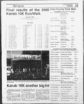
Show SOUTHERN UTAH NEWS Legal Notices ARTICLES OF ORGANIZATION Steve Jackson 1515 E. Cedar Ave, Suite Flagstaff, A Z 86004 HAVE BEEN FILED IN THE OFFICE OF THE ARIZONA CORPORATION COMMISSION FOR I Name: GAYLORD, LLC II D-- 1 The address of the registered office is: 1 24 Kletha Ovi, Flagstaff, AZ 86001 The number of persons to serve on the board of directors thereafter shall be fixed by the Bylaws. The name and address of the Statutory Agent is: Tom Shannon, CPA, 124 Kletha Ovi, Flagstaff, AZ 86001 Incorporators The incorporators of the corporation are: VIII. Steve Jackson 1515 E. Cedar Ave, Suite D-- 1 Flagstaff, AZ 86004 All powers, duties and responsibilities of the incorporators shall cease at the time of delivery of these Articles of Incorporation to the Arizona Corporation Commission. ARTICLE IX. Indemnification of Officers. Directors. Employees and Agents The Corporation shall indemnify any person who incurs expenses or liabilities by reason of the fact he or she is or was an officer, director, employee or agent of the Corporation or is or was serving at the request of the Corporation as a director, officer, employee or agent of another Corporation, partnership, joint venture, trust or other enterprise. This indemnification shall be mandatory in all circumin which indemnification is permitted by law. III (Please check A or B) Management of the limited company is vested in a manor ager managers. The names and address of each person who is a manager AND each member who owns a twenty percent or greater interest in the capital or profits of the limited liability company are: A. ( Management of the limited liability company is reserved to the members. The names and address of each person who is a member are: B. ( X ) Jean EXECUTED this 8th day of February, 2000 by all of the incorporators: Signed: Steve Jackson, INCORPORATOR 525-258- 9 8 Acceptance of Appointment by Statutory Agent The undersigned hereby acknowledges and accepts the appointment as statutory agent of the above-name- d Corporation effective this 8th day of February, 2000. Signed: Tom Shannon, CPA 124 Ktetha Ovi Flagstaff, AZ 86001 Published in the Southern Utah Nows on May 17,24 & 31, 2000. Mitchell PO Box 6928 Avon, CO 81620 (X) Member (X) Manager Published in the Southern Utah News on May 17, 24 & 31, 2000. ARTICLE X. Limitation of Liability To the fullest extent permitted by the Arizona Revised Statues as the same exists or may hereafter be amended, a director of this corporation shall not be liable to the Corporation or its shareholders for monetary damages for any action taken or any failure to take any action as a director. No repeal, amendment or modification of this article, whether direct or indirect, shall eliminate or reduce its effect with respect to any act or omission of a director of the Corporation occurring prior to such repeal, amendment or modification. ) liability PUBLIC NOTICE (for publication) ARTICLES OF ORGANIZATION HAVE BEEN FILED IN THE OFFICE OF THE ARIZONA CORPORATION COMMISSION FOR I Name: SNIDER HAYES PRODUC- NOTICE TO WATER USERS SEE EXHIBIT A (X)Member ARTICLE VII. Board of Directors The initial Board of Directors shall consist of one director. The person who is to serve as directors until the first annual meeting of the shareholders or until his successors are elected and qualified is: Phone (520) Fax (520)525-237- the following described property. (for publication) from Page 24 stances Flagstaff, AZ 86C01 PUBLIC NOTICE Legals Continued ARTICLE WEDNESDAY MAY 24, 2000 The following applications requesting an EXTENSION OFTIME WITHIN PARCEL 1: X) Manager WHICH TO SUBMIT PROOF OF BENEFICIAL USE have been filed BEGINNING AT A POINT 82.5 with the State Engineer. It is repreRobert Hayes 3650 N. Park Dr. FEET EAST AND 156.0 FEET sented that additional time is needed Flagstaff, AZ 86004 SOUTH OF THE NORTHWEST to place the water to beneficial use in CORNER OF THE SOUTHWEST Kane County. QUARTER OF ThE NORTHWEST (X) Member Persons objecting to an application QUARTER (SW14NW14) OF SECmust file a CLEARLY READABLE TION 27, TOWNSHIP 43 SOUTH. protest stating FILING NUMBER, (X) Manager RANGE 6 WEST, SALT LAKE BASE REASONS FOR OBJECTION. AND MERIDAN, AND RUNNING PROTESTANTS NAME AND REPublished in the Southern Utah News THENCE SOUTH 125.0 FEET; TURN ADDRESS, and any request THENCE EAST 90.0 FEET; THENCE for a hearing. Protest must be filed on May 17, 24 &' 31, 2000. NORTH 653' WEST 125.9 FEET; with the State Engineer, Box 146300, THENCE WEST 75.0 FEET TO THE Salt Lake City, UT 84114-630- 0 POINT OF BEGINNING. on or before JUNE 20, NOTICE TO WATER USERS 2000. These are informal proceedPARCEL 2: of the ings as per Rule R655-6-- 2 The State Engineer received a Division of Water Rights. CLAIM FOR DILIGENCE in Kane BEGINNING AT A POINT WHICH in SLB&M). IS NORTH 1 .037.38 FEET AND EAST County (Locations (LEGEND: Point(s) of Diversion Persons challenging this CLAIM 83.31 FEET FROM THE WEST POD: Place of Use POU: Nature of may file an action through the district QUARTER CORNER OF SECTION Use USE) court. Persons with information re27, TOWNSHIP 43 SOUTH, RANGE garding this claim may file it with the 6 WEST, SALT LAKE BASE AND 9 (A56283): Arthur Renold & State Engineer, Box 146300, Salt MERIDIAN, AND RUNNING Janice Lee Ronshausen QUANTITY: Lake City, UT 841 1 (801 THENCE EAST 232.0 FEET; 0.15 cfs. SOURCE: Underground on or before JUNE 20, 2000. THENCE SOUTH 393233 EAST Water Well. POD: (1) S 2790 E 460, 12.97 FEET; THENCE WEST 91 .76 9 in. well 100 fL to 400 ft deep (2) S (D6928): Roger Dieleman FEETTOTHE P.C. OF A293.0 FOOT 3140 E 560, 9 in. well 100 ft. to 400 ft. QUANTITY: 0.019 cfs or 2.75 ac-f- t. RADIUS CURVE HAVING A CENdeep (3) S 3400 E 1162 from N14 SOURCE: Spring. POD: (1)S TRAL ANGLE OF 1 845'; THENCE Cor, Sec 4, T43S, R1W., 9 in. well 1087 E 55 from N14 Cor, Sec 9. ALONG THE ARC OF SAID CURVE 1 00 ft. to 400 ft deep. (East of Kanab T38S, R9W. (Plains Area) USE: TO THE LEFT 95.88 FEET TO THE near Paria River) STORAGE: UnStockwatering: from May 1 to Nov 1 P.T. OF SAID CURVE; THENCE named, Capacity 2.0 act-ft- ., height of 82 head of livestock; Domestic: 1 SOUTH 71 IS1 WEST 15.63 FEET dam & ft., inundating 0.75 acs. in TO THE P.C. OF A 379.02 FOOT NW14.SE14 Sec 4, T43S, R1W. family from May 1 to Nov 1 . RADIUS CURVE HAVING A CENUSE: Irrigation: total acreage 1 0.0000 Robert L Morgan, P.E. TRAL ANGLE OF 61 THENCE acs; Domestic: 2 families; Fish CulSTATE ENGINEER ALONG THE ARC OF SAID CURVE ture: Commercial Fish Farm. TO THE RIGHT 41.06 FEET; Published in the Southern Utah News THENCE LEAVING SAID CURVE Robert L Morgan, P.E. on MAY 24 & 31, 2000. AND RUNNING NORTH 41 .64 FEET STATE ENGINEER TO THE POINT OF BEGINNING. Published in the Southern Utah News Tax Serial No. MAY 24 & 31, 2000. on PUBLIC NOTICE (801-539-724- 0) 89-126- 38-7240) 81-42- R-- D 25; Client: BENEFICIAL FINANCIAL SERVICES 1 Our File: 0FRANKUN, JOHN AND LAURIE 00-60- EXHIBIT A NOTICE OF TRUSTEES SALE Property Address: 415 East 100 South, Kanab, UT 84741 The undersigned disclaims any ability for any error in the street address. li- The present owner of the property is reported to be: John D. Franklin and Laurie L Franklin v TIONS, LLC The following descrfoed real propII erty will be sold at public auction to the highest bidder payable in lawful The address of the registered office money of the United States on June is: 124 Kletha Ovi, Flagstaff, AZ 86001 20, 2000, at 12:00, at the West entrance to the Kane County CourtThe name and address of the Statu- house, 76 North Main, Kanab, UT tory Agent is: Tom Shannon, CPA, 84741 , in the County of KANE, State of Utah, for the purpose of foreclosing 124 Kletha Ovi, Flagstaff, AZ 86001 a trust deed held by Beneficial MorIII tgage Cp. of Utah, as the current BenA or check B) eficiary, executed by John D. Franklin (Please and Laurie L Franklin as Trustor, A. ( ) Management of the limited recorded June 30, 1 999 as Entry No. at Page 488, of 99186, in Book liability company is vested in a manofficial names The and of or the records Kane County, managers. ager address of each person who is a Utah, given to secure an indebtedmanager AND each member who ness in favor of Beneficial Mortgage owns a twenty percent or greater in- Co. of Utah, by reason of certain terest in the capital or profits of the obligations secured thereby. limited lability company are: Notice of Default was recorded B. (X) Management of the limited February 11, 2000, as Entry No. liability company is reserved to the 101674, in Book 194, at Page 124, of members. The names and address said official records. of each person who is a member are: Trustee wifi sell at public auction to David Snider highest bidder without warranty as to 9150 Roundtree Ranch fide, possession or encumbrances. 0-8- NOTICE TO WATER USERS Bidders must be prepared to tender to the trustee a $5,000.00 cashiers check at the sale and a cashiers check for the balance of this purchase price within 24 hours after the sale. DATED: May 18. 2000 SLB&M). Persons objecting to an application must file a CLEARLY READABLE protest stating FIUNG NUMBER, REASONS FOR OBJECTION. NAME AND REPROTESTANTS TURN ADDRESS, and any request for a hearing. Protest must be filed with State Engineer, Box 1 46300, Salt Lake City, UT 841 1 (801 on or before JUNE 13, 2000. These eve informal proceedings as of the Division of per Rule R655-6-00 38-7240) 2 LORETTA K. POCH, Asst Vice President 105 E. Moreno, Suite 100 Colorado Springs, CO 80903 (719) The State Engineer received the following Application(s) to Change Water in Kane County (Locations in 634-486- Water Rights. (LEGEND: Puns) of Diversion POD; Place of Use POU; Nature of Use 8 7, Martin P. (&24420): Greenbank, Elizabeth J. Greer propose(s) to change the POD, POU, 85-10- and FIRST SOUTHWEST TITLE USE) & 55 USE of water as evidenced a by Successor Trustee deeded portion of 8 (A26838). West 500 South, Suite 318 HERETOFORE: QUANTITY: 1.0 85-99- 1C2 Salt Lake City, UT 84101 ac-f-t. SOURCE: Underground Wafer Wei. POD: (1) N 999 E 193, 10 in. Published in the Southern Utah New wefi 94 ft. deep (2) N 180 E 99, 10 in. on MAY 24, 31 & JUNE 7, 2000. well 94 ft. deep (3) N 1771 E 1 1 from S14 Cor. Sec 25, T43S, R5W., 10 in. well 120 ft. deep. USE: Irrigation: Legal dcadllne-Frlda- y et 1 p.m. See LEGALS, Page 26 |