| OCR Text |
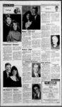
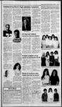
Show Page 10 PUBLIC NOTICES NOTICE OF TRUSTEES SALE NOTICE IS HEREBY GIVEN that the following described real property will be sold at public auction to the highest bidder, payable in lawful money of the United States at the time of sale, at the Sanpete County Courthouse, Manti, Utah, on December 28, 1990, at the hour of 1:00 p.m. of said day for the purpose of foreclosing a Deed of Trust executed by Don Lewis Larson and Emogene Larson, his wife and Juan L. Larson and Vicky Larson, his wife, as Trustors, in favor of Federal Land Bank of Sacramento, as Trustee and as Beneficiary, covering real property and appurtenant water rights situated in Sanpete County, Utah, more particularly described as: 1. Lots and the South half of the Northeast quarter of Section L Township 19 South, Range 1 East of the Salt Lake Base and Meridian; the Southwest quarter of the Southeast quarter of Section 1, Township 19 South, Range 1 East of the Salt Lake Base and Meridian; the North half of the Southeast quarter of Section 1, Township 19 South, Range 1 East of the Salt Lake Base and Meridian; The South half of the Northwest quarter of Section 1, Township 19 South, Range 1 East of the Salt Lake Base and Meridian; the North half of the Southwest quarter of Section 1, Township 19 South, Range 1 East of the Salt Lake Base and Meridian; ALSO beginning at the Southeast comer of the Southwest quarter of Section 1, Township 19 South, Range 1 East of the comer of the Northwest quarter of the Northeast quarter of Section 14, Township 19 South, Range 1 East of the Salt Lake Base and Salt Lake Base and Meridian; thence Meridian; thence West 20.00 chains, thence South 40.00 chains to Center of Section 14, thence West 20.00 chains, thence South 40.00 chains, thence East along the Section line 14.15 chains, more or less, to a fence line on the West bank of the City Ditch, thence North 48 degrees 20' East 968.5 feet along said West 15.00 chains, thence North 20.00 chains, thence East 15.00 chains, thence South 20.00 chains to beginning. 2. The East half of the Southeast quarter and the Southeast quarter of the Northeast quarter of Section 11, Township 19 South, Range 1 East of the Salt Lake Base and Meridian. 3. The North half of the Northwest quarter; the Southwest quarter of the Northwest quarter; the North half of the Southwest quarter of Section 12, Township 19 South, Range 1 East of the Salt Lake Base and Meridian. Also beginning at the Southwest comer of Section 12, Township 19 South, Range 1 East of the Salt Lake Base and Meridian; thence East 11.00 chains, thence North 8' East 10.00 chains, thence East 29.00 chains, thence North 10.00 chains, thence West 40.00 chains, thence South 20.00 chains to beginning. 4. Beginning at the Northwest corner of Section 13, Township 19 South, Range 1 East of the Salt Lake Base and Meridian; thence South 9.87 chains, thence North 61 degrees 55' East 4.94 chains, thence North 70 degrees 30 East 7.11 chains, thence North 8' East 5.20 chains to the Section line, thence West on Section line 11.00 chains to beginning. 5. Beginning at the Northeast Pillsbury 389 mix GRAVY Western Family iibPk,$2.39 Kraft Marshmallow 70Z.69C CREME Western Family i6.69c PEAR HALVES Western Family RAISINS b p, 2.1 9 Duncan Hines Angel Food cake mix $2.09 Stove Top STUFFING MIX 1.09 Del Monte FRUIT COCKTAIL 79 i?.z. Lenders 89C BAGELS ..; Lynn Wilson BURRITOS 3$1 GQoEEHl SBEGIAUS Choice 39c NAVEL ORANGES 2 lb. bag CARROTS Zucchini SQUASH is. Brussel SPROUTS lb. 39c Juicy TURKEY STEAK BarS Buddig, Thin-Slice- d MEATS Western Family BOLOGNA OR SALAMI ....i,oz.?1 .09 7. fence line and ditch, thence North ber, 1990. s Stephen C. Ward STEPHEN C. WARD Assistant Attorney General Attorney for Utah Department of Agriculture 236 State Capital Salt Lake City, Utah 84111 fence post at the Southerly end of concrete bridge, thence North 6 degrees West 1 18 feet to Northerly line of U.S. 89, thence North 84 degrees East 188.1 feet to fence corner, along thence North 2,379.3 feet along fence line to Northwest comer, thence East 411 feet, more or less, to the 116 Section line, thence North 1088 feet, more or less, to beginning. Less 4.83 acres in State right-of-wa- y right-of-wa- y Road. 6. Beginning at a point South 08' West 9.87 chains from the Northeast corner of Section 14, Township 19 South, Range 1 East of the Salt Lake Base and Meridian; thence West 20.00 chains, thence South 6.31 chains, thence West 1.00 chain, thence South 35.24 chains, South 80 degrees 1237 West alongNorth sideofU.S. Highway 89 5.32 chains y line, thence along same South 84 degrees West 188.1 feet, thence South 6 degrees East 118 feet, thence South 23 degrees 24' West 38.10 feet, thence South 11 degrees 2T West 256.20 feet, thence South 10 degrees 54' West 532.60 feet, thence South 22 degrees 10' West 67.90 feet, thence South 35 degrees 23' West 96.70 feet, thence South 48 degrees IT West 181.30 feet, thence South 48 degrees 20 West 968.5 feet, thence East 1.00 chain, thence South 55 degrees East 16.49 chains, thence North 35 degrees 35' East 28.00 chains, thence West 4.95 chains, thence North 15.47 chains, thence North 77 degrees 40' East 6.05 chains, thence North 71 degrees 45' East 4.05 chains, thence North 60 degrees 24' East 6.31 chains, thence South 40 degrees 6' East 11.41 chains, thence North 61 degrees 15' East 13.22 chains, thence North 6 degrees 45 West 4.45 chains, thence North 60 degrees 25' East 1.64 chains, thence North 6 degrees 451 West 9.17 chains, thence South 63 degrees 55 West 1.64 chains, thence South 36 degrees West 2.25 chains, thence South 59 degrees 45' West 0.21 chain, thence North 08 East 3 1.58 chains, thence South 70 degrees 30' West 7.11 chains, thence South 61 degrees 55' West 4.94 chains to beginning. Less 6.80 acres in state road. 7. Beginning at a point South 15' East 43.40 chains, thence South 59 degrees 45' West along the South line of County road 5.49 chains from the Northeast comer of Section 14, Township 19 South , Range 1 East of the Salt Lake Base and Meridian; thence South 60 degrees 24' West along South line of County road 6.31 chains thence South 71 degrees 45' West 4.05 chains, thence South 77 degrees 40 West 6.05 chains, thence South 15.47 chains, thence East 4.95 chains, thence North 79 degrees 29' East 5.52 chains, thence South 87 degrees East 3.23 chains, thence North 39 degrees 35' East 7.17 chains, thence South 89 degrees 15' East 7.33 chains, thence North 3 degrees 20' East 8.23 chains, thence South 61 degrees 15' West 3.99 chains, thence North 40 degrees 6' West 11.41 chains to beginning. 8. Beginning at the Northeast corner of Section 14, Township 19 South, Range 1 East of the Salt Lake Base and Meridian; thence South 9.87 chains, thence West 20.00 chains, thence North 9.87 chains, thence East 20.00 chains to point of beginning. BACON 538-717- 48 degrees ll'East 181.3 feet along said fence line and ditch, thence North 35 degrees 23' East 96.7 feet along said fence line & ditch, thence North 22 degrees 10 East 67.9 feet along said fence line & ditch, thence North 10 degrees 54' East 532.6 feet alongfence line & ditch, thence North 11 degrees 27' East 256.2 feet along fence & ditch, thence North 23 degrees 24' East 38.1 feet along said fence line & ditch to a right-of-wa- WALNUTS the Sanpete County Courthouse, Manti, Utah. The seller reserves the right to reject any and all bids. You can contact Mr. George Hopkin at the Utah Department of Agriculture at 350 North Redwood Road, Salt Lake City, Utah 84116 (801) The wheel lines are physically located on the Don Lewis Larson farm located north of Gunnison, Utah. DATED this 23rd day of Novem- TOGETHER WITH 409 shares of Gunnison Irrigation Company stock, evidenced by Certificate Number 970, 976 and 604. DATED this 21st day of November, 1990. sPaul M. Harman Paul M. Harman, Esq. Successor Trustee Publish Manti Messenger er December 6. 13. 1990. NOTICE OF SALE You and each of you are hereby notified as follows: The Utah Department of Agriculture will offer for sale to foreclose its security interest in the 29. following described wheel lines (see Exhibit A) on Friday, the 28th day of December, 1990 at 1:00 p.m. at , Telephone (801) 538-101- 7 EXHIBIT A DON LEWIS LARSON PROPERTY DESCRIPTION (Serial , Make, Model, Description) 15911, Wade Rain, 70 4", Wheel line sprinkler with movers. 16326, Wade Rain, 70 4", Wheel line sprinkler with movers. 15676, Wade Rain, 70 4", Wheel line sprinkler with movers. 16453, Wade Rain, 70 5", Wheel line sprinkler with movers. 16226, Wade Rain, 70 5", Wheel line sprinkler with movers. 15938, Wade Rain, 70 4", Wheel line sprinkler with movers. 17272, Wade Rain, 70 5", Wheel line sprinkler with movers. 17292, Wade Rain, 70 5", Wheel line sprinkler with movers. 15990, Wade Rain, 70 4", Wheel line sprinkler with movers. 16325, Wade Rain, 70 4", Wheel line sprinkler with movers. 15978, Wade Rain, 70 4", Wheel line sprinkler with movers. 15987, Wade Rain, 70 4", Wheel line sprinkler with movers. 15827, Wade Rain, 70 4", Wheel line sprinkler with movers: 16033, Wade Rain, 70 4", Wheel line sprinkler with movers. 16073, Wade Rain, 70 4", Wheel line sprinkler with movers. 15984, Wade Rain, 70 4", Wheel line sprinkler with movers. 16082, Wade Rain, 704" Wheel line sprinkler with movers. Publish December 6, 13, 20, 1990. . NOTICE TO WATER USERS The State Engineer received the following Application(s) to Appro- - - OTTHLUN it Persons objecting to an application must file a Protest stating the reasons for the protest. To have a hearing before the State Engineer, persons must request a hearing in the Protest. Protest must be filed in duplicate with the State Engineer, 1636 West North Temple, Salt Lake City, Utah 84116, on or before JANUARY 19, 1991. These are informal proceedof the ings as per Rule R625-6-- 2 Division of Water Rights. (LEGEND: Points) of Diversion - POD; Place of Use - POU; Nature of Use a USE) (A65031): Reid E. Bankhead T 66-36- J- 5 QUANTITY; 0.015 cfs. SOURCE; 8 in. well 100 ft. to 300 ft. deep. POD; ( 1) N 2450 E 2400 from SW Cor, Sec 4, T15S R1E (1.5 miles SE of Levan) USE; Stockwatering: 91 head of livestock; Domestic: 1 family. POU: NW 14 Sec 4, T15S, R1E. 7 (A56932): Manti City Corporation QUANTITY; 40.0 cfs. SOURCE; Manti City Creek. POD; (1) N 1490 E 690 from SW Cor, Sec 9, T18S, R3E. (5.5 mi E. of Manti) USE: Hydro-Powe- r, Power Plant Name: Manti Lower Pwr Hse, Rated Capacity 15 KW. The water will be returned to the natural stream or source at a points): (1) N 52 W Robert L. Morgan, P.E. STATE ENGINEER Publish in Manti Messenger on December 6, 13, & 20, 1990 KENNETH G. ANDERTON Attorney for the Estate 110 East 100 South Vernal, Utah 84078 0116 789-277- 0 Telephone IN THE SIXTH JUDICIAL DISTRICT COURT OF SANPETE COUNTY STATE OF UTAH IN THE MATTER OF THE ESTATE OF JESSIE WINTCH JENSEN, Defendant NOTICE TO CREDITORS Probate No. 4115 ESTATE OF JESSIE WINTCH JENSEN, DECEASED. PROBATE NO. 4115. All persons having claims against the above estate are required to present them to the undersigned or to the Clerk of the Court on or before the 18th day of March, 1991. Dated this 7th day of December, 1990. s Robert L. Jensen Robert L. Jensen Publish Manti Messenger cember 13, 20, 27, 1990. De- Manti Elementary Positive Action Students of the Week Positive Action Students of the Week are Evan Rasmussen and Kyle Sorensen. |