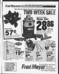
| Show 61 Standard-E- aTirer Tuesday February IS x 1SS3 1 Legais Legais KOTKE 0 TRUSTEE S SAL TN ng oec oa l w r 6 ' 0p uc--"toN n biOT- - c Iffm en 0 o- -i I’M m30 e I' c 0 j'eo of C Wft-- ' v Cou-—o- 4 ' i" m County o Cgoe" Rem T Sucm Weoe u"i to Centf cessor p STSCOPO LEE COOLER aiT-uv- or IM " ii tLt Trt - iw i ftcirw 1N5 as 6" Mr oE- U?‘r-t- v Pg ’eor of Npt Oc'ober w Dpj JO 19’ 1C749 6oo of sa 6 recer--K- at E -- try Pg 0'C‘I recorot auc- 2’ 15“8 t teii at pub estest booer tor peteo hi I "'m nII mwtiro utiteo S'a'es at wtnout bf to at to tion to t Cash o tn ty title possession or e- -c tne towowm oescnoeU commonly known at tn S'reet Ogoen U'an County of Weber S'eie ot U'an Part o Lot 1 and 3 m Bock 33 In Piat “A" Ogcen C'’ Survey Beginning a' a point 93 feet 9 iocnei East ot the Soutnwesi corner ot said Lot 3 running thenca North 05 feet thence East 31 eet thence South 45 feet thence West 28 teet to place ot begin- ju ning Together with a ever the following described trad of land situa'ed in Lots 2 n and 3 Block 33 Piaf "A" Ciir Survey Beginning ai a oom 65 teet Norm and 99 feet 9 inchet East ot the Southwest corner ot Mud Lot 2 thnnre E ast 14 feet thence Norm 110 feet thence West H5 teet 9 Inches-thencSouth 10 feet thence East 99 teet 3 Inches thence South 100 feel right-of-w- to the place of beginning nt for the purpose of paving secured by sa'd Deed of tees Trust Including charges and expenses of Trustee advances If any under the terms of said Deed Interest thereon and the unpaid principal of the Note secured by said Deed of T rust with interest thereon as In Mid Note and by law provided DATED this 10th day of Feo- - ruery 1938 PAUL T KUNZ a member of the U'ah State Bar Successor Trustee 2605 Washington Boulevard Suite 300 Ogden Utah 84401 Telephone (801) Pub Feb 1988 42330220 1 NOTICE TO CREDITORS of MARIA A YDO ITHURBIDE Deceased Probate No 16663 Estete AI! persons having claims against the aoove estate are required fo present them to the undersigned or to the Clerk of the Court on or before the 2nd day of May 1988 or said claims shall be for ever barred COMMERCIAL SECURITY BANK (KEY BANK) Personal Representative PETERSON By GARY Vice President Trust ONicer t Washington B!vd Ogden Utah 84401 2 9 16 1988 42229911 NOTICE OF TRUSTEE'S SALE the following described property situated In Weber County State of Uteh will be sold at public auction to the highest bidder on the front steps ot the Municipal Building Ogden Utah on February 29 1988 at the hour of 10:00 o'clock a m for the purpose of foreclosing a Trust Deed executed by DEXTER S HORTON as Trustor In favor of HARMON CITY INC PROFIT SHARING TRUST as Beneficiary recorded April 12 1979 as Entry No 773345 In Book 1297 at Page 1 of the official records ot Weber County State ot Utah and encumbers certain real property located In WeDer County State of Utah which real property t$ mo'e particularly described as follows: A part of the Southwest Quarter of Section 17 Township 6 North Range 1 West Salt Lake and Meridian US Survey: Beginning at a point 256 42 feet South from the Northwest corner of said ouarter section and running thence East 458 80 feet more or less to the West line of the Chauncev Stone property thence Southerly 122800 feet fo the North line of 7th Street in Ogden City thence North 8909'45" West 8372 feet to a point South 0'58'34" West teet and South 1478 58 East 39279 feet from the Northwest corner of said quarter section thence North C'30'15" East 140 feet thence Norm 8909'45" West 80 feet tnence South 0’30'15" West 140 feet tnence North 89'09'45" West 136 73 feet to e point 17556 teet South East of the Section line thence North 9'45' West 452 10 feet thence North 8’ West 7029 teet to a ooint on the Section line thence North 85 feet more or less to the point of Beginning Purchase price payable in lawful money of the United States of America Said sale wiil be made without covenant or warranty express or imDlied regarding title possession or encumbrances DATED January 26 1988 BvT RICHARD DAVIS Successor Trustee 800 Kennecott Building Sail Lake City Ulan 84133 CDN4354D Pub FeP 2 9 16 1988 42102697 NOTICE OF TRUSTEE'S SALE The following described property will be sold ai puonc auction to the highest bidder on tne 9m day ot March 1988 at 11:00 A M at the front entrance ot fhe County Court House at Ogden Utah In the County of Weber by KAY M LEWIS Trustee and FIRST SECURITY MORTGAGE as Beneficiary under the Deed ot Trust made bv MARSHALL SHARIFAN as Trustor and recorded Fehru-pr- v asEniryNo 1986 6 959853 In Book 1484 at Page 1595 o’ the official records ot Weber County Utah given to secure an indebtedness in favor ot said beneficiary bv reason o ceriam obligations secured thereDy Notice of Default was record- ed Octooer 20 1987 1078279 in Book No as Entry 1528 al Page 216 ot said official records Trustee will sen at public auction to the highest bidder In cash payable in lawful money of me United States at me time ot sale without warranty as to title possession or encumbrances me toilowing described prooer'y located at 5136 Kiwana Ogden Utah: A oarf o Lots 74 and 25 KIWANA SUBDIVISION to South Ogfien City Weoer County Utah Beginning at the Southeast corner ot said Lot 24 and running tnence South 59’49' West 62 90 feet thence to the ngnt along an arc ot a 25 toot radius curve 43 46 teet the chord ot said curve bears Norm 7023 West 38 19 teet Drive thence to tne ngnt along an arc ot a 175 toot radius curve 44 70 teet the chord ot said curve bears North 9'59'30" West 64 33 teel thence Norm 0 36 East 15 57 teet thence Norm 79’57' East 79 79 teet tnence South I7‘06' East 77 49 teet to the point of beginning for tne purpose of pevmg secured bv said Deed of Trust Including fees charges no expenses of Trustee advances it any under the terms o' said Deed ot Trust interest thereon and me unpaid principal of the note secured bv seid Deed ot Trust wth Interest thereon as In said contract and bv law prnvifli'd U ttns 27m day pi Janu- Da pry if 1088 HAY M LEWIS n ten South Fast Suite 1 S'I Lae City man Mill T i 370 Pub fen Jl ? 9 Ip 198 -- lfl February Seawo he eif sin 23 tjs tH o 1030 m of “N acceced Ogoen 28 - 24’" C St in v 2’3 Su-- t un‘4 mat Ogben o a1- tA4C t— when me w4t be eoe-ne- esc acud -- 6ARR cUAM Pjrcnas "g gr—t Ogce C --v Cotnc-etoPub Fee IS 14 ‘ 17 190 ilan THERE- FROM the following desc-lbe- d part of me property Southwest Quarter of Section 17 Township 6 North Rang 1 West Salt Lake Meridian US Survey Beginning 25642 feet South East 45880 feet East Southerly 1228 00 feet to the North line of 7th Street North 8909' 45" West 16372 feet and running thence North 030' IS" East 295 feet thence West 195 feet more or less to the Westerly tine of the above described property thence South 945' East 300 feet more or less to the North line of 7th Street thence East 13673 feet A 47711348 OPMENT CORP hereby grants TRUMAN W WELCH and CLARA A WELCH husband and wife a twenty foot wide easement along the West Boundary of the subiect property which Is to continue as access to the remaining or portions of the sub-te- c property in the event of default and only until another access of at least 20 feet In width Is provided in any other location which is located to suit the development of the property Purchase price payable in lawful money of the United States of America Said sale will be made without covenant or warranty express or implied regarding title possession or encumbrances DATED: January By T RICHARD DAVIS Successor Trustee Kennecott Building Salt Lake City Utah 64133 CDN4357D Pub Fee 2 9 16 1988 42102628 800 NOTICE OF TRUSTEE'S SALE The following described property will be sold at public auction to the highest bidder on the 15th day of March 1998 at 4:00 p m on the front steps of the Weber County Courthouse at Ogden Utah in the County of Weber by Paul T Kuni as Successor Trustee under the Deed Of Trust made by STANFORD LEE COOPER as Trustor and recorded the 6th day of September 1985 as Entry No 946874 in Book 1474 at Page 2581 of Official Records of Weber County Utah given to secure an indebtedness in favor of FIRST SECURITY BANK OF UTAH NA Trustee for PARLEY RICHARDSON JR bv reason of the breach of certain obligations secured thereby Notice of Default was recorded October 30 1987 as Entry 1029497 in Book 1528 at Page 2475 of said Official records Trustee will sell at public auction to the highest bidder for cash payable in lawful money of the United States a' me time of sale without warranty as to title possession or encumbrances the following described property commonly known as 214 24th S'reel Ogden Utah County ot Weoer Slate of Utah Parcel A A part ot Lots 2 and 3 in Block 33 in Plat "A" of Ogden City Survey Beginning 42 95 feet North from the Southwest cor- ner of Lot 2 Block 33 Plat “A" of Ogden City Survey thence North 53 teet 16 inches thence East 79 feet 8 Inches South 30 feet 4 Inches Wes' 6 teet Southwest ?o 88 feet to a point South 8932' East ot bethence North 8932' ginning West to beginning Parcel B pari of Lo's tjc and tn Block Plat A Ogden City Survey: Beginning ai a point 197 teet West ot the Southeast corner o said Lot 2 said point also being me Southwest corner ot FAMILY the RICHARDS PARTNERSHIP NO 2 Property and running thence North 2 -- s tcr k tw 3 sng-io- " 2558 Bouevarp Ogden U'an 8u01 on Me" 8 H8 a ' SO ciock a m Tn purpose e te sm no t'jsi e o a is me tomcc-vu-- e Pam ec b as Trus'or- m favor ot Vi Bank and T -- js' Comoeny covering tn reel prooe—v toced m Weber Cou"'v U'n ud ad Described as T: ot me Northeast Quarter of Sec'ion 25 Tpw"V o 6 2 Wes Sa t Norm Re-- ge Pan La Meriden Survey: U S a' me normeest comer o sad northeast smarter sec'd" mence E ast I 685 3 cnailti inenxk Sun" h Beg Mnng West 9 a point Sou'h 5551' East 455 5 teet and Norm 630' East 1214 ee' from tn Noc'hwest Corner of sad Quarter Section mence South Wes' 5"0 fee' mence West to Wes' tme o sad eerier section me-ic- e North lCli Chams to beginning Exceof 0 14 acre more er less m siae road commission 1806-5- PARCEL 2: Beginning at fhe Norm quarter corner & Section 25 Township 6 North Range 1 West ten Lake Meridian U S Survey Running mence Norm 594 6 feet ipng me ouarter section line thence South 29 E ast 102 5 teet tnence Sou'h 7920 East 462 0 teet more or less to m wes'e-i- y right of way line of Interstate IS thence Sou'h 914' East along line a dissad right of way tance of 425 67 feet thence West 57226 feet to the point of beginning Conteining 790 acres Excepting therefrom those portions thereof conveyed in fee to fhe United Stetes of America by Warranty Deed recorded In Book 604 of records cages 241-4- 5 Also excepting therefrom those portions thereof conveyed to stale road commission of Utah for Highway FIS PARCEL 3: Part oi fhe Southwest Ouarter of Section 24 Township 8 North Range 2 West Salt Lake Meridian Beginning at the Southeast corner of said oui 'ter section and running hence North 110 chains to middle of Wpber River mence South 6245' West 996 chains thence South 24 East 707 chains in bed of river thence East 6 0 chains to the place of beginning PARCEL 4: Part of the Northwest Quarter of Section 25 Township t North Range 2 West Salt Lake Base and meridian US Survey: Beginning at a point North 1095 chains and West 950 chains from the Southeast corner of said Quarter section running thence North 3 chains thence West 1 chain thence North 217 feet to the South line ot the Layton Intake Channel thence South 87'01' East 3433 feet thence South 259" West 3947 feet to a point East from the point of beginning thence West 255 feet to beginning Containing 261 acres more or less A right of way for ingress and egress over and across the following described land: Part of the Northwest Quarter ot Section 25 Township 6 North Range 1 West Salt Lake Base and Meridian A right of wav running in a Northerly direction adiacent to a parallel with the West line ot the Lavton Canal the East line of said right ot way is described as follows: Beginning at the intersection ot the center ot Wilson Lane and the West line of the Lavton Canal said point being North 72270 feet and West feet trom the Southeast corner of said Quarter Section and running thence North 259' East along said canal 682 teel more or less to the arc of a curve thence along the arc of a regular curve to the right with a radius of 225 feet for an arc distance of 1636 feet to the North line of said right of wav said point being the South line of the prooerty conveyed to Peck & Shaw Fine Cars Inc in Book 1278 Page 695 of official records: The above right of way Is subiect to the Fee Simple ownership of the US A in and to that portion deeded as the Layton Canal The above given as ingress and egress to and trom the prooerty deeded rf to Investment Company and their successors in interest in Book 1222 at Page 689 and Book 1267 at Page 298 of official records PARCEL 5: Part of the Northwest Quarter of Section 25 Township 6 North Range 2 West Salt Lake Base and Meridian US Survey: Beginning at the Northeast corner of said Quarter Section and running mence South 031' West along the East line of said Quarter Section 8189 teet to the Norm v line ot the Layton Intake Channel thence South 4439' West 3983 teel thence Southwesterly along the arc of a 2250 toot radius curve fo the left tor a distance of 574 teet thence Norm 8604' West 396 85 feet along existing fence thence Norm 039' West 3733 teet thence North 17'05' West 69 5 teet to a oomt 1050 Chains West from the East tine of said Quarter Section mence North 730 teet more or (ess to the Channel of Weoer River thence Northeasterly in Channel of said river to a ooint 6 chains West ot the Northeast corner ot said Quarter Section tnence East 6 chams to the 372 way easements privileges and appurtenances thereunto or tn anywise apbelonging pertaining (all as part of the premises hereby conveyed) which snail be deemed to include but not to be limited to (I) an mineral rights rents issues profits damages roval-a"e- s revenue and benefits PAUL T KUN7 member o' 'h U'ah Slate Bar T 47701 137 rusiee 2i0S Washington Sin' 300 Boulevard nnrtnn lltah 4401 tn'ephohe IlOU Pub Feb 1621 March To place your ad call Classified Mon-Fr- 1 ' T"t An ho pe-so- -s t4 ms havnq c'a see re--j hi---- s me aoove -t ed o r- es-- a tnm oe to m me Co-!'- 04V O r s' on "' 0 me C beto-- e m-- x me of 2- -3 cms May 198 or y4 oe tore-re-oe—es At SECLR TV BANK 'KEY B ANk I Sepw'i PETERSON GARY I 0tee ftTcne Bv c ss 2491 Wasntngion enng orsc oed veal a out- w e e a seer to me Tn prope-t- y sr-- v auc w —out —'¥ fias 0 t at toe es top" OCXS' o Cmoph Mumcipat Bu to- -d 2S9 Was-e- o Bvd Cg oe" U'a on 984 to 4n ov of MA-c- n 1000 0 cock a m o va-day Sa 3 v'uatod w Weoev Cou"y S'a'e o U'ah mo--to-e descrised as possess-o- " or evY-c-rc- -e IOWV Ah O Lof 56 CARRIAGE PLACE SuBD'ViSON NO 4 accord-nto me otticai pa' toe-eRoy County of Wee- - Sato of U'ah as 2977 known Commonly West S77S South Roy U'an Bvd Ogoe" U'an (401 ftS Fee 2 9 6 938 C7 NOTICE TO CONTRACTORS Seaed b ds we be rece-vebv me Boa-- d of Edjca'ion of School District tor Cgaen tee ms'eiia'ion o security eeme—a-- v systems m one moa t school locations and me district snoes B'ds win oe in ceorde"ce w m brewings one soectoca'ions preoa-e- d bv C Cia Loft Suand pervisor of Buildings School Grounos Ogden City D'smid 2444 Adams Avenue Ogden U'ah (4401 and me same may be ob'amed from the m Ogoen C’v School Room 100 ef Aommistratioh vrus 1 of bidoe's fs reouwed Prior to any biOdee receiving drawings and soecift-ce'ioit wi be necessary that he have on file with the Preauai-tfica'io- n Board of the S'a'e of U'ah completed and approved m resumed preouaiifica'ion s'a’ement pertaining 0 Con-- tr actor's exoerience and financial cond'hon Bids will oe received at Room 100 m the Administration Building al 2444 Adams Avenue Ogden U'ah 84401 untli the hou- - of 3 08 P M MST March 1 1986 and will be opened and read aioud m the Board Room of Ad2 2444 ministration Building Adams Avenue Opoen U'ah 84401 on March 1 1966 at 3 05 pm MST A bid bond In the amount of five percent (5) ot the bid made peveble to the Board of Education of Ogden City School District shall accompany bid If certified or cashier's check is used In lieu of bid bond a certificate from an approved surety company guaranteeing executiun of a 100 Performance Bond and 100 Payment Bond must accompany bid The Board of Educa'ion of Ogden City School District reserves the right to reiect anv or all bids or to waive arty Informality or technicality in any bid of the State in the inte-e- st 47 Tne Trust Deed b ng closed bv these non-iu- d trust seed 10 is ca’ed Ma-c- n xmLlxX h FR"FY'cr CUMMINS' l sherry band and w4 cummins as forec al ts64 ICC and hus- and lavs' o' GMAC MORTGAGE OF PA to CORPORATION BeneiC‘'v Th present owner is reported to by SHERRY L CUMMINS in Tn purchase once is oavabie lawful money ot the Lwi'ed S'a'es of America Da'ed th sm day ef February 19S8 In PAUL M HALLtDAY Sat i 394-167- 8 AM E CO - NOTKE OF SALE Tn tone descrioed real W oe sod a' preoe-'- v es' auc'mn to to p c?" warranty as to ' p or a pessess-enejmsrances -toe E 4s ont poor e W Mu" Ca PwnC 9 2549 Osaen L'a" on to )i— par e va-c- n lvl a' to hour of I JO a m Of sad Telephone Fie No 8823 Pub Feb 9 16 23 1988 NOTKE OF TRUSTEE S SALE The toewevg oesc--oarty w oe soto a’es au&v auc-t-- on to BOO" lawhu money of me poc paoe5es ' m — gf saw a me s'eos of to Crm Cdvr'hoss Ogee- - w toot ec Cpuf-Ma-- c sa-- of IN Nortowtos' Ouartor 4 of Sec 'on 21 Tow-sNorm Ra-- ge 2 eest Sat Lana Base and Merxjan u Surto North vey : Beginmne Ov-t- er comer o sad Secio" and njmr g toenc Sou'h 145' E ast 742 21 tee axtoy an exist-ce: thence North ing West 239 90 feet North 2722' West 139 05 toe toence North 145' West 17 28 toe to toe SeCon h "e toenc Norm 89 40" East 300 00 feet a me Section line to to pom o bedinm-S- L T M TfticC PlfcWij Ah W al closed bv these trust oeed proceed 9S is oaed September Is 1956 and was eiecutec " of CAR DON TITLE in as Trus'e ROBERT L JONES as REPRESENTAPERSONAL TIVE of THE ESTATE OF deb ceased is tstod as Benehc-r-wasv Deed whh sad 10 DORA'NE A assghj JONES and ROBERT L JONES as ©"V tenants as to 1 interest & ERALDMKE u L E R Company Vto carles keller LEEN k HUNT as toT h m'er-e- s cover—g real proper y located o 2980 Power Ogoen Weoer County U'an and more partic urn-- g descoed as: The Wes' 90 feet ot Lof 9 ROCKEFELLER SUBDIVISION of a part of Bock I Plat “C" Ogde" 0v Survey DATED tots Wth oey of February 1088 ROBERT E FROERER Successor Trustee S3 - 24'f Stree Suita B De-nd s McFeria-- d as in of AETNA favor T'usors F mence axa lTT Financial Services to BenehCtory Ov The purchase once s pavabie In lawful money of the United S'a'es of America DATED tots 5m day of Feb- ruary STEVEN R BAILEY Successor Trustee 24 54 Washington Boulevard Ogoen U'an 6448 i L'T 84481 Ogden Pub Feb 16 23 March (801 Pub Feb 9 16 1 NOXE OF 5 SALE totowwid oesc- - oea eraa- ta a 0uC- VX3 rY moo- - oe m to m n Ma-cM eav-a- oe of eav i7h ef in Unitoon to tes S’ktos to sf saw an me Pont $ of tn County Th TRUSTEE Cocroust Ferrtongtox U'an at HOE a m or sad car for tne PM-oof a Tvt Deed erecutod By ROT DEAN MO‘SON and LYNDA K faMORRISON ts Trustors vor of UN TED SAyNGS AND 6ee-ftcry ASSOCIATION as loan recoroed Junr IS I “63 e eacg-as Entry ivq page 772 ef reeves in tn etoce v tne Cou"v Recorder of Der-- s County U'eh te d prooerty n mor eartyrutarto oescr-oeas Lof 13 KCZ'AR hiLLS UN T 2 accordma to me o-hereof recoroed m tn or1 c of me County Recorder of Da- T9W For best results keep et ys County hr Dl ed November 6 -1977 Classified ads short and to tire point vix 6 nas Entry 1 No 677)21 to Book 1213 a' Pag 2 '9 ef sa-- oh records ted sa-- e win oe maae whout covenant or warranty express or tmoned regarding tme or encumorpnces DATED mis 9m day of February 1988 J SCOTT BUEHLES Attorney a Law Successor Trus'ee Lm 'ed Savings Pza 4185 narrgon B'vcL Ogoen U'an 8x473 Telephone 627-0Pud Feb 14 23 Ma-c- h (BCD Suita 300 (Oira tiiard-Esamin- fr CLASSIFIED ADS OGDEN 394-167- BRIGHAM 1 723-536- 1 198 C4'4'93 47414369 23 1988 42318458 42318040 Einita The BOARD OF EDUCATION OF OGDEN CITY SCHOOL DISTRICT JAMES L WEST Superintendent Pub Feb 12 13 14 16 19 20 21 35 1988 1 77 42329724 81 Home A NOTICE OF TRUSTEE'S SALE The following described property will be sold at public auction to the highest bidder on the 9th day of March 1988 at 11:00 A M at the front entrance of fhe County Court House at Ogden Utah in the County of Weber bv KAY M LEWiS Trustee and FIRST SECURITY FINANCIAL as Beneficiary under the Deed of Trust made by JOHN D and JCLENE F BATY as Trustors end recorded December 30 1985 as 950711 in Book 1482 at No Entry Page 1158 of the official records of Weber County Utah given to secure an indebtedness in favor ot said beneficiary by reason of certain obligations secured thereby Notice of Default was recorded March 18 1987 as Entry No 1003309 in Book 1512 at Page 247 of said official records Trustee will sell al public auction to the highest bidder in cash pavable in lawful money of the United States at the time of sale without warranty as to title possession or encumbrances the following described property located at 4349 South 950 W Riverdale Utah: Part of Lot 35 RIVER VALLEY SUBDIVISION No 1 In the City of Riverdale described as follows: Beginning at the Northeast corner of Lot 35 and running thence Southwesterly along the lot line 70 feet thence North 8328'11" West 105 feet thence Northe-l- v 85 feet to a point North 7633' 18" West 105 feet from the Beginning thence South 7633'18" East 105 feet to the point of begin- PHFM I r E s T 1 v A L March 10 11 12 Dee Events Center Win cash prizes plaques ribbons and gift certificates from area merchants Prepare your entries now for the sixth annua! amateur flower Home and show held in conjunction with the Standard-ExaminGarden Festival at the Dee Events Center er The flower show is coordinated by the Ogden Garden Club and is open to amateur gardeners and flower arrangers only Enter either in the Horticulture or Artistic Divisions Judging wiii be by area florists arrangers and design professionals Copies of the Fiower Show Schedule are available at the fol- ning lowing locations: for the purpose of paving obligations secured bv said Deed of Trust including tees charges and expenses of Trustee advances if any under the terms of said Deed of Trust interest thereon and the unpaid principal of the note secured by said Deed of Trust with interest thereon as in said contract and Ity law provided DATED this 27th day of January 1988 Standard-Examin- Weber County Library June's Blossom Shop er Lund Floral KAY M LEWIS Trustee 320 South 300 East Suite 1 Salt Lake City Utah 84111 Pub Feb 29 16 1988 42231334 Standard-Examine- HOUSE HUNTING? Let Classified by Co-sponso- red Ads help Ogden Garden Club r For information call Carole Shepherd Chairperson you find just what you're looking for 782-5- 1 S8 Standard-Examine- r th 6 Annual Home& Home & Garden Festival Garden bbeve F E S T I V A Dee Events Center March 10 11 & 12 L Exhibit Space Available This is an exceptional opportunity to sell or exhibit your products and services all relating to home and garden Attendance this year is expected to approach 30000 with free admission and hundreds of ideas for home improvement lawn care and gardening presented by the experts Call now for best location selection Steve Handy Promotion Department 1 6 PM 11 GUAM v utn on Mor-ca- of 14 ft4 at 10 38 a oav tor e pereose of Trust Deed tec tod SE bv START L® AND INVESTMENT a U'an General Pa'tnervc as LuAnn and 1 ni oav Part Successor 455 East 400 Sou'h Su" 202 te" Laxe Ci'v U'ah 14111 point of beginning Prooerty Address- Aoproxi-matei- y 1300 West 21st Street Ogden Utah TOGETHER WITH alt and singular the tenements hereditaments rights rights of 165 feet: thence East 32 teet more or less to the West line ot the FAY PUTNAM Prooe-t- v thence North 10 teet more or (2) an Improvements fixtures and equipment less to me South nne ot the ENTERPRISE (whether or not annexed Prooe'ty thence West along thereto) now or hereafter used in connection therewith (31 alt said South line 10 rods to the East line ot Lincoln Avenue water ana water rights hr-"e- r thence South to teet thence relating to or used In Fast 79 75 teet thence Sou'h connection will said prooerty 60 7 teet thence West 2 teet together with all shares oi thence Soum 84 5 tee' to a Stock evidencing any such water rights and an (mures end point on tne Sou'h line ot said Lot 2 which is 77 tee' 9 inches eouioment tor irrigation or East ot the Southwest comer gramage Household appliot said Lot 2 thence East 16 ances are deemed to be tee' thence North 65 feet and a Da- -i of the realty tnence East 78 teet mence and a portion of me security South 65 teet thence East to tor me indebtedness herein tne pomi ot beginning Subiec' v to a Tne Durmase price Is payable over me following descrbed tract e land in lawful money oi tne Untied si'ua'ed m Lots 2 and 3 Block S'a'es at the time of sal unless 33 P'4i "A" Ogoen C'tv Surmere is a prior written agree-mevey- Beginning at a point 65 with tn Trustee Tn teet Norm and 99 teet 9 inches prooeny is to be soid without East ot the Southwest corner any warranties ot till possesof said Lot 2 thence East 16 sion or encumbrances For Firteet tnence Norm 110 teet mer in'orma'ion about tn sal thence West 115 teel 9 inches Pease contact tn Trustee Valmence Sou'h 10 teel tnence iev Bank and Trust Comoany E esi 99 tee' 3 menes mence C'O Vanev Mortgage Cnioore-tio- n mence Sou'h 100 tee' to m attention George Hofmann 5 or tn puce ot beginning leiepnon (801 ' for me purpose o paving anornev tor me Trustee Paul secured bv Sad Deed of D Veasv ot Bei Hauam I 50 West Broadwav Trust including lees cnargas Ha'cn and expenses ot Irus'ee adFourth Floor Sell Lax CUv vances it any under me terms Ufa- - leieonon 1101) Ot said Deed interest memon DTt D mu 1st da ot Fee-ruar- v 1988 and me unpaid principal oi me Note secured by said Deed el VAt Lf v BANK AND Trust wm interest inecenn as in TRUST COMPANY Bv JOAN C HRIST t NSCN Sad Note and bv tew provnnd DATE D Ihis )0'h oav ot FebVre President Pub Feb 9 16 7J 1988 ruary 1988 Successor Es'e 7E Deceased Legais of NOTICE TRUSTEE V SALE NOTICE TO CREDITORS t maSTiN UnwR-- B re PhOi 4 peso--0- w b sod bcoee auC'dw to me Tn sa-4 oe fed ' me n e-ber Cojniy Cosymojs second Mr-- n eest e"rnc prooi-- PARCEL NOTICE OF A 33 - mt55 iwe pricunv tone "S TRUSTEE S SALE the fonowng oesc- - oed si’M'ed m ebv Cou-'- v S’a'e of U'ah wii oe sod a Public auction to m hgns! bd-o-ec on m Font seos o me Bu“d'og Ogoen U'an on Feon-ua-at me T o cisck lor hour of of a foreclosing pjoDcs st Deed execjieo bv R PARK DEVELOPMENT as Truvor m CORPORATION favor of TRUMAN W WELCH and CLARA A WELCH husband and wit as wnt tenants wi'h full rignt o survivorship as Benetic ary recorded January 28 1977 and March 11 1977 in Book 1U7 Page 294 as Entry No a91e27 The benehciai interest under sad Trust Deed was assgned e HARMON C'TY INC PROFIT SHARING TRUST by Assignment o Deed ot Trust recoroed September 54 197 as Entry No 1024708 in the ottic-a- l records ot Weber County Sta’e of Utah and encumbers certain real property located in Weber County State ot Utah which reel property is more particularly described as follows: A part of the Southwest Quarter ot Section 17 Tewn-shi- p 4 North Range 1 West Salt Lake Meridian US Survey: Beginning at a point 25642 teel South East 45880 feet more or less to the West tine of the Chauncev Stone property and Southerly 8935 teet trom the Northwest corner of said ouarter Section sod running thence West 163 42 feet thence South 030" 15" 3345 teet to the North line of 7m Street thence North West 13673 fee id a point 17556 feet South 89'09'45’' East of the Section line thence North 9'45' West 45210 feet thenca North 8‘ West 7029 feet to a point on the Section line thence North 85 teet more or less to fhe EXCEPTING T- OF TRUSTEE S SALE Deed D fo the ooinf of Beginning RUSSELL PARK DEVEL- 2491 Pub Feb ce te-- point of beginning March 23 16 Owt C'v CorKXt'W 4 N- -' c of o pg eo“-'q m Reboot Deoe- - g- PoorT Feo'-a-14 Pom ran y 10 30 a "" c cay W r Book 2577 o oi- ' Sec or OS ot Weber Cou-’- v lean vm o secure a" ecw-e?-r- s favor of Ralph R'ChardSON bv -- MSO" of tne oO- - wa’ons treece of ce-'a- t I Ntvncf ADDENDUM TO NtvtT ATOM TO BfO T W! N- t I 394-771- 1 1 |