| OCR Text |
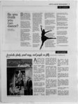
Show 6 BEYOND CAMPUS GRIFFINS RALLY FOR Lacs nap (feosa bests TIM SU STAFF REPORTER up those boots and the colors of at these five hiking locations around Utah. Lace 3. CITY CREEK CANYON Where: North of Bonneville 1. CECRET LAKE Where: Albion Basin near Alta Ski Resort in Little Cottonwood Canyon Distance: Starting at the Albion Basin Campground, the trail is one mile and takes approximately 30 minutes, according to Climb-utah.co- m. Elevation Gain: 400 feet Dog Ftfendly: Yes Cost: Free The view is spectacular, said Sean McCormack, first-ye- ar undeclared.Its an easy hike, but it has a tremendous view when youre standing at the top of it. Trailhead coordinates: 4034'12N iii37T9"W 40.570N ih.622W 2. MOUNT Boulevard behind the State Capitol building. Distance: 5.8 miles on paved road Honrs: 8:30 a.m. to 10 p.m. Dog Friendly: Yes Cost: $3 This trail is open to hikers, bikers, walkers and runners as well as service vehicles, according to bikeslc.com. Dont forget to pack a lunch to use at one of the many picnic tables located along the creek. TraiHiead coordinates: N 4047.388 W lli52.709 4. FRARY PEAK inhere: Antelope Island, one of Utahs state parks located within the Great Salt Lake Distance: 7 miles round trip OLYMPUS TRAIL Elevation Gain: 2,100 inhere: Trailhead located Dog Friendly: No at 5789 Wasatch Boulevard in Holladay. Distance: 7 miles round trip Elevation Gain: 4,196 feet Dog Friendly: Yes Cost: Free The hiking season for the Mount Olympus Trail runs from June through October, according to alltrails.com. It was a tough hike overall, the elevation tore my muscle, said Kristian Nilssen, sophomore computer science major. Despite that, I really enjoy the view from the top, and its probably one of the most spectacular views in Utah. fraUhead coordinates: latitude of 40.6527, longitude of -- 111.806 feet Cost: $10 per vehicle This hike provides views of the Great Salt Lake and Wasatch Mountains. According to RootsRates, an online hiking website, mid-da- y during the fall and spring are the best times to hike Frary Peak. Ifcailhead coordinates: N40.961890 W112.216060 5. DESOLATION TRAIL TO SALT LAKE OVERLOOK Where: Millcreek Canyon on 3900 S, .75 miles from the entrance, according to visitsaltlake.com. Distance: 4.8 miles round trip Elevation Gain: 1,239 feet Yes Dog Friendly: Cost: $3 per vehicle The trail is accessible from March until November, according to alltrails.com. Ttailhead coordinates: latitude of 40.69806, longitude of -- 111.72500 Over 40 Westminster students gathered to attend the climate change rally Sunday, Sept. 21 to support the Peoples Climate March in NYC, the largest climate march in history with 400,000 participants in NYC alone. Events were held worldwide. |