| OCR Text |
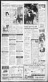
Show Public notices Uasant PUBLIC NOTICES Eagle Mountain seeks construction bids Pleasant Grove sets hearings Pleasant Grove Planning Commission will hold a public hearing on Thursday, July 16, 1998, at 7 in the Library p.m. Auditorium, 30 E. Center, The Utah. Pleasant Grove, items listed below will be discussed and anyone interested is invited to attend. Review and Approve the Report of Action from the May 14, May 28 and June 25,1998 meetings. The BUSINESS Item 1 - requests Joel Mall Preliminary Subdivision Approval for a 12-lsubdivision known as Hall Bros. Subdivision at approximately 21 00 N. 1300 West in a RR Zone. NORTH FIELD NEIGHBORHOOD. Item 2 - Harley Jacobs requests approval for an accessory building greater than 750 sq. ft. at approxi mately 1778 W. 1100 North in a Hi 8 zone. NORTH FIELD NEIGHBORHOOD. Item 3 - Public Hearing for rezoning of properties between 400 North and Center Street from 350 West to 600 West from MC to CS (Manufacturing) 100 East to about 150 EasL OLD FORT NEIGHBORHOOD. Pleasant Grove City Planning Commission will meet for a briefing at 5:30 p.m. in the Senior Citizen Center, 30 E. Center, Pleasant Grove. This will be (Commercial Sales) Zone. LITTLE DENMARK. Item 4 Jens P. Fugal and others request rezoning of properties at approximately 1010 W. 1100 North from RR (Rural Residential) to R1-- 8 (Residential) Zone. NORTH FIELD NEIGHBORHOOD. Item 5 - Public Hearing a public meeting; however, no testimony will be heard and no action will be taken on the agenda items. Notice of public hearing before Pleasant Grove City Council On Tuesday, Aug. 18, 1998, at 7:30 p.m. in the Auditorium of the Library Building, 30 E. Center, the Pleasant Grove City Council will consider the items listed above which may be referred to them by the Planning Commission. in Published the Pleasant Grove Review July land 15, 1998. to consider vacating a portion of 500 South Street from about 200 East to State Street. OLD FORT NEIGHBORHOOD. Item 6 - Public Hearing to consider vacating a portion of 100 South from 100 East, from the east side of Hearing to increase mayorcouncil wages Notice is hereby given that Pleasant Grove City will hold a public hearing on the 21st day of July, 1998, at 7:30 p.m. in the meeting room of the library, 30 E. Center, Pleasant Grove, Utah, at which time the will Public hearing on impact Notice is hereby given that Pleasant Grove City will hold a public hearing on the 4th day of August, 1998, at 7:30 p.m. in the meeting room of the library, 30 E. Center, Pleasant Grove, Utah, at which time the council will receive public comment concerning the public hearing. receive public comment concerning the proposed increase to the Mayor and City Council wages. An amendment to "Salaries 2.08.080, Established,' will be considered for approval following council Charmaine Childs City Recorder in Published the Pleasant Grove Review July 15, 1998. and interim fees Ordinance No. 98-2adopting the Street Impact Fee 98-2Ordinance No. and Interim the adopting 4:30 p.m .at City Hall, 70 S. 100 East, Pleasant Grove, Service. Charmaine Childs City Recorder Utah. A copy of these proposed Ordinances are available for public inspection at the office of the Recorder, weekdays from 8:30 a.m. to in Published the Pleasant Grove Review July 15, 1998. Pleasant Grove seeks painting bids Pleasant Grove City will be accepting bids for the interior painting of the city library. Bids will be accepted until 2 p.m. on Thursday, July 30, 1998, at which time the bids will be opened and read publicly. and Specifications scope of work may be picked up at the Pleasant Grove Library. A conference July 23, 1998 at 9 a.m. at the library. in Published the Pleasant Grove Review July 15, 22 and 29, 1996. pre-bi- d will be held Highland Conservation District notice and Rosella Miller have petitioned the board of directors of the Conservation Highland John D. District to remove water from the 1 ac.ft. of following water to description: IP1 801.1 the following 485.79' and N Sec 30.T4S, R1E, SLM; N 2'W686.28'S89deg34' description: IP 1804, Com. 29.89' S and 1739.34' E of NW Cor, Sec 31, T4S, R2E, SLM; S 42 deg 38'0" E 112.11; thence S 42 deg 31 '0" W 159.94; thence N 89 deg S 351 deg. 4' E 673.11 ft W along Sec line 495.21 ft. to beg. Area 6.6 acres. From 9 ac.ft. to 1 0 ac.ft. Julie Knittel has petitioned the board members of the Highland Conservation District to ac.ft. remove her property along with 3 ac.ft. of water from the district: IP1919.1 Com N 990 ft and E 33 ft frW14 Cor Sec 3, T5S, R1E, SLM; E 617 ft S 356 ft W 650.5 ft N 340.6 36'17'W 157.66'; thence N 0 deg 22' W 200'; thence S 89 deg 36'17" E 190.72' to pt. of beg. From 2 ac.ft. to 1 Peter D.Christensen has petitioned the board of directors to add 1 ac.ft. of ft , Engineer following to Application(s) Water in Utah Change County (Locations in SLB&M). Persons objecting to an application must file a CLEARLY READABLE protest stating FILING NUMREASONS FOR BER, PROTESOBJECTION, TANTS' NAME AND RETURN ADDRESS, and any request for a hearing. Protest must be filed with the State Engineer, Box 146300, Salt Lake City, UT 84114- 6300 on or before August 4, 1998. Rights. (LEGEND: Point(s) of Diversion POD; Place of Use POU; Nature of Use USE) 6 (a22152); Salt Water Lake County Conservancy District proposes to change the POD of water as evidenced by HERETOFORE: QUANTITY: 14.0 cfs. SOURCE: Underground Water Well. POD: (1)S 800 W 400 from W14 Cor, Sec 35, T2S, 20 in. well 500 ft. to 600 It. deep Judge Timothy Hansen THE STATE OF UTAH TO SAID DEFENDANT: You are hereby summoned to appear in the action and assert and defend any claim to water. This action was brought for the purpose of making a general adjudica above-entitle- d tion of rights to the use of all the water, both surface and underground, within the drainage area of Utah Lake and the Jordan River in Utah, Summit, Salt Lake, Wasatch, IP1920.1 Com S'1638' 633.47' frN J4 Cor, Sec 3.T5S, R1E, SLM: S 328' W 308' N 311' E 311' to beg. Area 2.35 acres. From 2 to 5 W 1 ac.ft. of water. to Anyone wishing protest this action must do so in writing and be presented before a meeting to be held July 22, 1998. in Published the American Fork Citizen and Lehi Free Press July 1, 8 and 15, 1998. and Juab Counties in Utah. Upon service of this summons, you are subject to the jurisdiction of the above-entitle- d court, and ft is your duty to follow the proceedings and protect your rights in this action. The State Engineer has published the Determination Proposed containing the water rights in of record the American Fork River Subdivision, and has published an Addendum to the Proposed Determination containing water rights that have been disallowed. IF YOU HAVE NOT BEEN PREVIOUSLY SERVED WITH SUMMONS, AND YOU CLAIM A WATER THAT IS NOT RIGHTS INCLUDED IN THE AMERICAN FORK RIVER PROPOSED DETERMINATION OR THE ADDENDUM, YOU ARE HEREBY REQUIRED TO NOTIFY THE STATE IN WRITING ENGINEER OF YOUR CLAIM, NAME AND ADDRESS, BEFORE AUGUST 28, 1998. (Utah Consultants. The Owner reserves the right to reject any and all bids. None of the fee will be refundable for either a bidder or Mountain E. Town 1680 Office, Heritage Drive (located in the Eagle Mountain Fire station), Eagle Mountain, Utah The 84043, Eagle phone: until 12:00 noon on Friday, July 31, 1998. of the bid Copies requirements, plans and be specifications may obtained from the office of the engineer Robert L. Morgan, P.O. State Engineer Published in the Lehi Free Press July 8 and 15, 1998. State Utah Engineer, LakeJordan River Regional 594 W. No. Temple, Suite 220, PO Box 146300, Salt Lake City, UT 84114-6300- Office, 1 After you notify the State Engineer, you will be sent, at the address you indicate, a Water User's Claim form and written instructions. Pursuant to Utah Code Annotated Paragraph persons failing to file a claims claim, including based on diligence under Code Utah Annotated 3 Section ("diligence claims" and "underground water claims"), shall be forever barred and estopped from asserting those claims. DATED this first day of July, 1998. Craig Ludwig District Court Clerk John H. Mabey, Jr. Heidi T. Decker Assistant Attorneys General Attorneys for Utah State Engineer 1594 W. No. Temple, Suite 300 Salt Lake City, UT 84114-085- 5 (Phone:801-756-611- payable to Sowby and Berg No Bid Bond is required. A 100 percent performance and payment bond will be required. be issued pending approval of the SID by the Town, funding of the SID and approval of the easements. A Pre-Bi- d Meeting will be held with the Town's Engineer Korey Walker of Epic Engineering at: The Cedar Pass Ranch Trailer Office located at 91 55 N. Cedar Pass Road, Eagle Mountain, Utah, at 12:00 noon on Thursday, July 23, 1998. Janet Valentine Eagle Mountain planners to meet Mountain, Utah. The agenda shall be as Town Clerk This project will be fund1998-- 1 Special Improvement District (SID) of the Town of Eagle ed by the 3. Park Master Plan presentation - Lyhgoe and Steinbach. 4. Consent hearing: Use a. Conditional Permit for Concrete Batch Plant - Eagle Mountain Ready MixJoel Woods. b. Preliminary Class II Permit for Eagle Point Plats G and H - James Dahl. to c. Amendment Patterson Final Plat C. d. Lot splitRed Hawk Notice is hereby given that the Planning of Commission Eagle will meet Mountain at 5 1998 Thursday, July 16, p.m. in the Eagle Mountain E. Town Office, 1680 Drive, Eagle Heritage Published in the Lehi Free Press July 15, 22 and 29, 1998. follows: 1. Approval of agenda. 2. Approval of May 7, 1998 minutes. Ranch- - Parcel R1N12. 3. Preliminary Class II Permit for the Estates at Red Hawk Ranch. 5. Discussion of conflict of interest ordinances. 6. General discussion, questions, announcements. 7. Adjourn. Scott Kirkland f Chairman Published in the Lehi Free Press July 15, 1998. PUBLIC NOTICE IS HEREBY GIVEN that on the 30th day of June, 1998, the Town Council of Eagle Utah Mountain, County, Utah (the Town"), adopted a assessed. resolution declaring its intention to create a special district to be improvement known as Eagle Mountain, Utah Special Improvement 98-- 1 District No. (the "District"). It is the intention of the Town Council to make the improvements described herein within the District and to levy special assessments as provided in Title 17A, assessed against the properties within the district and the method of assessment shall be as follows: Improvements: Roads, sewer, water, gas, electric, telecommunications, landscaping and parks. Estimated Assessment: $8,515,05. Method of Assessment: Per Acre. "For the purpose of within the district for the benefit of which such the most equifor assessment improved properties, the Town reserves the right to make to adjustments assessments by acre by taking into account the number of equivalent residential units to be constructed on each improved acre of prop- assessments are to be erty. expended in the making of OF ASSESSMENTS It is the intention of the Town Council to levy Chapter 3, Part 3, Utah Code Annotated 1953, as amended, on he real estate lying such improvements. DESCRIPTION OF DISTRICT The boundaries- of the proposed District shall coincide with the legal description set forth in Exhibit "A", all being located with the Limits Town of Eagle Mountain, Utah. INTENDED IMPROVEMENTS The improvements will of the construction and paving of approximately four miles of asphalt road, the construction of a concrete curb planter median in the cent er of said road, the consist OF cost of in the District total Improvements as estimated the by Engineer is $9,740,000, of which the Town will pay $0, a remainder of leaving $9,740,000 which shall be paid by a special assessment to be levied against the property abutting upon the streets to be improved or upon property which may be affected or specifically benefitted by such Improvements. The Town Council has determined that only those parcels within the boundaries of the proposed District, the owners of which have a present intent to develop said parcels, shall be benefitted by the proposed Improvements as indicated on the map attached hereto as Exhibit "B." The property owners' portion of the total estimated cost of the Improvements may be financed during the construction period by the use of interim warrants, in which case the interest on will said warrants be assessed to the property owners. In lieu of utilizing a guaranty fund, the Town intends to create a special reserve fund to secure payment of the special assessment bonds (the "Bonds"), the Town anticipates issuing to finance the proposed Improvements. The reserve fund will be initially funded with proceeds of the Bonds as an amount equal to approximately $1,125,000. The Town anticipates applying moneys remaining in the reserve fund to the final payment on the Bonds which, in tum, would offset the final assessment payments to be made by the owners of property benefitted by such all of which Improvements, will be further described in the assessment ordinance to be adopted by the Town. addition, the estimated costs of assessment include In estimated overhead costs in Published the American Fork Citizen and Lehi Free Press July 8, 15, 22, 29 and Aug. 5, 1998. American Fork, Utah 84003 Public Notice Advertising Protects Your Right to Know Mountain, Utah. The Notice of Award will notice of intention to create special improvement district The (2) S 55 W 30 from E14 Cor,Sec3,T3S, R1E, 20 in. well 500 ft. to 800 ft. deep. USE: Municipal: In Salt Lake Water Conservancy District. HEREAFTER: QUANTITY: 14.0 cfs. POD: Same as Heretofore, but adding the following: SOURCE: 20 in. well 500 ft. to 900 ft. deep. POD:(1)S850W465 from W14Cor,Sec35,T2S, R1E (Four miles east of Sandy) USE: Same as Heretofore; POU: Same as Heretofore: Berg Town of Eagle Mountain gives COST ESTIMATED IMPROVEMENTS Davis, Sanpete Parkway. and the construction of scaping and park improvements (collectively, the Said "Improvements"). will begin at Improvements the intersection of State Highway 73, proceed south to the intersection of the Lehi Fairfield Road, then both east and west to the boundary of the District. The roadway will be known as The Ranches The proposed Parkway. of location said Improvements is shown on Exhibit "B" attached hereto and incorporated by reference. Water rights determination IN THE DISTRICT COURT OF THE THIRD JUDICIAL DISTRICT IN AND FOR SALE LAKE COUNTY, STATE OF UTAH IN THE MATTER OF THE DETERMINAGENERAL TION OF RIGHTS TO THE USE OF WATER, BOTH SURFACE AND UNDERWITHIN THE GROUND, AREA DRAINAGE OF UTAH LAKE AND JORDAN RIVER IN UTAH, SALT LAKE, DAVIS, SUMMIT, WASATCH, SANPETE AND JUAB COUNTIES IN UTAH PROVO RIVER DIVISION AMERICAN FORK RIVER SUBDIVISION ALL TO SUMMONS CLAIMANTS OF WATER RIGHTS NOT OF RECORD WITHIN THE AMERICAN SUBDIVIRIVER FORK SION OF THE PROVO UTAH RIVER DIVISION, LAKE AND JORDAN RIVER DRAINAGE AREA. Civil No. 360057298 (55-2- ) Or from the town office listed above upon payment of $40.00 for each set 3 ac.ft. of water to the follow- ing property: 11 These are informal proceedings as per Rule R655-6-- 2 of the Division of Water Constructing approximately 2.5 miles of roadway, water and sewer improvements in Eagle Mountain installation of sewer, water, electritelecommunications, cal and gas improvements within the road right of way Notice is issued to water users The State received the and Sowby Consultants, 688 N. 780 East fttobeg.Area5acres. Robert and Carma Johnson have petitioned board members the add the E Com. 25' frSW Cor, NOTICE IS HEREBY GIVEN THAT THE TOWN OF EAGLE MOUNTAIN will receive sealed bids from qualified contractors for. which the Town projects to incur in the creation and administration of the District. The estimated cost to be determining table LEVY assessments as provided by the laws of Utah on all parcels and lots of real property to be benefitted by the Improvements proposed within the District. The purpose of the assessment and levy is to pay those costs of the Improvements which the Town will not assume and pay. The method of assessment shall be by acre as set forth herein. The assessment may be paid by property owners in not more than ten (10) annual installments with interest on the unpaid balance at a rate or rates fixed by the Town Council, or the whole or any part of the assessment may be paid without interest within fifteen (15) days after the ordinance the assessment levying becomes effective. The assessments shall be levied according to the benefits to be derived by each property within the District. Other payment and provisions enforcement remedies shall be in accordance with Title 17A, Chapter 3, Part 3, Utah Code Annotated 1953, as amended. A map of the proposed District, copies of plans, profiles and specifications of the proposed Improvements and other related information are on file in the office of the Engineer who will make such information available to all interested persons. TIME FOR PROTESTS FILING Any person who is the owner of record of property to be assessed in the District described in this Notice of Intention shall have the right to file in writing a protest against the creation of the District or to make any other objections relating thereto. Protests shall describe or otherwise identify the property owned of record by the BY ORDER OF THE COUNCIL OF TOWN EAGLE MOUNTAIN, Is! Janet Valentine Town Clerk UTAH EXHIBIT "A" Boundary of the District The proposed District will include the following described property-Revis- ed Main Parcel Beginning at the NE corner of Government Lot 1, a closing corner of Section 30, which point is also on the Easterly boundary of Fort Critenden Military Reservation, said point located South 89 deg. being 43'21" East along section line 1135.80 feet from the Northwest comer of Section 30, Township 5 South, Range 1 West, Salt Lake Base and Meridian; thence North 34 deg. 16'08" East along said easterly boundary 74.04 feet to the SW corner of Government Lot 8, a closing corner of Section 10; thence along said Fort Critenden boundary line as follows: North 35 deg. 40'00" East 535.26 feet and North 08 deg. 3000" West 8532.01 feet to he NW corner of Government Lot 8 of Section 19; thence North 88 deg. 19'10" East 1135.48 feet to the NE corner of said Government Lot 8; thence South 00 deg. 31 '41" West along quarter section line 1279.11 feet to the North quarter comer of Section 30; thence South 89 deg. 18'39" East along section line feet 2759.83 to;. the ' Southwest corner of Section 20; thence North 00 deg. 18'58" West along section line 2654.18 feet to the Wester quarter corner of Section 20; thence North 00 deg. 18'58" West along section line 2654.18 feet to the West quarter corn of Section 20; thence North 00 deg. 54'13" West along section line 1466.45 feet to the southerly boundary of Cedar Pass Ranch Subdivision, Plat "J" as recorded in the Office of the Utah County Recorder; thence the following two courses and distances along said Cedar Pass Subdivision, Plat "J" and "D": North 89 deg. 05'47" East 1131.69 feet, and North 00 deg. 14'17" East 2395.75 feet to the line of southerly State Road 68; thence the following three courses and xma at ku kxmw at along the arc of a 5804.70 foot radius curve to the left for 1114.39 feet (chord bears North 83 deg. 44'02" East for 1112.68 feet), and North 78 deg. WO?" East 2847.10 feet to section line; thence South 00 deg. 1 5 56" West along section line 1978.87 to feet the Northeast corner of Section 20; thence South 00 deg. 12'55" West along section line 2672.98 feet to the East quarter corner of Section 20; thence North 89 deg. 17'20" West along quarter section line 2657.50 feet to the Center quarter corner of Section 20; thence South 00 deg. 10'38" East along quarter section line 2665.33 feet to the North quarter corner of Section 29; thence South 89 deg. 0212" East along section line 1753.67 feet; thence the following twenty-on- e courses and distances along the center of a wash: South 24 deg. 56'36" East 1.83 feet, South 27 deg. 20'12" East 47.37 feet, South 57 deg 17'38" East 197.83 feet, South 08 deg. 1330- East 205.40 feet, South 67 deg. 15'52" East 197.12 feet, North 56 deg. 02'26" East 94.61 feet, South 08 deg. 08'50" West 127.18 feet, South 50 deg. 12'10" East 48.04 feet, North 54 deg. 39'22" East 113.62 feet, North 84 deg. 28'44" East 91.65 feet, South 61 deg. 28'58" East 66.30 feet, thence South 14 deg. 21 '48" East 108,76 feet, North 83 deg.40'59" East 142.28 feet, South 01 deg. 24'52" East 106.51 feet, South 36 deg. 37'17" East 218.46 feet, South 57 deg. 34'13"East 67.83 feet, South 33 deg. 23'06" East 136.30 feet, South 56 deg. 31 '12" East 155.18 feet. North 88 deg. 54'29" East 166.94 feet, South 33 deg. 10'35" West 40.34 feet and South 03 deg. 43'36" West 215.05 feet; thence North 89 deg. 18'58"West along 116 line 562.05 feet to section line; thence South 00 deg. 37'28" West along section line 1321.95 feet to the East quarter corner of Section 29; thence North 89 deg. 22'40" West along quarter section line 1327.62 feet; thence South 00 deg. 47'19" West along the west line of the West half of the NE quarter of the SE quarter of Section 29, 1322.35 feet; thence South 89 deg. 23'00" East along the south line of the ; 00 deg. 3704" West along section line 1322.37 feet to the Southeast corner of Section 29; thence North 89 deg. 23'20" West along section line 1335.51 feet; thence South 01 deg. 06'47" West 668.63 feet; thence West 964.48 feet; thence North 08 deg. 1 932" East 188.24 feet; thence North 21 deg.20'13" West 307.90 feet; thence North 75 deg. 37'07" West 360.84 feet; thence North 50 deg. 33'36" West 359.75 feet; thence North 87 deg. 55'48" West 372.18 feet; thence North 68 deg. 11 '55" West 217.19 feet; thence North 49 deg. 57 01" West 403.93 feet; thence North 27 deg. 19'57" West 446.95 feet; thence North 01 deg. 06'45" East 461.65 feet; thence North 43 deg. 40'04" East 136.29 feet; thence' North 59 deg. 44'37" West 62.25 feet; thence South 37 deg. 46 33" West 453.55 feet; thence South 70 deg. 53'37" West 724.58 feet; thence South 15 deg.08'19" West 888.60 feet to section line; thence South 89 deg. 59'15 West along section line 68.95 feet to the SE corner of Section 30, thence North 01 deg. 08'59" East along section line 1073.09 feet; thence North 58 deg. 13'09" West 692.02 feet; thence North 26 deg. 56'52" West 637.77 feet; thence South 36 deg. 54'13" West 208.71 feet; thence North 54 deg. 05'47" West 208.71 feet; thence North 35 deg. 54'13" East 208.71 feet; thence North 72 deg. 42'05" West- 469.58 feet;' thertce' North 46 deg. 15'26" West 636.94 feet; thence South 84 deg. 45'29" East 61 8.01 feet; thence North 77 deg. 16'06 East 691.72 feet; thence North 07 deg. 32'22" West 193.64 feet; thence North 23 deg. 27'55" East 279.24 feet; thence North 70 deg. 49'44" West 1663.17 feet; thence North 54 deg. 40'07" West 546.74 feet; thence North 89 deg. 1216" West 327.98 feet; thence North 43 deg. 1411" West 1607.06 feet to the point of beginning. Area 1410.9739 acres. Grant Smith Farms (Section 30) The SW quarter of the SE quarter of Section 30, Township 5 South, Range 1 West, Salt Lake Base and Meridian. Also described as: Beginning at the South quarter corner of Section 30, , I mmi too Utah, on or before 5:00 p.m. on the 11th day of August, 1998. Thereafter at 7:00 p.m. on the 11th day of 1998, the Town August, Council will meet in public meeting at the offices of the Town Council at 4114 N. 1680 East, Eagle Mountain, Utah, to consider all protests so filed and hear all objections relating to the proposed District. After such consideration and determination, the Town Council shall adopt a resolution either abandoning the District or creating the District either as described in this Notice of Intention or with deletions and changes 1945.08 feet to section line; thence North 00 deg. 42'04" East along section line 2151.83 feet to the point of 381.2533 beginning. Area acres Less and excepting Lots 129, 130, 137, 139, 142, 143, 144, 145, 146, 221, 227,313,314,316, 318 and 319 as shown on Final Plats recorded in the Office of the Utah County Recorder. Net Area 350.6989 acres. GRAND TOTAL ACREAGE 1802.4326 acres. (SAID) David V.Thomas RLS 163947 EXHIBIT "B" of Map Proposed Improvements j oust coNHcer 'fer 11$ CHUKH person or persons making the protest and shall indicate the total acreage represented by said protest. Protests shall be filed with the Town Clerk of Eagle Mountain, deg. 03'1 0" East along quarter section line 1327.42 feet; thence South 89 deg. 32'29" East along the north line of the SW quarter of the SE quarter of Section 30, 1341.46 feet; thence South 00 deg. 36'12" West along the east line of the SW quarter of the SE quarter of Section 30, 1332.40 feet; thence North 89 deg. 19'31" West along section line 1328.70 feet to the point of 40.7598 beginning. Area acres. Cedar, Meadows Phase 1 through 6 Beginning at the West quarter comer o Section 18, Township 5 South, Range 1 West, Salt Lake Base and Meridian; thence South 89 deg. 32'03" East 2447.01 feet; thence North 00 deg. 26'48" East 2641.01 feet to the North quarter corner of Section 18; thence South 89 deg. 06'47" East along section line 2634.30 feet to the Northeast corner of Section 18; thence South 89 deg. 30'41" East 1320.05 feet; thence South 1307.71 feet y to the northerly line of State Road 73; thence South 89deg.13'40" y West along said line 1325.70 feet; thence North 00 deg. 14'20" East 9.51 feet; thence North 89 deg. 30'43" West 2648.88 feet; thence South 00 deg. 26'48" West 142.12 feet to the northerly line of said State Road 73; thence the following two courses and distances along y said northerly line: along' the are of a 5804.56 foot radius curve to the left 605.47 feet (chord bears South 77 deg. 11 '52" West for 605.19 feet) and South 74 deg. 12'34 West 1 vm www KM) j J vm iM SMtnta smuts NOSTB 1JM mm. ran nufwtr S 0 net KM sis' iOKH tZZZZ SUM m m mm i made as authorized by law; but the Town Council shall abandon the District and not create the same if the necessary number of protests tiSL-?- r- i rni w rat tfw. Wfcv lu-- d : l as provided herein have been filed on or before the time specified in this Notice of Intention for the filing of protests after from such filed protests relating or relating to eliminating protests: (I) to property a type of Improvement which ha been deleted from the District and (ii) protests which have been withdrawn in writing prior to the conclusion of the hear- - . TOWH OF SAGliyQUKTADi - SPEOAL ing. The necessary number of protests shall mean distances along said protests representing one-haof the acreage to be line: North 89 deg. 14'02" East 309.94 feet, MXOVEWXTbimKI mi NE quarter of the SE quarter of Section 29, 1331.55 feet to section line; thence South -- r-j . pi 'IIS Township 5 South, Range 1 West, Salt Lake Base and Meridian; thence North 00 Published in the Lehi Free Press July 8, 15, 22 and 29, 1998. |