| OCR Text |
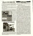
Show JULY 6,2006 Page 8 THE GARFIELD COUNTY INSIDER STATE AND NATIONAL PARKS GUIDES AVAILABLE AT UTAH TOURISM OFFICES New guides are available at the Utah Office of Tourism and other tourism offices around the state to promote the five national and 42 state parks in Utah. The Utah State Parks and National Parks guides were published by the American Park Network in partnership with the Utah Office of Tourism, Utah State Parks and Recreation, and the National Parks Service. The guides contain activities, dining, lodging, trails, history, maps, as well as a welcome message from Utah Governor Jon M. Huntsman, Jr. "This is a great opportunity for Utah to showcase its national and state parks to a global audience," says Leigh von der Esch, managing director of the Utah Office of Tourism. "An increase in our advertising budget'approved by Utah lawmakers has allowed us to partner with Utah's public land agencies on these publications for the first time." The guides are part of a $21 million, two-year advertising program launched by the Utah Office of Tourism, which is part of the Governor's Office of Economic Development. In addition to sponsoring the Utah publications, the tourism office has placed a full-page advertisement promoting the state in all of the 5.3 million guides printed by the American Computer Diagnostics Park Network. The Both Engine . £ set of national park & Transmission " ; J guides is available on CusiomBuSt _ M Transmission • ^ APN's website for (Standards Automatic) purchase by people Over 200 Units in Stock all over the world. in Southern Utah ,t Copies of the new Utah guides are avail1 Day Service (Most Cases) able for free at Welcome Centers and WE DO IT FASTI! fees - Tune-ups tourism offices around $ts-CV Boots OIL CHANGES the state. For ques''inspections - Clutch Jobs (Most cars & light trucks) tions, please contact . - $25 Including Tax . the Utah Office of j Warranty valid anywhere ' (Most Diesel Light Trucks) Tourism, 300 N. State I , in the country. - $45 Including Tax Street, Council Hall/ Capitol Hill, SaltLake City, Utah, 84114, (801) 538-1900, or .(800)200-1160. THE S&C MERC REMEMBER New owners Randy & Becky Yard have finished their renovation of the property located at 59 No. Main Street, formerly known as the S.& C Mercantile. Mayor Art Cooper donated the plaque that is memorializing his dad's store. This location, next to Cowboy Collectibles, is now known as the S & C Corral, invites visitors to stop by and watch the traffic go by, picnic or just sit and reminisce in a old time western cowboy atmpsphere. LEGAL NOTICES PUBLIC NOTICE Please take notice that the Garfield County Commission has scheduled a public hearing on Monday, July 10, at 11:40 a.m. in the Garfield County Commission Chambers, located at 55 South Main Street, Panguitch, Utah, to receive public comment regarding the following: 1. Paunsaugunt Cliffs Subdivision Phase III BEGINNING AT APOINTS88 29'58"W 50.01 FEET ALONG THE. 1/16 LINE AND S00 14'22"E 50.01 FEET FROM THE NORTH 1/16 CORNER SECTION 23 AND 24 (1972 B.L.M. BRASS CAP) TOWNSHIP36 SOUTH, RANGE 5 WEST, SALTLAKE BASE & MERIDIAN AND RUNNING THENCE S00 14' 32"E 1273.34 FEET PARALLEL TO AND 50.00 FEET DISTANT FROM THE EAST LINE OFTHE NORTHEAST 1/4 OF SAID SECTION 23; THENCE S19 12'52"E 51.33 FEET; THENCE N89 21' 13"E 229.78 FEET ALONG A LINE THAT IS 50.00 FEET SOUTH AND PARALLEL TO THE CENTER SECTION LINE OF SAID SECTION 24; THENCE S37 00'00"E 25.80 FEET; THENCE S60 00'00"E 230.92 FEET; THENCE S42 35'00"E 321.64 FEET; THENCE S74 00'00"E 111.74 FEET; THENCE S37 4 0 W E 229.00 FEET; THENCE S61 50'00"E 84.00 FEET; THENCE S12 20'00"E 145.00 FEET; THENCE S41 50'00"E519.66 FEET; THENCE S0032'12"E 402.60 FEET; THENCE S8904'43"W 132.41 FEET; THENCE SOOOOWE 350.05 FEET; THENCE S8904'43"W 675.51 FEET; THENCE N6005'21"W 189.29 FEET; THENCE N00 19'48"W 430.54 FEET; THENCE N43 16M7"W 90.03 FEET TO THE POINT OF A CURVE TO THE LEFT; THENCE ALONG THE ARC OF SAID CURVE 80.72 FEET, WITH A RADIUS OF 275.00 FEET, WITH A DELTA ANGLE OF 16 49*04", S46 43'43" W BEARING TO THE RADIUS POINT; THENCE N60 05'21 "W 52.26 FEET; THENCE S88 32' 11" W 828.27 FEET; THENCE N23 3 6 W W 357.43 FEET; THENCE S67 00'00"W 102.36 FEET TO THE POINT OF A CURVE . TO THE RIGHT; THENCE ALONG THE ARC OF SAID CURVE 206.71 FEET, WITH A RADIUS OF 550.00 FEET; WITH A DELTA ANGLE OF 21 32'00" N23 00'00"W BEARING TO THE RADIUS POINT; THENCE S88 32'00"W 613.78 FEET TO THE POINT OF A CURVE TO THE LEFT; THENCE ALONG THE ARC OF SAID CURVE 45.84 FEET, WITH A RADIUS OF 25.00 FEET, WITH A DELTA ANGLEOF105 04'05", S01~28'00"E BEARING TO THE RADIUS POINT; THENCE S1632'05"E164.16FEETTOTHEPOINTOFACURVETOTHERIGHTTHENCE ALONG THE ARC OF SAID CURVE 88.23 FEET, WITH A RADIUS OF 110.00 FEET,WITHADELTAANGLEOF45 57'23",S73 27'55"WBEARINGTOTHE RADIUS POINT; THENCE S88 32' 11 "W 74.11 FEETTO A POINT ON A CURVE TO THE LEFT; THENCE ALONG THE ARC OF SAID CURVE 34.36 FEET, WITH A RADIUS OF 60.00 FEET, WITH A DELTA ANGLE OF 32 48'27", N21 13'45" W BEARING TO THE RADIUS POINT; THENCE S88 32' 11"W 403.09 FEET TO THE SOUTHEAST CORNER OF LOT 56 OF THE PAUNSAUGUNT CLIFFS PHASE NO.2 SUBDIVISION AS RECORDED IN THE GARfIELD COUNTY RECORDERS OFFICE; THENCE N00 00'00"E 320.93 FEET ALONG SAID PHASE 2; THENCE N57 27'00"E 105.52 FEET ALONG SAID PHASE 2 TO THE POINT OF A CURVE TO THE RIGHT; THENCE ALONG THE ARC OF SAID CURVE AND PHASE 2,27.66 FEET, WITH A RADIUS OF 20.00 FEET, WITH A DELTA ANGLE OF 79 14'27", S32 33'42"E BEARING TO THE RADIUS POINT; THENCE N46 40*44"E 50.00 FEET ALONG SAID PHASE 2 TO A POINT ON A CURVE TO THE LEFT; THENCE ALONG THE ARC OF SAID CURVE AND PHASE 2,252.09 FEET, WITH A RADIUS OF 300.00 FEET, WITH A DELTA ANGLE OF 48 08'44", N46 40'44"E BEARING TO THE RADIUS POINT; THENCE N88 32'00"E 672.41 FEET ALONG SAID PHASE 2 AND ITS EXTENSION TO THE POINT OF A CURVE TO THE LEFT; THENCEALONG THE ARC OFSAID CURVE 187.91 FEET,WITHA RADIUS OF 500.00 FEET, WITH A DELTAANGLE OF 21 32'00",N0l 28'00"W BEARING TO THE RADIUS POINT; THENCE N67 0 0 W E 227.20 FEET TO THE POINTOFACURVETO THE RIGHT; THENCE ALONG THE ARCOFSAID CURVE 137.32 FEET, WTTH A RADIUS OF 350.00 FEET, WITH A DELTA ANGLE OF 22 28f44'\ S23 00'00"E BEARING TO THE RADIUS POINT; THENCE N11 16'19"W 207.24 FEET; THENCE N41 3T43"W 437.44 FEET; THENCE N08 20'48"W 369.63 FEET; THENCE N26 56'05"W 170.87 FEET; THENCE N38 37'33"W 501.62 FEET; THENCE N49 20'00"W 534.82 FEET; THENCE N47 02'25"E467.65 FEET; THENCE N8829*58"E 1337.30 FEET ALONGALINE THAT IS 50.00 FEET SOUTHERLY AND PARALLEL TO THE NORTH LINE OFTHE SOUTHEAST 1/4 OF THE NORTHEAST 1/4 OF SAID SECTION 24 TO THE POINT OF BEGINNING, THE ABOVE DESCRIBED PARCEL CONTAINS 103.006 ACRES MORE OR LESS. |