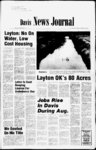
| OCR Text |
Show ukbiu.1 ncrLCA-un- utiio mo mil ivjuniinL, ocriCMDCM 0, diverted from a well, ft. deep, at a point S. 1100 ft. and E. 300 ft. from N Cot. Sec. 26, T4N, R1W (N. Kaysville); and used for the domestic purposes of 1 family and stockwatering of 5 cattle; and used from April 1 to Oct. 31 for the supplemental irrigation of 0.75 ac. in NWi4NE4 Sec. 26, T4N, 6-i- 100-40- R1W. Protests NOTICE OF TRUSTEES SALE The following described property w ill be sold at public auction to the highest bidder on the 20th day of September, 1977 at 11:00 A. M. at the front door of the Davis County Court House at Farmington, Utah in the County of Davis, by SECURITY TITLE COMPANY, as Trustee under the Deed of Trust made by G. David Heath and Marilyn J. Heath, his wife, as Trustors, and recorded July 28, 1976 as Entry No. 439076 in Book 610 at pages 552-- of the Official Records of Davis County, Utah, given to secure an indebtedness in favor of BOB B" ALLRED and SIDONA B. ALLRED, his wife, by reason of the breach of cer- tain obligations secured thereby. Notice of Default was recorded May 9, 1977 as Entry No. 4612C4 in Book 648 at page 385 of said Official records. Trustee will sell at public auction to the highest bidder for cash, payable in lawful mon y of the United States at the time of sale, without warranty as to title, possession or encumbrances, the following described property at 654 West 2575 North St., in the City of Clinton, County of Davis, State of Utah: All of ALLRED DIVISION Lot 1, a of SECURITY TITLE COMPANY, Trustee Farmington, Utah By Gordon Gurr Its Sole Proprietor Published in the Davis News Journal First publication Aug. 25, 1977 Last publication Sept. 8, 1977 NOTICE OF SHERIFFS SALE ON ft. deep, at well, a point S. 1530 ft. and W. 210 ft. from NE Cor. Sec. 26, T4N, R2W, SLB&M (2 mi. W. and used from Jan. 1 to Dec. 31 for the domestic purposes of 1 family and stockwatering of 6 cattle; and used from April 1 to Oct. 31 for the irrigation of 0.25 ac. in SEi4NE4 Sec. 26, T4N, R2W, 400-60- 0 feet from the southwest corner Section of 3 Township 1, North, Range 1 West, Salt Lake Base and Meridian and thence running 347.19 N0940'30W thence feet, S801930W 80.00 feet, thence N094030W 913.22 feet, SLB&M. Protests tnence N622200E 1394.361 REAL PROPERTY Civil No. 113406 DEE C. HANSEN State Engineer IN THE DISTRICT COURT OF DAVIS COUNTY, STATE OF UTAH AMAX ALUMINUM PRODUCTS. INC., A Corporation, Plaintiff, vs. DAVID L. JONES, dba SAXTON COMPANY Defendant. A the day of September, 1977, at the hour of 12:00 oclock, noon, at the north front door of the Davis County Courthouse in Farmington, Davis County, Utah, all the righ., title and interest of the defendant, David L. Jones, in a id to the following described ;al property, Lot 61, Sunset Dale No. 2 LOCATED AT: 2639 North 325 West, Sunset, Utah. PAYMENT TO BE MADE IN Lawful money of the United States of America. SUBJECT TO any liens. DATED AT Farmington, Utah, Davis County, this 25th day of August, 1977. 16th t: By DEAN H. MOSS, Deputy Sheriff ATTORNEY: Thomas A. Duffin 510 Ten Broadway Building Salt Lake City, Utah 84101 Published in the Davis News Journal First publication Aug. 25, 1977 Last publication Sept. 15, 1977 Reflex First publication Sept. 1, Last publication Sept. 15, Larry H. Hess, 2568 W. 800 N., Clinton, UT 84015, has filed with the State Engineer to Appl. No. 49533 appropriate 0.050 sec. ft. of water in Davis County. The water is to be diverted from a ft. deep, at a well, point N. 180 ft. and E. 2225 ft. from W4 Cor. Sec. 33, T5N, R2W, SLB&M (1 mi. SW Clinton); and used from Jan. 1 to Dec. 31 for the stockwatering of 5 cattle; and .used from April 1 to Oct. 31 forthe irrigation of 0.66 ac. in SEiNWi Sec. 33, T5N, R2W, running 840.95 feet, more or less, along said westerly line to the north line of Country 20-2- 5 Place Subdivision No. thence S7015W feet; thence N725248W 75.00 feet; 1; 150.51 100.00 thence feet; 380508W 415.36 feet; thence S695227W 301.28 feet; thence S703253 W 500.00 thence feet; S SLB&M. Protests 114.90 thence 100.00 feet; thence S2000E 37.04 feet; thence S882330W 706.36 feet . 1977. line southerly property conv to e "Q, City by page 60 of Deeds; NE ly along south line said property to a point S6623'W of point of thence beginning; N6623'E 2382.86 feet, Notice is hereby given that on Tuesday September 20, .1977, at 6:30 p.m. a public hearing will be held before the City Council of Fruit Heights City concerning petitions to rezone property from Agricultural A- zoning to -l Residential Suburban R-- S zoning as follows: Pyramid Investment, East Oaks Subdivision Phase C South Parcel: Begin at the southeast corner of lot 26, East Oaks Plat B at a point which is N 885625E 1178.11 feet along the Section line and N094030W 20.67 feet from the south west corner of the northeast The Weekly 1977 1977 l4 of Section 1, The following applications have been filed with the State Engineer to appropriate water in Davis County throughout the entire year unless otherwise designated. Locations in SLB&M. 49452 Jack L. Burton, 759 Windsor St., Salt Lake City, UT 84102. 0.015 sec. ft. of water is to be diverted ft. from a well, deep, at a point S. 200 ft. and E. 1075 ft. from NW Cor. Sec. 24, T4N, R2W (2 mi. NW (31-409- 200-60- 0 ); and used for the domestic purposes of 1 family and stockwatering of 2 cattle; and used from April 1 to Oct. 31 for the irrigation of 0.25 ac. in NW'4NWi4 Sec. 24, T4N, R2W. 49454 Alan K. & Tracy Jorgenson, 719 E. 100 S., Kaysville, UT 84037. 0.030 sec. ft. of 1 Fifty-seve- TRAINING curve to the left 31.42 more or less North Westerly to the P. T. of said curve, thence West along the South line of 3300 South Street 372.0 Ft, more or less to the P. C. of a 50 Ft. radius curve to the left, thence following along the curve South Westerly 4150 Ft. more or less to the P. T. of said curve, on the Easterly right of way line of Orchard Drive, thence N 40 09 East along the Easterly line of Orchard Drive 200.0 Ft. more or less to the P. C. of a curve to the left, the point of beginning. Excepting therefrom and reserving any and all easements in the above described road to their Planners Table 2 DnuliiiistlriaO Site Plan: aims Davis Unanimously passed and water is to be hereinafter described and identified county road, the Board of Davis County Com- missioners has determined that there is good cause for vacating the said county road and that the vacation thereof will not be detrimental to the general public interest. 2. That the following described and identified road situate in Davis County, State of Utah, be and the same is hereby vacated to wit: ATTEST: Rodney W. Walker County Clerk Published in the Davis County Clipper on Sept. 9, 1977 All that portion of South Street (Hilin lside Drive) Woodland No. 2 Subdivision, in South Davis County lying between the West Right Of Way line of 550 West Street and the Easterly line of Orchard Drive. Being described as follows: Beginning at a point which is South 716.5 Ft. along the section line to the North line of Woodland No. 2 Subdivision and West 706.7 Ft. along the North line of said Subdivision to the Easterly right of way line of Orchard Drive and S 40 09 W 492.0 Ft. more or less to the P. C. of a 50 radius curve to the left from the Northeast comer of Section 1 T 1NR1W Salt and Base Lake 3300 Meridian, thence following Southeasterly 11145 Ft. more or less along the curve to the left to the P. T. of said NOTICE TO WATER USERS The following applications have been filed with the State Engineer to appropriate water in Davis County throughout the entire year unless otherwise designated. Locations in SLB&M. Clearfield, UT 84015, 0.067 sec. ft. of water is to be diverted from a well, 100-50- 0 ft. deep, at a point S. 325 ft. and E. 310 ft. from W4 Cor. Sec. 35, T5N, R2W (W. Clearfield); and used from April to Oct. 31 forthe irrigation of 0.66 ac. in 1 NWi4SW'4 Sec. R2W. 49571 (31-444- 35, condominium units approval until Sweetwater plan for the condominiums developers, who will construct the condominiums, meet cer- based to plans and sketches of tain criteria. Mike Adams and Dale Smedley appeared at two 2 Named To County different appointment times to ask for site plan approval to construct commercial buildings in the area on Highway 193, both of which conformed with the 3 zoning. Board Of Health Two Davis County residents have been appointed as members of the Davis County Board of Health and will serve five year terms. Dr. Daniel Benton, 315 West 2300 North, Sunset and Mayor Stanley Green, T5N, Clifford L. Elliott Jr, 495 E. 200 N., Kaysville, UT 84037. 0.015 sec. ft. of water is to be diverted pointed by the Davis County Commission late last week. THE TWO will replace Kenneth Rock, 384 West 1185 North, Sunset and Dr. Harvey Broadbent, 661 Maple, Clearfield. Dr. Broadbent has served on the Board of Health for 23 years. The Board of Health serves in an advisory capacity over the 26 staff members that provide health services to Davis County. Dr. Richard Johns is administrator of the department. Richard Harvey ALTHOUGH the area is 3 for commercial use, it adjoins 17 acres of land currently being considered for rezoning by the Davis County Commission from l to It is the understanding of both the planning commission and the county commission that Mr. Smedley ultimately proposes to construct an industrial park at that site. C-- both the site plan the zoning change pending before the county commission, the decision to delay is based on an opinion from County En- gineer Glen Austin that the sewage system in the area is not adequate. Mr. Austin has 0.25 ac. in SW'4NWi4 Sec. 14, T3N, R1W. Protests resisting Kline announced, campaign adults. Mentally retarded citizens are finding new opportunities in living. New training techniques, precision all are giving new teaching hope and success to the retarded and their families. residents of Davis County, will have an opportunity to take part in this worthwhile event. We hope everyone who can will join us in the Hike-Bikeither as participants or sponsors, as prizes will be awarded to many of the bikers for their successful efforts. The Hike-Bik- e calls on volunteer citizens to bike for retarded citizens, over a measured course. Businesses and individuals are asked to pledge so much per mile for each ridden by participants. The goal this year is $6,000. THE RIDE will take place on Saturday, September 24, 1977 at 9 a m. The bikers, Kaysville and North, will rally at Vae View Park in Layton, and the measured course will run from the park to Antelope Island and back. The bikers, Farmington and south, will rally at the Woods Cross Regional Center and follow a course to Farmington Park and back. Check points will be set up along the routes to accurately clock miles ridden by participants, and refreshments will be served. The Davis County Jeep Patrol will assist in the safety of the riders in not run for for mayor of Centerville in September. He has been mayor for four years and a councilman prior to that. Dr. Benton is a dentist who practices in Roy, but lives in Sunset. Commissioner Wendell Zaugg, who is responsible for the Davis County Health Department, said the two men were suggested for appointment after a recommendation from the staff. the north and the BountituI Jeep Posse will assist the riders in the south. HIKE-BIKEhave been very successful in other parts of the country, Mr. Kline stated, and have raised thousands of dollars for the mentally retarded. know we can count on the citizens of Davis County to make the campaign here an outstanding success. All the monies donated will stay in Davis County for the benefit of the 2,500 mentally ON September 24, 1977," Mr. MAYOR Green accepted approval being considered by the planning commission and Assist Retarded Dan Kline has been named chairman of the Davis County 1977 Hike-Bik- e for the Retarded Citizens, it was announced today oy Guy Smedley, president of the Davis County Association for Retarded Citizens. the appointment after telling commissioners that he will THE planning commission will table site plan approval until drainage approval is given by the county engineers family; and used from April to Oct. 31 for the irrigation of To county health nurses. 1 1 they had given approval of the lots based on the agreement that Mr. George place a private access road down the middle of the five acre lots. On Thursday Mr. George appeared to argue that stipulation, but the commission stood firm and will require the road if Mr. George is to have the agriculture parceling approval. Davis Bike Hike Set Doleen Jewett supervises the C-- said that sumps as proposed by Mr. Smedley are not adequate and another storm drain system is needed. domestic purposes of by Frank George. LAST MONTH heads the environmental and health department from a ft. well, deep, at a point N. 650 ft. and E. 340 ft. from W14 Cor. Sec. 14.T3N, R1W (2 mi. NW Farmington); and used for the 100-50- 0 730 South 700 ap- East, Centerville, were warehouse building, requested by Dale Smedley, the planning commission said they would also have to check with UDOT to see whether an industrial park should be allowed in the areas. In agricultural parceling of 15 lots on 400 South at approximately 2375 West in West Bountiful, as requested ORIGINALLY the 6.7 acre condominium was to contain 28 units, but the new plan calls for 36. Last month the plancommission had ning approved a preliminary site at Oakridge Village northeast of Oakridge Country Cliib, but said they cannot give final zoned the construction presented by Fred Babcock of Architects Planners Alliance. In a final matter the commission again discussed the struction. IN ANOTHER decision they gave conceptual approval to 36 A-- Tana Culp, 49561 to be used as a before they could grant approval to begin concul-de-s- turn-aroun- d from UDOT. In tabling the decision on approving a site plan for a 16,000 square foot plumbing 8, 1977 754 N. 1000 W tection pipeline easements and a MR. ADAMS asked for approval of a site plan to construct a 100 by 50 foot building to serve a cookie distribution center. He said landscaping plans had been approved and drainage plans for the building had received conceptual approval. Mr. Adams said the building, which is just outside the clear zone at H ill Air Force Base, was given tentative approval subject to approval W. OF property owners abutting the Planning two applications asking approval for site plans for industrial buildings on Highway 193 north of Fairfield Road in Layton until the commission checks with the Utah Department of Transportation (UDOT) on future plans for that highway. tabled C-- 1st day of Sep- Chairman Reflex pn Sept. County Commission and the title to the above described road as vacated is' hereby vested in the abutting property owner. 3. In the opinion of the Board of County Commis sioners of Davis County, this Ordinance is necessary for the peace, health and safety of Davis County and the inhabitants thereof. Therefore, this Ordinance shall become effective immediately upon its passage and upon a copy being published in accordance with the law, and a copy being deposited in the office of the Clerk of Davis County, Utah. approved this tember 1977. and the commission checks with the UDOT for their plans for the area in the meantime. In another matter, the planning commission gave concept approval for a 36 unit subdivision at Oakridge Village, but said they must see plans for storm drainage, fire pro- By ROSELYNKIRK respective owners. n Toast-mistre- Published in The Weekly UTAH, FOLLOWS: 1. Upon petition of and with the consent of all real Hill Air Force Toastmistress members attending council officer training at Boise, are to r, Phyllis Abner, Rhets Club; Connie Truax, Articulettes Club; Shirley Maylett, Rhets Club; Ruth Smith, Articulettes Club. officers representing seven councils from Utah, sesWashington, Idaho, Oregon and Canada attended ss sions. The ultimate objective of International individual. the of Clubs is self development The educational programs are designed to help members extend their influence as a motivating force in today s communicate. world. Relate educate following around the STATE OF AS ORDAINS City Recorder Lay-ton- along the North line of 3300 South St. 270.0 Ft. more or less to a point North of the West right of way line of 550 West Street, thence S 70.0 Ft. to the P.C. of a 20 Ft. radius curve to the left and a point on the West right of way line of 550 West Street, thence DAVIS COUNTY, ALAN B. MANNING First publication Sept. 1, Last publication Sept. 15, thence East curve, BOARD OF COUNTY COMMISSIONERS By Glen W. Flint, COMMISSIONERS The hearing will be at the residence of City Councilman LaMar A. Green, 1584 East Green Road, Fruit Heights, Utah at 6:30 p.m. September 20, 1977. An opportunity will be given for all interested parties to be heard, either for or against the proposed zoning changes. in School. Published in the Davis News Journal First publication Sept. 8, 1977 Last publication Sept. 22, 1977 THE BOARD OF COUNTY more or less to the point of beginning. Containing 51.27 acres. Reflex 1977 Flint, C. E. Moss, and Wendell N. Zaugg all voting Aye. ORDINANCE NO. 25 AN ORDINANCE VACATING AND ABANDONING A COUNTY ROAD of Kays-vill- a DEE C. HANSEN State Engineer on Plat E, Kays Ts; thence northwesterly to a point south line of Block 16, Plat thence E; N4106W 445.4 feet, more or less, along westerly line of said Block 16, Plat E, to airman is graduate of Layton High Commissioners Glen 11, NOTICE TO WATER USERS NOTICE OF PUBLIC HEARING State Engineer, 442 State Capitol, Salt Lake City, Utah 84114, on or before Oct. 22, along said fence line to another fence line East line of Block resisting the granting of this application with reasons therefore must be filed in duplicate with the 69.86 feet; thence S7000W 1977 1977 NOTICE TO WATER USERS S339E Published 0 Published in The Weekly and S339E 122.27 feet along said westerly line from the northwest comer of the southwest 4 of the northwest l4 of Section 36, T4N, R1W, feet; N79ll16Wi State 1977. 7.56 thence S7015W 442 Capitol, Salt Lake City, Utah 84114, on or before Oct. 15, Begin on westerly line of a highway at a point 346.62 feet East thence resisting State Engineer, thence Service Mortgage Corporation, Haven Barlow property: SLB&M, the granting of this application with reasons therefore must be filed in duplicate with the N 67 12 00 E 135. 23 feet, feet, ); Lay-ton- the Northeast of S6520'10W AT on water in Davis County. The water is to be diverted from a acres. under the terms of said Deed, interest thereon and the unpaid principal of the Note secured by said Deed of Trust with interest thereon as in said Note and by law provided. Dated August 18, 1977. SOLD filed with the State Engineer to Appl. No. 49498 appropriate 0.015 sec. ft. of 1187.57 ning. Contains charges and expenses of Trustee, advances, if any, BE N0940'30W Chanute AFB, 111., for specialized training in the THE S. LeRoy Huffaker, 268 S. 3200 W Layton, UT 84041, has Begin at a point which is N885625E 1178.11 feet along the and line section N094030W 20.67 feet and N885625E and 247.796 feet the Community through vehicle maintenance field. NOTICE TO WATER USERS Pyramid Investment, East Oaks Subdivision Phase "C North Parcel: 4 1977 1977 acres. thence S801930W 81717 feet to the point of begin- Deed of Trust including fees, TO College of the Air Force. Airman Stevens now goes to Reflex feet, for the purpose of paying obligations secured by said SHERIFFS SALE 4. 463 S001310E Section 23, Township 5 North, Range 2 West, Salt Lake Meridian. BUILDING said lot 32, thence S09t4030E 81112 feet, thence S885625W 247.796 feet to the point of beginning. Contains Air National Guard Airman Bryan D. Stevens, whose father is U.S. Air Force Master Sergeant Robert H. Stevens of 262 North 1200 has West, Clearfield, graduated at Lackland AFB, Tex., from Air Force basic training. First publication Sept. 1, Last publication Sept. 15, DEE C. HANSEN State Engineer 245.00 feet along the south line of In AF Study Published in The Weekly 1977. thence 32, Graduated THE airman studied the Air Force mission, organization and customs and received special instruction in human relations. Completion of this training earned the individual credits towards an associate in applied science degree N801930E 273.41 subdivision of part State Engineer, 442 State Capitol, Salt Lake City, Utah 84114, on or before Oct. 15, along the easterly line of said subdivision to the south west corner of thence 16, SUB NO. North, Range 1 West, Salt Lake Base & Meridian and thence running N094030W 775.00 feet lot resisting the granting of these applications with reasons therefore must be filed in duplicate with the 3 Township Bryan Stevens S 1 handicapped children and YOUR support of the Hike-Bikon September 24 will e help these special programs expand. Your donations and pledges will provide stimulation for those who spent so many years taking back seats in society. please give selves. Jerry Mickelson, 736 W. Moon Circle, Farmington is the vice president of the Davis County Association for tarded Citizens. RESIDENTIAL COMMERCIAL FREE make recommendations ESTIMATES and set policy, rk the granting of these applications with reasons therefore must be filed in duplicate with the State Engineer, 442 State Capitol, Salt Lake City, Utah 84114, on or before Oct. 22, 1977. DEE C, HANSEN State Engineer STOP BURGLARS Use deadbolt locks as recommended by your police department FREE DEMONSTRATION t- i I Regular Price YOUR CARPETS ft ir COME ft BRI6MTER ift A OAT FASTER ft USX CLEANER Published in The Weekly Reflex First publication Sept. 8, Last publication Sept. 22, Re- Has A Point Some men have a reputation for truthfulness because they can't think fast enough. Guide, Audubon, la. THE BOARD of Health meets at a 7 a m. meeting the first Tuesday of each month to So generously. Feel good about helping others help them- 1977 1977 BOBS LOCK SHOP 376-466- 4 A- LONGER 773-71-84 20 Years Experience -f g |