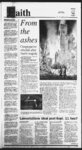
| Show Jt mi fnbmi dR-- Built OrifU Kte® teo f' w HIM ' 0 4' S - i r—r L t ili tji 'I'H less-travel- ry ilk f Ml ' - Cross country skiing trails abound in Logan and surrounding canyons (EH Lucero) herds of deer and elk The trail covers six Contiiiiied Awn pegs 11 D miles and climbs about ljOOO feet There CD are same tricks to finding some of the wide of a surroundings range O through routes in the area a The booklet “Cache Tours” gives an many check in the “Cache Toyra" booklet will sld trails extensive listing of cross-countbe a great help in the Bridgeriand area The booklet is out of publication and may be difficult tofind WoodCamp Hollow: Tbn miles up Tty to borrow one front a local skier Otherwise check the “Bridgeriand Winter Logan Canyon is the Wood Camp camp'Guide” which is available at die Cache ground The trail begins by crossing the Chamber of Commerce big bridge at the campground and continues through some stream crossings Also for Anther information on crossswitch-bacand forest glades before ulticountry skiing in Bridgeriand call Trailhead Spots 117 N Main SL Logan mately reaching die locally famous Janfine Juniper above Cottonwood 1 or Ncida’s Mountain Outfitters 1 Canyon This trail climbs 1500 feet over The following is a list of some of the 3J miles initially then continues 100 feet over five mdes to die Janfine Juniper more popular skinny-skiin- g routes listed There are book avalanche hazards in mis in the “Cache Tburs” guide They are listarea and staying on the coned trails is a ed by difficulty Before venturing out however check avalanche conditions by musL A map and the directions of a veteran will help steer you clear of most haz-ard- s calling die Logan Avalanche Forecast 6 Center at (435) s? M Hit? HIM ks 753-154- 752-2934- 797-414- BEGINNER TRAILS Sink Hollow: The high elevation gives the area early snowfall making it one of the more' popular trails in the area The trail dinibs 400 feet in two miles to a sink hole on the Idaho bonder and then continues becoming more difficult over four miles and 1200 feet to Gibson Basin The trail has been closed to snowmobile traffic stretch of the except for a shared 100-yarBeaver Creek road Driving 25 miles past Fust Dam in Logan Canyon and turning left (north) on die Beaver Mountain road parking is available at the trailhead or in the Braver Mountain Sld Area parking lot d miles Temple Fork: Fourteen-and-a-ha- lf up Logan Canyon (past Fust Dam) is the Temple Fork turnoff There is a kgn marking the turnoff If you reach Ricks Spring you have gone too for This area is closed to snowmobile traffic but some ts zone This nuqr stray into the trail is a favorite for wildlife lovers as it is a winter game range and generally has off-limi- ' INTERMEDIATE Bunch Grass: TWenty miles up Logan Canyon and six miles past the Tbny Grove turnoff is the first major drainage on the west side of die highway parking is usually available on the shoulder road This bail is a favorite with snowmobilers and has great scenery The tour coven five miles and climbs 2150 feet to die base of Ml Magog Again a check in the “Cache Tburs” guide a helpful for finding some of the more interesting areas on the Bunch Grass traiL Twin Creeks: Up Logan Canyon 18 miles is the beginning of this traiL Parking can be a probiem here This trail is closed to snowmobiles and offers some of the quietest and most unspoiled trails in die area The traU'passes Bubble Springs and the more adventurous may wantto brave the brush and continue to Tbny Lake The trad to Bubble Springs 1600 feet ova four miles nd to Grove Lkke is another six miles if- W?m - r K0 itfJttllitfnp A' Vt |