| OCR Text |
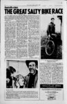
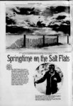
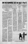
Show 8 raw msmp w SALT FLAT NEWS, APRIL, 1975 UVIUXJ by Richard N. Goldberger Thirteen million tons of salt, eleven million cubic yards, has disappeared from the Salt Flats since 1960. This is not exactly a drop in the bucket. Where did all this salt 00? In hopes of answering that question, the Bureau of Land Management and the United States Geological Survey have requested funding from Washington for a joint study on the problem. The NEWS is publishing the official abstract of the study below. Also in Part II of this salty series, the NEWS has prepared a chart outlining the various possibilities as to wfiere the salt could have gone.. WIND EROSION 50-100- (ACTIVE AND INACTIVE) use. ' . ' of the collection ditches. A factual determination of the area affected by. gravity, drainage would be desirable from the standpoint of assuring an equitable determination and distribution of royalty payments. It is probable that brine moves through both intergranu-la- r spaces in the crystalline salt and open joints in the underlying clays. Conflicting opinions exist, and are supported by conclusions of field studies, as to the degree of hydraulic continuity between the salt and the clay. Conflicting opinions exist, also on the chemical nature of the brine yielded by the salt and by the clay. Available data and interpretations obviously cannot resolve these conflicting opin. installaA tion on the Salt Flats uses brine from the Salt Flats and adjacent desert as a raw material for the production of potash. The high summertime temperatures- and low humidity and rainfall in the area, together with the availability of suitable brine, determined the location and govern the economics of operation of this industry. Production of potash from Bonneville brines started in 1916, continued intermittently until about 1940, and has been ions. continuous since then. Objectives of proposed study: Automotive speed enthusiasts 1. To determine, if and how throughout the world are famil. brine withdrawals by Kaiser ' iar with the Salt Flats as the site affect the salt crust where most land speed records 2. To determine the location are set. Time trials for racing and extent of the area from cars have been held there since which brine is withdrawn by the early 1930's, and in recent gravity drainage to collection years timing events for a variety ditches. of other vehicles have been held. 3. To investigate the effects of' Beginning in about 1960 and natural climatic fluctuations continuing intermittently since, on brine volume and salt a conflict has developed between crust characteristics. these two major uses Of the Salt 4. To recommend a long-rang- e Flats. The condition Of the salt monitoring program that crust has deteriorated, according would provide information land-speed to the sponsors of the relevant to management of 'record events, and the mineral the public lands and the recovery operation has been minerals therein. deteriorablamed for causing the tion. The State of Utah, U.S. Approach:.' Bureau- of Land Management, 1. All available published and and U.S. Geological Survey are file data will be studied. all involved in the controversy The cooperation of Kaiser by virtue of land ownership, Chemical Company will be land management, or mineral if possible, data " and, sought leasing responsibilities. from their files will be examined. Consultants' reProblem: ports, Highway Department Several hydrologic and geolog- - ' studies, railroad and tele-- . ic examinations of the Salt Flats phone company. data from have been made in an attempt to surveys in the early 1900's, State and Federal agency re-- . resolve the conflicts between uses. The two best documented ports, and other known or available studies prepotential sources of current hydrologic and historical information sent conflicting conclusions will be . sought out and ex- one appears to support the a mined. This information brine that theory recovery operwill provide a basis for a deations have affected the salt tailed work plan to be precrust on the speedway, whereas the other supports an exactly pared prior to initiation of fieldwork. opposite theory. 2. Install a recorder on at least Kaiser Chemical Co. proposes one of Kaiser's "freshwater" to reopen a' wells near the western edge ditch located near the speedway. This ditch was constructed severof the salt flat to monitor al years ago but was plugged in pressure fluctuations. These wells are completed in allu1966 and has been unused since. vial materials that are beIt is parallel to a part of the half-mile lieved to transmit recharge speedway and about a the. For to distant. aquifer(s) under the royalty computaSalt Flats, and the data tion purposes, it is arbitrarily assumed that all ' brine produced there, correlated with flow to collection a existing records from obserby gravity vation wells in this same ditch originates within one-ha- lf mile of the ditch. If this assumpgroup, measured periodicaltion is correct, production of ly by the Geological Survey . since 1962, will aid in deterbrine from thereopened ditch would have no effect on brine mining recharge rates. 3. Install a recorder or make under the speedway. Available other, provision for monitor-- ; data are not adequate to verify this assumption, however. ing one Or more of Kaiser's . "deep brine" wells south of Kaiser withdraws brine from ' the Salt Flats. The deep . fee, State, and Federal . lands. disbrine aquifers are believed their and Royalty payments to be an integral part of the on in based tribution are part lf one-hawide mile the assumed hydrologic system, and data from these wells wfll be re- side either on area of production solar-evaporati- on - . . . . -- . - . ' face, and to determine the altitude and configuration of the brine sur- face. The wells will be de-signed and constructed so that some, are open only in . , the crystalline salt and others are open only in the underlying clays. This arrangement wfll assist in determining the 'degree of hydraulic connection between the two units. Alti-- . tudeS of the wells wfll be de- termined by precise leveling from a benchmark: located off the saltcrust. 5. Construct production wells at selected locations on the salt crust and adjacent areas. Temporarily install pumps in these wells. Conduct long-terpumping tests under carefully controlled conditions to determine transmissivities and storage coefficients of the aquifers). The observation wells described in item (4) above will be used for monitoring brine-levchanges during . the test; additional observation wells will be constructed for the . tests if needed. Brine samples will be col-- lected from the discharge stream at intervals during pumping and analyzed to determine changes that may occur in the chemical, composition. The pump tests will assist in determining the extent of the area influenced by gravity drainage to the ditches, the degree' of hydraulic connection be- tween the salt' and day. units, and the chemical na- ' ture of the brines. . . NONE KNOWN - UNKNOWN NONE KNOWN , unknown none known ' . 6. Install recording equipment or otherwise arrange to continuously - monitor brine withdrawals from the brine collection ditches north of v Interstate Highway 80. A continuous record of rate of withdrawal is necessary for correlation with brine 4evel fluctuations in the observation wells. 7. Conduct controlled pumping tests on existing "freshwater" and "deep brine" wells, if possible, to deter-' mine transmissivities and , storage coefficients of the' aquifers. Collect samples ' during . pumping to determine chemical changes, if '. any, in the fluids. These data will be 'required for the ..i - overall analysis' of the hydrologic system. 8. Establish a climatologic data ' station of the Salt Flats to . monitor precipitation, air temperature, humidity, wind movement, and evaporation. These data, in con- junction with data from the NOAA station at Wendover, wfll be used in preparing a - - NONE KNOWN UNKNOWN m el . MR. ROBERTS UTAH SALT COMPANY ' TtouristIN quired for the analysis of recharge and discharge. 4. Establish a network of observation wells to monitor brine-leve- l fluctuations in the crystalline salt crust and '' adjacent areas where lake-be- d clays form the land sur- .000 UNKNOWN . ,5S . RroN TON PER YEAR IN SURFACE SOLUTION REFERENCES 60.000 TON PER YEAR UTAH SALT COMPANY prepared by Ted Amow, District Chief of Water Resources UJS. Geological Survey : Background: The Bonneville Salt Flats, located near the western edge of the Great Salt Lake Desert in Utah, are unique in manner of origin, physical and chemical character, location, 'history and , CARRIED OFF IN BRINE CANALS Project Proposal Hydrology of the Bonneville Salt Flats, Utah ; 0UTTKLT SPECIFIC ACTION "water budget" for the area, as. well as interpreting changes in the surface con- ditions of the salt crust. 9. Establish one or more sites for periodic (monthly or. - if possible changes in apextent of the pearance and " salt crust. 11. Establish an observation site on the. salt crust in Pilot 1 fi vmiIsm aw' SUW akAiit .Vail .S.W Mil f J) northwest of the Bonneville Salt Flats. Equip this site to ' obtain concurrent data on climatologic parameters,. AUM-va- : surface conditions. Comparison of these data with those " 1 511 T uoiainea on me oonnevuie Salt Flats should aid in the A.1 evaluation of natural The Pilot Valley salt crust is similar in many respects to the Salt Flats, but it remains in a natural state with no brine production or speedway. .. 12. By the end of the second year of the study , prepare an interpretive report giving the results of the investiea-tion and recommendations' for .'continued operation of selected data sites tor long- ' term v monitoring. changes. - Estimated cost of two-yeinvestigation: The, estimated cost of the work described above, based on ar - -- more frequent) photo-- . graphic recording of 'the. condition of the salt surface. Detailed visual examination of the crust wfll be made concurrently with the photography. Correlation of ',. the photographs, records of visual examination, and fluctuations in climatic parameters, brine withdraw-al- s, and brine-levemay enable a determination of how these various factors interrelate. 10. Examine available aerial photographs and ERTS satellite imagery to determine, work are as follows: Salaries and benefits Travel and supplies . Contractual and other supplies Administrative and technical support. ls 5,000 7,000 15,000 $80,000 . Manpower: One hydrologist will be e signed to the project full-tim- as- as project chief.. At the present time, the Utah' District does not have a man available for this work.' on ob-tain- 6,000 transportation Equipment and - brine-collecti- $48,000 ed . ' .' One unknown factor in the nhenamenan of vanishing ult k thtt amount scooped uo annually by tourittt and taken home a a taltv souvenir |