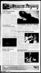
| Show a ' ih i: a r I' ' ill' f 't' !’' j tup' “t m ' - til l' l" tin 'in - in I' ot atr quality EmtsSKtn ii' ' ti )ti i'in i j nlt M !! 'i'll M tnl !' '(- iili'i nui rii him "i 'i" ' n ' ill a ' tt ' n n' " i' 'V I'l V 'i it'll II if t tl ' n ' 'n II 'i ' ' ' If the i" il'iiiM ' n'l ' S it in in b' a 'i 'tl' i'Atlft ") the n pi irr urv H considtH- U'ah H A3jt contnys include a bagbouse 6 " ' ' i ti‘ ilt and PM PM10 602 emissions wit be conlrolted by tbe inherent dry scnjbbing of ttie lime pro du'lmn proves NO will t controlled tbrougb elbrient crxnbustion practices ot tuet consuni tion and minimization air for tbe combustion process Tbe t'irmation ot CO and VOCs will also be limited by controlling tbe ot tbe fuel and proividmg adequate oygen (02) for complete combustion evess Emissions will be controlled sufficiently to meet I'j Ktd combustittn pra'tnes) Best Available Control Te' hnoloqy (BACT) requirements of tbe PSD program wth and IJDAQ regulations UDAQ regulatvins regui'e all modifications and increases to meet BACT New Sourte Performance Standards (NSPS) 40 CER 60 Subpads A (General Provisions) Sutpart y (Standards oi Performance for Coal Preparation Plan's) Sut parf HH (S'andards of Performance for Lime Manulaclunng arrf Sul arf OOO (Standards of Performance for NonmetaHic Mineral Pox essmg P'ants) reguiatirms apply to tbs sou" e National Emission Standards 40 CER 63 Subpart AAAAA (Lime bjr Hiza'dous Air Pollutants (NESHAP) Achievable tijrmg Plants) regulations ap'y to tC'S source Maximum do not apply to this source T'tte V ot tbe revpjlatifins (oi ttol bnotogy (MACT Clean Air Art applies to this source Tbe sourre has lirmtations that a'e estat bsbed in tbe intent to Approve Vs 'e emissions a'e controlled by opa dy standards set in the ITA Some of tbe limit Bums that a'e iis'ed m tt’e ITA are included in this newspaper notice and are ill THENCE WEST 646 BEGINNING LAKE BASE AND THENCE MEPIDIAN EAST THENCE FEET SOUTH 330 0'53 ALONG THE COPNER THE NORTH 0'53 39' ALONG SAID consum (on of ma'mum a'lowable cteer sourres located in the aferted a'l EAST Sufj' PM 10 Annual 'jf ' if t'f ' st’it ”1 I'l AH I'm si - M ' ' n St in t v" s 'rm-- f l! " x t'fi '!' li LTAVLP 0 ' r ca’et sea'vej a s ewa eve s poed —a'e i PC ' ‘iV ' y v - j a - ru Cou'’ :oc r t S‘if' £ - ft - ' air- " h Crts a '3 ?i 3 n P'P'Ml Vy c' a scst a rt- Vj-- i 3 rd 23 rc't txg a " - bow" - :e ? (X 2'r” r a—d c a mg cf 4 30 ' tee Deda g p‘eae “east one dav png to penye vo 8 2'59 Jav Scea‘er S Gnea'ny Cy Recorder Published in the Mittand County Chronicle Progress May 23 2007 200 Cw ! revew re perw! July for tovdoees tc c- Mr Da a a r 2X5 i L"a- - c c mr 'a "t y t e c J ? s e p n li— 'i- C e ' M- S— eef a e da‘e - :a 2X' n 2 (a- - '' e '2 3 sa— od at f 53 N VCTX2E P'b r CrC £m-- d — ‘nr long Cae Cmer e Rrp r Pits 435 -- incaed y be County 23 2007 e— r CVa re ptooosa1? long fnmc wavs M m- - ji us mi a'dnnumoeKe-e- rtp rg sr-e- h ! scmo- - Cf a toss’ wb yev- - oe He e 121 3 'em may m '8 2X7 to K?y NORTH ’i’l 3 FEET OUARTER THENCE OF ti e Ccvef wes May DEBT May L Ea'es successor bus'ee SoaVv Read ng Ea'es S Rasmussen RC Ga'ewev Tower West 5 West Se AX RC Bo i'42S Sa- - Lae L“a- - fa -eennore Busmess Hcurs vpn 9 X a m to Manon No be Nng LeamrgTn be y rve 1C se"’e'v7es -f - e and M Rard May O1 ef 8935 18' THE '6X PARCEL ft at 7 M May 208 7 NORTH FEET LINE TO THENCE 121 30 FEET WEST SECTION ALONG THE FROM THE LINE CORNER NORTHEAST SOTHWEST SECTION 6 6 THE OF THE OT QUARTER NORTHEAST RANGE 0031 29' NORTH FEET 121 3 '6 OF QUARTER 17 SOUTH TOWNSHIP WEST MERIDIAN SALT BASE LAKE THENCE SOUTH 8935 18'WEST2C8 7 FEET THENCE NORTH 0031 29' EAST 2C8 7 FEET THENCE NORTH 8935 18' EAST 7 FEET 208 LINE THE TO THENCE 208 7 16 SECTION 0031 29' SOUTH FEET TO THE POINT CE BEGINNING Togeber wb an be improvements new or herearfer erected on be property and a4 easements a part and Fibres now or cf be property Tax Parcel No: Te umdemg-e- d y y emor m be sheet address cunent EeoaN of be bust deed ts James H and Cangt J Martin and be record ewe-- cf be property as cf be record ng of ebee of default reposed to be M S A Tnjst amd Pa'sade Toist Bdders must be to tender tc be bus'ee $5 CX X a' be sa e ad of be purtbase prxe by be ba'a-12 00 noon be day g be sa'e Bob pav—vs be be Mm c‘ a or money cashier s order cash and Eak 0031 Checks ae net A accec'ab'e deed be made ava abe fo be success yi w- -- bee bus— ess davs Mowic be bd amu- -t ng sae s made ‘soay wamay ever mckxbog tjt not to ay wa—amvy as tc e ‘es possession aes °f cord vy- o be sa'e is sub err to a wn yjt pave sa'e ca"deranon or postponement ect t d? g or y ortums'anot o be bus'ee s b be evert of be Megomg be sa'e f be s ax be suocess‘u fcdder vd y tab y to be be bus'ee or bene'daa'y M m'e'es: or ay damages GVEN V0'CE S HECEEY for r f's t LSEO for Da'ed May IS CET OSTA AT 13 ANY ANO NEO WXL EE PURPOSE 2X7 T 5 uccessor ’vs'ee Mameson kMnesor 6 Jeopsorv FC 66 East Frss SaT Lake C Lha- - wrt 0sen 64 ’C2 X' Wan pm County 23 2X7 E'RM COLLECT 'NRORMA’NON C'Nne 6 3 nn Pu6i Chronie 30 tbe 482 08 0031 29' 2: EAST AND ALONG THENCE OF BEGINNING BEGINNING Sa& in NORTH THENCE EAST 0031 29' TO THE POINT at Topes wrf rdupe ’ vacipnpva of Va- 2X8 0nor I Amme'vjng be f yeir 2 X 7 E vrt 3 Published LINE SOUTH FEET 16 SECTION SOUTH County 1$ ng wvgVest - 98 FEET SERVICE bV (K ba‘ vc at 2V- 646 OF DELTA GARBAGE THENCE 208 7 THAT Leammgrjr jtH THENCE LINE EAST INC FEET WCST 35 40' THE SOUTHERLY GARBAGE PROPERTY 8935 18' EAST SERVICE NORTH TO Public Hearing Town of R 00"52 O- 'ere "V 21 DELTA THE WESTLINE TO COuLECT Tyw o- - Jj-- e 6 s THE ALONG 1340 SECTION ALONG PROPERTY THENCE 0052 40 EAST 321 64 FEET 'NrORVA'"ON C6’’A'NEC FOR rHAf Pu'PPOSE CAED bs 3rfJ Cay of Tusre FEET SECTION 8647 41' NROTH ALONG THENCE INC will a WEST QUARTER tg jne LINE 8935 30' THE Published In Chronicie Progress 23 2007 c FEET 16 SECTION 306 82 irw pmvders fiax of 'am a exy o' 330 WEST AND SOUTH THENCE TO THE POINT RANGE BASE THENCE TO WEST M SOUTH LAKE EAST 33C FEET 6 SECTION LINE 'X “9335 current beneficiary of trust National deed is Wachovia Bank a nabonai Assoo as Trustee for Long Beach and tbe Mortgage Loan Trust 2X2-of record property as of of nebee cf de'aurt reoordmg Ca — en Couch ae Jce Couch bus'ee s sae cf the be made real property as to possesB dde-- s must sion or encumtra-ce- s to $5 CsX n be peca-ece"ed unds at tbe sae av) m of pvebase Mew- -g am by busmess cay The bus'ee reserves -t to canoe-creoiesu'e sae tased upon r‘y -e to tbe trustee a' 4 cf sae such as a no a loan ss'a'enert or an agreement tveween ad tc postpone or sa e so caceed coN neccu"se c be Pu'aser s tc rece'e a reM'd be IS cad to be bus'ee 1o ea“- NORTHEAST OF SOUTH FEET SOUTHWEST THE OF 0031 29' THE NORTHEAST THE OF QUARTER OF AN DESCRIBED THE FEET a deed cf trust purpose of Medcs'-iCarmen executed by Joe Couch Couch covenng real property loca'ed at arprovma'ety 75 West 300 South Fittmone Utah ard Mlarfj County more particu'aby described as at a pomt 115 feet Begmnmg corWest of ner cf Let 5 Block 33 Pat A F ''more C'ty Survey and run110 feel West ning South 10 rods thence North East 110 Mt 10 reds to pomt of a yes AT 7 FEET 7f 5 Eo Jth Hwy pg FT’mone County Utah on Monday June 4 2007 at the hour of 2 00 noon of that day for the ANV Cccry K Soub Mv" Ftbyvy Lb 64631 654 V: v mee- - cs erco—injnon CORRECTLY 1: PARCEL 7 EE L SEC tg a’ 5“X x taer br M's- - a C7 4f - Eoua C'op:'j"'“ Empkove Pubt’shed in tbe M ttanS Cowrvty Chncewce and IS 2X7 waif Dea Cv vea- - s ease be ec pncvdeH Lha- Seaed pmoosa's must be am Ones 2X Wes? get yen re THE SAME 208 SVEST SOUTH TOGETHER WEST 208 NORTH 320 FEET AND '4 Mk o r to cst sewei - M PC eceve p b‘ C'rxgsed is tg a psbvg 437 Ask 664 FLANGE BASE NORTH THENCE THENCE 6 SECTION SOUTH LAKE SALT IN ON OF INGRESS AND THE PURPOSE OF ANDOR REMOVING MERIDIAN Mowing described real be sold at putke auctbe highest bidder purchase rnce payable m lawful money of tbe United States of Amenta at the time of sale at the West mam entrance of tbe Fourth Distnct Court of Mffland g M Hard May Notice Legal C is “ SOUTHEAST 2 LOT 17 WEST MERIDIAN please oaf re Deba C a" teas' one ' ' day poor fo Prone Vg re nr-s G"rgo-- i Ja Recorder M Pubi'shed in County Chronicie Pg-es- s May 23 2007 ' in the Progness promp-- v Mr spec a Ma n V to W' 2X e e '2 455 Cbmorwete a—g a 522 5a'2 - m oi-t- y —t a fi— eig f on hea—ng '5 V— at ?ee gven c Deta a 222' 7 Fra - re C“—:e o' re 252 a ca'ed vI to yea- ts of the C by C nevgx Boa-- J t— C“e at Notice y 2X' 2X8 Eenue SC ACTS nved m C tv 'v Budget Proposed S nw' ar spec s of re Ccnfa d te b?" Wal ss Man PO r u'ae M53i (435 5ba si Published in tbe M Hand County Chronicle Propreai May 16 23 and 29 FuMc a" C'ty n C -ii r xx Dea Budget e xo m C fy pvorc serf for s'ai Year to pa1 s you need a to FarfKica'e fe mganjFmai ap v na m ag 1 eavf tt 9 B? 12 rb' 2007 gven rat tee C f c tee C ly c DeTa Ltae a putK " g on wt' Xre 7 22C7 at f"e Ct Bu kJmg y ca'ed at 76 Vrb 23 West al pfbc beanng seal teg-6 5 p m purpose of tee puth to put be s NCbiCE oor cm 6re e 23 May Notice m Kanes- N v— ASnlb at Van Tn a sad c eats- ‘1 ' rp ACT' 27H llard County Chronicle Progress T'wn Man PO a' M I - f i fi' !'' i "I f m ' tr e i “e Sepa'a'e Vs 4 24 M accept Bids tos v To f 28 2 Ca'ecfN 'toe May Published in the 'fHtSniti A' 844 L'AC ' ' 129 SAID LAND FOR CORNER REMOVING The rt USDA Accepting pre - applications ' 6 0 24 Annual OF TOWNSHIP 6 METALS MINERALS RIGHTS THE RIGHT EGRESS 17 CORNER 7 7 FEET ALL MINES GFtAVEL AND ALL OTHER AND GEOTHERMAL SALT property tion to pt't -- Public Notices ' A' 93 24 Hour Annual THEREFROM GAS OIL 208 208 EXCEPTING COAL INGRESS AND PURPOSE OF AT THE NORTH EAST OF BEGINNING WEST BEGINNING THENCE SOUTH TO THE POINT MORE Notice of Trustee’s Sale The compre'ed eva'uation and a Quality imoart ana'vsis 0t a qua 'fy meet be reg inemebat be proposed to mtenq Evecubve rules be Sfa'e ar issue an Approval Order pending a 3Gday puNtc comment period Tbe p'Oimrt K cl be eert on local a r qua by d'art Approval Oder a'e r CKvsion cf ' Utah ai toe Oua' and fy cemmynt rvpectvyi 3a tsn Nr— 19A1 West Sat Lake Cfy UT 84t'44820 Comments on or teMe June 23 2CC7 same m makmg be cons deoson on be appmva' d sappreva' cf be red S' prnva' Order a so te accepted 3ufa- - gov if anvcre so Ema( trv—e-i- s to be Eecutve at be Dv'sdn m wnfng 15 cays cf fh R3C7401-ca' V n' to s ct e a heanng w'5 te bed m 1' ' f M de Dm Su'fjr So' i' OF THENCE THENCE THENCE 6 BEGINNING Input Level FEET 7 FEET 7 FEET BEGINNING 2: 10 onifcant 208 THE SAME THENCE of S 32 4 208 WEST SALT LAKE WEST MERIDIAN AND 7 6 TOWNSHIP 6 RANGE SOUTH BASE CORNER SOUTHEAST PARCEL EAST Annual 3 H Air THE NORTH FEET 121 3 QUARTER TOWNSHIP 13 93 3 55 4 3 TOGETHER AND OR THENCE 5 cmer a'eas' Pc'u’a”t Duration N I'rgen D'OV'de Su Standard ot 24 H'Xir Annual THE SAME AS FOLLOWS IN ON RIGHTS THE FOR ALL REMOVING AND 'OR EXPLORING METALS MINERALS INGRESS AND PURPOSE OF OF THE FOR IN ON TOGETHER SAID LAND THE RIGHT EXPLORING MINES MINERALS RIGHTS AND GEOTHERMAL WITH ALL METALS MINES AND ALL OTHER GRAVEL OR UNDER THEPEFROM POINT THEREFROM GAS OIL WITH POINT 18 FEET THE TO LINE EXCEPTING COAL 18 FEET THE SAID LAND THENCE 26 4 3 Hour D'Onde Su'f'jr Diovje Si f jr Dnii de f Min 24 Hour - 3 qua'ty increases shedi are as SAID SAID THENCE 353 EAST OF BEGINNING THENCE 353 TO LINE GAS OIL FEET Qua dy Standards PoblutantDu'aton Annual N bogen Dic'de k a'r Amt ient Air National C’ass air THE OF BEGINNING EGRESS euefted NORTH LINE SECTION QUARTER WITH THE RIGHT 6 AND BASE OF DELTA CITY PROPEPTY 645 50 FEET THENCE SOUTH 0'53 39' WEST 32164 SOUTH THENCE FEET 86'48 646 95 FEET TO THE SAID EXPLORING Tee 6 ALONG BOUNDARY SOUTH ALONG 32164 8648 24' THE TO LINE SECTION 053 39' OF LOT 2 SECTION LAKE EAST SOUTH FEET QUARTER NORTH PARCEL RANGE OF DELTA CITY THENCE PROPERTY 645 50 FEET SOUTH 0°53 39' WEST 95 THE ALONG EAST BOUNDARY SOUTH BASE NORTH THENCE MERIDIAN 8936 01’ LAKE SALT WEST FROM THENCE 3601' TOWNSHIP 6 6 BEGINNING SECTION SALT WEST FEET OF QUARTER 17 SOUTH NORTHEAST SECTION NORTHEAST SOUTH 17 MERIDIAN 8 9" 330 OUARTER SOUTHWEST RANGE AND CORNER NORTHWEST THE THE OF THE LINE SECTION OUARTER THE OF SOUTHWEST THE OF QUARTER TOWNSHIP 6 POINT A AT EAST OF LESS BEGINNINGATAROINTNORTH 39' EAST 330 FEET ALONG FROM OR UNDER OF SECTION QUARTER NORTHWEST THE OF QUARTER OR UNDER ites sourre and 10 0°53 EGRESS 39" FPOM LINE THENCE TO THE POINT 320 FEET NORTH FEET 1320 330 FEET NORTH THENCE WEST BEGINNING LESS BEGINNING AND GEOTHERMAL ipomt HAPs RANGE SOUTH 17 SALT WEST 6 GRAVELANDALLOTHER 8 6 SECTION OF QUARTER TOWNSHIP COAL 81 emissions m tons per year will change as fc'iows PM10 soume and big 've) NO () 920 SC2() 259 COtH022 VOC( !15 NORTHEAST THE OF OUAPTER SOUTHWEST THE OF CORNER n The NORTHWEST AT THE hum b nl ifli' FEET PARCEL bidder of tbe to control Paae ?3 M?Y Mowing described propersold at public auction to tbe payat'e r lawful monUnited States at tbe Mam ey Enhance M i'ard County Courthouse Utah 765 South Highway 99 Fillmore on June 12 2007 at 12 00 PM tor the purpose of foreclosing a Trust Deed da'ed December 2 2002 executed by M S A Toist as Trustors in favor as of James H and Carol J Martin genetic iary covenng real property cated in Miltard County and desenbed as follows be ty will S'Hnts' of s Progress Tbe Bfa"l Ojay Inc EXCEPTING !r ' ' Kiln e i' V 11 1' Notice of Trustees' Sale w'h rryarvQ jt i'll! I'"" II I'll S if Daicrlption Mod Station to Approval Oder DAQE AN03 13021 J6 t'X Ad lirjn ct Kiln 5 and Pfpla' emnr't ot Scnjbter on Kiln tl ft1"' a Bagbouse t a tfJOI) fof an f Vi A'ntfi US Inc subrrvtled a Noti'e Intentfor ttie and Title V Permit ct'ang'? proposed Aiptoval f Pm (AO) modification aaftAii rj g rr een In wte assoriated conveyors Iimes'one screen p'od a"d crusbets Kjad'jjts and storage s'los In ad't'C'tn G'aymont en'b wet Kiln a on to e the scrubber s’tng rela' bagbouse (to(cises and add petroleum coM to tbe hst of primanodf a'''r s to Kiln and 5 and high sulfur coals to tbe list of pnma'y fuels ry fuels fur Kilns Tbe Cncl'et Mfjuntam thru Kilns plant is cur'e'tly oterated under AO DAQE AN')31 302 dated March 16 2006 and Title Operating Permit da'ed August 15 2006 Under brjth ttie tJee Source Petiew (NSP) IW'O a"d itte v "rg'ams tbe CncKet Mountain Plant is a maj'tf stationary source This fro)ect wilt result m a 'vgmficant net emissions increase' rjt air y sulfur d' ride (502) nitrogen oride (NO) cartion monoride (CO) particut late maMer (PM ar'd particulate matter less tban 10 micrometers m mean (PM '0) Tbe CrKet M'xintam Plant is treated southwest of tbe oty ot Delta m M a"J Coun'y U'ab M'Ma'd County is an aM3mment area of tbe National Aft tent Af Qua'tfy Standards (NAAOS) for all pottu'ants Tbe plant is located it m 260 Mometers of several a'eas that a'e classified as Class areas der tt e Preen!ion ot Signifi'ant Deterioration (PSD) program fot tbe prefer tion V iv l- U’a jtiri'j Proct Ml i" f Mi’ ' a ' V t tri biJS (iJAO) Ait Company Name QrafwyX Wes'm U$ Location Lrvl lt'jr tam P'ant 32 M Joe Antonio Andrade - If’' t'j !s U'ah A'ttniniAtfati9 C'yit nr' 'IS A Chronicle MiHafd Couniy Notice In Mentoriam tc 4 X Fte Nd hed in th s Fi pm 'SK'm M May 16 Cesmty 23 and 2X7 UPAXLP POOR |